

2015
Ramblers Hikes |
||
|
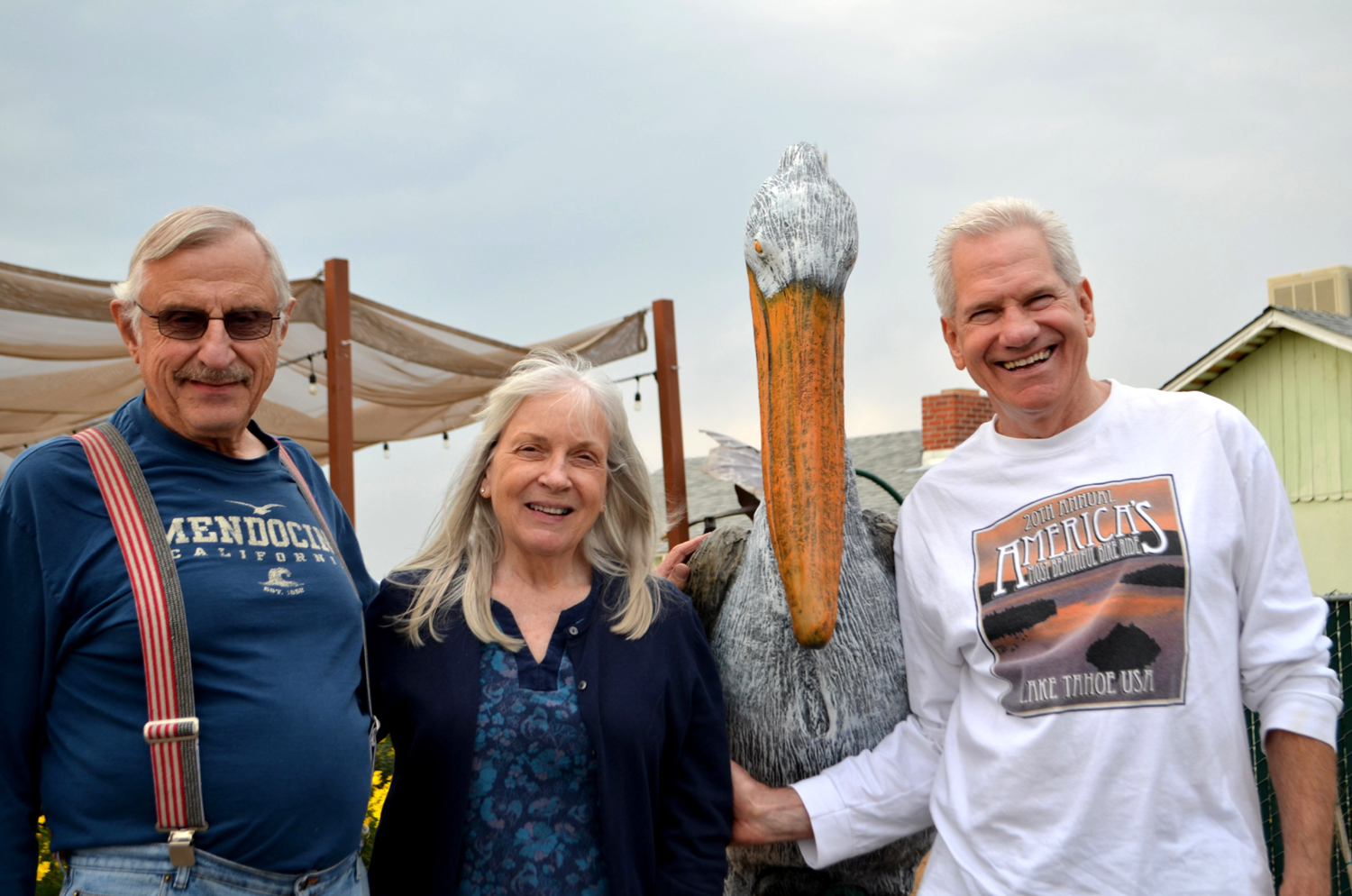
The Ramblers are Carolyn
Amicone, Julie Hornback, Wes Thiessen, and Dick Estel, former
colleagues at the Fresno County Department of |
||
|
Courtright Reservoir Hike Taft Point Wawona Trails Shadow of the Giants San Joaquin River Trail (Finegold) Jensen Trail |
||
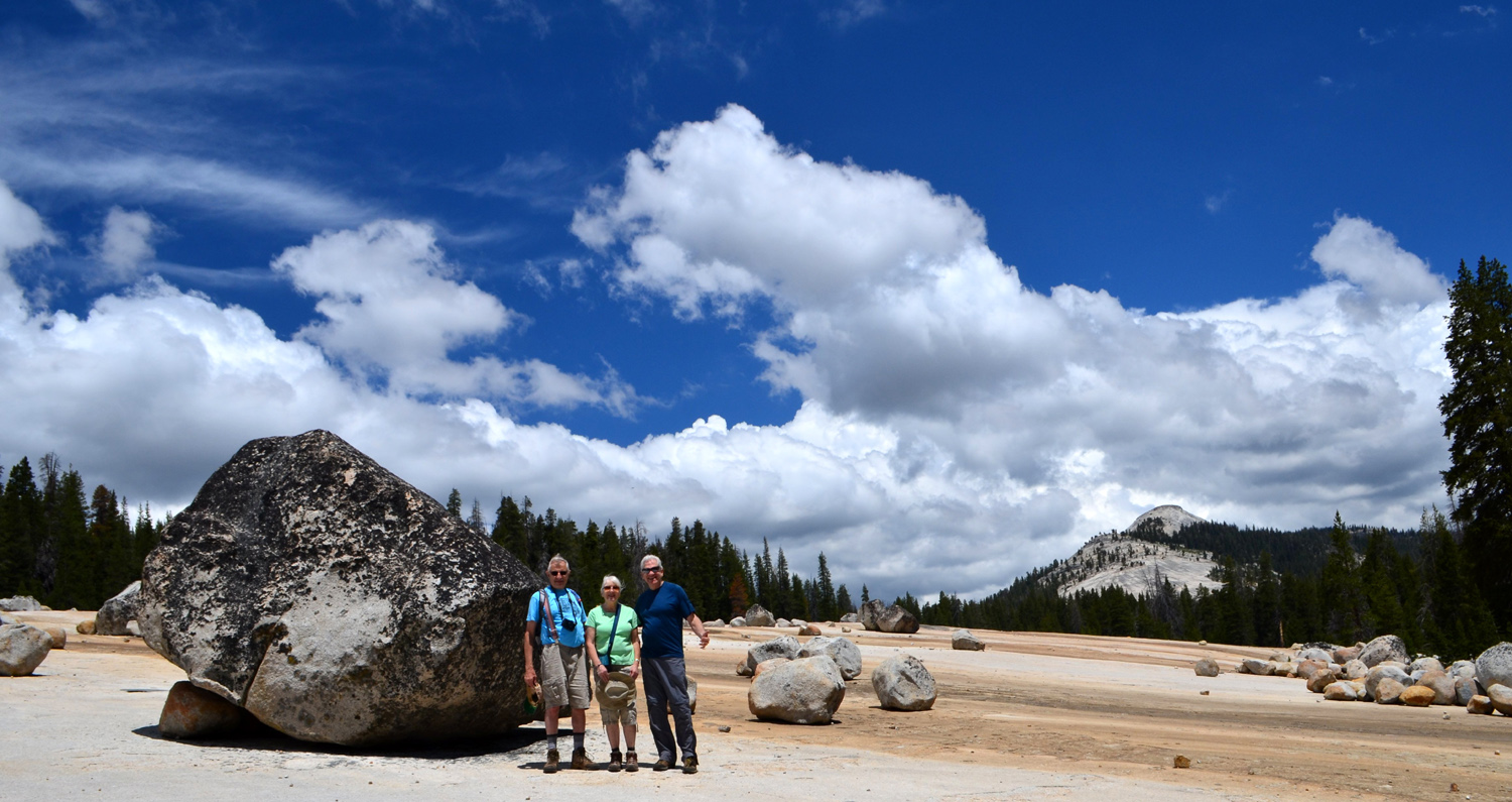
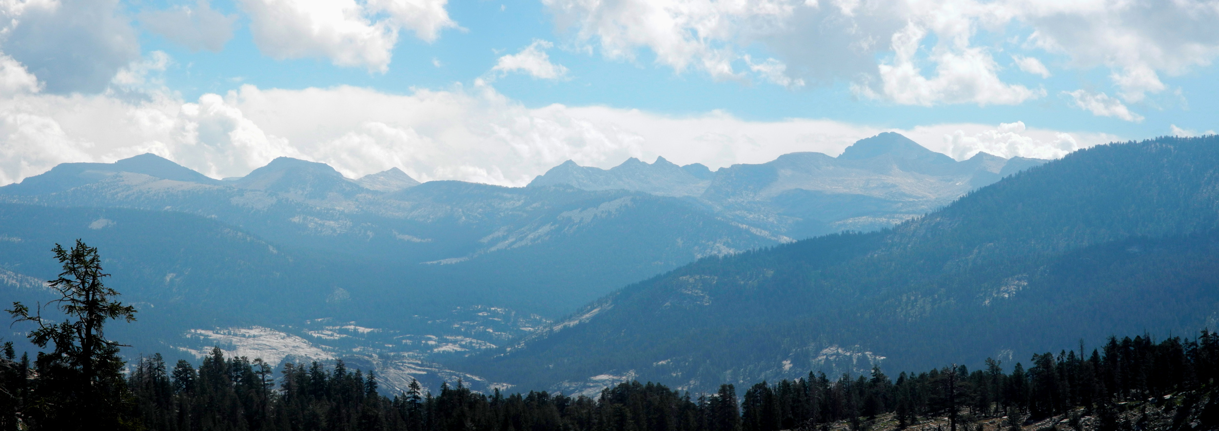
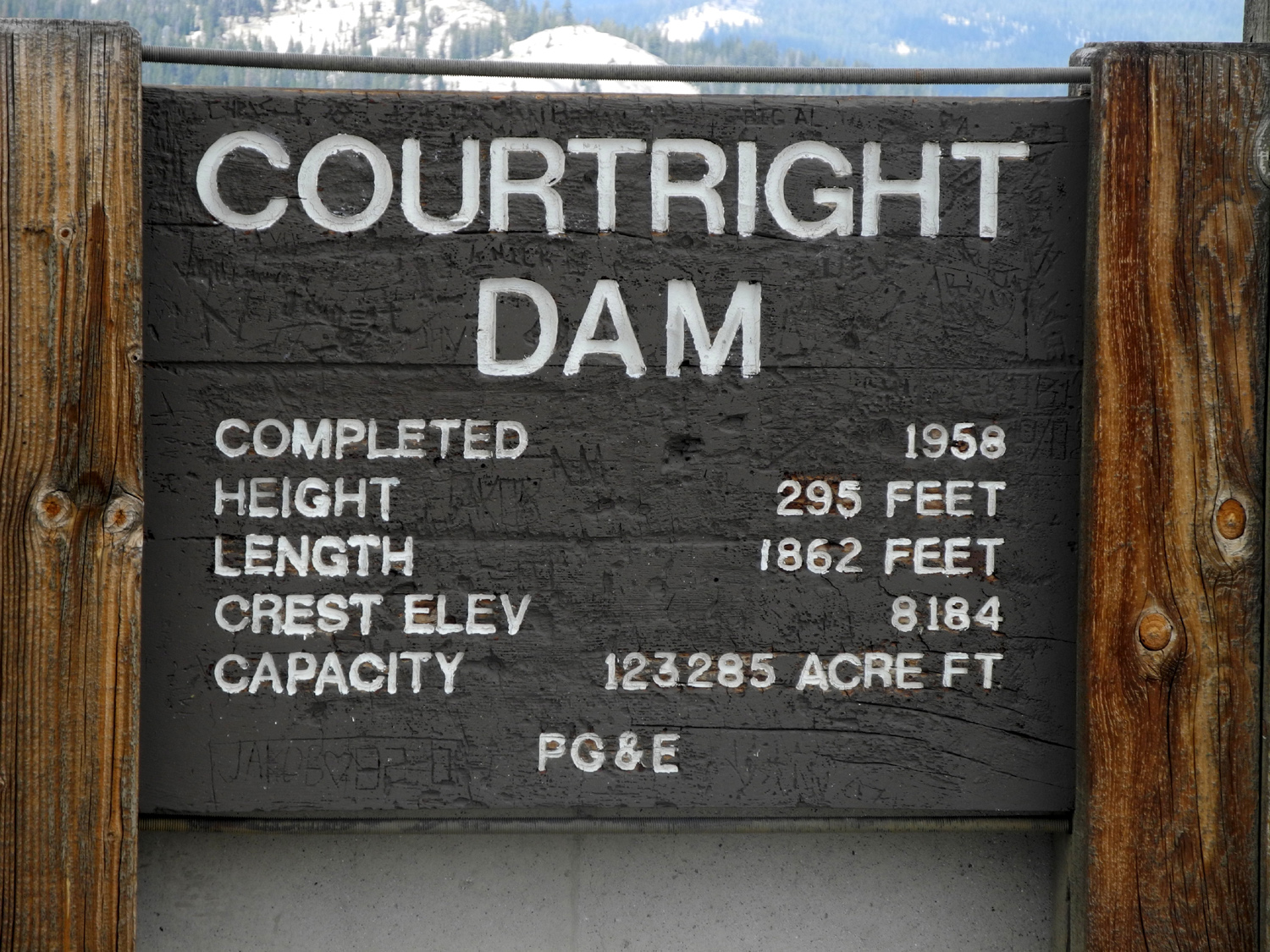
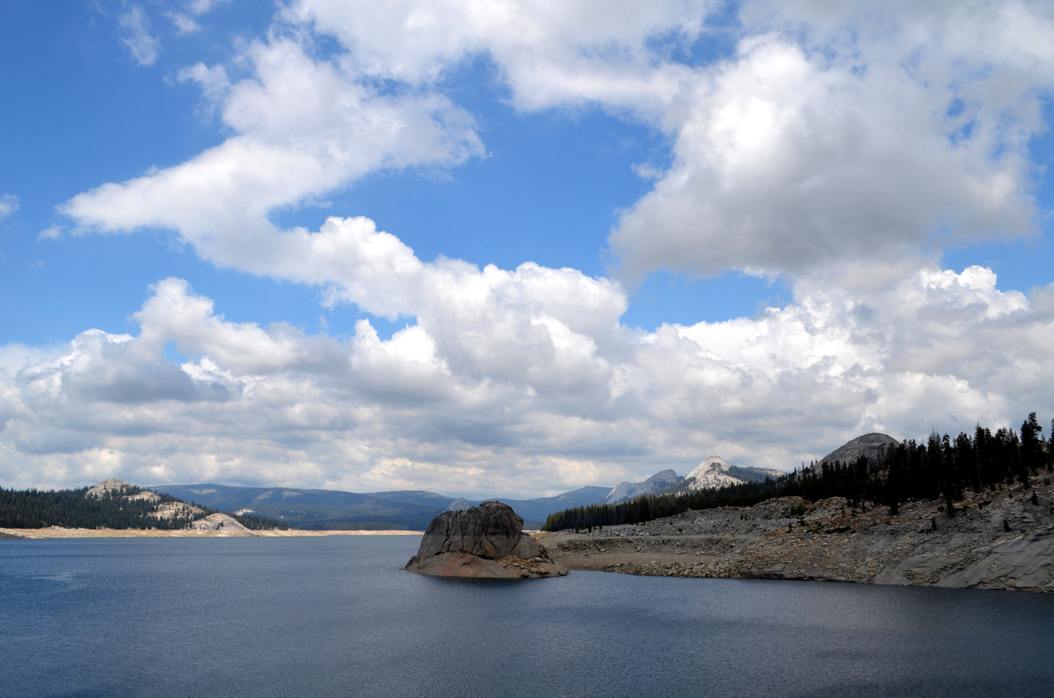
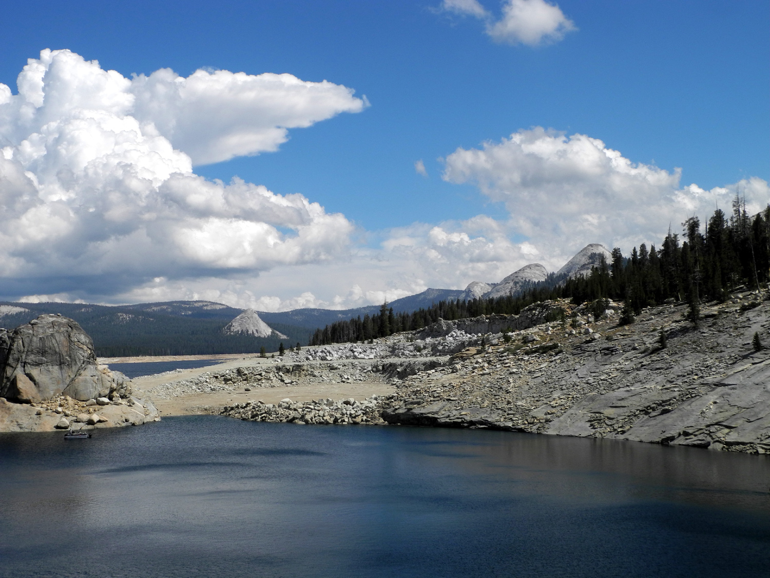
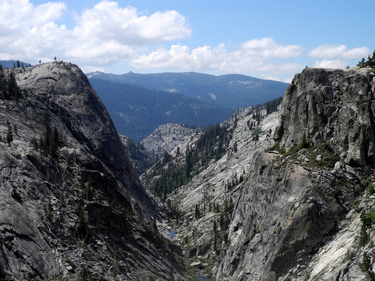
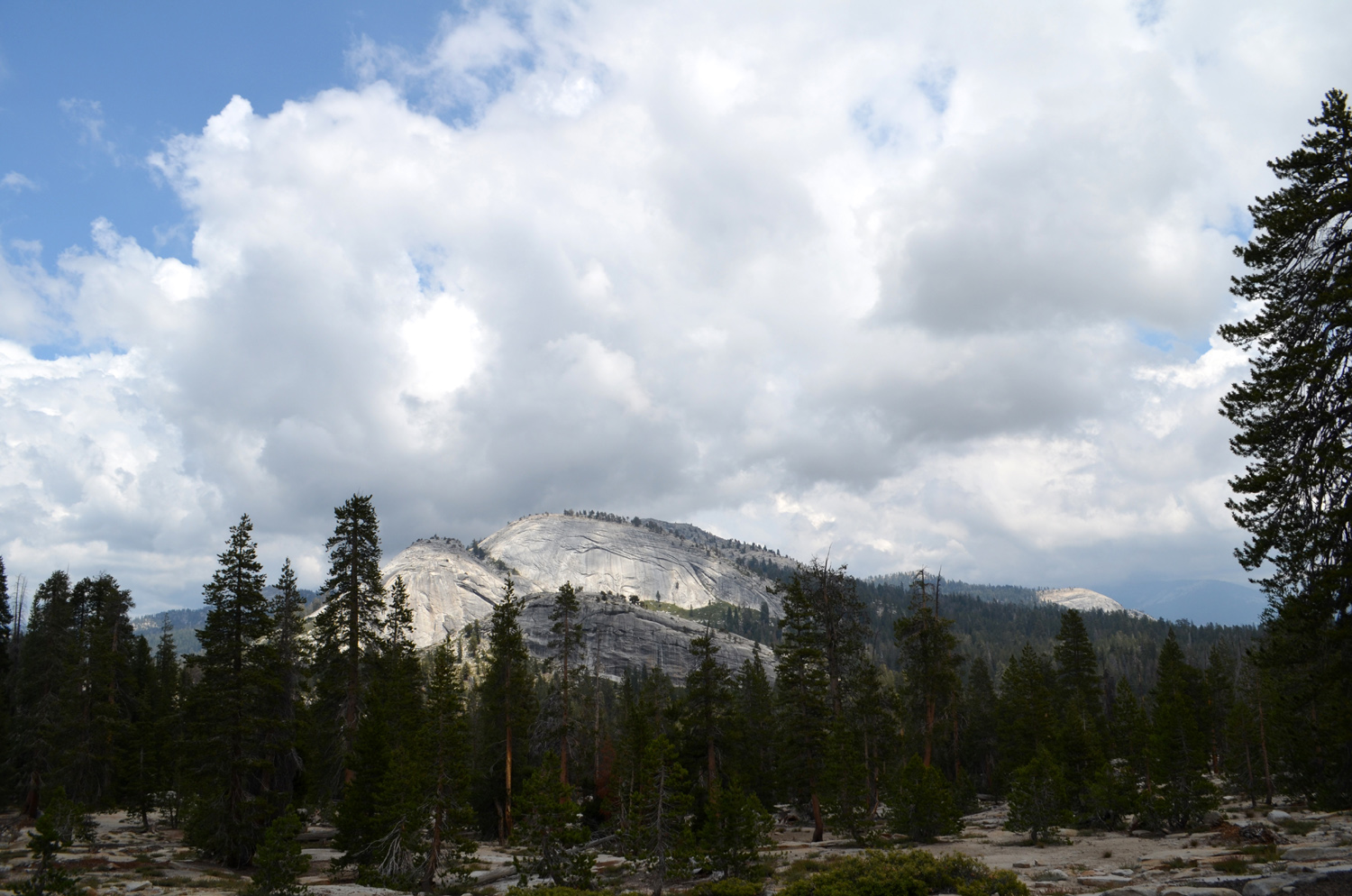
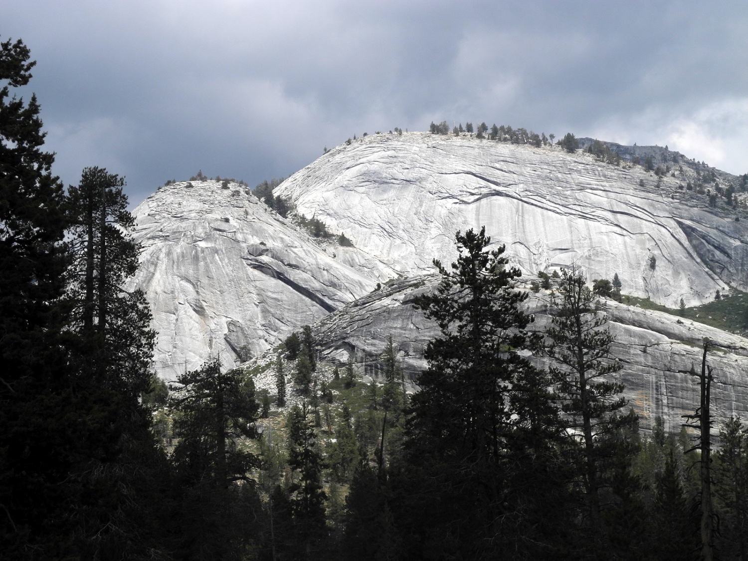
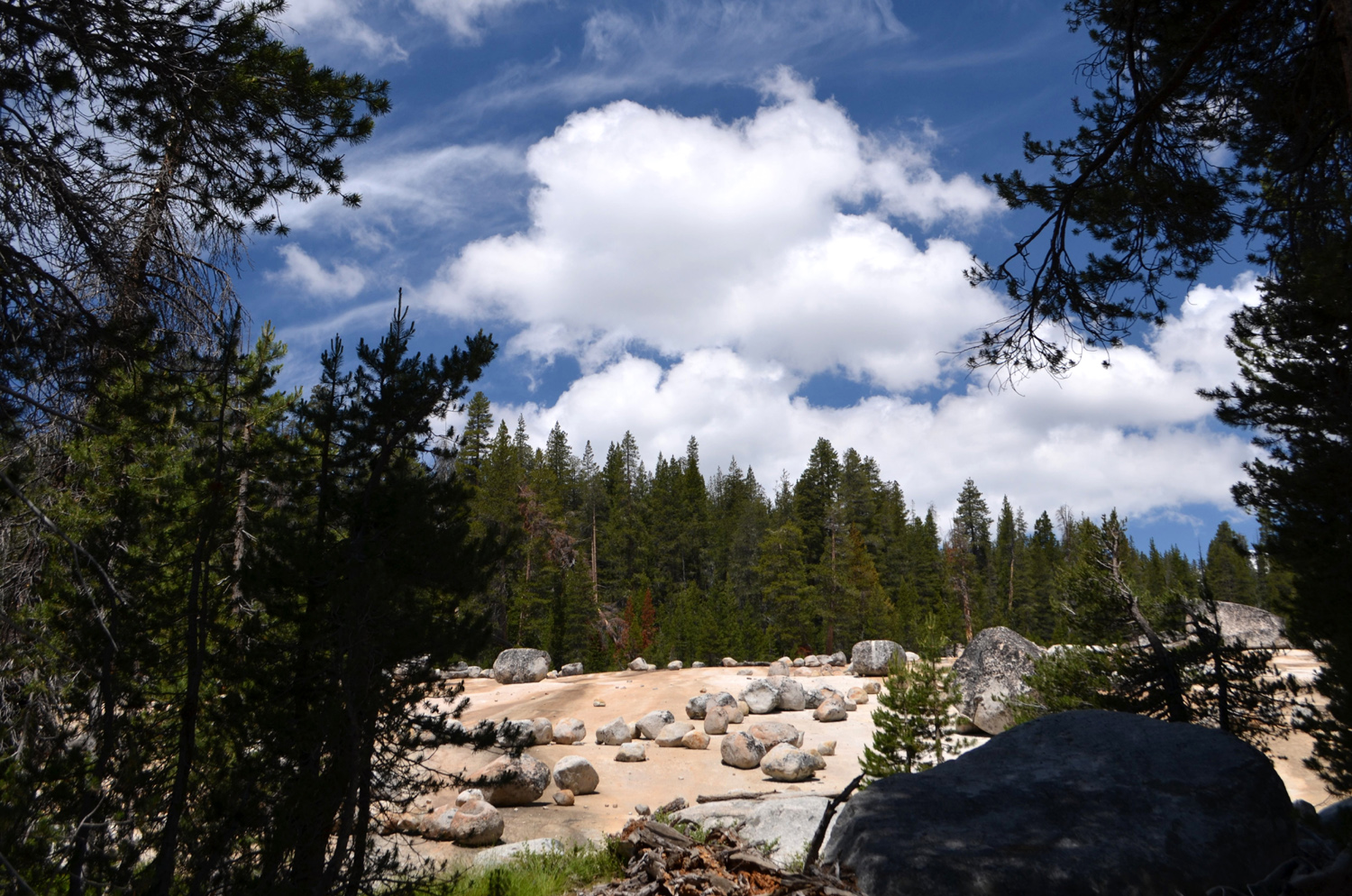
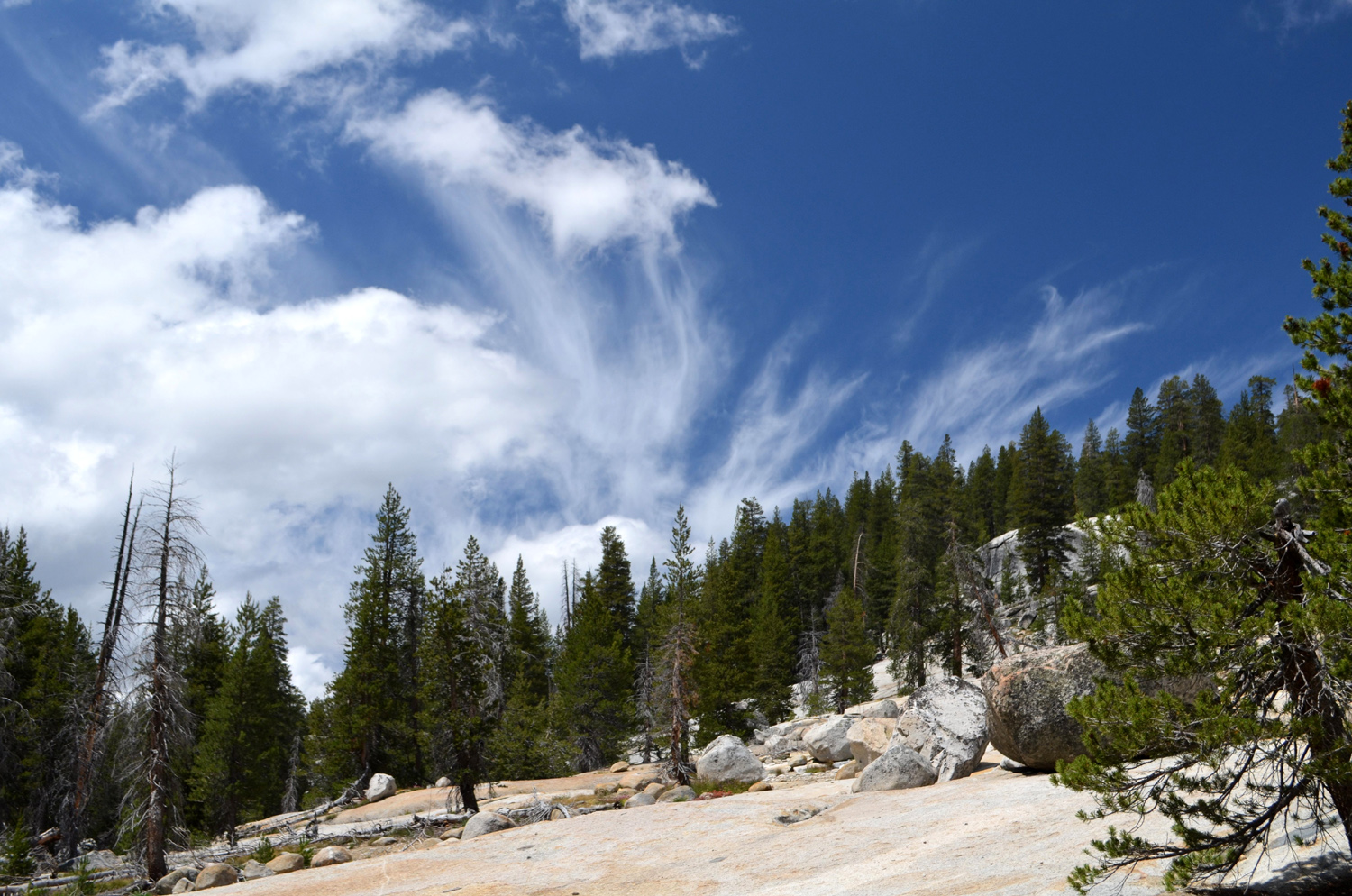
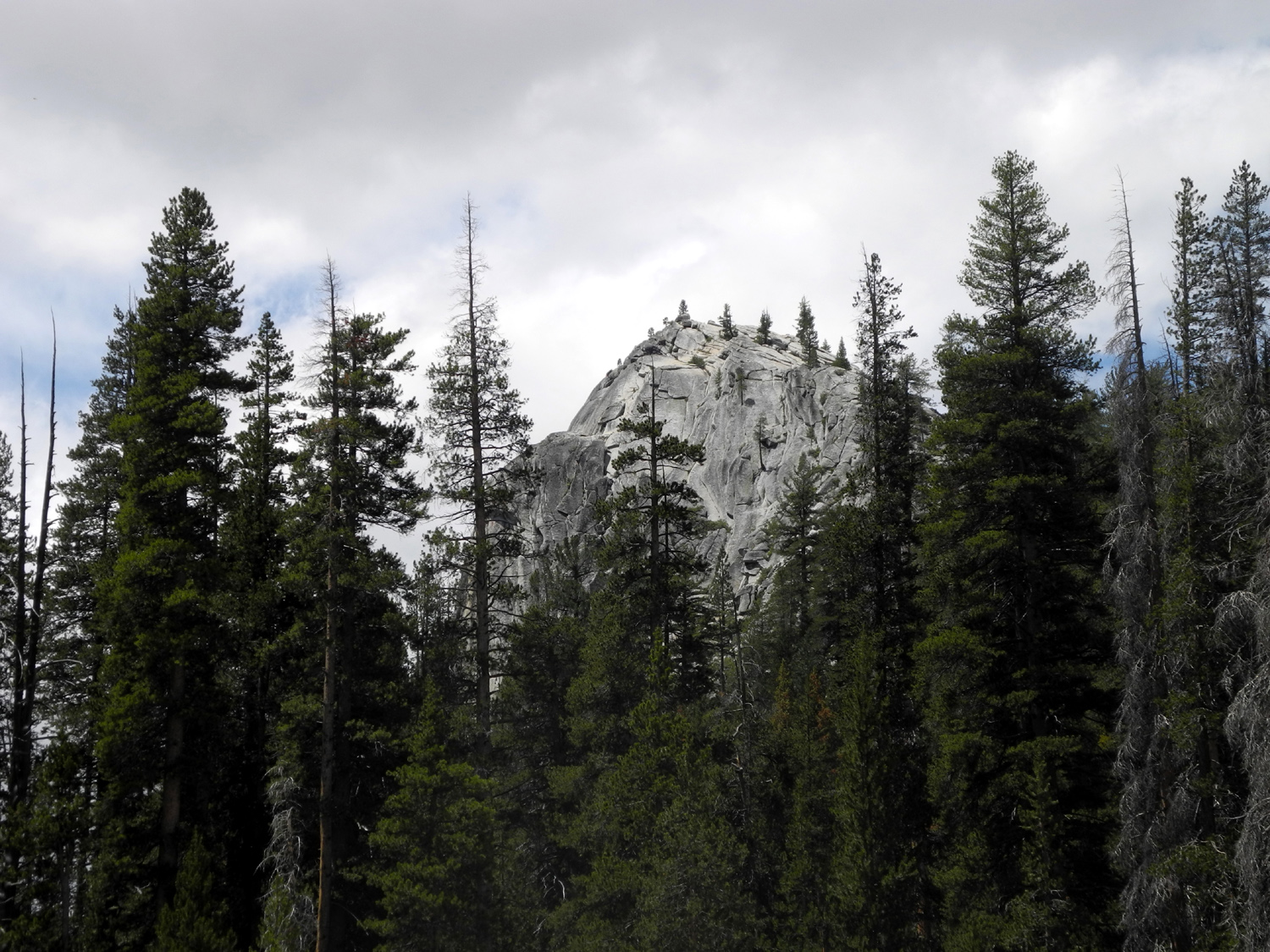
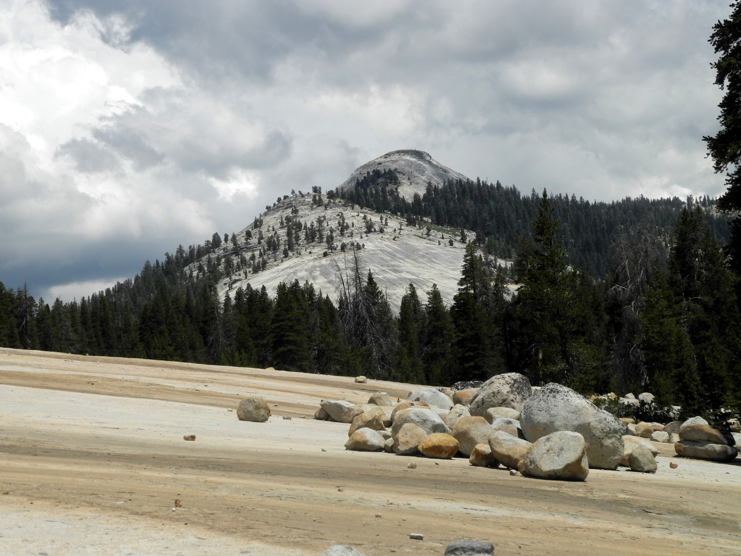
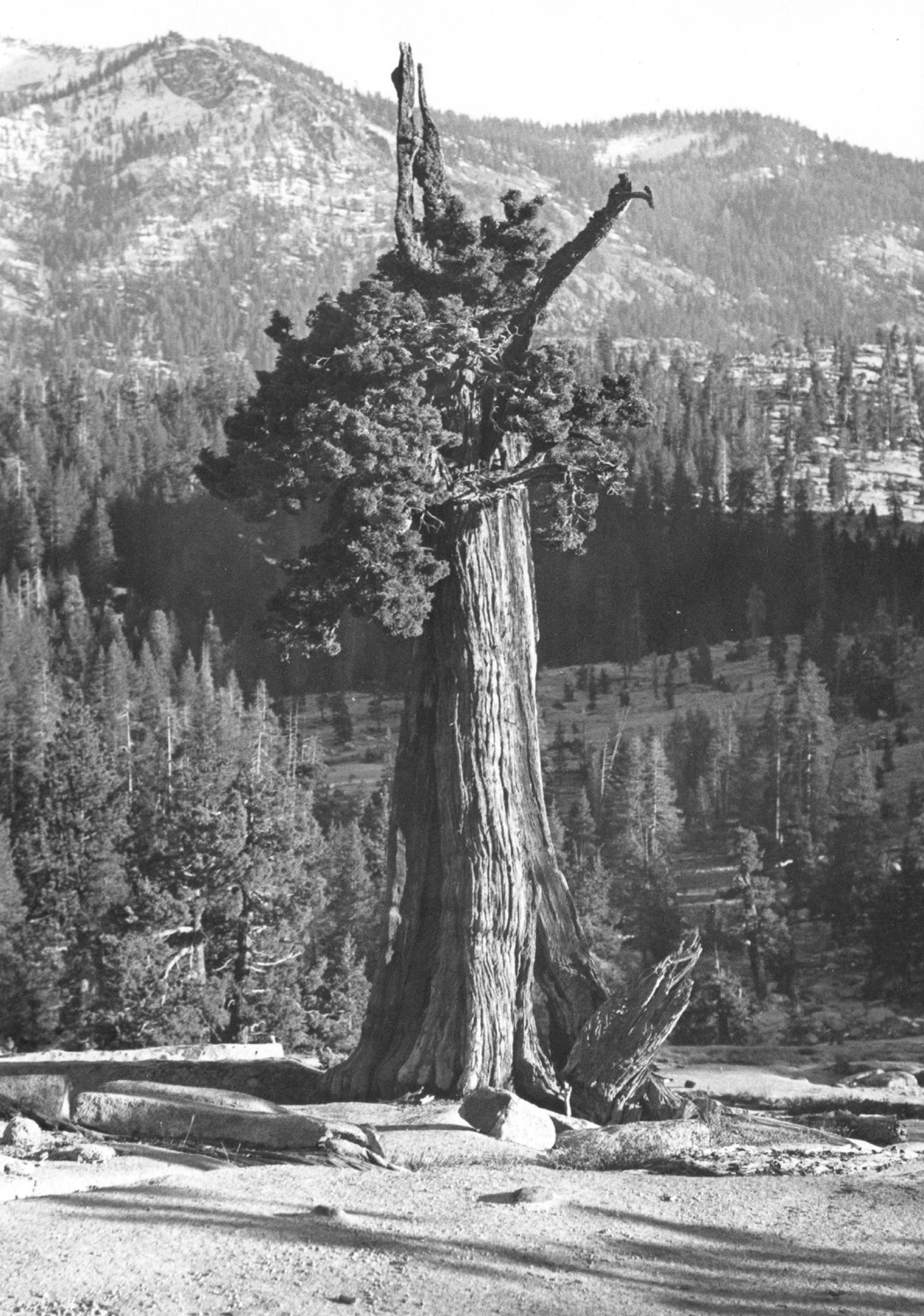
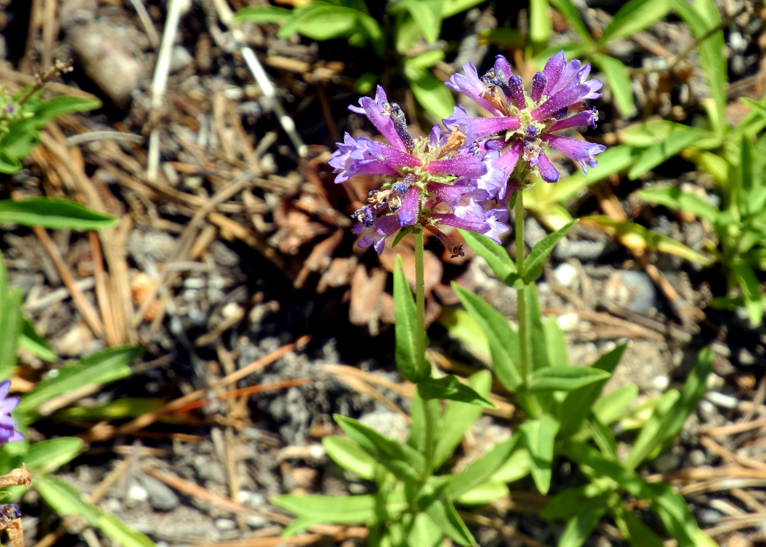
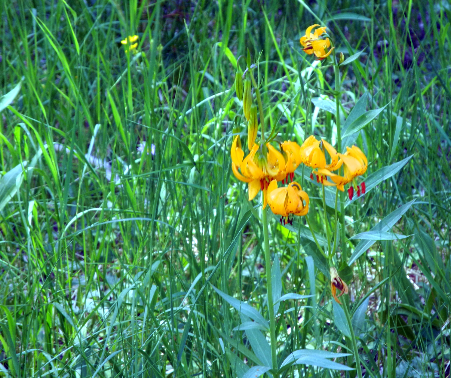
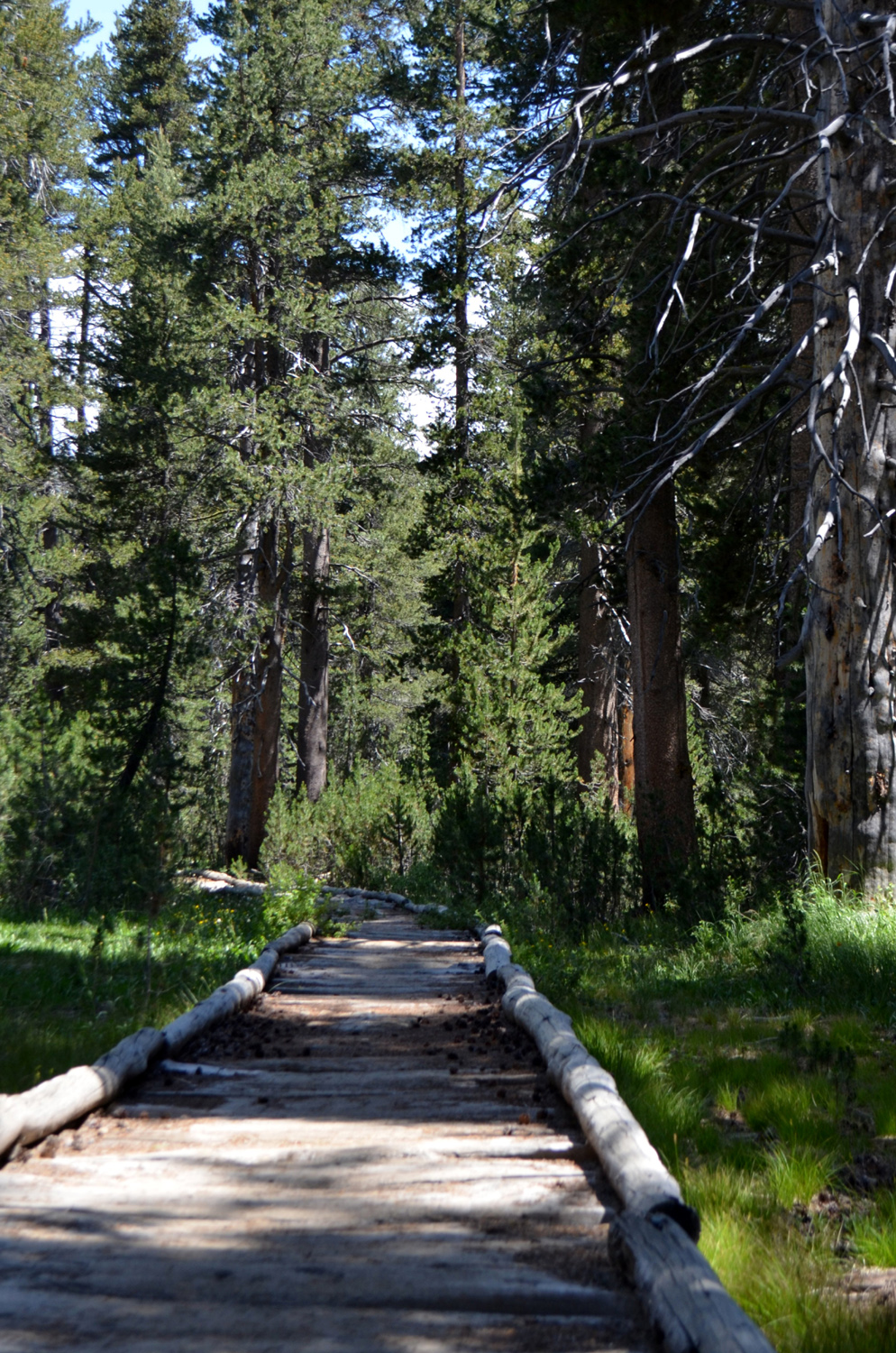
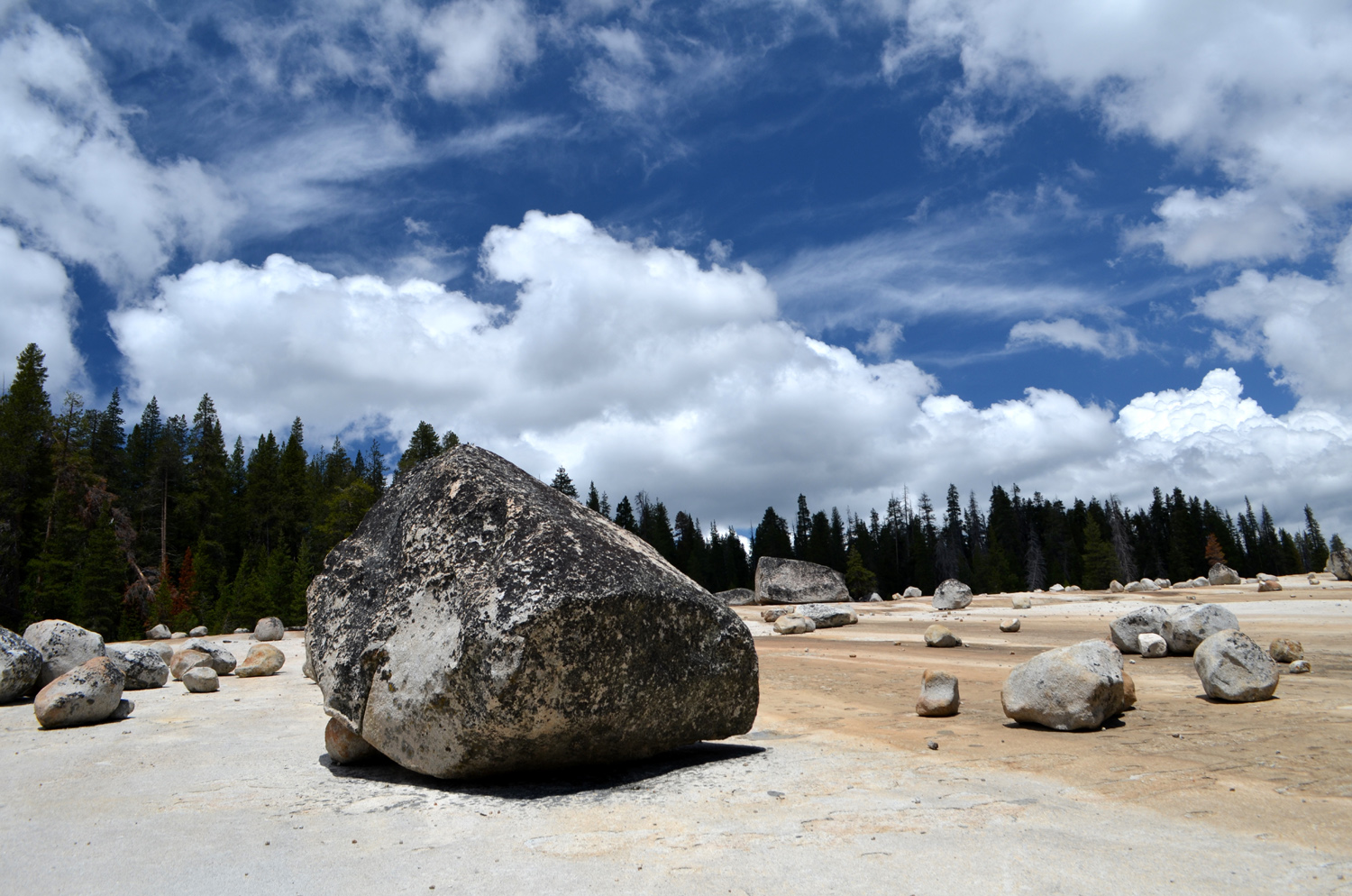
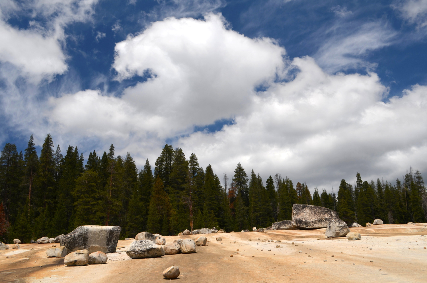
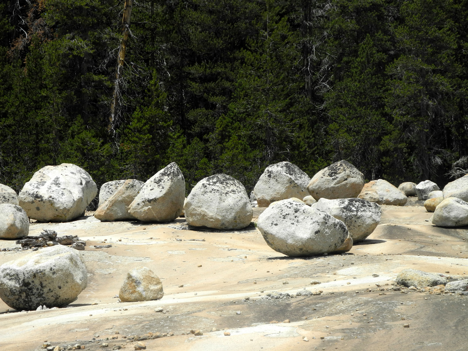
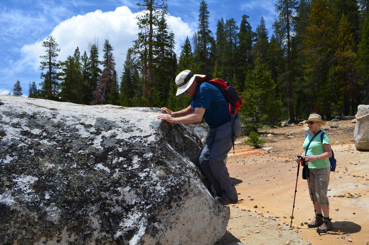
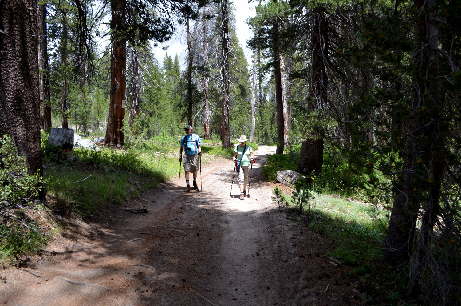
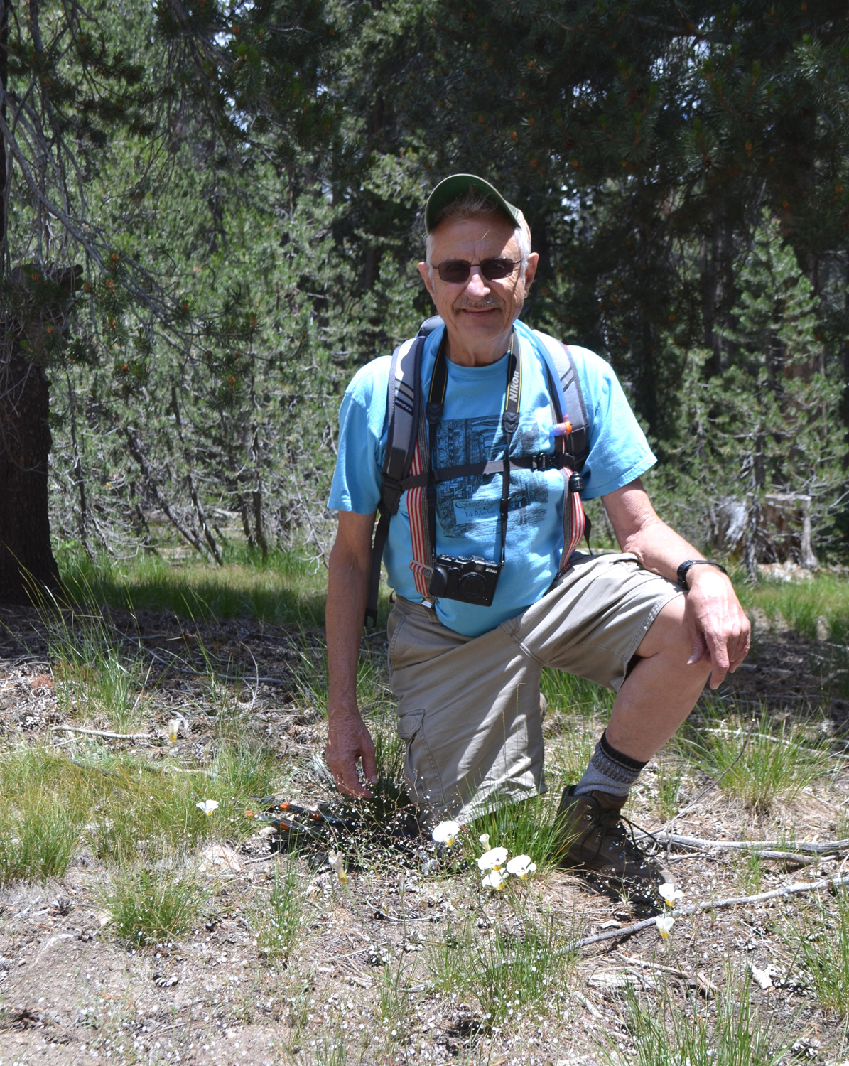
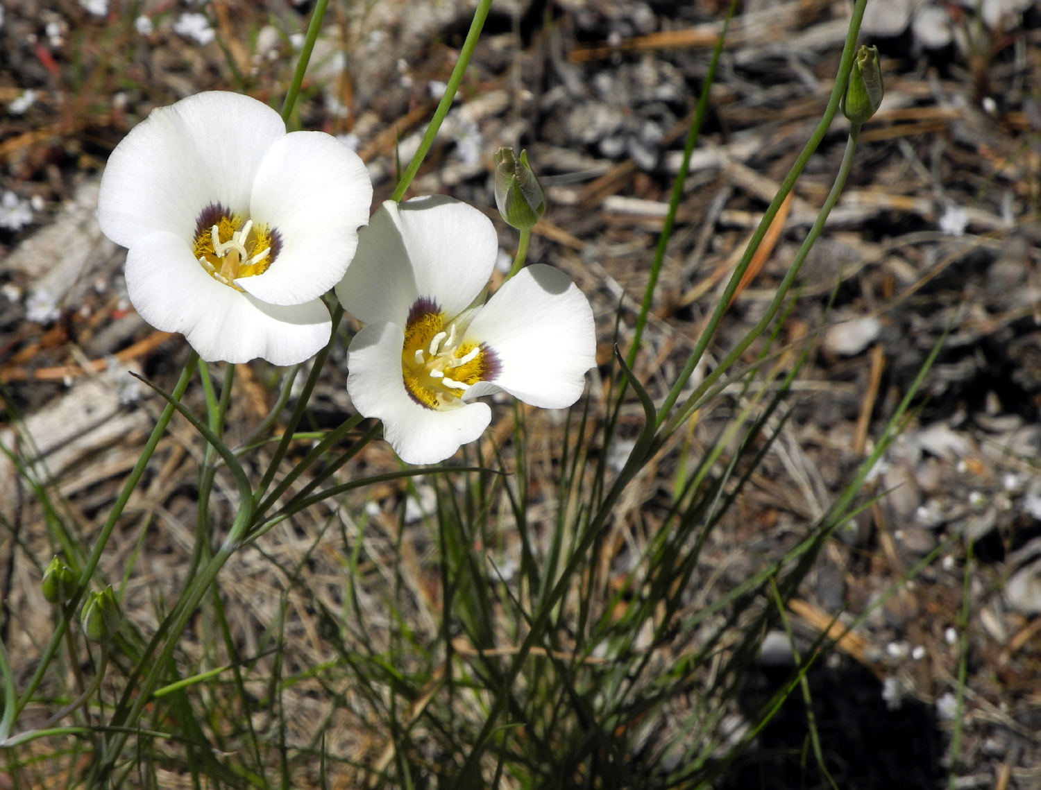
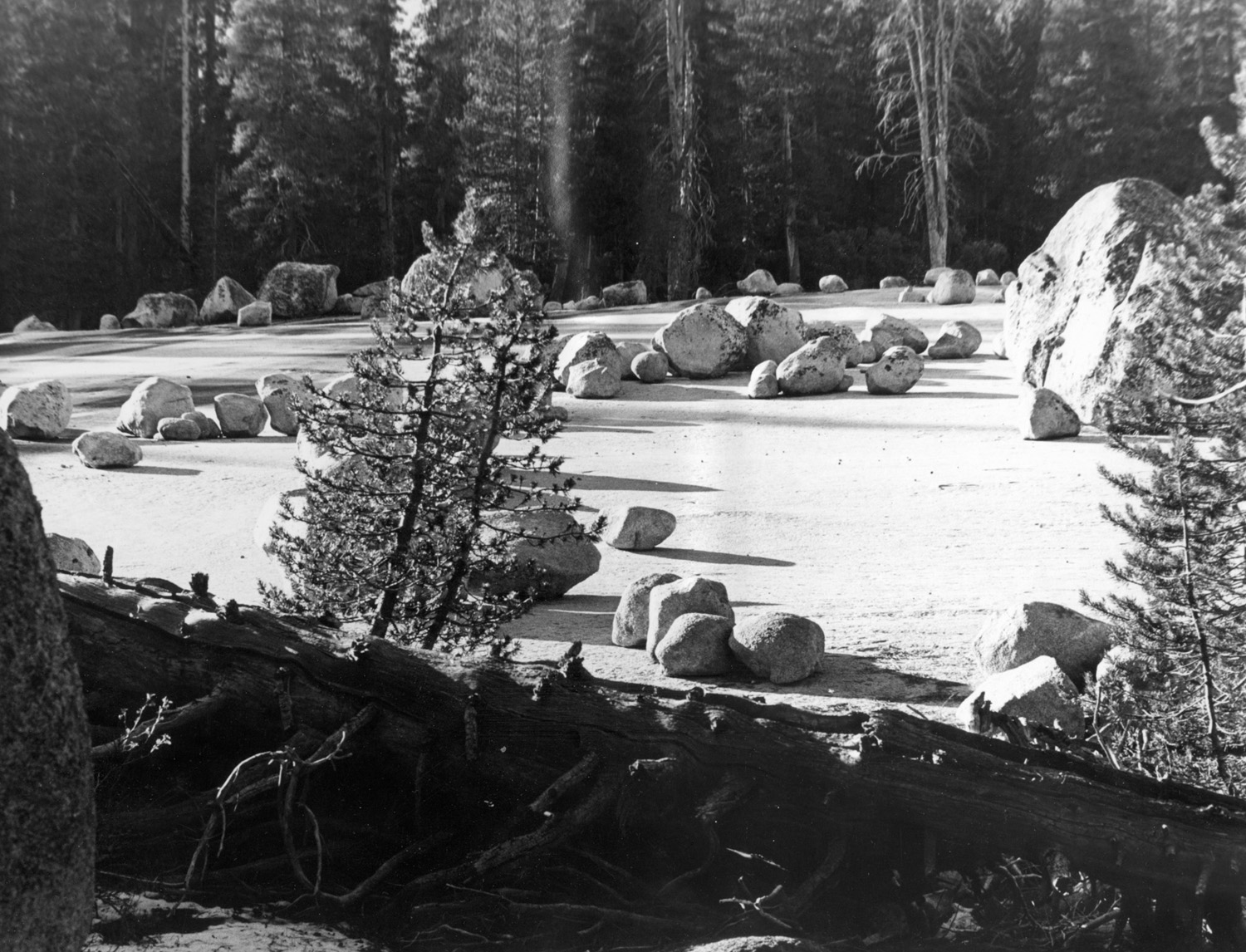
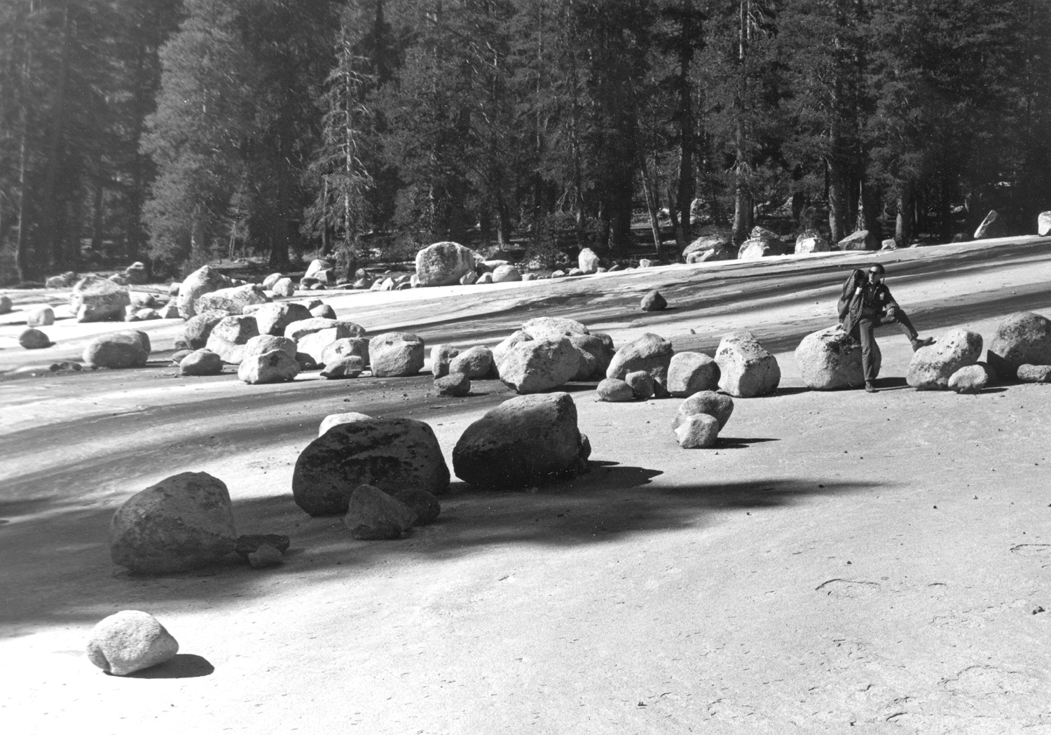
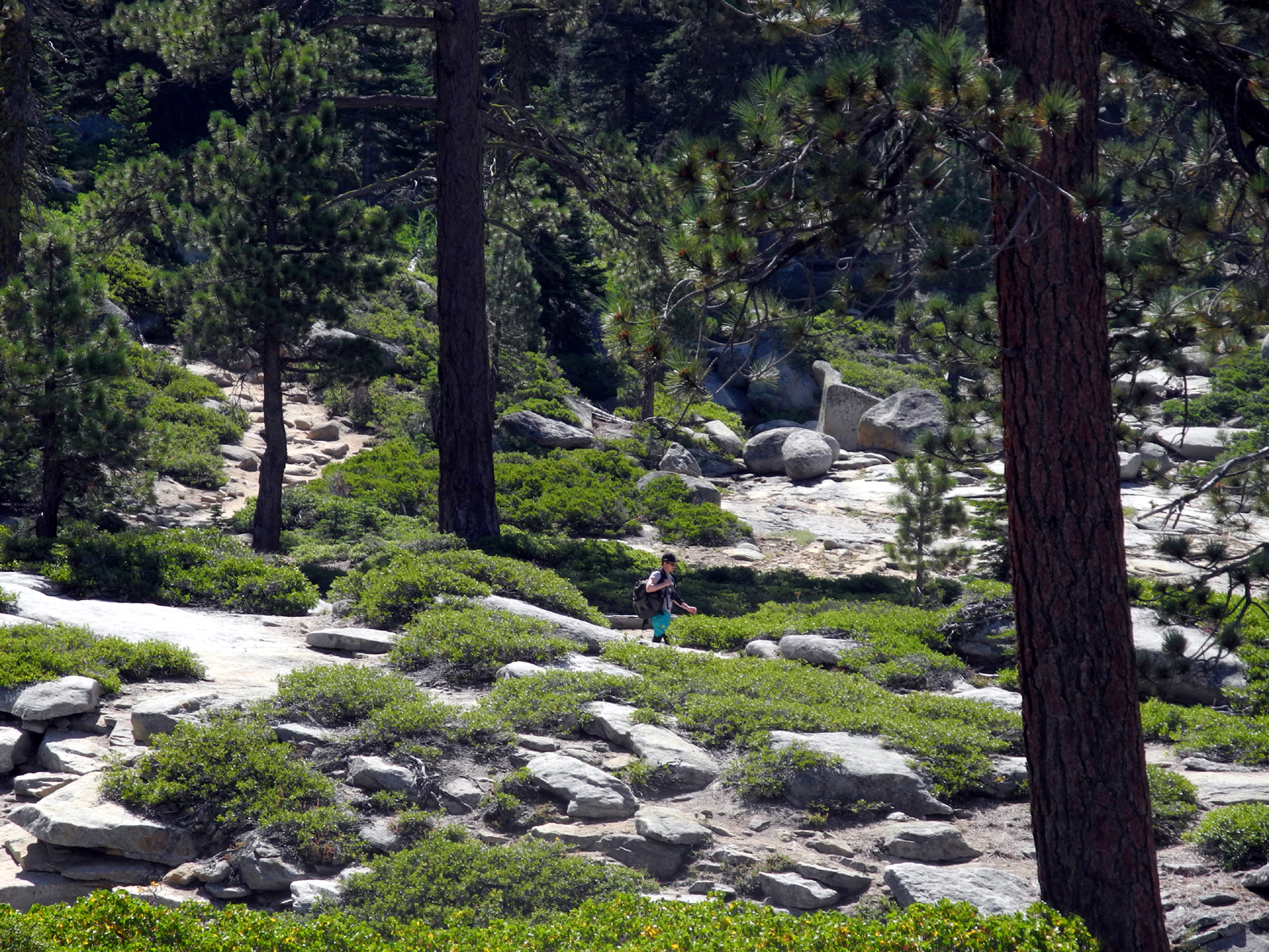
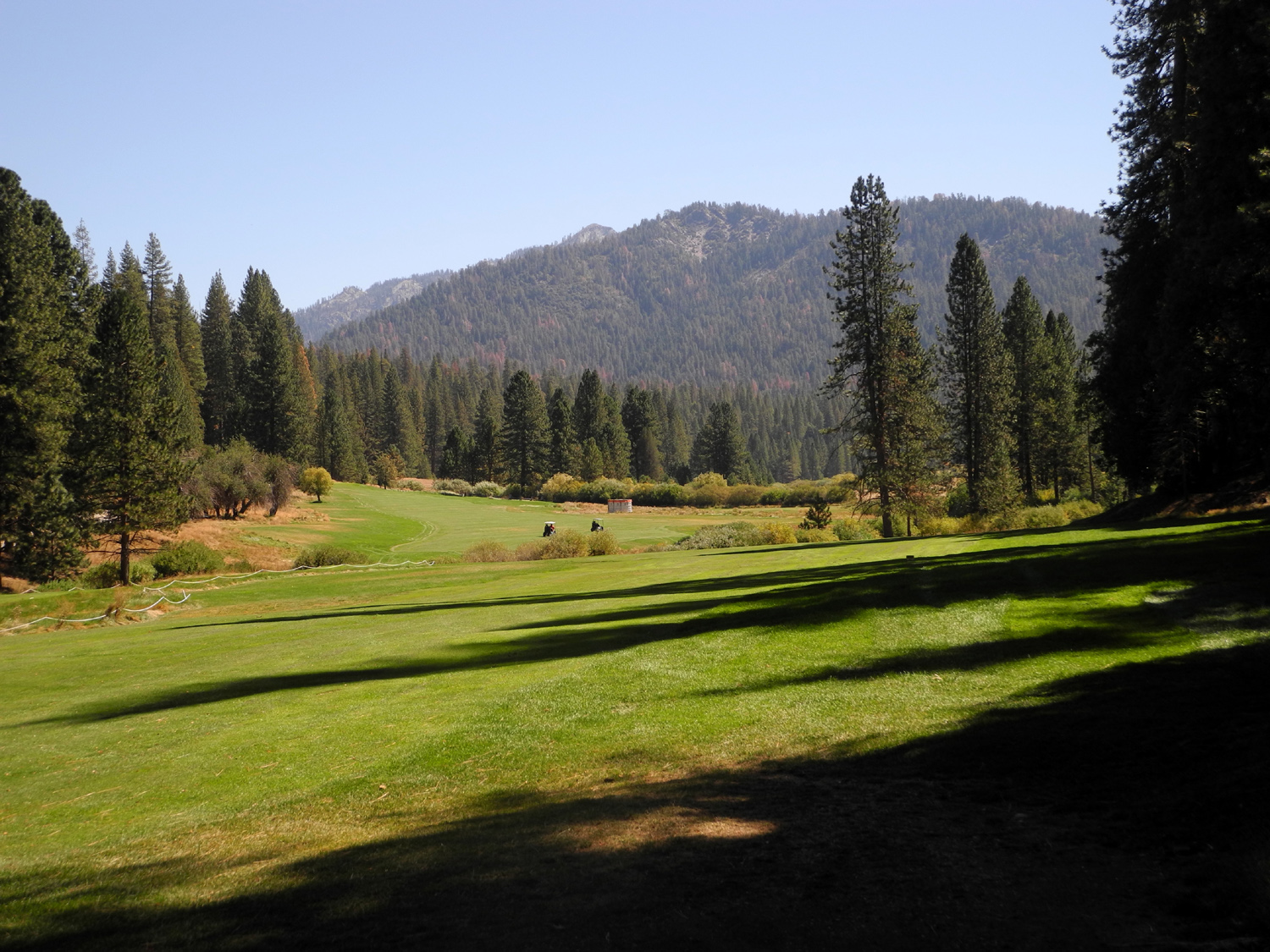
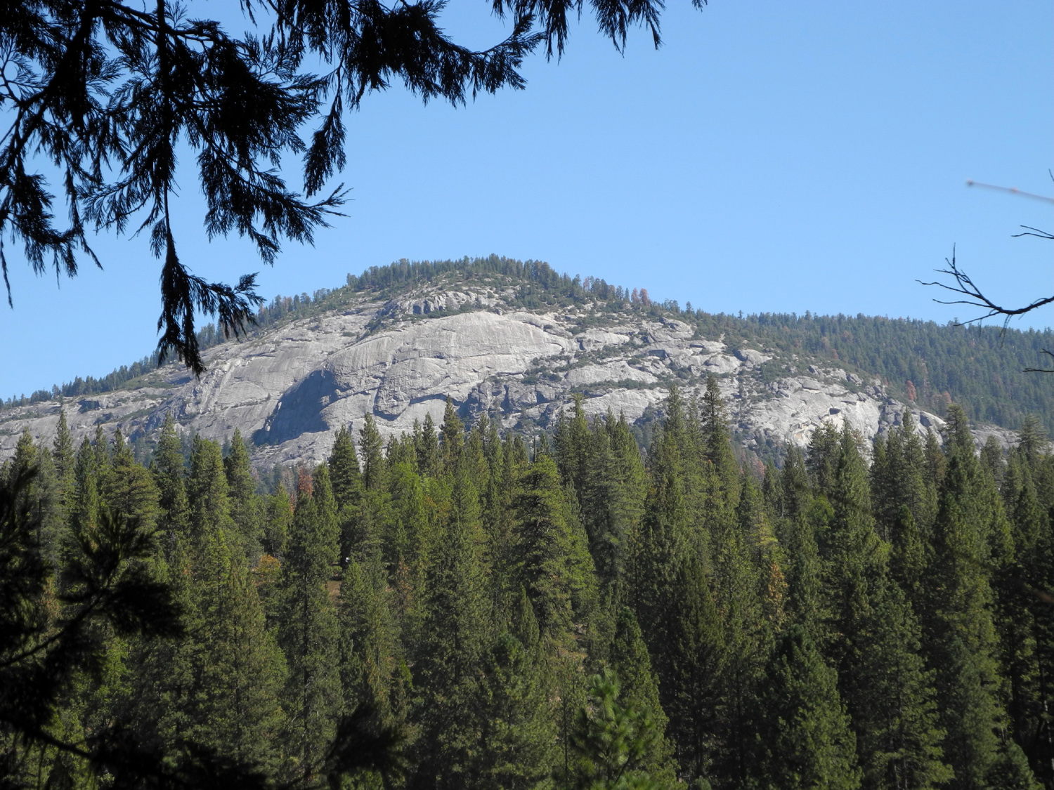
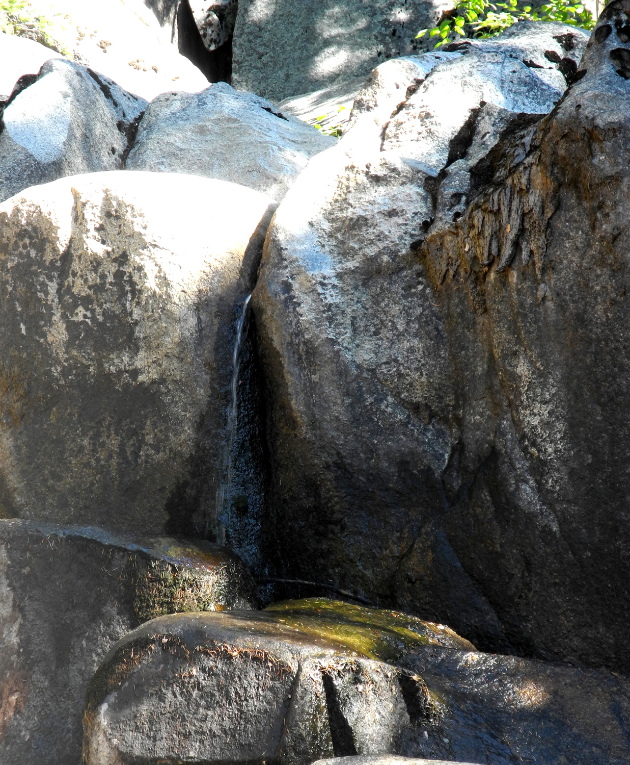
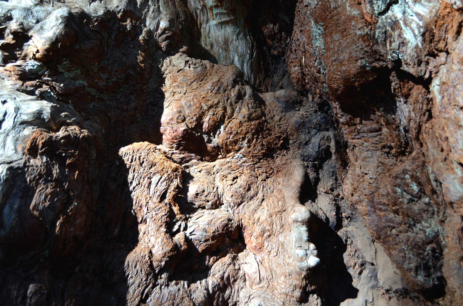
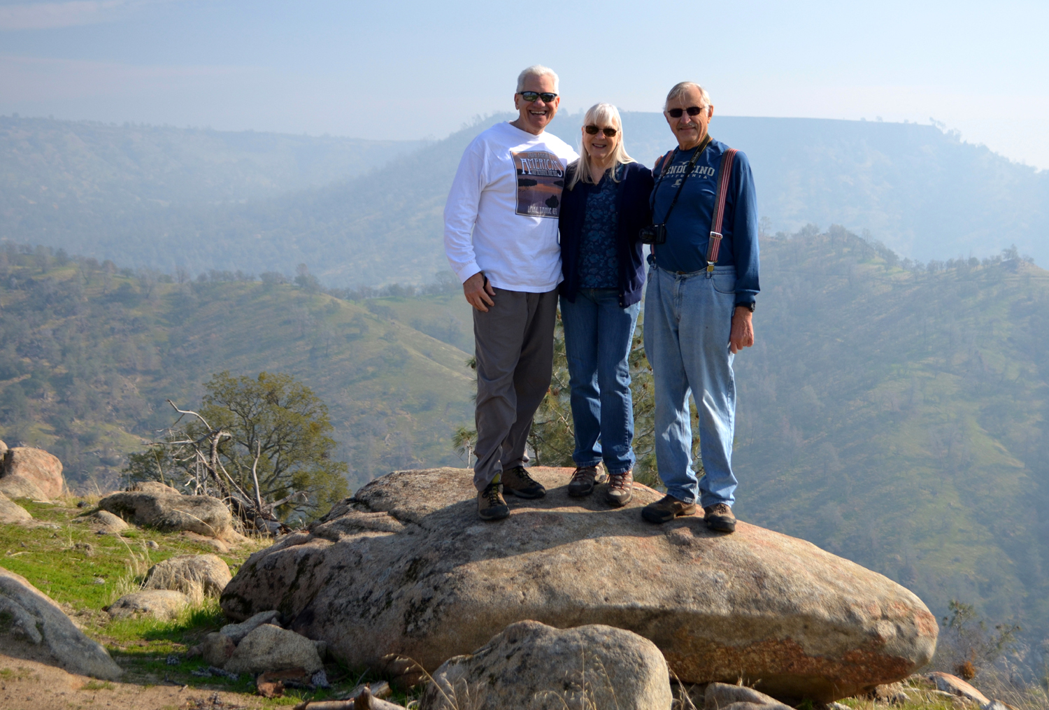
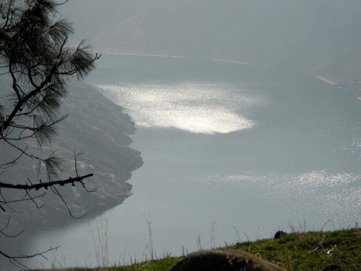
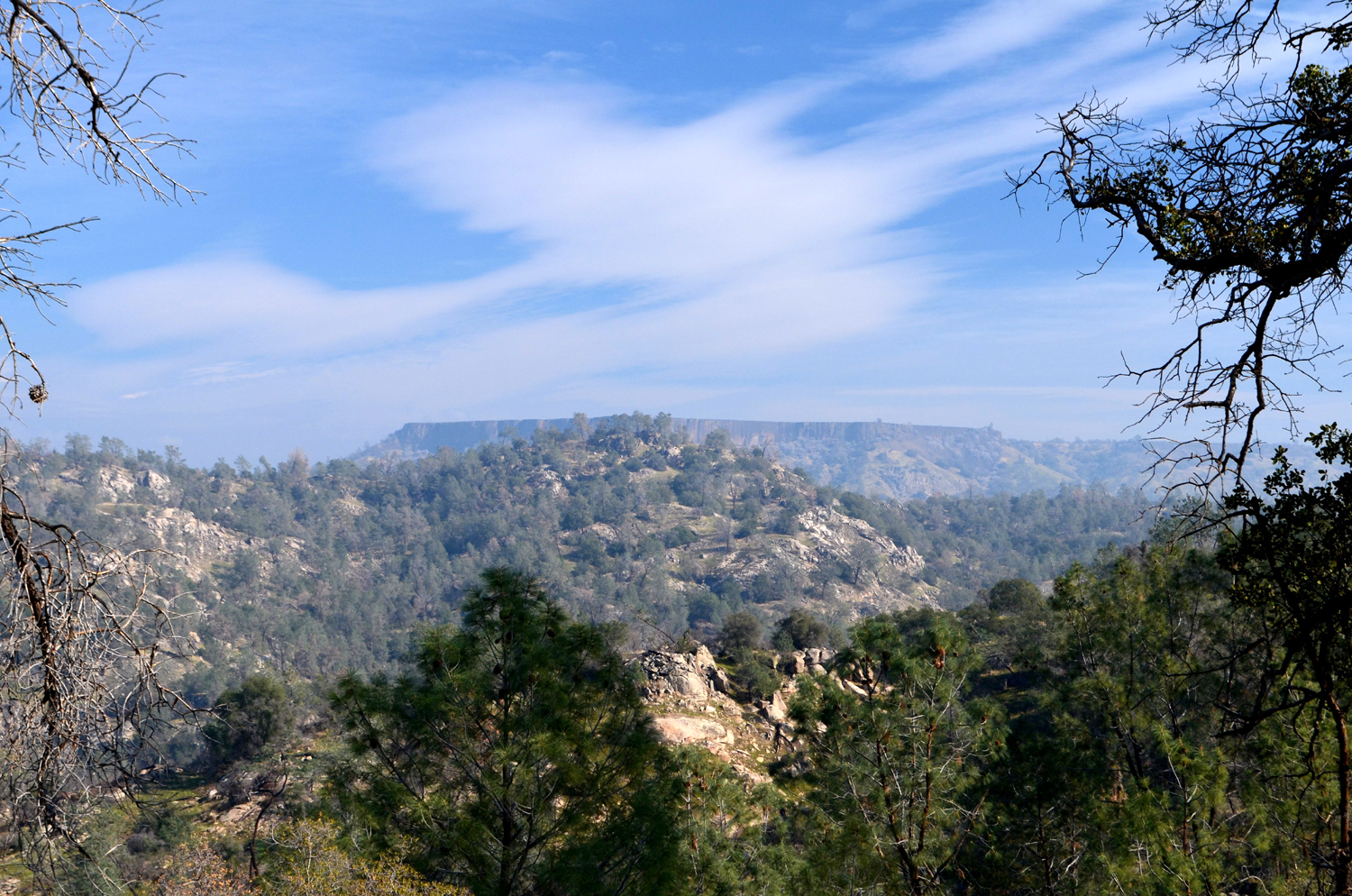
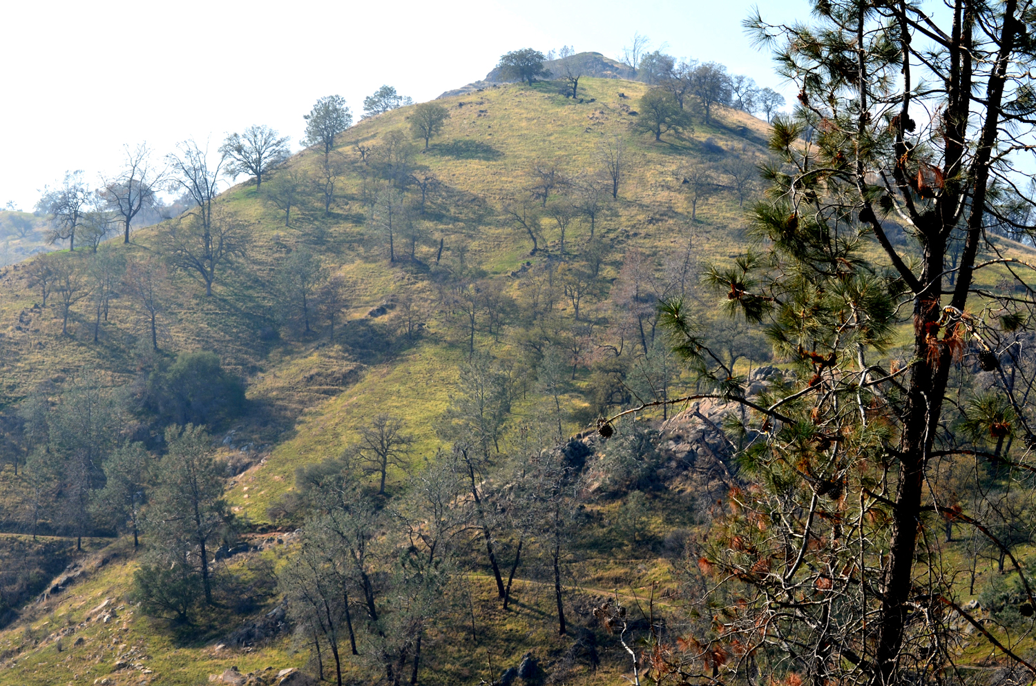
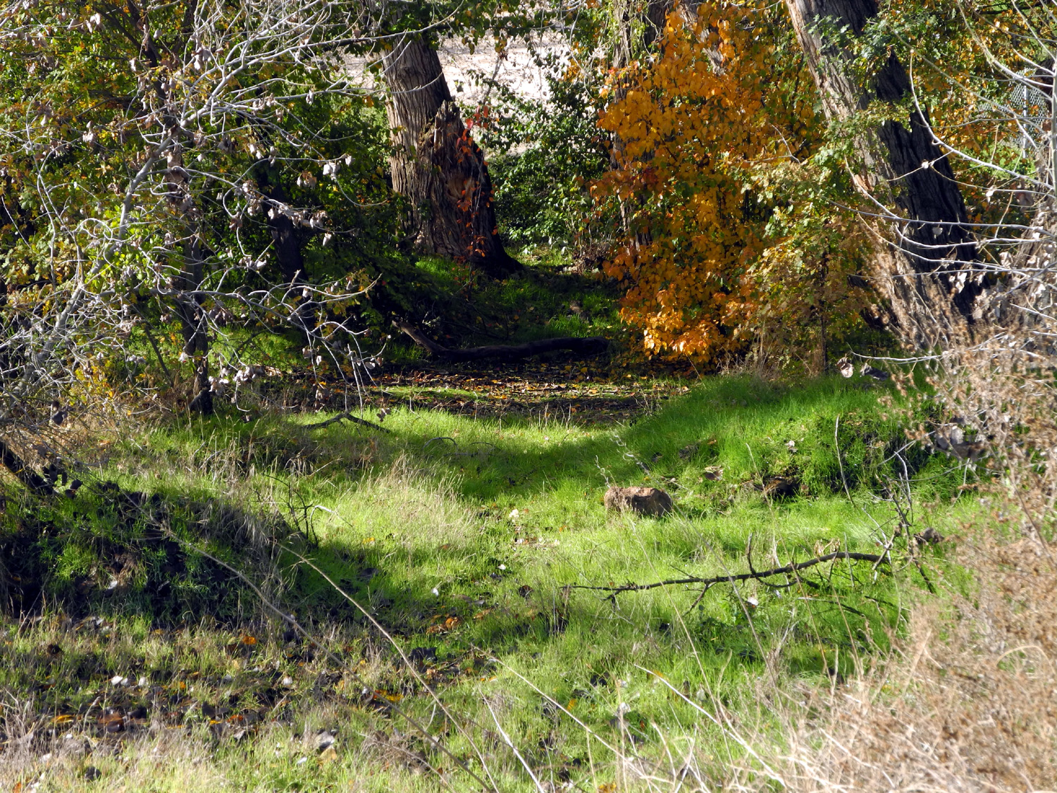
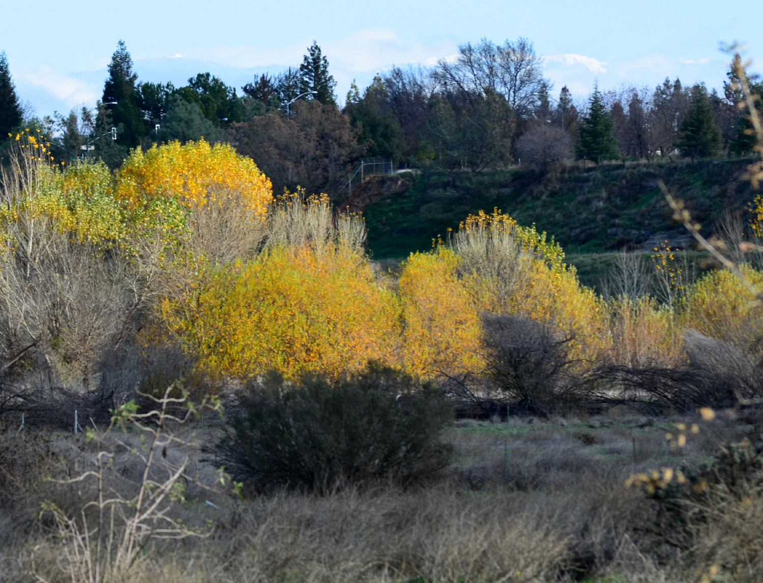
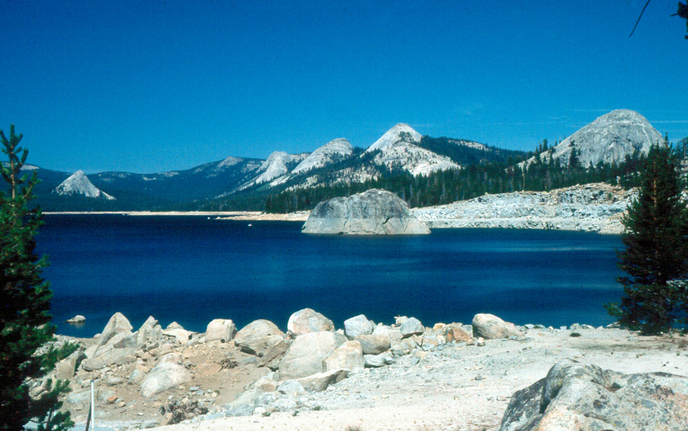
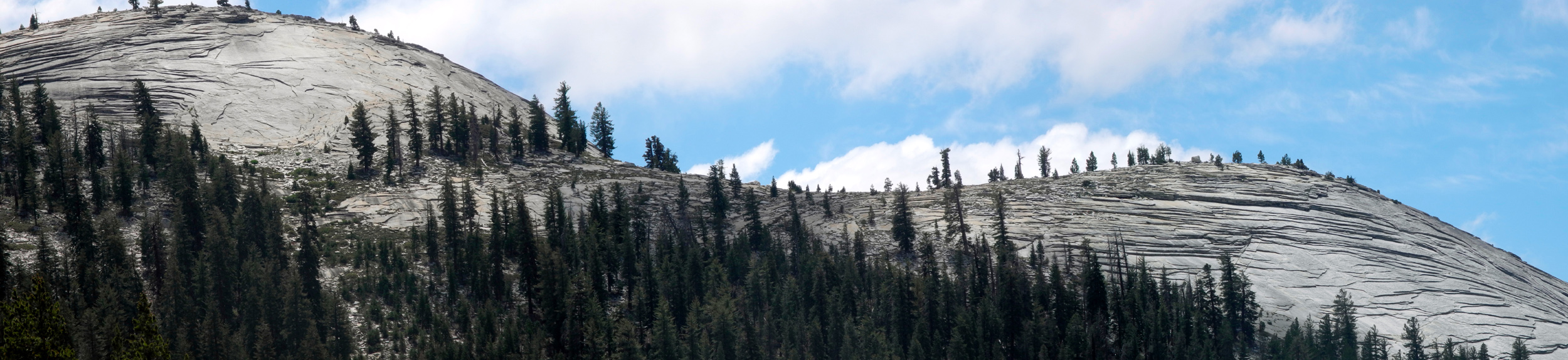
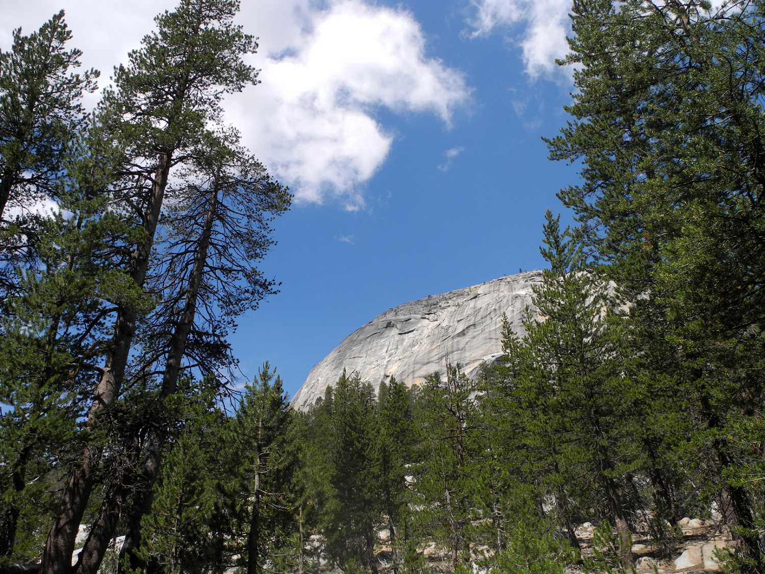
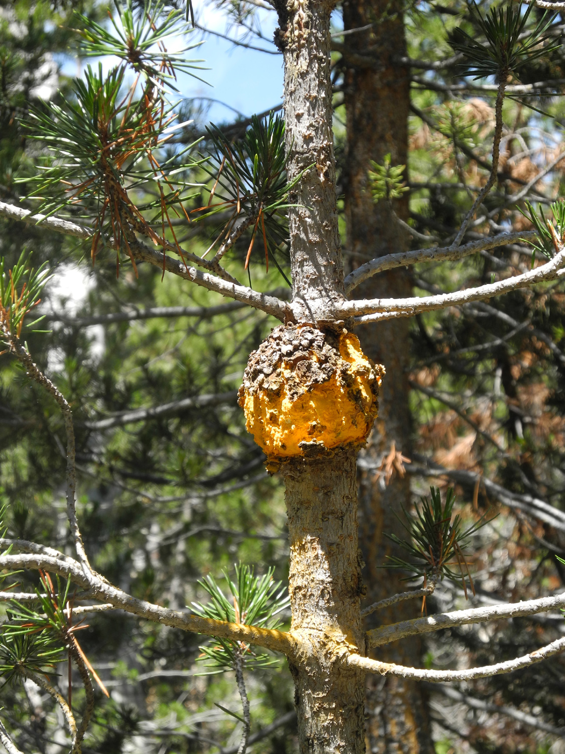
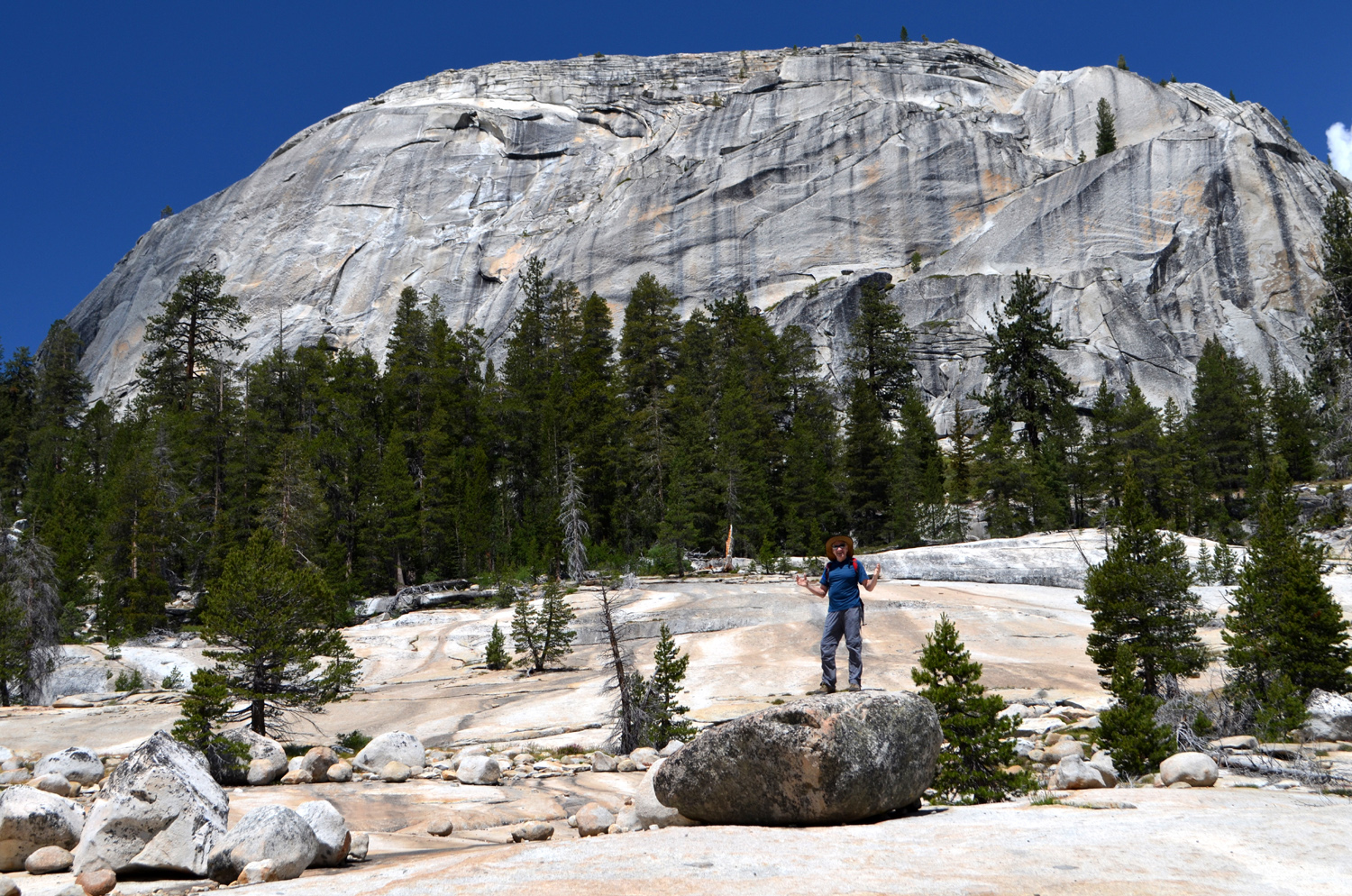
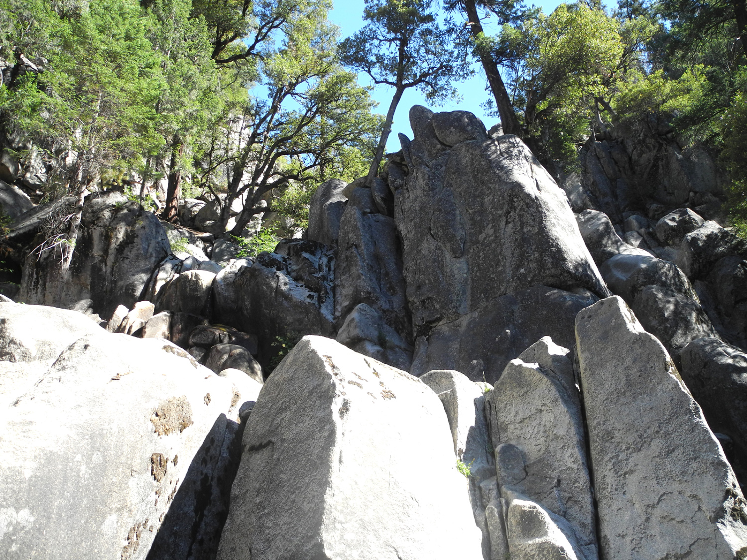
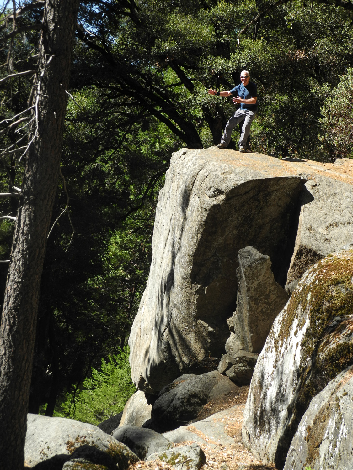
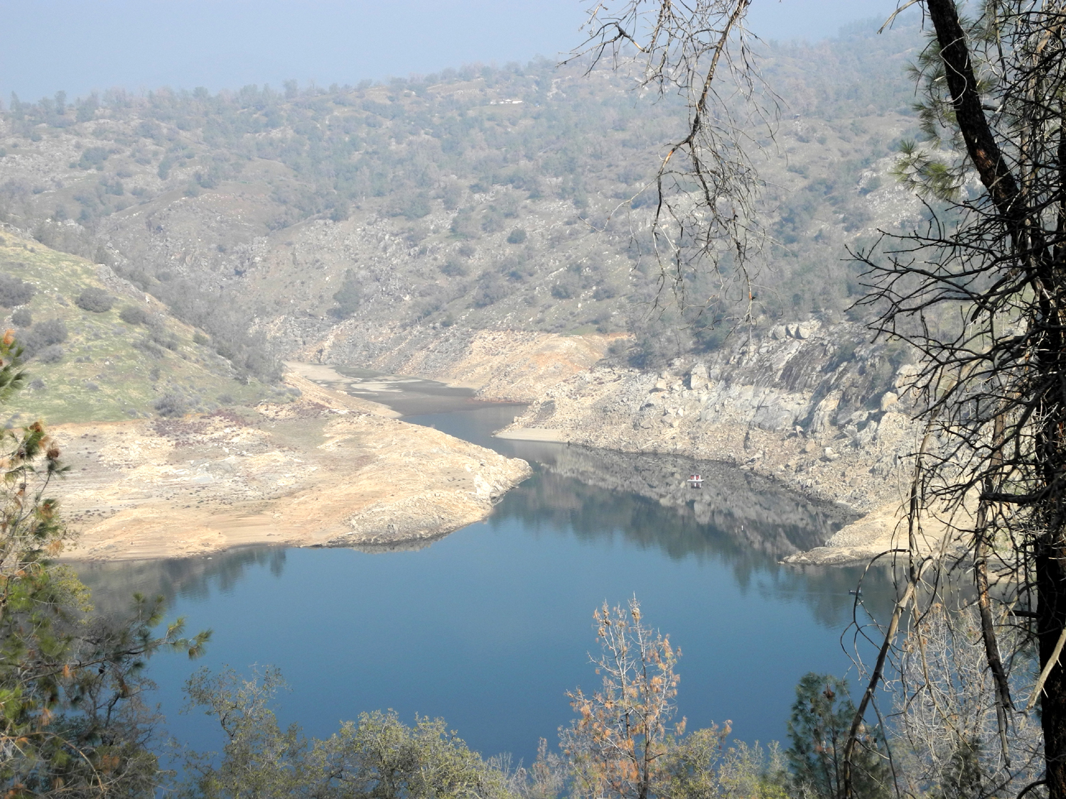
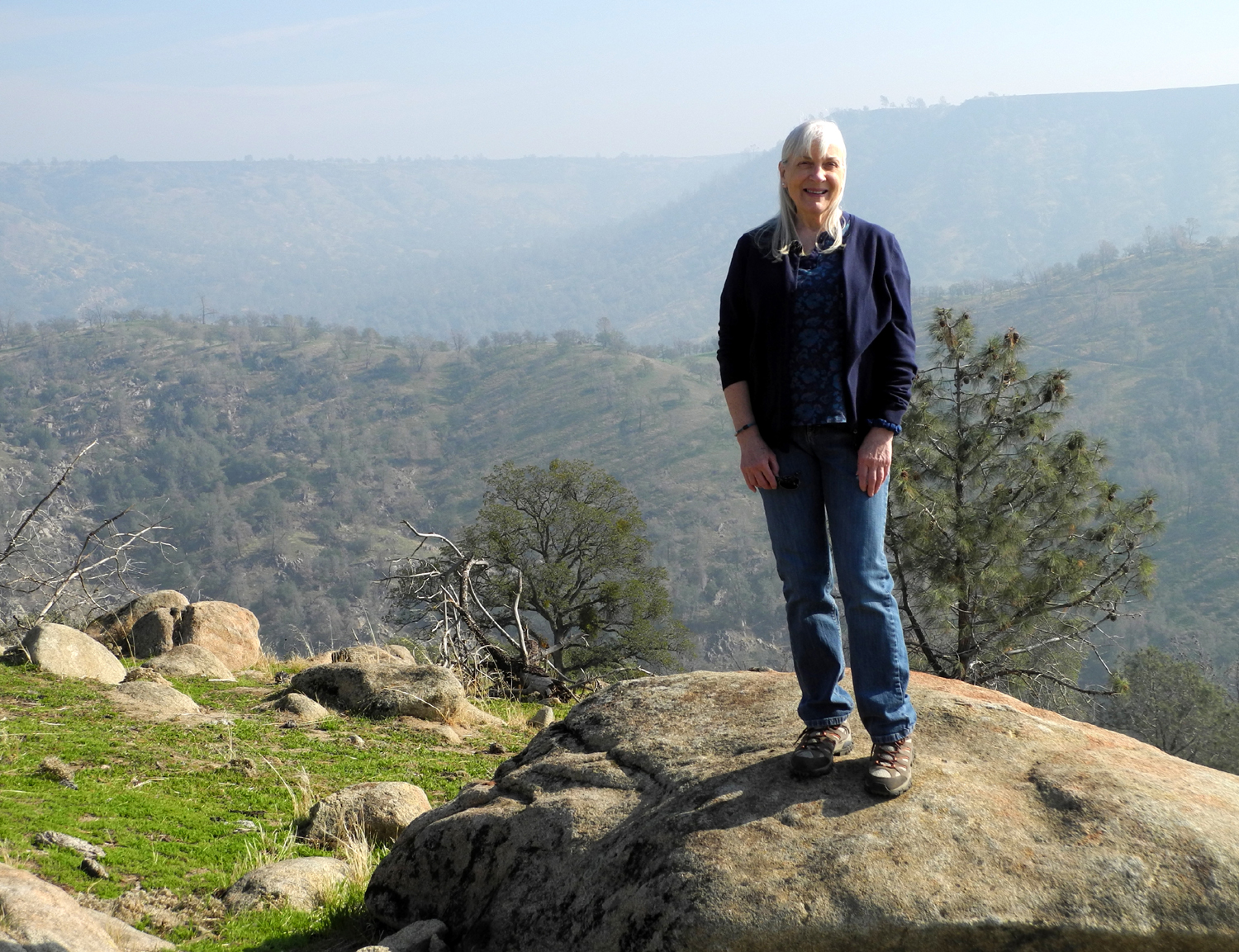
Courtright Reservoir Hike My hiking history can be divided into several distinct time periods, each with different levels of effort and distance. First, when I was a kid, lots of hiking and just walking around the countryside near my house in Bootjack (Mariposa County CA), mostly very unstructured. Then, hiking in Yosemite Valley while attending 4-H camp. These were organized hikes, with a bunch of kids and an adult leader. They were either a half-day around the valley, or a full day on some trail that usually went up to a specific destination, including the top of Yosemite Falls, and Glacier Point. These all-day hikes were typically about eight miles round trip. After this there was not much hiking - usually just short walks when camping, starting around 1963. Finally there were day hikes in the Sierra as an adult. When I moved to Fresno in 1966, I became friends with Lew Koch, who worked with me at KJEO, Channel 47. He was from Kentucky, and had fallen in love with the Sierra. He had taken a number of day hikes, sometimes with his wife, but more often with another colleague, Wil Heath. One day they invited me to join them. Our destination was Courtright Reservoir, at 8,000 feet in the Sierra, beyond Shaver Lake and Dinkey Creek, about a two-hour drive from Fresno. None of us had ever been there before. A mile or so before you reach the dam there is a vista point off the main road which gives a good view of the LeConte Divide, a range of peaks that separates the San Joaquin and Kings River watersheds. When we approached the lake itself, we were captivated by the scene - rows of domes rising up on both sides of a small blue lake, with a deep gorge running out below the dam. Our hike revealed even more impressive scenes, and I have been there a number of times since then. It has probably been over ten years since my last visit, so it seemed the perfect place for the Ramblers' July hike. None of the others had been there, and the elevation meant we would have pleasant conditions for a summer hike. We got an early start on July 8, but sadly, Julie was not with us. She has some vision issues that need to be corrected, so she plans to skip hiking until September. Our route was up State Highway 168 to Shaver Lake, where we turned east on the Dinkey Creek Road. From here it's about 15 miles to Dinkey Creek, a resort community that includes public and private campgrounds. Here we took the McKinley Grove Road east across the creek. Normally you see people fishing below the bridge, but weather conditions have reduced this stream to a tiny trickle. Six miles from Dinkey Creek the road passes through McKinley Grove, a small stand of giant sequoias. This location has a picnic area, paved handicap access trails, and a campground nearby. Most of the trees can be seen from the road. When I first visited Courtright, the trailhead started at the dam, but a number of years ago the road was extended across the dam, and a large parking area was constructed about a half mile further into the forest. This is not just a hiking trail, although it connects to the major trails of the Sierra, including the John Muir Trail. It is also the southern end of the Dusy-Ershim Off-Highway Vehicle (OHV) route. I walked on and wrote about the northern section of this "Jeep trail" in June. It is considered one of the most challenging four-wheel drive routes in the nation, although this end is not nearly as difficult as the northern section. For hikers, it's not difficult at all, except for the danger of tripping while gazing at the amazing scenery in all directions. From the parking lot there is a fairly steep but short downhill stretch, then the trail is relatively level for a little over a mile, which was as far as we went. It passes through a glaciated valley, with domes and other granite formations on both sides, and the usual offering of wildflowers, trees, shrubs and fresh air. It should be noted that there is a ridge, a large dome, and a fairly wide expanse of land between the trail and the lake, so the water is not visible anywhere along the section we hiked. Along much of the trail the landscape is dominated by large domes on each side. One of the things photos can't quite capture is the constantly changing views of the dome to our west as we walked past it. Although it was obscured by trees now and then, from start to finish we could nearly always get a glimpse of it. (Later I created a slide show with various views of what we now call Constant Dome.) Among the things that impressed me on my first hike here were the gnarly Sierra junipers that grew in some of the more rocky, inhospitable areas along the trail. Due to the extension of the road, we drove rather than walked through this section, so I didn't get any new photos, but I've included a couple of juniper photos from my early trip on this page. About 3/4 of the way in from the trailhead, the road and trail become separate, with the 4-wheel route going to the left, more or less northwest, while the trail jogs to the right through a flat, forested area. Apparently in normal rain years this is a somewhat swampy area - for about 200 yards the trail is a boardwalk constructed of logs. This division of the trail and the boardwalk are new since my last visit. The most dramatic part of the hike, this one and my first one, was our arrival at an area we called the Giants Marble Game. It is a huge flat granite area, sloping up slightly from the trail for about 100 feet, and at least a thousand feet long. It shows typical signs of glacial polish, areas that were smoothed off by the passage of glaciers, and is covered with boulders of all sizes that were carried along in the ice, and left in their current location when the massive ice sheets melted. The OHV route crosses the southwest corner of the granite. We ended our hike here, but spent a half hour or more wandering around, taking pictures, and taking note of small details, such as an area where pebbles and small rocks have been washed down across the huge granite slab by flowing water. There is a good view here of Maxson Dome, which rises above the northeastern corner of the lake, so we took our usual group photo with this striking feature in the background. Wes also found the perfect boulder to climb up on for the obligatory "Wes on the rock" photo. After enjoying the beauty of the granite bedrock littered with boulders and the surrounding forest and domes, we started back. It was not long before we noticed a Mariposa lily. I had thought these flowers were confined to lower elevations, probably because I was used to seeing them in the foothills of Mariposa County, where I grew up. At first we saw only two blossoms, but then we saw them at many places along the trail. For some reason, we had not noticed them at all on the hike in. When we started back we were well up on the huge granite slab from the trail, and noticed markers for the 4-wheel drive road across the rock, so we followed that route back. After it left the rock, we came to a section that was clearly one of the challenging areas for vehicles. However, most of the OHV route was relatively level and quite "smooth" for a back-country dirt road. We watched the views of the domes change as we walked, and soon we were making the short but slightly steep climb back up to the parking area. Driving out, we stopped at a geological exhibit a short distance from the trailhead, and again at the lake to take some photos. We drove back to Shaver Lake where we planned to eat. We had researched several restaurants, but the one we chose was only open for dinner, so we went to the Shaver Lake Market & Deli. The sandwiches were very good and the service was fair, but the restrooms were out of order, so I have to give them a black mark for that. After lunch
we returned to the valley, glad that we had been able to enjoy a
cooler climate for the day. And I will always be grateful to Lew
for helping to introduce me not only to this specific area, but for
getting me interested in day hiking in general. --Dick Estel, July 2015 |
||
|
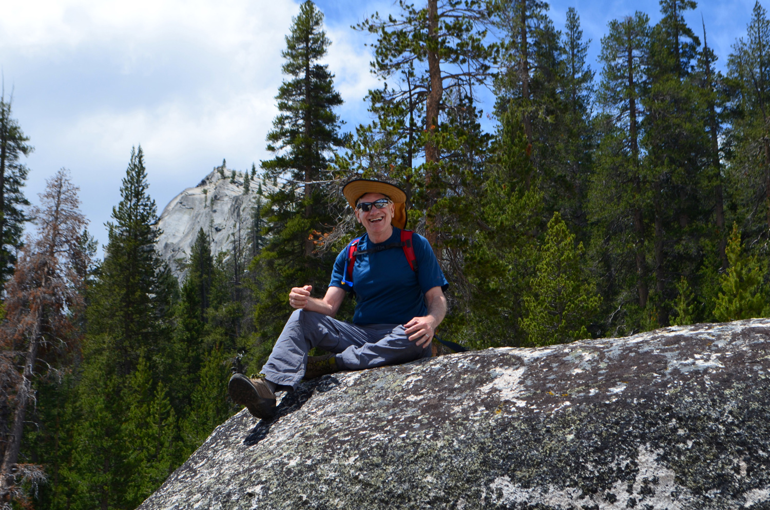
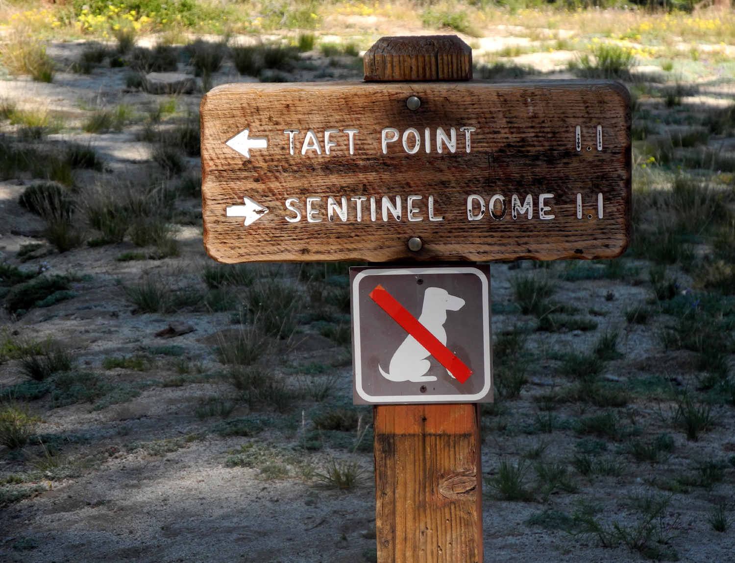
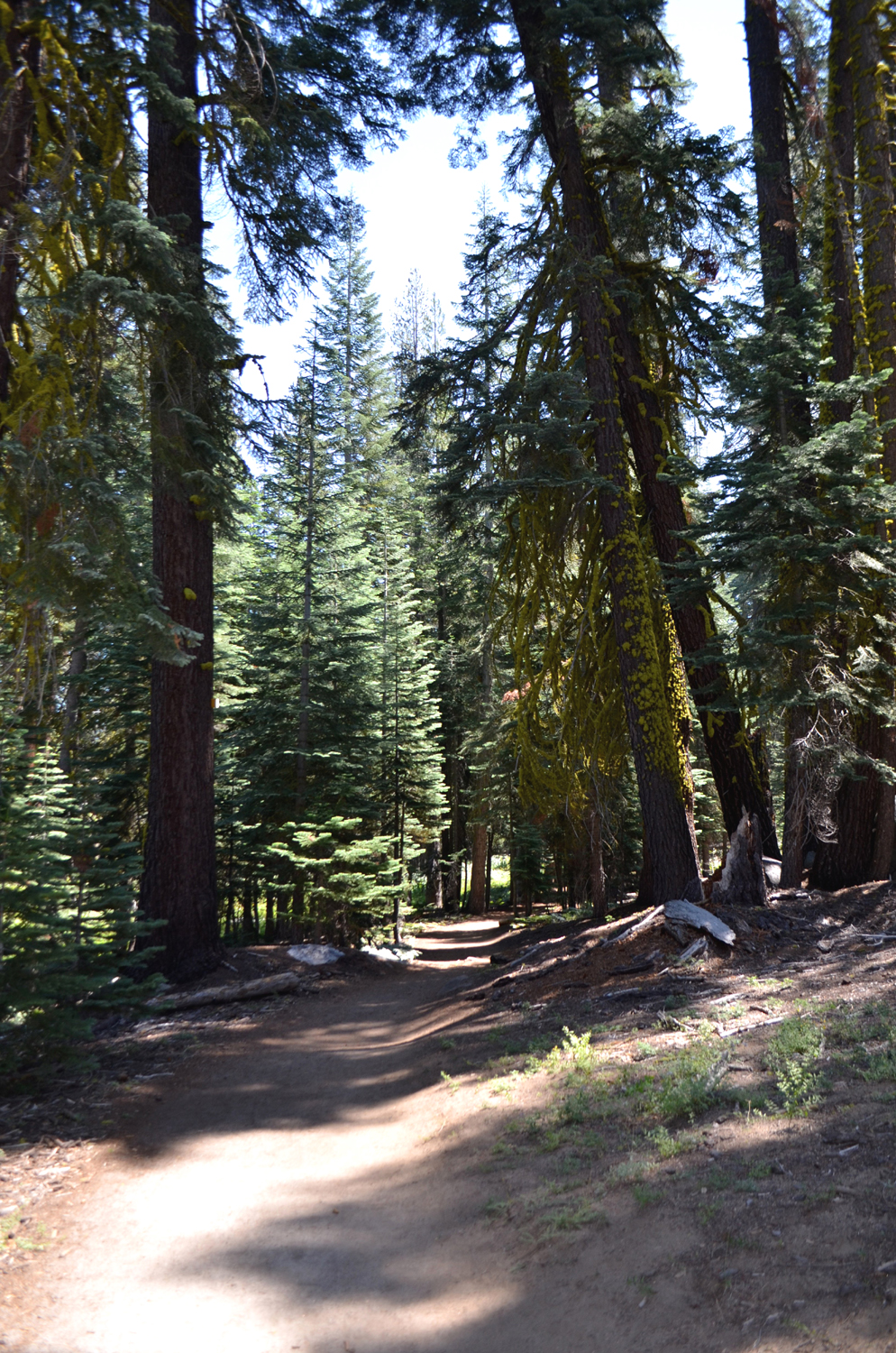
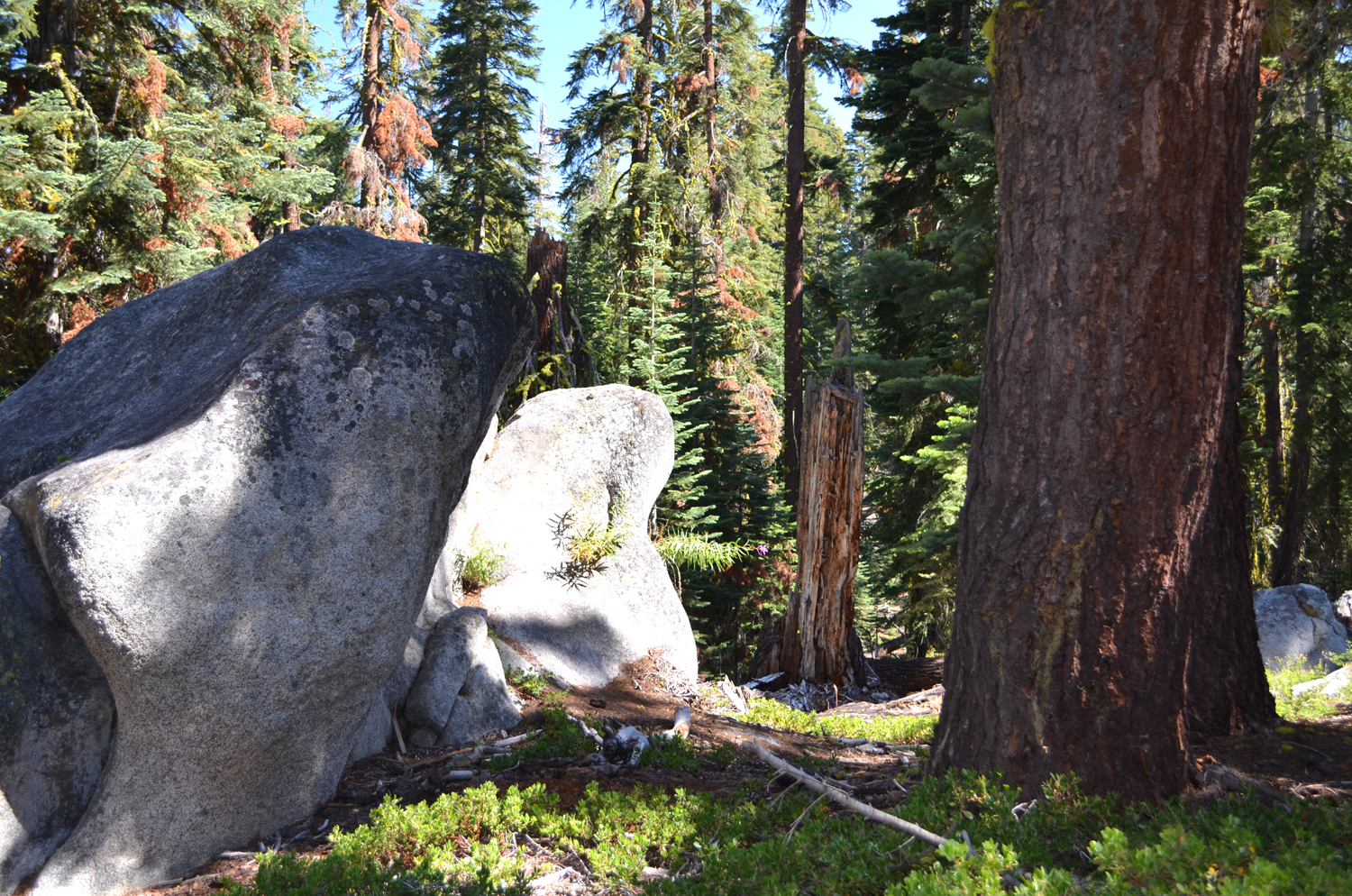
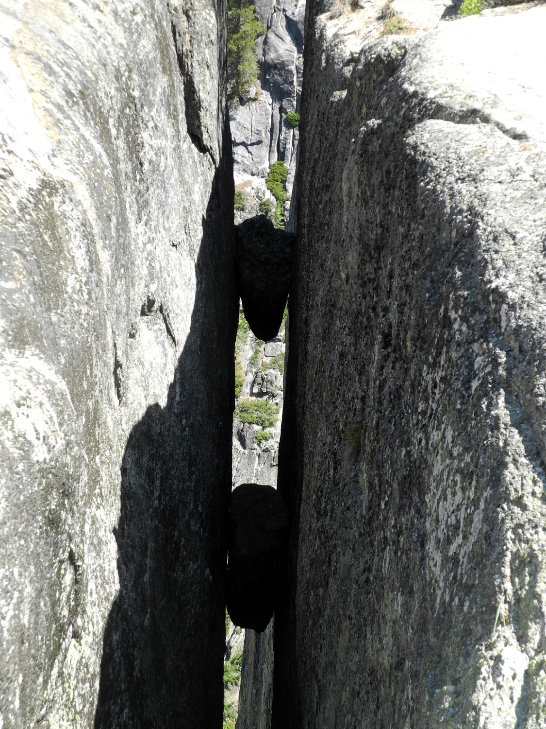
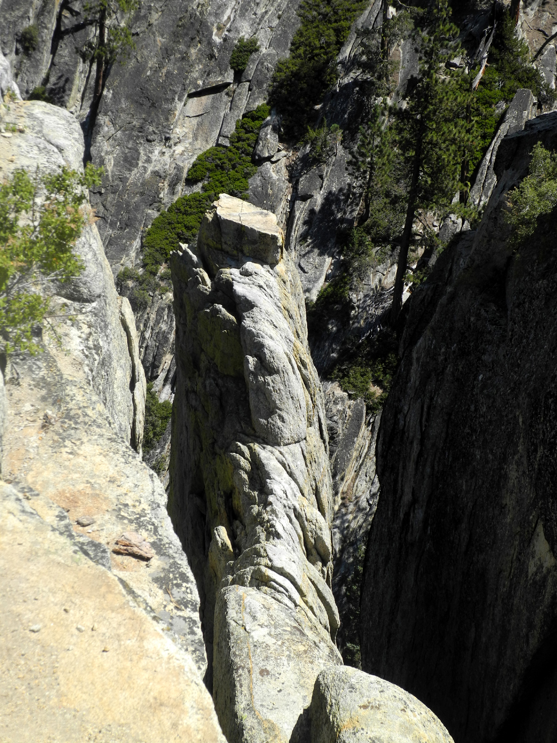
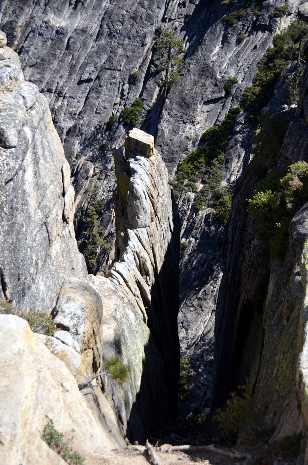
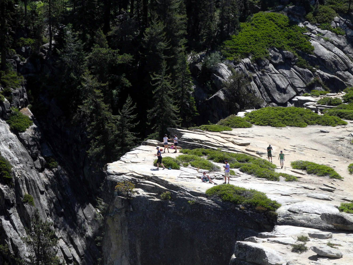
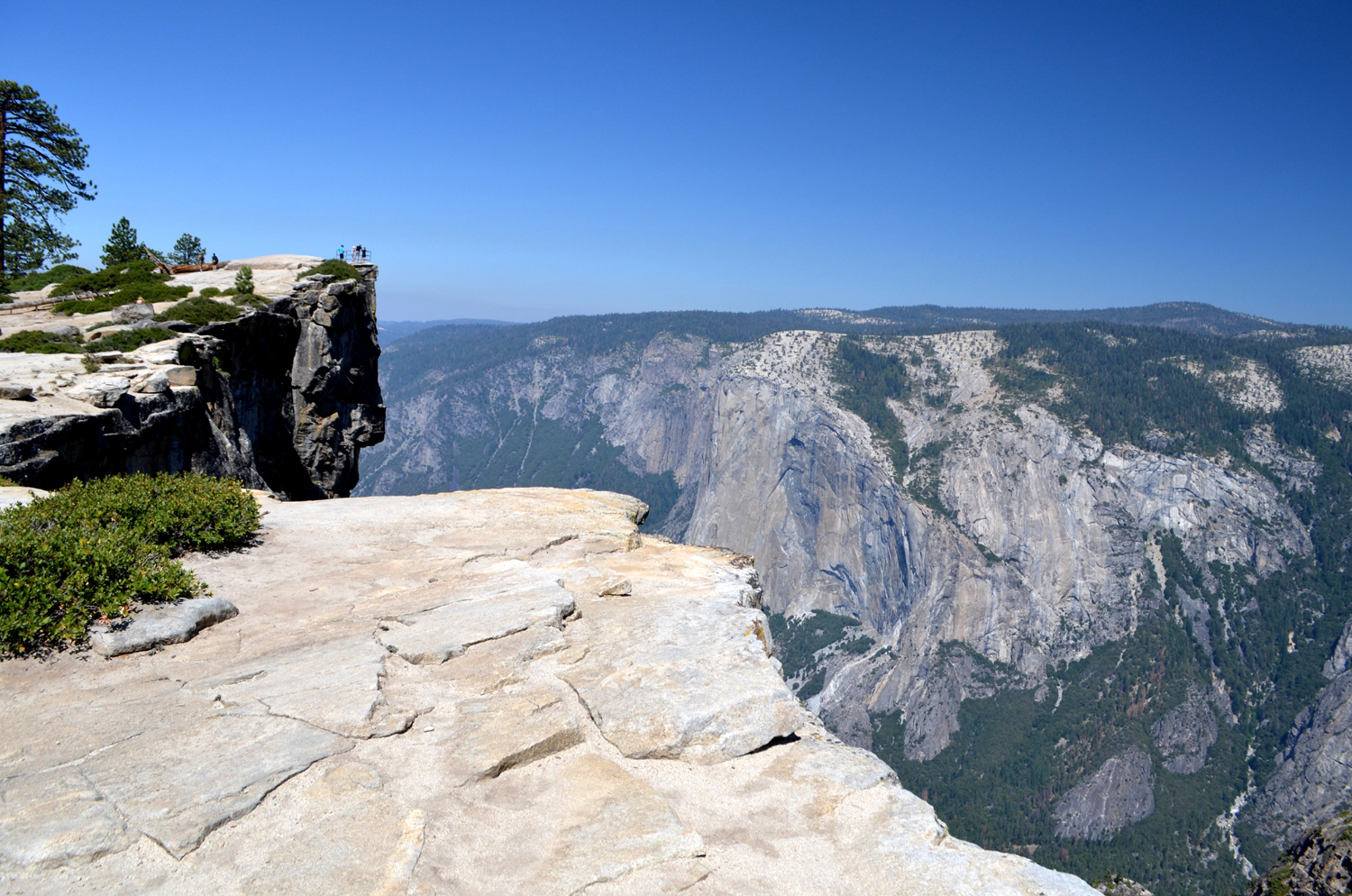
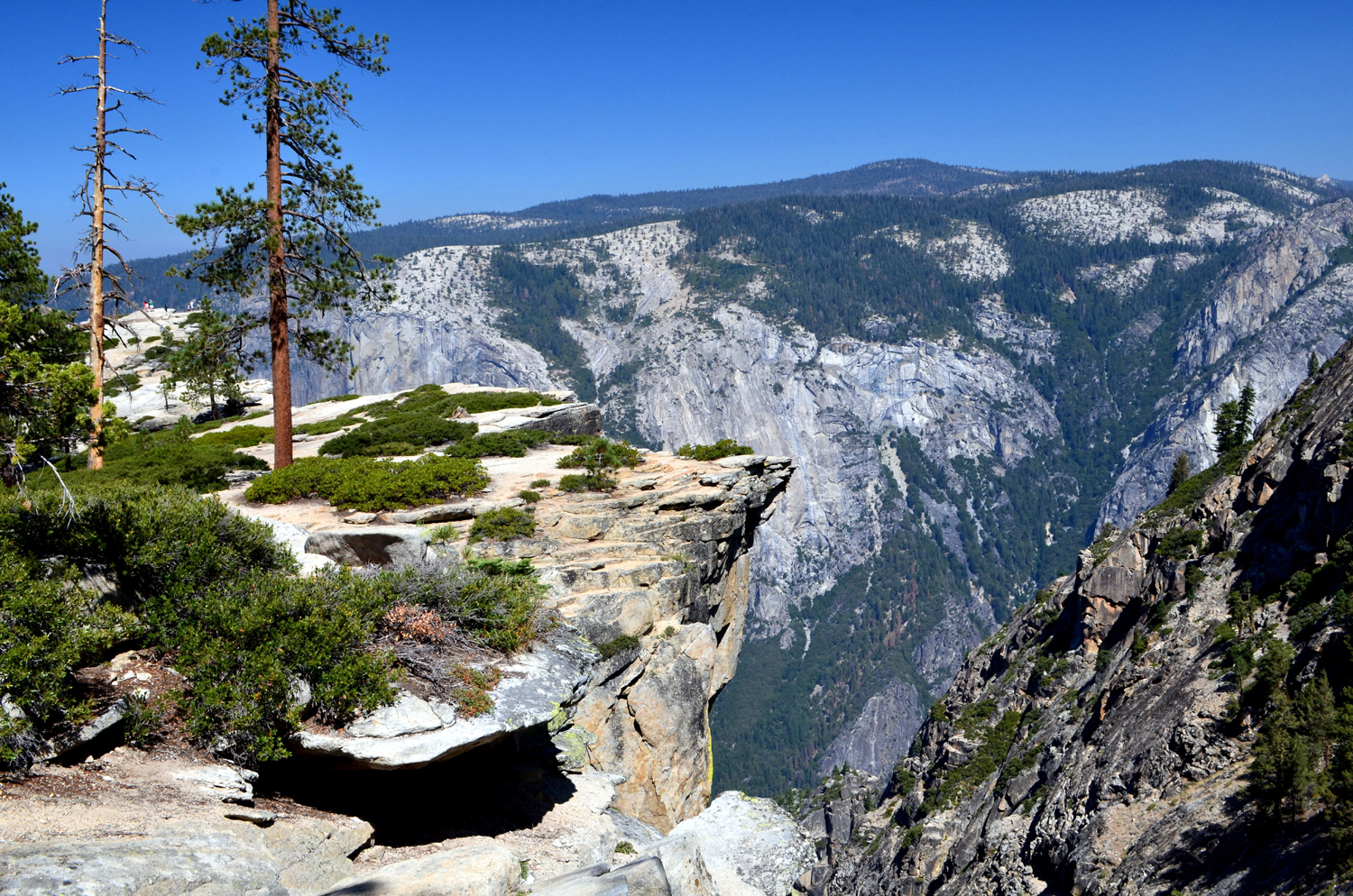
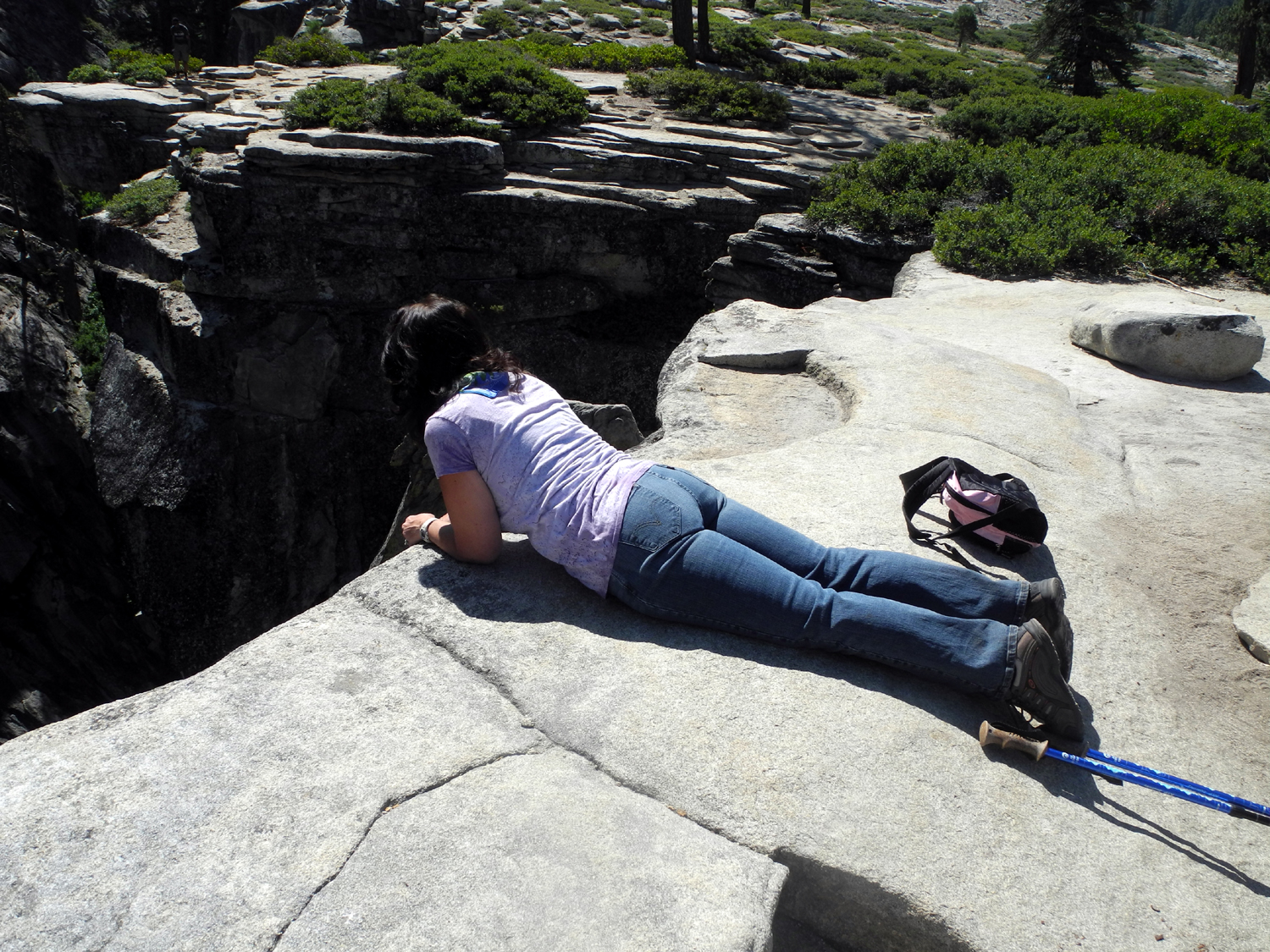
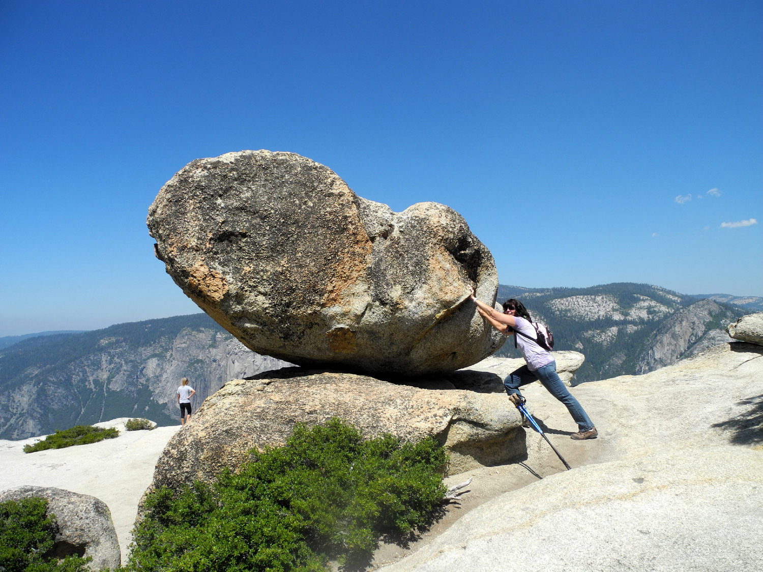
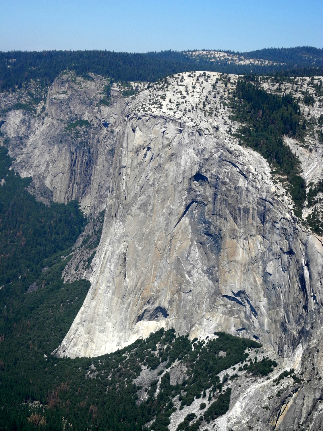
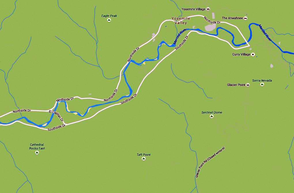
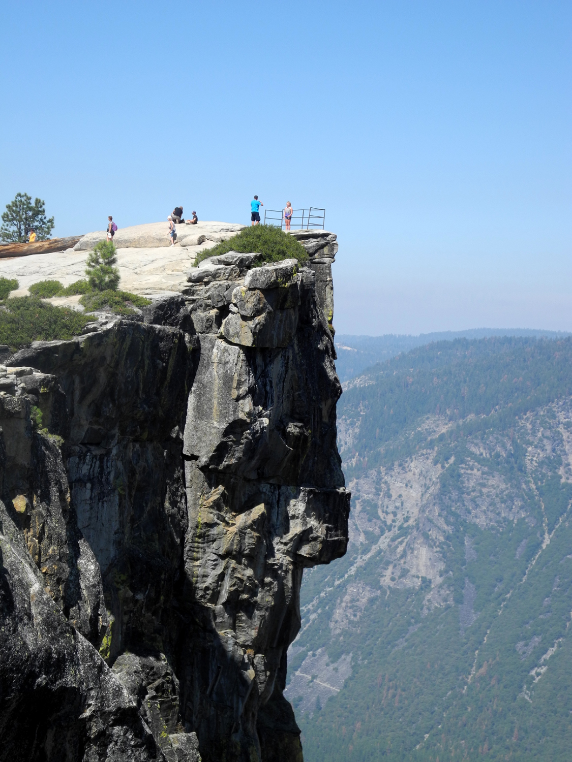
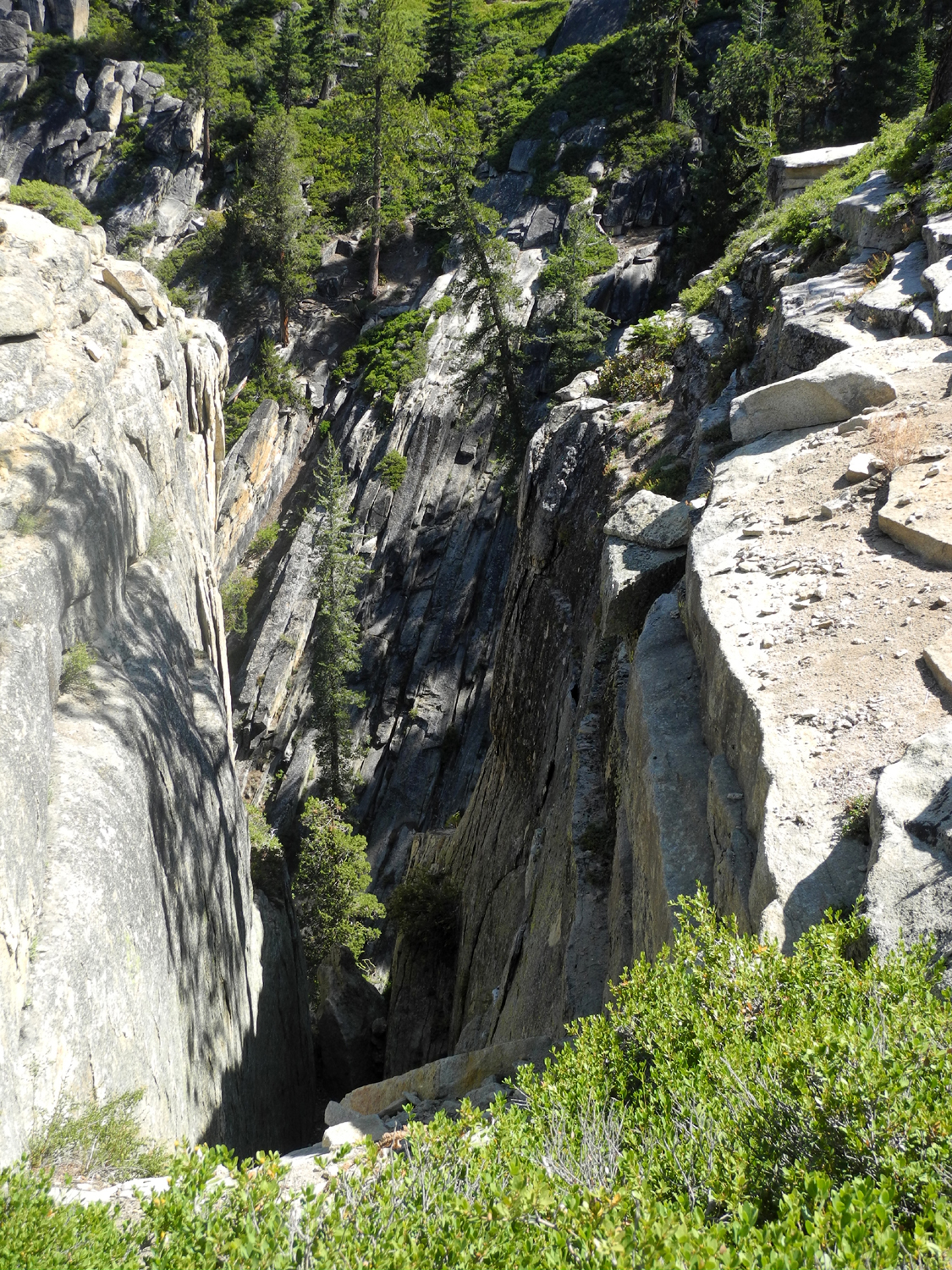
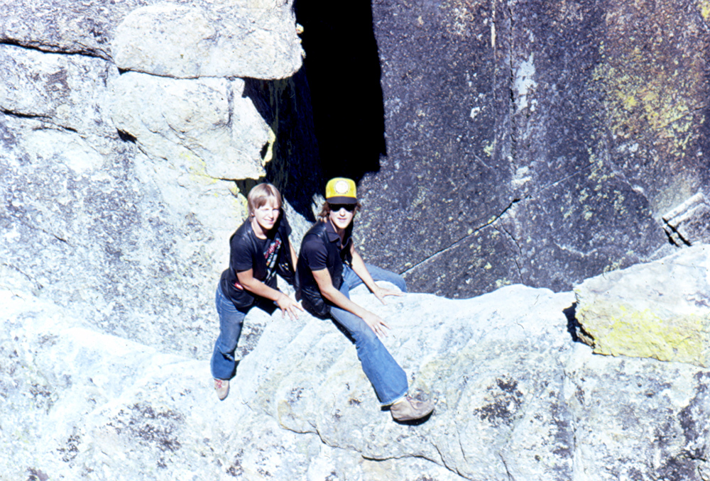
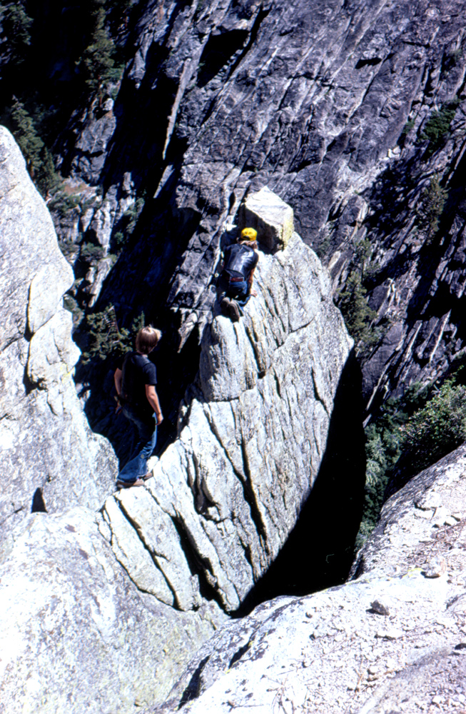
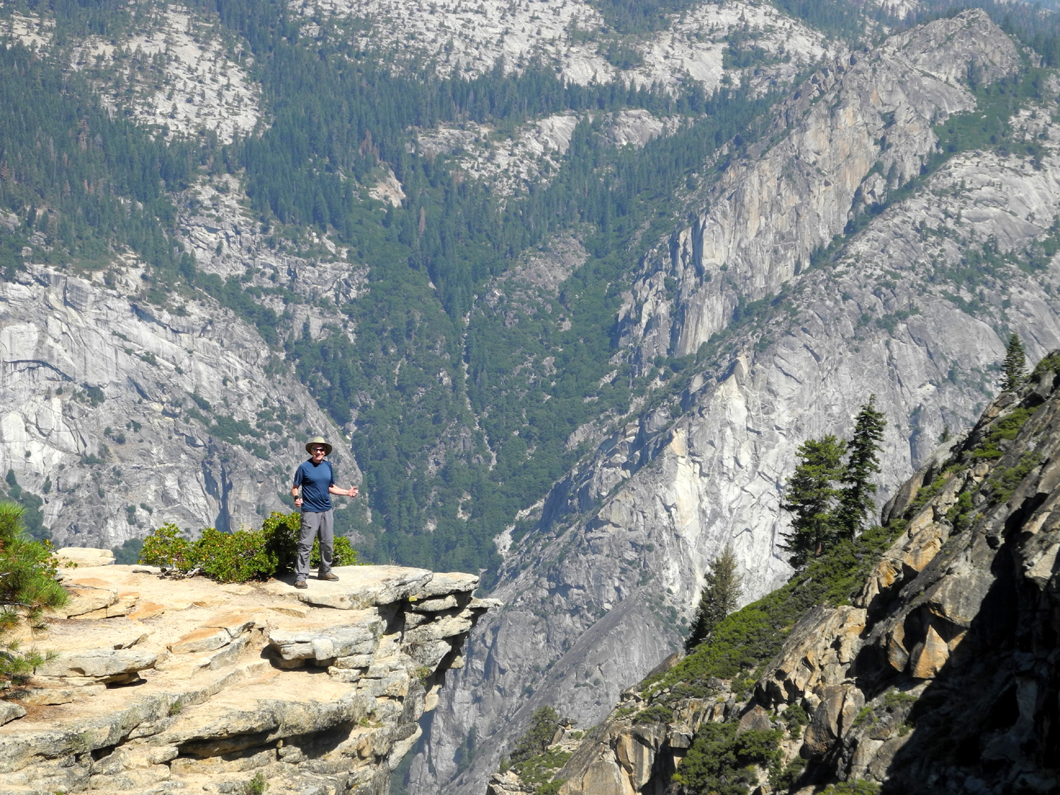
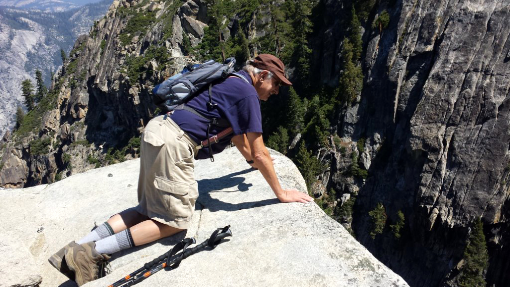
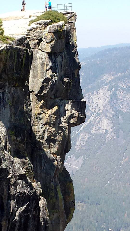
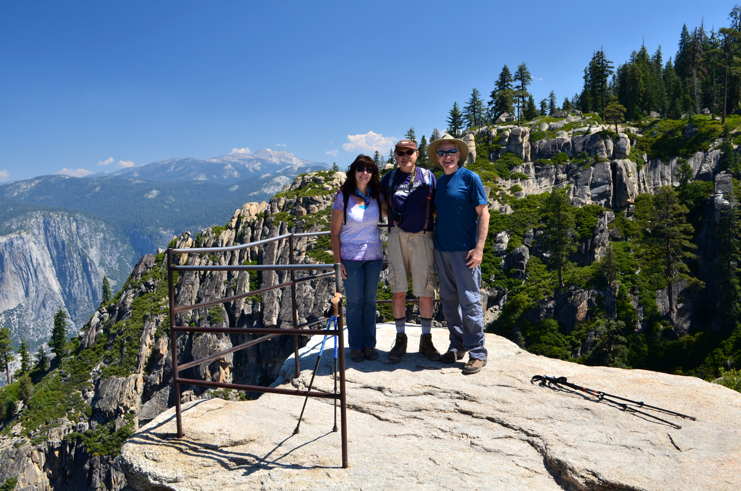
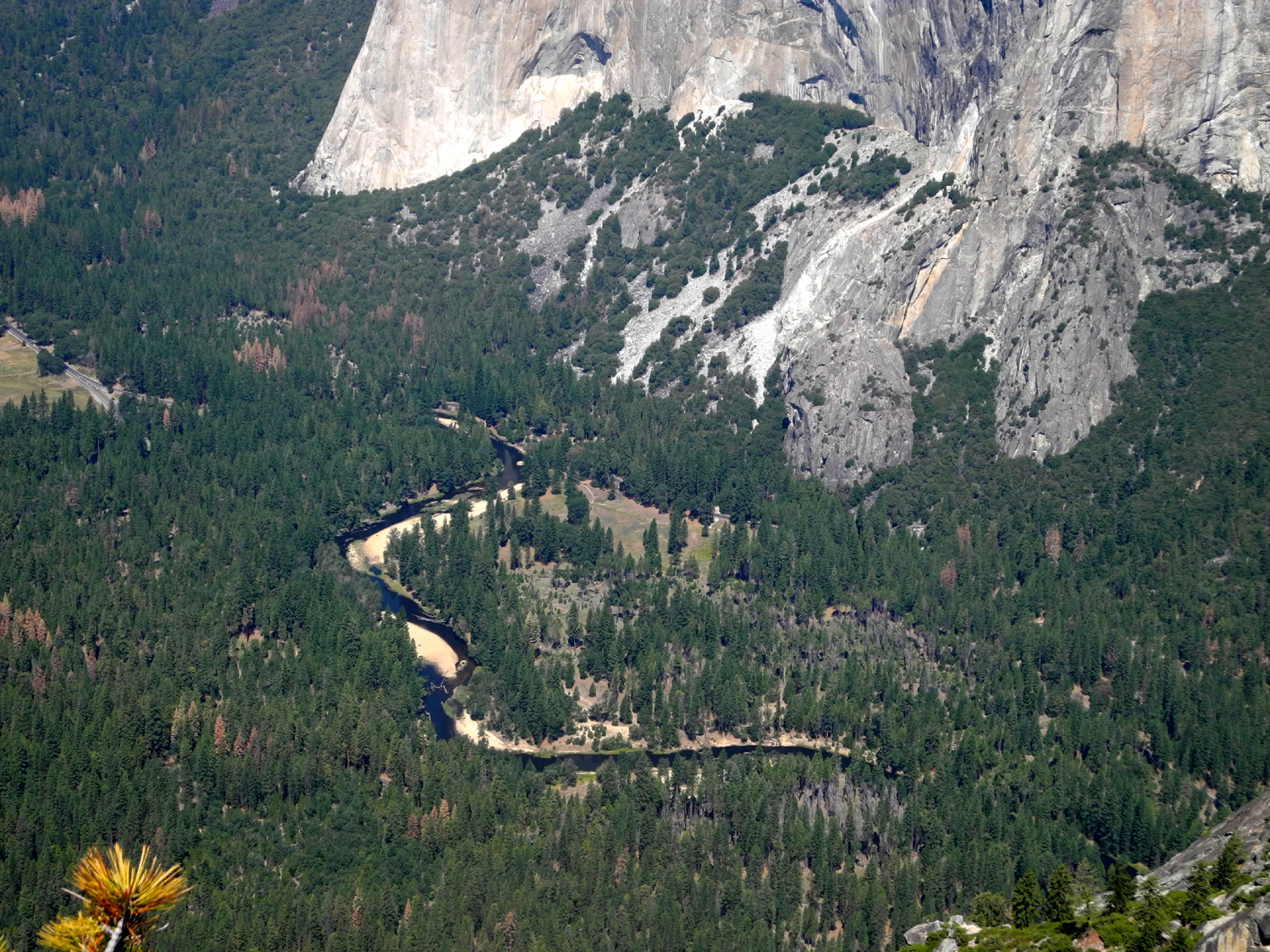
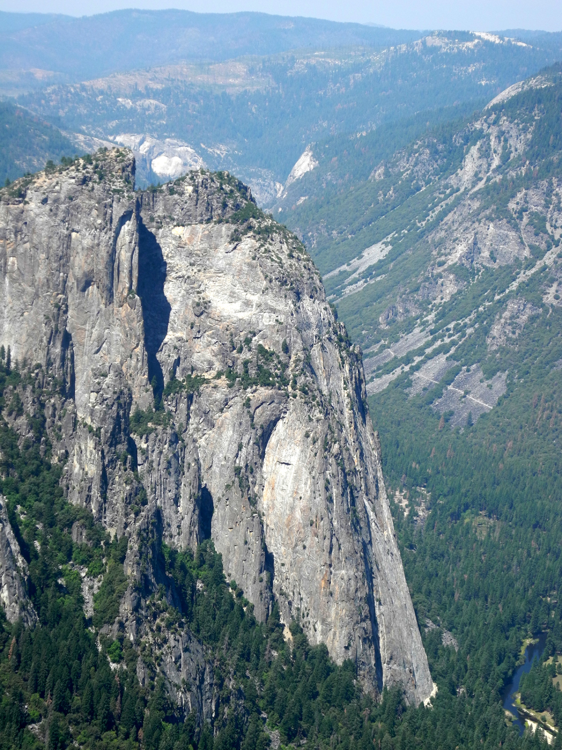
Taft Point Our August hike took place on the 9th with a trip to Taft Point in Yosemite National Park. Unfortunately the injury list increased to two when Carolyn reported that she was experiencing severe shoulder pain, and was unable to join us. Julie was already out till September. We had invited my daughter Jennifer to join us. She lives near Oakhurst, on our way to Yosemite, so it was a good chance for her to do some "rambling" before returning to her teaching job two days later. Since we were going to a very popular national park on a summer weekend, we wanted to get there as early as possible to get a parking spot at the trailhead. Wes picked me up just after 7 a.m. and we made a quick stop at a nearby Starbucks. We got to Jennifer's, about five miles above Oakhurst, around 8:30, and were on our way within a few minutes. Driving back to Highway 41 on Bissett Station Road, we saw her husband Rod on his morning bike ride, and stopped to say hello for a few moments. As we expected, there were a lot of cars at the trailhead, but we got the last legitimate parking spot. After that people were parking anywhere from a hundred feet to a half mile from the trailhead, wherever they could find room. This was the same starting point as our Sentinel Dome hike in October of last year. From the parking lot it's about 50 feet to the start of the trail. Go to the right and it's 1.1 miles to the dome; to the left it's 1.1 miles to Taft Point. Wes went there about 20 years ago, and I was there in 1982, but it was Jennifer's first time, although she has done many other Yosemite hikes. This is one of the easier treks that takes you into serious off-road territory - only a little over a mile each way, and with just a little up and down, nothing steep. The first part is fairly open, with huge western white pines and a few Jeffrey pines. Then it goes into a cool, shady red fir forest, with a few other tree species, many shrubs, and probably a half dozen kinds of wildflowers. The most common shrub, appearing in the more open areas, is pinemat manzanita, a very low-growing member of this species. It is found at higher elevations throughout the west. Although it has the red branches of its tree-size relatives, these "branches" are really small woody stems, seldom more than a half-inch in diameter. After some up and down, the trail comes to a fairly long gentle slope, where you can see your destination, which rises up to a large, rocky overhang. But before walking out to the actual point, a look at The Fissures is mandatory. These are short, narrow canyons into the side of a larger fissure, best explained by the photos below. If you are walking along the edge of the main fissure, you will come to a side fissure which is maybe ten to fifteen feet across - but you have to walk back from the edge 50 feet or more to make your way around to the other side. Needless to say, this is a place where being careful is essential. I was here in 1982 with two 18-year olds, Tim (now my son-in-law) and his friend Scott. They made their way out on to a ridge in one of the larger fissures. As Scott touched the rock at the very end, it tilted a little. He decided he had gone far enough, but even this limited excursion looks pretty scary, as seen here and here. Wes, Jennifer and I did not feel the slightest temptation to repeat their actions, and the place looks just as scary with no one sitting on it. This proved to be a good area for the first of two Wes on the Rock photos, and I repeated my action of 33 years earlier, getting down on hands and knees to look over the edge. While I was doing so, Wes captured this scene. Jennifer claims she was taking a photo of her shoe, but let's face it, how many people go around photographing their footwear? After enjoying and photographing the fissures, and peering cautiously over the edge at the steep drop below, we walked out to the main part of Taft Point. From the fissures, this is seen to be a huge rock promontory, which slopes back from an overhang. At the edge of the highest point there is a small railing, where you can lean over and look straight down for a loooooooooooong ways. There is a view here of El Capitan where you are actually looking down at the top of that huge rock from a slightly higher elevation (7,500 feet). You also get a good look at Yosemite Falls, which is mostly dry, but appears to have a tiny trickle of water. Most of the other famous rock features of the valley are hidden by the ridge on the opposite side of the main fissure. From the point you can see Mt. Hoffman clearly, and make out the top of North Dome and Basket Dome. Of course, there is a nice view down into Yosemite Valley, with the river winding through it. To the west, fairly close to Taft Point and on the same side of the valley are the Cathedral Rocks. Half Dome, Glacier Point, and the falls on the Merced River are hidden from view. We probably spent an hour at the fissures and the point, enjoying a snack to give us energy for the return trip. On the trail both ways we saw countless chipmunks, probably preparing for the winter. We also saw a fat ground squirrel, and heard ravens. The most common animals were our fellow humans - to the best of my memory, we saw more people on this trail than any other Ramblers hike. We talked with some of them, including one party that was making the full tour of the trail system to visit Taft Point, Sentinel Dome and Glacier Point, a trip of probably at least six miles. Along the trail there are junctions to trails leading to Old Inspiration Point, about eight miles away above the very western end of the valley. There's also a cutoff trail that goes to Sentinel Dome, and other destinations I can't recall. During our walk we discussed the deaths of two world-class BASE jumpers, who were killed in May jumping from Taft Point. Although the advocates of this activity defend their "right to jump," it is illegal and one of the most dangerous sports in existence. Every year jumpers who insist on tempting fate die in the process, and we all agreed that we could not understand its appeal. During our drive back to Oakhurst we decided to eat at the Pizza Factory, an excellent chain that operates almost exclusively in small towns. They started in Oakhurst and Mariposa, and Oakhurst remains the site of corporate headquarters. Jennifer called to see if Rod wanted to join us, but he requested that she bring something home for him. Also on our drive we listed to a couple of CDs that I had brought. We started this with one of our trips a few months ago, and I have made it a point to try to expand my companions' musical horizons and challenge their ability to recognize songs and artists. This time I brought a compilation CD that I had made of pop songs from my vinyl collection, many from the 1940s and '50s. This included a tune that we have declared the Rambler's official song, "The Happy Wanderer." Check out the lyrics here to see how well they fit. There's a link to play the song on that page, and the original recorded version is on You Tube. When we finished our
lunch, we drove back to Jennifer's, and visited with her and Rod for
a short time, then made our way back down the mountain, ready to
plan another adventure for next month. Hopefully Carolyn and Julie
will be back on the trail with us.4 --Dick Estel, August 2015 |
||
|
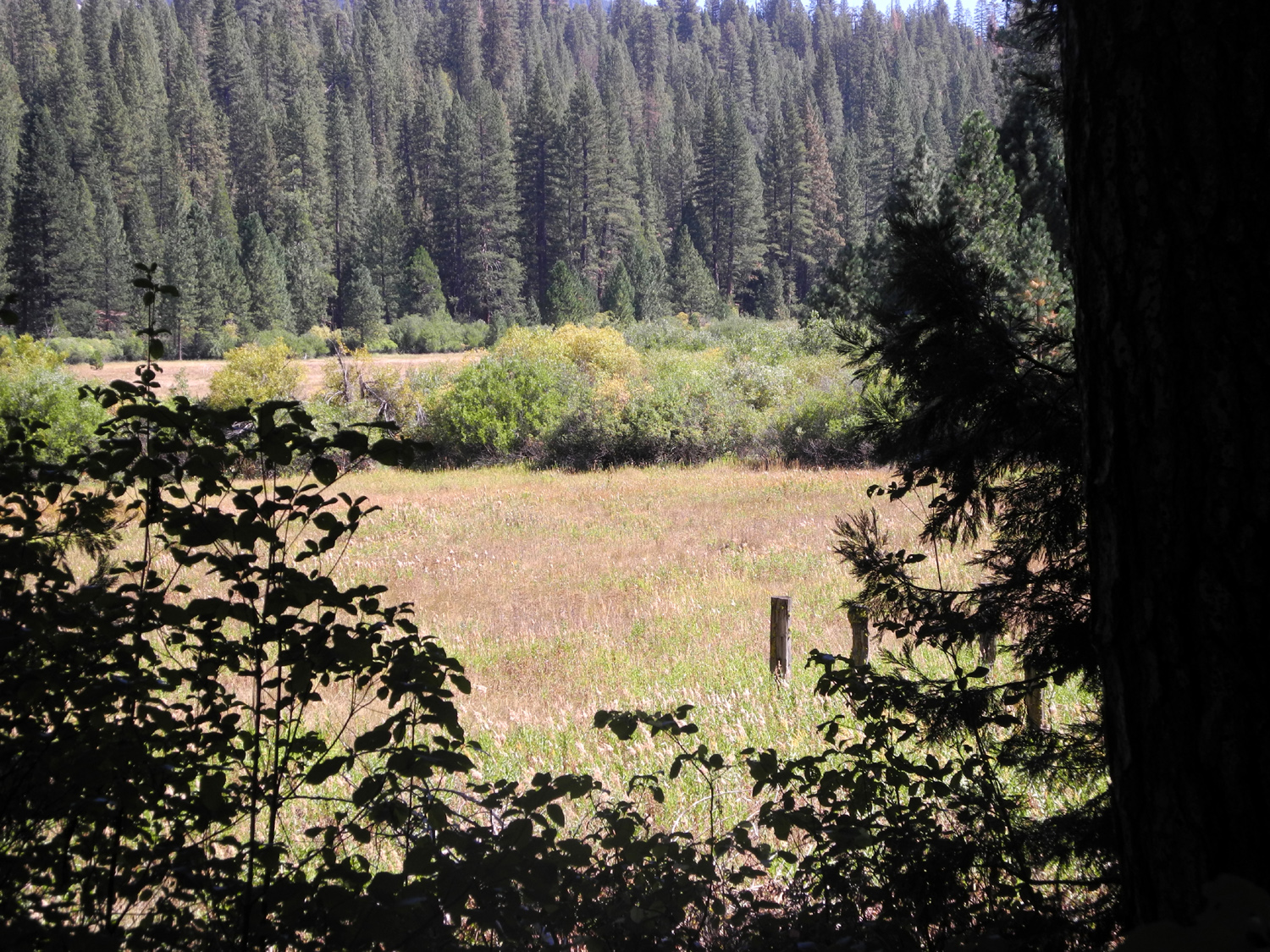
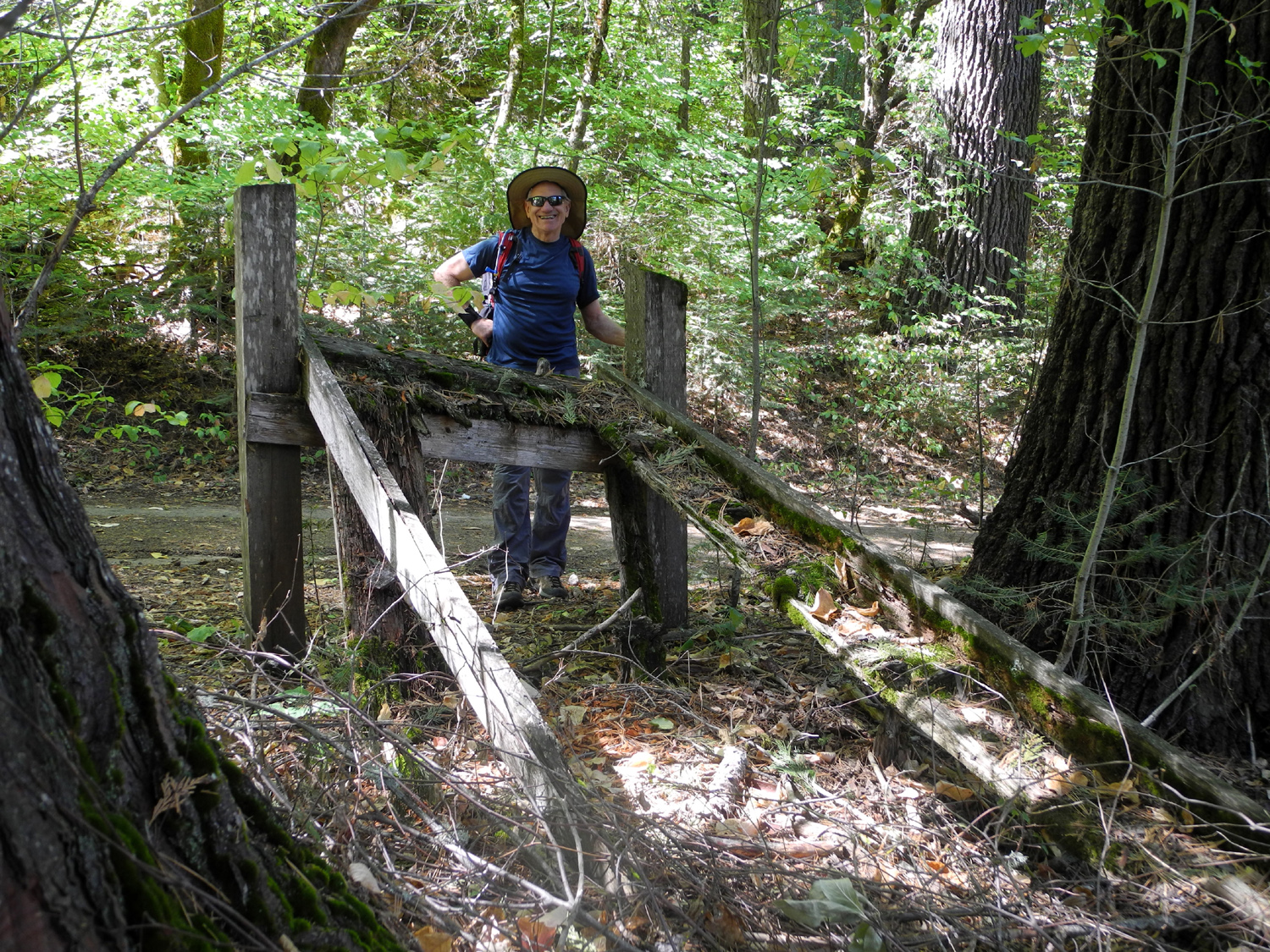
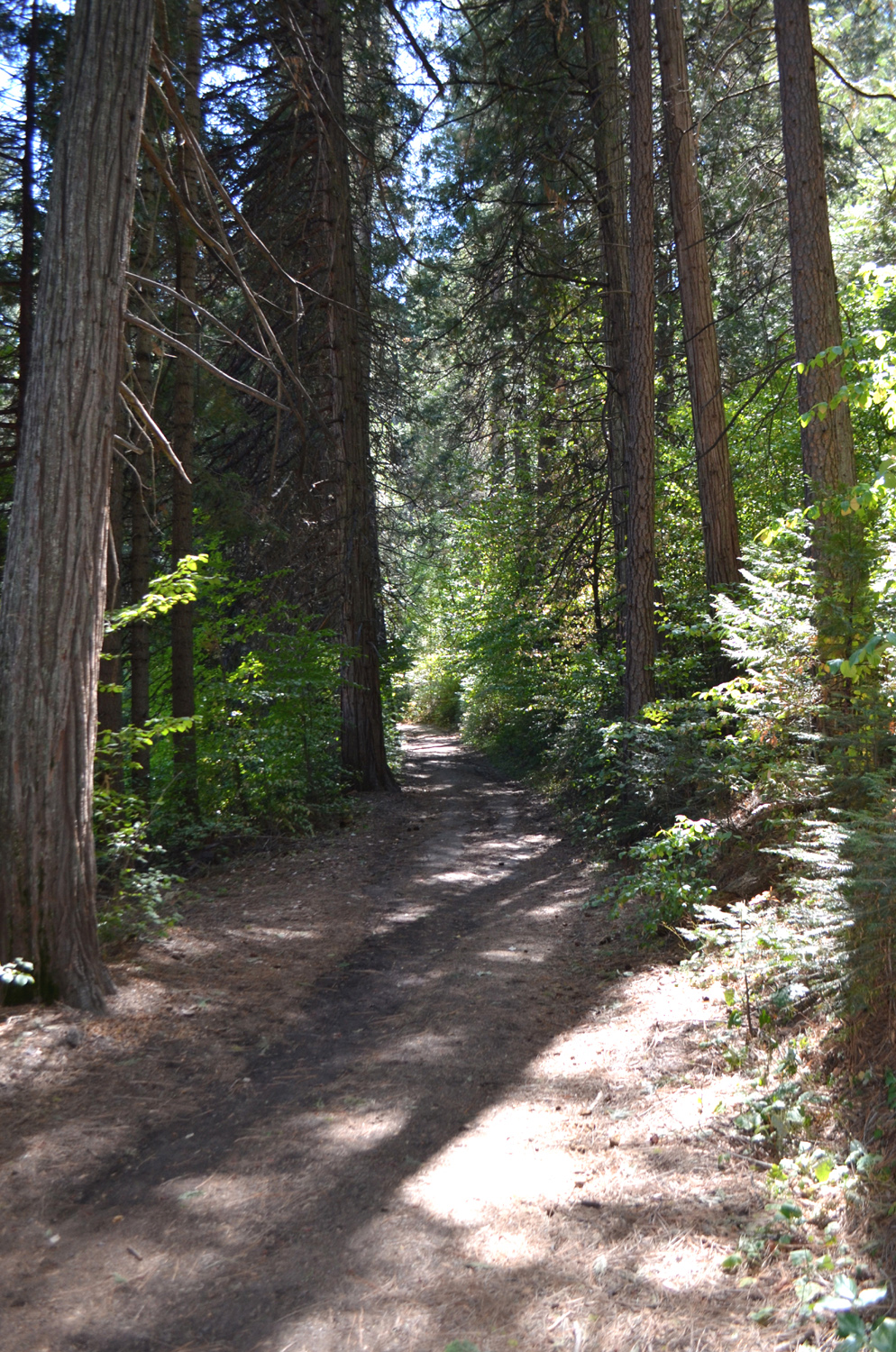
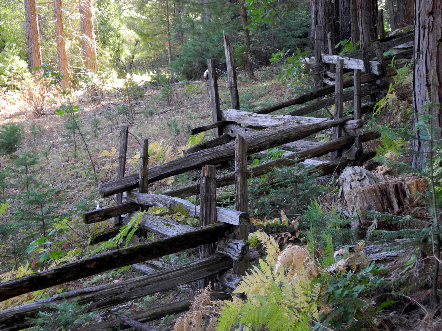
Wawona Trails For our September hike, the Ramblers were again without Julie and Carolyn, both still dealing with health issues. Fortunately, it looks like they will be back on the trail in October. On September 17 Wes picked me up about 8 a.m., and we again drove up highway 41 to Yosemite National Park. We had originally planned to hike in the Sequoia National Monument north of Grant Grove in Kings Canyon National Park, but a major forest fire has spread throughout that area, starting from lightning at the end of July, and only now getting mostly under control. Our destination was Wawona, one of the earliest places of development in the Yosemite area. The first road into what is now the park came into Wawona through the Chowchilla Mountains to the west. Three brothers of the Washburn family came from Vermont, and had modest success in mining and as merchants in Mariposa County. They improved an existing road, bought the crude existing facilities at what was then called Clark's Station in 1874, and began a program of improvements to what soon became known as Wawona. They rebuilt the hotel after it burned, and started a stage coach line to bring visitors to Yosemite, and of course, to their commercial operations next to a huge meadow. Today the area contains numerous government, private and commercial buildings, dominated by the 1885 hotel, restored and modernized inside, but keeping the original exterior. Other buildings include a historic covered bridge, at least two stores, a schoolhouse and a post office. A drive of a mile and a half on a winding road through Wawona leads to the trailhead for the Chilnualna Falls Trail. The falls is actually a series of five cascades, spread out for some distance on Chilnualna Creek. The upper fall is the most dramatic, but also difficult to see and get close to. The trail to that point is four miles, and in the words of the trail description, "climbs relentlessly." I had been part way up this trail with my older daughter in 1980, and Wes has gone the full distance, but it was our intention to just cover as much of the trail as I was comfortable with. We had talked of taking another trail there, a fairly level route that runs around the golf course and adjacent meadow, and by the time we started up the Chilnualna trail, we were pretty much in agreement that we would go a short distance on this trail, then walk as much of the meadow trail as we had time for. The Chilnualna trail goes many places and many miles beyond the falls, and at the start of our hike we talked briefly with a couple who were carrying full size backpacks. They were going in for three nights, with no firm destination - just wherever they ended up. As you start up the trail you can look down into the creek, and it immediately appeared that there was very little water if any, the fate of most Sierra streams this year. We soon arrived at the first cascade, where we left the trail and walked down toward the creek. There was the tiniest little trickle of water coming down the rocks, and then disappearing under the boulders - nothing like the roaring cataract that should be there, even in late summer. The route of the stream is not a gentle creek here. You are looking at and standing in a jumble of giant blocks of granite, with a steep drop down into the bottom of the creek. The huge boulders are piled up in front of you, reaching up a hundred feet above. We could only imagine what it would be like to stand there in late spring of a good rain year and see the tons of water crashing down. This proved to be the perfect spot for the obligatory "Wes on the rock" photo, in fact, we found two good spots for it. Leaving this area, the trail moves away from the creek and starts a series of switchbacks. Coming to a trail junction, we opted to follow the horse trail back to our starting point and conclude part one of our hike, having covered 1.5 miles. We drove back out to the main highway and parked at the Wawona Hotel, then walked across the road to the trail that crosses the golf course, then goes around the course and the adjacent meadow. The section of this route from highway to trail is part of the old Chowchilla Mountain Road, the oldest road in the park. Back in the 1960s I drove in from Mariposa on this road, but I believe access is now blocked, since it allowed people to bypass the entrance stations and enter Yosemite without paying. Of course, they often check your receipt or pass on the way out, and collect at that time if you don't have evidence of legal entry. The road continues to the west, how far I don't know, but we turned left on to the trail, and enjoyed a delightful "walk in the woods." The trail goes through a forest of sugar pine, ponderosa pine, cedar and fir; as well as many lesser species of shrubs, bushes, trees and plants. As far as we followed it, the trail is within sight of the meadow. There is an ancient rail fence surrounding the entire meadow, and it appears that it dates from the early days of the hotel complex. We also came to the remnants of a cattle chute through the fence, with nothing but the side rails still standing. We walked well past the golf course and along the meadow, finally turning back "just around the next bend," with a total walk of just under two miles. We had not eaten the snacks we brought with us, so by this time we were ready for lunch, and went into the hotel dining room, where large windows along two walls provide a nice view of the outdoors. Our lunch was very good, although fairly expensive, not surprising for a national park. Two weeks ago smoke from the Rough Fire had spread as far as Oakhurst, on the way to Yosemite. Even in the park, views were seriously degraded However, everything was clear and sharp for our trip, with stunning views in the foothills and mountains. It was warm when we hiked uphill, but very comfortable on the meadow trail. The temperatures were in the high 60s, with a slight breeze now and then. All in all, we could not have asked for better conditions. Note: The articles I read about Wawona history (links below) give some conflicting information about the dates of events during the early history of the area. I would give the most credence to the article by Shirley Sargent, who lived in Foresta, a private reserve adjacent to the park, for decades, and wrote many books about Yosemite people and places. 2016 update: Due to the greed of the prior concessionaire and the laxity of the park service, the Wawona Hotel was officially known as Big Trees Lodge at the time of our hike. Those of us who grew up in the area had vowed never to speak that name, and this travesty was resolved in 2019, restoring the original name to this and other locations in the park.
|
||
|
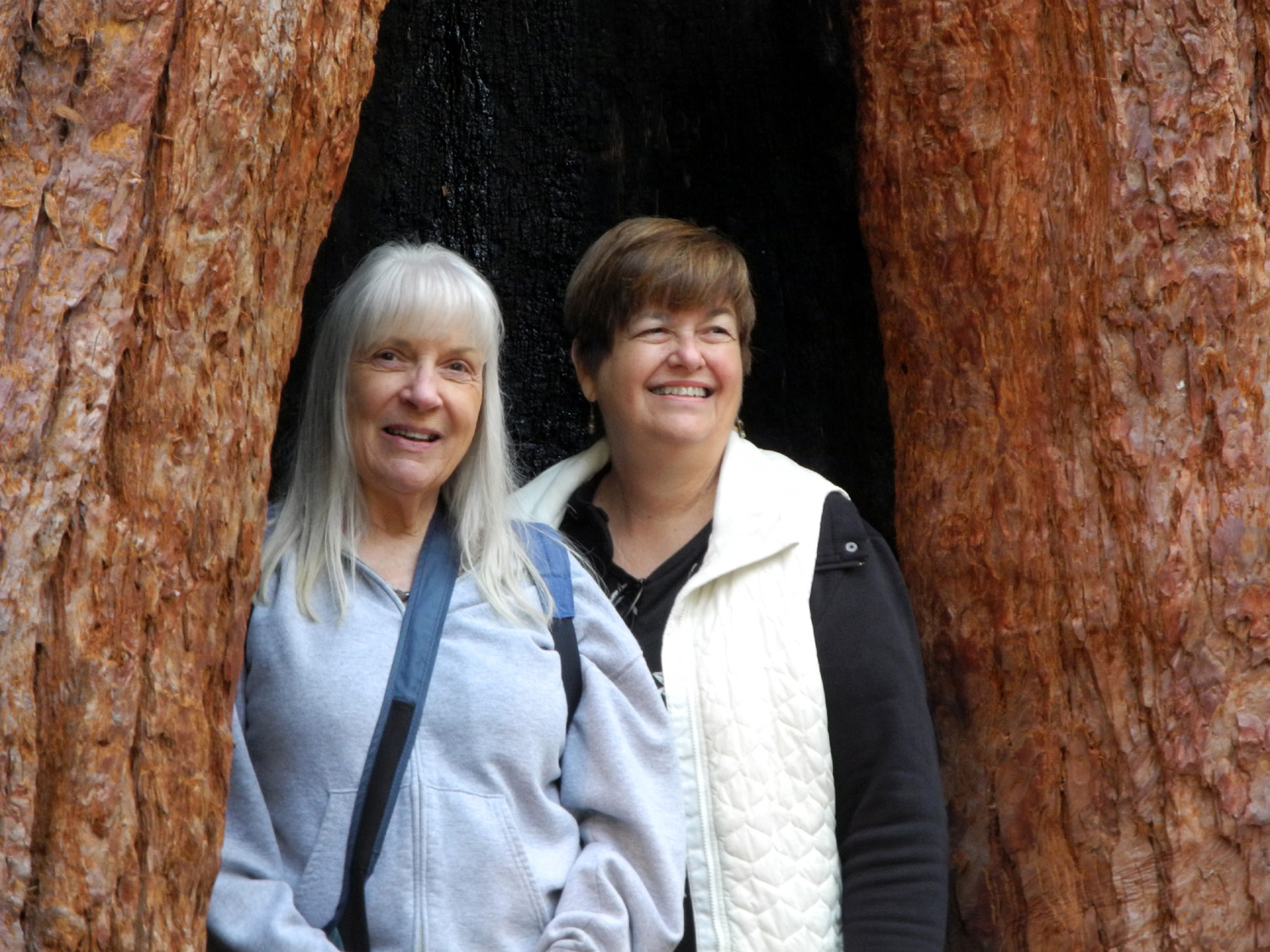
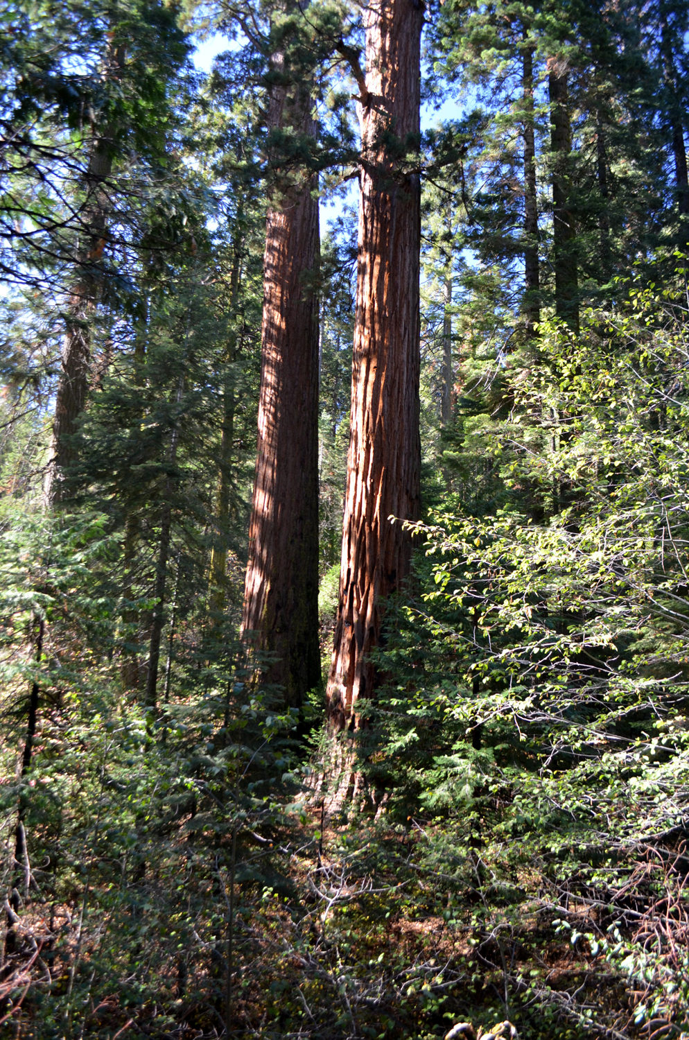
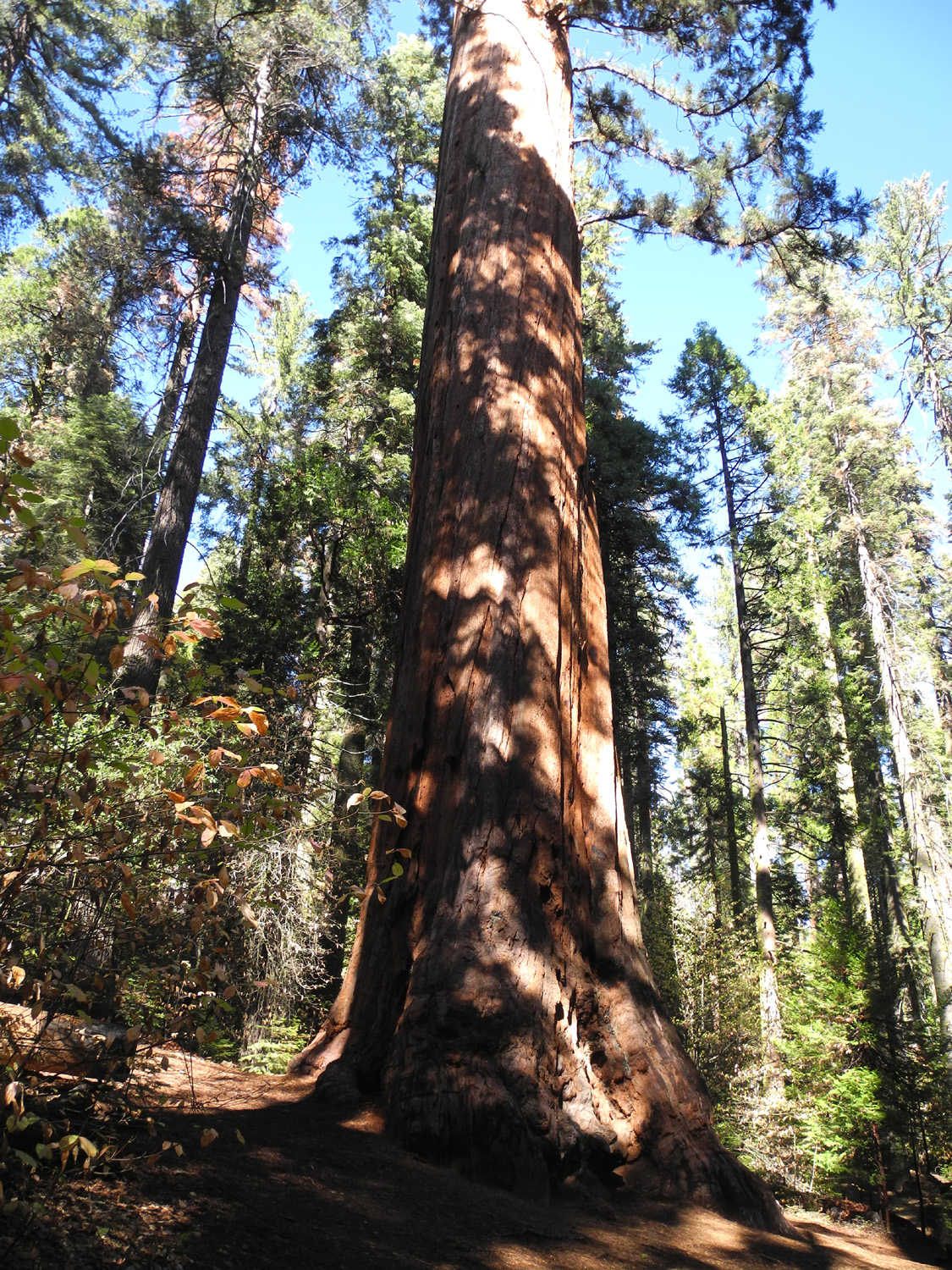
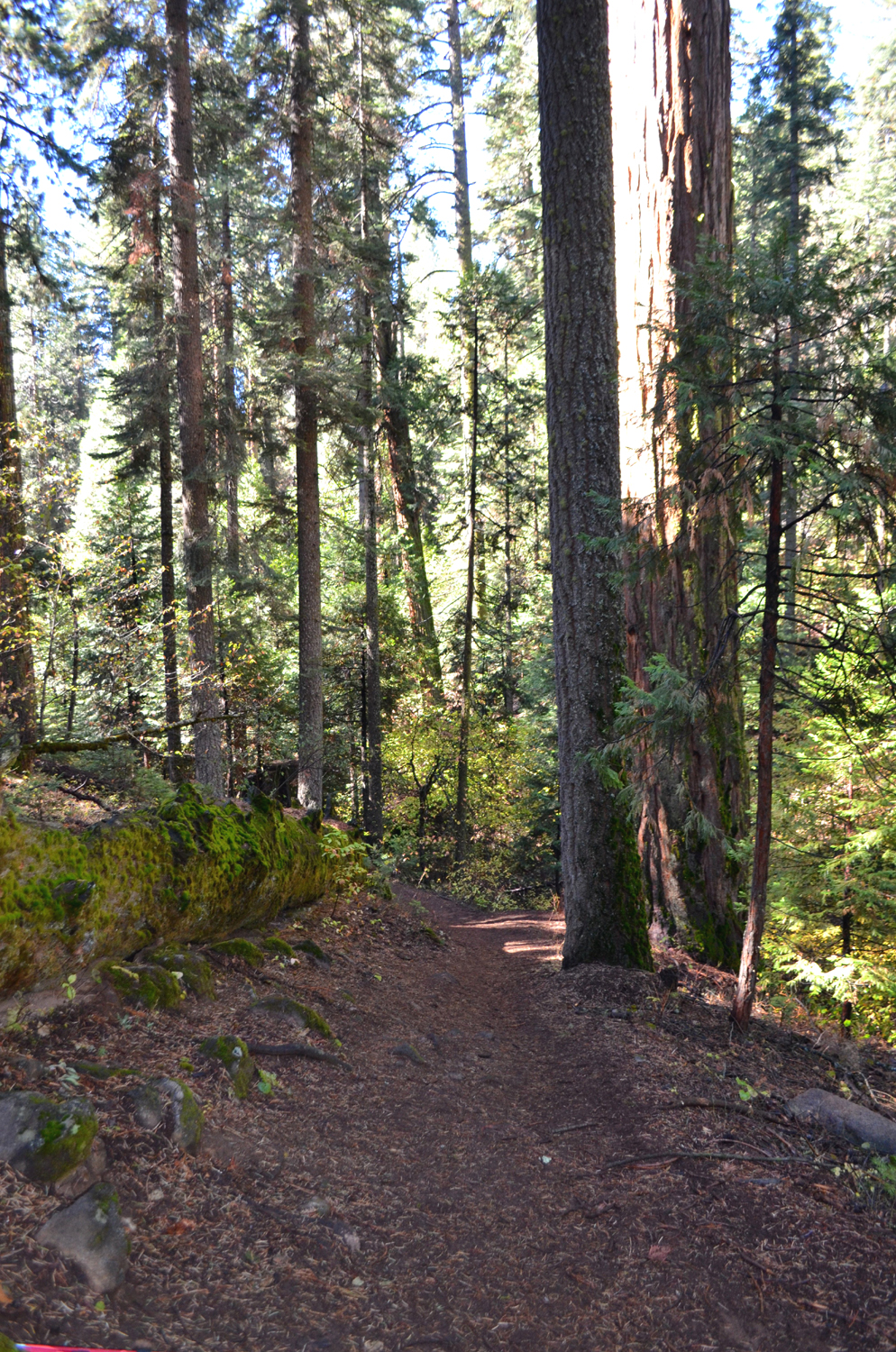
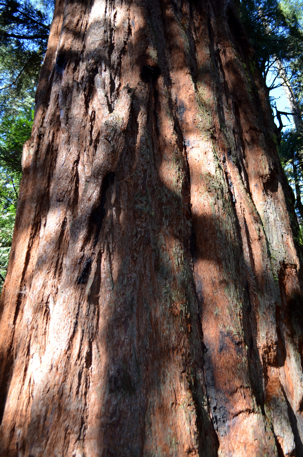
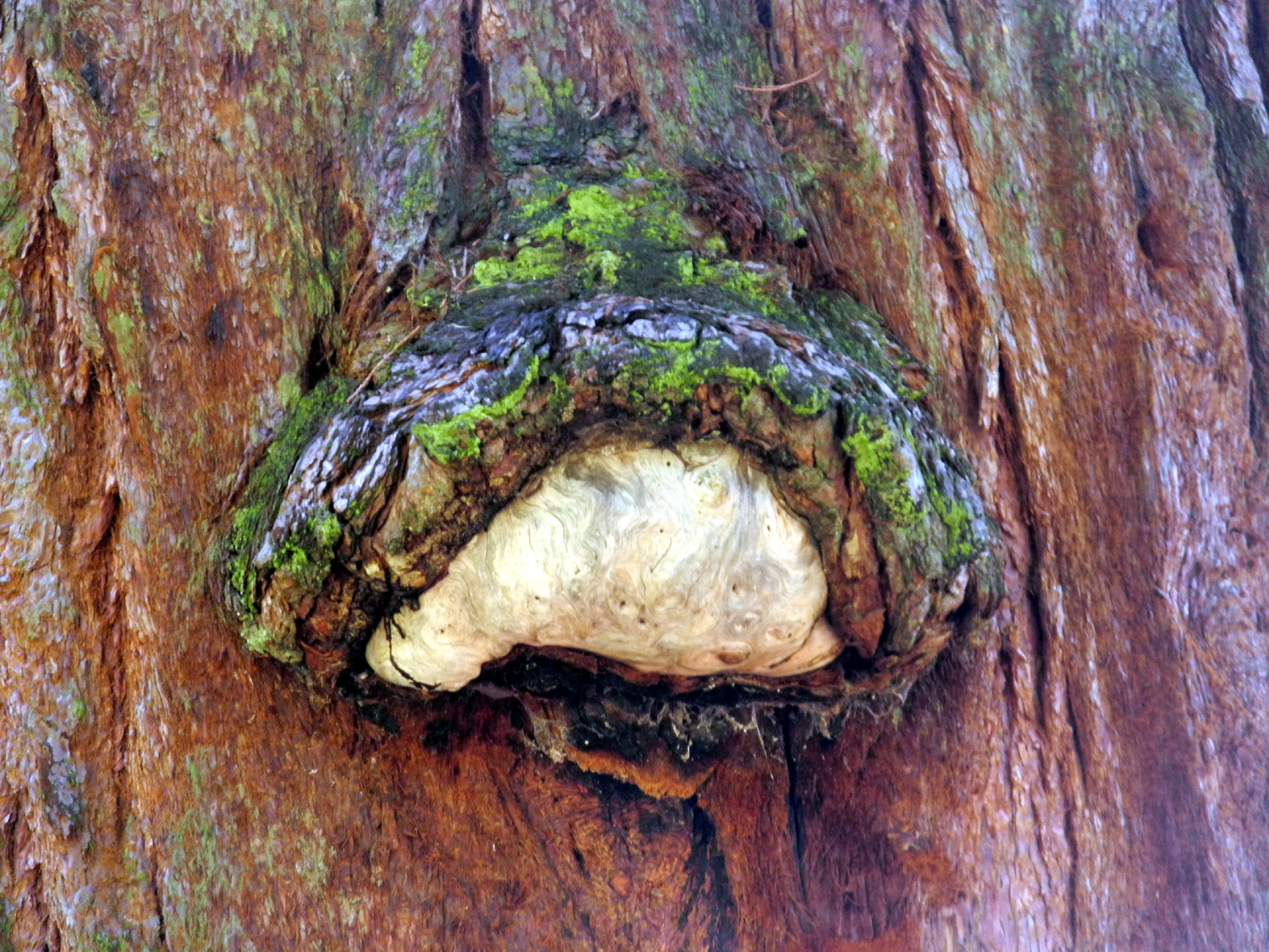
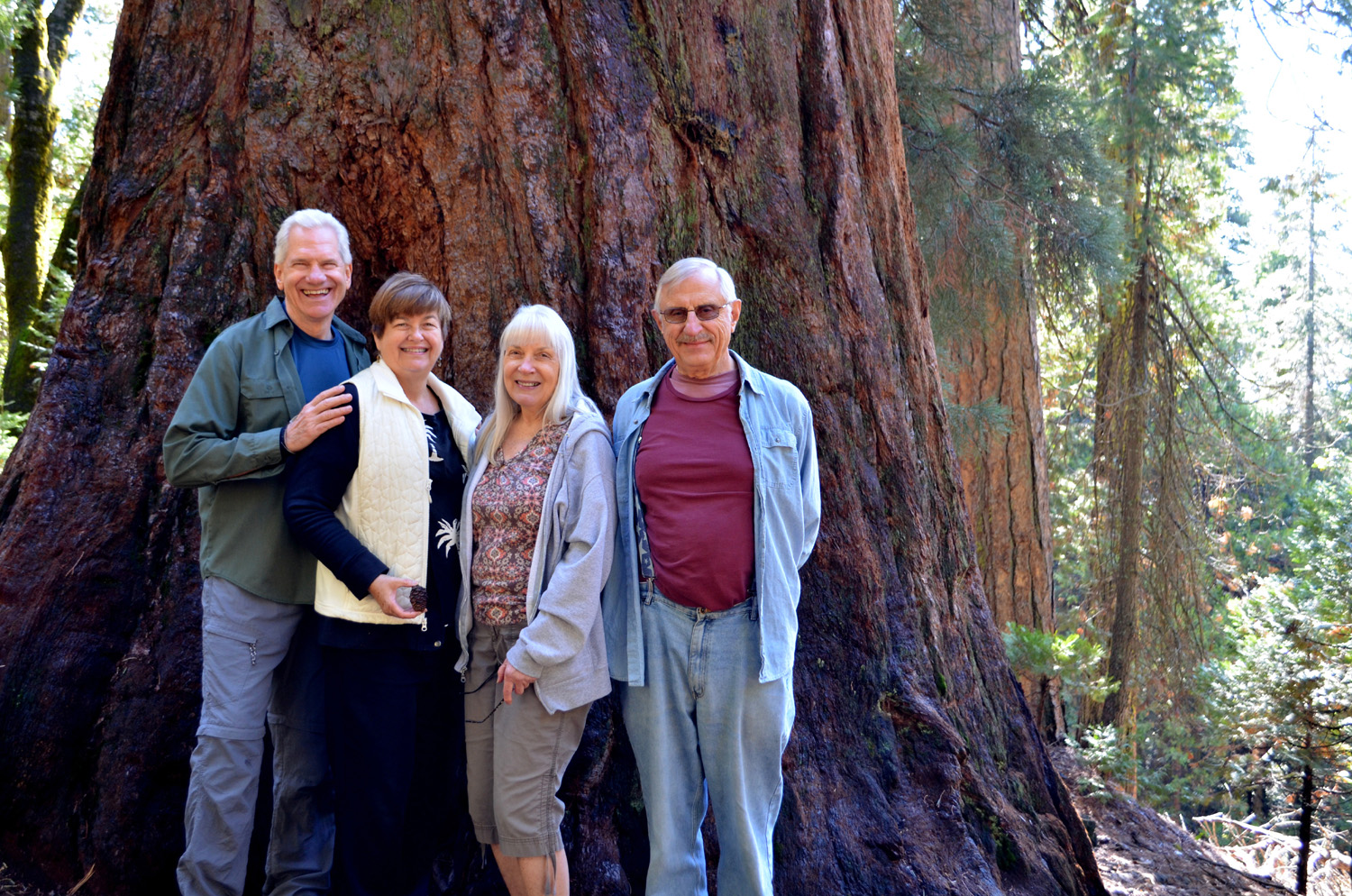
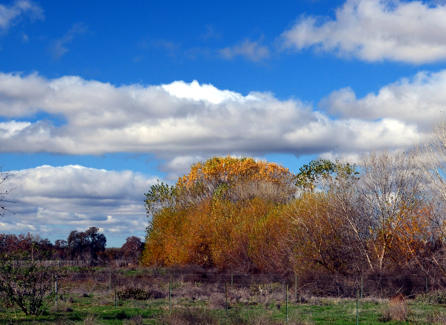
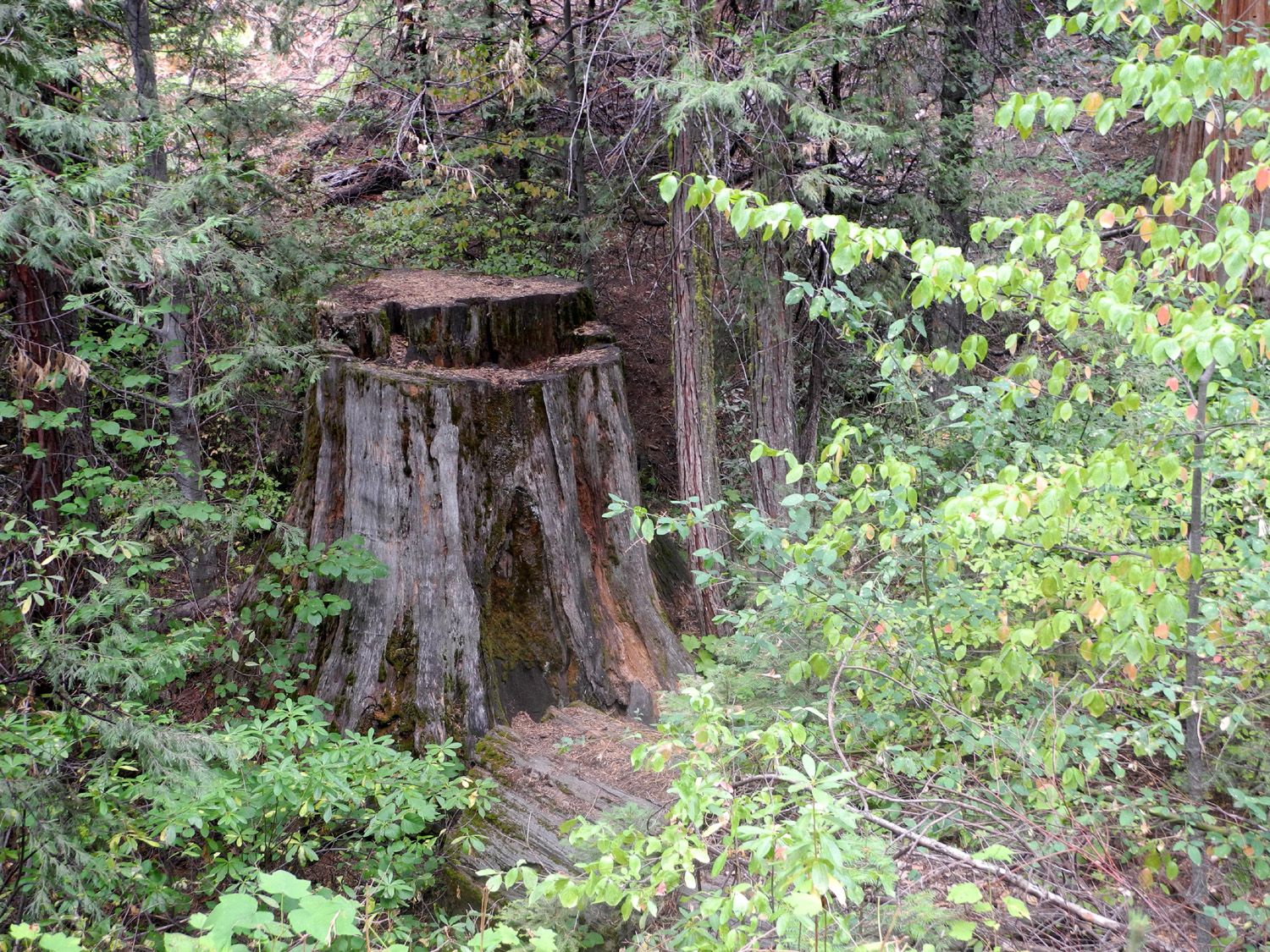
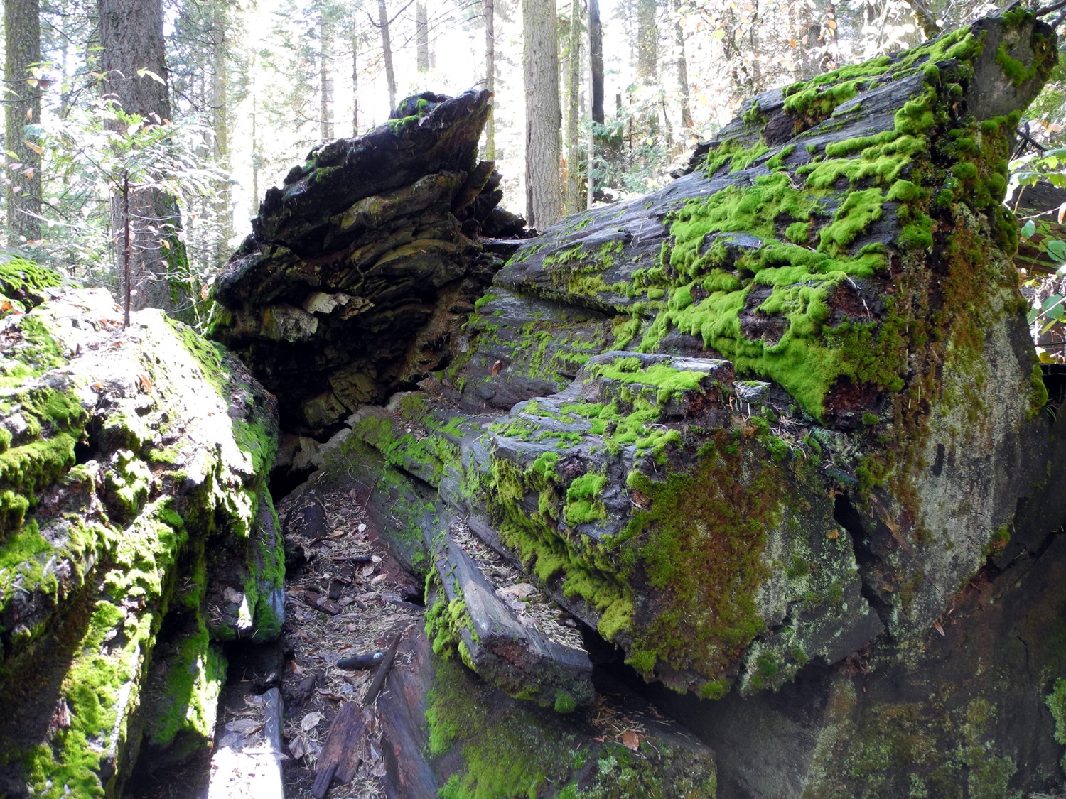
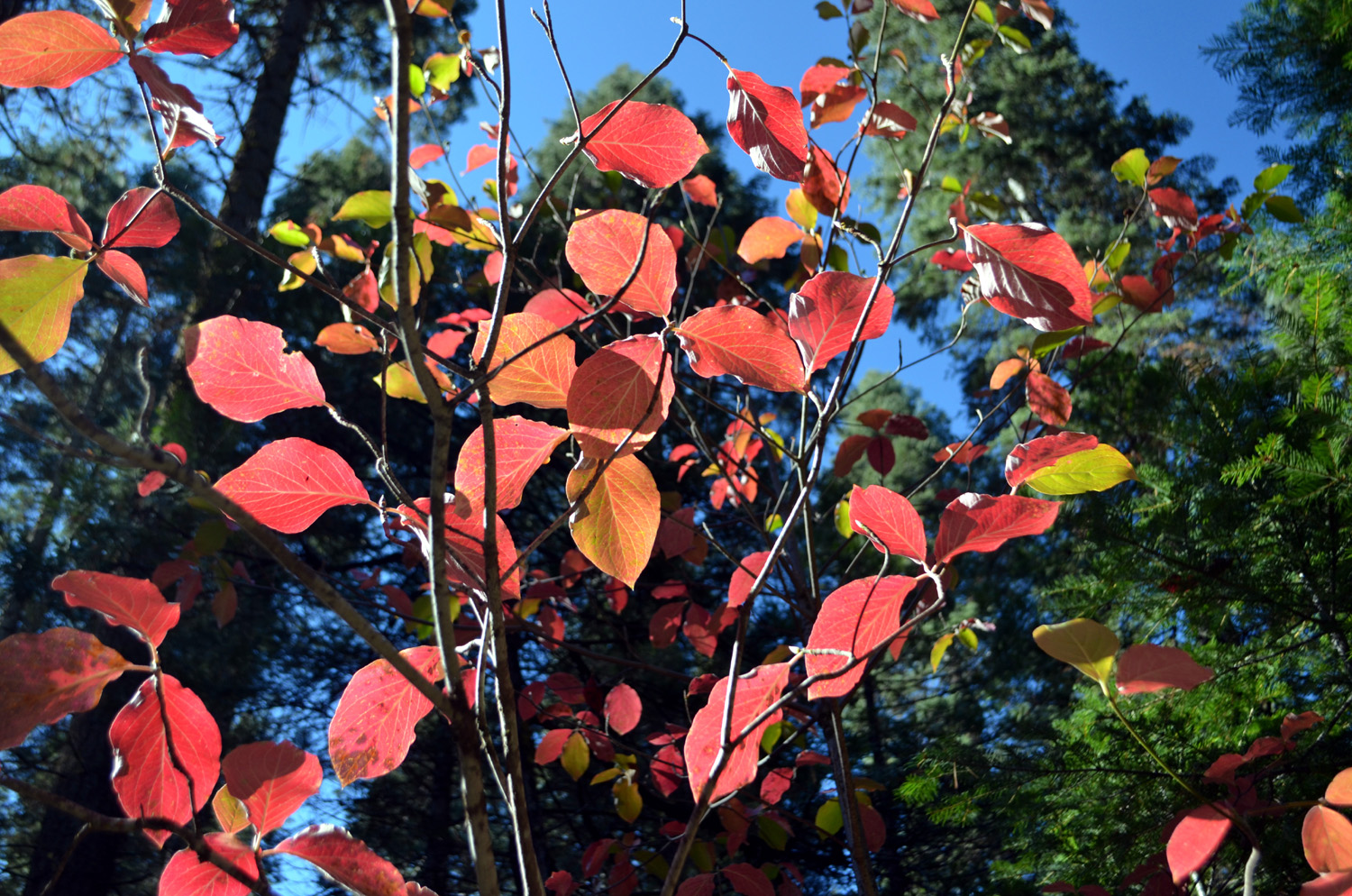
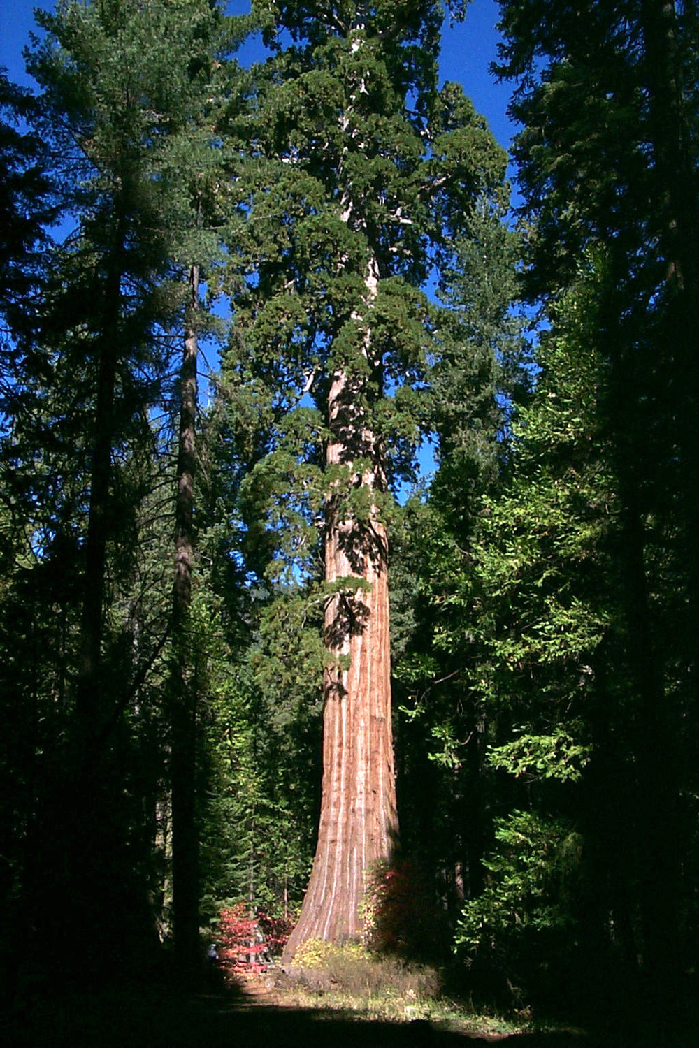
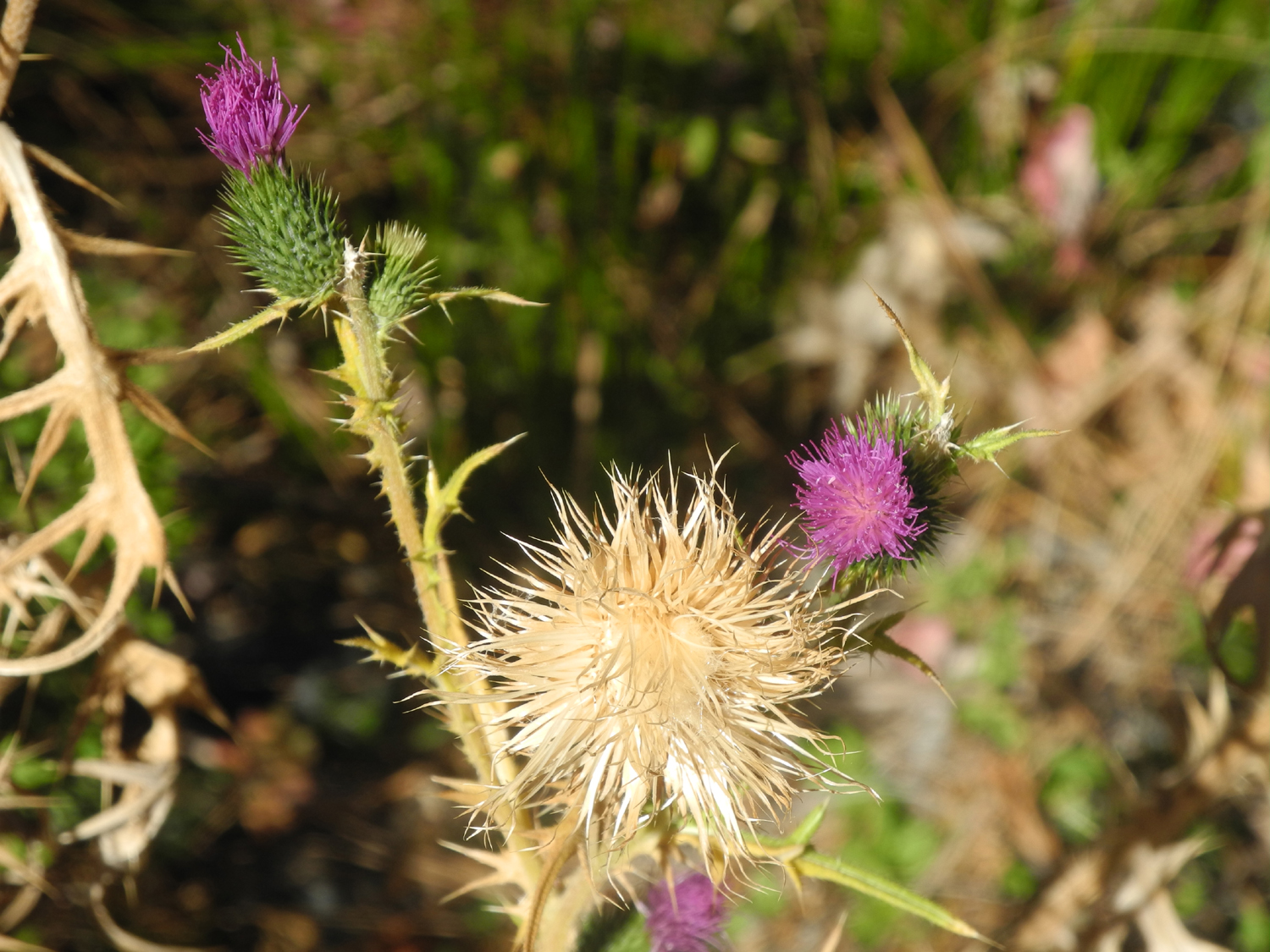
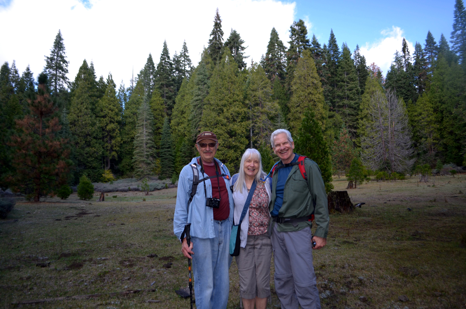
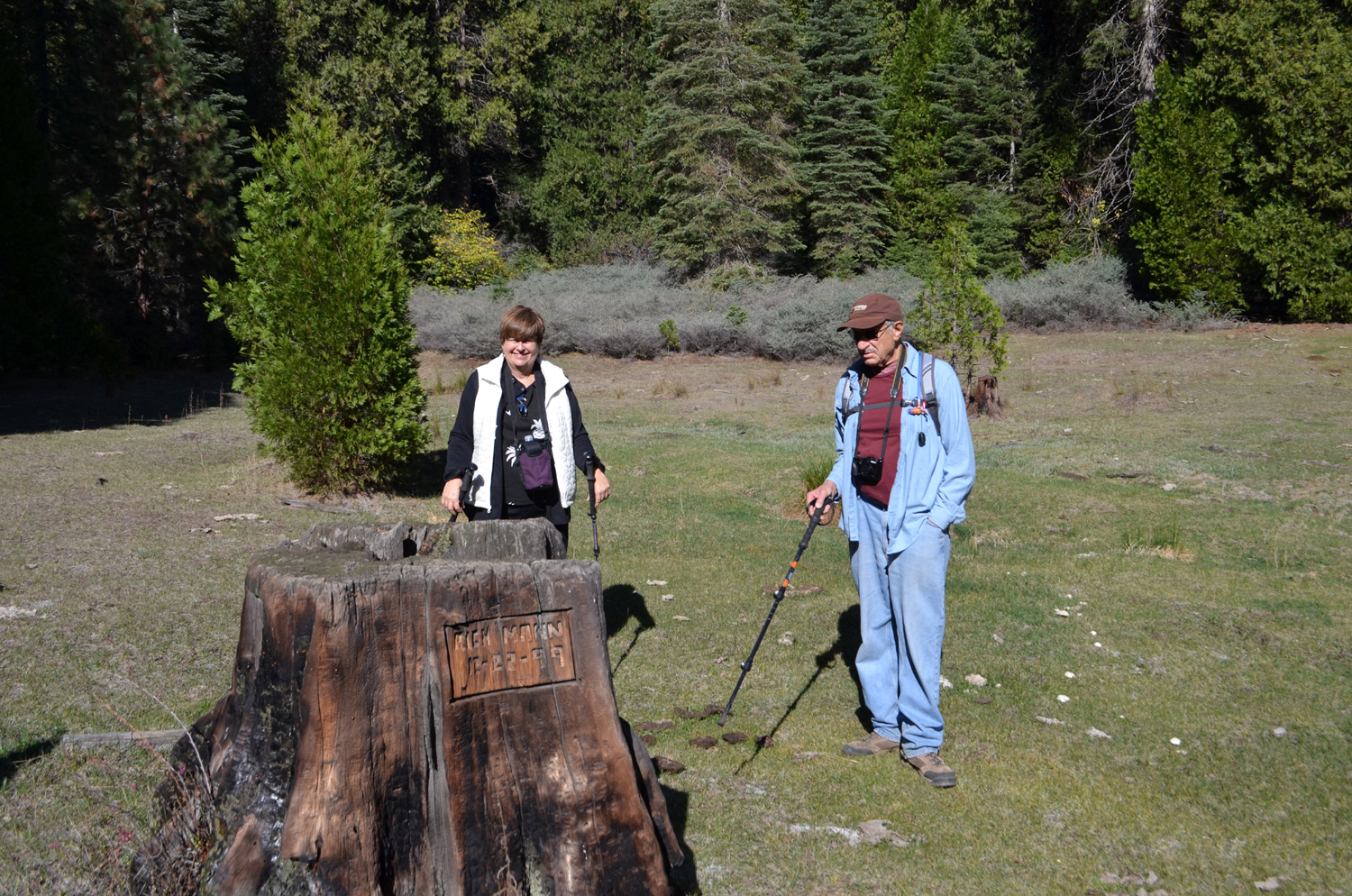
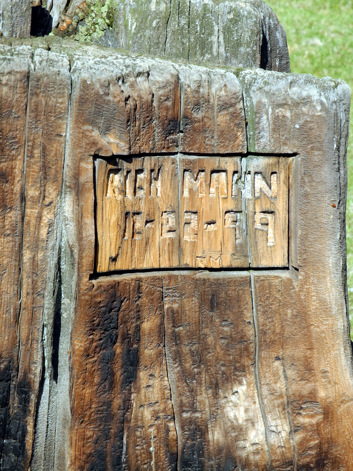
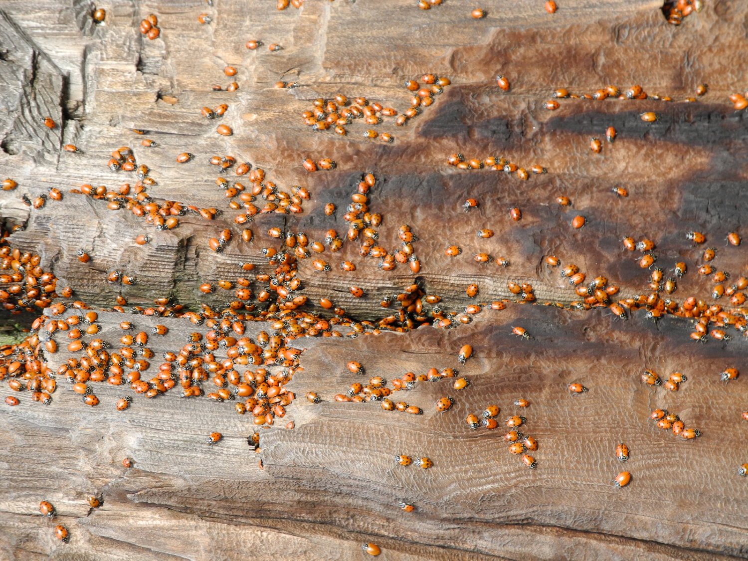
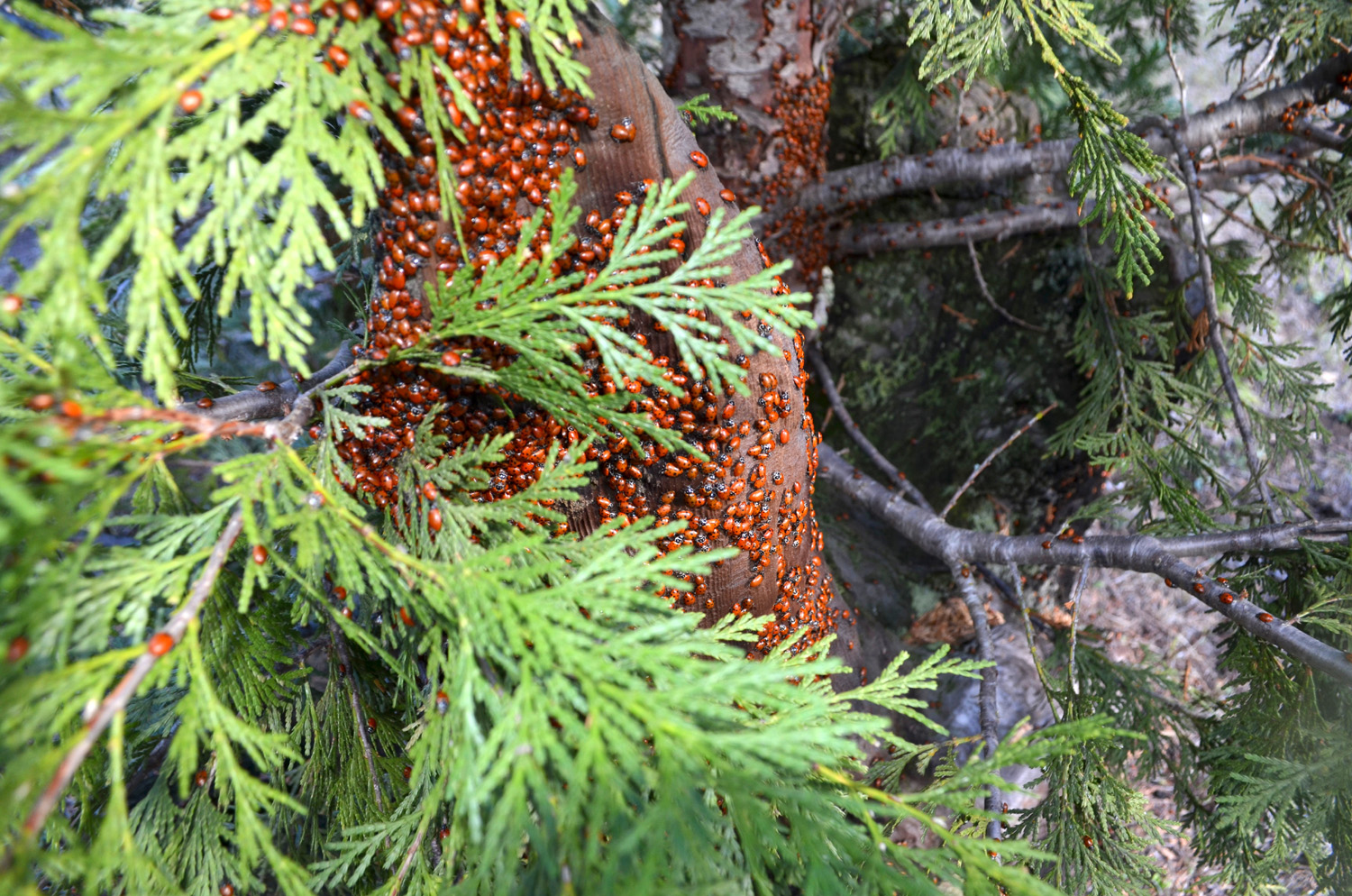
Shadow of the Giants Trail & California Meadow Although I visited Nelder Grove a number of times over several years before I found the Shadow of the Giants Trail, I have been on it a number of times since. My daughter Jennifer and I went there in July of 2013, and I took my next door neighbors, Bob and Alice, there in September of 2014. The Ramblers hiked in the main part of Nelder Grove in early September last year, but this was their first visit to the Giants trail, which is about a mile and a half west of the campground by road. In the Good News Department, we were back at full strength, with Julie and Carolyn fully recovered from their health issues. So we met at Julie's about 9 a.m. on October 29, stopped for coffee, and made the drive up highway 41 through Oakhurst to Sky Ranch Road. After a short jaunt on two dirt surface forest roads, we got on the trail between 10:30 and 11. It had rained in the mountains during the previous two weeks, so the ground was damp but not muddy, and the air was cool enough that we all were glad that we wore light jackets. Just as we started our hike, a group of young school kids was finishing a hike, and one turned out to be a neighbor of Wes. We said our hellos to the kids and their adult companions, and started up the trail. It goes up one side of Nelder Creek, crosses on a wooden bridge, and returns on the opposite side. There are informational panels along the trail, discussing the logging of sequoias in the late 19th century, and describing various trees and other sights that hikers encounter along the way. The large sequoias in the area are best seen on the west side of the creek, although some of them can be glimpsed through the forest on the east side. For this reason I prefer to walk the trail counter-clockwise, in order to encounter the more impressive specimens during the last half of the hike. Particularly notable is a huge standing dead sequoia, which is fairly rare. The species is highly resistant to fire, disease and insects, and the most common cause of death is falling over. When they do fall, the wood stays solid for decades, instead of rotting fairly quickly as most trees do. This particular standing snag appears to have been dead for many decades, but still has a significant amount of bark around the lower part of the trunk. The wood of the sequoia is quite brittle, with the result that many trees shattered on being cut, and were not suitable for lumber. A number of these were left where they fell, but the wood is still as solid as they day they fell. We enjoyed the half dozen or so large trees that were visible on the downstream part of the hike, some of them immediately adjacent to the trail. A bonus feature was the dogwood trees, with their leaves changing to fall colors and adding some contrasting red and pink spots against the evergreens. We also had a pleasant conversation with a group of two families from southern California. They had visited Yosemite, and were now looking for a chance to show their kids the biggest trees. We gave them directions to the Bull Buck Tree, located near the campground, and also gave them some suggestions about visiting Grant Grove and Giant Forest in Kings Canyon and Sequoia National Parks. Across the road from the trailhead there is a single large sequoia, the Sierra Beauty, and a picnic table, where we rested and enjoyed our snack, and took our group photo. Since the hike we had just completed was only a mile, I suggested another walk in a location I've been to a number of times, and everyone agreed they could handle some more hiking. We drove back the way we had come and parked where California Creek crosses the dirt road a short distance from Sky Ranch Road. An old road goes in about a half mile to California Meadow. The road parallels the creek at a distance, and the stream is not visible till you get to the meadow. Although this road was once drivable, it is now blocked by a large log and is not maintained. Nonetheless, hikers and even dirt bike riders have managed to find a narrow way between the log and the bank. I have been up this road a half dozen times or more and have never seen anyone else there. However, where logs have fallen across the road, enough people have been through there to create short detours that are fairly easy to hike, and the path looks well-used. Along the way there is a patch of thistles in the road, most of them gone to seed and dying as nature intended. However, a couple of them are confused by the changing weather and were putting out new blossoms. Accessing the meadow requires crossing the creek, and this proved to be a little more difficult than I expected. The recent rains have created enough of a flow that the little stream was too wide to step across, but more problematic, the edges were marshy. We found some old board that we put down and all made it across, but then there was another branch of the creek to cross. All but Julie got across OK, but this crossing was a bit more difficult, and she was feeling a bit unsteady. We finally located another spot where the creek was narrow enough, although Julie had to squeeze under a log that had fallen across the channel. Finally we were all in the meadow, and everyone was glad they had made the effort. Among the unique aspects of this place are some old stumps, one of which has been turned into a memorial of sorts, with the name and dates of a woman who died much too young. These stumps were here when I first came to this place in the 1970s, and they looked ancient then. The carvings, which include just a name and date on one side, appear to have been made since 1990. Even more fascinating was a sight that Wes and I have seen once or twice, but was new to Julie and Carolyn. Thousands of ladybugs were massed together on old logs and stumps, apparently in preparation for winter. We saw them on virtually every stump and piece of old wood in the meadow. Walking toward the downstream end of the meadow, we found a crossing place that was much easier than the ones we had picked before, and the two sections of the stream had joined by this location, so getting across was not the challenge it had been earlier. We made our way up to the trail, and soon were back at Wes's SUV, ready for the return trip home. We were also ready for a late lunch, so our first stop was at El Cid, an excellent Mexican restaurant in Oakhurst. With our various stops along the Nelder Grove trail, our wandering around the meadow, and time spent eating and snacking, we made a rather late return, getting back to Fresno a little before five. We were discussing where to go on our next hike, and agreed that the changeable weather of this season meant we would have to make a fairly last-minute decision. (Note: Some photos linked above are from previous visits to Nelder Grove) --Dick Estel, November 2015 |
||
|
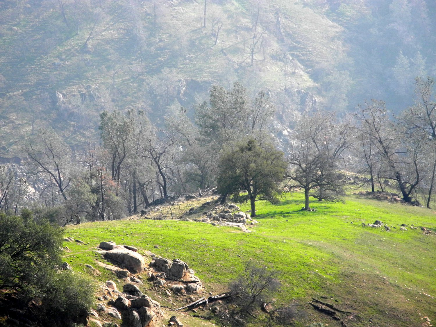
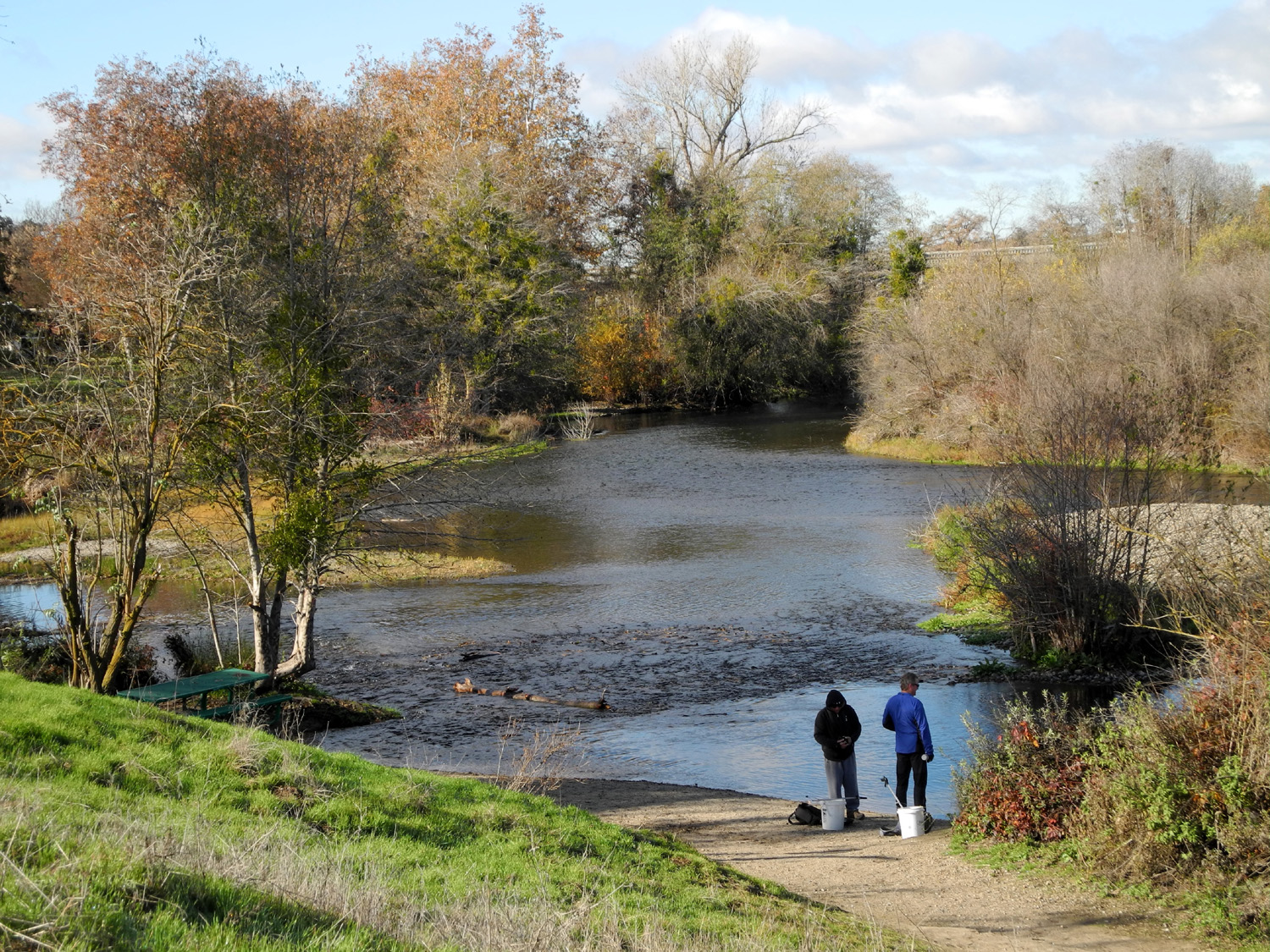
San Joaquin River Trail (Finegold) We've reached that time of year when the weather often dictates where and when we ramble. For our November 24 outing we had planned to hike near Bass Lake, but rain was predicted at that location early in the day. Rain was also expected in the San Joaquin Valley and nearby foothills, but not till around 5 p.m., so we set out for the Finegold Picnic area, by Millerton Lake at the end of Sky Harbor Road. Here we would hike up a short distance on the San Joaquin River Trail, enjoy the scenery and a snack, and return. Julie was called to Texas to help a friend, so it was just Dick, Wes and Carolyn, all of whom have hiked this trail in the past (Wes has done the entire 11-mile route, all the way to the San Joaquin River Gorge area). I had done it very recently, on November 8. At that time the new green grass was just getting started, but now, just over two weeks later, it is growing well, thanks to a series of rainstorms starting in mid-October. It was quite cool as we started out, and I carried an extra shirt in my pack. This proved unnecessary, as we all ended up removing a layer, and I had to haul TWO shirts part way up and all the way down. Since I had very little other than water in my pack, this was not a great burden. This area is around 1,000 feet in elevation, with typical foothill vegetation - blue oak, live oak, bull pine, manzanita, chaparral, and lots of annual plants, many of which will produce flowers in a couple of months. There were a few clouds drifting over, but for the most part we had blue skies, slightly hazy sunshine, and very nice conditions for hiking. The trail goes up for about a mile, then crosses a saddle, and continues parallel to the lake and the river, with long stretches that are relatively level. We did not go past the saddle, but did go up an unofficial trail to the north. After a hundred yards or so this leads to the top of a knoll, where the view includes the lake on two sides, bright green grassy areas, and hundreds of trees on the hillsides. You can also see the very top of Pincushion Peak sticking up above another knoll to the west. There's a trail to the top of Pincushion, but it's a fairly strenuous hike, and we had no plans to include that destination at this time. Everyone posed for an "on the rock" photo, and we took our group photo in that format also. Then it was time to start down the trail, which takes almost as much effort as the uphill portion due to the steepness of the route. When we got back to the car, we drove to the small town of Friant, located just below the dam that bears the same name. Wes had recommended the Sandals at the Beach Grill on one of our previous hikes in the area, but it was closed. This time we were in luck, and we enjoyed a great lunch. This facility is basically a large, permanent tent with optional patio dining. There's a beach volleyball court and various beach related items outside. The heavy vinyl walls of the tent are rolled up during the summer, but they were down in this season, and the temperature was quite comfortable. Instead of taking Wes's Toyota Highlander, for a change of pace, I drove my sort of new (2014) Honda CR-V, and we finished up our outing listening to The Best of the Nitty Gritty Dirt Band on the CD player. --Dick Estel, November 2015 |
||
|
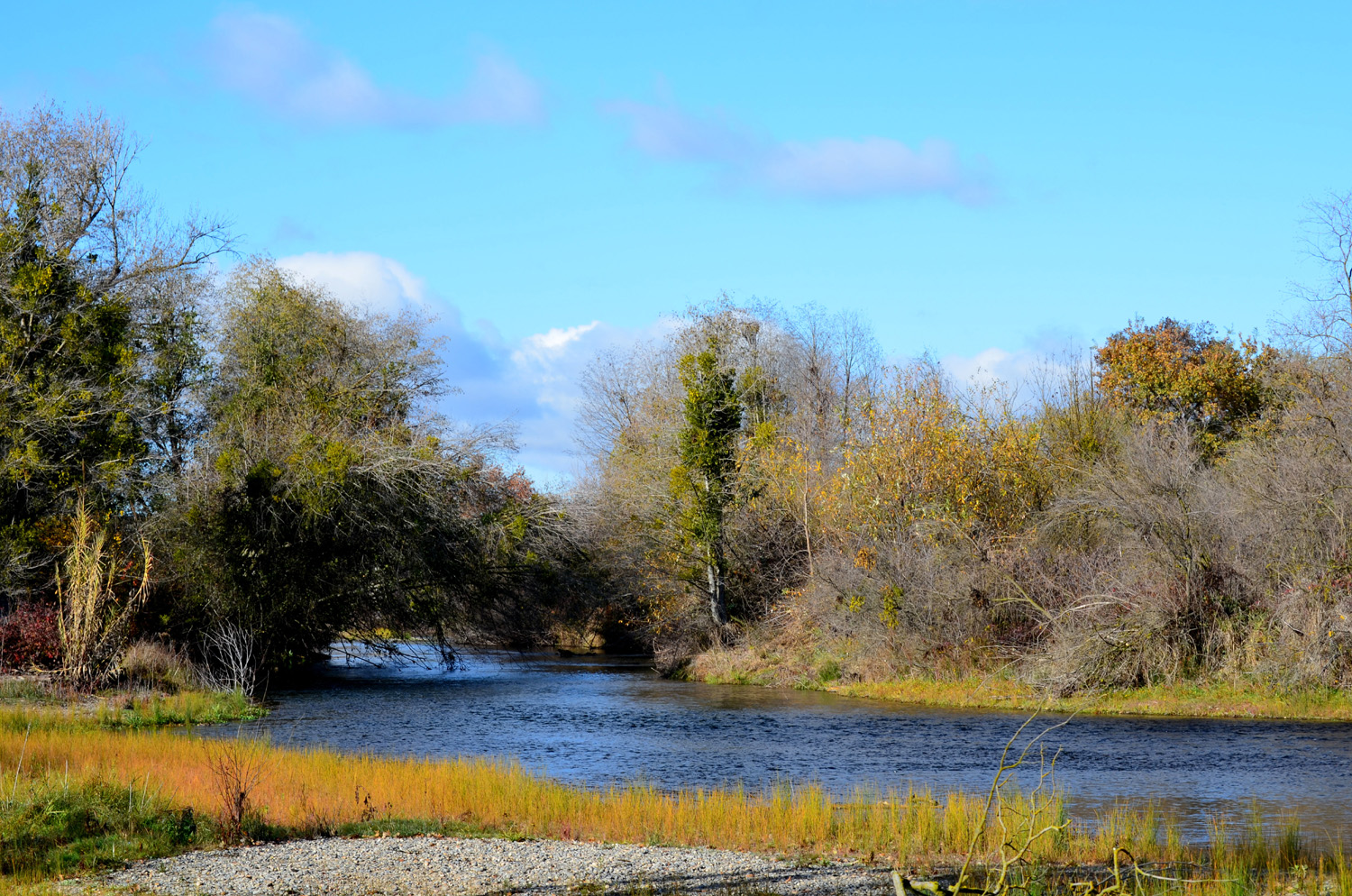
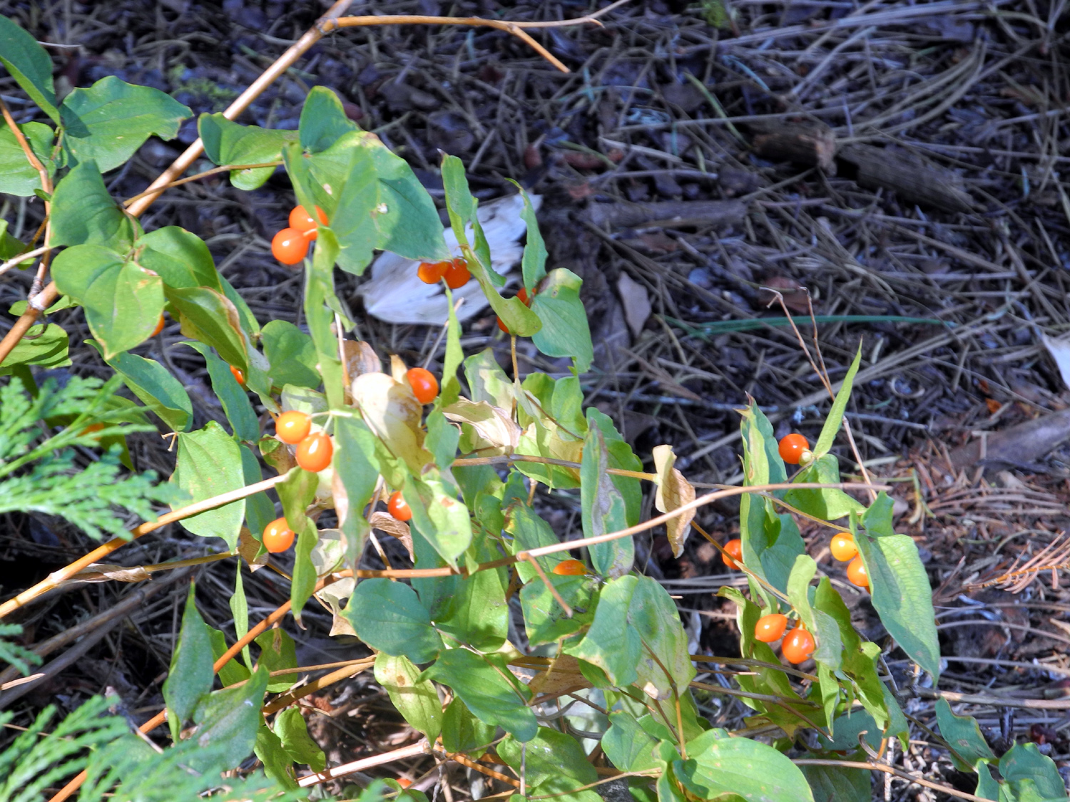
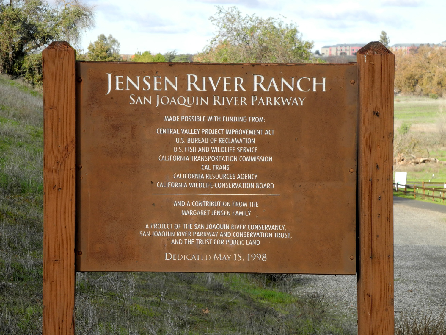
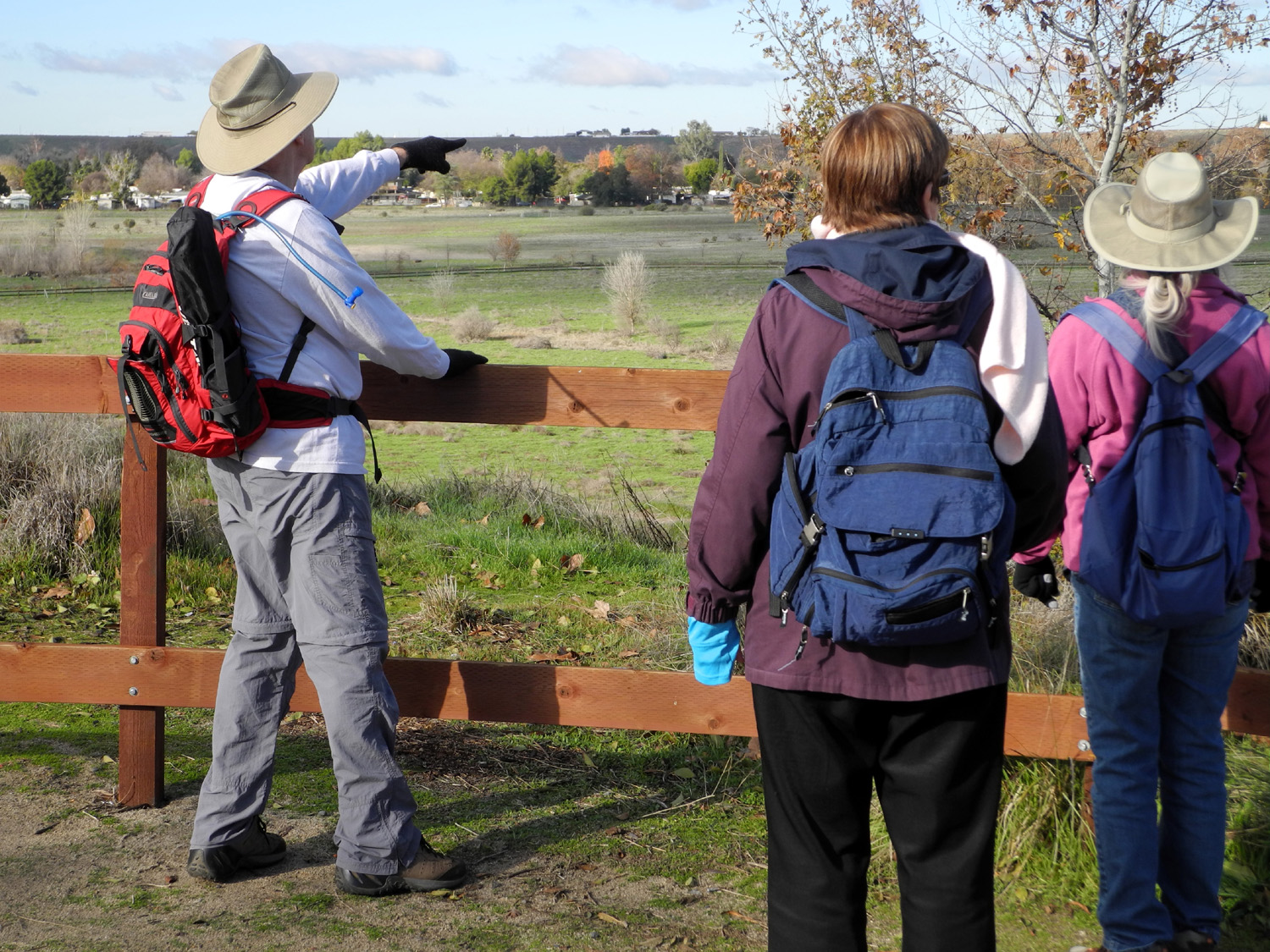
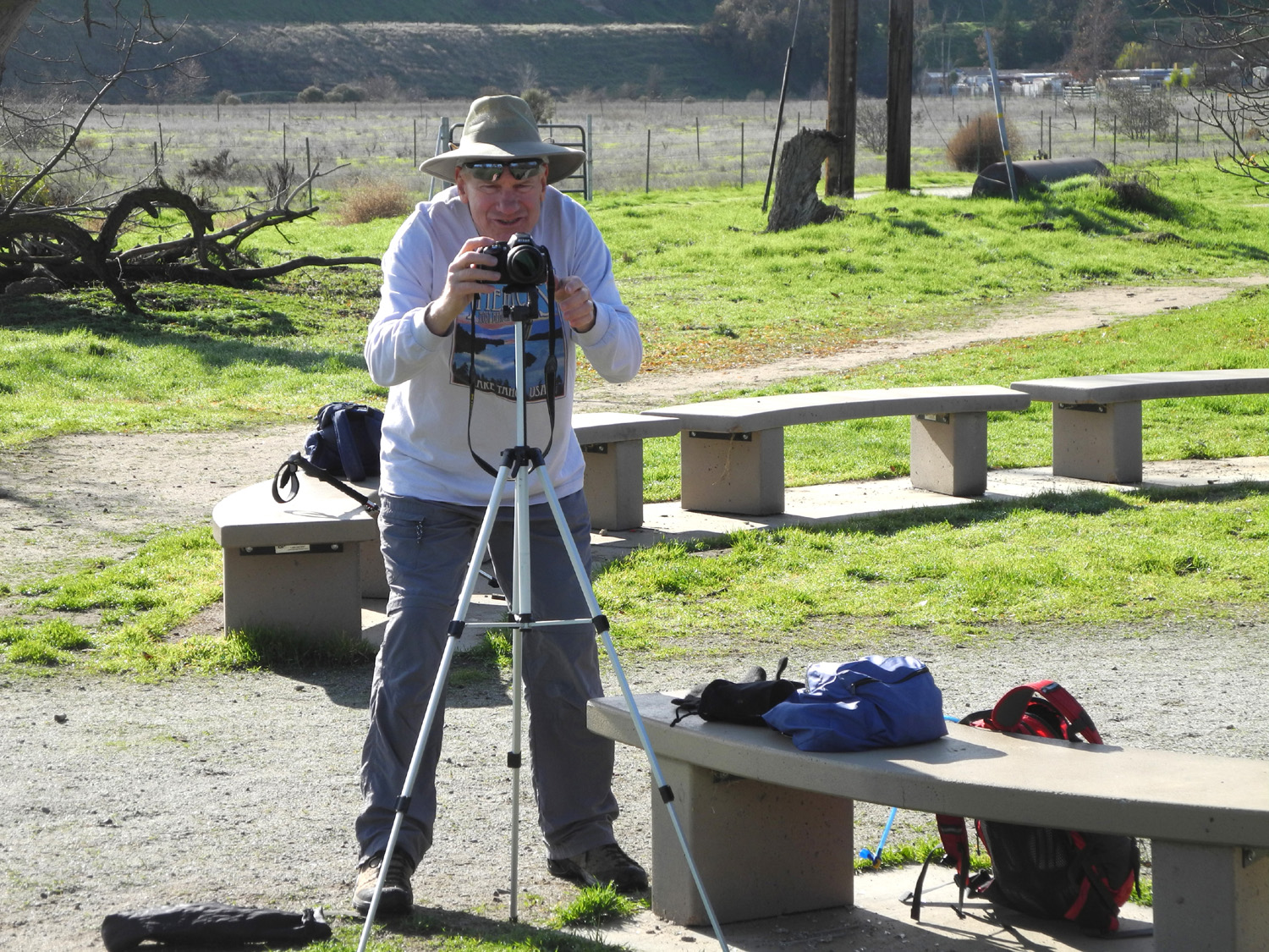
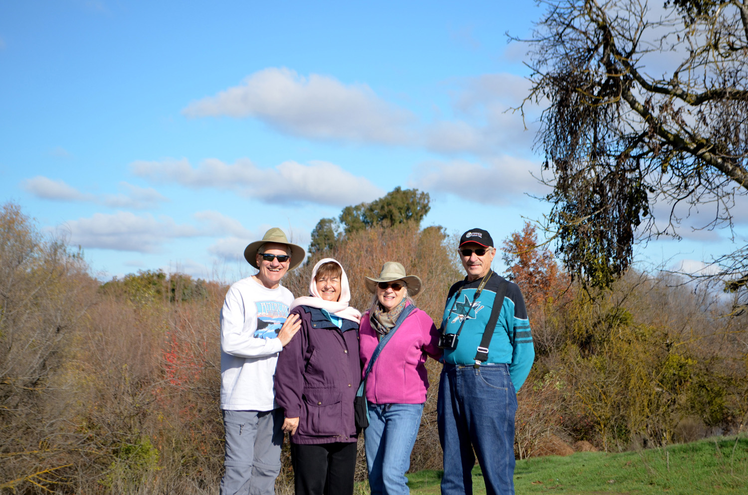
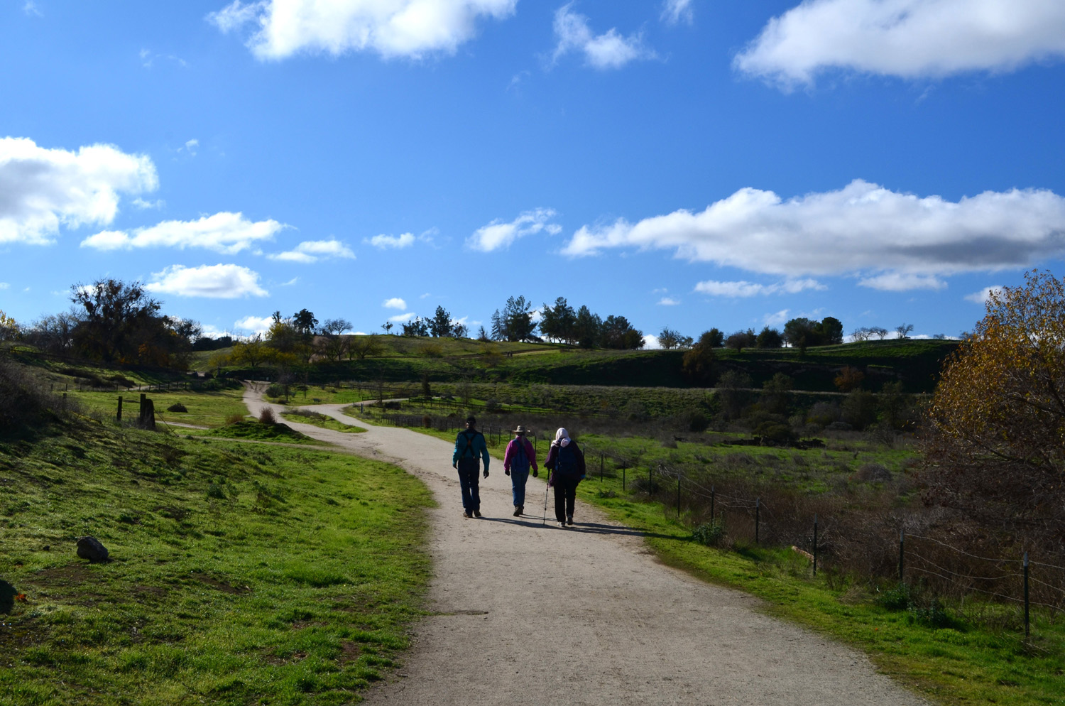
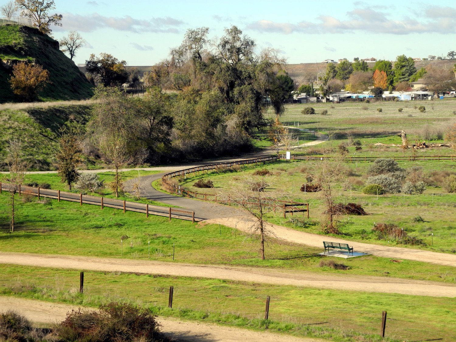
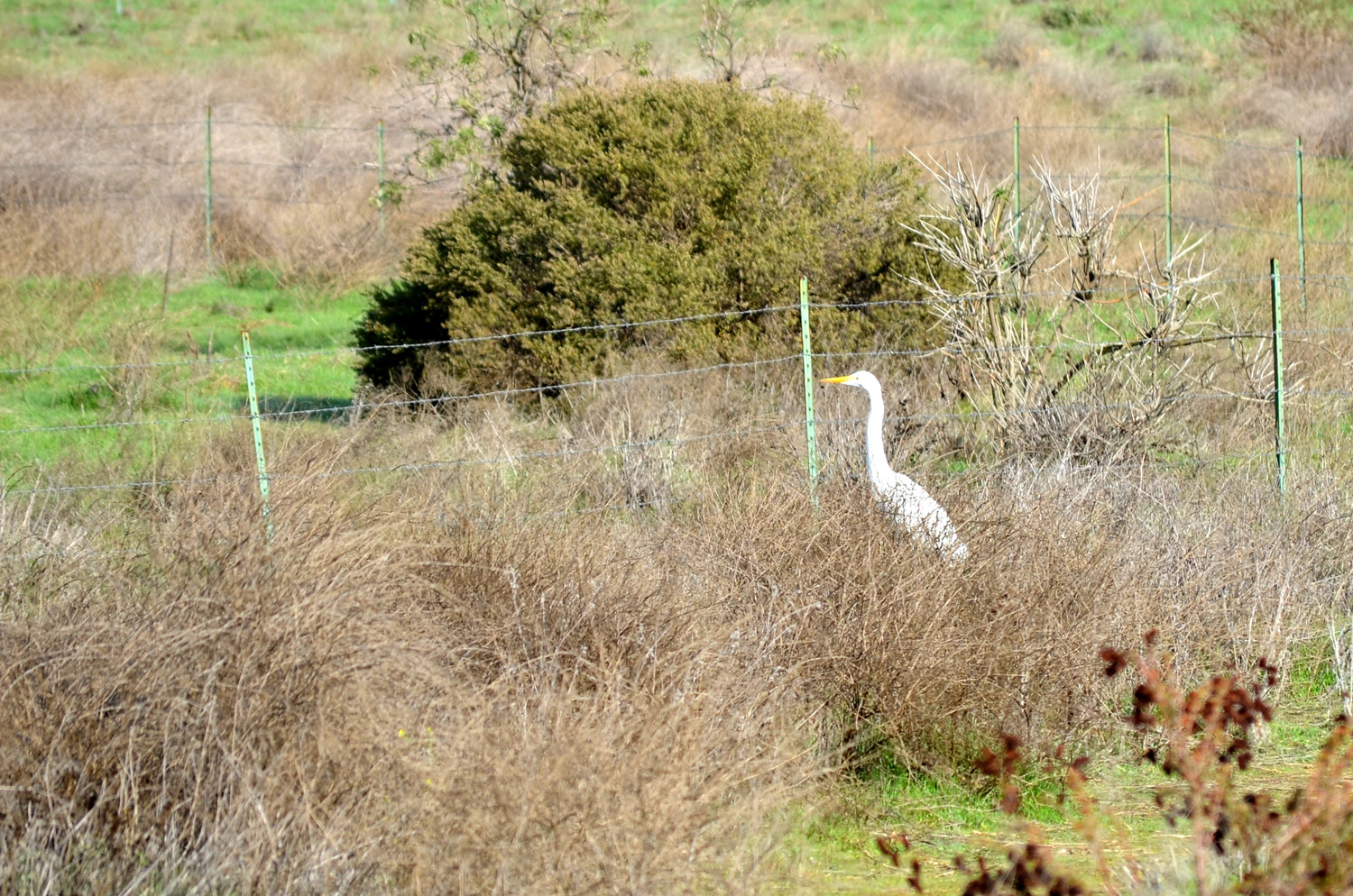
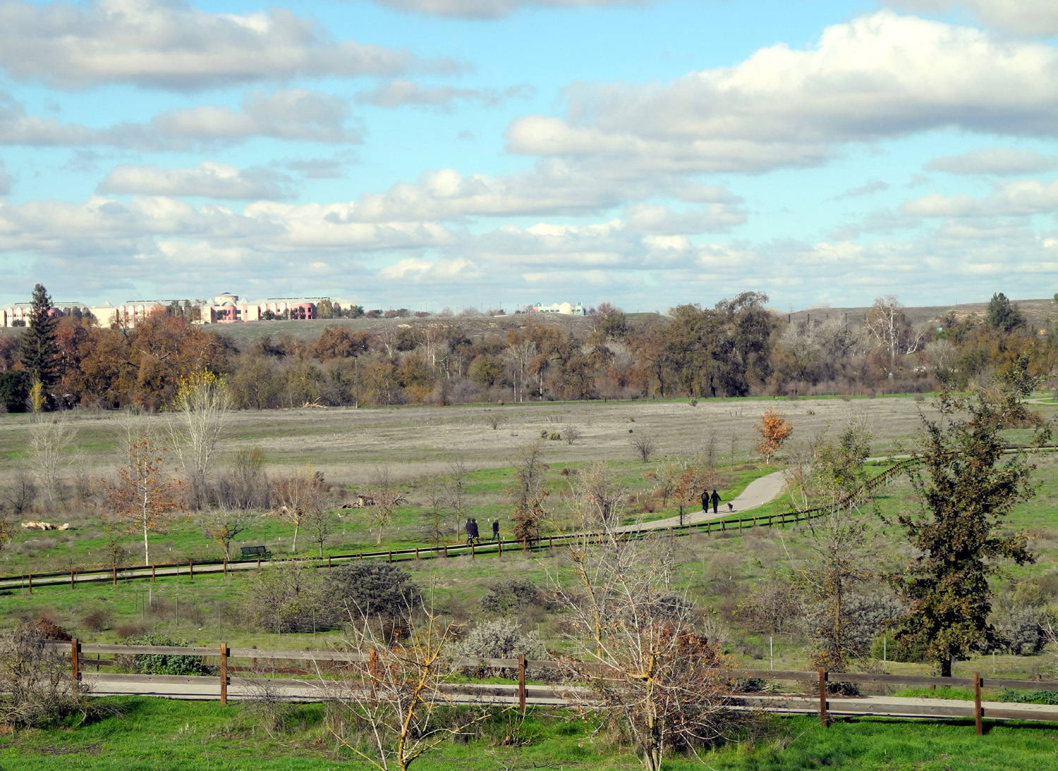
Jensen Trail The Ramblers were back at full strength for our final hike of the year, which was scheduled for December 14 at the San Joaquin River Gorge. Of course, with a year that has already seen above-average rainfall and low elevation snow, we are obsessively watching the weather forecast for days before each hike, ready to adjust our plans if necessary. When we gathered at my house around 9 a.m., the prediction for our hiking area was for temperatures below 40 and winds up to 9 MPH. In addition, we had received rain, hail, and low elevation snow the day before, so we decided on a destination closer to home. Wes suggested the Jensen River Ranch Trail, in the San Joaquin River bottom north of Woodward Park. He has hiked and biked there extensively, and Julie had also hiked there. Carolyn and I did not even know this trail existed. We parked in a shopping center across from the start of the Eaton Trail at the edge of the park, crossed the street, and walked along the bluff to the west. From here a short section of trail took us to the river bottom and the location of the former Jensen Ranch. In this area the river flood plain is at least a mile across, with the river itself occupying a narrow channel in the middle. The trail branches off in several places, with both paved and dirt sections, and you can take different loops to control the length of your walk. At one point we took a short dirt path that goes right to the edge of the water, which was flowing strongly. We encountered another hiker who had seen a 20-inch salmon in the river earlier that day. We didn't sight any fish, but we saw many birds, rabbits and squirrels. We saw a red tail hawk, also watching for the rodents, an egret, and a sandpiper, both standing in marshy areas in search of food. In one area a habitat restoration project is under way, and a number of trees have been planted in sections that are fenced off to protect the young saplings till they can reach a larger size. Near this spot there is a drainage channel that collects runoff from the bluffs above, creating a marshy stream near the trail. The only thing lacking on this hike was a rock for our traditional Wes on the Rock photo, but we got a nice shot of the Ramblers with the trees along the river as our backdrop. The weather was very cool, about 50 degrees, but mostly sunny with some nice fluffy white clouds for contrast. Eventually we made our way back up the bluff, through a newly developed area of the park, and back to the car, a total of three miles of walking. This gave us a good appetite for our visit to Eddie's Bakery, on Cedar just north of Herndon. This place features various pastries, as well as an extensive breakfast and lunch menu, and we all enjoyed our choices. Driving back to our starting point at my house, our conversation turned to the first hike of 2016, but we realized that weather has a greater say-so than we do, so we did not make any specific plans yet.
|
||
Photos
(Click to enlarge; pictures open in new window) |
||
|
Courtright Reservoir Hike |
||
|
|
||
 |
||
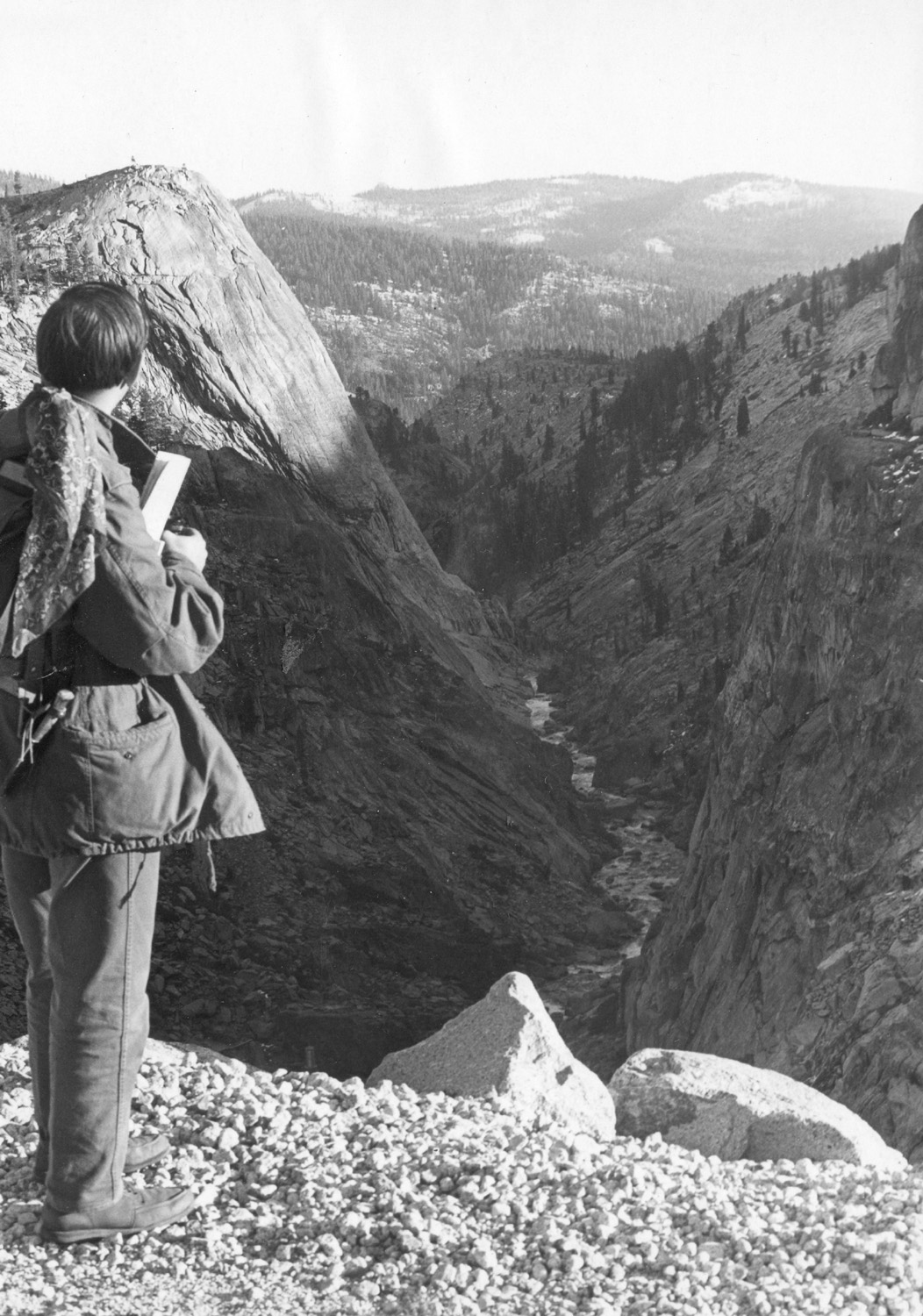
| The LeConte Divide | ||
|
|
 |
 |
|
Dick and Carolyn at LeConte Overlook |
Helms Creek flows
through the |
Information |
 |
 |
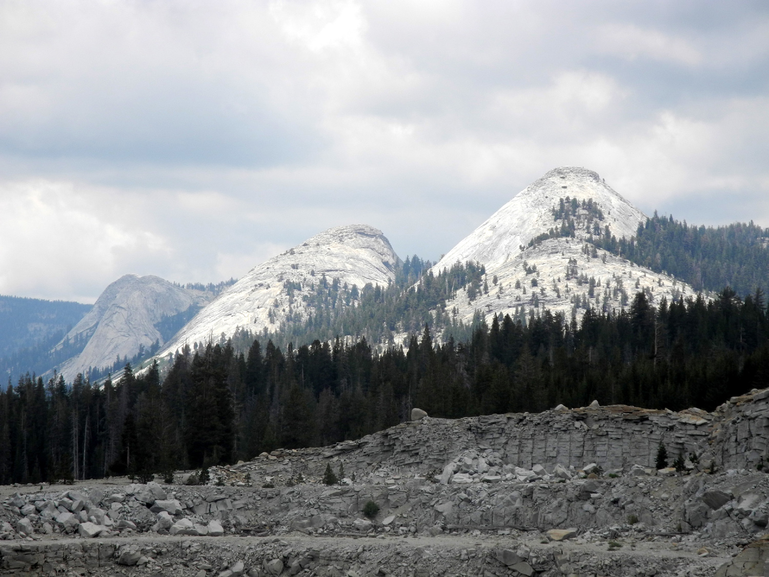 |
| Courtright Reservoir | Another view of the lake | Domes to the east of the lake |
 |
 |
 |
|
Helms Creek canyon from the dam |
Looking down the canyon | Dome to the east of the trail |
 |
 |
 |
| A closer view of the eastern dome |
View of the boulder field from the trail |
The southern edge of the boulder field |
 |
 |
 |
| Three views of the dome to the west of the trail, between trail and lake | ||
 |
||
| Panoramic view of the eastern dome | ||
 |
 |
 |
| Maxson Dome |
Juniper on the rocky slopes above the trail |
Multiple juniper trunks |
 |
 |
 |
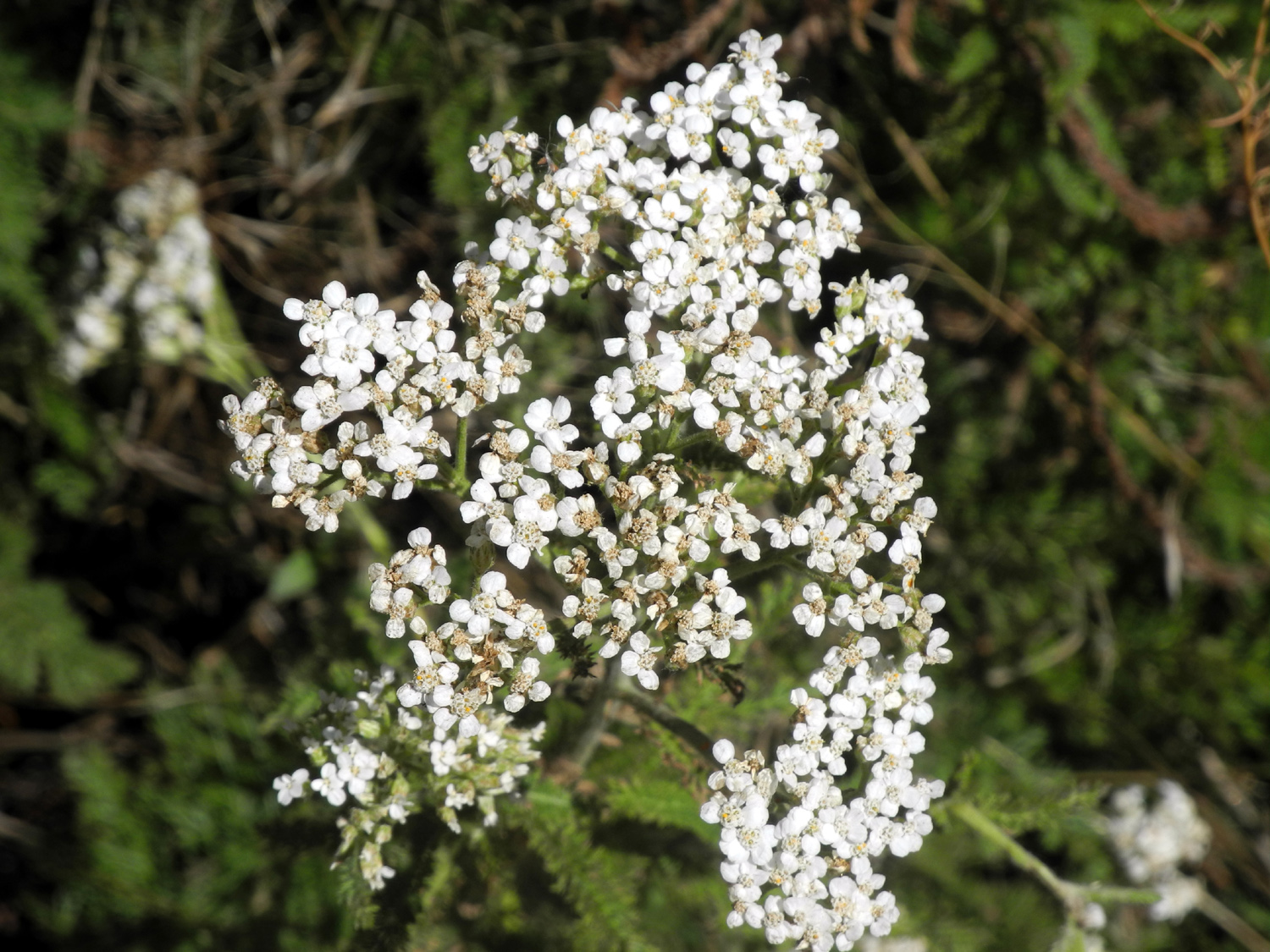
| More of those unidentified flowers |
These flowers appeared in only one location |
Burl on a young lodgepole pine |
 |
 |
 |
|
Where the trail and the OHV route separate |
On the boardwalk | Wes and Carolyn on the
granite slab, setting up for group photo |
|
 |
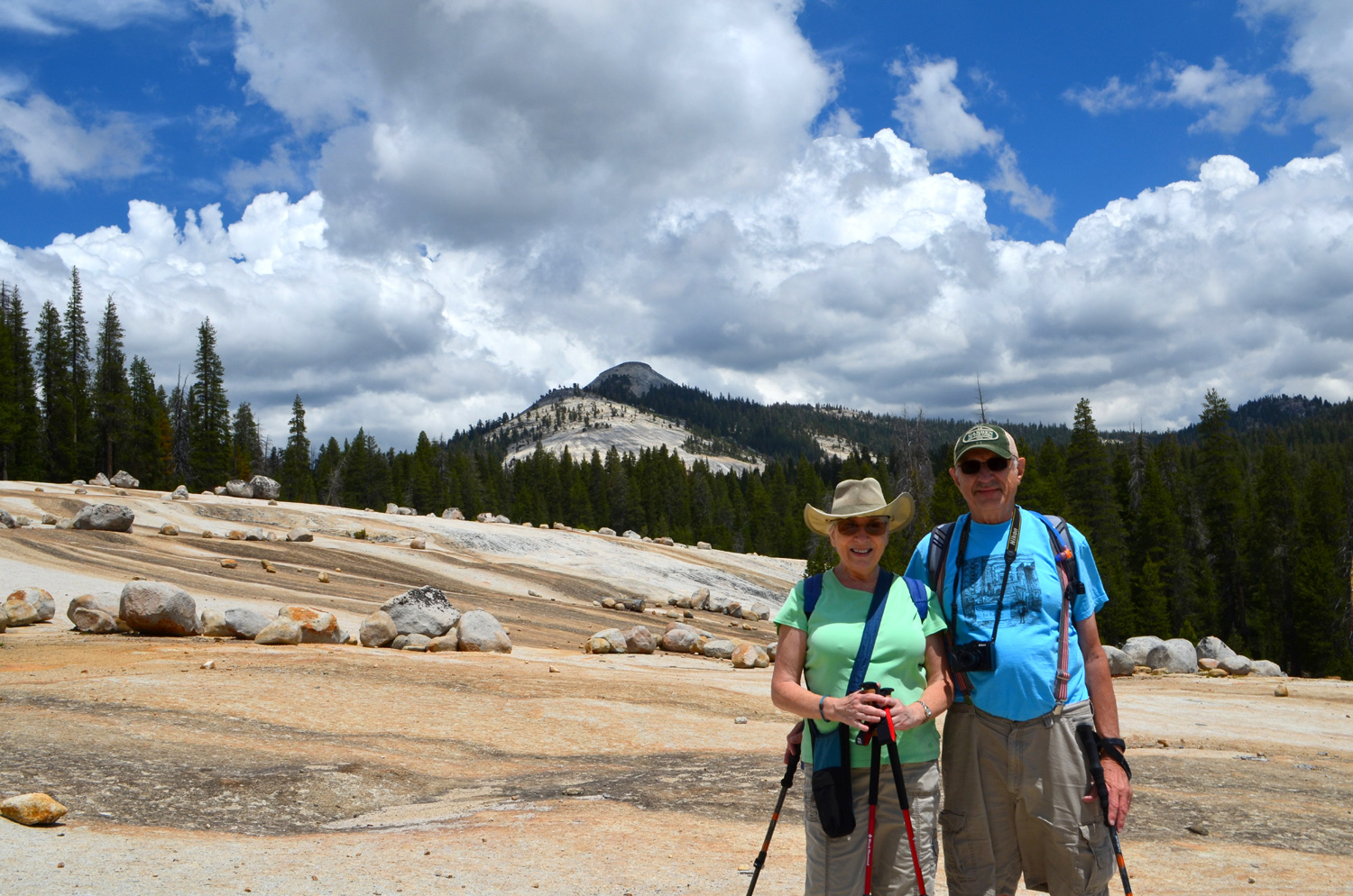 |
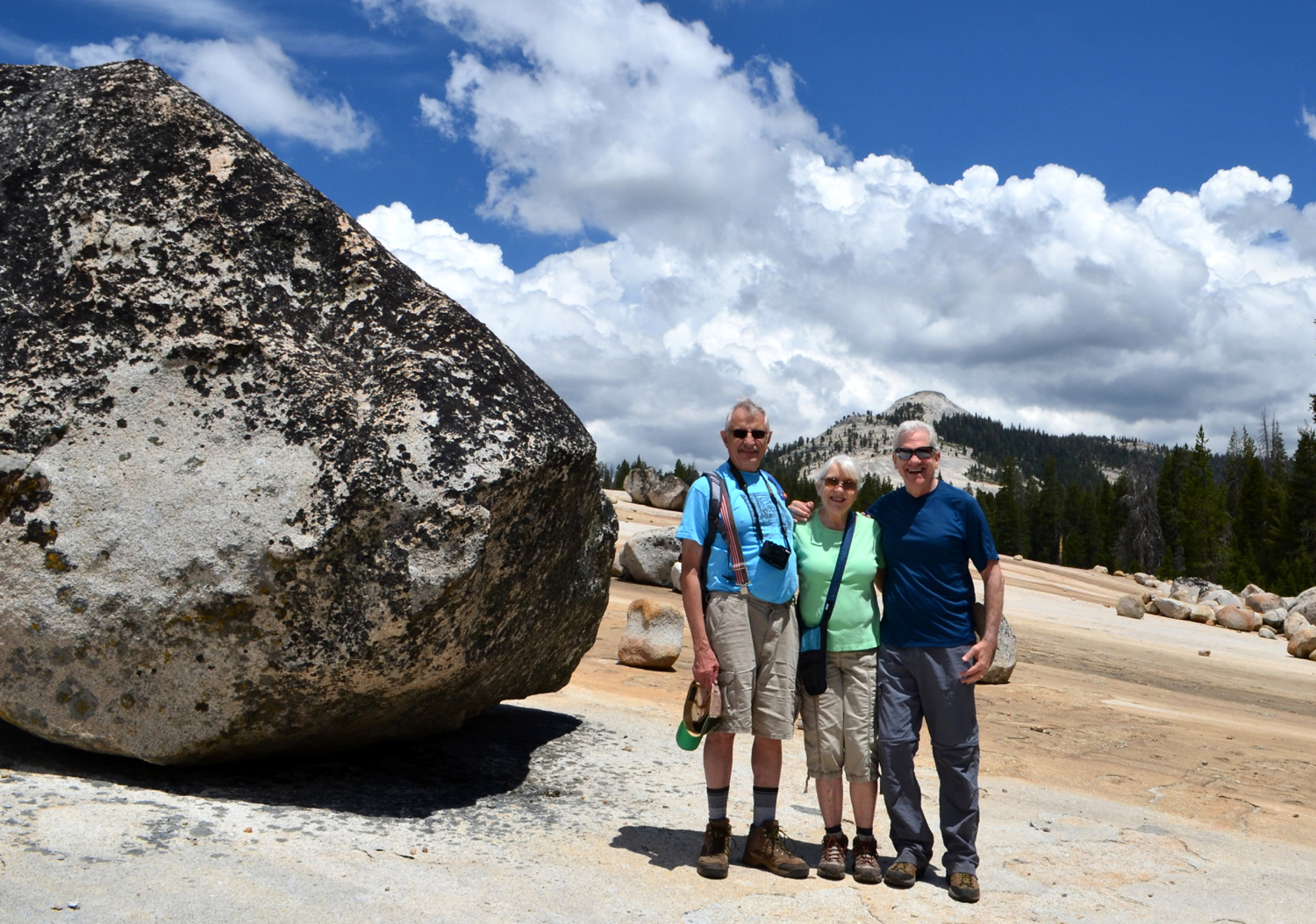
| The Ramblers, a huge
boulder, and Maxson Dome beyond |
Closer view of the gang | Carolyn and Dick |
 |
 |
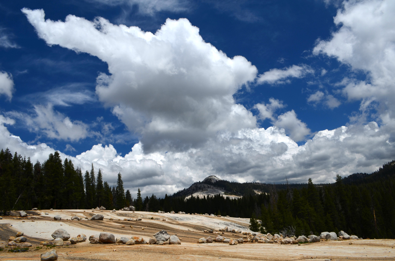 |
| Dramatic granite and striking cloud formations | ||
 |
 |
 |
| Huge boulders were dropped at random as the ice melted |
Carolyn's thinking,
"You'd |
Wes safely on the rock |
 |
 |
 |
| Typical section of the road |
A Mariposa boy with Mariposa lilies |
Close up of Mariposa lilies |
 |
 |
 |
| Three photos from my first visit to the area (Lew Koch on the boulder) | ||
| Taft Point | ||
 |
 |
 |
| Now we've been both ways | Into the red fir forest |
Neatly piled rocks east of the point |
 |
 |
 |
| Boulders and red firs | Typical trail scene -
rocks,
trees and lots of pinemat manzanita |
Rocks hang in this fissure |
 |
 |
 |
| Ridge where Tim and Scott crawled out in 1982 | Another view of the ridge | And yet another view |
 |
 |
 |
|
A large side fissure off the main one |
Hikers by the big fissure | Wes on the rock, keeping a safe distance from the edge |
 |
 |
 |
|
Edge
of the cliff with the top |
Along the edge of the big
fissure, with the valley's north rim beyond |
Boulders near the edge |
 |
 |
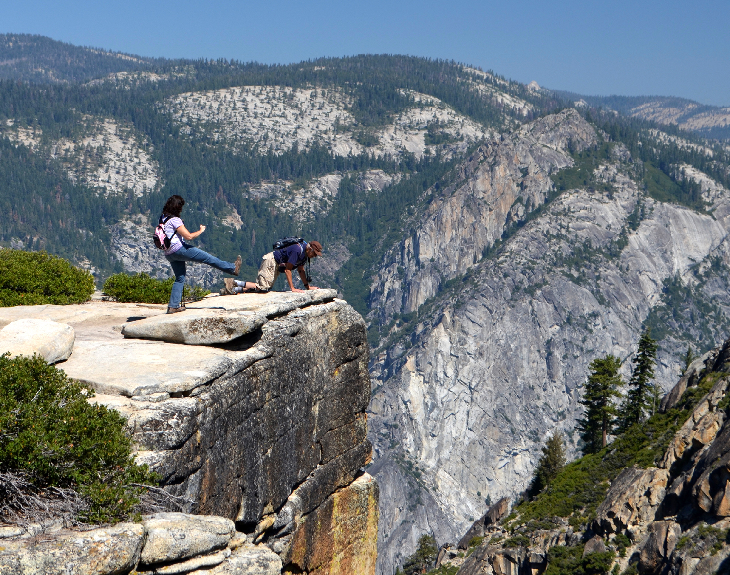 |
| Jennifer chooses a safe way to look into the void | So does Dick |
Jennifer claims she was
just |
 |
|
 |
|
Half the Ramblers plus
Jennifer |
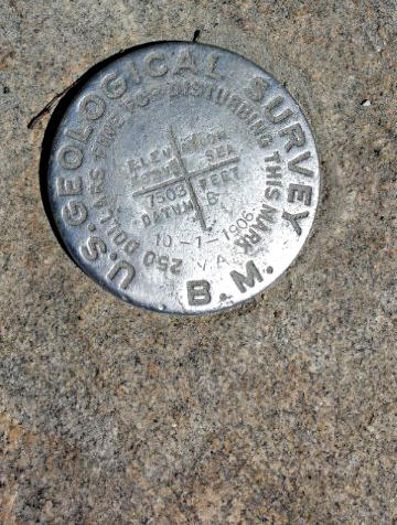
The dramatic overhang of Taft Point, looking north | Benchmark at the point |
 |
 |
 |
| "If I push this off, Wes won't be tempted to climb it" | Too late - he's up there! | Yosemite Falls - or maybe Yosemite Trickle? |
 |
 |
 |
| Looking down on El Capitan |
Cathedral Rocks, west of Taft Point |
Mt. Hoffman, on the north side of Tenaya Canyon |
 |
 |
 |
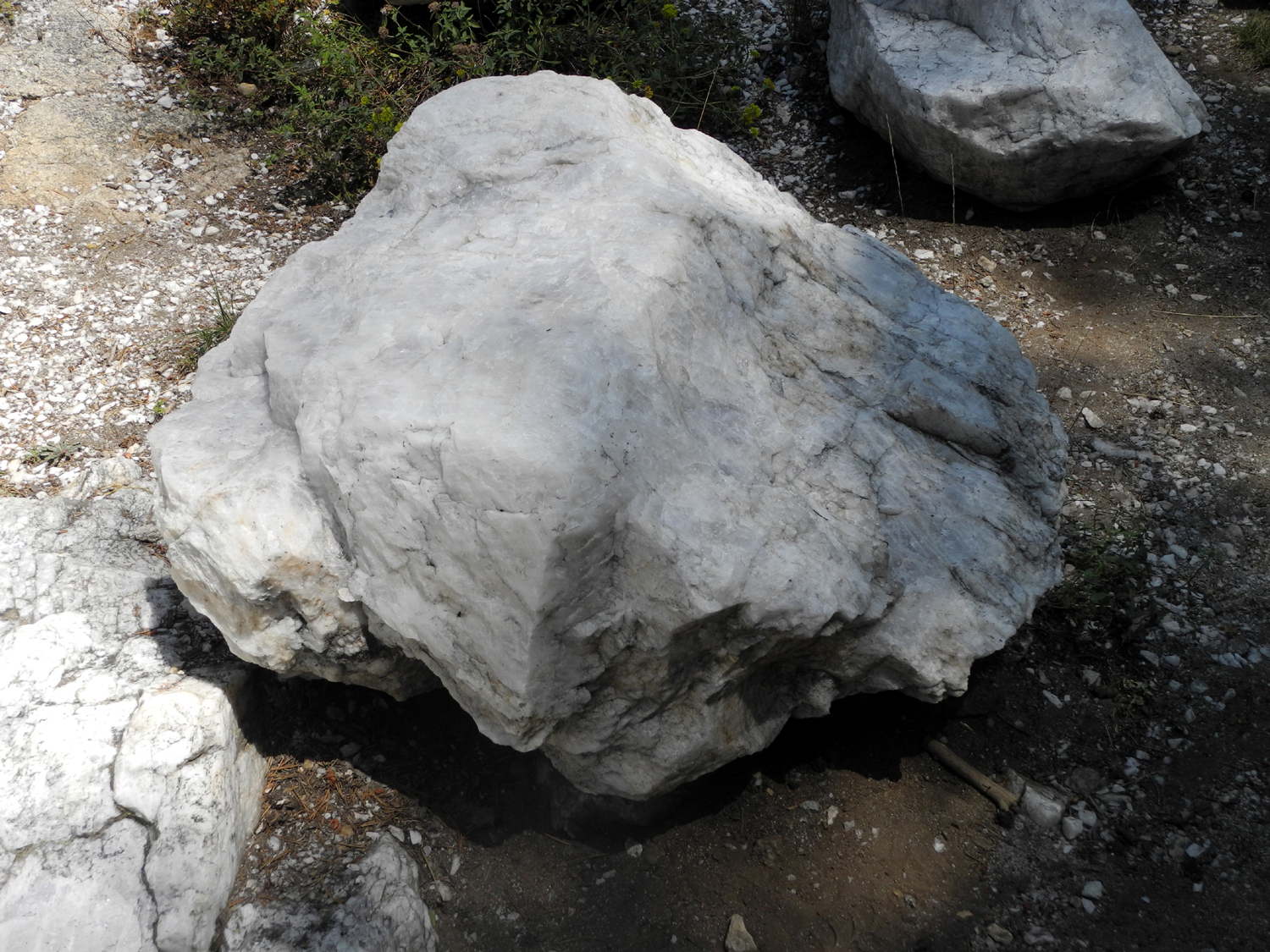
| The Merced River winds through Yosemite Valley | Eight-foot boulder is part of a large quartz outcropping |
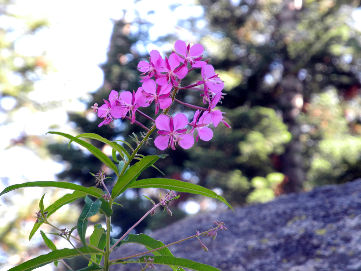
Fireweed with a big red fir as background |
 |
 |
 |
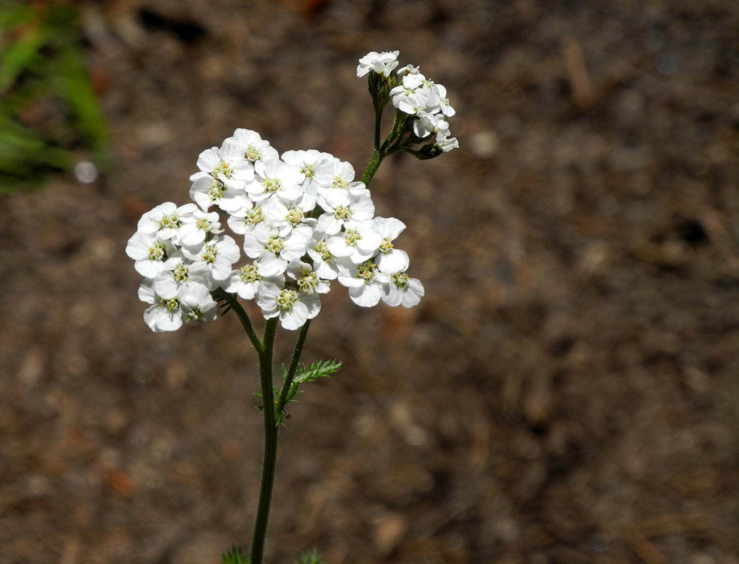
| Close-up of fireweed blossom | An unidentified flower |
Map
showing Taft Point and |
 |
||
| One of dozens of chipmunks we saw during our hike | ||
| Wawona Trails Photos | ||
 |
 |
 |
| Golf course and meadow | Wawona Dome |
Jumbled rocks on Chilnualna Creek |
 |
 |
 |
| The tiny trickle of the falls | Wes on the rock | Bear clover AKA mountain misery |
 |
|
 |
| The meadow | Rail fence from pioneer
days surrounds the meadow |
Wes stands by an ancient cattle chute, now out of service |
 |
 |
 |
| The trail by the meadow | Yummy snack for the wildlife |
Distinctive bark of a ponderosa pine |
 |
 |
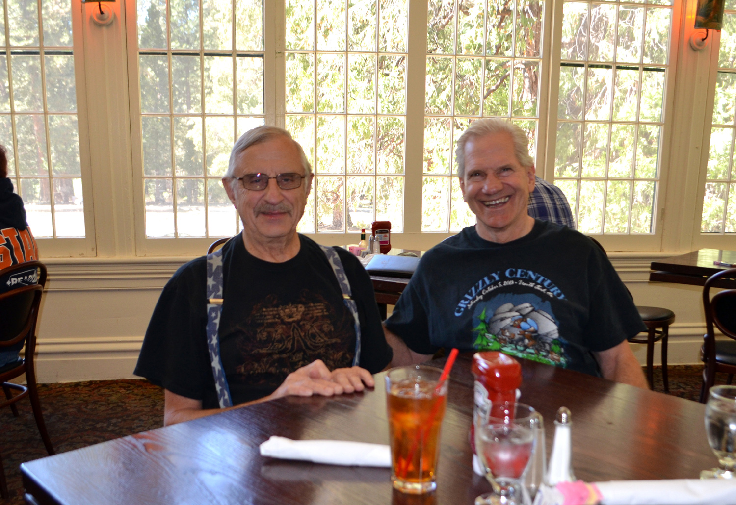 |
| Unknown white blossoms | Wes and Dick in front of the Wawona Hotel | Time for lunch |
| Shadow of the Giants Trail & California Meadow | ||
 |
|
 |
|
Dogwood leads the fall color parade |
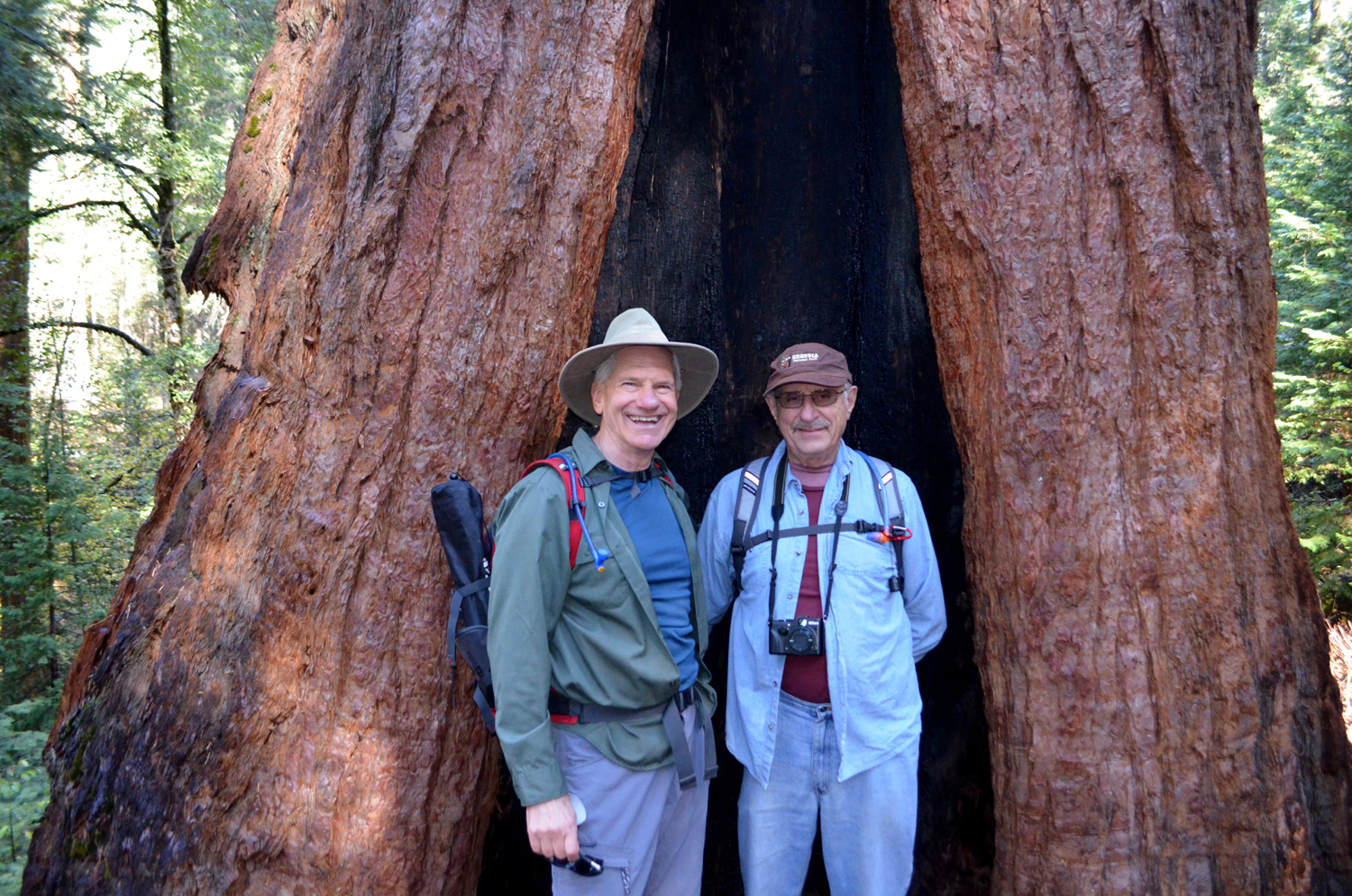
Carolyn and Julie squeeze inside a sequoia |
Wes and Dick try it too |
 |
 |
 |
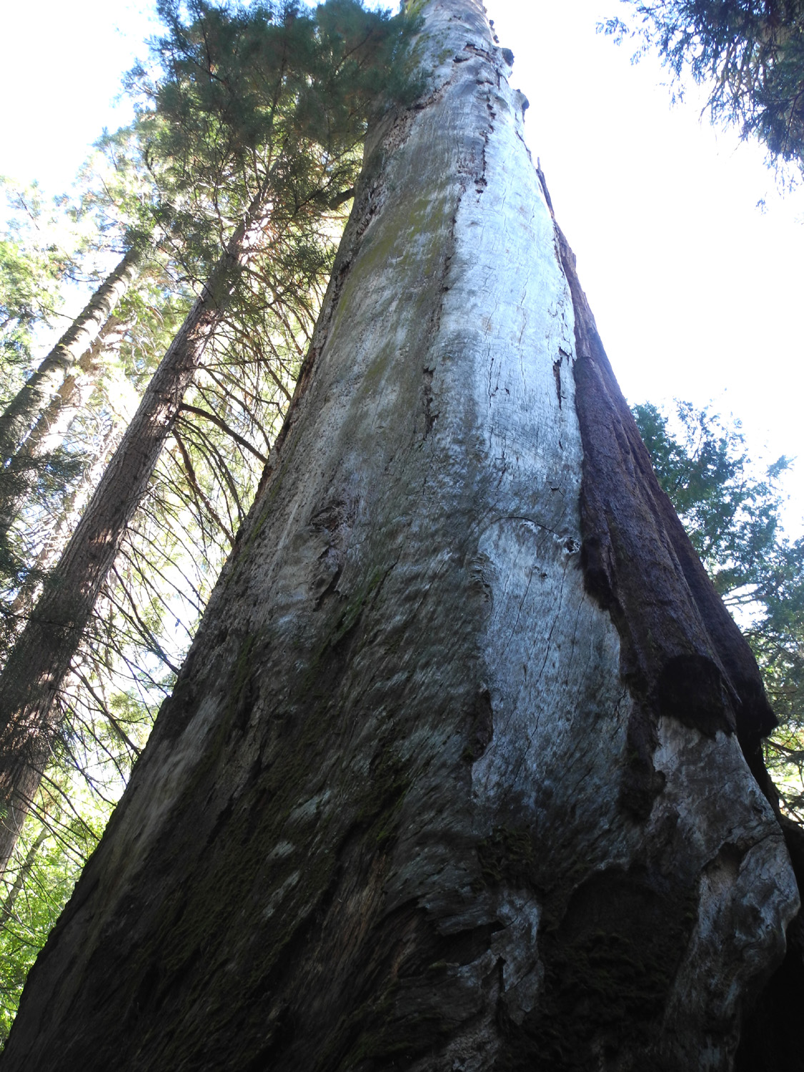
| Dead but still standing | Two big sequoias | Wes on the log |
 |
 |
 |
| The log Wes was on | Probably the biggest giant on the Shadow of the Giants tril |
The trail and the trees |
 |
 |
 |
| Massive lower trunk |
Thick, rugged bark at
the |
Burl on the Sierra Beauty |
 |
 |
 |
| The Ramblers next to the Sierra Beauty tree | Dick, Carolyn and Wes in California Meadow | Rick has made this stump his personal monument |
 |
 |
 |
|
Julie and Dick examine the carved stump |
Lady bugs preparing for winter | More ladybugs |
| San Joaquin River Trail - Finegold | ||
 |
 |
 |
| The lake is fuller than last year | Carolyn
and Dick above the half-way point on the trail |
A great sight - bright green grass |
 |
 |
 |
| This time it's Carolyn on the Rock | And all the Ramblers present too | It was misty down on the lake |
 |
 |
 |
| This
dead blue oak stands guard at the top of the knoll |
A nice crop of cones | Squaw Leap in the distance |
 |
|
 |
| Pincushion
Peak peeps over the green knoll to the west |
We met this gentleman on the trail on our way down | At Sandals on the Beach with a typical beach denizen |
| Jensen Ranch Trail | ||
 |
 |
 |
| Jensen Trail sign | Wes points the way | The trail down to the river bottom |
 |
 |
 |
| A grassy glade beside the trail |
Fall color set off by blue sky and clouds |
A huge, leafless tree near the river |
 |
|
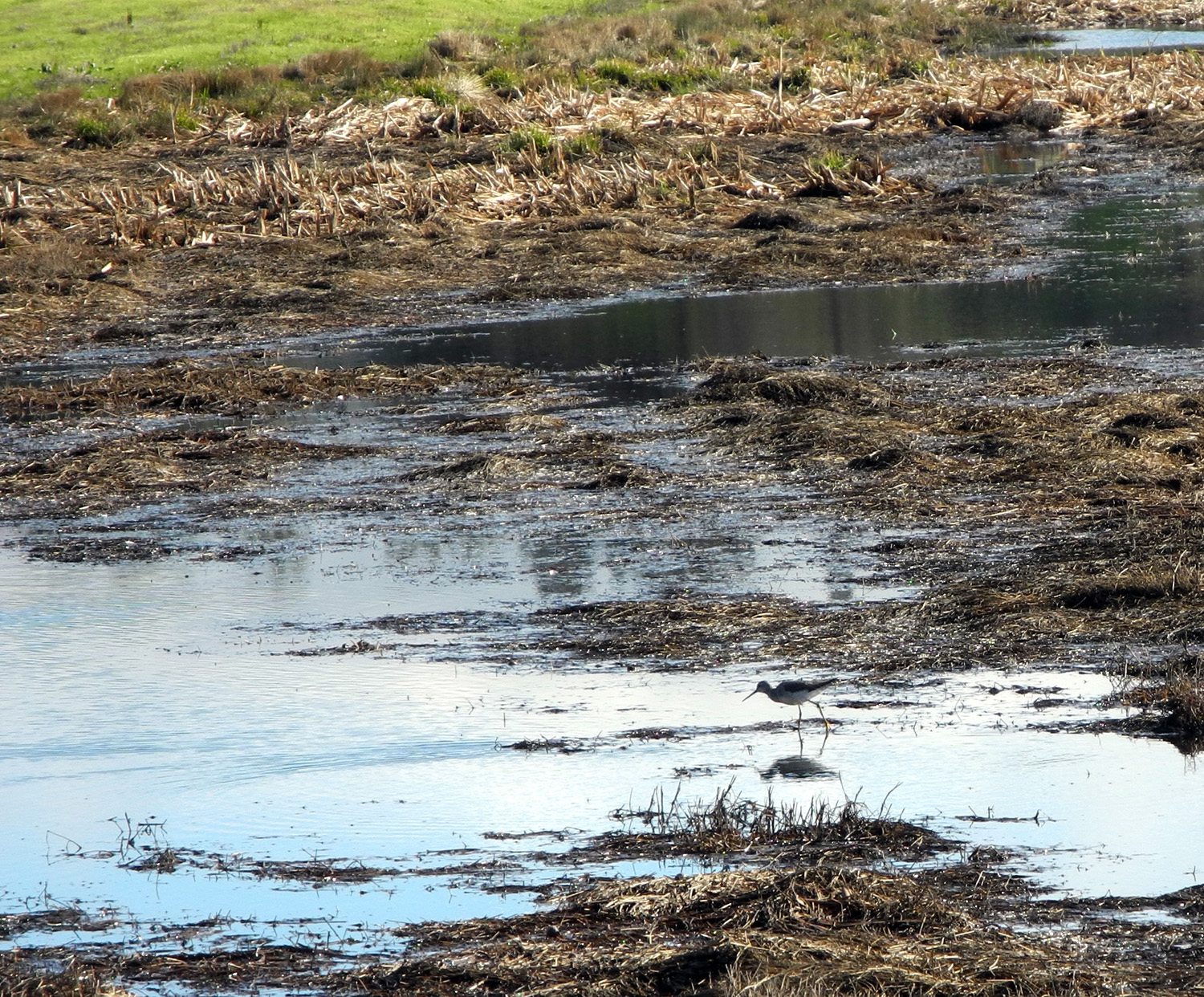 |
| Volunteers were gathering trash | The San Joaquin River | Sandpiper searches for lunch in a marshy spot |
 |
 |
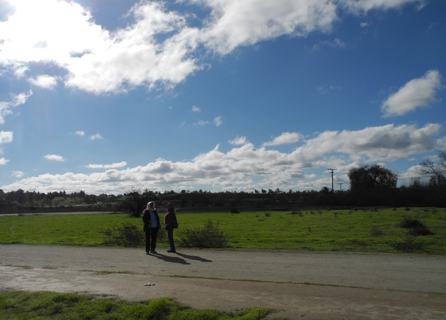 |
| Wes sets up for the group shot | The Ramblers | Julie and Carolyn on the trail |
 |
 |
 |
| More clouds | More walkers enjoying a cold, sunny hike | Egret waiting for lunch |
 |
 |
 |
| Golden trees | Valley Children's Hospital, on the bluffs above the river |
Rambling |
| Related Links | ||
| Shaver Lake | Dinkey Creek | McKinley Grove |
| Dusy-Ershim Trail | LeConte Divide | Sierra National Forest |
| Courtright Reservoir | Taft Point | Bissett Station |
| Old Inspiration Point | Pinemat Manzanita | |
| Red Fir | Yosemite National Park | Sentinel Dome |
| Washburn Family | History of Wawona | Wawona Hotel |
| Chilnualna Trail | Undiscovered Yosemite | Shirley Sargent |
| Nelder Grove Trails | El Cid Mexican Restaurant | Nelder Grove Photos |
| Jensen River Ranch Trail | Friant Dam | San Joaquin River Gorge |
| San Joaquin River Parkway - Trails, Parks etc. | ||
