|
|
The Journey of 2014 |
| |
|
Photos
Related Links
More
Travel Reports |
| |
Prologue
June Lake
Baker & Great Basin
Utah & Dinosaur National Monument Colorado
& Dinosaur National Monument Colorado
& Rocky Mountain National Park Missouri
& Indiana Ohio
& Michigan Missouri
Again Heading
Home Observations |
| |
|
NOTICE:
Due to the large size of this report, photos are on a separate
page
|
| |
Prologue
June 14,
2014: If I had known how much work it was to travel by car, I might have
stayed with the motor home. It's not the driving that is difficult;
that hasn't started yet. It's the planning - deciding where I will
go, how long I will stay, then finding and booking motels.
Of course, I
had to find a place to stay with my trailer or motor home, but if I
could not find an RV park, I could have stayed in a rest stop,
parking lot, or wide place beside a rural road. In practice, I made
reservations less than half the time, and usually was told
"come on down, we've lots of room." Only once in all my
travels did I arrive at an RV park with no reservation and find it
full. And there was another one a half mile down the road with
plenty of room.
So I am
studying paper and on-line maps, calculating mileages, looking at
national park web sites to see what there is to do, and trying to
locate nearby towns in a couple of very remote areas. I've already
made one reservation change, and decided to hold off on some others
until the trip begins.
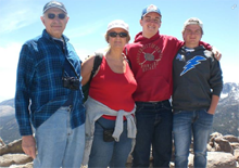
The first
stop is the easiest. I will be camping with my daughter Teri,
grandson Mikie, and his friend Max, at June
Lake on the eastern side
of the Sierra, and Teri took care of all the planning and booking. I
just have to show up.
After that
it gets more complicated. My first stop will be Great
Basin National Park, a day's drive from June Lake, and one of the more remote parks
in the whole system, on the eastern border of Nevada next to Utah.
The fact that this area is considered to have some of the darkest
skies in the country will give you an idea how far it is from any
town of significant size.
The second
stop is Dinosaur
National Monument, another remote and far-flung
area, with two distinctly separate sections, one in Utah and one in
Colorado. The nearest motels seem to be anywhere from 15 to 50 miles
from the various points of interest in the monument. So far I have
booked motels for everything up to and including the western part of
the monument, and have a couple of possible places in mind for the
eastern.
June 15:
It's not just route planning and motel booking. There's also
deciding what to take. I'm so used to having all the comforts of
home, I'm tempted to try and fit them into my Honda Accord. To help offset
the added cost of restaurant meals, I don't see why I can't at least
have stuff to make breakfast and sandwiches. This of course means
ice chests, which can take up a lot of room, as well as a few dishes
and some silverware. Right now I have not
yet started figuring out how to load the car, but I hope to fit in a
full-size ice chest, a smaller one, a large plastic tote box, an extra large suitcase, and
several smaller carrying cases, brief cases, etc. Not to mention a
laptop, cell phone, iPad and all the charging equipment required.
In deciding
to take the car, I did a rough cost analysis. With the car there
would be more restaurant meals, and motel rates would be two to
three times that of an RV park. But the big factor is gas. The motor
home gets less than 10 MPG, while the Honda can hit 30. In my
calculations, I forgot to
include the fact that with the motor home, I would need to rent a
car in several places. It still came out several hundred dollars
cheaper to take the car. There's also the fact that near Great
Basin, there is no car rental agency closer than 60 miles, and it's
probably just as bad at Dinosaur.
June 16:
Another disconcerting aspect of the pre-planning process is reading
motel reviews on line. My first few stops are in fairly remote
areas. This means small towns, with few motels, which means high
prices for facilities that are less than ideal.
For the most
part, negative reviews have been offset by positive ones, and I've
made reservations with my fingers crossed, hoping that any serious
problems have been corrected. I also take comfort in my pre-internet
travel experiences. In 1978 I drove across the country and back,
making reservations by phone without any reviews to comfort or
concern me. We had no serious problems, although the motel with the
worst service was the most expensive. Interestingly, it was in a
major tourist destination, Niagara Falls. The problems were offset
by the fact that we could go outside the hotel and walk across the
street to the falls.
--Dick
Estel, June 2014
|
| |
|
June Lake:
June 17: I had
heard of June
Lake and the June Lake Loop,
but had only a vague idea what and where they were. After Teri
invited me to join them for camping there, I checked Google
Maps, and expanded my knowledge.
I knew June Lake was
located on the eastern side of the Sierra Nevada, not far from Lee
Vining. What I did not know is that it is an actual town, with a Zip
code and stores, restaurants and rental cabins. The Loop is
California State Highway 158, which leaves US 395 south of Lee
Vining, winds into the mountains, and returns to 395 about eight
miles farther south.
June 22: We are at our
lodge and settled in, after a busy weekend for all of us. Mikie and
Max were at a hockey camp in Oxnard all week, and just returned home
Saturday afternoon. Teri had a meeting in Mariposa Saturday evening,
so she spent the night there and came up this morning. I attended
the Mariposa High Alumni picnic Saturday, then returned home and
loaded the car last night.
After last-minute
preparations, I drove across Fresno to pick up the boys, and headed
up State 99, with Mikie driving. We left 99 a few miles north of
Madera, taking several back roads into LeGrand, then across to State
140, and on to Mariposa where we made a quick pit stop. I took over
the driving at El Portal near the entrance to Yosemite Park, and not
far past that we took Highway 120 which goes north, then east over
the Sierra, with the high point at 9,943 foot Tioga Pass. On the way
we stopped at Olmstead Point, as I always do on this route. Here
there is a great view of Half Dome from a very different angle than
the classic one seen from Yosemite Valley. You also see 9,900 foot
Cloud's Rest, and nearby Tenaya
Lake.
At Tioga Pass we
left Yosemite and continued down to US 395, then to the southern end
of June Loop. It was about three miles from this junction to Reverse
Creek Lodge, where we found Teri waiting for us.
Our "room" is a large
A-frame, with a good size bedroom with two double beds at one end, a
separate bedroom with two twin beds and two bathrooms in the middle,
and a large room at other end with a small kitchen, dining table
that would be comfortable for six adults, a couch, and another
double bed. There are TVs
in the two end rooms, a deck outside, and trees and rocky mountains
to look at outside all the windows.
Teri fixed a good dinner around 5, then she and the boys drove to the creek to
investigate the fishing. I took a short nap (having missed my nap
yesterday and today), then began an exercise in frustration that is
not only not resolved, but looking like resolution may be
impossible.
First some background -
my Outlook program on my home computer is flaky in several ways, but
I hate the newer versions and refuse to upgrade. I have to re-enter
my password every time I restart the program, a minor annoyance that
I am used to. The version of Outlook on my laptop is newer and
doesn't have the menu items I normally use for the password entry, and I
can't find out how to do it. Maybe it does not need to be done on
this computer, but it does not look like I will find out, since I
can't access the internet anyway (Teri can, and I can with my iPad
and smart phone). We have Wi-Fi, and the network information window
shows a connection, but none of my browsers will actually access the
Internet. This means that you may get this massive report all at
once some time in August. Or maybe it will work tomorrow or when I
get to Nevada. Right now I'm going to do something else.
June 23: By using
my iPad as a wireless hot spot, I was able to connect to the
internet, which is ridiculous, since the iPad was connected through
the lodge's Wi-Fi. Still no Outlook email, however; I suspect I will
have to call for tech support, which I won't do until I feel like
spending an hour on the phone.
Today is Teri's 50th
birthday, and she is calling this vacation her Fabulous Fifty. At
the top of her "to do" list for this area is the gondola ride to the top of
Mammoth
Mountain,
so that's where we went today. Mikie and I had gone up it in
2007, but he appreciated it a lot more at age 16, and it was
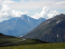
everything Teri had hoped for and more. At various times on the ride
up, there is a view of the Minarets
and other high Sierra features. From the top the view is even better
- Mt. Ritter,
Banner Peak
and Mt.
Lyle, and directly to the south, the Minarets, topped by the
highest of these jagged peaks, Clyde Minaret, named for the noted
climber Norman Clyde who was the first to climb it, a solo ascent in
1928.
We took the very short
walk to the
top, 11,060 feet, with a 360 degree view of the Owens
Valley and Mono Lake to the east, and many high peaks south, west
and north. Following the advice of a ranger, we took the short walk,
maybe 1/4 mile, to Seven Lakes
Lookout. From here we looked down on
five small lakes surrounded by evergreens, plus Crowley
Lake and another lake out in the valley.
As expected it was colder
at the top of the mountain, but the comfort level was very
inconsistent. In some spots we were hit by strong, cold winds, and
could have used a hood; then we'd get out of the wind and think
about taking off a layer.
We purchased a package
that included the gondola ride plus lunch, and had excellent
sandwiches at the snack bar on top. For our sides, Teri and I chose
potato salad, which was also great, while the boys had chips. It
turned out that we were ready for lunch at the same time as everyone
else, and we ended up sitting on the steps outside to eat, not very
comfortable, but offset by the amazing view of the Ritter
Range.
Once we got back down, we
discussed other possibilities for the day's activities, but everyone
was ready for a rest, so we returned to the cabin. Teri drove to a
nearby lake to do her resting, while I took a nap then read, and the
boys watched TV and their cell phone screens and played cards.
Later Teri drove the boys
to a nearby lake where they fished with no significant results.
June 24: Today
Teri and I planned to go to Obsidian
Dome and the Panum
Crater. We first dropped Mikie and Max off at Gull Lake since
fishing held a lot more interest for them than geological wonders.
You can drive right to the base of the dome, but the crater requires
some hiking, so we decided to do that first in order to take
advantage of cooler morning temperatures.
Panum is part of the Mono–Inyo Craters, a chain of volcanic craters, domes and lava flows
that stretches 25 miles from the northwest shore of Mono Lake to the south of Mammoth Mountain.
Teri had been there before, but it was my first visit. The crater
was created about 700 years ago when hot magma rising up through the
earth came into contact with underground water. This created an
instant steam explosion that blasted rock and dirt into the air,
with volcanic activity continuing for some time. The result is a
small, rugged cone, known as a rhyolitic
plug-dome volcano, with large and small
chunks of obsidian
and pumice. At the
top there are twisted boulders of the two types of rock, which are
chemically identical, but as different as night and day in weight.
Teri easily lifted a 16-inch diameter pumice boulder over her head,
while it would have been impossible for us to lift a chunk of
obsidian the same size.
The trail leads up from
the parking lot, reached by a one-mile dirt road off State Highway
120, east of US 395. A straight, moderately steep section leads up
to a fork. To the right is the Rim Trail, which seemed to offer less
interest. We took the Plug Trail, which leads down into the
crater, and zig zags up to the twisted rock plug, where you can
wander around on side trails as much or as little as desired. There
are a number of distorted trees, whose trunks look like those of a
Sierra juniper, but they are mountain
mahogany, a broad-leaf plant. Bushes with
ancient-looking trunks were only a few feet high.
All around there are
broken and twisted chunks of
rock, testifying to the violent
explosion that created this phenomenon. When
I went to Obsidian Dome several years ago, I was expecting a smooth,
shiny black surface, but weathering has left it somewhat gray. On
the crater, there were many areas of shiny black obsidian, ranging
from finger size to as big as a washing machine. All in all, it was
a very impressive hike, especially since I have had an interest in
geology since my high school days.
We decided we were ready
for more relaxing activities, so we passed on Obsidian Dome for now,
and took the longer section of the June Lake Loop, the northern
junction, which is about 14 miles back to our cabin.
Meanwhile at the lake,
Mikie and Max caught eleven trout between them, bringing home three.
These were cooked for dinner, along with barbecued ribs, and were
excellent (and this is from someone who rarely eats and does not
like most fish).
June 25: Today's
first adventure was fairly low key, and mildly disappointing in one
aspect. We went to Hot
Creek, a thermal area about 30 miles south of June Lake. In
times past people could swim in the creek, which is warmed by hot
water bubbling up under the creek after being heated by magma three
miles below the surface. Due to weather conditions in the last few
years, the creek is dangerously hot, and you can't get close enough
to test it.
Fishing is allowed in the
area above the hot spots, but the water there is normal creek
temperature. Still, there are thermal pools beside the creek
with steam rising, and some incredible rock formations. Internet
articles about this area imply that swimming is permitted, but it
did not appear that there is any access to the heated part of the
stream.
Returning to June Lake,
we dropped the boys off at Gull Lake for fishing. Teri headed for
the beach again, while I tackled my email problem, with limited
success. I was able to send the second chapter of this report, but
only after a lot of tedious work copying and pasting email addresses
from one program to another. (The things I do for you people!)
Today's fishing results
were not as good - the boys caught the same number of fish as I did
without leaving the cabin. It has been very windy the last two days,
especially on the lakes, so the fish decided to stay where they
were.
As part of the continuing
celebration of Teri's birthday, we went
into Lee Vining and had dinner at Bodie Mike's
Barbecue. Even
choosing some of the smaller dishes, Teri and I had more than we
could finish. Of course the two teenagers made short work of their
hamburgers, which came with a large serving of fries and a side
salad.
June 26: Our
plans for today were to take it easy, and maybe go some place close.
A sudden change in the weather made that schedule seem perfect. Last
night when I checked the weather, the chance of precipitation was
0%. However, just before I went to bed I went outside and saw a huge
black cloud to the northeast. During the night there were heavy
winds, and one time when I got up it was raining.
By the time I was up for
the day it had stopped, so I decided to try my morning walk. On the
way I could feel the wind at my back, and I knew it would be in my
face on the return trip. I turned around and felt mist on my face,
and saw heavy mist above the mountains nearby, in the direction from
which the wind was blowing. I decided it was time to return to the
cabin. I got back safe and dry, and so far there has been no further
rain.
After breakfast, Teri and
I went to Obsidian
Dome, while Mikie and Max decided to just hang
out at the cabin for the day. When I went to that location with
Mikie in 2007, we didn't walk around much, and I didn't really
appreciate it. This time Teri and I walked quite a ways along the
mountain, and I realized there were many more areas of shiny black
obsidian than I had thought.
This is not a dome like
the granite features that stand out in Yosemite, but more of a huge
jumbled pile of volcanic rock. Walking along the north face of it,
there are sections with smaller chunks of broken rock, much of it
pumice, with dark streaks of obsidian all along the way, where the
rock chunks tend to be larger..
We turned back and walked the other direction,
where the mountain curves around to the south, an area Teri had not seen on her
previous visits. We saw a place where some cars were parked, and
noticed what seemed to be a path up the mountain.
We returned to the car
and drove in that direction, and discovered that there is an old
road, now just a wide
path, leading up the hill. It was not very
steep, and took us to a place where we could walk on what seemed to
be cleared paths between piles of twisted rock - obsidian, pumice,
and other materials. It was a completely different view of Obsidian
Dome, and we were delighted to have found it. With further
research, I discovered, as I had suspected, that these cleared
areas were the result of mining activity.
One of the more
interesting sights on top was what appeared to be an ancient steam
vent. It was a more or less circular area with rocks in it. Another
hiker there shined a flashlight down between the rocks and could not
see bottom.
Most of the time we had a
very strong wind, but we had prepared for it with an extra layer,
and considering how much walking we did, we would probably have
found warm weather to be less pleasant.
It was after two p.m. by
the time we got back to the car, so we returned to the cabin and
had a little snack, not wanting to spoil our appetite for the
promised dinner of carne asada.
June 27: This was
my last day at June Lake, and it seemed that the time went very
fast. We took a trip to one of my favorite places in the Sierra
Nevada, Devil's Postpile
National Monument. I had been there three times, most recently
with Mikie in 2007, and Teri had ridden there with her husband and
friends on motorcycles, so Max was the only first-timer.
With limited exceptions,
private vehicles are not allowed into the area, so we got tickets
for the shuttle bus that leaves from the Mammoth Mountain ski area,
and got in line. The first shuttle filled up before we got to the
door, but they run every 20 minutes, so after a short wait we were
on our way. The road is narrow, steep and winding, and offers some
excellent views of the Minarets, so we were happy to let someone
else do the driving.
The bus stops at a number of
places in the area, which is known as Red's Valley and is graced by
the middle fork of the San Joaquin River. The stop for the Postpile
is at a small ranger station, from which we walked the half mile,
which is mostly level or very gently sloping. This easy
accessibility brings many visitors, young and old.
The Postpile itself was
formed by a flow of lava that came down the valley about 100,000
years ago, and was stopped by a moraine, a natural earth dam that
marked the termination of a glacier. The lava formed cracks as it
cooled, and when each crack was about ten inches long, it branched off at a 120 degree angle, forming hexagons. The face of the formation consists of vertical columns about 100 feet high. There is a large talus slope of broken posts between the trail and the bottom of the cliff.
Not all the columns are hexagonal, but the majority are.
After looking at the
dramatic face of the pile, and taking the requisite photos, we
followed the loop trail that goes up on top, where you can walk across the rock and see the
hexagonal
divisions.
There are also some nice views of the river and the meadow on the
opposite side of it.
Many people walk an
additional two miles to Rainbow
Falls, which Teri and I had both done on earlier visits. We did
not have that much ambition this time, and I suspect that because of
the low water level in the river, the falls is not at its
best.
We walked back to the bus
stop and caught the next shuttle. It was going on to the other stops
in the valley before heading back to Mammoth, but we were happy to
ride along, and we learned some new things from the driver's spiel,
mostly about Red
Sotcher. He was a farmer and merchant who was the big cheese in
the area in the 1880s, and gave his name to Sotcher Lake as well as
the valley and Red's Meadow.
Here he grew potatoes which he sold to miners and loggers for a
dollar each, the nearest alternative being a distance of several
days travel.
Eventually our shuttle
started back to Mammoth, where we enjoyed another walk of several
hundred yards to the car, at which time the boys were expressing an
interest in food. Once we got back to the cabin we had an early
dinner of barbecued chicken, baked potatoes, and potato salad. Here
I'd like to salute my daughter for her cooking abilities. She likes
to cook, but due to her
busy schedule at home, she usually sticks to very simple cooking.
For this trip she brought along all the spices and ingredients to put on several feasts. My cooking is
mostly limited to
punching in the numbers on the microwave, so it was a welcome
change.
This was the day of the
National Hockey League draft, of great interest to all of us, and we
were able to get the channel that was showing it, so no further
outings were planned. I made a quick trip to the general store for
ice and a few groceries, and got back just as the show was starting.
The rest of the day was spent relaxing, although I also got as much
ready as possible for my departure the next morning.
|
| |
|
Baker, Nevada and
Great Basin National Park
June 28: Baker,
NV is a tiny town
located in the remote high desert of Nevada, not to be confused with
Baker, CA, a tiny town located in the remote low desert of
California. I drove here today from June Lake, a distance of about
365 miles, leaving about 8:45 and arriving at 4:30.
I drove down the June
Lake Loop to US 395, then a short distance to State 120, where I
turned east. There was a lot of
variety in the scenery, starting with the volcanic features south of
Mono Lake. This route goes through areas
of pine forest, over mountains, and through some nearly treeless
areas. At one point the side of the road is decorated with small
lavender colored lupines, as well as some unidentified yellow
flowers. In another area, a seemingly bare spot on a hillside was
painted purple by the lupines. Another nearly barren spot had
log barriers along the highway and signs warning against off-road
use, since the fragile terrain looks like the perfect place to tear
up with a dune buggy (it isn't).
Past this was a section
with a sign warning "dips next five miles." Some of the
dips were mild, but some were the kind that get you in the pit of
the stomach, and a couple were the kind that make you say
"wooooo!." Sometimes I felt like I was on a roller
coaster!
Since it was open range,
I thought about the time I hit a cow in
Utah, but I didn't see a
one, on or off the road. This section had very little traffic - I
saw only eight other vehicles between Mono Lake and the town of Benton,
where Highway 120 comes to an end. Before you get to Benton, there
is Benton Hot
Springs, but neither place is much of a place. The Springs had
what seemed to be an RV park with some dilapidated units that were
probably long-term residences, while Benton claims a population of
264.
At this point your
choices are US 6 to the right or US 6 to the left. This highway goes south and west to Bishop on US 395, or
north and east to Cape Cod, MA if you choose to go that far. I rode it all the way across Nevada until
the last five miles of my trip, although the final 50 miles
were contiguous with US 50. The latter is known as "the
loneliest road in America," but US 6 could give it some
competition. From Benton it was only about ten miles to Nevada.
Through Nevada the roads went through
typical basin country, up over mountain
ranges, and down
across flat sections, most covered with sage brush, but one or two
of them white alkali plains. In many places the highway is straight as
far as you can see, and that's pretty far in the wider basins. At
the higher passes, there are juniper and piñon trees, but most of
the vegetation is sage and other low growing plants. In these areas
I was usually going through a section of Humboldt-Toiyabe National
For
The most interesting
terrain was a long stretch where the highway went into some
mountains, winding up through a little valley that had some
irrigated land and quite a few small ranches. Then it went through a
canyon with rock cliffs on both sides and into a forest of piñon and juniper. Most of the sections over mountains were much shorter.
This was Murray Summit, above 7,300 feet, the highest point on the
drive.
Earlier in the day I stopped for gas at
Tonopah, a small town 120 miles from my starting point. Coming down
from Murray Summit, I made a
second stop for groceries at Eli, a larger town at the junction of
US 6 and US 50. I also filled up the gas tank here, in the belief
that gas would be more expensive in out of the way Baker.
From Eli US 50/6 goes
south, then east, then north a short way to Sacramento Pass,
just north of the national park. At the bottom of the pass I turned
right for the five mile drive into Baker on Nevada 487, and soon got
settled into my motel room for the night.
June 29: After
fixing breakfast in my room, I set off on my first ever visit to
Great Basin National Park. I stopped at the main visitor center
which is here in town, then started the uphill drive into the park.
Baker is at 5,300 feet, but it did not take long to reach the 7,500
foot level, just below upper Lehman Creek Campground. I had allowed
three days here, with several items on my to do list. Three nights a
week there is an astronomy talk at the Lehman
Caves Visitor Center, with telescope viewing to take advantage
of the dark skies in this remote area. I also want to take a tour of
the caves, which requires advance ticket purchase. The other thing
that interested me is the Wheeler Peak Scenic Drive, which is twelve
miles on the only major road that goes into the park. That was my goal for
today, and after reviewing a
description of the drive on the park
web site, I was ready for the steep winding se
way, and I stopped at all of
them, plus a few unofficial places where there was room to get off
the road. The major point of interest is 13,000 foot Wheeler
Peak,
the highest point in the central Great Basin. There were good views
of it from several places, including a look at the tiny permanent
snow field on
the side.
There are several trails
near the top, and the one that interested me most leads into one of
the few existing stands of bristlecone pines. Unfortunately it is a
three mile round trip, starting at 10,000 feet, so I passed on it
for today. I'm still considering it for Tuesday.
At one of the viewpoints,
and again at the end of the road, I had a nice conversation with a
couple from Kansas who have been traveling throughout the west for
over three weeks. Like me they are driving a Honda that is over ten
years old, but theirs has 250,000 miles to the 102,000 on mine. It
gave me hope that I will not have to buy a new car for a long time.
I walked around a little,
sat in the amphitheater and read a while, then started back down. On
the way I checked out the upper Lehman Creek Campground, where there
is a ranger talk that I plan to attend tomorrow night. Then I went
to the Lehman Cave Visitor Center and got my ticket for tomorrow. I
also walked a short nature trail that loops around the hill above
the visitor center, learning the names of some of the trees I'd been
photographing earlier.
Although it was early in
the afternoon, I was ready to get back to the motel and just take it
easy the rest of the day. I read, fixed a salami sandwich for
supper, and watched a few minutes of TV. I went out at about 8:35 to
look around and there was a buck deer slowly walking through the
field right behind the motel.
June 30: Unlike
most days, today I had a schedule to follow, but of course, not a
demanding one. I needed to be at Lehman Caves visitor center in time
for the 10:30 tour, so there was no need to get up early. Naturally
I woke up before six and could not get back to sleep. I got up,
checked my email, went for a walk and mailed an anniversary card for
my younger daughter, Jennifer, and son-in-law Rod, and had
breakfast. By this time I had nearly an hour before it was time to
leave, so I did some reading.
The
cave tour was all I had hoped for. I had visited Oregon Caves, in
the southwest part of that state, two or three times twenty years
ago or more, but that was the only cave I had visited. It was nice,
but nothing special, and a very quick tour. The cave here is much
more extensive, and the features are what you expect to see, all
kinds of formations including stalactites, stalagmites, shields,
drapery and so on. The tour took about an hour, and we were able to
take photos. The most common feature seemed to be stalactites, with
hundreds of them, many quite short and less than an inch in
diameter, but also many large ones and quite a few columns, where
the two formations have grown together.
Ithor was
still early when the tour ended, so I sat on a shady bench and read
for a while before heading down to a lower, warmer elevation.
Actually the weather today has been very nice at all locations, with
a very good breeze this morning while I was walking.
Along
Nevada highway 488, which runs from Baker to the park border, I had
noticed a "ranch exhibit," so I stopped there. It consists
of several panels with information on ranching from early days up to
today, with an emphasis on how people must learn how to adapt to the
area's harsh conditions to make a go of any enterprise. Nearby, just
over a barbed wire fence, was an old rusted out truck, being
"driven" by a horse skeleton. The best feature of the exhibit
was a row of metal silhouettes relating to ranching - cowboys,
cattle, a barn, windmill, wagon and other items. From
here I headed for the Baker
Archeological Site, which I had noticed on the way in, a mile
off the main road. This area was excavated by archeologists from
Brigham Young University in the early 1990s, and was found to be a
village of the Fremont
culture. After artifacts were collected and catalogued, the dig
was filled in and there is little to see now, but there is a short,
self-guided trail that explains what we know or think we know about
these people, who abandoned the site about 700 years ago, probably
in response to drought. Once
back at the motel I tried napping, to no avail (if I start typing
gibbrish you'll knowo i felw asleop at the keeborfd). Since I was
tired of fixing my own meals, I went to town (a one-minute trip).
There are two restaurants, but one was closed for mid-day, so it was
an easy choice to go to T & D's, where I had an excellent roast
beef sandwich. While there I talked with some bicycle riders who
have been traveling since early May, starting in Virginia and headed
for San Francisco. I don't envy their ride over the many ranges
across Nevada. Tonight
and tomorrow night I'm going back up to the park for the evening
programs - "competition" tonight and astronomy tomorrow.
This will require me to do one of my least favorite things, drive on
mountain roads after dark. Since I've been doing it all my life, I
suppose I can manage a few more times. 9:30
p.m.: The ranger talk at upper Lehman Creek Campground was
interesting, although not a topic I would have chosen. The focus was
on competition between species, specifically various kinds of trout.
The only species native to the area is the Bonneville
Cutthroat, which once swam in large numbers in ancient Lake
Bonneville. This body of water occupied much of the great basin,
and was as big as Lake Michigan and a thousand feet deep. About
14,500 years ago it began to drain away, and the trout eventually
occupied various streams and rivers in the area. The Great Salt Lake
is a small remnant of the original body of water. Unable
to let well enough alone, humans over the years introduced rainbow,
brown, brook and one or two other species. The competition for space
and food was not favorable to the Bonneville, so humans once again stepped
in, removing the other species and reintroducing the cutthroat.
Currently they are found in two or three streams in fairly remote
parts of the park, while the newcomers remain in other locations. July
1: After much thought, I decided to try the trail to the bristlecone
pines. It starts just below 10,000 feet, but gains only 600 feet
in elevation, although that's some pretty thin air. Some sources said the
trail is 1.5 miles each way, but rangers I asked and a sign at the
trailhead say 1.4. I decided that I could always turn back if it was
too much, so I got to the trailhead about 10:30 and started out. It
took me a couple hundred yards of hiking to get acclimated, then it
seemed a little easier. I took short, slow steps, stopped often, and
drank lots of water. When I got to a fork that marked the half-way
point, I knew I was going to be able to go all the way, and it
seemed easier after that. The
first two-thirds of the trail goes through a thick forest of Engleman
Spruce and Limber
Pine, and is mostly shady. Then it goes through a rocky, open
area, with some sunny uphill sections, although there are always
trees close by. I
arrived at the first identifiable bristlecone, a dramatic but dead
giant, about the same time as an older couple and a young man. We
took each other's pictures, and they were still photographing when I
went on. Apparently they turned back at that point, although it was
barely 100 yards to the main grove. These
are amazing
trees, not huge but very old. They are known to live up to 5,000
years, and after death can remain standing for another 2,000 years.
There is lots to tell and learn about these trees, but those who are
interested can find plenty of information on
line. I'll just add that the main thing I learned is that they
occur in many more areas than I realized. I've seen bristlecones and
Foxtail
Pines in California, and they are also found in Oregon, Nevada,
Utah, Colorado, Arizona and New Mexico. There are three species,
Great Basin bristlecones, Rocky Mountain bristlecones, and foxtail
pines. Some sources say they are all considered to be foxtail
pines, and all are part of the white pine family, which has over 100
species. The foxtail articles from the Internet all seem to treat it
as separate from the others. I
chatted with a ranger at the grove, sat on a rock and ate an orange,
then started down. Although I don't go much faster walking down, I
can take longer steps. As I had expected the entire trip took three
hours, one and a half up, a half hour there, and an hour down. 8:15
p.m.: Tonight I was going back to the park for the final time to
attend an astronomy talk. However, storm clouds that were predicted
for this afternoon have arrived, putting an end to that plan. Since
I had a pretty good hike today, I'm not really broken hearted about
just relaxing the rest of the evening. When
I drove to the top of the road the first day, I stopped at a number
of places along the way, went to two visitor centers, and still got
back to the motel in the early afternoon. I began to think that two
days here would have been enough. However, each day has had plenty
of activity, without any feeling of being rushed to see everything
in a short time, something I have experienced at other places in the
past. Tomorrow
I will be heading northeast, and will be in Utah after a few
minutes. I will be staying in Springville, about 180 miles away. I'm
not doing or seeing anything there, I just wanted a shorter drive,
so I picked a place about half way between Baker and Dinosaur
National Monument. The next day's drive is only 160 miles.
Springville is close to Provo UT, and there are a number of towns
around there that are probably all suburbs of that city. It will
give me a chance to buy groceries and gas without paying resort
prices. Also a screw fell out of my prescription sun glasses
yesterday, and I plan to get them fixed there. About
Baker: This is a very remote small town in the Snake
Valley, 60 miles from Eli, the nearest "big" city.
There are two motels, one of which includes an RV park; two
restaurants, one of which is part of one of the motels; two grocery
stores, both of which are part of the restaurants; a post office, a
gas station, a church, and a bunch of cows. Actually the latter are
out in the fields east of town. There
are a number of old
buildings made from square logs, in town and in the
field nearby. Most seem to be part of old ranches and some are still
in use. There is one that has been spruced up a bit and looks like
it may be a residence. Although
a lot of the area around is sagebrush desert, there are a few
streams flowing down from the Snake
Mountain Range, which includes the national park. There is quite
a bit of green area in the open land east of town, and a small lake.
There are a number of ranches, with the headquarters identifiable by
clumps of trees. The underground water of this area has been
targeted by Las Vegas, and a heated battle is underway. I
have named Highway 488, the road into the park, "Whimsy
Way." On both sides there are a number of objects obviously
placed there by a rancher for the entertainment of passers-by: The
old truck and horse skeleton I mentioned yesterday, several metal
sculptures in the form of human
figures, a plastic pink flamingo,
two life jackets and a tire, a motorcycle, another skull, and some
things that defy description. The
area is plagued with moths and butterflies. The butterflies are
thick up at the end of the road into the park, at just under 10,000
feet, while the moths predominate down in the valley. I was keeping
my windows slightly open, and last night when I left for the ranger
talk, there were about a dozen moths inside. The ranger said they
are a cyclical event, like the 17-year cicada, and of course, the
profusion of moths and butterflies means there was a large invasion
of caterpillars earlier this year. My
motel leaves a lot to be desired, but choices are limited. The
towels and sheets seem to be clean and they aren't stingy with fresh
towels. It has a microwave, refrigerator and TV with DirecTV, so in
that respect it beats most motels I've stayed in. It appears that
they do not vacuum or sweep and they did not empty the waste basket
until the last day. At least there are fewer dead bugs on the floor
of my room than there were at the pit toilet in the park. There's no
free breakfast, but I brought a lot of stuff for fixing breakfast
and lunch, including a toaster, so that's not a problem. |
|
|
|
Utah
and Dinosaur National Monument
July
2: This morning I slowly got ready to go, enjoying my homemade
breakfast, packing carefully, and even just loafing a bit. I got
underway about 10:40, and returned to US 6/50 headed toward Utah. At
the border, just a few miles from Baker, is a
motel/casino/restaurant/gas station. The casino is on Nevada soil,
while the rest is in Utah. This
was the last commercial establishment I saw until I arrived at
Hinkley and Delta, two adjacent towns 88 miles from the border.
The
first part of the drive was much like my trip across Nevada, with
some very scenic
mountains and basins and very little traffic, but as I
approached
these towns I entered the Sevier River Valley. Like all Great Basin
streams, this one ends within the basin, never reaching the ocean.
The river, and the nearby Gunnison Bend Reservoir, make this a
significant agricultural area, and traffic out of Delta included
lots of trucks with ag-related cargo. I had stayed at the RV park
in Delta twice in the past, but didn't stop this time.
This is where US 6 separates from US 50, heading north to intersect I-15.
I drove about 15 miles on 6, then took Utah 132 at Lyndyll. This is a
slightly more direct route, connecting
with I-15 at Nephi. From here
it was about an hour to my destination, Springville, Utah. My first
stop was at the offices of Caywood & Winward, eye doctors, to get
my sunglasses fixed. I had called yesterday to make sure they could
do it, and I was in and out in less than five minutes, at no charge.
Five stars for this medical practice!
Since
it had been a long time since breakfast, I went to a nearby Wendy's
before heading to the hotel, which was up I-15 another mile.
I am
staying at the Best Western Mountain View, and it is aptly named. The
Wasatch Mountains are visible on three sides, including from my
window. The motel is very nice, and I only wish I could expect equal
accommodations at the remote areas I'm headed to after today.
July
3: Before getting under way today, I did some grocery shopping
and went to Big 5 Sporting Goods to buy hiking poles. I've been
considering this purchase since my Hite's Cove hike in
March, and
could have used them on the bristlecone trail in Big Basin. Since
there are many more trails ahead, I decided it was time.
I had
a very scenic drive from Springville to Vernal, Utah. The most
direct route is to head north for a short way, then take US 40 all
the way to Vernal. Naturally I went south, got back on eastbound US
6, and enjoyed every mile. Unlike the lonesome road of Nevada,
this section of the highway had a lot of traffic, but there were
passing lanes where needed, and I could go as fast as I wanted to
99% of the time. During the rare times when I had to go "too slow,"
I had an opportunity to get a better look at the scenery. Not
long after I started out, the road went up over 7,000 foot Soldier
Summit. On the east side of this the country was
"softer," more open, with grassy areas and fewer desert trees.
However, it eventually went down through a particularly striking
canyon, along Price Creek. In some places there are red sandstone
cliffs, but it is rough-textured, not smooth like that in southern
Utah, and contains foreign rocks. In this area there was and still
is a lot of coal mining, and there is a large electric generating
plant that burns many tons of coal per day to produce steam to
power the turbines. Just
past this area I left US 6 and took US 191, which goes northeast
toward US 40. There was more great scenery on this route, and a lot
less traffic for the first few miles. After going over a 9,000 foot
pass, the highway descends through a long, narrow valley with a
stream and a lot of cultivated
land. There are also many places
where oil pumps are operating. The
junction of 191 and 6 is at Duchesne, seat of Duchesne County, and about seven
miles from Fort Duchesne, which is in Uinta County. This is Ute
Indian territory, with a number of commercial enterprises operated
by the tribe. The first part of US 40 follows (what else) the Duchesne River,
but then the road jogs north out of the canyon, and down into a
lower valley. Beyond here it soon enters true Colorado Plateau
country, with long mesas and canyons, where the road goes down,
levels off, then drops down into another canyon. I
stopped in the town of Roosevelt and had a pizza, taking half of it
with me for later. From there it was about 30 miles to Vernal, which is in
the Uinta Basin. I got checked in and just
spent the rest of the day unpacking and reading. Tomorrow,
dinosaurs! July
4: This morning I drove east 15 miles on US 40 to Utah 149,
which leads into the Dinosaur National Monument, running along the Green
River the last few miles. The main attraction in the Utah
section of the monument is the Dinosaur Quarry, where fossils were
first discovered in 1909. The location proved to be an area where
floods had deposited hundreds of dead dinosaurs. After many fossils
had been removed, it was decided to leave the remainder, visible on
the cliff side, and build a viewing area beside it. Fossils were
collected from almost 400 different animals. There are 1500 bones
remaining, from 100 individuals. This display was very impressive,
and it was possible to get some pretty good photos of the
bones. In addition to the bones, there are
replicas of several of the creatures that lived there, informational displays, a
real apatosaurus
skull, and a long mural depicting what the area
might have looked like in those prehistoric days. Access
to the viewing area is via shuttle from the visitor center, a ride
of only three or four minutes. My
visit to the quarry was my final activity of the day; before that I
drove the 11-mile road to the Cub Creek area, known as the Tour of
the Tilted Rocks. This route goes through endless scenic areas, with
15 "official" stops listed in the guide book. Much of it
is near or along the Green
River, and most of it features sandstone
formations. At
least four of the stops are where people of the Fremont culture
created petroglyphs a thousand years ago. Usually it requires a
short walk from the road to the cliff face to get a good look. At
one point artifacts were found a number of years ago that date back
7,000 years. Along
the way the road goes through some private land, where the Chew
Ranch is
still being worked by the same family that homesteaded it in the
early 1900s. Past
this point the pavement narrows then ends, with a fairly good dirt
road the last mile or so. Some of the best petroglyphs are along this
section, but require a short but steep hike which I did not feel up
to. At the end of the road is one of the more interesting man-made
sites in the park, the cabin of Josie Bassett Morris, also referred
to as Josie Jensen. The stories told of her in the guide book and in a
handout I picked up at the Uinta
County Heritage Museum are certainly colorful, and probably
contain some exaggeration. With
five husbands, stories of association with Butch Cassidy, and other
allegations, it's not surprising that she chose to move to this
remote area at age 40, in 1913. She built a cabin, which was
replaced by the current building in 1924, and lived there till just
before her death at age 89 in 1963. She raised cattle, grew fruit
and vegetables, and according to the stories, sold moonshine during
prohibition to get cash for necessities. She was accused of
rustling, and almost certainly butchered a stray cow or two that
wandered on to her property, but was acquitted the only time serious
charges were brought. You
can wander through the four-room, dirt floor cabin, see the fruit
trees, and hike two short trails into box canyons where she
corralled her cows. I took the shorter of these trails, and had some
fantastic views of sandstone cliffs, juniper and piñon trees, as
well as reeds and cottonwoods in the wetter areas. If you're a cow
and have to be penned up, this is the place; you would have plenty
to eat and about ten acres to wander around in. Driving
back out, I turned off the main road to the Split Mountain area.
This is a place where the Green River flows through a deep narrow
canyon, giving the impression that the river cut through the hard
rock of the mountain, rather than taking an easier route through
softer material nearby. In fact, the river is much younger than the
mountain. There is a campground, picnic area, and boat ramp by the
river. Although
it was early afternoon, I was ready for a rest and something to eat,
so I returned to the motel, where I stayed the rest of the day,
except for a short walk down the street. July
5: There were a couple of hiking areas that I bypassed
yesterday, mostly because it was late in the day and a bit too warm
for anything ambitious. Today I
got up a little after six so I could do my hiking before it warmed
up. The trail that intrigued me most was the Sound
of Silence Trail, the second stop on the Cub Creek Road.
According to the guide book, this trail "will take you into an
arid landscape of towering stone
walls, dark red paths, and
solitude." All
of this is true, with some disclaimers. I certainly had solitude - I
did not see another person on the entire hike. The land is arid
right now, but the trail follows a dry wash most of the time, and
from the flattened-down vegetation and obvious water sculpted land
along the side, there was a lot of water runoff earlier this year,
either from rain or snowmelt. Along the upper part of the wash there
is enough moisture underground to sustain a number of large
cottonwood trees. And somehow animals are getting a drink - I saw at
least a dozen or more lizards of two or three species, and ten or
twelve rabbbits,
two cottontails and the rest pigmy
rabbits. These smaller rabbits had a
tendency to sit still while I watched and photographed them. I'm not
sure how that works as a survival technique. There were also many
deer tracks along the trail. The
trail is a three mile round-trip loop, connecting with another trail. I
didn't go all the way, and came back the way I went in, probably
hiking about a mile each way. The sign at the trailhead makes it
sound like they really don't want you to hike it. Warnings there and
on line include an admonition to carry a gallon of water per person
(the guide book says a half gallon); "sections of the trail can
be difficult to follow," "this is mountain lion and black
bear country," "the trail is easy at first, but gets more
difficult," and "there is no shade on this trail."
Despite all this, the dramatic
beauty of the area makes it well worth a visit. I
went through a couple of difficult areas, but they were very short,
and my new hiking poles came in very handy at these places. For the
most part, it was level or a very gentle rise up the wash.
Eventually the trail left the wash but stayed parallel to it. At the
place I turned back, it was going back down to the wash, and the
terrain ahead was rounded dirt hills rather than rock formations.
Since I got started at 8:30, there was shade on the western side of
the bank and the large rocks, and a couple of places where there was a
good sitting rock. At mid-day, these areas would be in the sun. After
I got back to the car, I continued on the dirt road nearly to the
end, to the next to last stop. This is the location of the best
collection of petroglyphs on the tour. I didn't see them yesterday
because it requires a short but very steep hike up through the talus
slope to the base of the cliff, about a third of a mile. Today I had
more energy and made the hike with no difficulty, taking short slow
steps on the steepest parts. The
masterpiece here is a large lizard etched into an area of desert
varnish, resulting in a striking light tan on black effect.
There are at least nine lizard figures in this area, and many others
including human figures, a flute player and some abstract designs.
In one place there is a family group that looks for all the world
like the family silhouettes you see on the back windows of cars. I
completed the day with a last stop at the visitor center, then got
gas and groceries when I got back to town, in preparation for my
departure tomorrow. I also stopped at the Uinta County Museum. They
are still unpacking after moving from a much smaller location into
what used to be the library. They have a nice collection of
artifacts from the county's early days, including cowboy and Indian
items. They have dozens of photos of the Ute tribe, dating from the
late 1800s forward. There's also a display devoted to the notorious
Josie Bassett. An
employee told me that in the old building they had no storage space,
and had to display everything in a disorganized, crowded way. Now
they are able to put together more meaningful displays. Later in
July they are doing a display in conjunction with the Smithsonian on
how and why people moved across the nation. 5:45
p.m.: There has been a fire north of here for the last two hours
or so, probably a brush fire. There were big clouds of
smoke, and
still are. For a while the sun was dark red and almost dark enough
to look at. My car is covered with white ashes. As of 7 p.m. a lot
of the smoke has cleared and the ash fall seems to have ended. About
Vernal: The town seems bigger than its population of just under
10,000 would indicate. I think that's because it is strung out along
US 40 for about five miles, so it's long but not wide. It's
the county seat of Uinta County, and is located in the Uinta
Basin 20 miles west of the Colorado border, and 30 miles south
of Wyoming. Considering its proximity to Dinosaur National Monument,
it's no surprise to see a number of businesses with a dinosaur
theme, fossil stores, plaster dinosaurs, etc. It's also the home of
a substantial museum, the Utah
Field House of Natural History State Park Museum (say that ten
times fast. Or even once). And a block or two west on the opposite
side of Main Street is the Uinta
County Heritage Museum. There is also a satellite branch of the Daughters
of Utah Pioneers museum, which has its main headquarters in
Salt Lake City. When
I drove out of town the morning of the 4th, the streets were lined
with chairs, in anticipation of an Independence Day parade, which I
of course missed. The main street is also lined with flags and
planters overflowing with petunias - very festive. The town is so
patriotic that they set off fireworks till almost midnight on the
Fourth, and fairly late on the third. |
|
|
|
Colorado
and Dinosaur National Monument
July
6: This day actually started with my final Utah adventure, a
visit to Utah Natural History Museum in Vernal. This is a wonderful
facility, with displays that will satisfy everyone from young kids
to those who want to learn everything there to know about the area.
The
focus is on the geology of the area and the fossil record. There is
a lab where they are working on various restoration projects,
including stabilizing and cleaning a pair of mammoth
tusks. You
can't enter the controlled environment, but large windows with signs
explain what is being done.
There
are literally hundreds of mineral samples,
including rock that goes
back to the earliest days of the earth, nearly four billion years
old. There are many fossils and bones of animals ancient and modern,
and paintings, dioramas and displays of what things may have been
like in pre-historic times. Outside there are a number of life-size
dinosaur models, as well as a wooly mammoth that looks like he might
just turn his head as if to say "are you lookin' at me?"
In the main entry there
is a cast of a complete apatosaurus
skeleton, the huge plant-eater
that we used call brontosaurus. There is also an excellent display
of Indian projectile
points, in such a variety of colors that I
could only think they were able to shape any kind of rock.
I spent about 90 minutes
there, and decided if my great grandson becomes a dinosaur nut like
his uncle Mike was, I would gladly bring him to this museum.
When I finished there, I
had a short drive of 20 miles to the Colorado border, and just
beyond that, the town of Dinosaur. I drove on through another mile
or so to the Canyon Visitor Center of Dinosaur National Monument, to
get information on what I can do the next three days. I had already
done a lot of research on line, and of course had literature I
picked up in the Utah section of the monument, but I did get some
information on things to see just outside the park that I was not
aware of, including a place where wild horses can be seen.
There was a 1/4 mile
nature trail starting at the visitor center, so I decided to walk
that. I think it would have been interesting if the trail guide
container had not been empty. As it was, all I could tell was that I
was walking through sage brush, and I've been doing that since June
22. I decided to just let it count as my exercise for the day.
I drove back to Dinosaur
and went to the Colorado welcome center, where I got a map and
information on an area to see near where I am staying, the Canyon
Pintado Historic District.
I had wanted to stay in
Dinosaur, but could not book its only motel on line, and they never
returned my call, so I was forced to choose a place in Rangely,
20 miles away. Looking at the motel in Dinosaur as I drove by, I
think I was lucky.
I got to Rangely about 2
p.m. and got checked in. I brought in all the stuff I need to make this
my home for the next four nights, did some laundry, and had lunch.
Or maybe it's supper like back on the farm; it's definitely my last
big meal of the day.
July 7:
Today's
adventure was a 110 mile round trip, 40 of those getting from
Rangely to the park entrance and back. The road I took into the park
is a little over 30 miles one way from US 40, with lots of good
places to stop along the way. I stopped at all of them.
The first stopping point
is the Plug Hat Butte picnic area and trail. The butte is a
flat-topped mountain, with light colored sandstone above, and red
rock around the base. The road passes to the east of the butte,
revealing a dramatic canyon to the north. A short, mostly paved
trail from the picnic area takes you out to the edge of this canyon,
with views to the Utah section of the park to the west. Across the
road, another trail leads out on the butte on that side, to where
the highway passes between Plug Hat and this butte. There are also
more views of the canyon to the north, and of the lower country
along US 40 to the south. This trail has interpretive signs along
the way.
Some of the view points
along the 30 mile drive are somewhat similar to each other, with the views to the west
generally less interesting. The vistas on the opposite side of the
road are mostly of the canyons that contain the Yampa and Green
Rivers, which come together at Echo
Park, one of the areas where the
Powel Expedition was able to rest and catch its breath between
dangerous and challenging runs down the rapids.
Most of these turnouts
have interpretative signs, but some of them, instead of telling what
you are looking at, focus on how bad people are, editorializing on
air pollution, noise, and development. Even if the points made are
valid, I'd rather read about how the land was formed and the names
of features I'm looking at.
The two best viewpoints
that are accessible by car are Canyon Overlook and Echo Park
Overlook. I believe the first one is probably the highest
point on the road. In addition to good looks at the river canyons,
you can picnic near Douglas fir and aspen trees. As I drove out the
road to the overlook, there was a pronghorn antelope resting in the
ditch right next to the road. When I got close, he got up and moved
into the field, then stood there and posed for a photo.
At the Echo Park
Overlook you can see a little bit of the river and Steamboat Rock,
which marks the river junction. You can also see the twisted canyons
through which the rivers and their tributaries run, an endless sweep
of canyons within canyons, carved rock cliffs, and flat plains
making up the different levels.
The road ends at Harpers
Corner, where the best views are seen by hiking the two-mile trail.
There is a trail guide available at the start, and 16 posts marking
either features you can see or explaining geological and historical
information. In the latter category, down in the canyon are some buildings from the
historic Chew Ranch, the same people who now ranch on the Green near
the western part of the monument. A narrow dirt road into this area
is visible, and in one place it runs through a canyon that appears
barely wide enough for a vehicle.
You also get good views
of the river, both in the Echo Park area, and on the west side of
the ridge, the Green River as it runs into an open area where it
meanders slowly before raging through the canyon of Split Mountain.
This trail mostly follows
a long ridge, and after I had hiked most of it, it started down
hill, meaning an uphill trek coming back. I was getting tired, my
water was warm and running low, and I was hungry, so I turned back
at this point. I was content that I had seen the best views, and got
an hour or more of exercise besides.
By the time I got back to
the car I was ready for a fast trip home, and not making ten stops
along the way did speed up the journey. I did stop at one place to
photograph an old cattle guard and corral, but I made good time
getting back to Rangely. I stopped at the market for a couple of
items, got gas, and came back to the motel and finished off the last
of the pizza from my stop at Roosevelt, UT.
July 8:
Today I did
the longest excursion from my home base that I have ever done, 232
miles round trip. That's farther than my next destination, but no, I
didn't leave for Rocky Mountain early, I went to Dinosaur Monument
again. In this case, it was the far northeast corner of the
monument, a remote and isolated place even in an area that is
relatively remote and isolated overall.
My
destination was the Gates
of Lodore, where the Green River enters a rugged canyon, after
wandering quietly for about 30 miles through an open valley. When
John Wesley Powell and his crew camped here in 1869, they recognized
that they were entering dangerous and exciting country. They named
the place for a poem by Robert Southey, "The Cataract of
Lodore," whose words proved to be prophetic.
"All at once and all
o'er, with a mighty uproar - And this way the water comes down from
Lodore," he wrote. Sure enough, just below the gate one of the
expedition's boats was wrecked in a rapids they named Disaster
Falls. They salvaged much of their equipment, and learned a lot
about navigating the unknown rapids of the Green and Colorado
Rivers.
Today rafters float down
the river with relative ease, and the really smart explorers, like
yours truly, hike the trail from a campground down to an overlook
where the canyon starts.
I had previously asked a
ranger, and myself as well, if the long drive was worth it, but I have
the time, I'm here, and it would be silly to pass it up. So I
started out at 8 a.m., taking a shortcut across via Rio Blanco
County Road 1 from just west of town to US 40 at Blue Mountain, more
a sign than a town. From here it was about sixty miles to my turnoff
at Colorado 318, and another 46 miles north and west to the dirt
road that leads into the area. I think THIS is the loneliest road in
America - I saw a half dozen vehicles in 50 miles, and there was
only one person at the campground where the road ends - the
campground host. However, rafters were expected.
A few miles in on 318
what should I find but my old friend, the Yampa River - well above
the canyons where I spotted it yesterday, and flowing leisurely
through a broad green valley, where it supported cattle and crops.
However, most of the drive was the usual high desert, with sage
brush and in the higher spots, piñon and juniper.
The trail starts at the
very end of the camp ground, and is only 3/4 mile each way, with a
few steps and switchbacks at the start, then a gentle up and down
walk. The river is visible nearly all the time, and the opening of
the canyon is seen from various angles. Where the trail ends you can
see down into the canyon a few hundred yards, with dramatic rock
walls towering above - surely a daunting if challenging sight for
Powell and his men. Unlike other canyon views where I was looking
down from high above, this time I was only about 100 feet higher
than the river.
Was it
worth the drive? I'd say yes, once. I would probably not make that
long drive again, although I'd visit other parts of the monument
again. Of course, if you could stay at the tiny town where 318
leaves US 40, your round trip would be "only" 100 miles.
July
9: Unlike yesterday's outing, today was probably the shortest of
the entire trip so far. I scheduled myself for three days in the
eastern part of Dinosaur National Monument, but this was a day more
than I needed. There are other roads into the park, but they are
dirt and mostly limited to high-clearance 4-wheel drive, which does
not apply to my Honda.
Fortunately
the woman at the Colorado Welcome Center in Dinosaur had steered me
to the Canyon
Pintado Historic District on Colorado highway 139 south of
Rangely. The chamber
of commerce booklet that I picked up that day lists sixteen
sites with historical interest along the highway, of which eight are
in the official historic district. The book gives the mileage post reference
for each site and a description of what to look for, and most of
them have signs.
The
one I spent the most time at was Four Mile
Draw, which has a loop
trail that is probably about a mile total. The book says there are
"a great number of panels," but I only saw one. An old
line shack, which could be mistaken for a pile of old boards and
logs, helped make the walk well worthwhile. The one panel I saw was
a pictograph, meaning it's painted on the rock, not chipped in as
are petroglyphs.
There are a number of informational signs along this trail, but
unfortunately they are faded to where they are unreadable -
essentially off white lettering on a white background. The same
problem has occurred with other signs along the road.
I
made three other stops, one of which required a 15 minute uphill
hike. This is the White Bird site, which has bird paintings, which I
had had not seen anywhere else. There are also other figures.
The
best one, featuring the ubiquitous Kokopelli,
as well as a lance and another figure, was visible from the road,
and could be seen fairly close with a 100 foot walk. There is a
problem here: The rock has cracked and is in danger of falling, so a
cable has been placed right across the middle of the figure, and
bolted to the rock (I used PhotoShop to remove the cable in my
photo).
The
third spot is said to have camel figures, but after making my way
through a trail of dry, flattened down grass, I came to a very steep
ascent which I chose not to try.
Of
course, throughout the area there are canyons, plateaus, and
striking rock cliffs, as well as the usual vegetation - sagebrush,
greasewood and saltbush in the lower elevations, and juniper and piñon
on the top of he cliffs above.
When I
returned to town I spent about a half hour at the Rangely Museum. It
has a number of old, rusty, mostly broken artifacts outside, but
there are nice displays inside the three buildings, all historic
structures that were moved to the location from elsewhere in town.
There
is a particularly fine collection of Indian projectile points, from
various areas of Colorado, identified as to type and location.
Another similar collection identifies the time period of the object,
going back to 2,000 B.C.
After
returning to the motel to rest and shower, I walked across the
street to a Mexican restaurant. I had considering patronizing the
Subway that is attached to the motel, but wanted a hot meal after a
week of sandwiches and re-heated pizza. The dinner I had was OK, but
made me long for the many wonderful Mexican restaurants we have at
home.
About Rangely:
This seems like a very out of the way place, and indeed, it is said
to have been one of the last places in the nation to be settled. Its claim to fame is oil production, and it is the location of a
major
field that was developed in the 1930s and produced 815 million
barrels of oil. "Settled" seems to mean the development of
the town, since there have been ranchers in the area at least since
the late 1800s, but it was the oil boom of the 30s and 40s that
brought a sudden population of 5,000. In the 2000 census it was a
little over 2,000.
Rangely
is located in Rio Blanco County on the White
River. I first thought
that it was the county seat, since I did not see any other town in
the county on the Colorado state map. However, I was misreading a
stream as a county line, and the honor actually belongs to Meeker,
about 60 miles from here. Like most of this area, it is high desert
country, with sage brush and similar vegetation.
South
of here is the Canyon Pintado Historic District, home to the largest
concentration of Fremont archaeological sites, with many petroglyphs
and pictographs.
There
is a fairly diverse bunch of businesses, a community college,
elementary and high school, Ace Hardware, Family Dollar Store, and a
number of motels, restaurants and gas station/mini-marts. The
economy is obviously still based strongly on oil, although there has
been ranching here since long before the oil boom.
|
|
|
|
Colorado
& Rocky Mountain National Park
July
10: With a relatively short drive of a little under 240
miles, I got a late start and drifted and wandered from Rangely to Granby, near
Rocky
Mountain National Park. I managed to take over
seven hours to make the drive, with lots of stops to take pictures,
and a lunch break at Steamboat Springs.
Instead
of returning to US 40 the way I had come in or the way I went on
route to the Gates of Lodore, I continued east on Colorado 64 for 60
miles to Meeker. Along the way I was following the White River, and
driving through a wide valley, often with sandstone walls, but with
small farms and agricultural crops, mostly
hay. This was another of
those lonesome roads.
At
Meeker I took Colorado 13 north, leaving the White River behind, and
going up over Nine Mile Gap Summit. This is still sagebrush and
juniper country, but more open and with fewer sandstone cliffs. There
were still some of these, but the country got greener as I went on.
When I came down from the summit I soon crossed a river, and guess
what - the Yampa once again.
When I
reached Craig at the junction of US 40, I turned east and was in the
Yampa Valley for many miles. Here it is a very wide valley, with
lots of farming, plus fishing access and a state park. My next stop
was in Steamboat
Springs, a well-known vacation spot for both summer
and winter. I stopped here at the Burger House and had a very good
hamburger with shoestring fries.
Just
past this place the road starts up into the
mountains, and into
national forest land. The slopes are heavily forested, with tall
evergreens instead of the endless piñon and juniper I have seen
since the first day. I also made several photo stops along here, one
of my favorites being a place with an old house off in the field,
and a wooden corral and cattle chute by the road.
From
Steamboat Springs on it was obvious I was heading into the storm. The
road went up and away from the Yampa, but soon came down to another
river, which proved to be the Colorado. I've seen the Colorado River
in California, Nevada, Arizona and Utah, but this was the first time
I had seen it in Colorado.
Just after the highway went through the small town of
Kremmling, 26
miles from Granby, a few raindrops fell, and in less than a minute it
was pouring hard. I had rain off and on, mostly on and mostly pretty
hard, for about 20 miles. Then at Hot Sulfur Springs the road veered to the north
where the sky was partly blue, and I had only very light rain into
Granby.
The
motel is reasonably nice, but best of all you can look out the window
right into Rocky Mountain National
Park, complete with rugged peaks
with patches of snow.
July
11: Today I drove into the park, a very scenic drive. US 36 from
just west of town goes uphill past Granby Lake (the second largest
reservoir in Colorado), and the smaller Shadow Mountain Lake and
Grand Lake. Along the road by all the lakes there are many
businesses catering to tourists, offering lodging, food, guide
service, fishing and ski lodges.
The
road is known as the Trail Ridge Road, and goes up over 11,000 feet
and down to Estes Park outside the eastern boundary of the national
park. I did not want to drive the entire road today, and I knew
about only one short hike, so as always, I stopped at the visitor
center. A ranger at the Kawuneeche Visitor Center gave me some good
advice on hikes and places to see on the west side of the park, and
I set off for the Coyote Valley Trailhead.
This
is an easy, level half-mile walk along the Colorado River in the
Kawuneeche Valley, which is Arapaho for Coyote. The river begins at
the head of this valley, about 15 miles away. On the south side of the river the forest
and hills are very close, but on the north side there is a huge
meadow which runs for several miles. Across the meadow are views of
12,397 foot Baker Mountain and other mountain vistas. There are also
many wildflowers - I counted at least 17 separate varieties. There
are informational signs at several places along the trail, and it's
an easy walk for young and old.
My
next stop was at the Holzwarth Historic
Site. There is a
homesteader's cabin here from 1902. Although he stayed long enough
to claim his 160 acres under the Homestead
Act, the hard life of the
Rockies eventually proved too much for him. He left in 1911 and was
not heard from again. A fellow tourist speculated that his bones may
be lying out in the woods nearby. The sign is not clear on the
nature of his leaving.
A half
mile walk from the road takes you to an early dude ranch, which I'll
discuss tomorrow, since I did not take that walk today. Instead I
continued up the road, thinking to go as far as I felt like or till
the storms started, whichever came first. On the way up I saw many
cars pulled off the road at an unmarked spot, a sure sign of
wildlife. I didn't want to attempt a U-turn so I went on by.
A few
miles up the road, after it started really climbing and presenting
many 15 MPH curves, there was thunder and a few drops of rain, so I
started back down. Many cars were still at the presumed wildlife
spot, so I stopped, and soon saw that a cow
moose was feeding in the stream below. A lot of people scrambled
down the bank, within 50 to 100 feet of the animal, who continued
her meal as if curious humans were a normal part of her day (they
probably are).
Continuing
back down the mountain, I turned off at Grand Lake
Village, where a
dirt side road leads to a trailhead. Ambitious hikers can choose
several destinations, the farthest one nine miles in. Hikers like me
take the 1/3 mile trail to Adams
Falls. Here a fairly large stream
known as East Inlet crashes down over the rocks, making a series of
cascades and drops, and rushing through a narrow chute at the
bottom.
Although
this area is above 8,000 feet, it seemed low and warm compared to
the other places I had been, and I was glad to get back to my car
and turn on the air conditioner. I drove back to Granby, went out to
eat and did some grocery shopping, and was in for the day by 4 p.m.
As I drove from the restaurant to the grocery store, there was
lightning in the east, a wind came up, and I felt drops of rain as
I went in and out of the store. I got back to the motel and got
everything carried in just in time to miss getting wet.
As I
was writing this I had to stop, get my camera, and go outside. The
setting sun was hitting the snow dotted Rocky Mountains that I can
see through my window, presenting a much better view than I had
yesterday when I arrived right after a storm.
July
12: Yesterday I decided to make some changes in my
schedule. I had planned three full days at Rocky Mountain, but
that was proving to be more than I needed. Unless you like to do
long hikes, Rocky Mountain is kind of a "drive through"
park, with some places to do short walks. The Trail Ridge Road goes
through the park to Estes Park, and I was planning to leave that
way, so I decided to cancel my last night and make that drive on the
way to my next destination, on what would have been my third day.
Today
I returned to the Holzwarth Historic
Site, and walked the half mile
in to the old dude ranch. The Holzwarths came from Germany in the
1860s, and ended up here after working at various jobs and operating
a saloon and lodge in Denver. Prohibition put an end to that
enterprise, so they decided to homestead along the Colorado River,
on land that was right next to the park.
Eventually
they ended up establishing a dude ranch, where people could stay in
primitive cabins and dine on Mama Holzwarth's cooking. After the
older couple died, their son continued the enterprise, and
remained in the area until the 1970s, when he decided to retire. Both the National Park Service and
developers who wanted to build a ski lodge were negotiating for the
property. Finally he agreed to sell to the Nature Conservancy, which
would turn the land over to the Park Service, as long as they
promised to keep the original buildings intact and make them
available for public visits.
Born
of parents who arrived penniless in the 19th century, the younger
Holzwarth walked away with over two million dollars, and the land
was added to the park in 1975.
There
are several volunteer rangers on duty who give an interesting talk
on the history of the place, and conduct tours through the family
home. Several other buildings can be entered, including the earliest
cabin and a taxidermy shop operated by the family patriarch. Of
particular interest is a sod roofed ice house which kept 125
100-pound blocks of ice through the summer. The ice was collected in
the winter from Grand Lake, using various tools designed for the
purpose, and hauled to the ranch on wagons.
As I
was getting ready to walk back to the parking area I felt a few
drops of rain, and they continued throughout my walk, but never
turned into anything serious.
On my
way in there was another moose sighting, so I stopped, but this one
was not as easy to see as the one yesterday.
July
13: This was the best day of my visit to Rocky Mountain
National Park, with a drive through spectacular scenery on the Trail
Ridge Road. I got an early start, in hope of getting over the
mountains ahead of the thunderstorms. However, when I looked at the
Rockies from my window, there were just a few white clouds, unlike
the previous two mornings, when storms were already building.
I got
on the road just after 8 a.m. and drove past the places I had
visited Friday and Saturday, seeing the daily
moose along the way. The road soon began to climb and the
curves often had a speed limit of 15 MPH, but it was not long before
I had gone from a little over 8,000 feet at the entrance of the park
to over 10,000 at Fairview Curve. Here you can see the length of the Kawuneeche
Valley and the Never Summer Mountains above it, the only volcanic
mountains in the park.
My
next stop was just past a sign that read "two miles above sea
level (10,560 feet)," where a marmot scurried off into the
trees when I got out of the car. At this point I started seeing the
alpine tundra area above the tree line on the side of the mountains
above me.
I
won't describe every single stop, since I pulled over nearly every
place that had a parking area, delighting in the always changing
view of mountains and tundra. (You can read a stop-by-stop
description here.)
One significant stop was where the road crosses the Continental
Divide, at 10,759 foot Milner
Pass. Interestingly, this is not the highest point on the road.
Not
far above this the trees end, and the road is above tree line at
11,500 feet or more for eleven miles. Although treeless, the land
here is still covered with life, over a hundred species of plants.
During my trip, wild flowers were abundant.. There are also large
patches of snow along the road throughout this area.
At the
Alpine Visitor Center there was a very cool breeze, and I put on my
sweatshirt for the first time since June Lake. At the back of the
center you can look down into a glacial
cirque. I've looked up at them before, but had never been above
one.
Once
you go "over the top" at 12,183 feet, the scenery changes,
but is still breath-taking. Many of the designated views along here
are of "parks," the term the mountain
men used to describe meadows. At one point you can walk along a
path at the side of the road and see four or five such features.
Instead of rugged peaks, the hills are softer looking on this side.
The
descent seems to go on a long time, and it's good to remember that
the "bottom" is around 5,000 feet. As soon as you leave
the park you are in the city of Estes
Park, from where the road follows the Big
Thompson River for a number of miles. The river descends a half
mile in elevation as you drive down the canyon to Loveland; it runs
into the South Platte south of Greeley.
Loveland
is a fairly big town, and marks the beginning of farm land, although
there is a lot of development along the road to Greeley. This is an
even bigger city, but beyond that the road runs through the
countryside, with only a few small towns. It was along this route
that I did my first driving on an Interstate, I-76, which took me
through Fort Morgan and to my overnight stop in Sterling, CO.
Although my total drive was only 209 miles, it took from 8 a.m. to 5
p.m. to complete it, testimony to the many places to stop and enjoy
the surroundings in Rocky Mountain National Park. (I take that back
- later I remembered that I drove about 30 miles on I-15 in Utah.)
I had
wanted to stay in Fort Morgan, but there were no rooms available.
The road I wanted to take the next day left I-76 there, but I had to
go up the interstate another 30 miles or so and stay at Sterling.
Driving
over the mountains there were two or three misty drops when a small
dark cloud was overhead, but nothing you could call rain. Down in
the plains it was a different matter. Rain started about 30 miles
from Sterling, and continued on and off till just before I arrived.
It was hard at times, but nothing like the blinding rain coming into
Granby last week.
Thus
ends the part of this trip where I commune with nature. Starting
Tuesday, I commune with friends and relatives.
About
Granby: Granby is a
nice, small town in a beautiful setting. It's located just below
8,000 feet at the junction of US 40 and US 34, with views into Rocky
Mountain National Park. The population is a little over 1,850, the
largest town in Grand County.
It has
a variety of businesses, including Ace Hardware, several gas
station/mini-marts, a number of restaurants, a general store that
advertises "Christian books, electronics and more," and many
other businesses. The big supermarket is located two miles out from
downtown, in a shopping center that includes a McDonald's and a
Subway, seemingly the only chain eateries in town.
Of
course, its economy is based mostly on the tourist industry, with
the national park, Arapahoe National Forest, many lakes, and a
number of ski lodges a few miles away.
|
|
|
|
Missouri
& Indiana July 14: The days of
driving to enjoy the surroundings are over, and now I'm driving just
to get somewhere. I'll be visiting friends and relatives for the next
two weeks or so, and doing some long drives with overnight stops when
my destinations are more than a day apart.
Because of having to go out
of my way to find a place to stay last night, I found myself back on
US 6 heading east from Sterling. Much of the way US 34 is contiguous
with 6. This route took me into Nebraska, where I turned south on US
83 at McCook, into Kansas, and then east on US 36 at Oberlin. I will
be on this highway for all of tomorrow's drive and some of the next
day.
My favorite signs along the
way were for the names of several gentle creek valleys in Nebraska, all
of which were "something" Canyon.
All along the way, even in
eastern Colorado, it was like typical Midwest territory, with little
towns every ten miles or so. I went through Fleming, Haxton, Paoli and
Holyoke in Colorado; Imperial, Enders, Wauneta, Culbertson and McCook
in Nebraska; and Oberlin, Norton, Phillipsburg, Agra, Kensington,
Athol, Smith Center, Mankato, Montrose, Courtland, Scandia and into
Belleville in Kansas. The only one of these towns I had ever heard of
was Oberlin. Most are very small, with one traffic light and more
often none. Imperial, McCook, Oberlin and Norton were the biggest, but
only one of them was big enough to have a Wal-Mart
(and I can't recall
which it was).
In
Kansas I stopped at a
sign proclaiming that I was near the geographical center of the
continental United States, a little over three miles away.
On this two-lane highway I
had to be especially alert for two things - slow moving farm vehicles
on the road, and trucks with wide loads, typically big farm equipment.
I met a truck hauling a tractor bigger than a homesteader's cabin,
another with a combine, and others with various unidentified pieces of
large equipment. Fortunately the traffic was light enough that I could
always pass a slow-moving tractor within a few moments.
The weather was sunny and
in the mid 80s, with a strong breeze nearly all the time. Although
people say these areas are flat, I disagree. Most of the way,
particularly in Kansas, I was driving through rolling
hills, comparable
in appearance to what we see heading into the low Sierra foothills in
central California. Of course, California's hills are brown in this
season, while the ones I saw today were green.
I arrived at 5 p.m., and
did some laundry, ate the rest of the Subway sandwich I got for lunch,
and bought ice. Now at 9:20 it's just getting fairly dark, and I'm
thinking about getting to bed in the next fifteen minutes or so.
July 15: I had a
pleasant and relatively short drive of about 280 miles today, going
through typical Midwest country similar to yesterday. US 36 is
pretty much a straight line across northern Kansas, with lots of ups
and downs. It's a two-lane road except when it goes through
towns. The countryside is unrelentingly agricultural, with corn and
soy beans predominating. There are some beef and dairy cattle, and
some fields that look like they might have had wheat, with the stalks
gone, probably baled into straw.
As I approached the
Missouri state line, the road became a four lane highway (not a
freeway), and I crossed the Missouri River into St. Joseph. This was
by far the largest town I've been in since leaving Fresno. There were
a couple of traffic lights on the highway, but the road was still divided four lane,
and I was through the city and out in the country in less than ten
minutes.
The rolling hill country
continued across Missouri, but it seemed there were more trees, with
woodland bordering most fields. Where there were no crops being
grown, the land was still green. The road no longer had long straight
stretches, but gently curved with the land.
In Kansas, the highway went
right through every town, which I expected and enjoyed. However, in
Missouri each town seems to have a Business 36 exit, and you never
actually get into the town itself.
My destination was
Macon, MO, and my first visit with people, in this case a friend I had not
seen for 26 years (although we have talked on the phone a few times).
Jim McGee grew up in California, and lived in or near Fresno for many
years, leaving there in 1988. Back in the day we visited each other,
hung out with a group of other friends, went camping, and were well
acquainted with each other's families.
Jim drove down from La
Plata, about 30 miles north of here, and we spent some time catching
up. I showed him pictures of my family and other people he knew,
including recent photos that showed how they had or had not changed since
he last saw them. One of the biggest changes was my older grandson
Johnny, who was four when Jim left California, and is now a 30 year
old father of 1.5 kids.
We went out to eat at a
Mexican restaurant that Jim was familiar with, then drove by a nearby
lake where he frequently goes fishing. After returning to the hotel I
placed a call to Gary Reed in Fresno, one of our most frequent
companions back in the "old days," and they talked for 20 minutes or so. We
took a few pictures of each other and some together, and had a very
nice visit. It's interesting how long time friends can go so long
without seeing each other, but then sit down and pick up right where
we left off.
July 16: Today
was a long and sometimes frustrating day. I had a 428 mile drive ahead
of me when I started out before 7 a.m., on my way to visit June
Watkins Ganshorn, a distant cousin. It ended up being 490 miles, and
the added time was more than it would normally take to drive the extra
62 miles, since correcting my errors involved stopping and studying
the map to find the way back to the right road, and then traveling on
state highways with a slowdown at every little town. The trip started off fine,
with the road taking me east through the last miles of Missouri,
through Mark Twain's home town of Hannibal, and into Illinois. There
had been a lot more traffic this morning, but as US 36 became
contiguous with I-72 at the Illinois line, the number of vehicles on
the road dropped dramatically.
Except for about 50 miles
total in Utah and Colorado, this was the first time I had driven on an
Interstate. Since I was no longer driving to see what was there, but
driving to get somewhere, I was glad to have the faster road for what
was going to be a longer drive than my daily average. Just before Springfield,
the state capital, I-55 joined my road, so I was on I-72, I-55 and US
36. I expected I-55 to exit to the north, while I would continue on
72. Apparently it was I-72 that exited, while I stayed on what seemed
to be the "same" highway I had been on since the border. It
was about 20 miles before there was a sign indicating that I was on
I-55 north only. I got off at the next exit, drove into a tiny
village, and found a place to park while I studied the map. I saw that
there was a state highway that would take me across from I-55 to I-72.
I got back on the Interstate and drove the eight miles or so to the
state road. It proved to be a fairly slow route, since it started with a 30 MPH
trip through a fairly large town, and through two or three more places
with low speed limits. Thinking back on part of a conversation I
overheard at a rest stop before I discovered my error, I think there
was another driver who missed that exit, so the signs probably are not
as clear as they should be. However, I finally got onto
the right Interstate, and soon after made the change correctly from
I-72 to I-57 to I-74, which took me east into Indiana. The rolling
hills that I had driven through since leaving the rocky mountains
continued for most of my drive today, but as I neared my destination,
the land became flat.
Eventually I
ran into more trouble. Because the route from Macon to Etna Green, IN,
was not very direct, I had to do a lot of zig zagging on various US
and state roads. At Lafayette I needed to get on state 24, which would
take me most of the way to my destination. However, I did not see a
sign for that road where I expected it, so kept going on a US highway.
I knew I should soon cross an Interstate, but I kept going long past
when that should have happened. When I checked the map I found I was
going southeast, parallel to the Interstate. I was able to take a
short drive on another state road, get on the Interstate, and finally
get off on 24. However, from the time I arrived at Lafayette till I headed
northeast on the correct road, it was at least 45 minutes.
Of course, I always
eventually get where I am going, and finally arrived at the home of
June Watkins Ganshorn, a few miles north of Etna Green. She is a distant
cousin (3rd cousin twice removed if you're keeping track). Her great
grandfather and my great great great grandfather were brothers. She
and my mother somehow got in touch a number of years ago, since both
were working on Watkins family genealogy. They became good friends,
and my parents visited them on their many trips to Ohio, and the
Ganshorns visited the Estels in Mariposa.
I had met June and her late
husband Cap only once, about 1996 at a Watkins reunion in Ohio, but I
kept in touch with her by phone after my mother died, usually calling
once a year to check in. We had a short visit and a light supper, and
by this time it was getting late (being now in Eastern time), and I
needed to rest from my long stressful day, so I went to bed.
July 17: After we
finished breakfast and got ready to go out into the world, June took
me to see where she was born and grew up, one of 14 children, two of
whom died in infancy. Along the way she pointed out various farms that
are now or once were owned by her various relatives.
The farm where she lived
was homesteaded by her grandfather, Robert Watkins, and is still
owned by the third generation to occupy the land.
Next we went to the Sand
Ridge Cemetery, where her parents and grandparents are buried. Her
grandfather Robert was the youngest of four brothers who enlisted in
the Union army in the Civil War. They joined at the same time, fought
in the same unit together throughout the war, and all returned home
safely to live to an old age. An unusual aspect of this burying ground
is that there are a large number of small cactus plants growing there.
After that we went to
another cemetery where her husband, Earl "Cap" Ganshorn is
buried, along with other relatives.
Finally we drove to the
town of Bourbon and went to the pizza
parlor there, where one of
June's daughters-in-law works, and had lunch. During our drive we saw
two fawns go into a corn field.
Before leaving town I got
ice and a battery for my computer mouse, which suddenly started
misbehaving. I don't think the battery fixed the problem, but I can't
be sure. Using the little finger pad on the laptop is tedious, so I
may have to get a new mouse. And to add insult to injury, the ice
melted! (Well, actually not yet, but I just know it will happen.) (The
next day the mouse worked fine.)
When we got back to the
house, we spent quite a bit of time looking at photos and genealogy
information. June started working on her family genealogy before the
days of home computers, and has continued to maintain the records the
"old fashioned" way. She has dozens of binders for the
different family branches, and has everything very well organized. Her
photos are in binders by subject or family also.
June
lives in the 100-year old house that she moved into right after she
and Cap were married, about 60 years ago. They have a large amount of
land in corn and soy beans, currently being farmed by renters.
July
18: Today's drive was delightfully short, 153 miles to Maumee,
OH, a suburb of Toledo. I went back south on Indiana 19 to US 30,
east to State 15, then north to good old US 6. This took me east into
Ohio, and not long after crossing the border, I got on US 24 going
northeast. A short drive on an Interstate took me to the off ramp just
a few blocks from the Extended
Stay America motel in Maumee.
These
properties offer a full size refrigerator and kitchen with utensils,
stove and sink, a nice change from making do in a regular motel room.
The bed is in an area separated from the main "living room"
by an arch, and there's a large opening between the kitchen and
bedroom, making the room seem very open and spacious.
Today's
travels started in the flat area of Indiana, but I was soon going
through gently rolling country. This continued into Ohio, then it
flattened out again, which I expected since I have been in this part
of the state a number of times.
I have
five full days here, and five people to visit, and I've scheduled all
the days, so tomorrow I'll be seeing another cousin, Martha Evans. Her
mother and my dad are first cousins, making us second cousins. After
she graduated from high school in the 1960s, she came out to
California and lived with my parents and sister for several years. She and Linda became
good friends, and I've visited her in Ohio twice before, and always
kept in touch.
She
married a man from Merced, CA, and had four children. They have been
divorced for many years, and I have not met her current husband Scott,
but that will change tomorrow..
|
|
|
|
Ohio
& Michigan July
19: Around 11:30 I set off for cousin Martha's place, about
twelve miles away in Swanton. Swanton
and Delta
were the two towns I heard about from my dad as a kid, although
technically he grew up near Ai
(pronounced A-eye). Although Wikipedia calls it a "ghost
town," I hear there's a traffic light there now. Martha
grew up in Maumee, where I'm staying. Her mother and my dad were the
same age and went to school together, and kept in touch throughout
their lives; my sister and I have continued this tradition with
Martha. I
had a bit of trouble finding Martha's house, because the numbers are
not necessarily in order. However, when I called for help, it turned
out I was only one driveway away, so no time was lost. We
last saw each other in the mid 1990s, so we had some catching up to
do, although we exchange email regularly. The first bit of news she
had was that my sister had just been there a few days earlier, but had
left for Niagara Falls before I arrived in Ohio. We
toured her garden, which is spectacular with flowers and vegetables,
tomatoes being the major crop right now. She also has some very tall mulleins,
a plant that most consider a weed, which I have seen in just about
every state and at every elevation I've been in. We
had already planned to hike in Oak
Openings Preserve, so we headed there, just a few miles away. I
hiked there during my time in Ohio
in 2002, and I always selected one of the marked trails and
watched the signs carefully. Today we just set off on the first trail
near where we parked, which I assumed was fine because Martha has
hiked there many times. We ended up walking a bit longer and farther
than I would have preferred, because we were not sure where we were,
although it turned out fine. I haven't done much walking since leaving
the mountains, so it was good to get in a 90 minute walk, and it was
pretty much all flat. We
went through an area where a tornado came through a few years ago, so
there were lots of broken
trees. Throughout the area we walked there
are huge oak, ash, tulip, and maple trees, and many other trees and
bushes, large and small. We also saw lots of wildflowers, and at one
point about eight deer ran through the woods near us. Just after that
we saw two fawns that probably had become separated from the main
group. The
exercise gave us a good appetite for a light lunch when we got back to
the house, then we talked, looked at pictures and rested up for the
evening. Actually I did most of the resting while Martha made a potato
salad and got other things ready for dinner. Her daughter Heidi came
over, with twin daughters Vanessa and Natasha, and their friend
Morgan, three lively six year
olds. Martha
and I ate barbecued chicken, while the rest had vegetarian links, then
we topped off the meal and the day with homemade blueberry pie a la
mode (berries freshly picked that morning by Martha and Heidi). Since
it was nearly dark and it's been ten years since I drove the roads in
this area, I depended on my GPS to get home, but it directed me to a
longer, slower route than I had taken in the morning. When I got back
to the hotel, I decided it would be useful to get out the map of the
region that I had brought with me, and get reacquainted with the road
system of Lucas and Fulton
Counties. July
20: Today started too early, although the result was good. It also
started with a prediction of fog on my Weather Channel app, but a look
out the window revealed hazy sunshine. Just a quarter milsnydee into my
drive, I encountered the fog, and drove through it off and on the
first ten miles or so. I
attended the Vaughan Breakfast, a long established tradition. My
Grandma Estel's sister, Marjorie Clifton, married Kenneth Vaughan, and
gave birth to ten children. These siblings, their children, and other
relatives who are available or visiting the area have been meeting for
breakfast at 8 a.m. on Sunday for many years. I attended quite a few
of these breakfasts with my parents, and with Mikie
in 2004. Although
many of the older generation are gone, their kids are getting
involved, and today we had a group of eight, including two of the
original siblings, and two from the next generation, plus spouses, a
cousin from another line, and me. For
a long time they went to Valleywood Country Club, but changes in
ownership and the menu caused them to look for a new location, which
turned out to be Wings
Station, in Swanton. Despite the name, this place has a large
traditional breakfast menu, and I had my favorite, pancakes and bacon,
two things I can't fix in a motel. After
breakfast, instead of returning "home," I drove west on US
20A (AKA Airport Highway) toward Delta, then turned right on County
Road 5-2. Just off this road a couple miles north is Fulton Union
Cemetery, where many family members are buried. This includes my
great grandparents John and Pauline Estel, and his parents, Frederick
and Augusta, the first Estels to come to America, from Germany in the
1850s. As well my paternal grandmother's parents, William and Aletha
Gasche Clifton, are buried there. There are also many members of the
Watkins family, both direct ancestors and distant relatives. My
mother's parents, George and Opal Watkins Mason are among them, as
well as her parents, K.K. and Tillie Watkins. I
walked around the cemetery, seeing many familiar last names I had
heard my parents and grandparents mention, some of whom are also
distant relatives. I was disappointed to see that Frederick Estel's
limestone marker has become virtually unreadable, something I may try
to remedy. His wife has a much newer-looking granite marker. I
returned to the motel to rest, read and write, then a little after
three left for the Snyder residence northwest of Delta, stopping in
Swanton to pick up some pizzas. Annette
Snyder is a half third cousin once removed, and I visited her and
husband Rob and their three kids in
2002 with my parents, and in
2004 with Mikie. At that time they had added another son. Since
my last visit, two more boys have been born, and oldest daughter
Helena has joined the Army, so there were five kids and three adults
present. It was a nice afternoon so we took the pizzas and sodas out
to the picnic table, where everyone enjoyed a good dinner. We had a
nice view of their pond, where Mikie and Jacob caught
frogs ten years ago, of the evergreens that line three sides of
their two-acre property, and of their large garden. Luke
and Dominic, the "new" kids, were cute and funny, and as
active and excited as you'd expect from four and five year olds. It is
fascinating to see the changes in Mark (only a year old when I last
saw him), Catherine, now 13, and Jacob, who will be 16 in
August. Rob and Annette don't look any older, and I commend them
for raising a delightful
family. After
we ate, we toured the grounds, starting with the extensive garden.
Besides a large array of vegetables, there are raspberries and
blackberries, which Luke and Dom "thinned" as we walked
through the area; and an extensive orchard with apple, apricot and
peach trees. Behind the back row of evergreens are two walnut trees. We
finished the tour of the yard near the playground equipment, which
includes some climbing structures that Rob recycled from a
nearby church when they bought new equipment. These structures include
a train and a stage coach. All the
kids, but primarily the younger
two, demonstrated their climbing abilities. The
older kids have been raising rabbits for several years, and Jacob
showed me the different varieties they have now. They've won a number
of prizes showing them at fairs. Before
I left, Luke presented me with a picture he had colored, of Mickey and
Minnie Mouse. It is safely stored in my brief case, and will receive
an honored place on my refrigerator when I get home. The
delightful day ended all too soon, as Luke and Dom went off to bed. We
said our goodbyes and I made the 22 mile drive back to Maumee. I was
familiar enough with the road numbering system
that I made this a "GPS-free" trip, but in the dark and in
less familiar territory near the motel, I went two miles out of my
way, and had to call on technology to get me back home. July
21: Today was the first of two visits to Michigan, both to visit
cousins named Nancy, who both live in yellow houses on lakes. In this
case it was my second cousin, Nancy Dzierzawski and her husband Ron at
Wampler's
Lake. The actual town they are in is Brooklyn, MI, a few miles
from the Ohio border, about a 60 mile drive from my motel. Nancy
started doing genealogy research many years ago, and I had
corresponded with her by email starting in the late 1990s, before I
ever met her in person. Mother, Dad and I visited them during my trip
here in 2002. She is the daughter of one of the ten Vaughan siblings. Soon
after I arrived we had a good lunch, including an unusual but very
good salad. It has a name, which I can't remember. Then we went for a
ride around the lake on their pontoon boat. There are many houses on
the lake, ranging in size from small cottages to pretentious mansions.
There is also a state park, Girl Scout camp, public access area, and
some swampy territory where no one can build or approach the lake. At
one point during the trip we saw one of three blue herons that make
their home at the lake. When
we got back to the house Nancy connected her laptop to the flat screen
TV and we looked through part of her genealogy data base. She has it
very well organized, with literally thousands of names. She also has
an extensive collection of photos on the computer, some that I had
seen, and many new to me, going back four or five generations. She
showed me a couple of connections to people I knew of, but didn't know
were relatives. Next
we went across the street to a house they own that is used by their
sons when they visit. An example of the difference between one side of
the street and the other: The assessed value of the lakefront lot is
about six times that of the other lot. Behind this house is a large
shop where Ron has his pride and joy, a Model A Ford which was
originally owned by Nancy's father. He took me for a ride around the
block, my first time in such a vehicle since I was a very small child. I
had used my GPS to get there, but was able to return home without it,
and without taking any unintended side trips. July
22: Today was devoted to relatives of my paternal grandmother,
descendants of the Clifton line, mostly Vaughans. One of Grandma's
sisters married Kenneth Vaughn, and had ten children, of whom five are
still living. One of them is Aletha Vaughan Schmidt, one of my Dad's
cousins, and her house was my first stop. She
took me to Schmidt
Brothers Farm, a huge operation just a block from her home. This was
started by her late husband Bob and his brother, and has developed
into a vast complex of greenhouses. Two of her sons drove us through
the buildings on electric carts, and gave an explanation of what we
were seeing. There
are 14
acres of greenhouse. Since their specialty is bedding plants, the
flowers and vegetables you can buy in six packs or small pots, much of
the area is empty right now, but they ship hundreds of thousands of
plants each spring. Currently they have about 110,000 chrysanthemums
starting to bud, and they are planting poinsettias for the Christmas
trade. They will have around 75,000 of these. Most
of these plants are in the newest section, which is largely automated.
The roof has panels that are open during the day. At night, or if
there are storms, or if it gets too cool, they close automatically.
The mums require short days to force blooming, so there are blackout
panels that also operate automatically to create artificial night. An
overhead sprinkler system with drip lines moves through the building,
with a row of sprinklers stopping over each individual row of pots,
providing just the right amount of water needed for each separate
plant. There
are 25 people working in the greenhouse now, but at peak production in
the spring it provides employment for 85 persons. When
we left the greenhouse, we drove west then north to the home of Marion
and Evelyn Lehman. She and Aletha are first cousins; Evelyn's father
and Aletha's mother were siblings. They live on a farm where they
moved a little over 50 years ago, but at age 92, Marion leaves the
farm work to someone else. My parents always visited the Lehmans when
they were in Ohio, and I had accompanied them when I was back here in
2002. I had also met them at a family dinner a few years earlier. On
the way to Lehmans, we drove through Ai, at Fulton County Roads 4 and
L where Dad and some of his Estel cousins lived. Although Wikipedia
would have you believe Ai is a ghost town, there is a pizza joint
there, as well as a couple of farm-related businesses and a number of
houses The school they attended still stands. Lively ghosts indeed. I
did not see the rumored traffic light, but if Aletha says there is
one, I believe her. We
had a nice visit, then headed back to Swanton, and to a Mexican
restaurant for lunch. The food was OK, but like the restaurants I
patronized in Rangely, CO and Macon, MO, did not measure up to what we
have in California. Our
last visit of the day was to see Chet and Dorothy Sadowski. They are
not relatives, but have been friends with the Vaughans for many years,
and are the only non-family members who have been a regular part of
the Vaughan Breakfast. They own a large farm market, and grow most of
the fruits and vegetables they sell in nearby fields and in a small
greenhouse. The actual work has been taken over by younger family
members, but Chet was looking out the window from his easy chair,
keeping track of how many cars were parked at the stand. We
went back to Aletha's, where we both read and napped until it was time
to go to dinner. This was held at Delta
109 in Delta, with a total of 14 present. They included the three
Vaughan siblings that still live in Ohio, the widow, daughter and son
of another, some spouses, four grandchildren of the son, and me. It
was enjoyable to meet some more relatives I had not seen before, and
to renew acquaintance with others. I had a very good grilled chicken
salad, and everyone agreed that the food there is excellent. About
half the group went to Aletha's after dinner for some more visiting,
then I said my goodbyes and made it safely back to the motel without
any unwanted detours. July
23: The scattered thundershowers predicted for early morning
arrived about 2 a.m., with an extensive lightning show, and noise that
at first made me think a jet was going over. The rain had moved on by
3:15, although lightning was still visible in the distance. This area
is badly in need of rain, but I don't think this storm did much to
fill the need. There was a little more lightning and thunder later,
but no further rain. However, the storm cooled down the entire region,
and today was very pleasant. This
was my day to visit Harry and Nancy Teets. She is my first cousin, the
daughter of one of Mother's sisters. Like 2nd cousin Nancy, they also
live on a lake in Michigan, about 55 miles away. In fact, they told me
that there are supposed to be 50 lakes within 15 miles in that area.
This one is Devil's
Lake, a well known and popular vacation spot for many decades in
the northern Ohio/southern Michigan area. Because
of the rain, it had cooled off a lot, and was breezy. We discussed the possibility of
a boat ride, but none of us were enthusiastic. I had just had a boat
ride two days earlier, and Harry and Nancy go out on the lake nearly
every day during the summer. We decided we could find other things to
do. The
first of these was a very good lamb chop dinner, with raspberry pie
for dessert. After that Nancy and I went for a drive around the lake.
It turned into a tour of the area, as we drove by or tried to drive
by, several of the other lakes. We ended up driving right past the
"other" Nancy's house, which is maybe five or ten miles from
Devil's Lake. We also stopped at a farmer's market and got fresh sweet
corn, which is available in great abundance in the Midwest right now. Our
drive took us down some "no outlet" roads where we had to
back on to grass to turn around, and at one point through about a mile
and a half of fairly good dirt road. We were looking for the highest
point in Lenawee County, and maybe we saw it; at least we saw a place
where the land rose up to what could almost be called a hill. We
also drove past the Michigan
International Speedway, which is not far from Devil's Lake. There
are extensive grounds around and near the facility where fans come by
the thousands in RVs, as well as filling up all the motels for miles
around. Back
at the house we caught up on each other's lives, including the
discovery that Nancy and Harry have a new grandchild, just under a
year old, who is number twelve. They have five kids, including
triplets who were born on my birthday, many years after I was of
course. We
also looked at pictures of each other's kids and grandkids (and my
great grandkid), and she showed me a book containing the genealogy of
her father's family. By
this time it was time to eat, so we had a light supper of vegetables,
including the corn. It compared well with what we get at the Fresno
State University farm market. It was close to 8 p.m., and I was hoping
to get home before dark (about 9 p.m.), so I said my goodbyes and
headed back south into Ohio. Again I had a successful GPS-free trip. July
24: From now on it's all west, all the time. When I left Maumee
this morning I was starting my homeward journey, with 3,869 miles on
the odometer since leaving Clovis on June 22. A significant part of
that was local driving, including 382 miles at the eastern side of
Dinosaur National Monument. A total of 1,148 local miles were added at
the three national parks, plus Ohio and Michigan. There should be only
a few more of these local miles, at Lebanon, MO, where I will be visiting my
cousin Jim Hall and his family, including his son James, who just
retired from the Navy. My
drive today took me into Indiana and almost all the way across the
state to Terre
Haute, about twelve miles from the Illinois border. I got on US 24
just a mile or so from the hotel in Maumee, and followed it to Fort
Wayne, where a bypass freeway took me to I-69. This led to
Indianapolis, another bypass, and I-70 all the way to Terre Haute. I
stopped about 20 miles from here to get a Subway sandwich, which I ate
in the room after my arrival. It
was very sunny in the morning, with clouds all around later in the
day, but no storms in sight. There was a lot of wind, so it was cool
outside, but the sun made the closed car seem warm. I ran the A/C for
a while in the room, but now it is very comfortable with it off. |
|
|
|
Missouri
Again
July 25: Today's
destination was my final stop visiting people; when I leave here I
will be driving, driving, driving every day just to get home. Although
I completed the day's drive fairly early, the trip was not as
smooth as I would have liked. From Terre Haute I continued on I-70 to St. Louis, where
my GPS and I had a serious disagreement on how to get through that
area. I was concerned when it told me to leave I-70 and take I-270, but when it told me to go ten miles north on I-55, I
rebelled. Eventually I got onto I-255 and/or I-55 south, and crossed
the Mississippi into downtown, right by the Gateway
Arch. Two very
busy freeways came together at this point, and traffic was moving
about 5 MPH, but at least it was nearly always moving. As I passed the
arch I was able to take several pretty good photos through the
windshield
It was not long after this
point that I saw the exit for I-44, which would take me southwest to
my goal, Lebanon, MO,
and once on this highway, traffic moved at a good pace. St. Louis is
surrounded by many smaller cities, and it took a while to get through these and into the country, but once I did, it was one of the most
scenic drives since I left the western mountains. Leaving St. Louis, I
realized I was actually going down a real hill, and for much of the
trip, the tree covered ridges of the Ozarks were spread out on both
sides of me. Everywhere the road went through a cut, there were layers
of exposed limestone, a sure sign that the area has many caves.
Indeed, there are signs urging you to visit various caves all along
the road through Missouri.
I also got the impression
that people in southern Illinois and south central Missouri are just
trying too hard. I saw signs for the world's
largest golf tee, world's
largest wind chime (both in Casey IL), and in Missouri, world's largest
rocking chair. Of course, all these pale in comparison with the world's
largest ball of twine, which is also on my "must miss"
list, and is claimed
by Darwin, MN; Cawker City, KS; Lake Nebagamon, WI; and Branson,
MO.
The people at the end of
the trip were my cousin Jim Hall and wife Gayle, and their son James
and his wife Paz. James is retiring after 20 years in the Navy, and is moving to this area in search of a quiet
country way of life, after being on an aircraft carrier with about
5,000 sailors, or stationed in a big city on the Virginia coast. He made seven cruises and
was an avionics specialist throughout his career. His wife retired
after many years as a civilian employee of the Navy. They are living
in a house that his father owns nearby, waiting for a moving company
to deliver their furniture on August 1. That seems like it's not far off, but they
have been in Missouri since mid-July, and the furniture is in storage
only an hour away.
About 17 years ago Jim and
Gayle moved to Missouri from California, where he was an engineer for CalTrans,
California's transportation department. He pursued similar work here, as well as raising cattle, but
is now officially retired, although he has plenty to keep him busy,
with 20 acres of woods, as well as a house he is fixing up in
Springfield, about an hour away.
After I got checked
in at my motel, I
called to see what our plans were. Following the GPS on my smart
phone, I found Jim and Gayle's place with no difficulty, even though
it is hidden back in the woods out of sight of neighbors and the main
road. The latter is a good dirt road (official speed limit 35 MPH),
and there is a driveway about a quarter mile long, bringing you to a
large home which Jim remodeled when they moved there from a nearby
town about nine years ago.
We visited for a couple of
hours or so, getting caught up on each other's kids and lives since we
last saw each other, which was about 1990. Then we drove into town for
dinner at the Elm
Street Eatery, where we had a great dinner. Mine was prime rib with home fries and stuffing (two of about a dozen sides to choose from). The waitress was friendly in a southern mildly pushy way, but service was faultless. Everyone else was happy with their food, and
Jim and Gayle have eaten there many times. A nice small town touch was
a marquee sign in front congratulating a local couple on the birth of their
child.
After dinner we returned to
the house and had a choice of berry or rhubarb pie with ice cream for
dessert. I chose the berry since rhubarb is one of the few foods I
hated as a child and still do, but James was in seventh heaven since
it was his favorite. Thoroughly stuffed by now, I headed out so I could
find my way back to the motel before dark. I did so without resorting
to technology.
July
26: Of all the
things that were not on my list of things to do on this trip,
today I did probably the most unlikely. I attended a Tea Party
function. Jim is the membership chairman of the Lebanon chapter,
and was committed to helping with the barbecue, as was Gayle. So I
decided I would be a spy/ambassador from the DNC and see what it was
like.
The
barbecue was fantastic, with hot dogs, chicken and pulled pork, plus
all the extras you’d want and more. When the program started, things
got interesting. There were some statements made that I could agree
with, quite a few that were reasonable from the speaker’s point of
view but wrong, and some that made it obvious the speaker had gotten
all his information from Fox News.
The
people I talked to were friendly and polite, and it was clear that
some were well informed and sincere in their beliefs. John Webb,
running for Congress against a popular Libertarian incumbent, was
intelligent and charming one on one, but his program as described in
his talk is essentially to shut down the Federal government.
All
in all it was an entertaining day, and I'm glad I went. I got a couple
of nice pens too, one of which will be a gift for one of my more
conservative Friday lunch companions.
After
the event ended we went to Jim's house and had an enjoyable afternoon
visiting, eating more homemade berry pie, and taking photos. James got
out his bow and arrows and did some target
practice. He has become
very skilled at it, and is looking forward to hunting season this
winter.
We
were also treated to a harp concert and some piano music by the
daughter and son of a missionary family who are staying with the Halls
while on a break from their service in the Dominican Republic.
As
it started to get dark, it was time for me to head back to the hotel
while I could still see the street signs well, although by this time I
had learned the route pretty well. It was great to reconnect with James,
who I knew only as a kid; to meet this wife, and to see Jim and Gayle
again after so many years.
July
27: Just as I was getting up I received several texts from James,
giving me the address and phone number of his brother Aaron, who lives
near Springfield. Since it had been about 24 years since I had seen
him, I decided to make one more stop for visiting purposes. He lives
in the small town of Nixa, south of Springfield, so I made the
necessary detour down a series of state and local roads, into a rural
subdivision, and found him waiting for me. Also present was Aaron's
daughter Casey.
Aaron
had recently retired from a career at a prison in Springfield, and is
doing some remodeling in his house while deciding what his next
activities will be. We had a nice visit, which included looking at
some photos of the two boys when they were kids and young adults. I
stayed only about a half hour but I was happy that James helped me
connect with Aaron after so many years.
The
roads out of Nixa took me northwest back to I-44. I was happy to see
that one of these roads was US 60, which was the route taken by my
father and his parents when they first came to California in 1935.
This took me into I-44, which I would follow all the way to Oklahoma
City.
The road
through Missouri had a lot of gentle curves, which continued a short
distance into Oklahoma. Then the Ozarks came to an end, and there were
long straight stretches, but with lots of up and down. All along the
way in both states it was bright green, with grass and trees
everywhere. It cost $8 in addition to gas to drive through Oklahoma,
due to two toll roads.
At OK
City I got on I-40, which will eventually take me all the way to Barstow, CA, and
reached my motel in El Reno, OK,
around 5 p.m. I had a sandwich in the room, drawing
from my "comforts of home" food collection, and had a quiet
evening reading and working on this report.
|
|
|
|
Heading
Home
July
28: Most of I-44 and I-40 on my route are close to the alignment
of historic Route 66. I drove west on I-40 from near Oklahoma City
in 1978,
except that the Interstate was not yet complete. I know we were no
longer on the new highway going through Gallup, NM and Flagstaff,
AZ, so through those states and California we traveled the original Route
66. Mikie and I came this way on both our cross-country trips,
leaving I-40 at Amarillo in 2004, and somewhere in Oklahoma in 2009.
There
are still sections of the old road that are intact, the longest
being in western Arizona. And of course, there are many Route 66
themed businesses all along the way, and sections of the old road
in most towns.
This was the first day of
a four-day marathon race to get home. Actually I don't travel very
fast overall, since I stop to nap and stop to use a restroom several
times during the day. Sometimes I stop to eat.
Today was the second time
I had to drive through rain, and it was quite a bit longer than the
other time. It started about 9 a.m. in Oklahoma, and continued till
about 11:30 in Texas. Most of the time it was hard enough to
have the wipers going constantly, but I only had to turn them up to
the highest speed when passing or being passed by a truck.
The rest of the way it
was fairly cloudy, and in New Mexico I could see a storm off to the
south. I ended up going through just a tiny edge of it, with one
minute of hard rain.
It was pretty green
through the rest of Oklahoma, but seemed a bit dryer almost
immediately after I entered the Texas panhandle. The last 30 miles
or so started looking more like New Mexico, with mesas and buttes,
and the foliage was mostly small, high desert plants all
the way to my stop at Santa
Rosa, NM.
Having eaten in three
Mexican restaurants that were just OK, I figured I could not go
wrong in New Mexico. It turned out I could. I had two chicken enchiladas that tasted OK,
but were a little dry. The red chili served with them was delicious.
Salsa and chips were extra, and not worth what they charged. The
salsa was hot, but not the fresh, chunky kind that I prefer. Still,
the food was reasonably good and the service likewise, but I'm
looking forward to visiting one of my favorite Mexican restaurants
in Fresno or Clovis.
Since I jumped back
another hour entering Mountain Time, I will probably be ready for
bed fairly early, which is fine with me. As it is, it is only 7 p.m.
now. My mileage was 405 for the day, but I arrived earlier than I
expected, even considering the time change.
July 29:
When
I got up about 1 a.m. I heard a noise outside. I opened to door to
find what I expected, pouring rain, but no thunder or lightning. I
must say that I blame my friend Clayton for this. He drove through
this area heading east recently, and had rain all but two days. I
have had rain ONLY two days, and I think he stirred up these storms.
There
was some thunder later, then about 3 a.m. my phone made a strange
beep, and displayed a warning for flash floods. I'm to avoid flood
areas, if I only knew where they were. At the same time, the warning
was underscored by a lot of thunder and lightening. After about a
minute of light and noise, the downpour started. I think the flood
area is the motel parking lot! All this reminded me of the fact
that driving through New Mexico back in 1978 was the first time I
ever drove in rain so hard I had to pull off the road.
When I got up about 6:30
the rain had stopped, although there were clouds all day. The part
of New Mexico I went through on the first part of the drive was very
green. Later there were lots of nice standard southwest views of red
sandstone mesas, cliffs and buttes, especially right where the
highway entered Arizona. It was hot most of the day, and I had the
obligatory few drops of rain for about 30 seconds during the last
half hour of the drive.
At the eastern border of
New Mexico I stared seeing billboards for the Flying
C Ranch, which is located near Moriarty, NM. The last few miles
before the location had more and more billboards, till they were
spaced just far enough apart to allow reading them. I had to reward
all that effort by stopping. For the most part, the store has a huge
collection of worthless tourist junk. There are some nice T-shirts,
and lots of odds and ends, and about a third of the store is devoted
to fireworks, the kind you can't buy in California. I made a small
purchase, but I'm invoking my 5th amendment rights and will not tell
you what it was.
I'm in
Winslow,
AZ, made famous by the Jackson Browne song, Take it Easy.
I actually haven't seen much of the town, since my motel is at the
first exit, near a gas station/restaurant and a feed store. As has
been the case all through Kansas, Missouri, Oklahoma, Texas, and New
Mexico, it is windy. You can't set anything moderately light weight
down outside without putting something heavy on it to hold it in
place.
Since Arizona is the only
state that does
not observe daylight savings time, it is now the same time as
California. An exception is the Navajo Nation, which is spread
across three states and observes DST for consistency. Also they are
not as loony as the rest of Arizona. But don't call it Pacific
Daylight Time here - it is Mountain Standard Time. So I gained
another hour. Supper is over, I'm settled in for the night, and it's
only 5:45 (MST).
One more night in a
motel, two more days of driving!
July 30: Today's
travels took me across 255 miles of Arizona, with a wide variety of scenery. I can't remember it all, because I was focused on driving,
but there were a lot of red sandstone cliffs in some areas, as well
as other rock and mountain formations of various shapes and colors.
About
10 miles from Winslow I saw a 5,000 foot elevation sign, and of
course knew that I would be climbing up to 7,000 at Flagstaff, a
distance of less than 50 miles. The first thousand feet was very
gradual, and when I saw the sign for 6,000, it hardly seemed that I
had been climbing. After that the road became a true mountain road,
and the next thousand feet was attained in a much shorter distance.
Through
this section the way went through piñon and
juniper, which then
gave way to almost 100% ponderosa pine through Flagstaff and beyond.
This part of the drive was very scenic, with pines continuing for
miles on the downhill run, and even when the forest turned to the
high desert trees, there was green grass all over the land.
Farther
west the dryness of the desert took over, and near California most
of the vegetation was creosote bushes, sage and tumbleweeds.
The
150 mile drive from the Arizona border near Needles to Barstow is
one I've taken many times, but I still enjoy the desert scenery.
It's true that there are enough creosote bushes in one acre to
satisfy my needs for a lifetime, but the mountains in this area are
quite dramatic. Most of them are distant enough that you can't tell
what the vegetation is, and the closer hills are often covered with
scrub brush only. The road goes up over several summits, and the
vistas coming down from these places are the best part of the drive.
I
arrived at Barstow about 3 p.m., after a drive of 416 miles, got
checked in, and went out to eat. I wanted a hamburger, so I looked
up In & Out and Denny's, and was happy to see they were very
close to each other, so I could decide were to go as I drove. I am only
familiar with the freeways in and out of Barstow, so I entered the
address into my phone's map app, and discovered a part of the town I
never knew existed. The motel is just off East Main, near where I-40
comes in to I-15, and my directions took me south on I-15, past the
road to Bakersfield, and through bare hills with no development. Then
I came to a huge complex, including an outlet mall, several motels
and gas stations, and apparently every chain restaurant in
existence.
I
decided on simplicity and went to In & Out, but it was crowded
and very noisy, and I went out as fast as I came in, drove across
the road to Denny's, and had a nice quiet meal.
Tomorrow
I will have a shorter than average run, only 250 miles to my home in
Clovis.
July
31: I've driven between home and Barstow at least a dozen and
probably fifteen times since I retired in 2002, and I realize that I
usually skip over this section of my trips in a sentence or two.
Time to remedy that. Barstow is a fairly small town, but a major
crossroads.
I-40
starts here and goes to Wilmington, NC, 2,554 miles away. From
Barstow east to Oklahoma City, it mostly parallels old Route 66. I-15 comes
in from Victorville and beyond that, San Diego, and goes north to
Las Vegas and all the way to the Canadian border with Montana. From
Barstow south to San Bernardino, it is the modern incarnation of
Route 66.
State
highway 58 also begins at Barstow, and goes west through Bakersfield
and on to Santa Margarita on US 101. In addition, this is a major
railroad switching center, with lines going south, east and west.
The Mojave River
runs through town, but you will rarely see water in it. It flows
underground for much of its length.
Adjacent
to Barstow is Fort
Irwin, the Army's desert training center, where General
George Patton and his troops trained in the 1930s. I attended
National Guard summer training here several times in the 1960s.
There was not a lot going on there at the time, but with the US
involved in desert warfare the last two decades, it has regained its
importance to the nation's defense.
My
normal travels take me through Barstow a few miles on I-15 (coming in on
I-40 or from Las Vegas), and west on CA 58. The next stop is Kramer
Junction, where 58 crosses US 395. There are gas stations, a couple
of restaurants, and a souvenir shop here, and at the end of busy
weekends, lots of traffic backed up coming in from Sin City. There
is also a huge complex in the desert north of the junction which is
a solar-thermal
generating plant that was built in the 1980s. Driving into the
area, you can see acres of parabolic mirrors that appear blue
from a distance.
Heading
west the route goes past Edwards Air Force
Base, famous as the site
of the X-15
rocket plane experiments in the 1960s, and the landing spot for
many of the space
shuttle flights. Nearby is the town of Boron,
which my cynical friends who have driven through it say is the right
name for it. It is certainly not a vacation spot, located in a
mostly featureless part of the Mojave Desert, but it has a fairly
nice RV park that I've stayed at when it was just too late to forge
on to Fresno. As you might guess from the name, it's the location of
major borax
mining operations. You might not expect to learn that it has two
museums, devoted to space
and to borax
mining.
As you
approach the eastern slope of the Tehachapi
Mountains, you come to the town of Mojave. This used to be a
regular gas and food stop, but highway 58 was converted to a freeway
that bypasses the town, so I'm not sure how it's faring now.
This
is another crossroads, with CA 14 coming in from Lancaster and
continuing north to join US 395 at Indian Wells. West of the town
and on the mountains east of the town of Tehachapi,
you can see hundreds of wind
turbines. Tehachapi is the jewel of the route so far, a small town in
a level valley with mountains on three sides. The elevation here is
4,000 feet, so it's not unusual to see snow in the town, and it's
common on the higher mountains.
From
here it is all downhill to Bakersfield, a drive that is very scenic
in the spring, and enjoyable at any time. It's a drop of 3600 feet
from Tehachapi to the San Joaquin Valley floor, through oak-covered slopes, past
the famous Tehachapi
Loop on the rail line at Keene,
and through farmland in to the city. Keene is also well known as the
headquarters of Cesar Chavez and the site of the Cesar
Chavez National Monument.
The
vegetation through the desert is mostly creosote bushes, with some
palo verde. From near Kramer Junction to just east of Tehachapi,
there are Joshua
trees in many areas. Between Barstow and Mojave there are some
small mountains, but nothing like the more dramatic ones between
Barstow and Needles.
Since
I was driving only a little over 250 miles today, I made a number of
stops to take pictures, including my first and surely last visit to
Keene. At the bottom of the hill I went to Murray Family Farms, a
farm market complex that includes a lunch counter, gas station, and
shaded picnic areas. I have found this place to have limited
selection and high prices, and didn't find anything that tempted me
today. Despite
a lot of construction areas, I made good time, and traffic was
moderate and moving fast. I arrived home a little before 2 p.m., and
have done about 15% of my unpacking. I am very glad to be back, but
I greatly enjoyed the trip, and would do it all again. --Dick
Estel, July 2014 |
|
|
|
OBSERVATIONS |
|
Motels
Gas Prices
Weather
Wildlife
Bad Jokes
Roads
Fulton
County Road Numbering System
All the Comforts of Home?
What
the Heck Is this Guy Doing?
Statistics
I've Been Everywhere |
| |
|
Motels: A summary of each
motel I stayed in:
Reverse
Creek Lodge at June Lake: A housekeeping cabin, meaning no maid
service during your stay. The selection of dishes and utensils was
the best either Teri or I had seen in a place like that. They provide
a basket so you can take used towels to the office for exchange, but
we had enough to last the entire week. With no nightstand or lamp
near the bed, I had to feel my way to the bathroom light each time I
got up. Electrical outlets were not well located. Over all a ***½
rating.
Whispering Elms at Baker: Plenty of towels; sheets and bathroom clean, but they have not vacuumed or swept the floor for a while. Good refrigerator and DirecTV satellite are a plus. There's a nightstand, but no lamp on it. However, overall lighting is very good for a motel. Give it ***.
Best
Western Mountain View at Springville: A big upgrade from Baker, very
clean and with a fantastic mountain view out my window. There is a
complete complimentary breakfast, free wi-fi that works
consistently, refrigerator, and microwave. It has nightstands! With
lamps! I'm going to go all out
and give out my first ***** award. (A few hours later I learned
that the wi-fi here is unreliable, just like the previous two
places.)
America's
Best Value Inn in Vernal: Even the name is a lie. There are a
lot of motels in Vernal, so I don't know why anyone would stay at
this one. I think it had to do with price and availability, with
others close to double the cost here. You get what you pay for, and
what you get here is a faucet that was loose, and seemed like it was
going to come free of the sink. I had to use two hands to operate
it. The ice machine worked once; the next time I went to it, I got
about six chunks, then it refused to provide any more. There's a big
hole in the wall with exposed wiring, where some repair may be
underway. The air conditioner worked well sometimes, and hardly at
all other times. On the other hand, the place was clean, I had all
the towels I needed, and there was a very minimal free breakfast.
Despite being close to US 40, it was quiet when there weren't
fireworks going off. There are signs saying it's under new
management, so maybe they just haven't had time to fix all the
problems. Meanwhile, I can only give **.
Budget
Host in Rangely: This was one that I worried about a little. I
believe it had some really bad reviews, it's expensive for its
location, and I knew it was in a remote area. However, it has proved
to be one of the best so far. It's clean, only a little beat up
looking in a few spots, has two beds and plenty of towels. It has been
quiet so far. The ice machine did not work the first day, but when I
reported this they had someone working on it. Meanwhile, you could
get ice from the Subway next door at no cost. The A/C works very
well. The refrigerator has no freezer; there's no breakfast; and
the shower whistles. Yes, a loud, ear-piercing whistle. A strong
***+.
Littletree
Inn, Granby, CO: For a big plus to start with, this was the first
motel where the Wi-Fi service was reliable throughout my visit. The view into Rocky Mountain National Park was spectacular.
The price was high but not unexpected in a resort location. I had to have an upstairs room; big pain in the butt hauling my stuff upstairs.
Super
8, Sterling CO: The ice machine was in a room right next to my bed; I heard it every time someone got ice. Lots of other noise too.
Very expensive for the location and quality. The room was clean and adequate for one night. Extra electric outlets in two lamp bases were appreciated.
Super
8, Springville KS: A big improvement over Sterling because it was
about 40% cheaper. The laundry room was filthy, but the clerk said
she had never been in it and was clearly upset at its condition.
Like the other Super 8 it was fine for a night. Both have inside
entrances, so I had to carry stuff a little farther than usual.
America's
Best Value Inn, Macon, MO: I think this chain has been allowed to
deteriorate badly, and now new managers are trying to bring it back.
The room here was OK, and only for a night anyway. The outside was
very bad; sidewalks literally crumbling. When I drove up, the man
who checked me in and a woman were painting, so I hope improvements
are underway. Breakfast was supposed to start at 6, but the door was
still locked at 6:10. Since I had a very long drive I wanted an
early start, so had to provide my own breakfast. I would not stay at
one of these motels again.
Extended Stay America, Maumee, OH: This hotel should get four or
five stars, but there is a full star penalty for a terrible design
flaw. There is a room called the "maintenance room," in
which a loud piece of equipment comes on every 90 seconds and runs
for about fifteen seconds, 24 hours a day. It sounds like a muffled
jackhammer. This room could have easily been placed between the
laundry and the exercise room, but instead it is right next to a
guest room, mine of course. I will admit I got used to the noise and
it did not keep me awake, but if there had been a night when I had
trouble sleeping, it would have been an extra irritant.
On the
plus side the unit is large, with a separate kitchen with full size
refrigerator, four-burner stove, microwave and dishwasher. In a
really cheap move, the refrigerator was set at the lowest setting,
allowing ice cream to melt until I discovered the problem. The dial
did not have a knob; it needed to be turned with a screwdriver or a
dime. The bed area is separated from the living room by an arch;
there are plenty of drawers, coffee table, good desk, and there are
more than enough electrical outlets. Wi-Fi service was good with no
disconnections. A very limited "breakfast" of muffins,
granola bars, fruit and coffee was provided. This is not a
criticism, since the room has cooking facilities and I planned to
fix my own breakfast. I would definitely
patronize this chain again, as long as they could guarantee I would
not be next to the maintenance room. I'm going to go ahead and give
a generous ****.
Quality
Inn, Terre Haute: This hotel lacks a comfortable chair, a microwave,
and a refrigerator. I rely on a refrigerator to chill my water and
freeze my blue ice for the next day. I don't use the microwave much,
especially for one-night stays, but the presence or absence of one
indicates the service level the hotel is trying for. This room also
has a smell - not gross, but not pleasant; not enough to really
bother me, but I think more sensitive people would be bothered by
it. I think this is the darkest motel room I've ever been in. Entry
is from a hallway, and that is dark also. Otherwise, it's a typical
average motel, good for a one night stay. The
A/C works better than most I've experienced on this trip, and
electrical outlets are adequate. The Wi-Fi disconnected without
warning, something that happens at MOST hotels. I give it *** due to
the missing amenities.
Best
Western, Lebanon, MO: The Wi-Fi did not work at first, but after a
half hour it connected, and never dropped the signal after that.
This was one of the better old motels I've stayed in, with an
excellent A/C (a must in the humid land of Misery). Room was
reasonably clean with plenty of towels, room for everything I needed
to bring in, and very quiet, despite being close to the Interstate.
A rating of **** for the type of hotel it is.
Best
Western, El Reno, OK: Another very dark room that has not been
upgraded for the modern traveler. The desk was located under the
only overhead light, which would have been fine if there were an
electrical outlet anywhere near it. I had to move the desk across
the room so I could use my laptop. The A/C seems to struggle against
the Oklahoma heat and humidity; I can work up a sweat indoors if I
am active. Otherwise it's the usual "OK for one night," worth
three ***. There was a bit more variety for breakfast, including
bacon, sausage and potatoes. However, they were not good, sort of
pre-fab tasting.
Best
Western, Santa Rosa, NM: This is the best Best Western yet - it has a
table AND a desk, with enough outlets in the right place. There are
three chairs plus a desk chair. There is a
sink in by the toilet and another sink in what I guess is like the
"dressing room" area. There's no freezer in the
refrigerator, which I use to freeze my blue ice each night, but I
just use cubes from the machine for the little cooler that I keep
water bottles in. The breakfast is said to be a full, hot breakfast,
but that can be disappointing sometimes. So far, a rare ***** five
star rating. Breakfast was nothing special - unappetizing sausage,
so I had raisin bran. The toaster only toasted one side of the
bread.
Best
Western, WInslow, AZ: There's a disconcerting inconsistency between
BW hotels in different areas. The staff at check in was somewhat slow and disturbingly
unprofessional. Again the refrigerator has no freezer.
There's no microwave, on a night I actually planned to use it. Entry
is from inside, which makes it inconvenient to carry stuff in, and
tonight I needed to bring in more stuff than usual. At least there
was a luggage cart. The water pressure was barely a trickle when I arrived,
but then a letter was slipped under my door saying that a break in
the municipal line was the cause, and it was fixed within an hour or
so. There's an easy chair and a fairly good desk chair,
and enough electrical outlets in the right place. It seems somewhat
unfair to dock them for no microwave, when most nights I would not
need one, but it should be there for those who want it, and the same
goes for a freezer, so *** three stars. We'll see what breakfast
brings.
When I
walked into the breakfast room and smelled bacon, my hopes were
high. However, it was paper thin, too crisp, dry and tasteless.
There was a machine that made pancakes, something I'd never seen
before. The pancake was a little tough to cut, but pancakes are just
an excuse to eat syrup, so it was acceptable.
Super
8, Barstow, CA: Another "OK for a night" facility. No
freezer, but there's a microwave. The desk chair is a straight back
model, not adjustable, and a bit too low for comfortable typing. I had
to get down on hands and knees under the desk and unplug the clock
to have a place to plug in my computer. Overall it's nice enough, clean and
with outlets well located for charging. The
price is the lowest I've paid on the whole trip, so I'll shut up
about the limitations, and just hand out the three stars it deserves.
***
A
final rant: About half the motels
had inadequate electrical outlets. There are not enough unused ones,
and they are poorly located. This is considering what SHOULD be
provided for guests who have a laptop and two or three devices that
have to be charged daily. I have had to unplug lamps or other items
to free an outlet, and place my iPod dock in less than desirable
locations. I have also plugged in a surge protector I have that
turns one outlet into two, but this is not usually enough. The
better properties had a desk lamp with outlets in the base. Every
motel could provide this at a very reasonable cost. Like Tim Taylor, I want MORE POWER!
Sometimes
the lengths motels go to be cheap is beyond annoying. In at least
two places the refrigerator was turned to the lowest setting. I
didn't discover this till my ice cream started to melt. In one motel
on a different trip, the refrigerator didn't work at all, a
discovery I made after putting medication that needs to be
refrigerated into it overnight.
Gas Prices:
I bought gas at $3.89 a gallon before leaving home, not the lowest
in Fresno, but one of the cheaper places that's convenient for me. I
was glad not to need gas at Crane Flat in Yosemite - long lines
waiting to pay $4.99. It was a bit lower on the eastern side of the
Sierra - $4.89 at Lee Vining, $4.69 at Mammoth Lakes, and somewhere
in between that at June Lake. Although gas is normally cheaper
everywhere outside of California, I was in fairly remote areas in
Nevada, paying $3.94 at Tonopah and $4.01 at Eli. It's around $4.10
in Baker, but I won't need gas till my next stop in Springville, UT.
Gas
prices across Nevada were consistently higher than in California. In
Springville, UT, I paid $3.59, the least I have paid anywhere since
January. I've also been getting over 30 MPG on these long, mostly
straight highways compared to my overall average of just over 25. It
makes me extra glad I'm not driving my 8 MPG motor home.
Gas at
Vernal, UT was $3.65, although there were several stations charging
more. At Dinosaur it's $3.79, but I don't need it yet. I will
fill up before I start my 220 mile round trip to the northeast
corner of Dinosaur Monument. When I did I paid 3.69 in
Rangely.
Despite
being a resort area, Granby offered good gas prices, ranging from
$3.59 to $3.69. There are some major brand
stations charging the usual high prices.
The
lowest prices of the trip so far were observed driving through Nebraska and
Kansas on July 14: $3.49 in Imperial, NE, $3.48 in Kensington, KS,
and $3.29 in Belleville, KS. I got gas in McCook, NE, where all
stations were charging $3.52. In fact, it seems that gas price
fixing is common in this area; in many towns there is a variation of
no more than one cent.
The
lowest price yet was $3.15 in Indiana, but I didn't need gas when I
was near that station. Three stations in Maumee are all charging
$3.55, but since I'll be driving around northwest Ohio a lot before
I need to fill up, perhaps I can scout out a cheaper place. By the
way, most of the prices I've quoted are either for 85 octane, or for
"super unleaded." Stations that sell the latter also have
"regular unleaded," usually for 20 to 30 cents more.
There's nothing on the pump to explain the difference, but perhaps
one of my readers will enlighten me.
I
finally
needed gas when I was in an area of lowest prices, $3.39 in Swanton.
Quite a few stations in the area were at that price abound July 23. It's a
tribute to the shameless greed of the oil industry that we think
that is a "low" price.
Prices
just keep getting lower - a new record, $3.25 per gallon at Warren,
IN. Other prices across the state range up to $3.55. A new low
at Oklahoma
City, $3.14.
In New
Mexico, prices started creeping up - $3.43 at Tucumcari, and most
prices above that in western New Mexico and Arizona. I got off the
highway in Holbrook, where the first station I saw was charging
$3.99; the next one $3.69 cash price. I finally found one for $3.64,
a price I would have thought low before I left California. I am
assuming that Arizona is still less than the Golden State, so I will
make a point of getting gas shortly before I cross the border.
Across
Arizona my next to last day, the prices I noticed were $3.55 to
$3.65. I paid $3.55 at a Flying J close to the California border.
According to a cheap gas finder app on my iPad, prices in Needles,
CA were $4.25 and up. It's always been one of the highest in the
state. Closer to Barstow, a travel plaza displayed $3.65.
My
final fill-up was at a Love's Travel Center in Barstow, where the
prices told me I was finally back in California - $3.89 for regular
unleaded.
Weather:
As always I've been watching the weather for the first few stops for
a week. There were days of possible thunderstorms before I left, but
predictions for all clear the first week. We did have a completely
unpredicted rain storm on June 26, but it was at night and did not
interfere with my activities.
Possible
thunderstorms were predicted for the day I went to the bristlecone
pines, but the sky was deep blue with just a few lacy clouds. The
clouds arrived in the evening, causing me to cancel my trip to the
park for an astronomy talk.
There
are scattered storms predicted for my first day at Dinosaur National
Monument.
Lots
of clouds in Springville July 2, with scattered thunderstorms
predicted around Dinosaur National Monument. It was very hot
anywhere I got out of the car today, although it had cooled down
quite a bit when I went out walking for a few minutes at 8 p.m.
As of July 4 no storms of
any kind, although we had some big black clouds to the north. The
shuttle driver at Dinosaur Monument said the clouds would go east
and stay to the north of us, and not drop rain anywhere. It's nice
and warm, but not like home, where the highs have been 105 to 110.
Makes me appreciate the 95 degrees in Vernal.
Not exactly
"weather," but it stays light quite late and gets light
early in northeastern Utah.
As of
July 9, it's been hot all day and warm
inside at night, although the mornings are cool. I have not slept
with even a sheet over me since the night I stayed at Springville. I
hate to sleep with a motel air conditioner running, but at Vernal
and Rangely, I sometimes turned it on for a few minutes when I got
up during the night.
On the
evening of July 8 in Rangely I heard a great crash, which sounded like the
people upstairs were throwing ice chests off the balcony. It
immediately started to rain, and soon was pouring down, with a great
flow of water running off the parking lot. It was hard enough that
it washed all the dust from the day's dirt roads off the upper part
of my car, and ended about 15 minutes later. On the 9th there are a
lot of dark clouds and quite a strong, cool breeze. The forecast
says 20% chance of rain.
My
final full day in Granby brought only a few drops of rain while I
was in the park. There are plenty of clouds over the mountains, but
no really dark areas. However, my neighbors at the motel reported
heavy rain at Grand Lake later in the day.
After
leaving the mountains, the weather was warm and dry, or warm and
humid, and always windy. There's
a Wikipedia entry, or maybe it's a Rogers and Hammerstein song,
that says "Oklahoma, where the wind comes sweepin' down the plain."
That wind has been sweeping down much of the territory I've been in,
especially Kansas, Missouri north and south, Oklahoma, and Texas.
Hot or cold, the wind seems always to be there. It was nice on
July 28 in New Mexico, more of a breeze. On July 26 in Lebanon, MO,
a humid 98 degree day, it provided some cooling in the morning, but
just emphasized the heat in mid-afternoon. Those of us from the San
Joaquin Valley need to brag that we not only have a dry heat, we
have a mostly still heat.
In
Ohio it was fairly nice most of the time; a bit warmer on the next
to last day, then very nice the last due to a nighttime shower.
It
really IS the humidity. Every two days or so I empty the water from
my ice chest. I did this in the parking lot of the motel at Lebanon,
MO. It was hot, and in Fresno, the water would have evaporated within
fifteen minutes. Here it was almost all still there over an hour
later.
All in
all, I have had very little rain, especially compared to my friend
Clayton, who has been traveling since July 8. They had rain all but
two days. I had a hard rain driving into Granby CO at the start of
my Rocky Mountain visit, and approaching Sterling CO at the end of
it. There was rain at night
in Rangely, Granby, Maumee; and Santa Rosa, NM, hard rain 2.5 hours going from OK to
TX July 28, and a bit of rain in NM and AZ.
In
Santa Rosa, NM I got up about 1 a.m. and heard a noise outside. I opened to door to
find what I expected, pouring rain, but no thunder or lightning. There
was some thunder later, then about 3 a.m. my phone made a strange
beep, and displayed a warning for flash floods.
Wildlife:
I have seen many hawks and vultures, as well as hundreds of smaller
birds. I was in an area of swallows' nests one day, and being very
protective, they were circling around above my head.
The
number one mammal is certainly the prairie dog, which I've seen by
the dozens along the road, as well as many dead ones ON the road.
I've
seen at least three or four different kinds of rabbits - large and
small jack rabbits, cottontails, and pigmy rabbits, both along the
road and on trails. Several varieties of lizards have also appeared
in great quantity along the trails.
Somewhere
in Nevada I saw a large dead animal in the roadside ditch, probably
an elk. At Baker, NV, I went outside at dusk one evening and saw a
buck in the field behind the motel. On the Harpers Corner road in
Dinosaur Monument, a
pronghorn resting right by the pavement got up and went into the
field, but stopped and posed for a photo.
Driving
across Utah, a vulture in the road must have had the tastiest tidbit
ever, because he waited so long to fly up that I hit him. I think I
just grazed his wing; I didn't see him fall to the road, but he lost
a bunch of feathers.
Teri
was floating on one of the lakes at June Lake Loop when an eagle
flew down and caught a fish just a few feet from her. A short time
later, he came back and caught another one. A man in a Mono Lake
shop said it was probably an osprey. They nest at Mono Lake, but
since it's salty and empty of fish, they go to the nearby lakes for
"groceries."
Somewhere
along the way, probably in Colorado, a doe darted across the road in
front of me. And in Rocky Mountain National Park I saw three female
moose, as described in the entries for July 11, 12 and 13.
There
was a dead gopher snake in the middle of "downtown: Baker, NV,
and two marmots were seen in RMNP
July 13.
June
and I saw two
fawns going into the cornfield in Indiana; and when I was hiking with Martha in
Oak Openings eight deer
ran through the woods near us. Just after that we saw two fawns who
probably had become separated from the main group.
Since leaving Ohio, I
have seen very little wildlife, mostly birds, including several
large raptors, certainly hawks and possibly eagles.
Bad Jokes: Uinta
Mountains? Yeah, I'm inta mountains. You?
The White River runs west
into the Green, where it becomes the Light Green River.
Painted
on a rock east of Rangely: "Jesus is comming." What I'd
like to paint on the next rock: "And he shall enlighten the
ignorant."
Roads:
Except for a few miles here and there, and of course the dirt roads,
I've had smooth driving for the entire trip, whether on US or state
highways or country roads (I am mostly avoiding interstate
highways).
When I
took Rio Blanco County Road 1 from Rangely to US 40, I was delighted
to discover that it was newly paved. In fact, workmen were putting
the finishing touches on it when I drove through. There was a sign
saying "rough road next five miles," which can now be
taken down. Incidentally, I think most of this work crew was staying
at my motel. Each evening there were more than a dozen pickup trucks
and company work trucks in the parking lot, and a large contingent
of men arriving around 5 p.m.
When I
left Rangely on Colorado 64 East, I soon came to a sign warning of
ten miles of construction, "expect delays." There were men
working, but they were taking down the Construction Zone sign, and
the road was completely finished - another ten miles of smooth new road,
striped and everything. My timing in this area seems to be pretty
good.
Speed limits are observed in the rest of the country with the same
faithfulness as in California, that is, hardly at all. There are two
exceptions: going through small towns, some of which are known to be
speed traps. On the two-lane US highways which go through every
little burg, there is usually a 50 or 55 miles section, then 40,
then 30. It looks like everyone observes these limits. In most
place, most drivers observe the limits in construction zones, even
though there is no construction visible in many of them. In one two
mile stretch in Missouri, one lane was blocked with orange cones,
but the only person working was a highway patrolman.
Since
I-15 in Utah has a section where the limit is 80 MPH, the drivers in
that state and western Colorado have the opinion that they should
always be able to drive that fast. Indiana has some very nice
four-lane divided highways, which tempt you to go 70, but the limit
is 60. I noticed a lot of cars got close to 70 on these.
On the
entire trip as of July 20 I had seen only ONE patrol car
on the state, US and Interstate highways. I saw two or three local
police or sheriff cars. In Rocky Mountain National Park I saw law
enforcement rangers writing tickets the first two days (they are
very serious about the low speed limits there). Now as the trip
nears its end, I have seen a half dozen or so patrol cars, mostly in
NM and AZ.
In
California we're
used to roads that are grooved on the sides, to remind you not to
run off the road. Two-lane roads in Nevada and some other places are
grooved in the middle, to remind you not to cross over into oncoming
traffic.
The
worst roads and worst traffic were in Indiana. Of course, part of
this was because I went through Indianapolis,
the country's 12th largest city. Well, maybe they were in
Missouri. I got caught in 5 MPH traffic where two freeways converged
coming into St. Louis. However, it only lasted maybe ten minutes.
An
unusual thing on I-44 in Missouri was a rest stop between the two
traffic lanes, with a left exit and entrance, always a bit confusing
and dangerous. At first I assumed they were feeding cars into one
facility from both directions, but there were two separate sets of
buildings in the land between lanes.
Texas
is not friendly to travelers, at least in the panhandle. Across the
entire distance the only state operated public restroom was at the
Travel Information Center in Amarillo. Near the Oklahoma border
there was a place that looked like it was once a rest stop, with the
usual road configuration, but it was bare - no buildings or trees.
There were several "picnic areas" and at least one
"parking area," none of which had restrooms.
There
was construction in every state, but very few delays. I think I may
have waited two or three minutes a couple of times; mostly it was
just a matter of slowing down. The most construction was between
Tulare and Fresno in California, and the traffic was moving close to
full speed there. The work activity was separated by concrete
barriers from the traffic lanes.
Fulton
County road numbering system: Some people are confused
by the road numbering system in Fulton County, OH. In my opinion,
nothing could be simpler. Like many flat areas, there are roads in
both directions a mile apart, although of course not every road goes
all the way through and there are places where sections may be two
or three miles apart. North-south roads are numbered, and east-west
roads are lettered. If there is a road in between the
"whole" numbers, it is given a designation that indicates
the quarter mile location. So Road 5-2 is a half mile west of Road
5, and 7-1 is a quarter mile west of 7. Simple, right? Of course, it
helps that I spent a month here in 2002, a week in 2004, and rode
around the area with Dad and Mother different times in the 1990s.
All
the comforts of home? Since 1992 I have done nearly all my
longer traveling with a trailer or a motor home, so I'm used to
having all the comforts of home. The thing I miss most is not having
a bathroom with me wherever I may stop. This is followed closely by
a well-equipped kitchen. I don't do a lot of cooking other than
breakfast, but even for sandwiches and snacks, having a good size
refrigerator is no longer a luxury, but a necessity.
Therefore
I have tried to cram as much stuff into the Honda as possible, in
order to recreate my "comforts of home" experience. It was
a real challenge to fit Mikie and Max in for the drive from Fresno
to June Lake, but after that the car has been well packed but not overly
so.
I have
a large and a small plastic tote with food and utensils, including a
sauce pan to make oatmeal, although I have not had a stove yet. I'm
getting by with paper plates (I do that a lot in the motor home
too), but I have a plastic bowl, glass, one each of all the
necessary silverware, dish soap, sponge, towel, and so on. I have a
cardboard box with laundry soap, fabric softener, and dryer sheets.
There's another box that holds my iPod dock, iPod, headphones and an
inverter. I have yet to use the inverter, and I think I used the
headphones only once. But I've set up the iPod every where I've
spent more than one night.
Another
box holds chargers for my various electronics, a magnifying glass, a
tiny flashlight, and extra car keys. There's a large suitcase with
t-shirts, shorts, pants, a couple of "nice" shirts, and a
new pair of sneakers. I have hiking boots, crocs, and my "every
day" sneakers. Once I get out of the mountains to the towns of
the Midwest and less outdoor activity the new ones will come out.
There
a small suitcase with warm clothing, although I've only worn a light
sweatshirt a couple of times. Jeans have likewise stayed in the
suitcase all but a day or two. There are two containers of CDs for
the car, a cassette case, and a bag with socks and underwear.
There's a large ice chest for milk, bloody Mary mix, yogurt, Cokes,
lunch meat, cheese, mustard, mayonnaise, and whatever else needs to
stay cool. There's a small ice chest lunch kit that I use for extra
water in the car.
There's
a bag for various daily needs such as razor, tooth brush,
medications, first aid needs, etc.
There
are various items either lying on the front passenger seat or
stuffed into corners in the trunk. The latter includes extra bottled
water, a compressor for inflating tires, a few tools, binoculars,
and an umbrella. The front seat usually contains my camera, iPad,
smart phone, book, and whatever papers and maps I need for the
current day's activity.
There's
more, but that's enough. Oh, yeah, the laptop that I'm typing on
right now. And two ever growing bags of dirty clothes.
What
the heck is this guy doing?
Approaching the Rockies,
I came came around a curve in the road in Colorado and spotted an
old corral, barn and house. It was a perfect picture, but by the
time I realized there was a place I could pull off, I was right by
it. A mile or so up the road I found a place to turn around, and
again got too close before I could identify the driveway. Another
mile, another U-turn, and I finally parked and got some good photos.
I've done a lot of
traveling where I saw things I wanted to photograph, but either due
to time limits or an impatient grandson, I passed them up. On this
trip, I vowed, I would stop every place I wanted to, road
conditions permitting.
I've made U-turns in a
number of places on this trip, always where it's safe. I saw on old
log cabin in Utah, and found a good place to get off the road
several hundred yards farther on. I walked back, took a photo of the
cliffs across the valley on the way, and focused on the cabin.
Nothing...battery was exhausted. Since I had already invested so
much effort, there was absolutely no doubt what I would do. I walked
back to the car, changed batteries, walked back to the cabin, and
got my photos.
I probably could have cut
a day off the eastbound trip if I had not stopped so many times, but
that was all part of the plan.
Statistics:
I traveled a total of 6,406 miles. 1,192 of these were
"local" miles, that is, driving around while at a
destination. I had reached 3,869 when I left my farthest eastern
destination in Maumee, OH. I bought 205 gallons of gas on the trip,
and averaged 30.54 MPG.
I
drove through or spent time in 15 states, but didn't add any new
ones to the list of 36 I've been in.
I took
2,012 photos. There are actually more, since some were taken in panorama
mode, which is usually two to four separate photos. However, they
will ultimately become one, so I counted each set as one. Many will
be discarded, either because they are different exposures of the
same scene, they are out of focus, or they are just not worth
keeping. Less than 10% of the photos I keep will make it on to the
web site.
When I
got home, I did four loads of laundry in the first two days (I did
laundry twice on the trip).
I left
my thermostat set at 86 degrees; it took from 2 p.m. till 10 p.m. to
cool the house down to 80.
I got
lost five times but found myself quickly.
I had
more fun than the law allows, but I'm looking forward to being home
for a while.
I've
Been Everywhere: Not really, but I've been a lot of places.
Maybe it's just natural human chauvinism, but I have not found a
place I would prefer to live over California. There is at least one
place I think I could live and be happy, and that is Arizona. It
would have to be somewhere half way between the high country and the
Valley of the Sun, maybe Wickenburg. I'd have to investigate the
weather patterns a lot more thoroughly than I have just by driving
through there a few times in February or March.
Another
place I liked a lot was Missoula, MT. It's a good size town, with
Target, Wal-Mart, Rite-Aid, and other chain stores, but only one of
each instead of half a dozen like Fresno. It's in a fairly level
basin surrounded by mountains. I think the only drawback, and it's a
deal killer, is winter. If they ever do something about that, I'll
reconsider.
Just
about every other place I've been is too hot, too cold, too humid,
too rural, or too red.
|
| |
|
Due to the large size of
this report, the photos are on a separate
page. |
| |
| Related Links |
| |
| June
Lake Loop |
Reverse
Creek Lodge |
June
Lake |
| Lee
Vining |
Panum
Crater |
Obsidian
Dome |
| Great
Basin National Park |
Baker, Nevada |
Mono-Inyo
Craters |
| Dinosaur
National Monument |
Obsidian
Dome Mining |
Devil's
Postpile National Monument |
| Rocky
Mountain National Park |
Truman
Library |
Geology
of Devil's Postpile |
| Rainbow
Falls |
Wheeler
Peak Scenic Drive |
Lehman
Caves |
| Humboldt-Toiyabe National Forest |
Tonopah,
NV |
Eli,
NV |
| Baker
Archeological Site |
Fremont
Culture |
More
about Fremont Pepole |
| Foxtail
pines |
Foxtail
Pines Again |
Harpers
Corner Road |
| Bristlecone
Pines |
Great
Basin Bristlecones |
California's
Bristlecones |
| Amazing
trees |
Engleman
Spruce |
Limber
Pines |
| Bristlecone
Photos |
Lake
Bonneville |
Cutthroat
Reintroduction |
| Bonneville
Cutthroat Trout |
Green
River |
Utah
Field House of Natural History
State Park Museum |
| Uinta
County Heritage Museum |
Uinta Basin |
Rangely,
CO |
| Canyon
Pintado Historic District |
Kokopelli |
More
About Kokopelli |
|
John Wesley Powell |
Holzwarth Historic
Site |
Trail
Ridge Road |
| Fulton
County, OH |
Schmidt Brothers
Farm |
Fort
Irwin |
| Powell
Museum |
|
|
| |
|
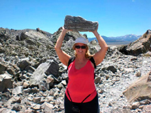
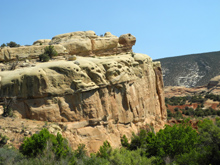
|
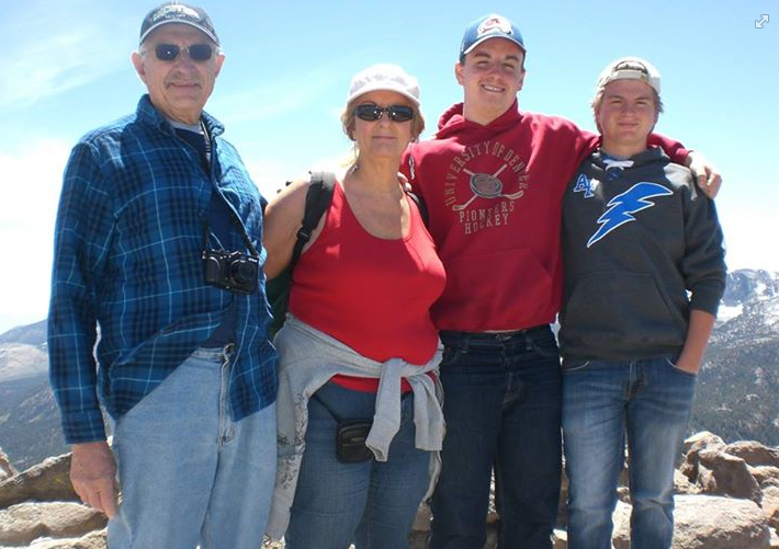


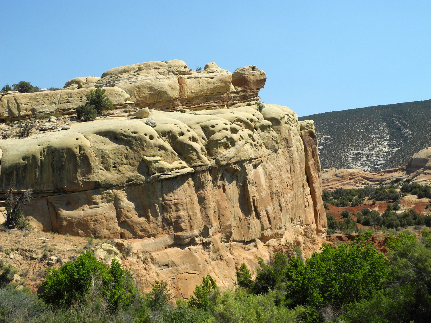
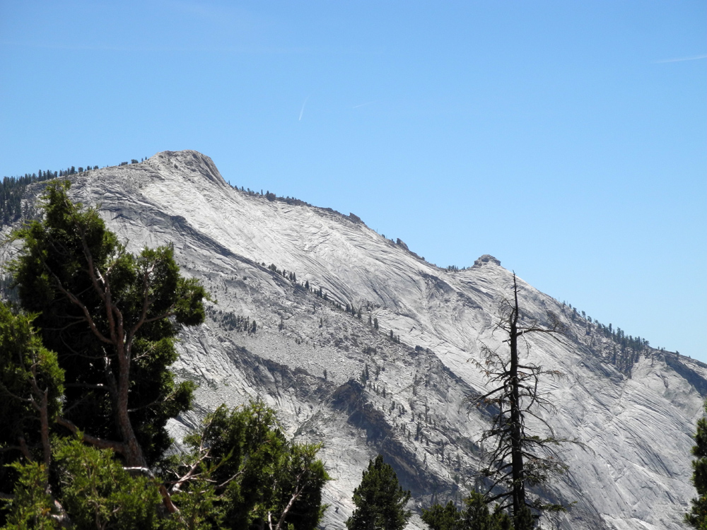
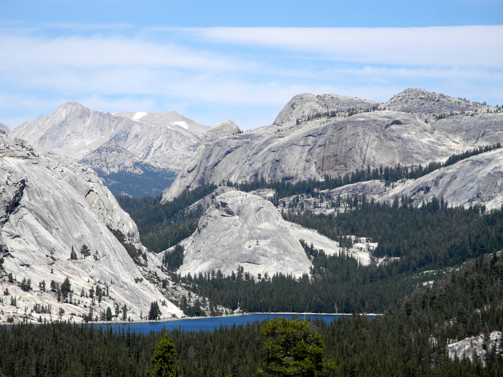
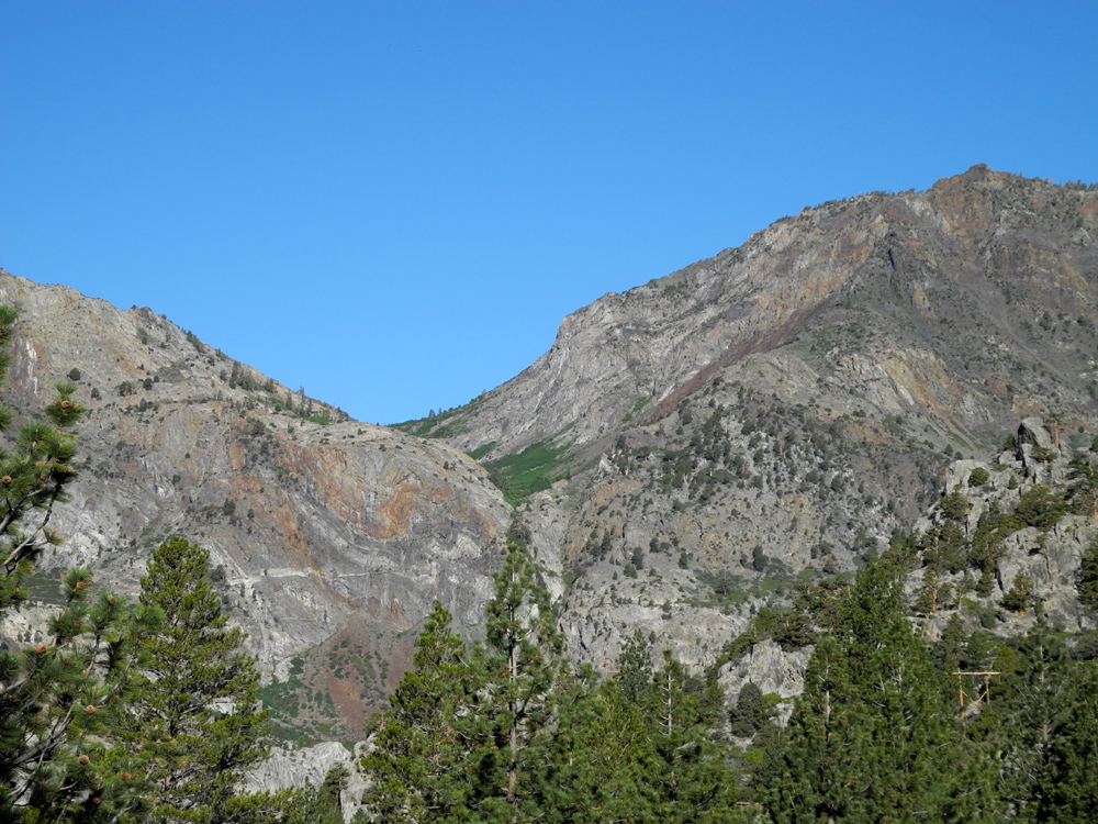
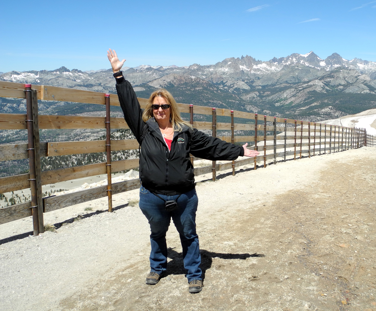
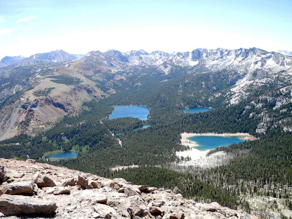
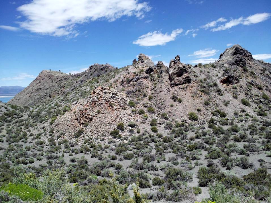
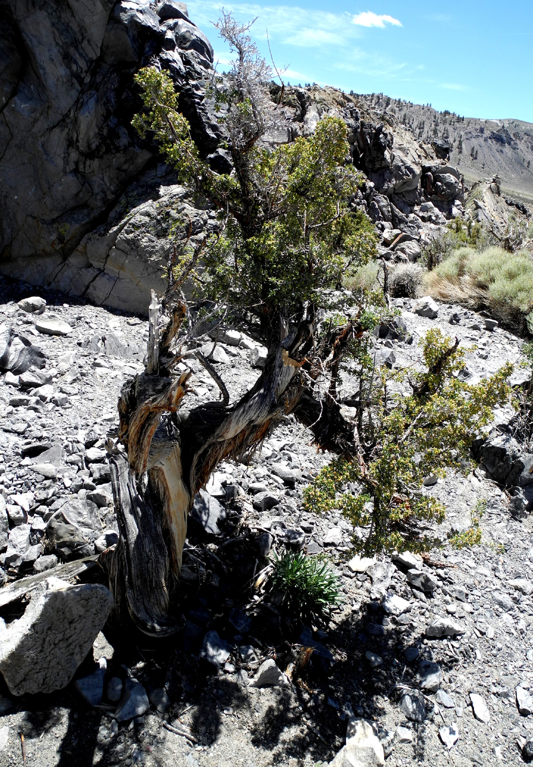
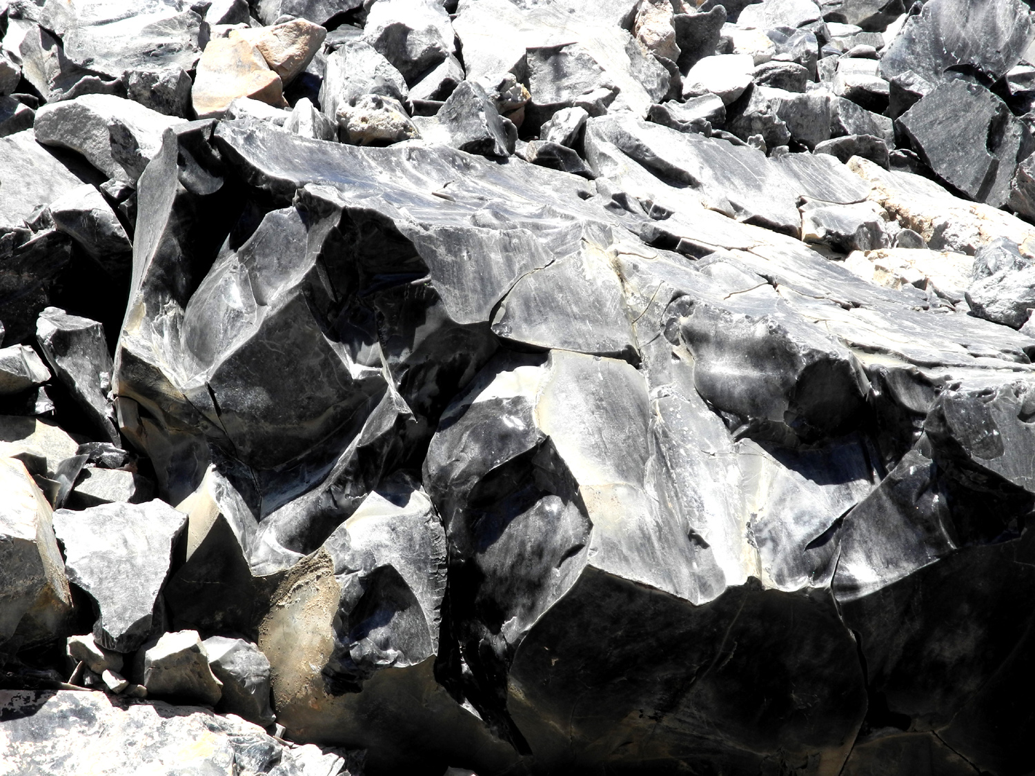
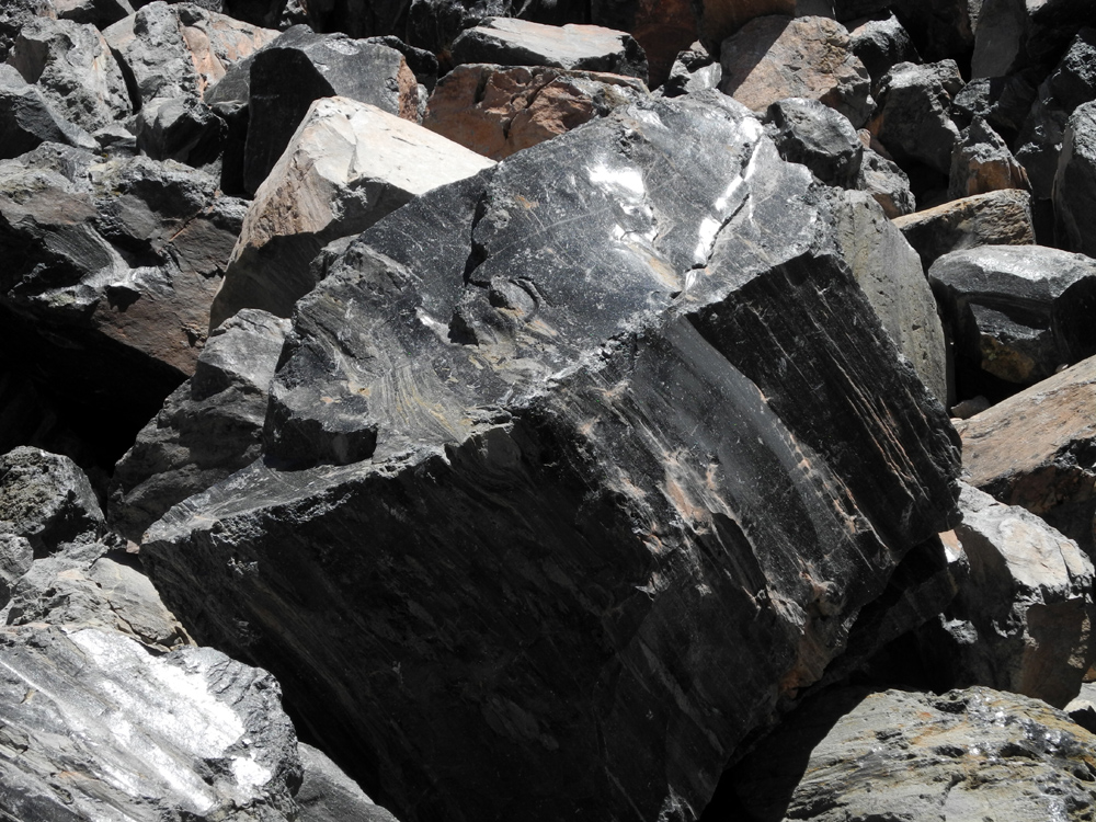
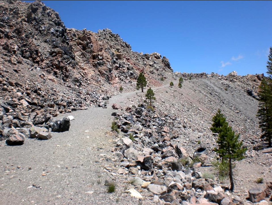
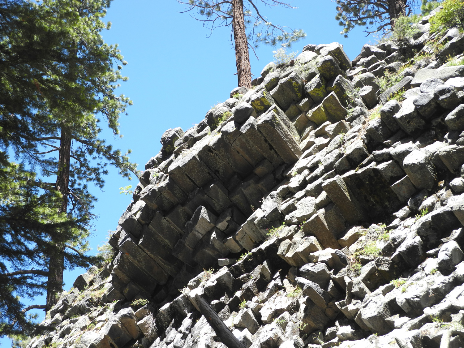
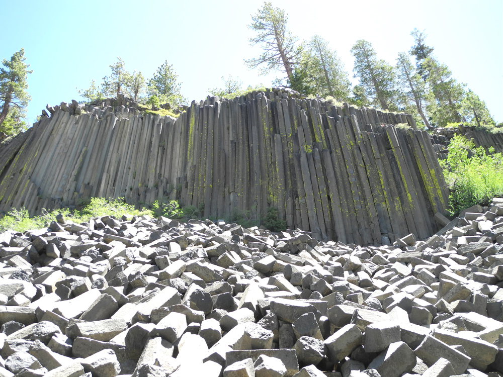
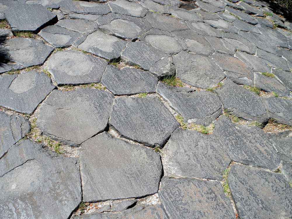
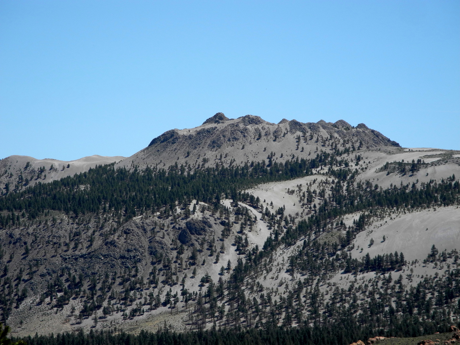
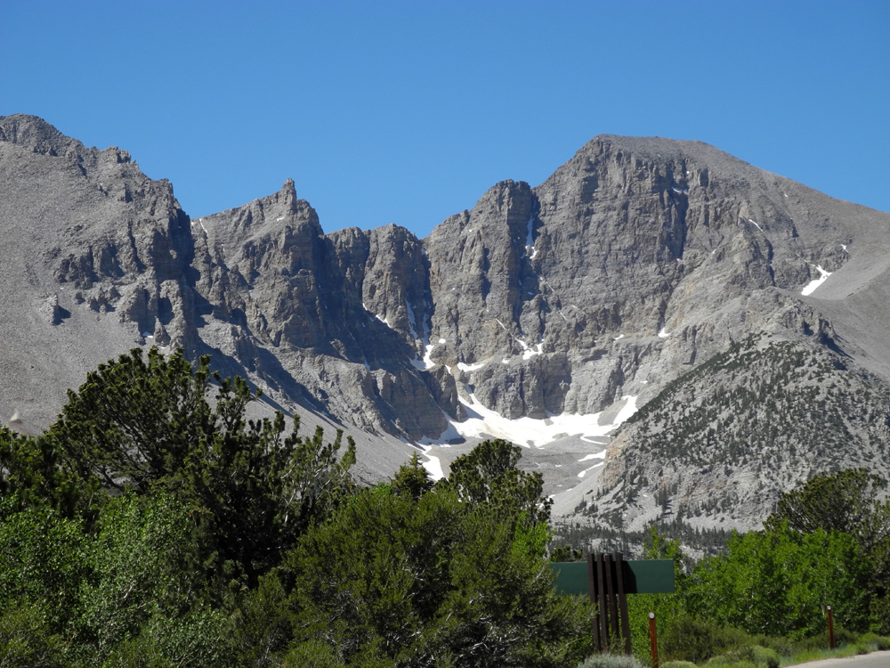
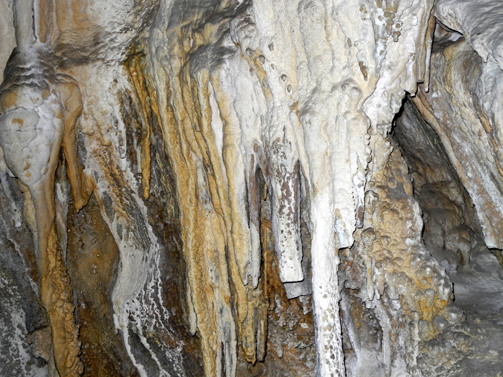
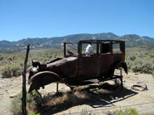
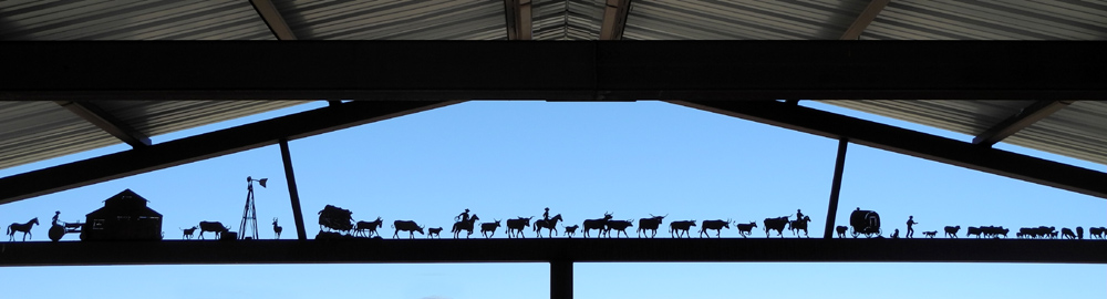
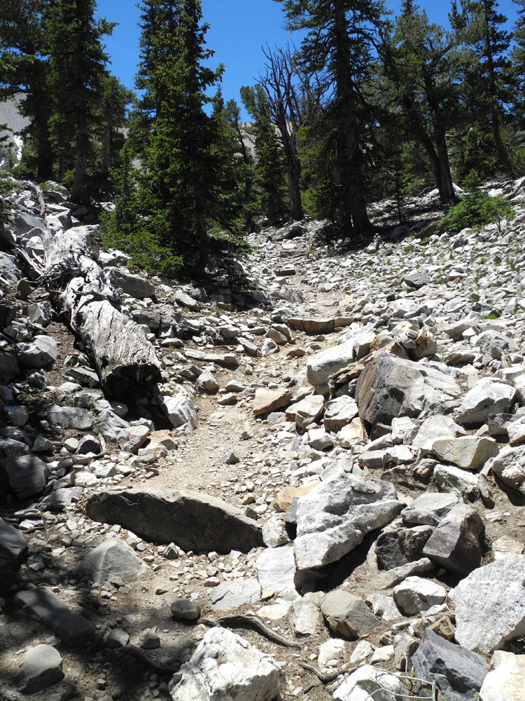
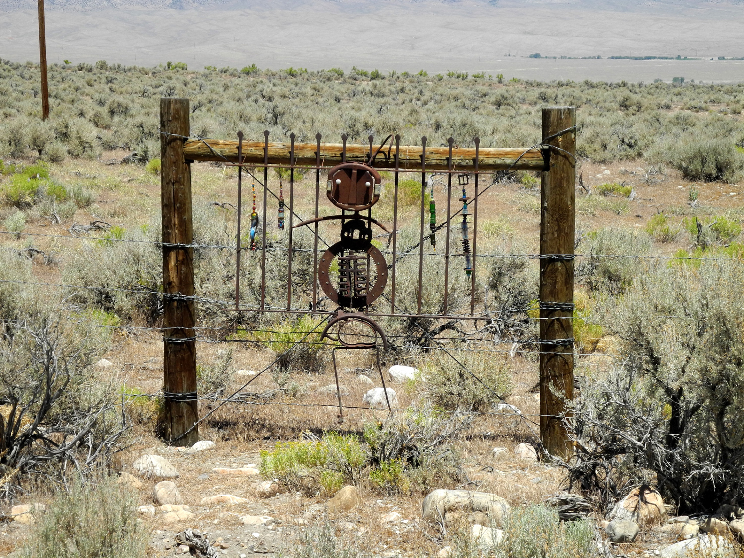
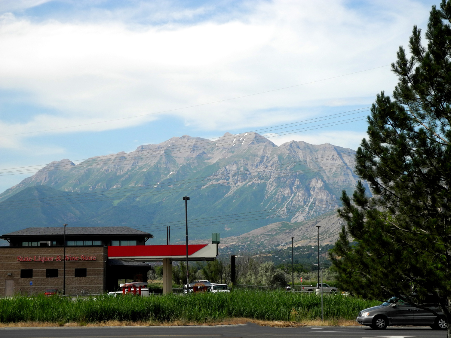
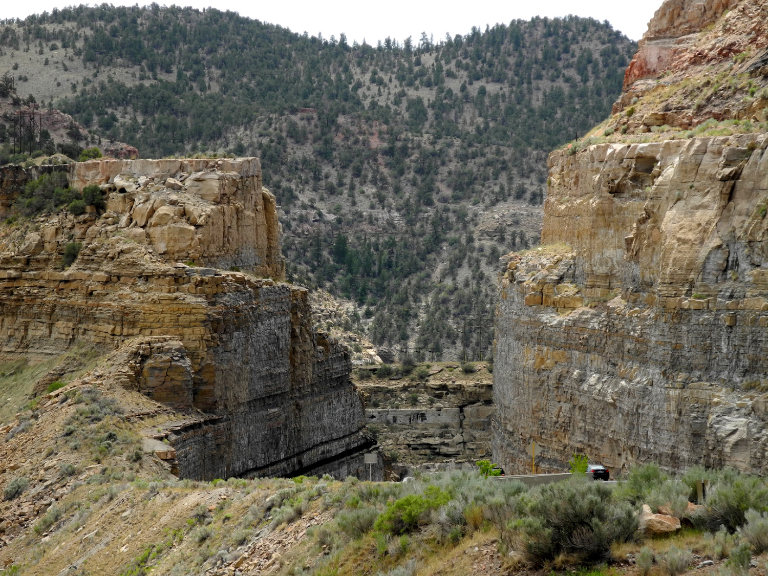
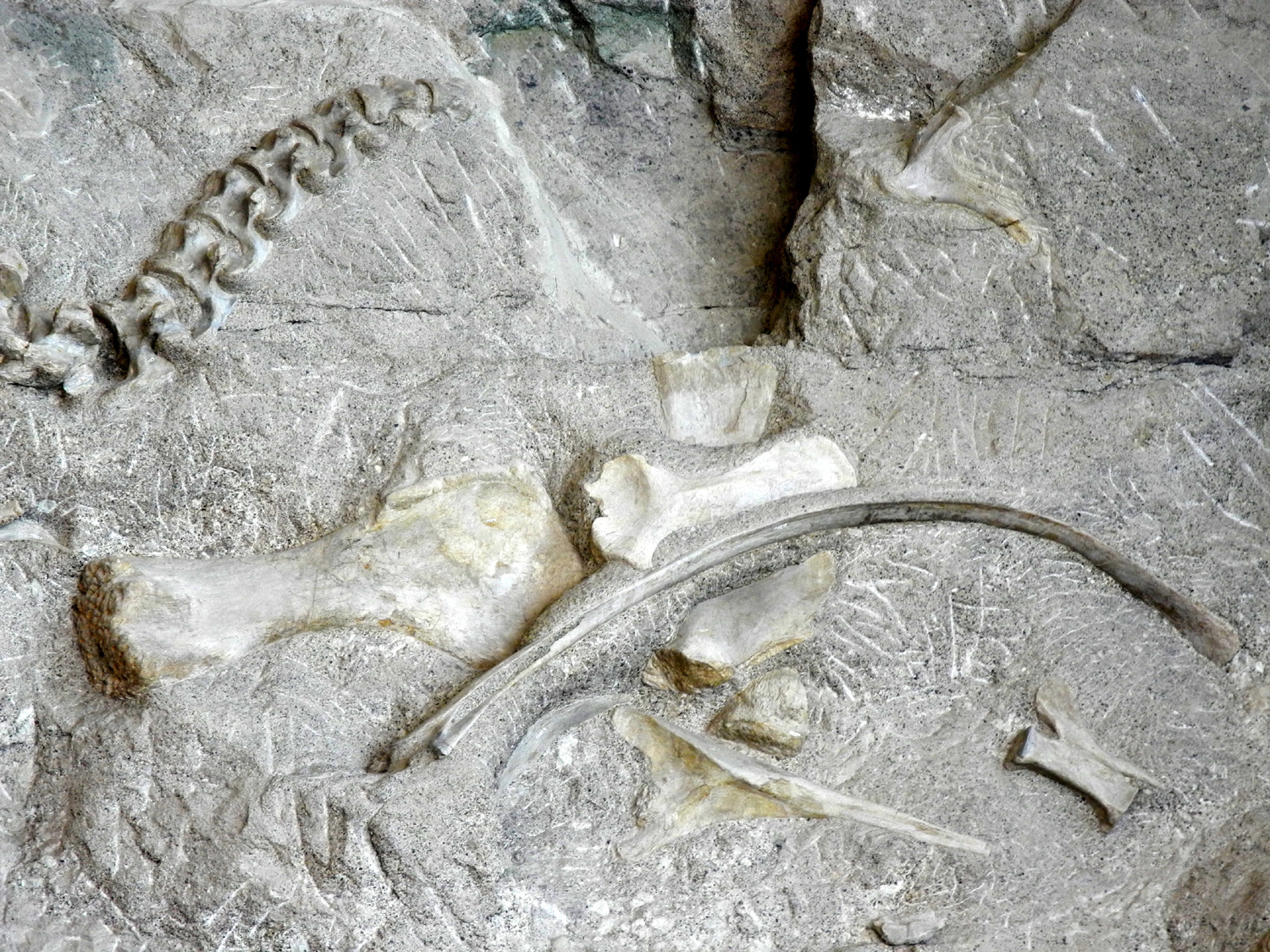
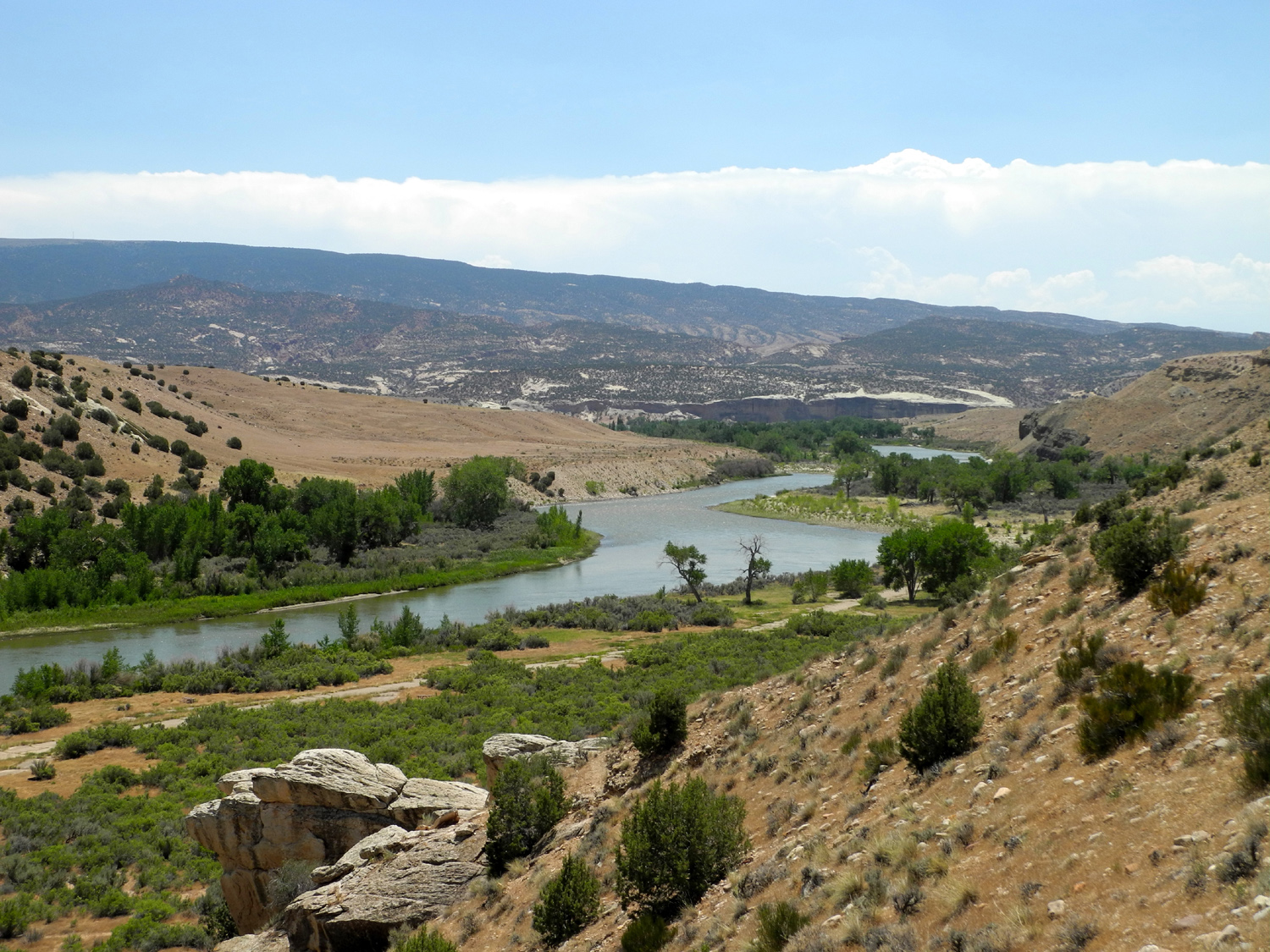
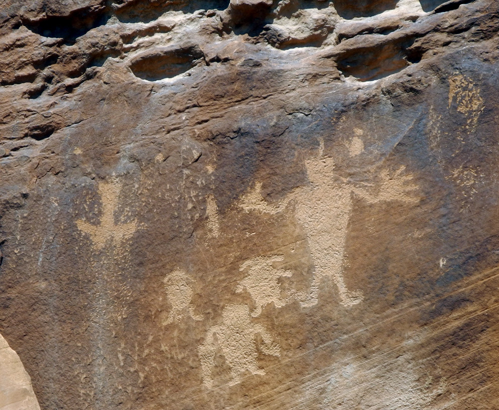
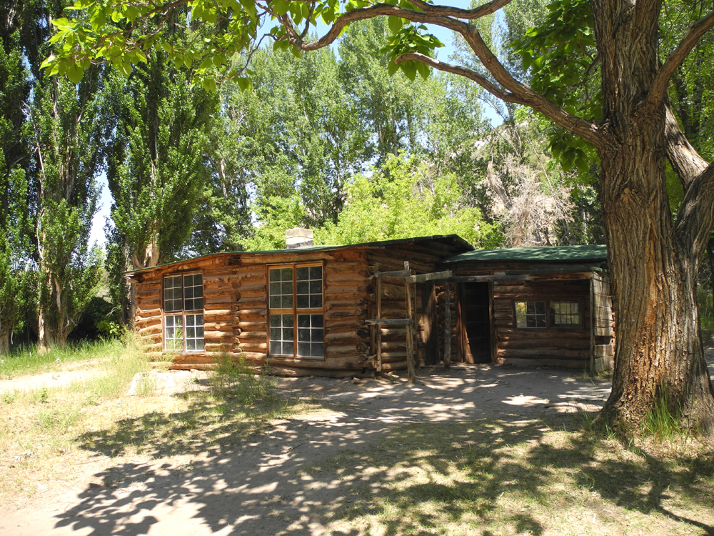
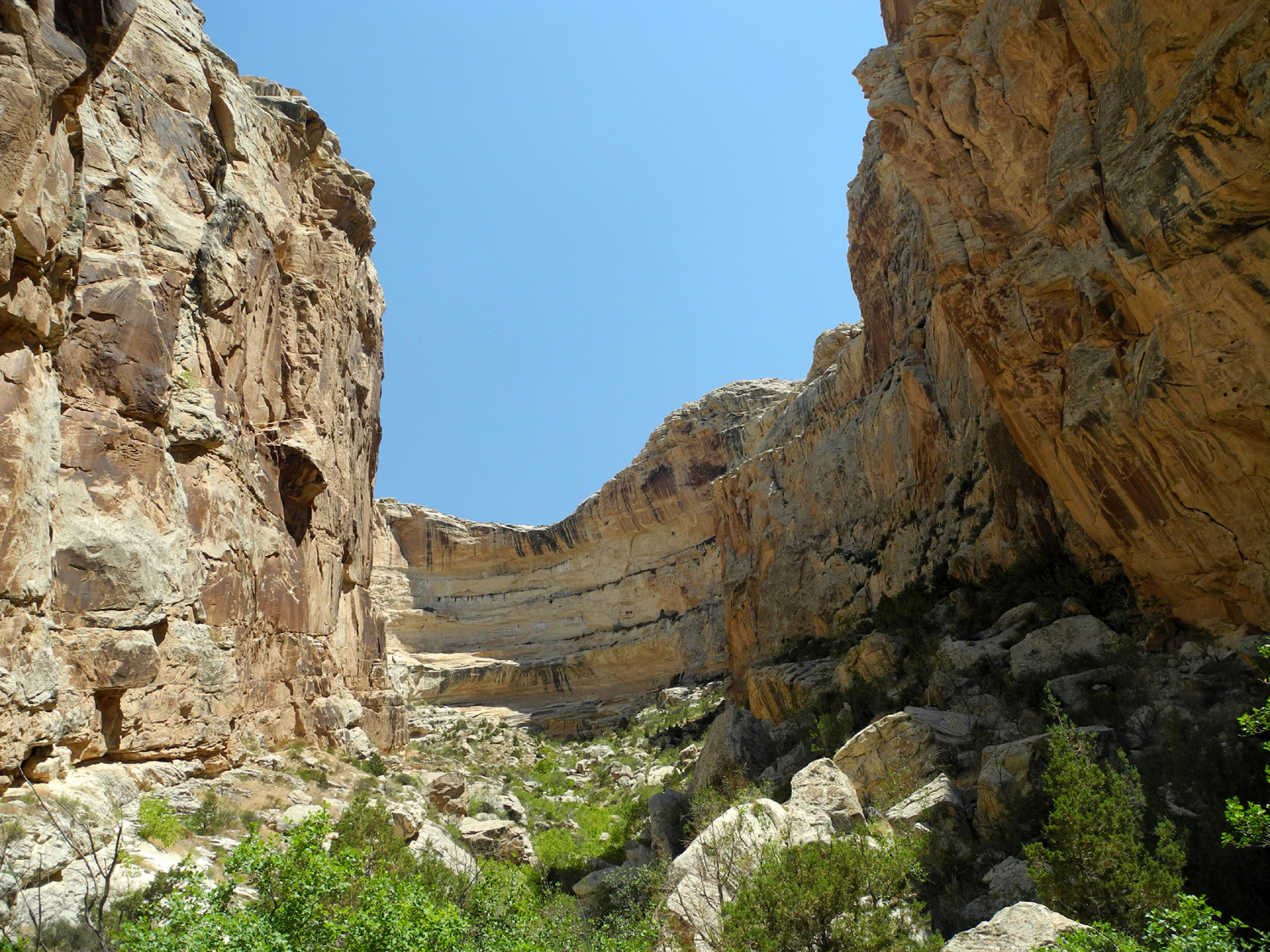
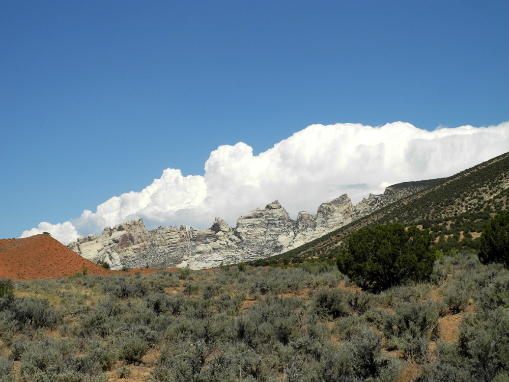
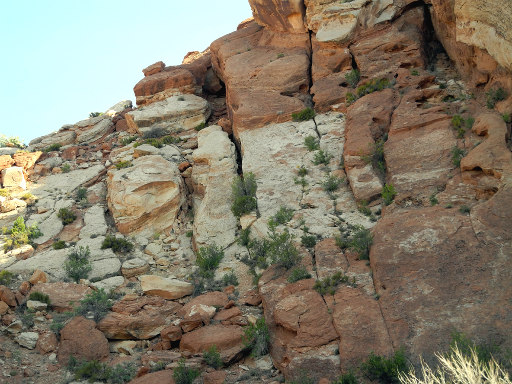
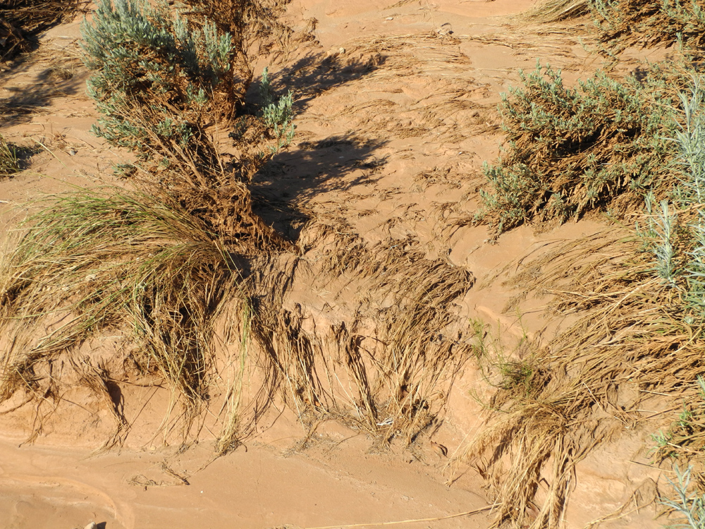
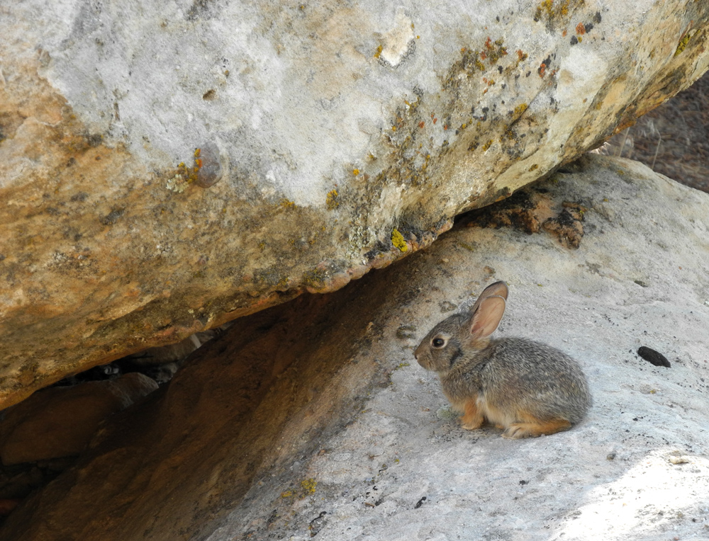
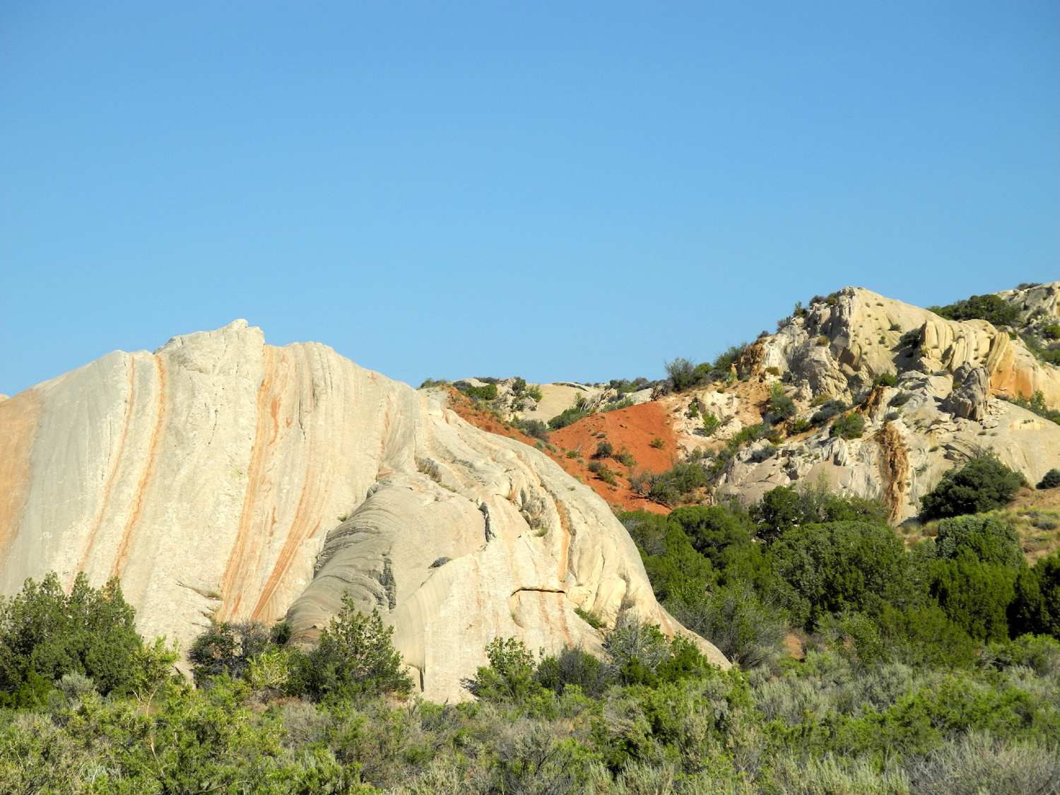
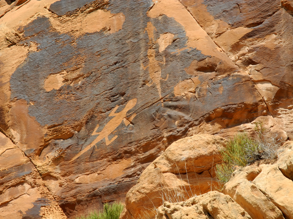
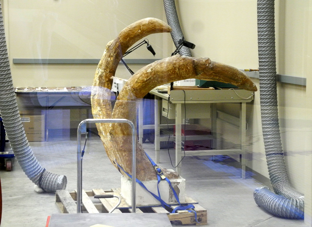
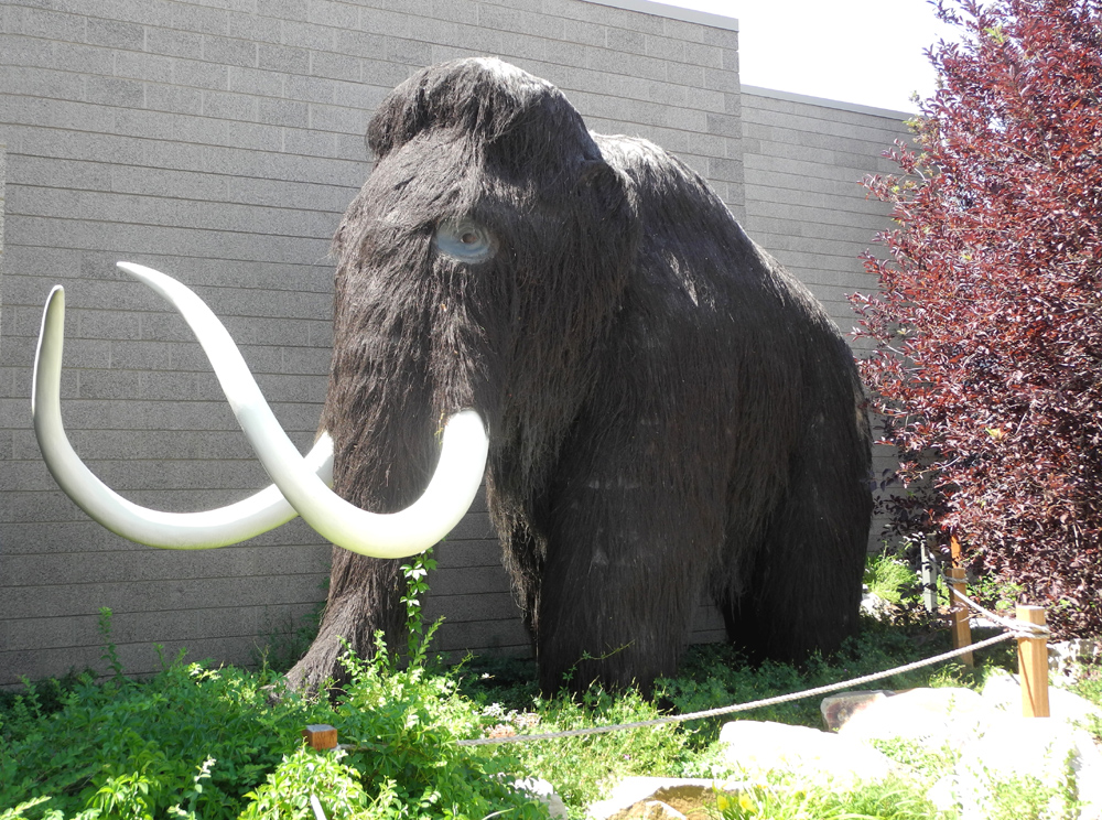
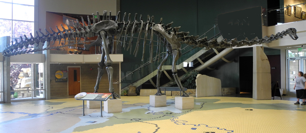
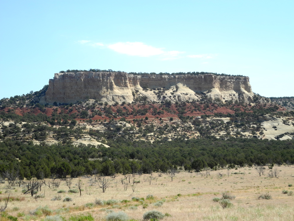
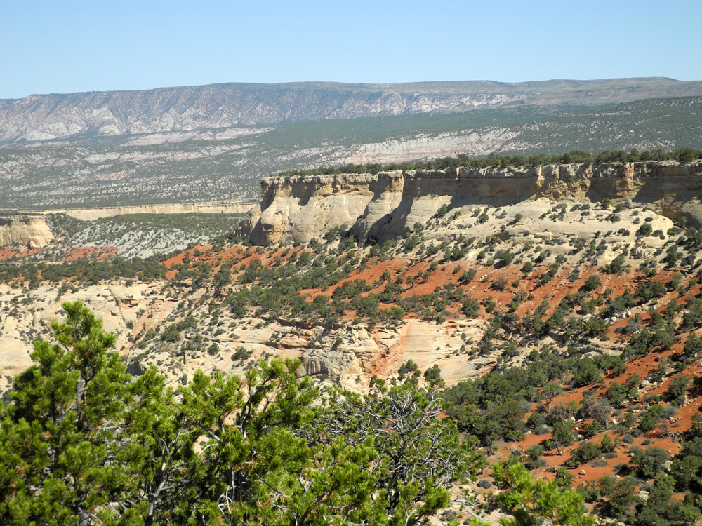
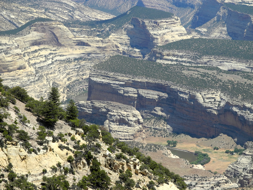
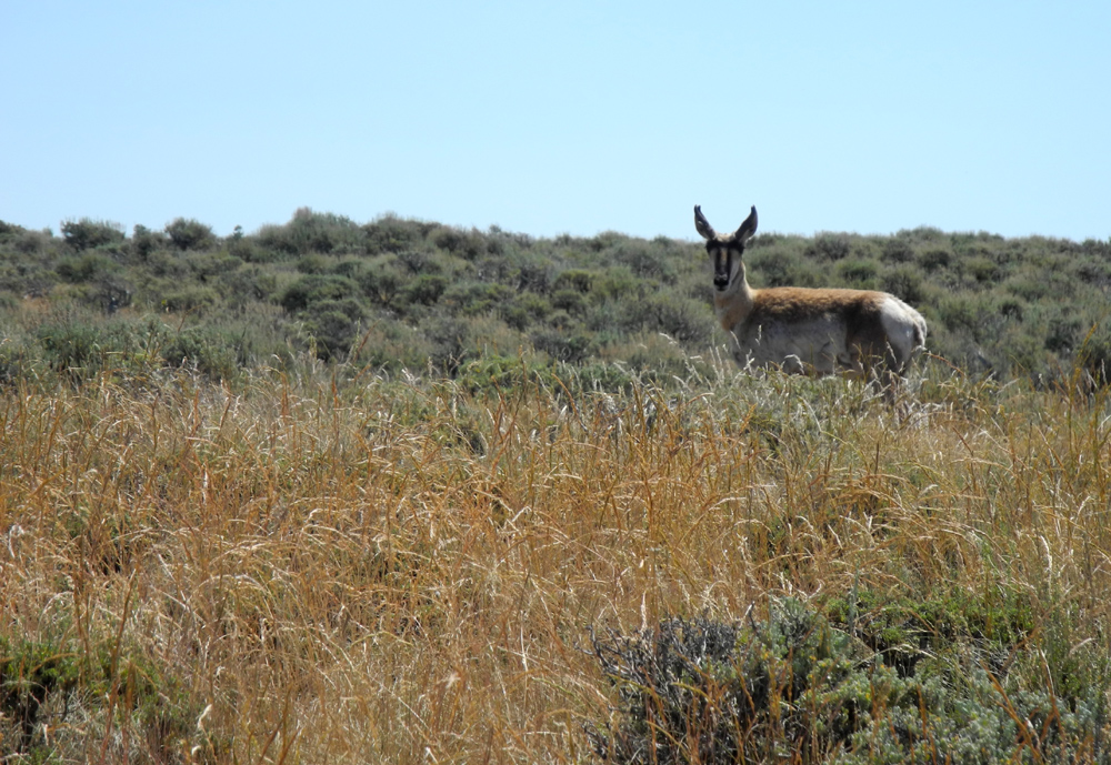
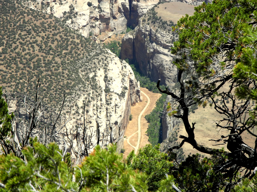
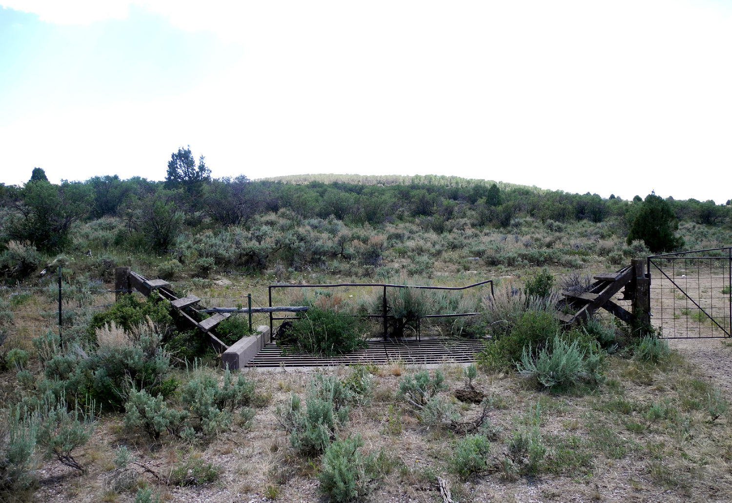
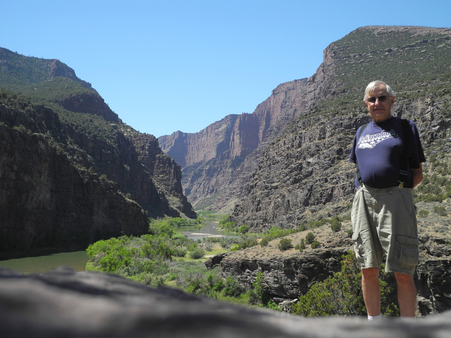
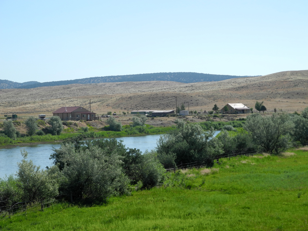
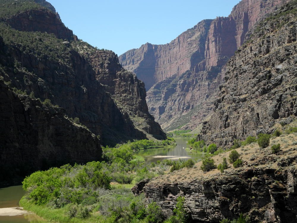
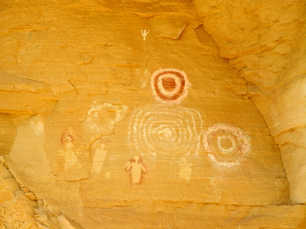
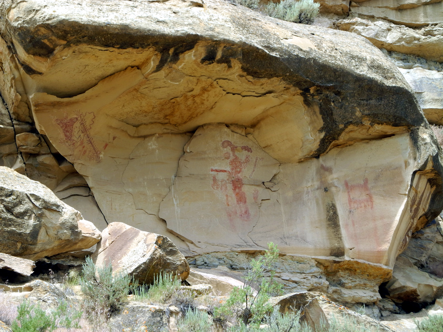
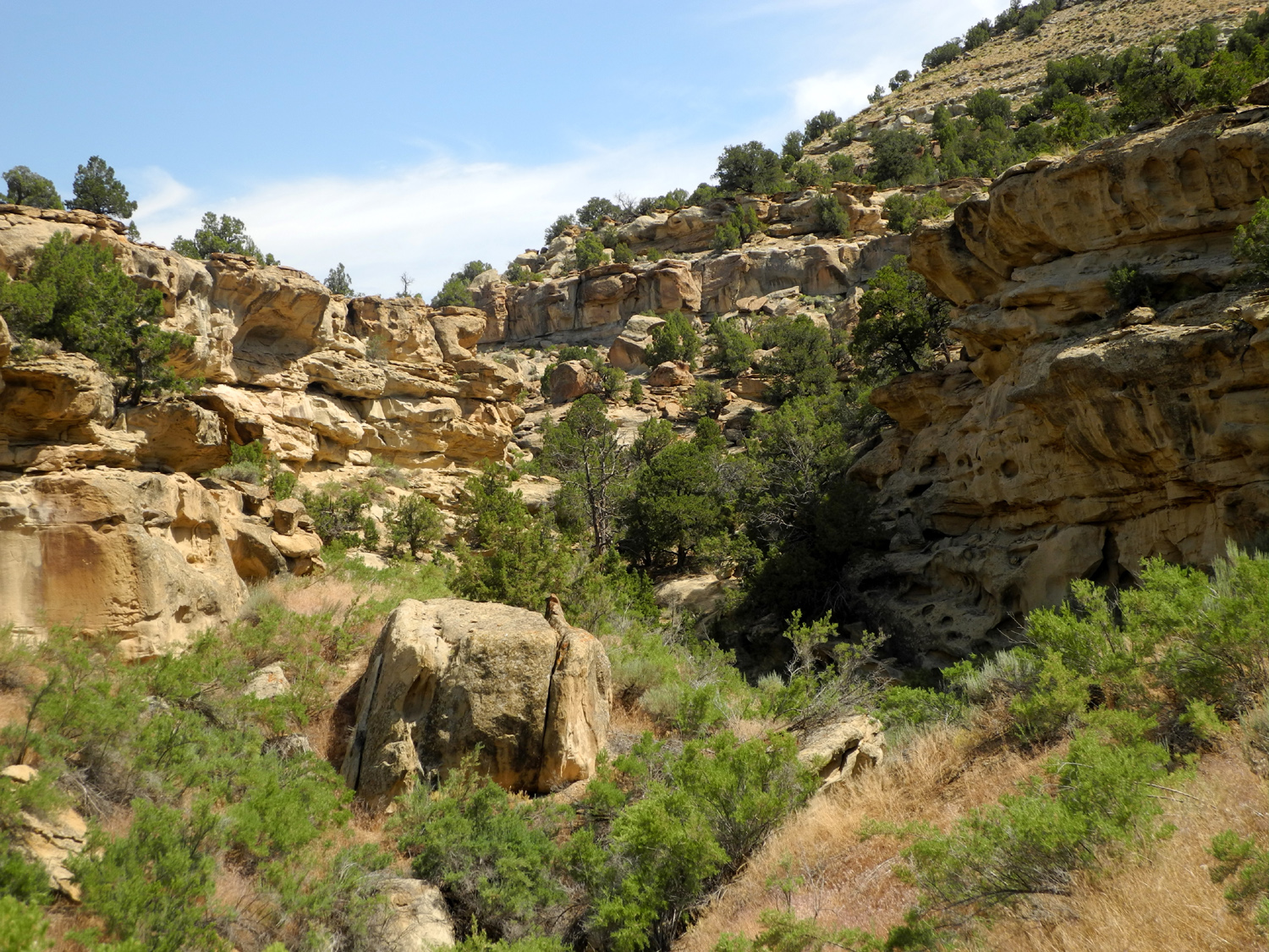
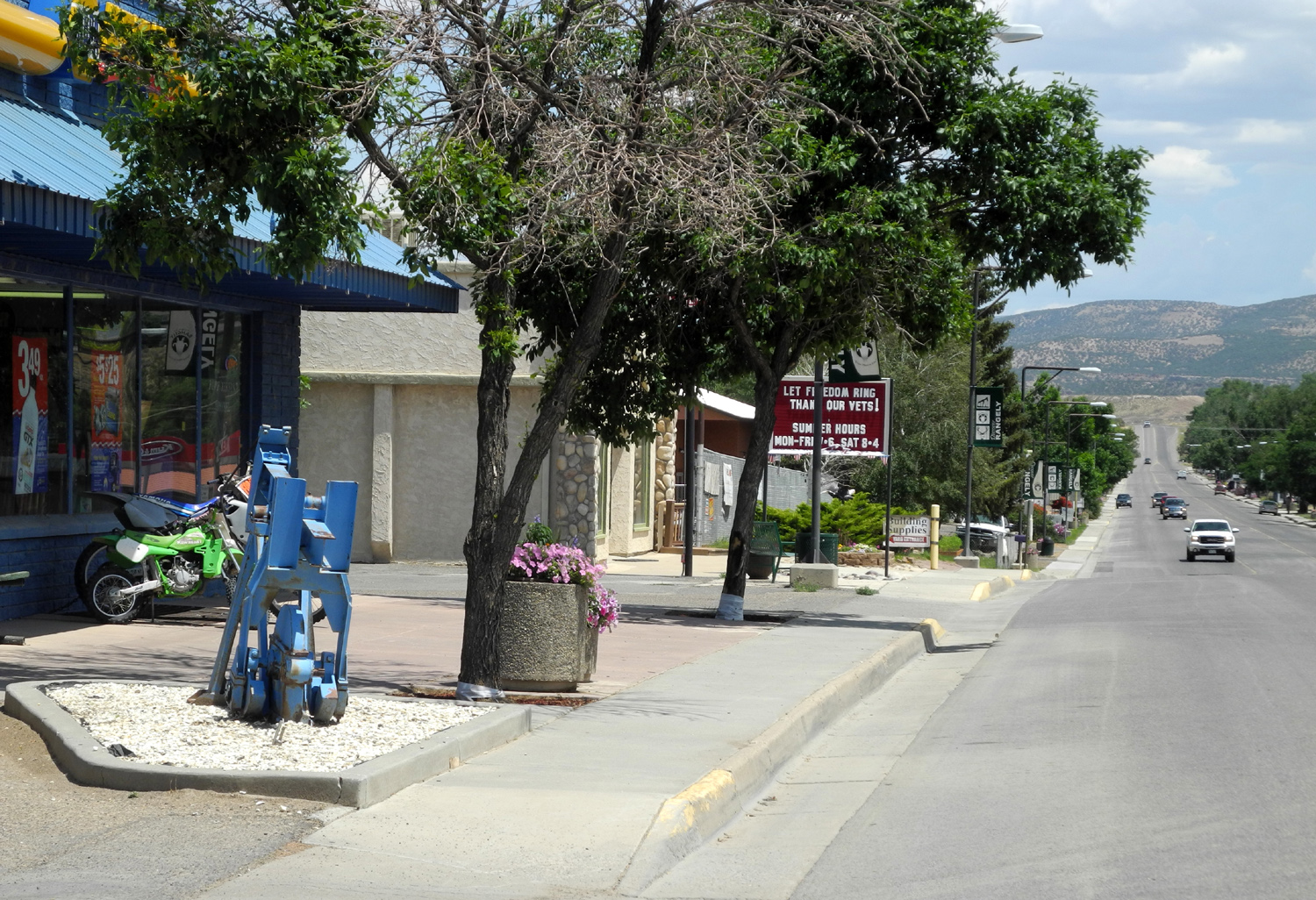
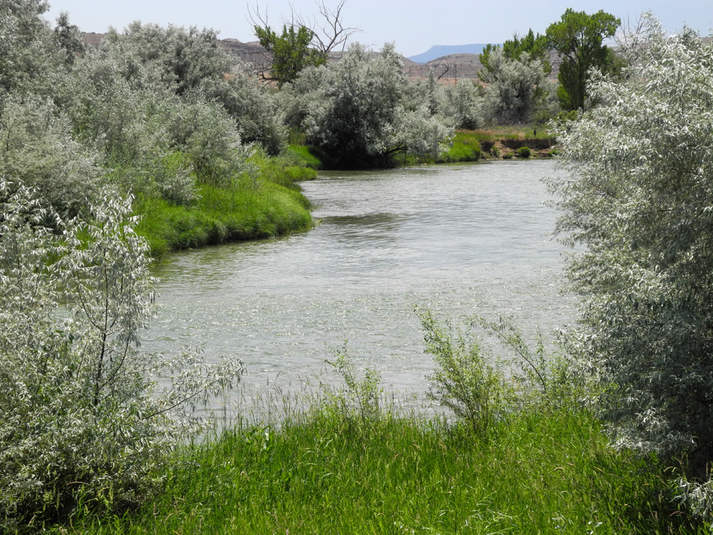
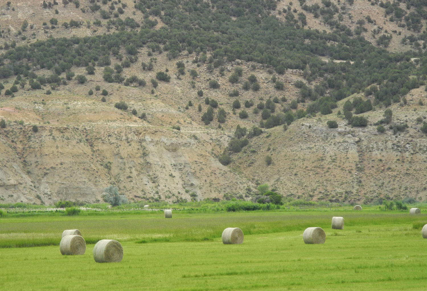
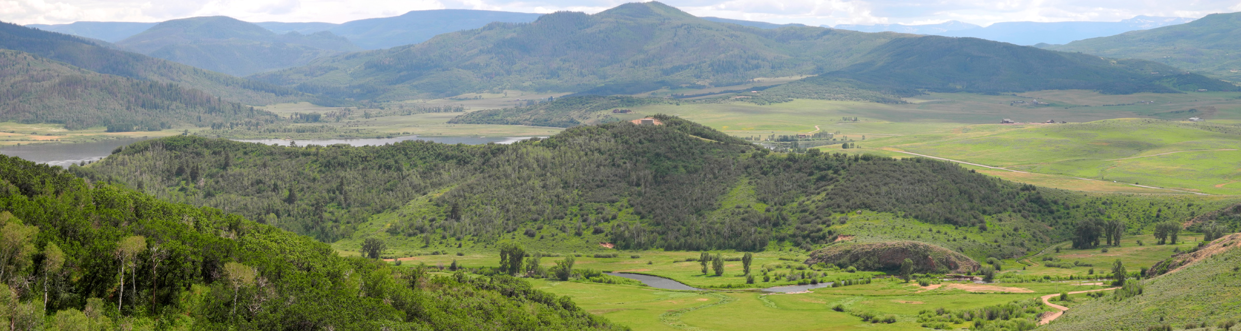
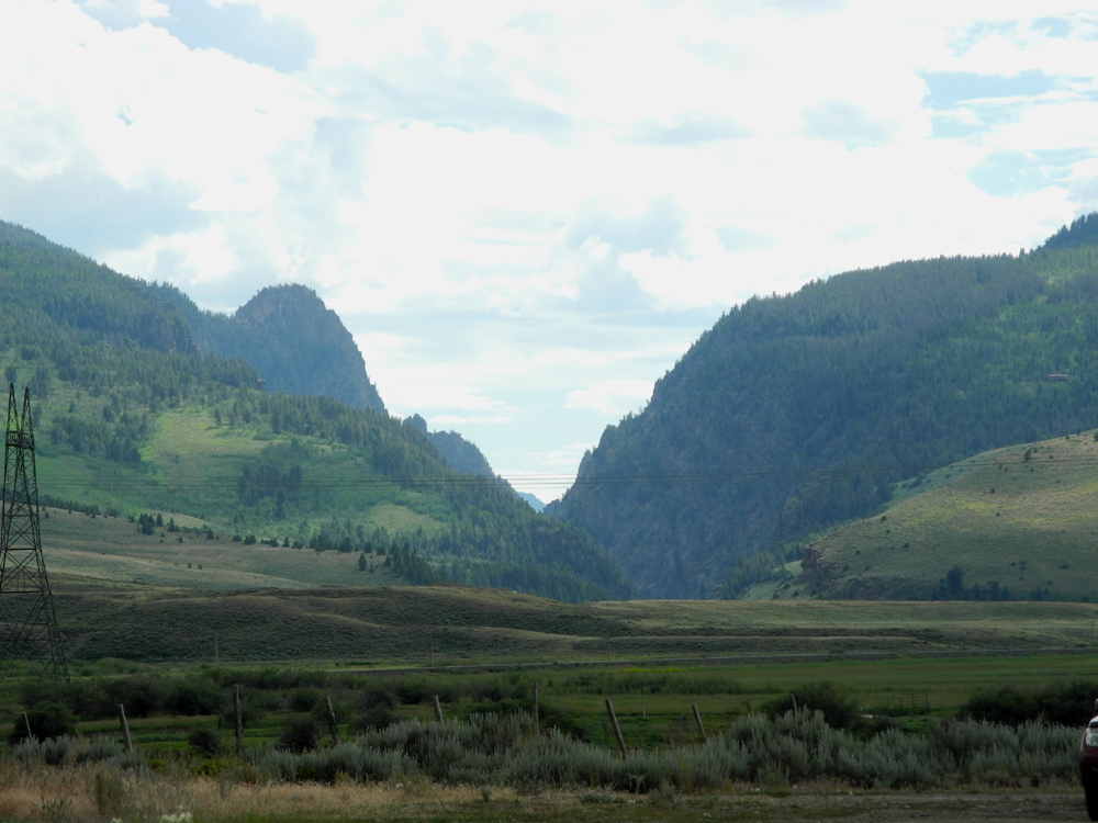
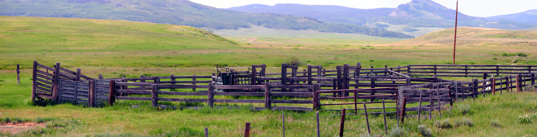
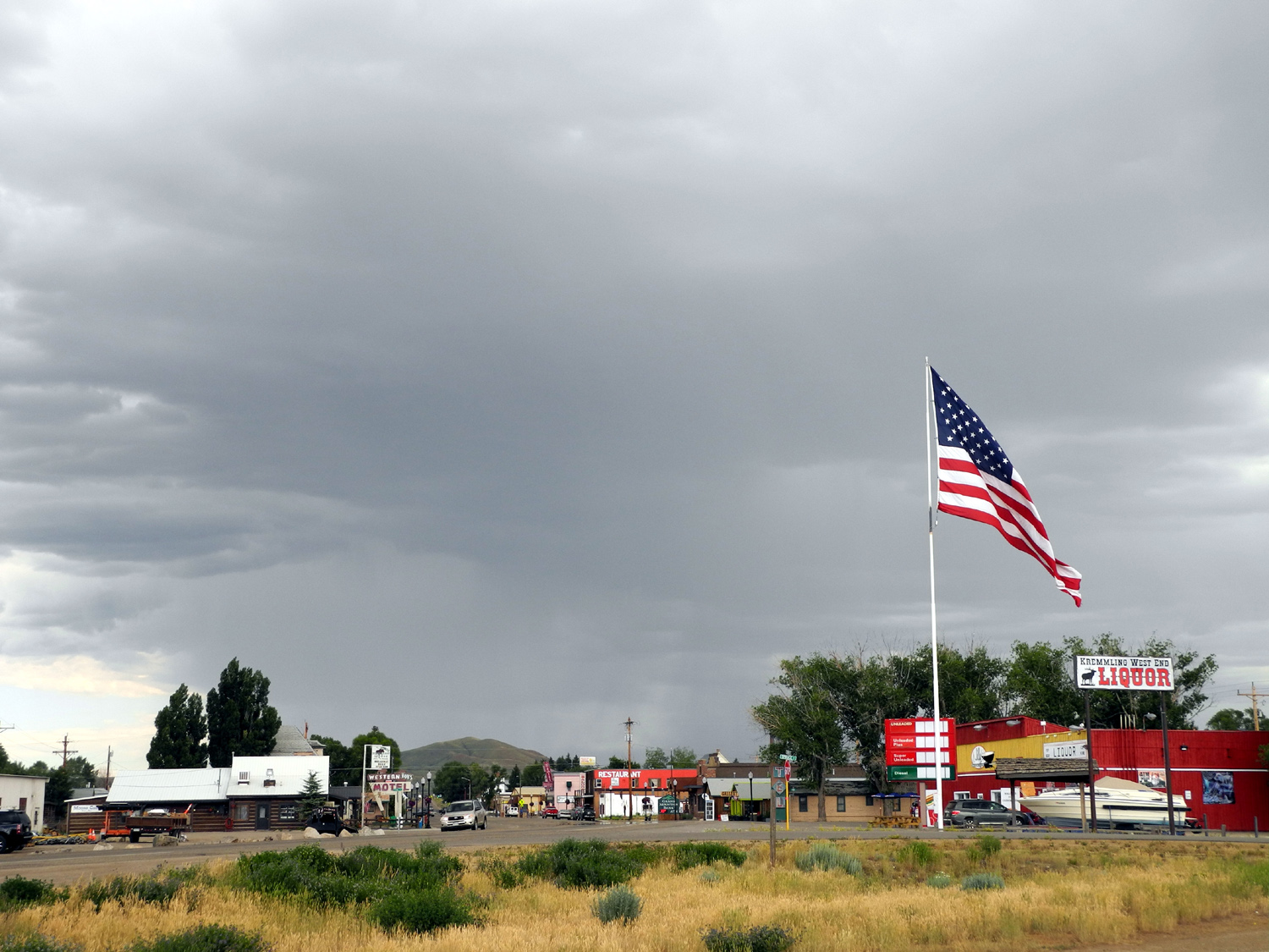
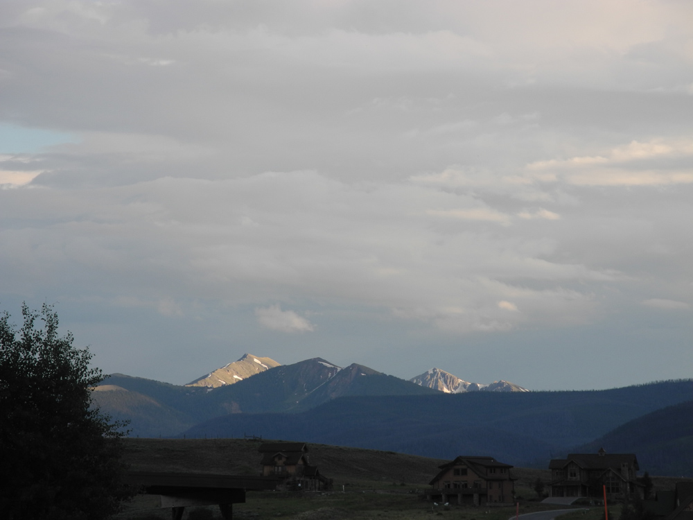
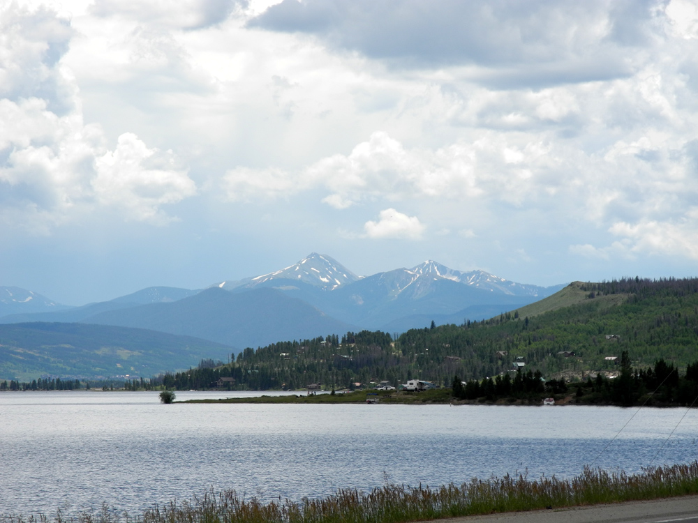
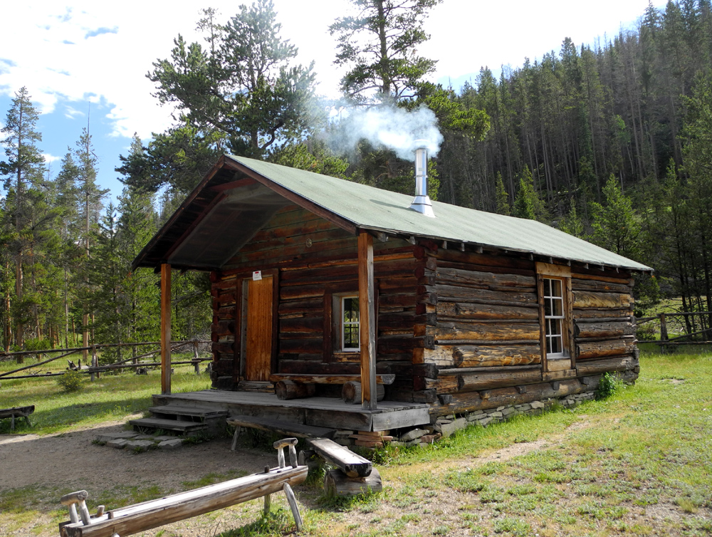
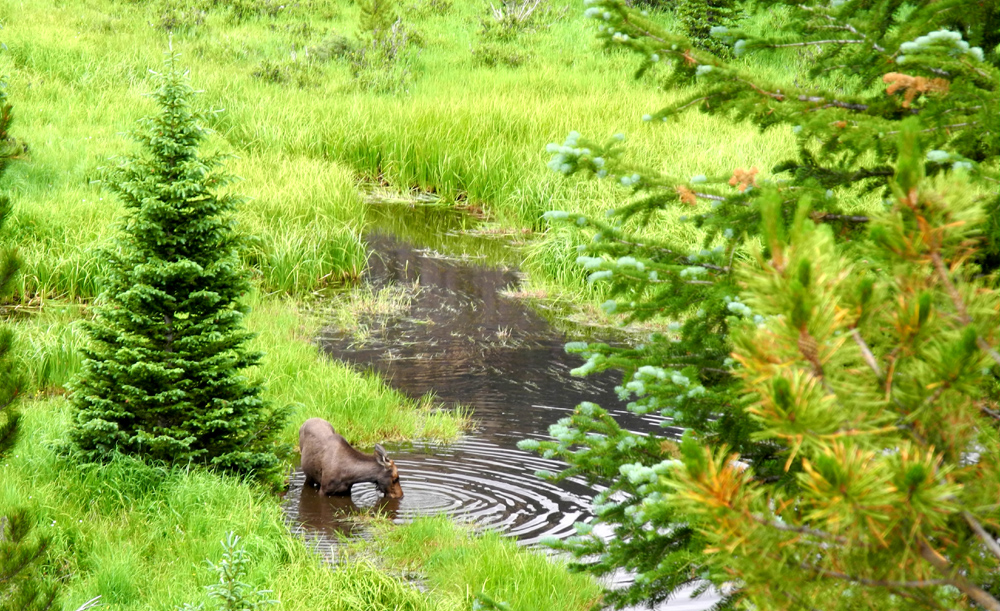
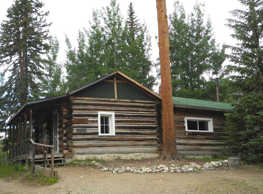
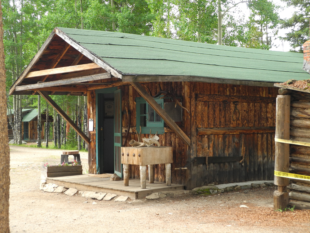
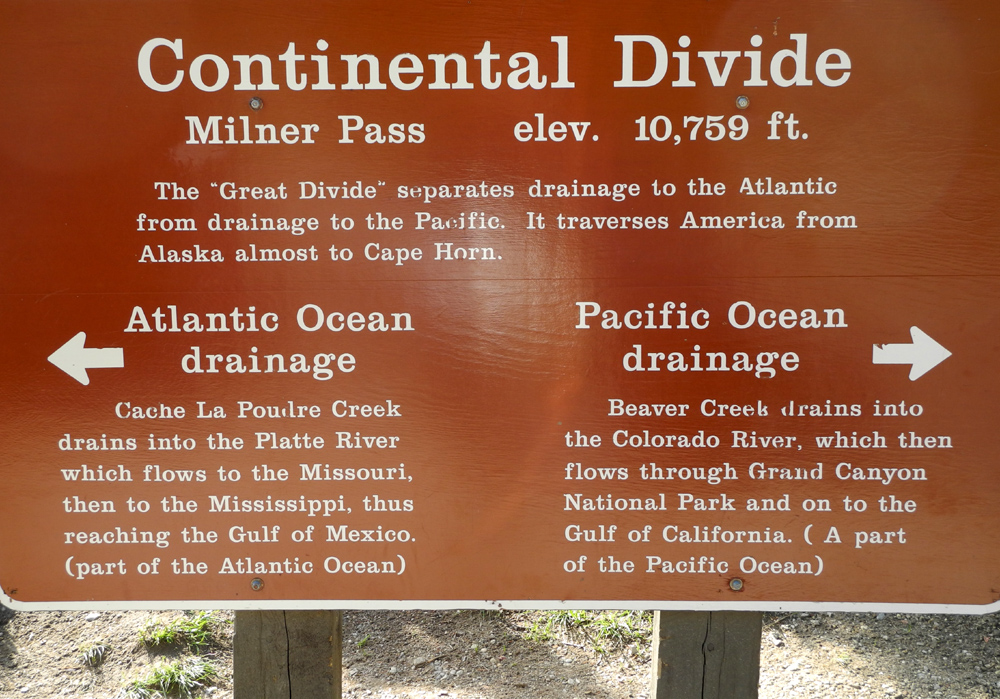
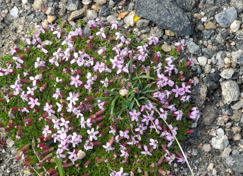
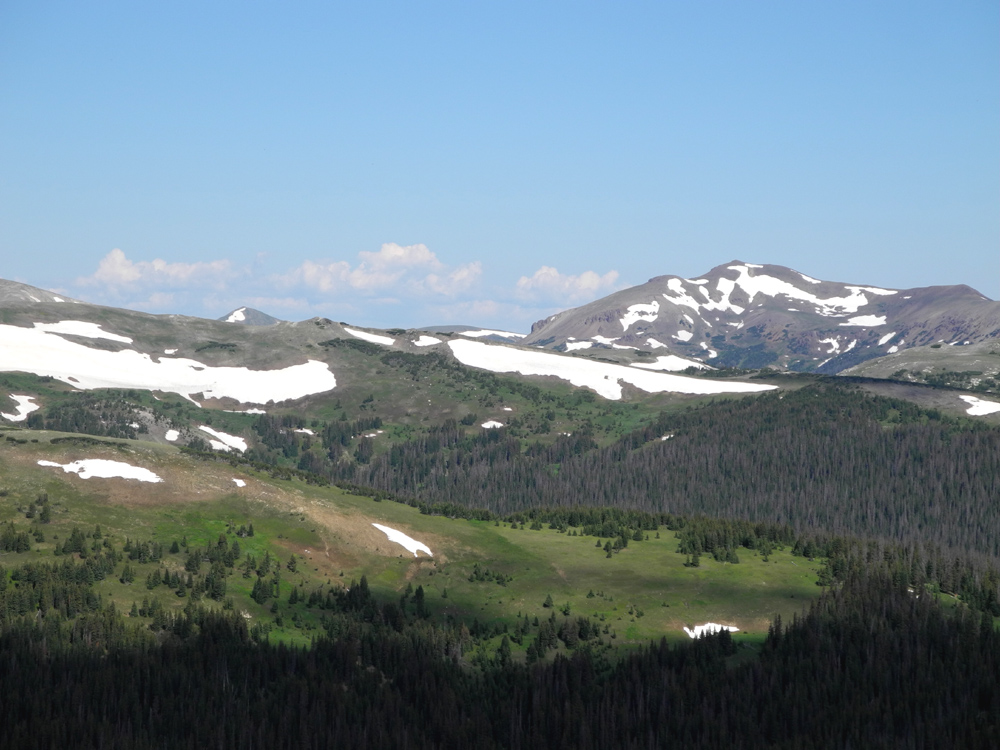
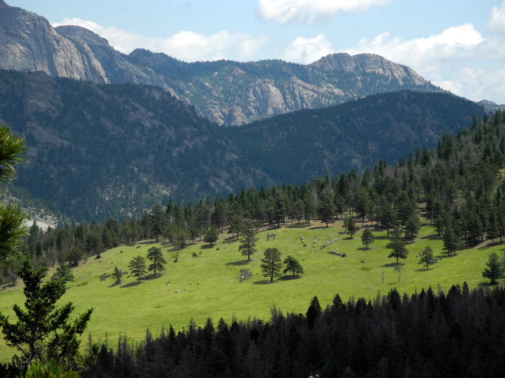
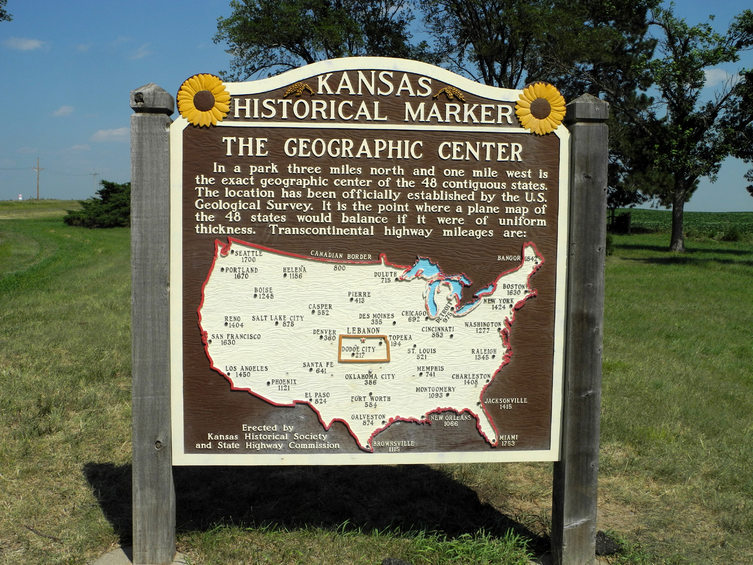
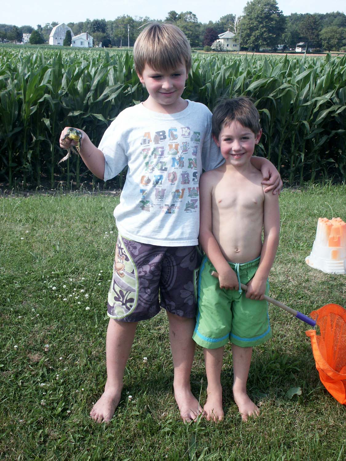
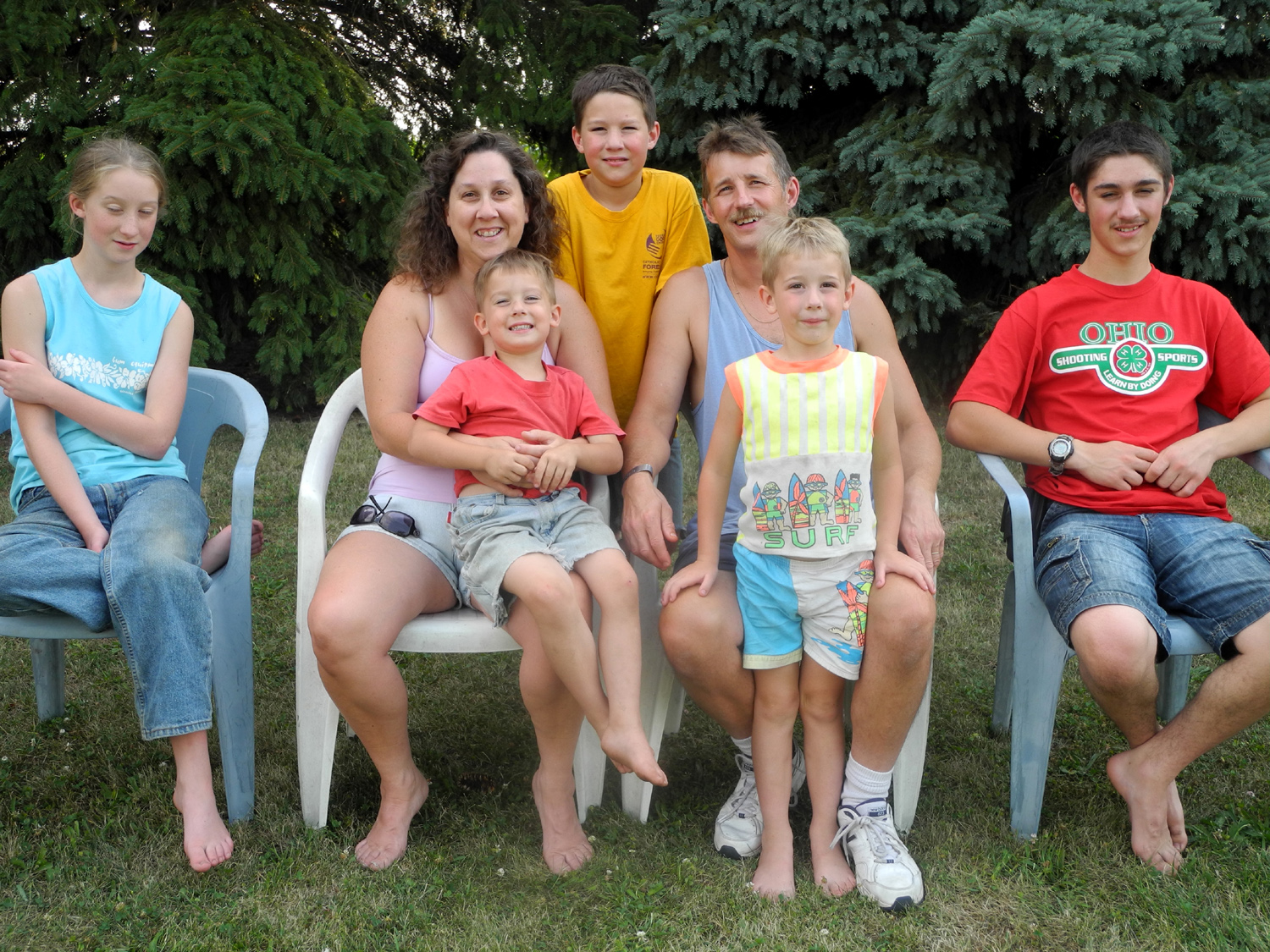
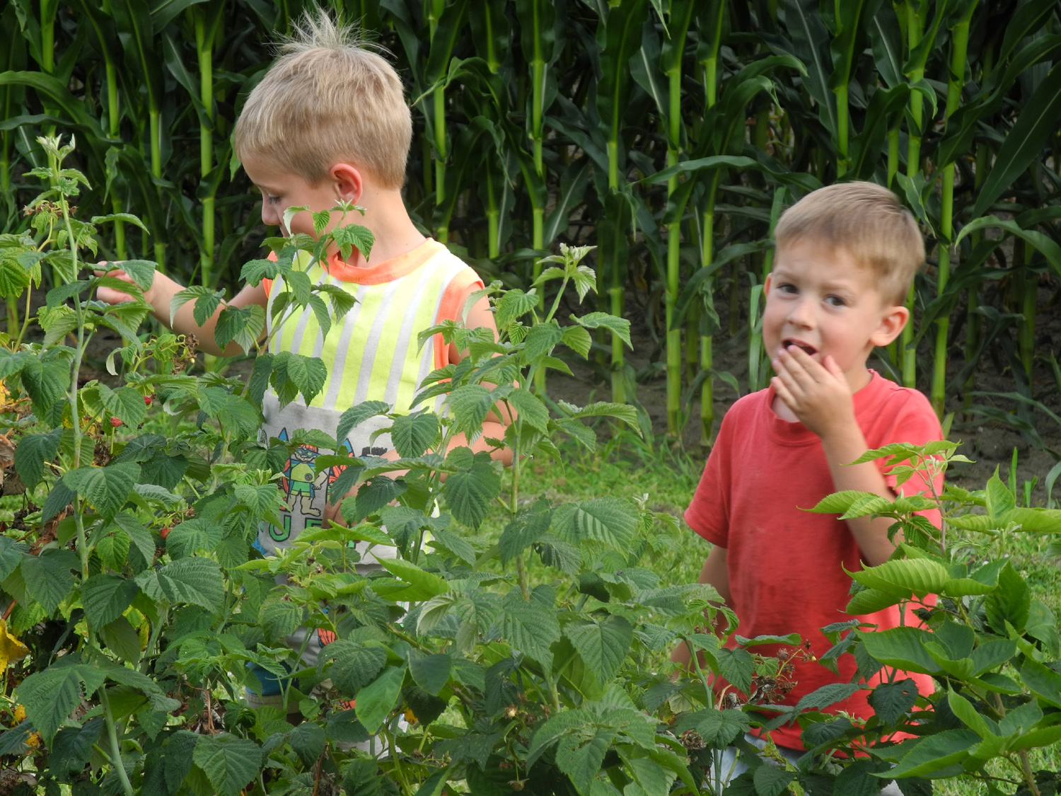
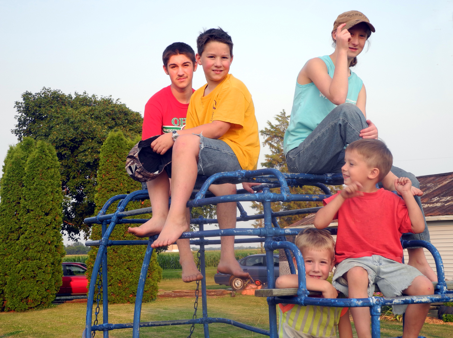
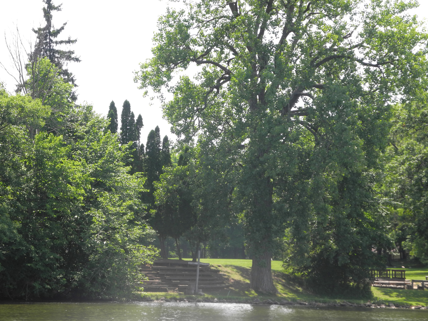
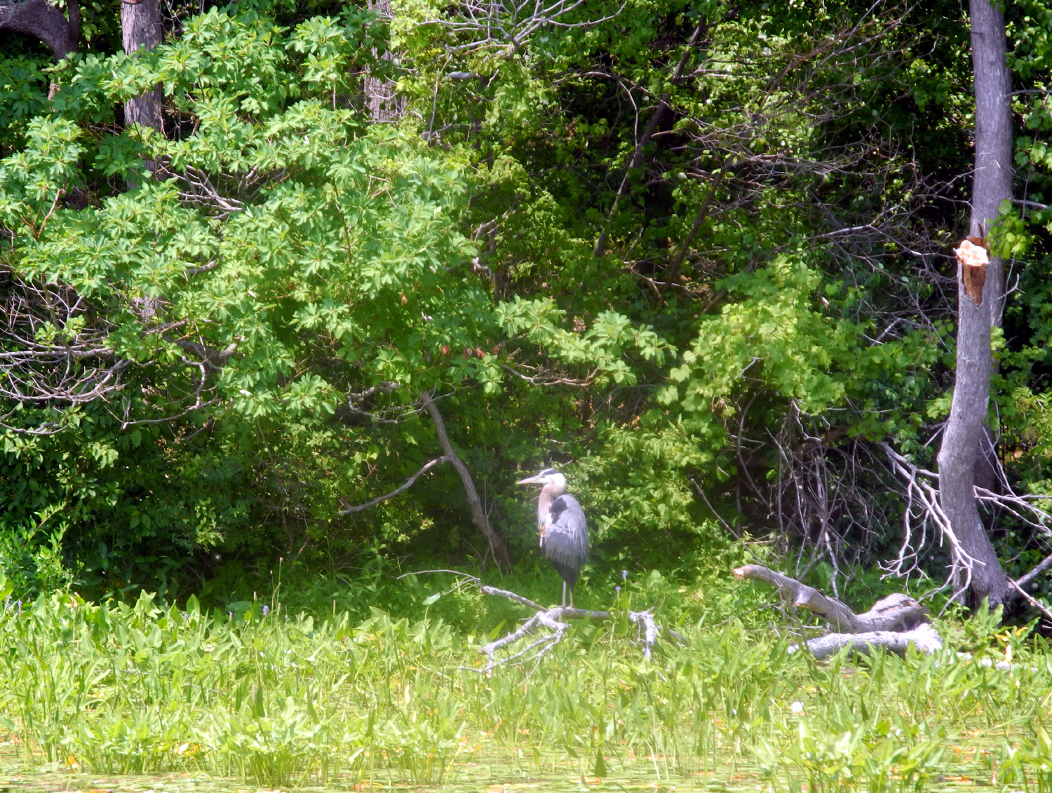
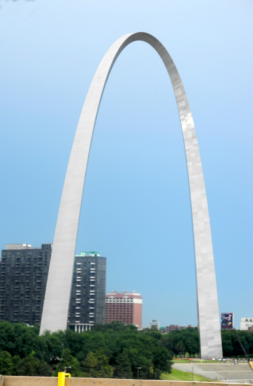
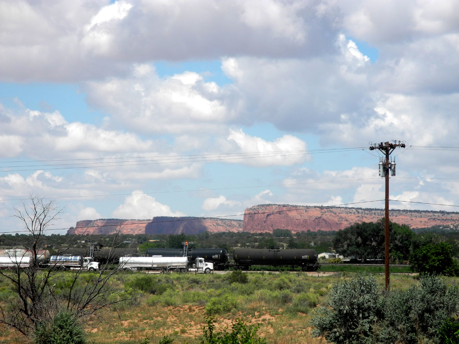
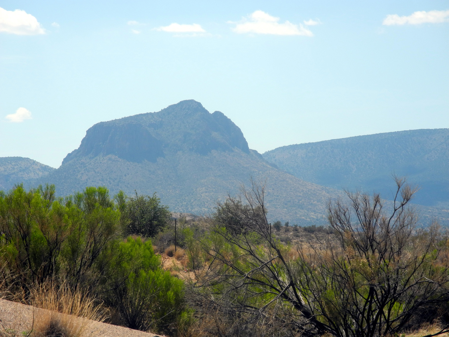
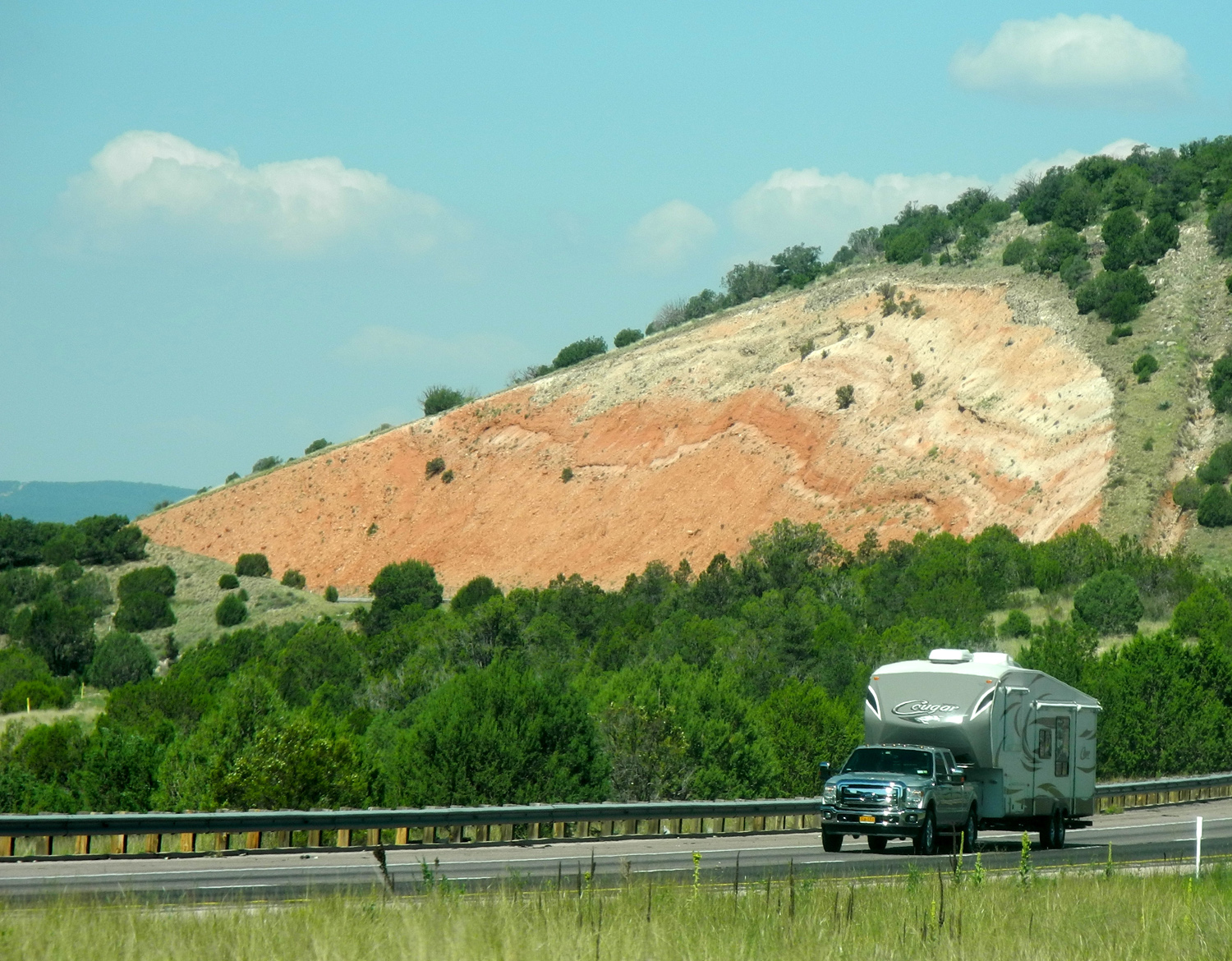
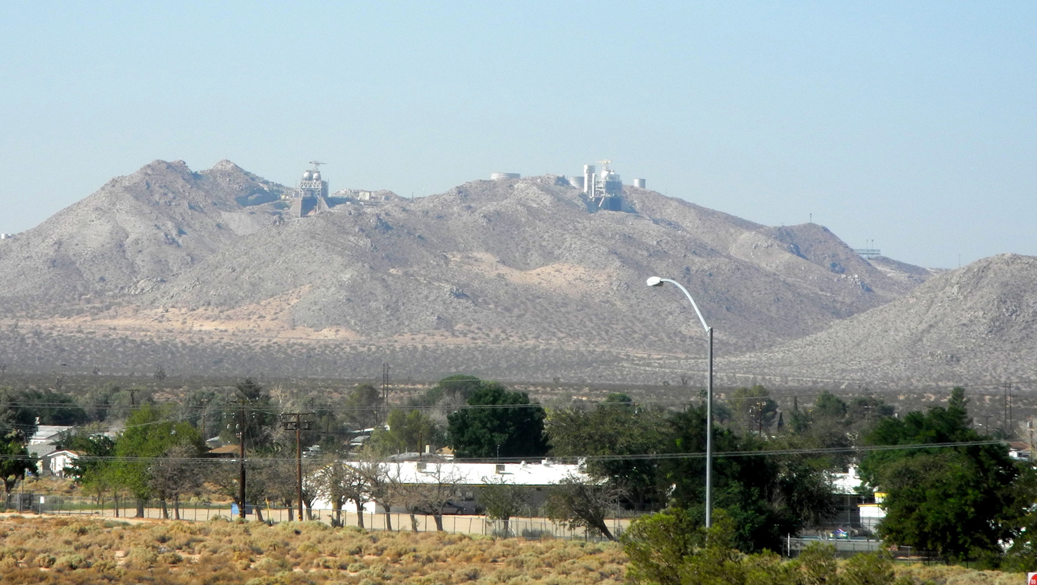
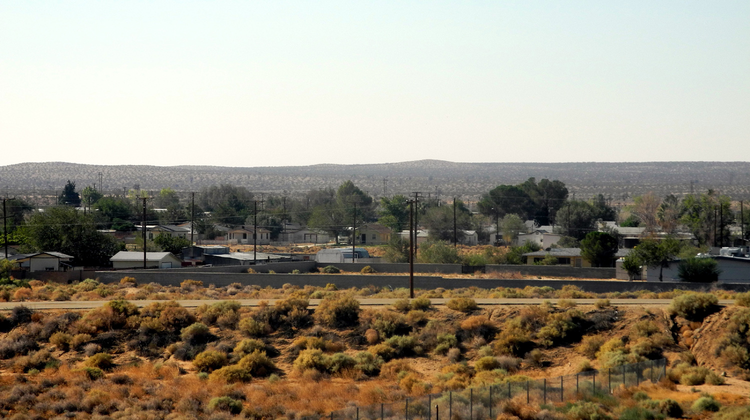
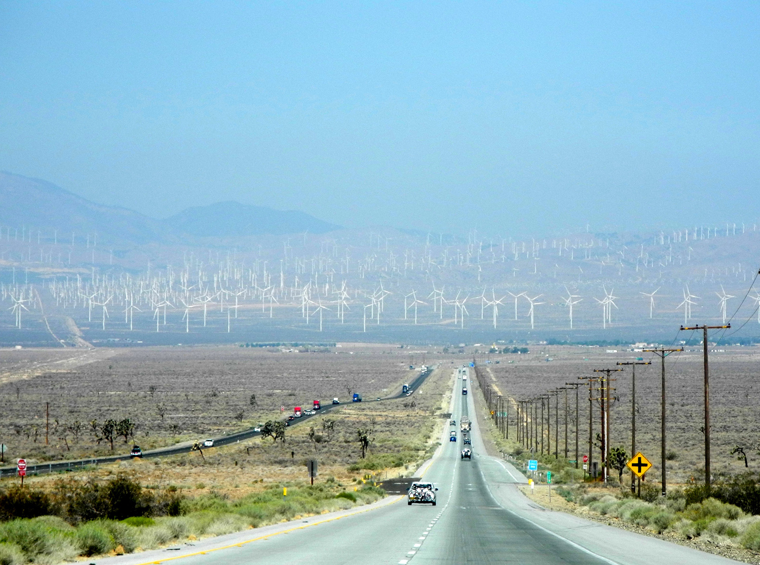
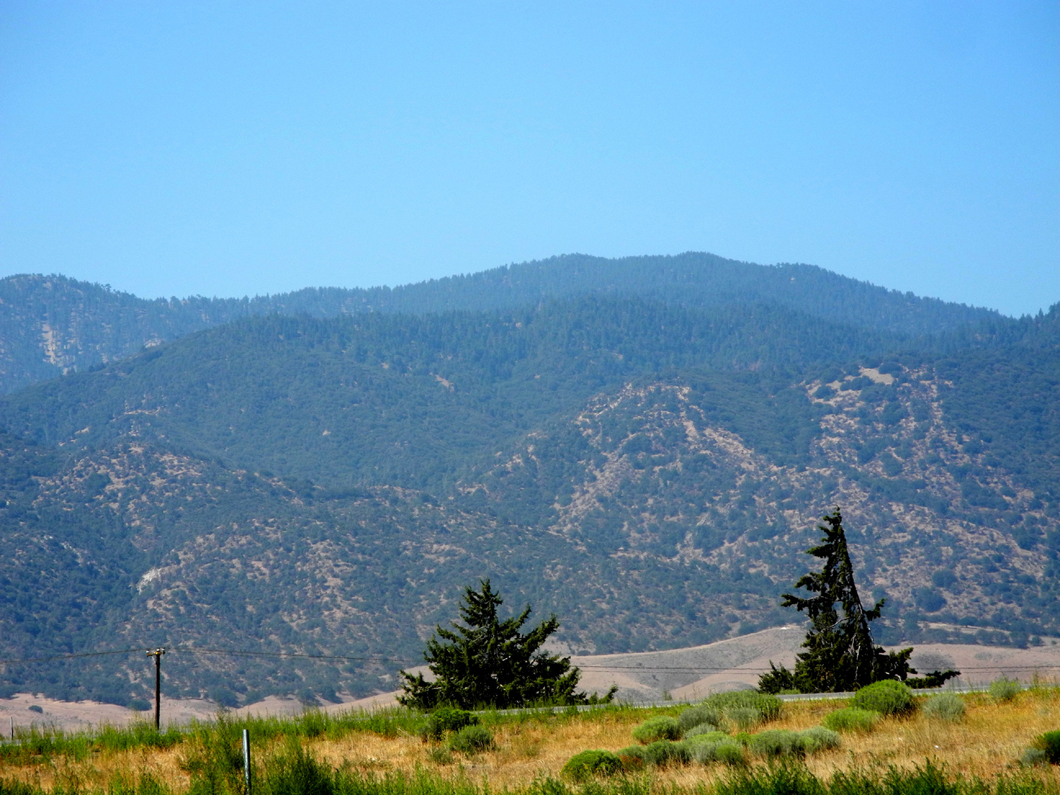