

|
Hiking
& Hockey San
Luis Reservoir, Gilroy, Morgan Hill, Henry Coe State Park,
Uvas Canyon, San Jose Sharks - January 24 - 27, 2017 |
| |
|
Photos
Related Links
More
Travel Reports |
| |
|
Westbound
Henry Coe State Park
Uvas Canyon
Sharks
vs. Oilers
Eastbound |
| |
|
Westbound:
Every year I try to
attend a San Jose Sharks hockey game, usually with my grandsons.
This year we planned our trip for the game against the Edmonton
Oilers on January 26. It would be Johnny and his wife Brittany,
Mikie and his girlfriend Lizzie, and myself.
In the early years it was
just Mikie and I, and we would stay overnight in a motel in Morgan
Hill. When Johnny started going, he would drive, and we would return
after the game, due to school or work obligations.
This year I decided to
partly revive the old tradition, driving over by myself a day or two
before the game, and doing some hiking in Henry Coe State
Park, east of
Morgan Hill in the Diablo
Range. I've been wanting to explore this park for a number of
years. During my advance preparation I looked up "things
to see and do" in Gilroy and Morgan Hill. Most of them were
wineries, which hold no interest for me, but I found three museums
and a county park that offered good hiking in the hills west of the
city.
I made reservations at
the Quality Inn in Morgan Hill, one of the motels Mikie and I had
stayed in previously. It hasn't been improved in the ten years since
I was last there; the quality is in name only.
The way to San Jose is
north on State 99, west on State 152 through Los Banos and over
historic Pacheco
Pass, then north on US 101. The state road joins
101 at Gilroy, then it's about five miles to Morgan Hill, and
another 25 to downtown San Jose. It was mostly sunny from home to
the place where Highway 33 joins 152 from the south, then I got into
fog. Visibility was good most of the time, although there were a few
thick spots where slower speeds were required.
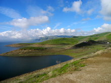
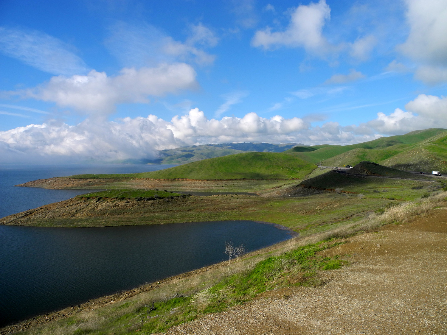
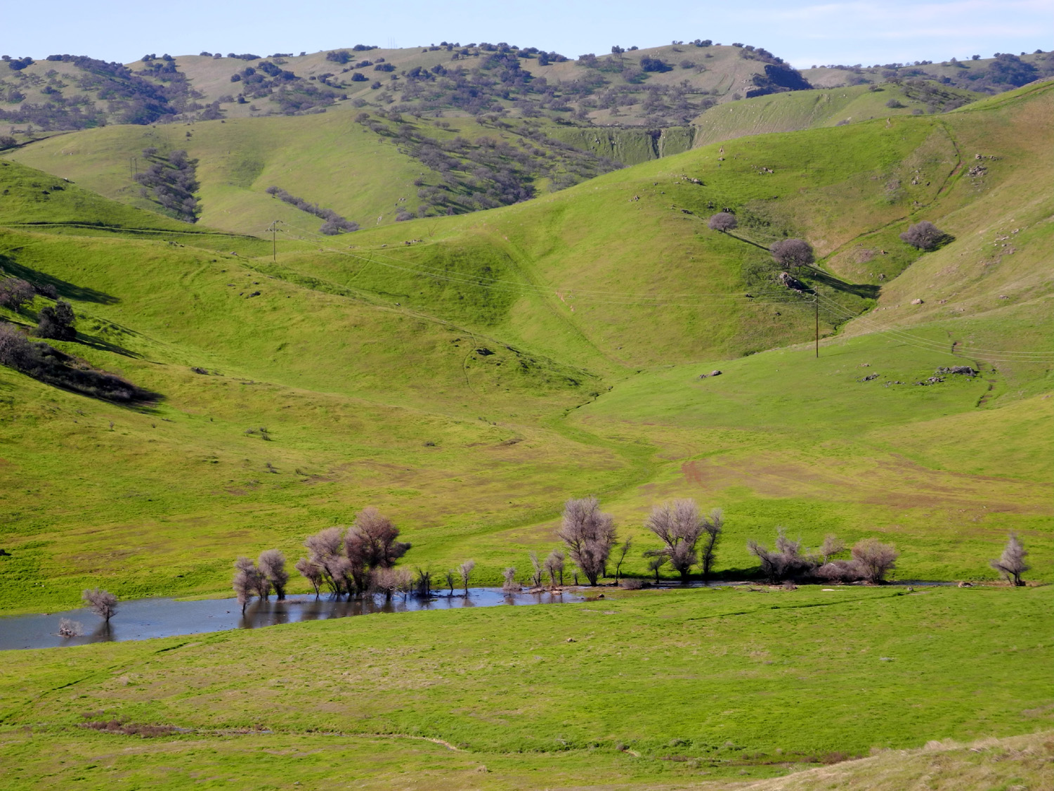
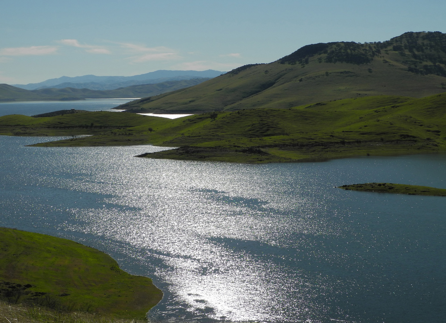
Highway 152 goes by the San
Luis Reservoir, a large "off-stream" storage lake
where the road starts up hill from the San Joaquin Valley, and it
was sunny from this point on. Most of the
water here comes from northern California through the California
Aqueduct and the Delta-Mendota Canal. Thanks to a record rain year,
everything there is green, and the lake is nearly full - a special
delight since it was at a historic low of 10% capacity only last
year. I made the first stop of my trip at the Romero Visitor
Center, which
offers displays explaining the California Water Project, as well as
views of the lake and hills (and not coincidentally, a bathroom).
I took some photos of
the water, trees and green hills, then went another mile or so and
stopped for more pictures beside the road where I had a good view
down into one of the many small canyons that run
into the lake.
I had plenty of time
before my 3 p.m. check-in, and had decided to visit the Gilroy
Museum. I have driven through Gilroy on the highways many times in
the last 20 years, but had not been in the downtown area for
decades. I followed my GPS instructions into the old part of town,
where I recognized an old building with a clock tower that I had seen when
I changed buses near there on my way to Fort Ord for basic training
in 1962.
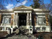
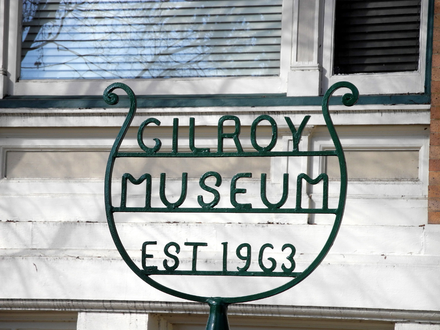
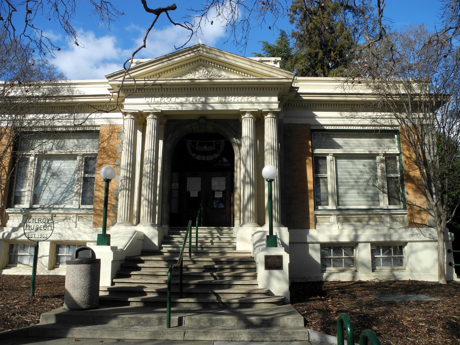
It was not far from there
to the museum, which is located in the old Dale Carnegie
Library,
dating back to the early 20th century. Among the things I learned
there was that the building with the clock was originally the city
hall, and is now a restaurant. I also found out where the name "Gilroy" came from.
John Gilroy was born in Scotland in 1794, and arrived in Monterey in
1814. He learned Spanish, became a Catholic and Spanish citizen, and
eventually worked his way north to what is now the Santa Clara
Valley. He worked at a ranch there, married the boss's daughter,
Maria Ortega, and had 17 children. How could the town NOT have
been given his name?
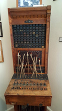
The woman who greeted me
when I entered the building was also part of the history of Gilroy.
Betty went to work for the telephone company when she finished high
school in 1947, earning 49 cents per hour. In the museum there is an
old-style
switchboard, and
on the wall next to it a photo of Betty and other operators seated
in front of a similar board in 1949.
After looking over
artifacts from the past and displays of photos and other
information, I got back on US 101 for the short drive north to
Morgan Hill. I got settled into my room, and heated some
leftover takeout in the microwave for my supper. I took a short walk
down the street in front, through an area that includes a soccer
complex, an aquatic park, a mobile home dealership, a Harley
dealership, and at least six
other motels. I spent most of the evening getting caught up on
reading, and got to bed early to be ready for my big hike of the
next day.
|
| |
|
Henry
Coe State Park: The temperature got down
below freezing overnight, and when I left at 9:15, I actually had to
scrape ice off the windows of my car. Finding the way to the park
was easy - the first street north of my motel was Dunne,
which goes all the way across Morgan Hill and right into the park.
The trip was short in distance but long in time. The road
rises 2,000 feet in elevation in only ten miles, on a steep, narrow,
winding road where the usual safe speed is 20 MPH. It was also
a very scenic drive, past a lake and a
waterfall, through canyons
filled with oaks, bay, madrone and other trees.
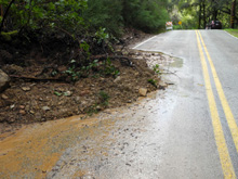
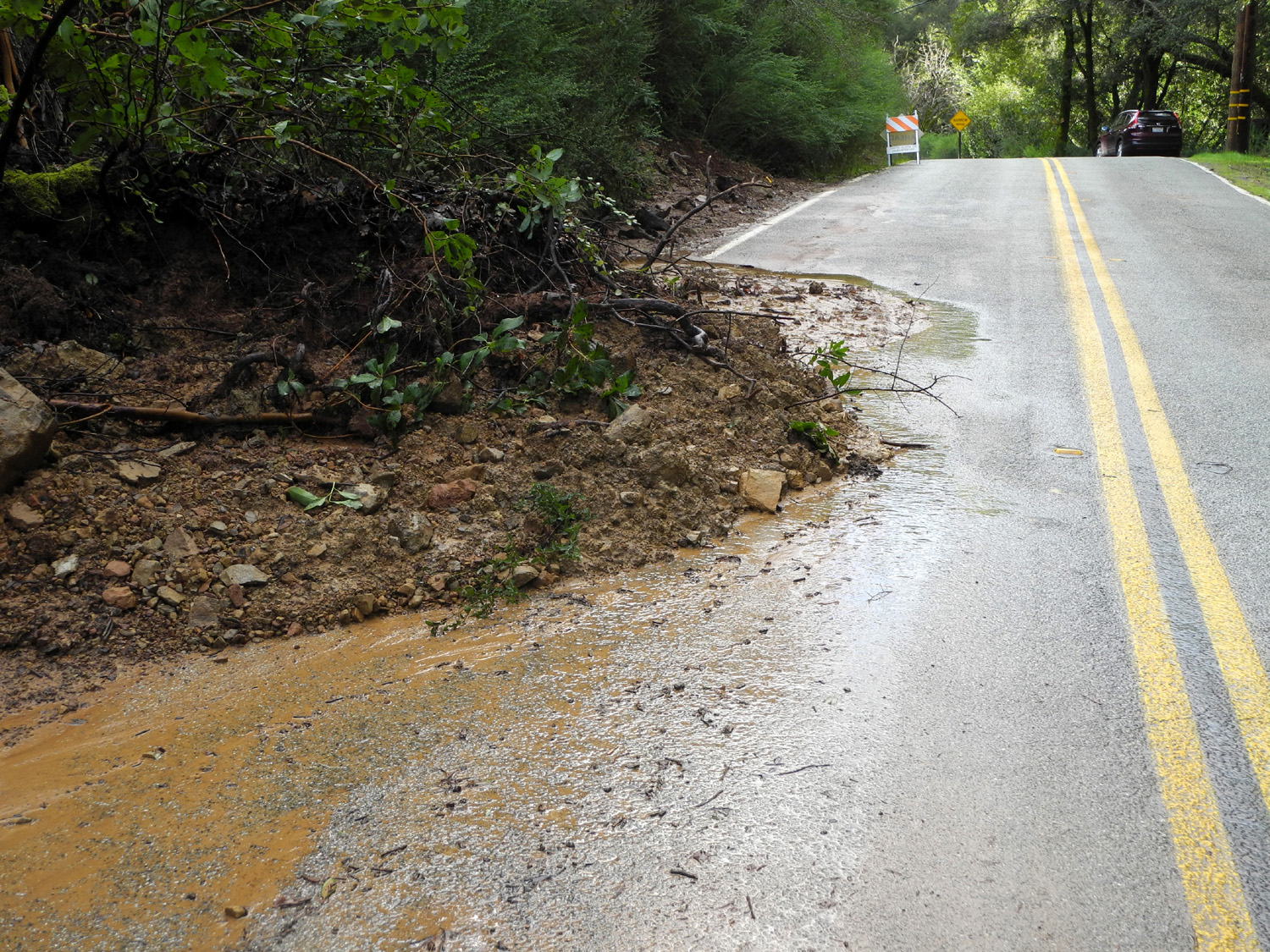
Because of the heavy rains, there have been slides all along the
road. Everything had been cleaned up, but I could see where dirt had
washed down in places as much as 100 feet long.
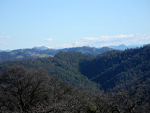
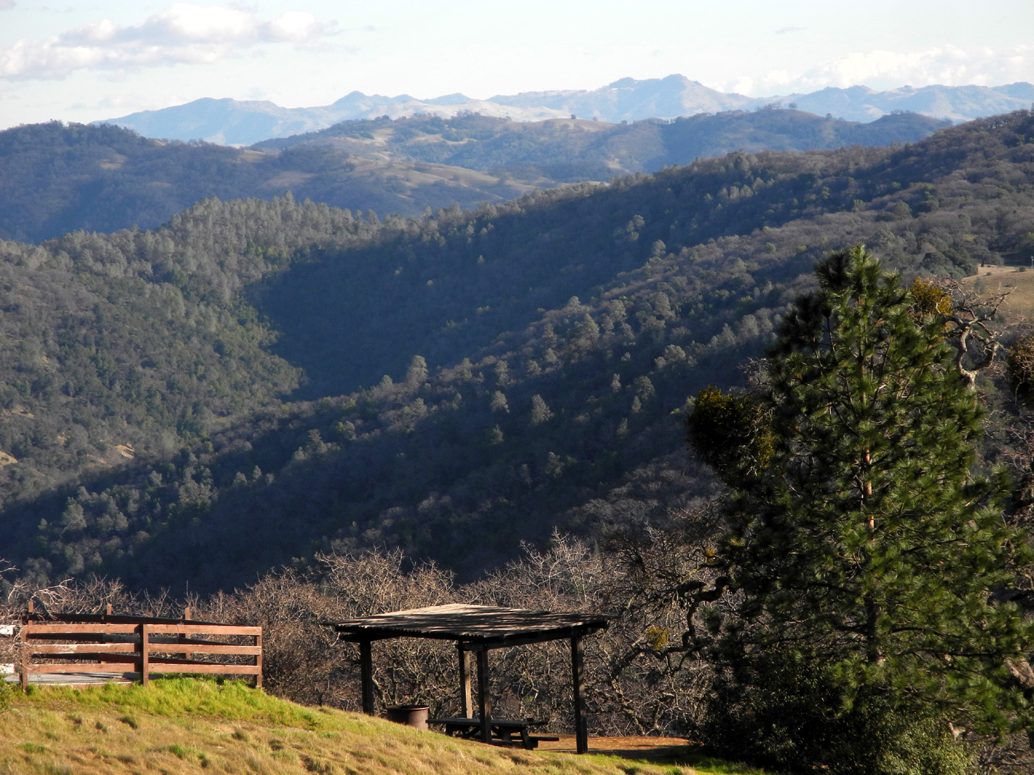
I arrived at the park
entrance and visitor center, situated at about 2,200 feet, and
parked where I had a fantastic view of hills to the south, or maybe
southeast. I always forget I have a compass in my car. I talked with
the ranger on duty about the trails I thought would be best for me,
and was advised that there are some wet spots, and maybe a tree down
across the trail. The entrance fee was $8, so I decided to buy an annual state park pass, since
three park visits will more than pay for the $20 cost.
Where I arrived at the
park is the Coe Ranch entrance. There are a number of other entry
points, some of them open only in certain months. I'd like to check
out the Dowdy Entrance, which goes in from Highway 152 near Casa de Fruita, at the
bottom of the grade below Pacheco Pass. This would be about 30 miles
closer to home, but it's only open weekends from May to September.
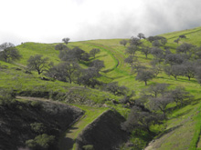
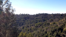
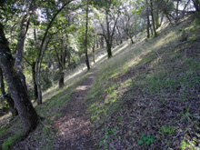
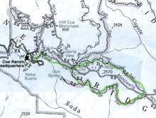
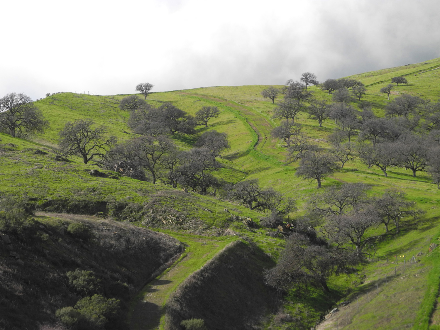
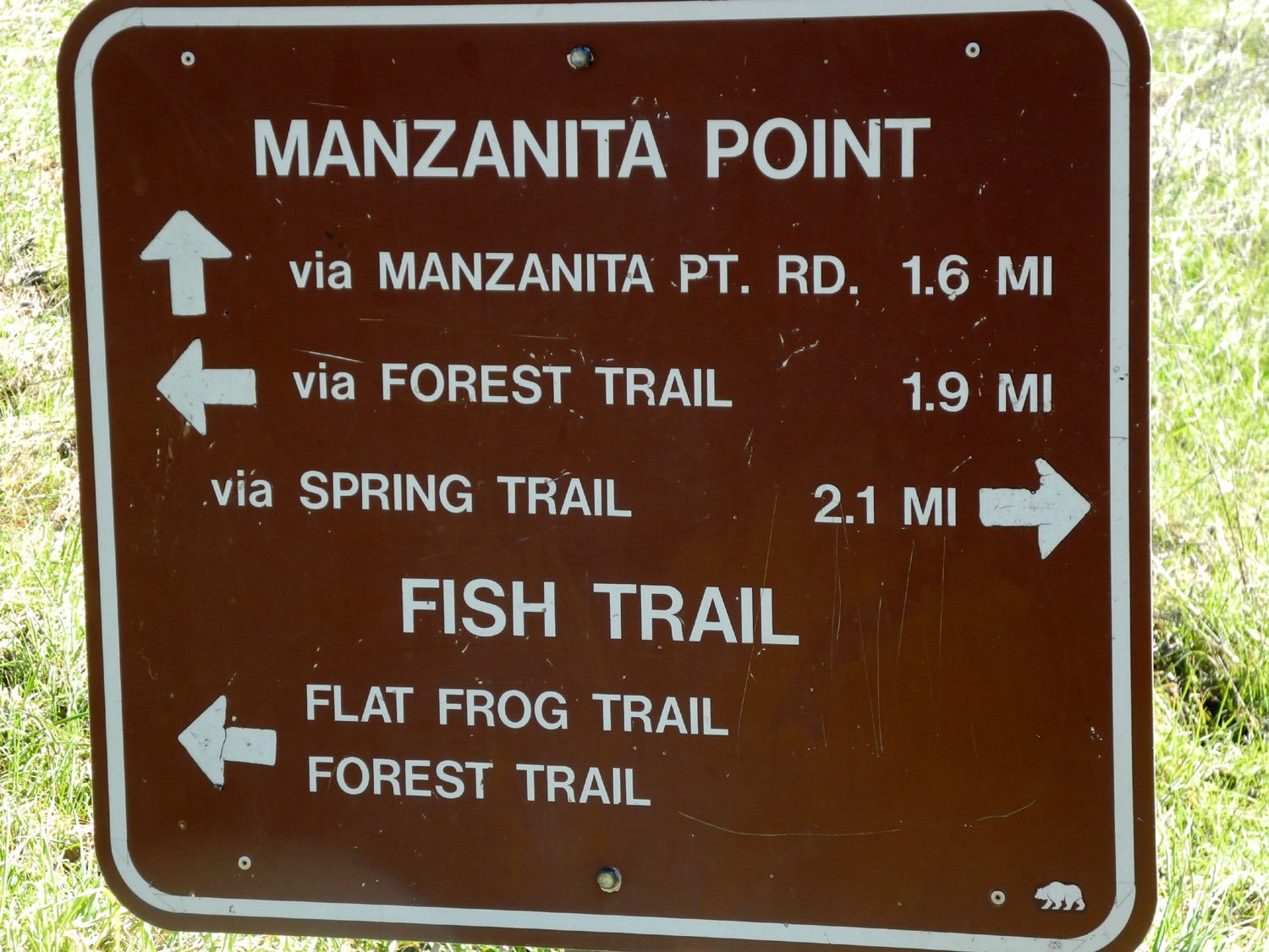
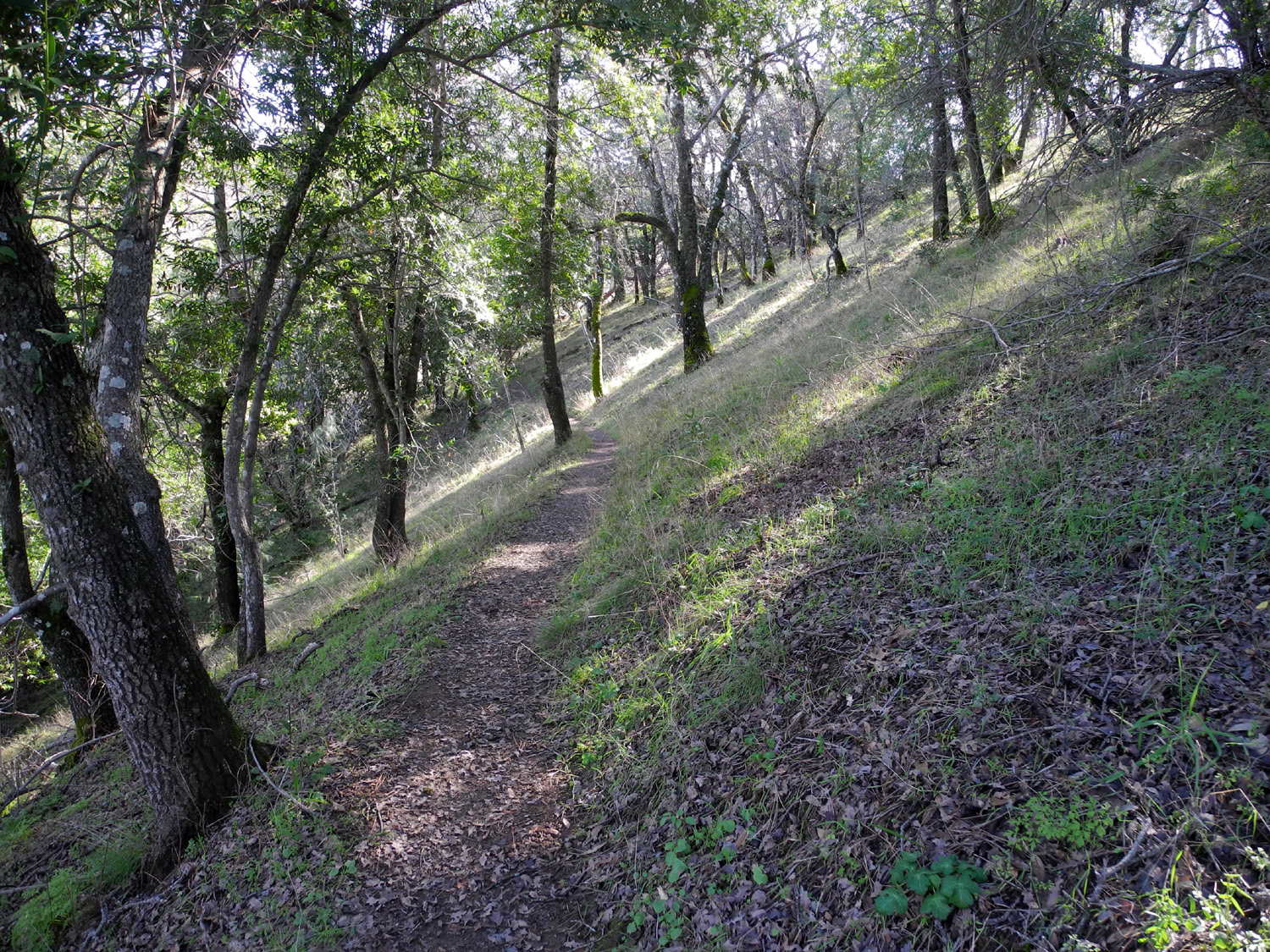
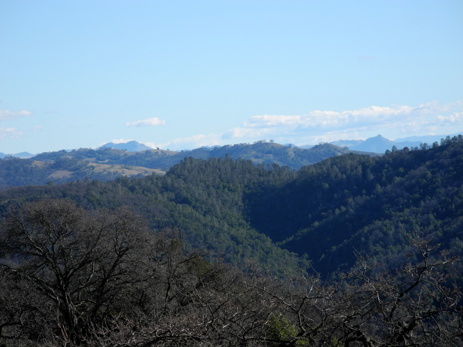
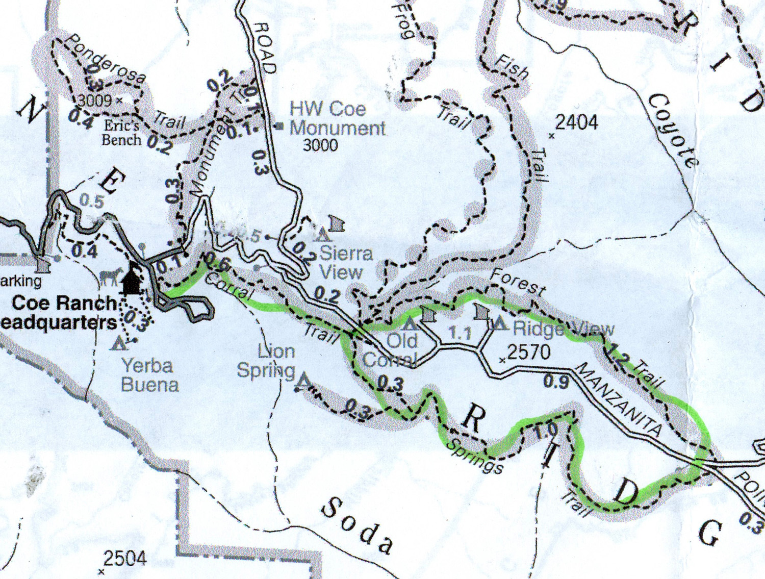
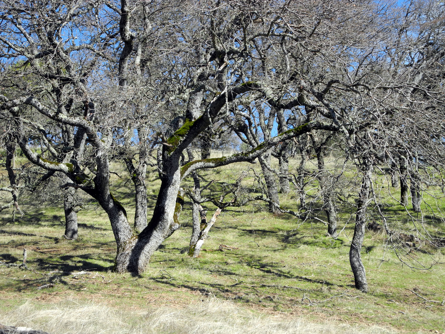
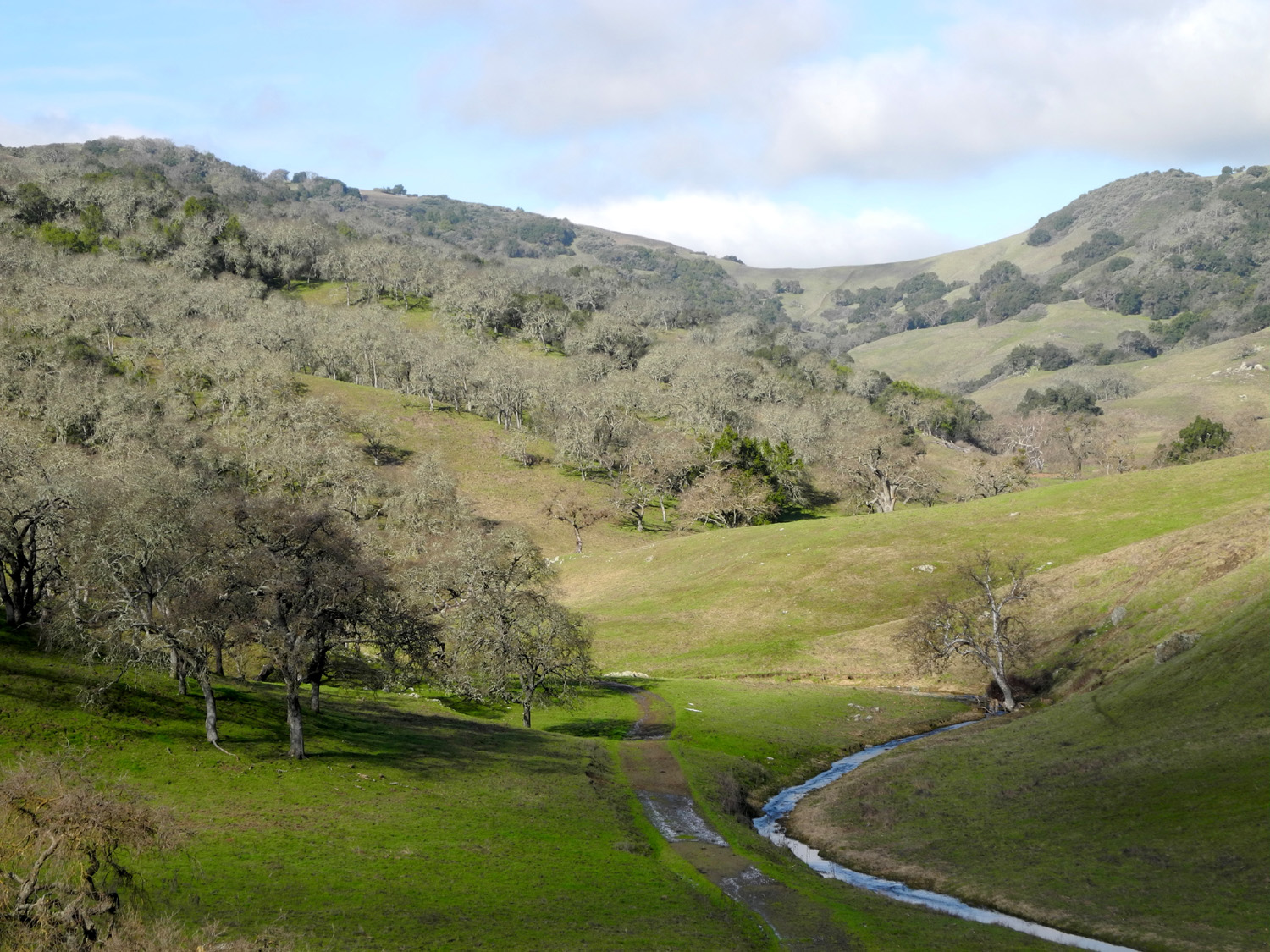
My route was to be a loop
on the Forest Trail and Spring Trail, which are reached by first
taking the Corral Trail right across the road from the visitor
center. This trail runs along the southwestern contours of Pine Ridge
for a half mile, mostly through shady, heavily wooded terrain,
crossing several
creeks. It comes out to a more open area with
valley oaks and blue oaks just before the junction with several
other trails. You can take the Spring Trail to the right, or cross the dirt Manzanita Point Road,
where there
are three choices - the Fish Trail, the Flat Frog Trail (very
temping just for the name), and the Forest Trail. It is called
"Grand
Junction," but maybe it should be
3-F Junction.
As planned,
I took the Forest
Trail to the right, first picking up a copy of the trail guide that
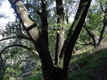
identifies trees and plants marked by numbered posts along the way.
I immediately left the grassy oak savannah and entered a
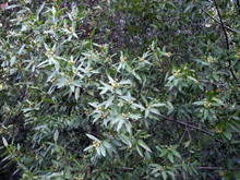
shady area of large and small trees and bushes. One off the more
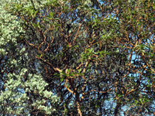
interesting aspects of this hike was seeing the huge bay
trees. In
the Sierra foothills we call them bayleaf, and they are small,
multi-trunk bushes, rarely more than 20 feet tall. In the mountains
near the coast and in northern California;, bay trees may have a base
six or eight feet in diameter, with several large trunks a foot in
diameter rising up 50 feet or more.
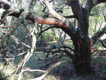
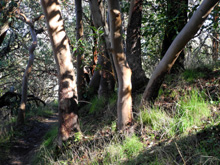
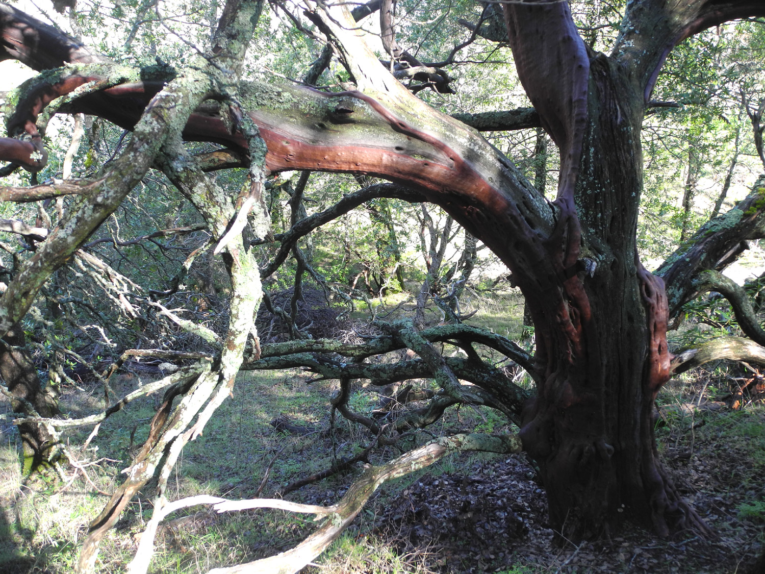
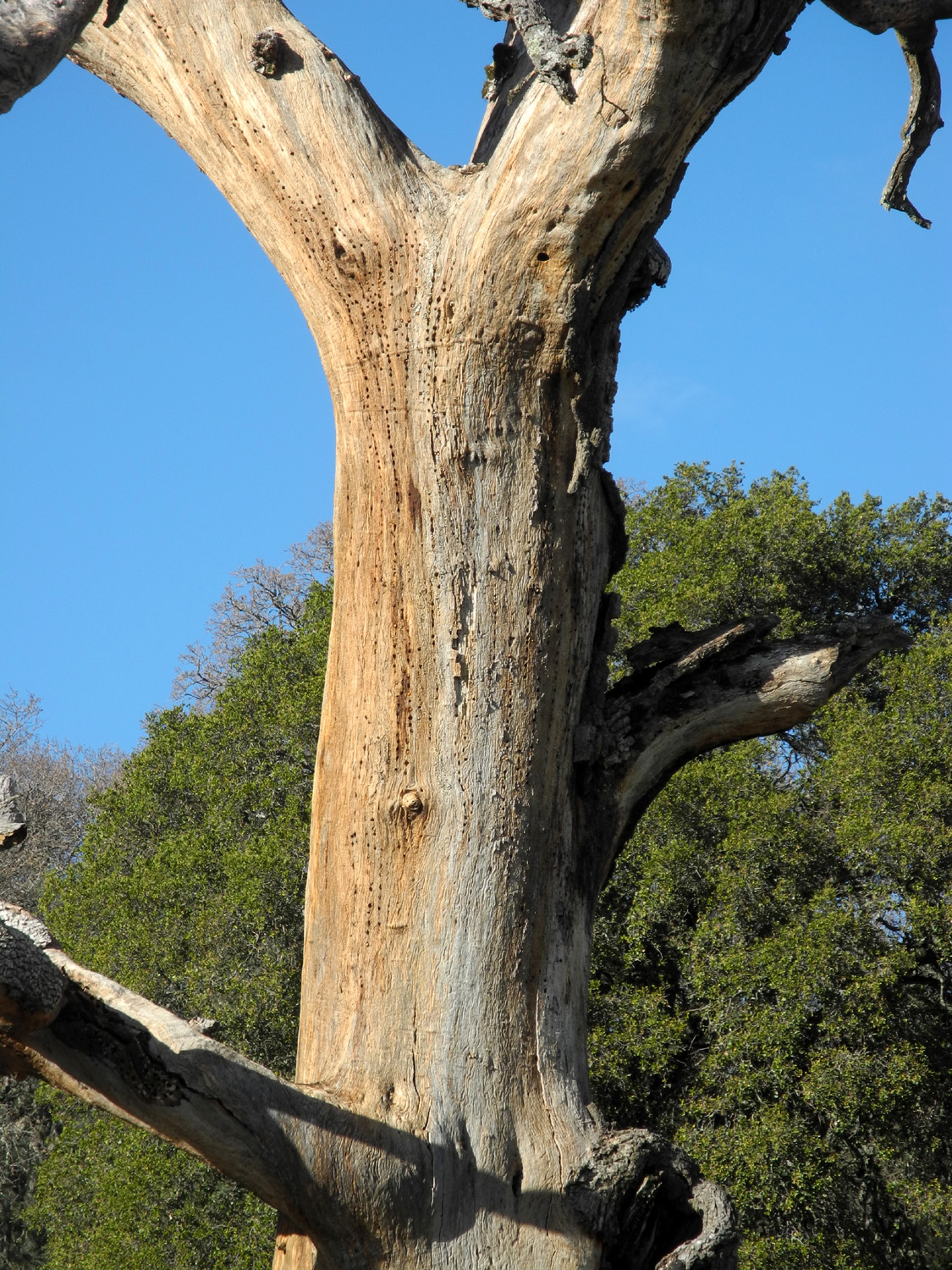
Another typical
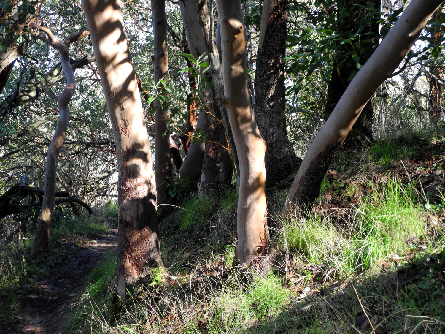
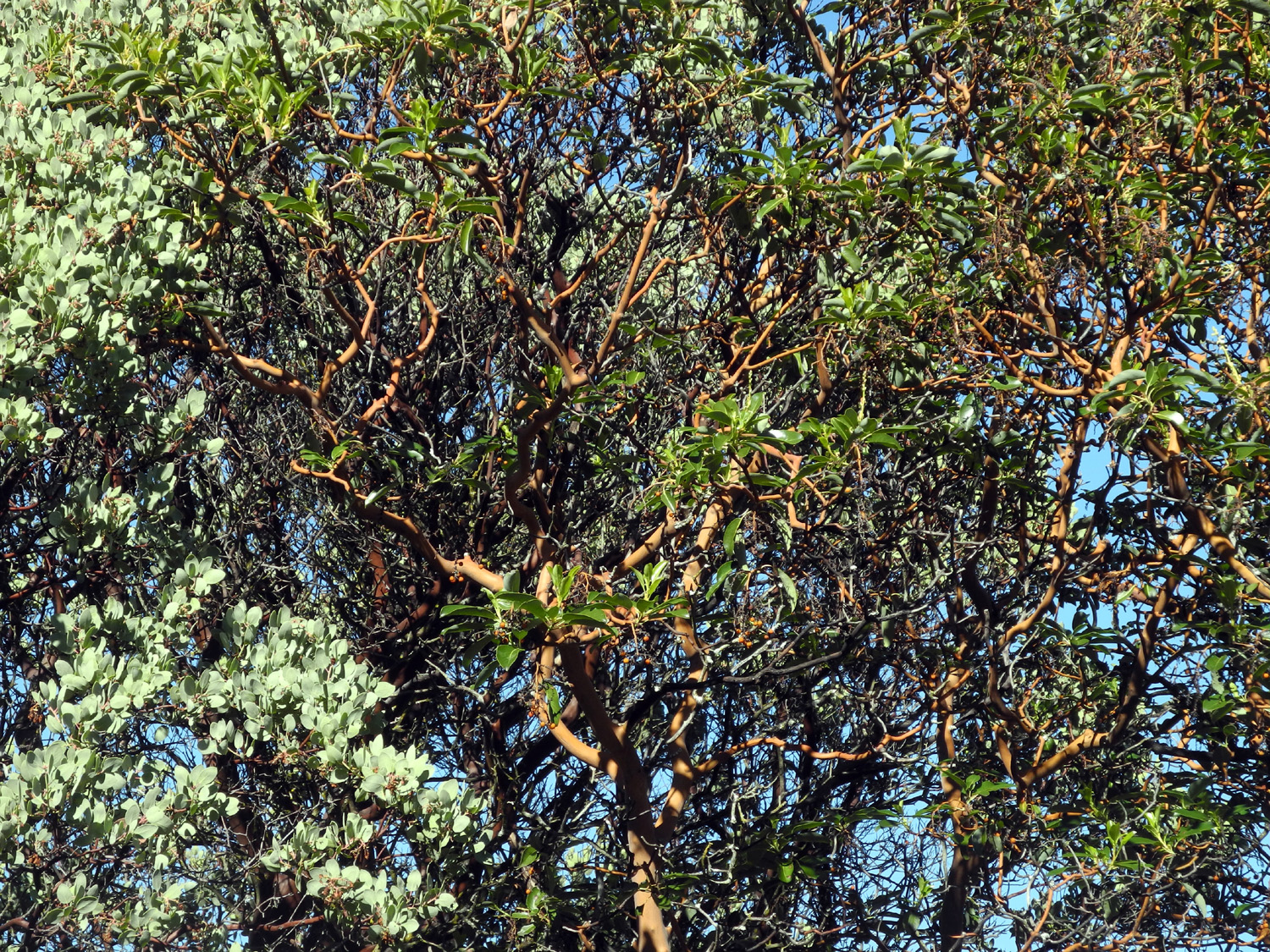
sight in
this terrain is the red trunks of madrone
trees. When I first saw them back
in the early 1970s I thought they were a type of manzanita, and they
are related. Both trees have reddish brown bark, and both shed bark
in strips in the summer. Madrones, however, have large
trunks and grow to as much as 80 feet in height, while manzanita is more like a
bush. Even so, in this area and some other places I've been, there
are some extra large examples of the
latter. Other frequent trees along this trail are black oaks, live oaks, bull pines and a few ponderosas.
Ponderosas rarely appear below 3,500 feet in the Sierra, but it's
believed the moister coastal air in the Diablo Range allows them to
survive here.
The Forest Trail runs
high up along the canyon of Coyote Creek, the main drainage of these
mountains, and I was told at the visitor center that it has been up
to 40 feet across in some areas. Fourteen inches of rain will do
that. The trails I was on do not get close to the creek, but I
presume all the small streams I crossed run into it.
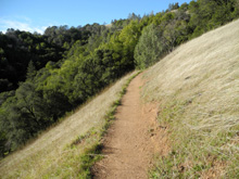
The trail was relatively
level throughout, with some gentle ups and downs, but never any
steep sections. It was also very narrow, making it difficult
sometimes to place my hiking poles. It was also virtually deserted.
I believe I saw four other solo hikers, and a group of five or six
on the entire route.
Just before crossing
Manzanita Point Road again and meeting with the Spring Trail, the Forest
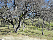
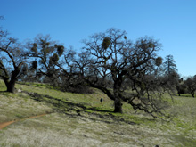
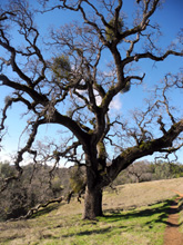
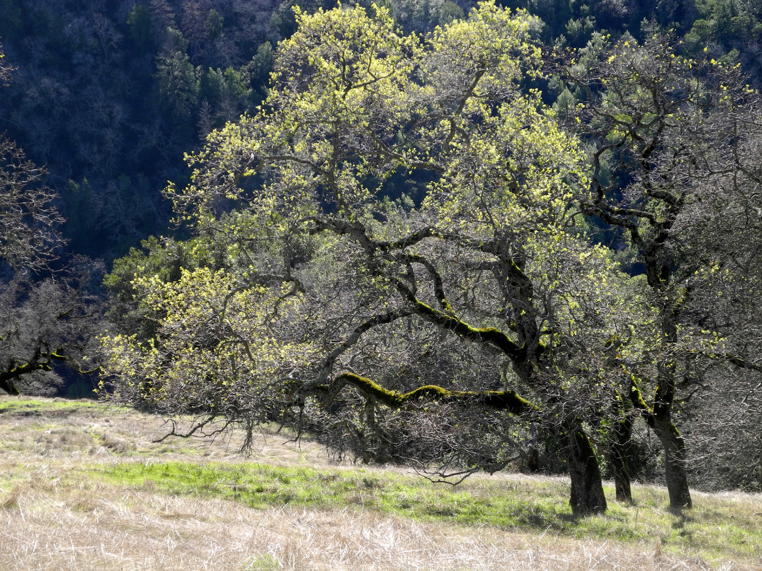
Trail emerges from the deep woods into more open, grassy terrain,
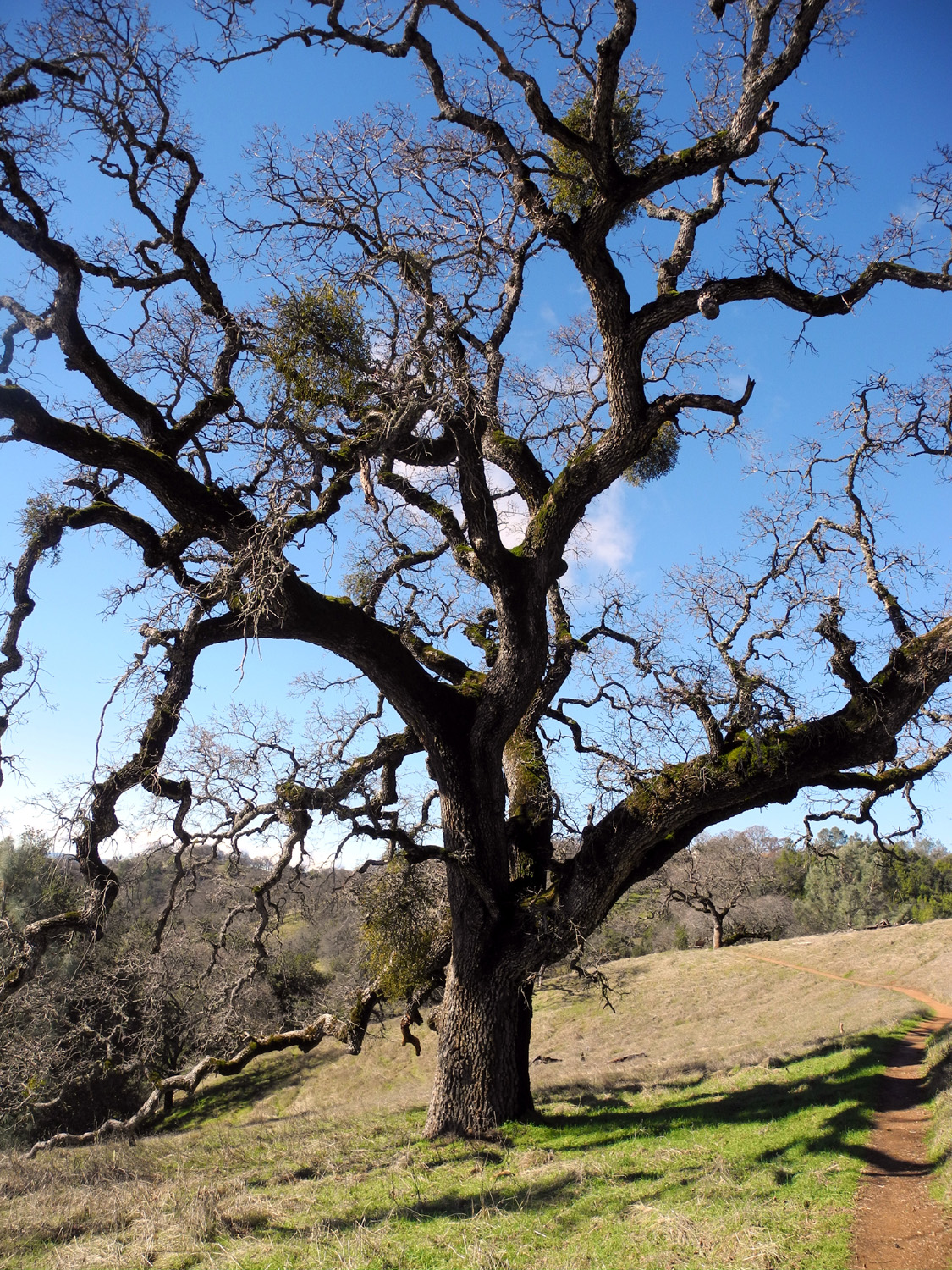
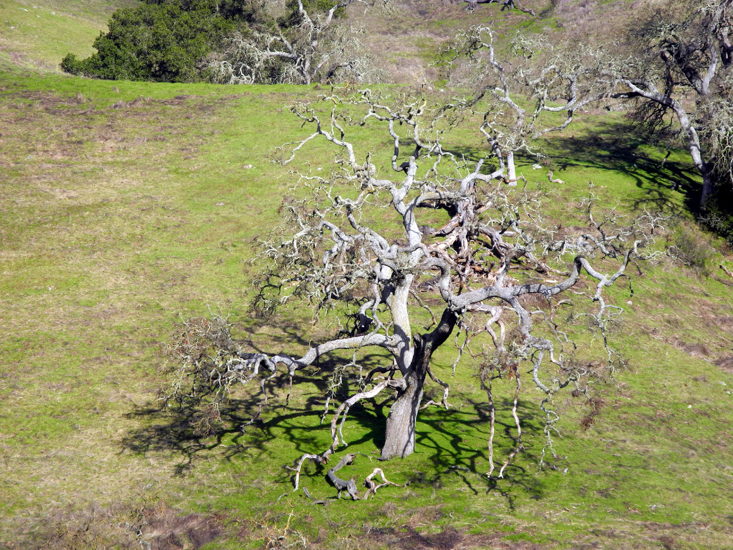
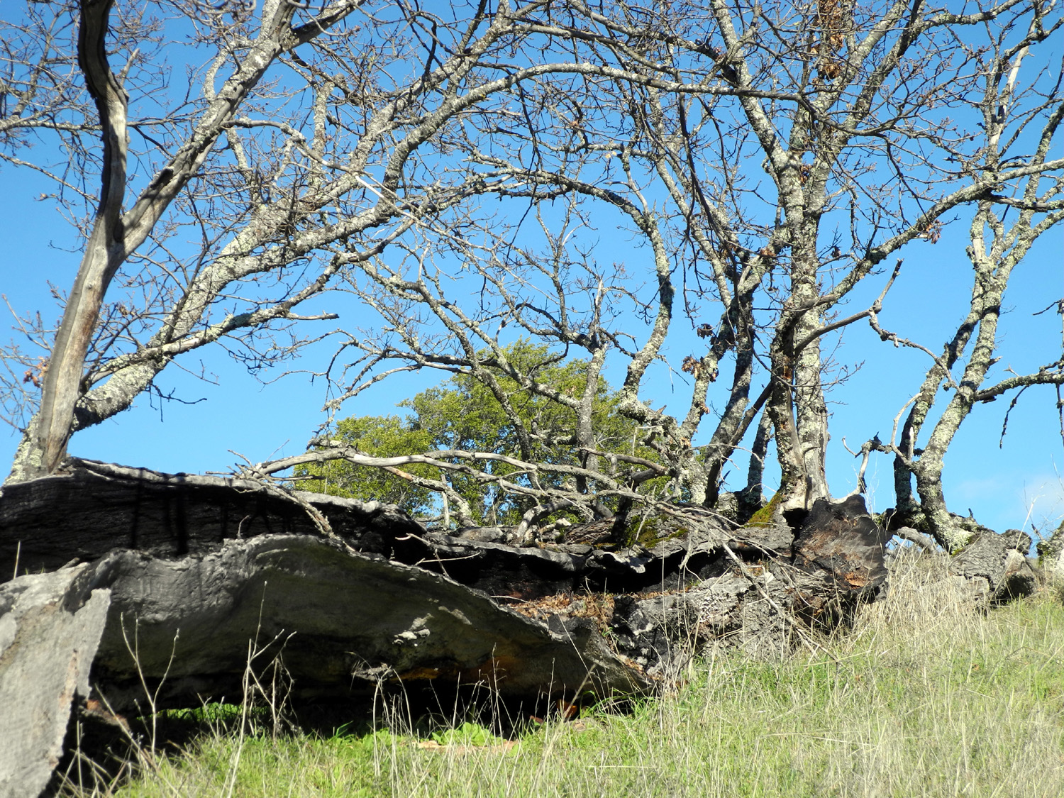
again with many blue and valley oaks. There are a number of large
oaks that have lost a big branch or two, some that have
fallen, and
some that are dead but still
standing. In every condition they area a delightful part of the scenery.
At one place along the
Spring Trail I passed by what I thought of as a "tilted
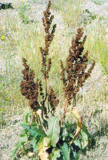
meadow." This was a grassy slope above the trail, with water
running and seeping on to the trail in several places. Water-loving
plants like dock were growing along the edge. This is obviously one
of the springs that gives the trail its name.
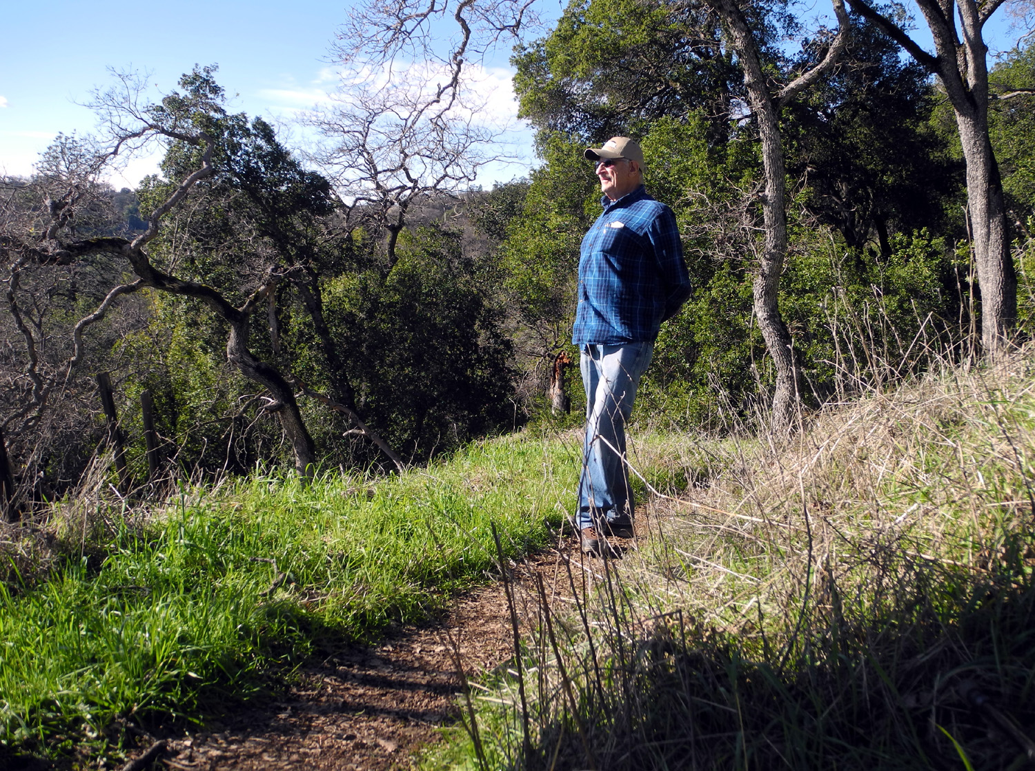
There are benches along
the trails in several places, and I took advantage of one to rest,
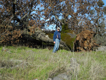
then set up my mini-tripod on it and took a photo of myself on the
trail. After putting the tripod away in my backpack, I was forced to
get it out again to get a photo of myself standing beside a huge
fallen oak tree.
From
this spot it was only a
short walk to my final trail junction, the one I had passed near
the start of my hike, so I was back on the Corral Trail with only a
half mile to go. It's a truism of hiking that you will notice
something going one way on a trail that you missed going the other
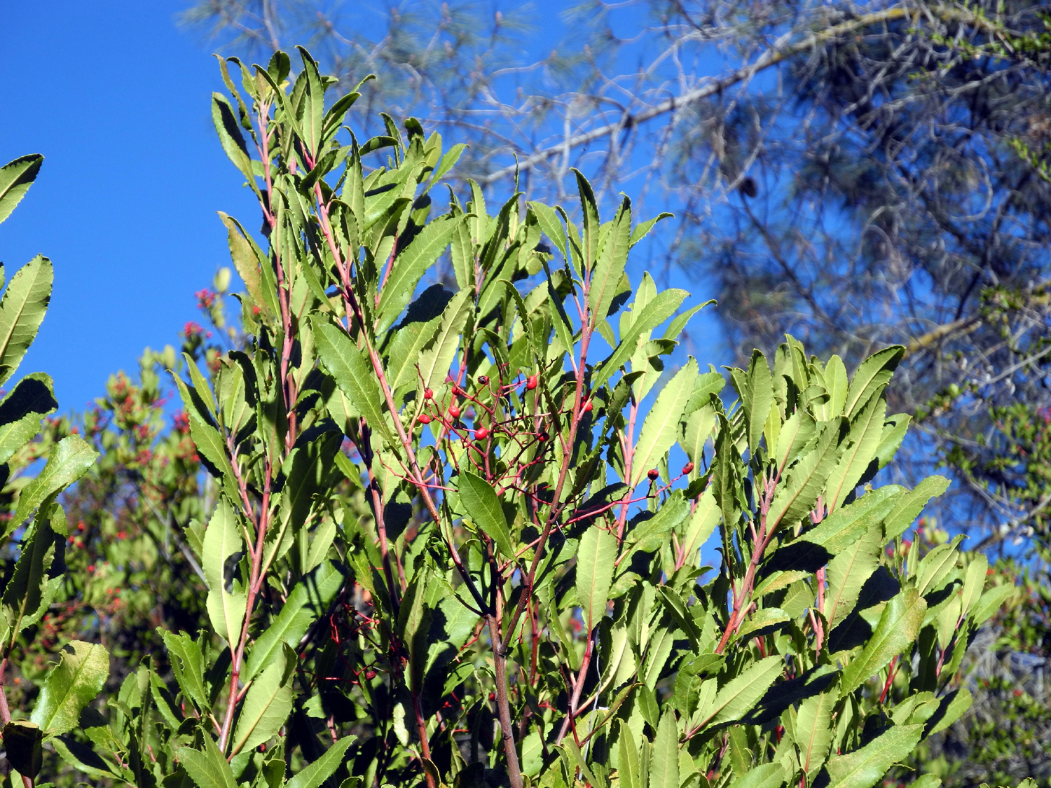
way. This included several plants I read about and saw in the Forest
Trail guide, including toyon, whose red berries
cause it to be called holly in some parts of California. When I'm on
a "one-way" trail, I try to
remember this "two way" rule and turn around. You should
also look to the right and left, and up once in a
while.
When I
got back to the trailhead, I went first to my car and changed out of
my boots. I went into the visitor center and bought two magnets and
a copy of the Forest Trail guide book, which proved very helpful in
writing this report. With a walk of 3.85 miles, I felt I had put in
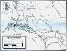
a long, hard day of fun. However, looking at the map of only the Coe
Ranch area, my trail covered a tiny fraction of that section,
and my map showed maybe one fourth of the entire park.
There
was quite a bit more traffic on the road back down, probably due to
the people who live in these hills returning from work in the city.
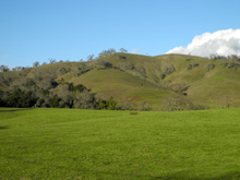
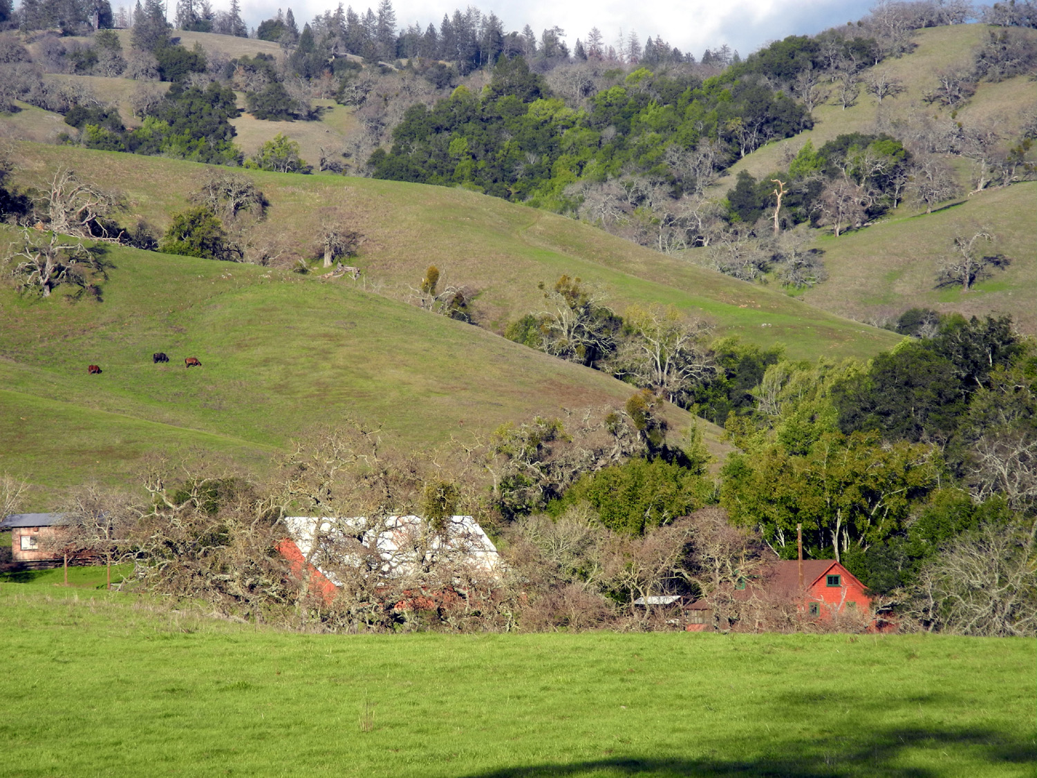
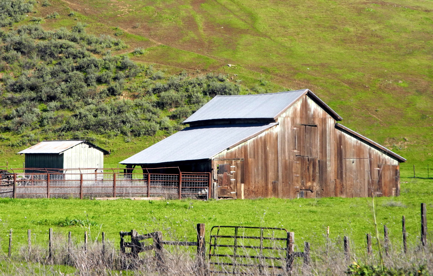
I made one stop, by the Oak
Flat Ranch. This is about the only place that is close to level
along this road. There are big, gently rolling meadows,
and old ranch buildings set up against the hills that rise to the
east. Of course, I did not actually step onto the ranch property,
but I had a good view from the road.
I had
eaten a fairly good breakfast, and had a snack on the trail, but by
the time I got to the bottom of the hill I was quite hungry. I had
my phone locate the nearest Denny's, and instructed my car's GPS to
guide me there. I had a chicken and sausage skillet dinner, which
was enough to also provide my lunch for the next day.
Photos
|
|
|
|
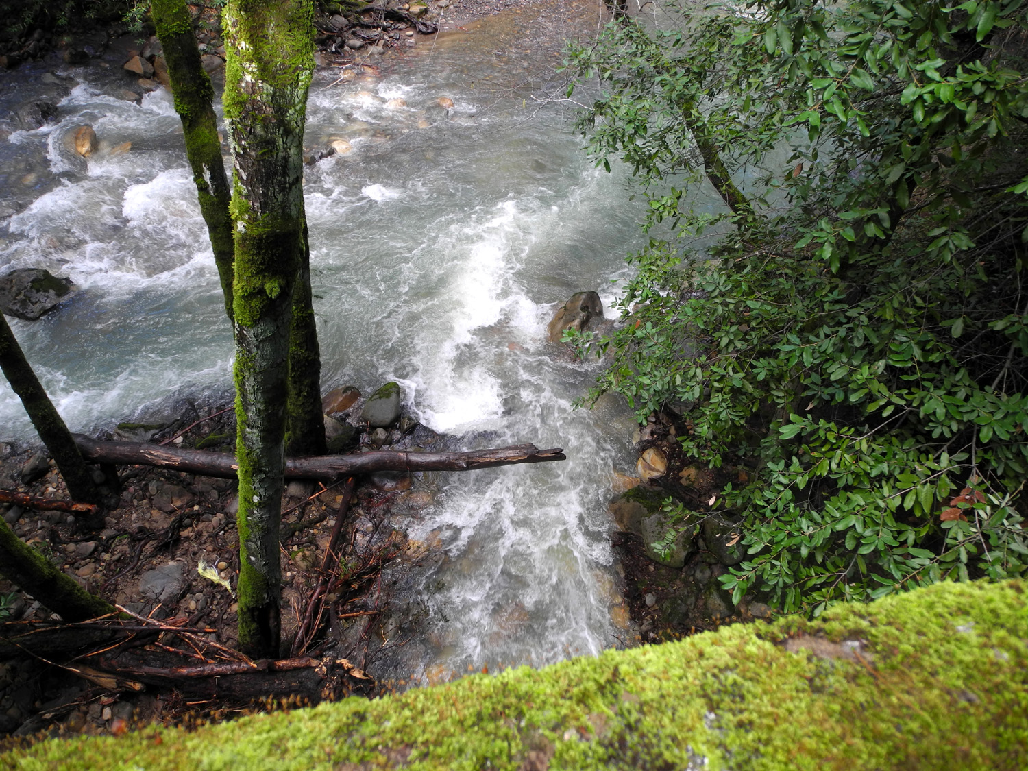
Uvas
Canyon: Since I would not have to leave for the hockey game till
about 6:30 Thursday, I had searched for another place to hike during
the day. West of Morgan Hill in the Santa Cruz Mountains is Uvas
Canyon County Park, a drive of only thirteen miles from my
motel. It had a fairly long loop trail, but I could just hike as far
as I wanted then turn back.
Once I
got out of the city, the drive led through green rolling hills, with
oaks and small
creeks just like the other side of the valley. However, when I
got to the last turn, Croy Road, there was a sign saying that Uvas
Park was closed to all users. It was another four miles from there
to the park entrance, so I decided to drive as far as I could.
This
proved to be a good choice, since I was soon enjoying views of Uvas
Creek, a very large, rushing stream, lined with oak, madrone and
coast redwoods. I stopped to take pictures where Croy Creek, another
good size stream, crossed the road and joined
Uvas Creek. This was also the site of a
slide that had not been cleaned up yet, with mud and tree
branches covering almost all of one lane. Traffic was very light, so
getting past it was no problem.
Eventually
I came to the barricaded park entrance and turned around, enjoying
the drive through the same terrain in the opposite direction.
With
lots of time left in the day, I decided to go to the Morgan Hill
Museum, a quest that turned into a comedy of errors and frustration.
At the location given on the web site there was no museum, but I was
right by the civic center, so I went into the Chamber of Commerce
office to see what I could learn. They said there was no museum in
that area, although there was a historical house. The museum was
"somewhere" on Monterey Avenue.
Back
in my car I finally located an alternate address, and found the
museum. Would it surprise you at this point to learn that it was
closed?
Having
learned more than I had planned about the layout of the City of
Morgan Hill, I returned to my motel, heated up the previous night's
leftovers, and had a late lunch. The rest of the day was spent
resting and reading and looking forward to the game.
Photos |
| |
|
Sharks
vs. Oilers
Back
of the days of Wayne Gretzky,
the Edmonton Oilers won
four Stanley Cup Championships (plus one more after he was traded).
In recent years they have become bottom feeders, which means high
draft picks, and they selected first in 2010, 2011, 2012 and 2015,
and in the top seven for 2013 and 2014. This embarrassment of talent
didn't lead to a playoff spot until (probably) this year. With
Connor McDavid, the 2015 pick, leading the way, they have been in
the top three of their division most of the season. This high rank
is also "Sharks Territory," so a game between the two
teams can make it possible for one of them to move up a spot past
the other in the standings.
The
rest of my party was driving over after work/school and we planned
to meet at our seats inside. I arrived 45 minutes before game time,
and the parking lot was full, only the second time that has
happened. There was equally expensive parking right across the
street, so it was not a long walk to get in. The others arrived just
before the opening face-off, and we settled in for what we hoped
would be the Sharks 7th straight victory. They have won at least 2/3
of the games we've attended, but this was to be the exception. The
Sharks scored first, but that was the end of their offensive
success, and Edmonton put in a total of four, the last one into an empty
net.
Despite
the loss, we all enjoyed the game and getting together. After slowly
making out way out along with the other 17,000 fans, we went in
opposite directions to our cars. They did not get home till 1:30
a.m., while I was back at the motel and in bed long before that. |
| |
|
Eastbound
The
breakfast at my motel left a lot to be desired, but I had brought
some food of my own. On Friday I took three slices of French bread
down to the dining area, toasted it, and picked up some butter. I
then enjoyed a breakfast of fruit and leftover cold cocoa in my
room.
Since
I had nothing on my schedule, I didn't leave till about 10:30, and
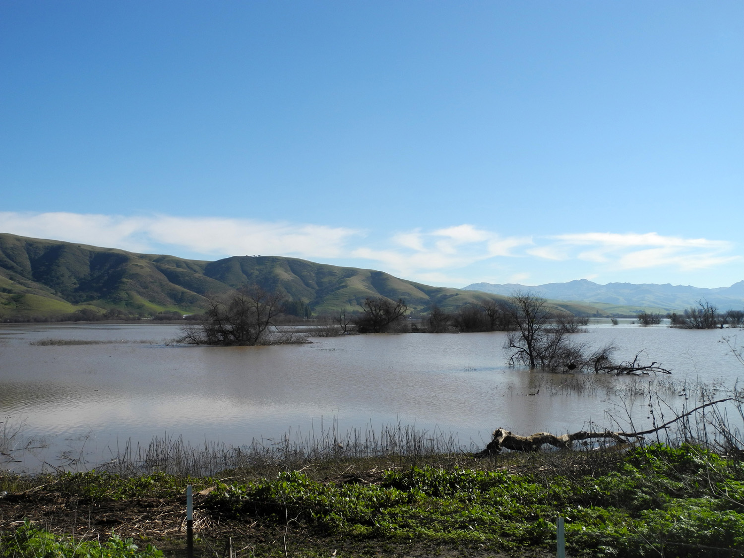
made a couple of photo stops along the way. A few miles east of
Gilroy there is a large area of water, source unknown. I have seen
it up to the road like this
before, but not for maybe 15 years. Usually it's a small,
distant pond. I stopped and got pictures of this "lake,"
as well as a couple of old
barns.
After
I got over Pacheco Pass, I pulled off in a large dirt turnout beside
the highway where people park to walk down to San
Luis Reservoir. There is a trail that parallels the lake, but I
walked up a path that went up and around a hill, then made my way
down the other side. Here I joined the level trail, and walked back
to the car, enjoying the sight of the first
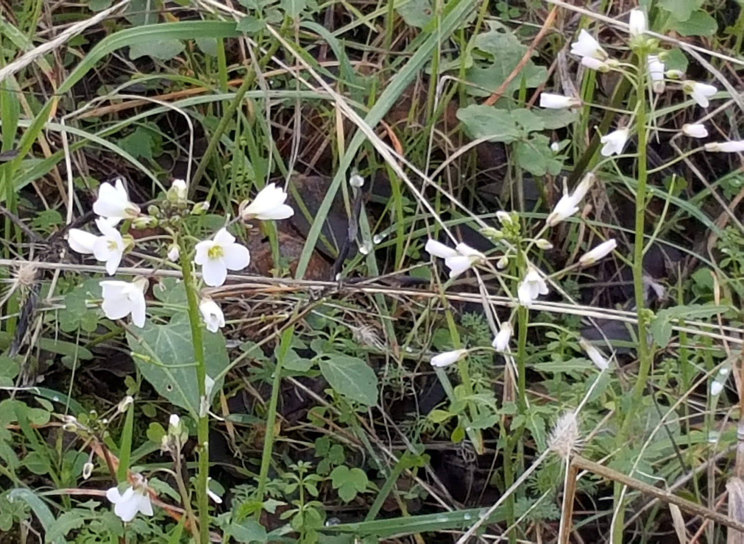
wildflowers of the season.
Although
I was ready to get home as soon as possible by this time, I knew I
was out of certain food items, so I practiced self-discipline and
went to the grocery store first.
I
enjoyed the entire trip, and will definitely be returning to Henry
Coe State Park again.
Photos
--Dick Estel, February 2017
|
| |
|
Photos
(Click to enlarge; pictures open in new window) |
|
 |
 |
 |
|
Clouds
and green hills
at San Luis Reservoir
|
One of many little
canyons
leading into the reservoir |
Gilroy Museum sign |
| |
 |
 |
 |
The museum, a former
Dale Carnegie Library |
A long time before
cell phones! |
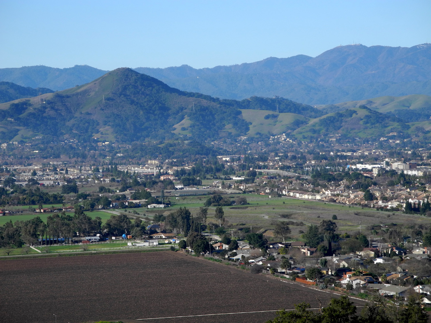
Morgan Hill from a
mile up Dunne Avenue |
|
|
 |
 |
 |
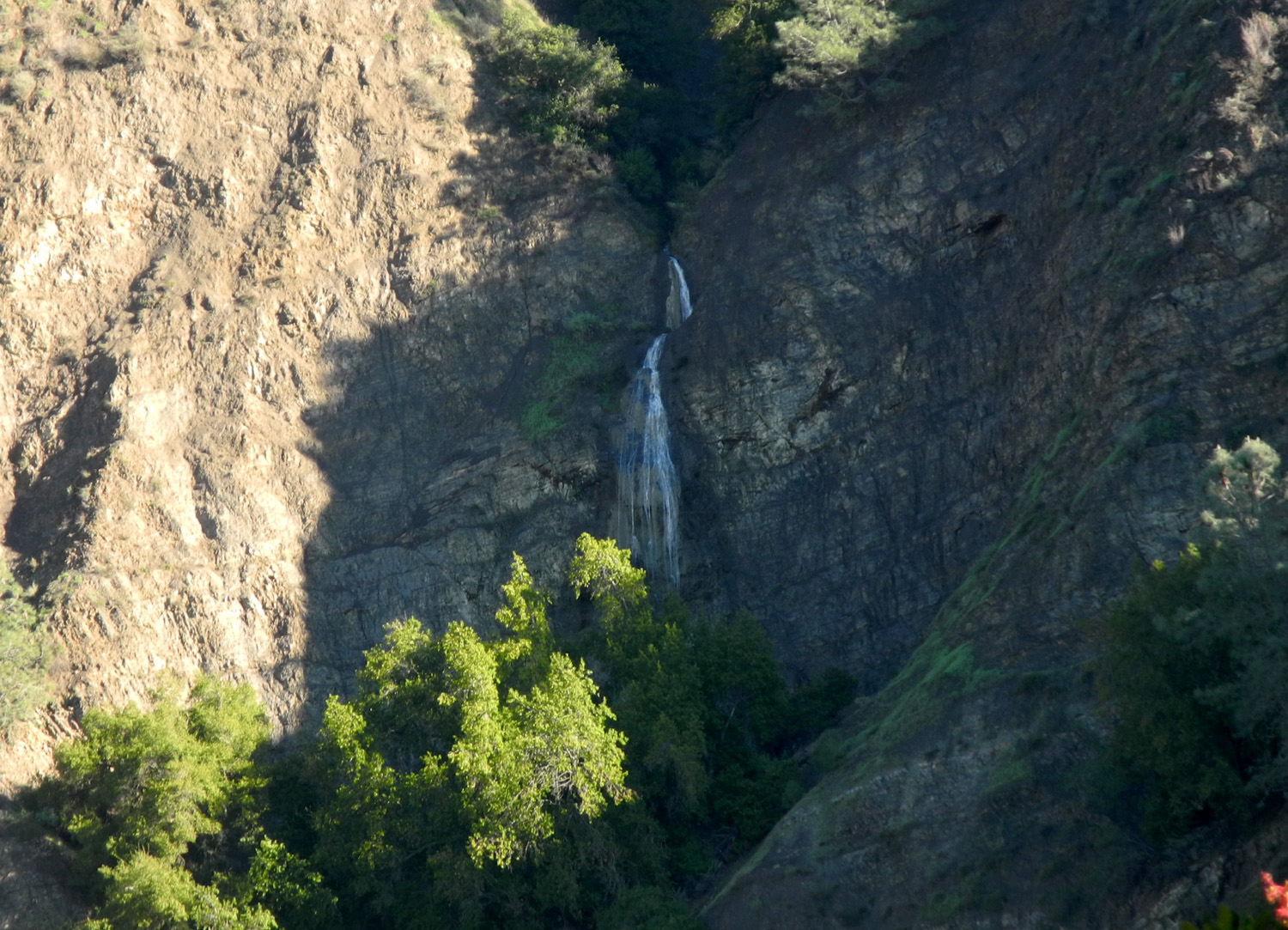
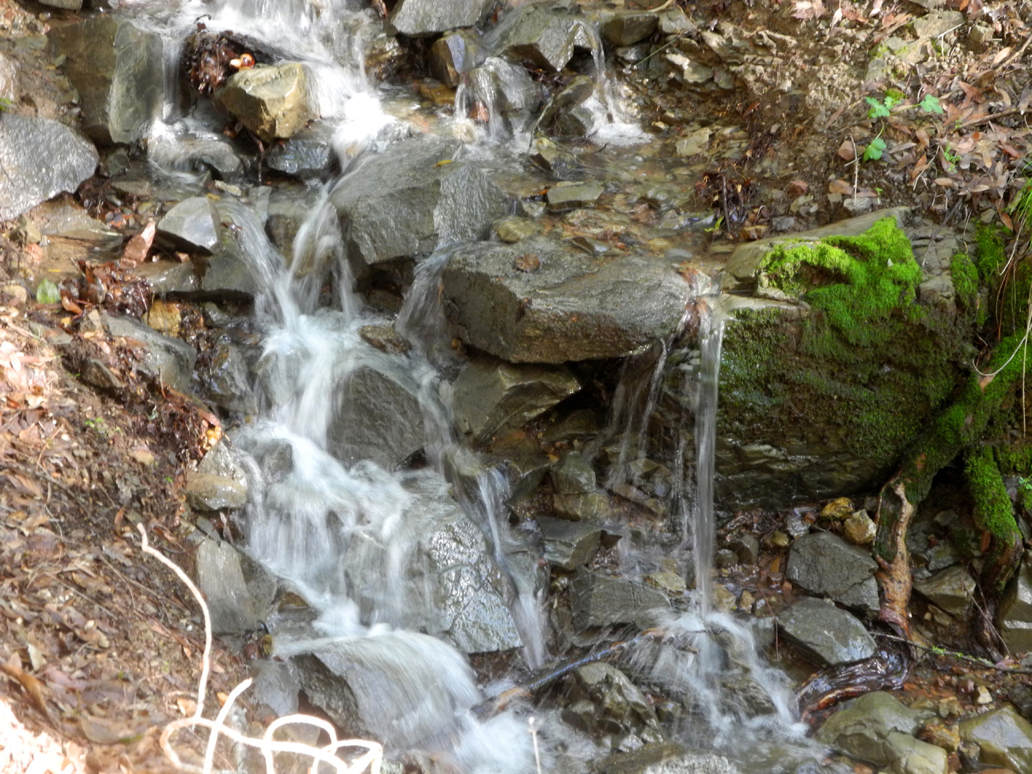
| Small waterfall
along Dunne |
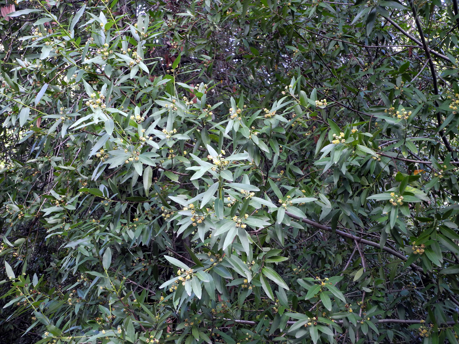
Bay leaves |
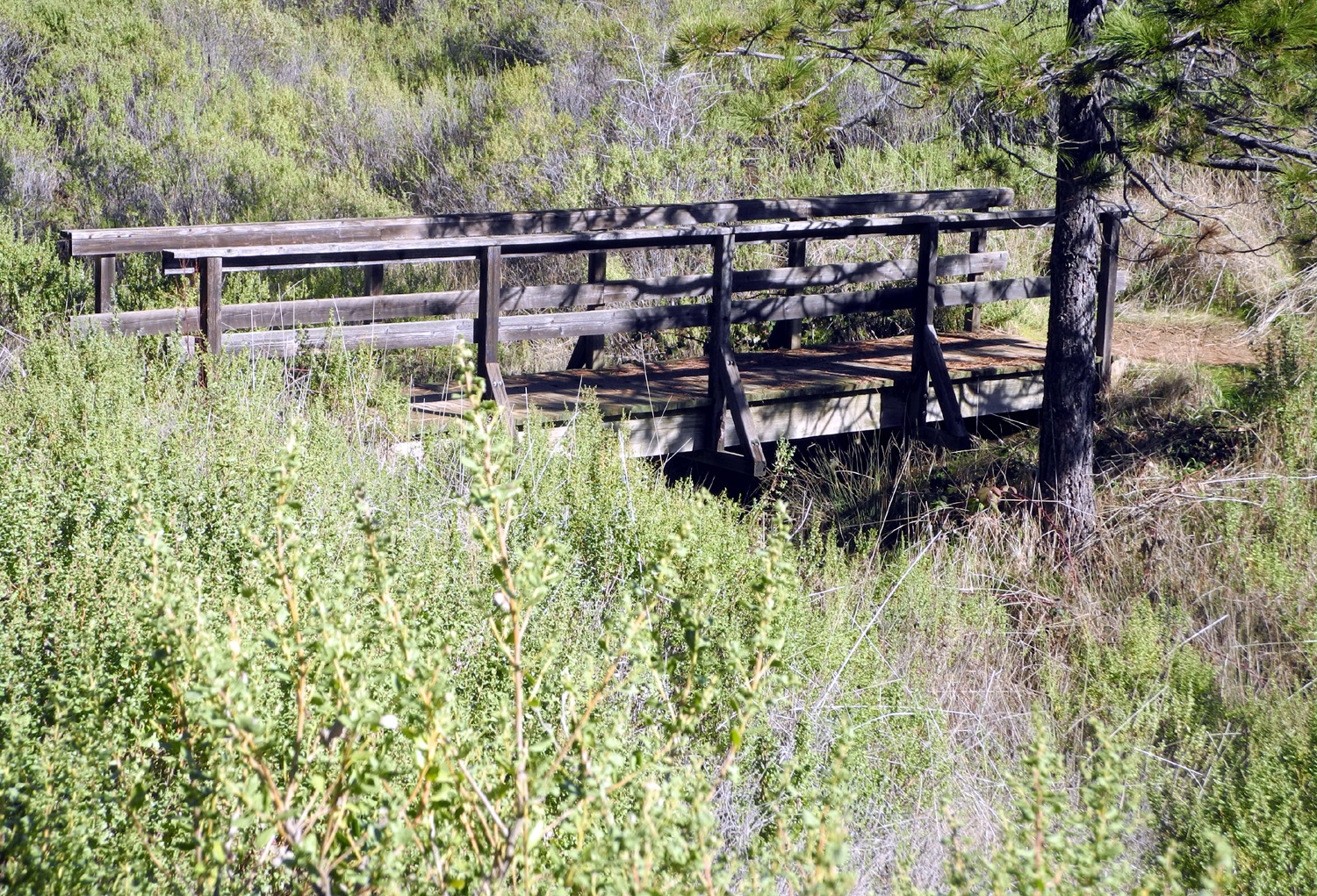
Bridge on the Corral
Trail
near Henry Coe visitor center |
| |
 |
 |
 |
|
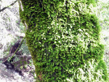
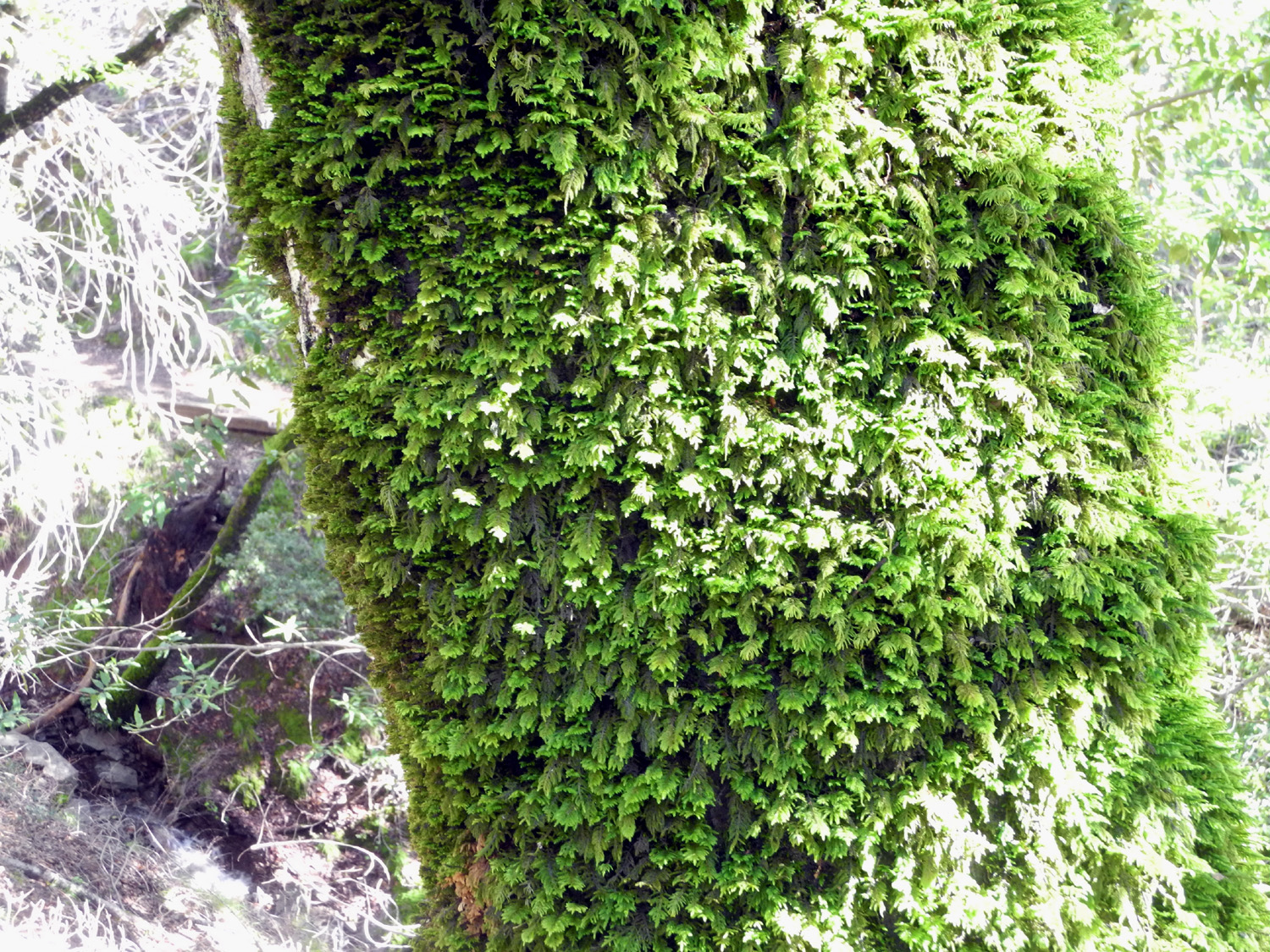
The
wet climate produces thick moss
|
One of many creeks
along the trail |
Ridge
to the west of the Corral Trail
|
| |
 |
 |
 |
| Lots of blue oaks |
A
hiker passes under a big valley oak
|
Another view of the
tree |
| |
 |
 |
 |
| Where decisions must
be made |
The start of the
Forest Trail |
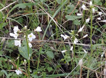
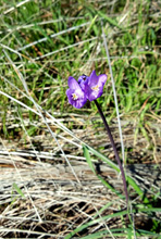
These flowers were
common along the trails |
| |
 |
 |
 |
| A huge manzanita
specimen |
Looking across at
the Fish Trail |
Bay
trees reach a
huge size in this area
|
| |
 |
 |
 |
| There are ferns
everywhere |
Madrone trunks |
The top of a madrone |
| |
 |
 |
 |
| Some of the oaks are
leafing out |
Branches on a fallen
oak become new trees |
Coyote
bush beside the Spring Trail
|
| |
 |
 |
 |
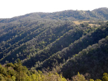
| Looking to the south |
Afternoon sun
streaks this row of ridges |
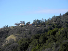
The
park headquarters
from out on the Spring Trail
|
| |
 |
|
 |
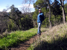
Dick contemplating
the
view on a delightful day |
We know this tree
made
a sound when it fell |
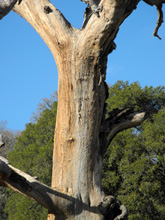
Colorful trunk of a
dead oak |
| |
 |
 |
 |
Most of the trail is
narrow
and runs along steep hillsides |
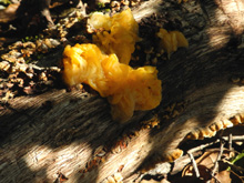
A gooey looking
fungus |
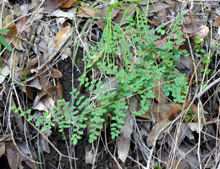
Maidenhair fern |
| |
 |
 |
 |
| Toyon, often called
holly |
The view from the
visitor center |
Oak Flat Ranch,
dating back to 1877 |
| |
 |
|
 |
Oak Flat is the ONLY
flat
place on the road to the park |
A creek on the road
to Uvas
Canyon, west of Morgan Hill |
A gnarly old blue
oak |
| |
 |
 |
 |
Slides were frequent
on
all the roads in the hills |
Where
Croy Creek
runs into Uvas Creek |
Lake or flooding
west of Gilroy |
| |
 |
 |
 |
| Barn along Highway
152 |
Where a little creek
runs
into San Luis Reservoir |
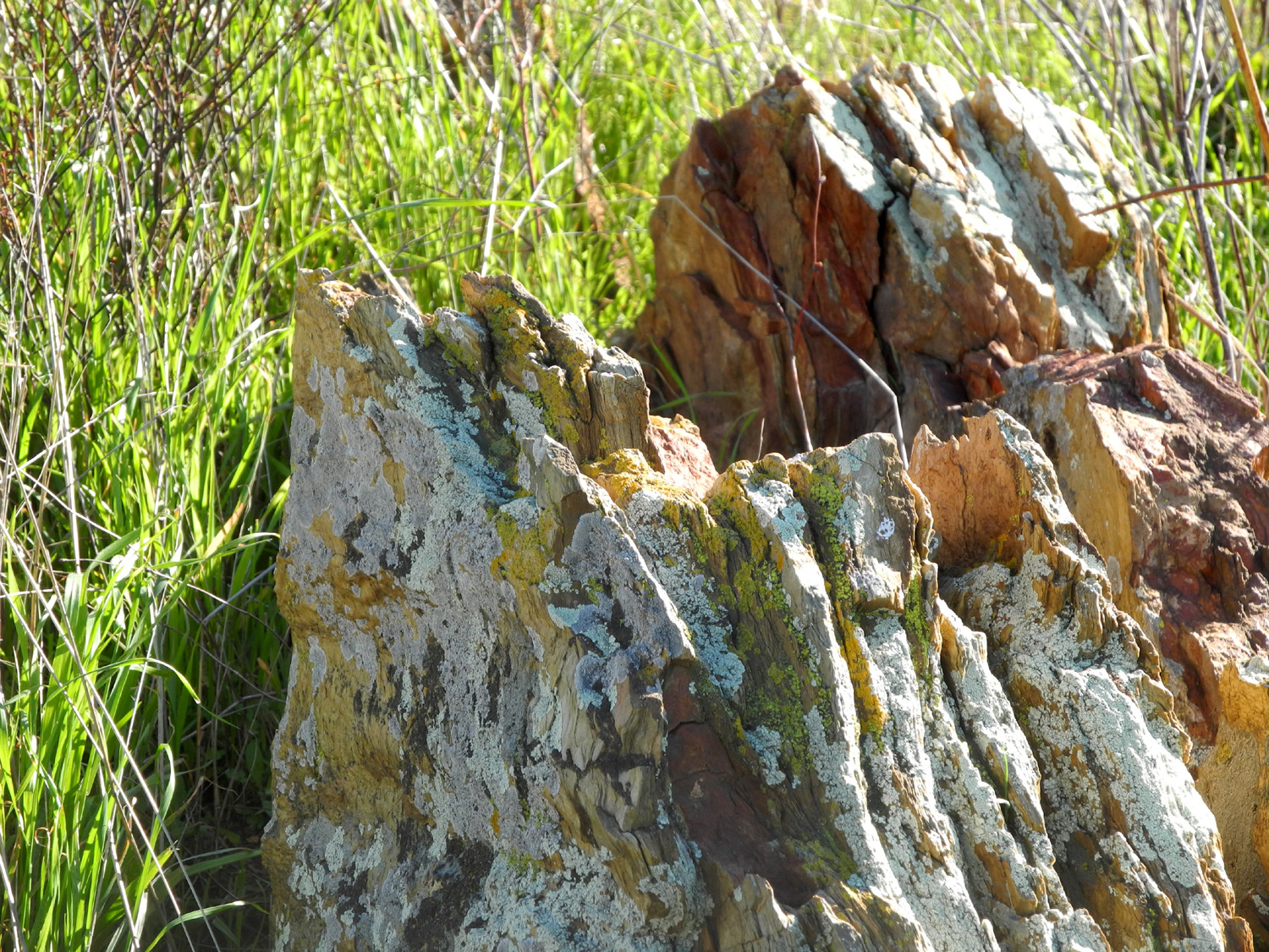
Rock along the trail
near the reservoir |
| |
 |
|
 |
| The first wild
flowers of the season |
San Luis Reservoir
shines in the mid-day sun |
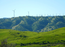
Wind turbines on a
ridge above the reservoir |
| |
 |
 |
 |
My walk was the
green loop
marked on the left center |
Enlarged view of the
area where I hiked |
Trail forks at Grand
Junction |
| |
| Related Links |
| |
| San
Luis Reservoir |
2016
San Luis water level |
More
about San Luis |
| Gilroy |
Gilroy
Museum |
Morgan
Hill |
| Henry Coe State
Park |
Diablo
Range |
Pacheco
Pass |
| California
Aqueduct |
Madrone
Trees |
Uvas
Canyon County Park |
| San
Jose Sharks |
Romero Visitor
Center |
|
| |
|
|


