


2017 Ramblers Hikes Page 2 |
||
|
The Ramblers are Carolyn Amicone, Julie Hornback, Wes Thiessen, Don McClellan, Sue Wirt, and Dick Estel, former colleagues at the Fresno County Department of Social Services. Every month or so we get together for a short hike, good conversation, and lunch. |
||
Ahwahnee Hills Regional Park Tokopah Falls Indian Pools Wawona Trails Buena Vista Peak |
||
|
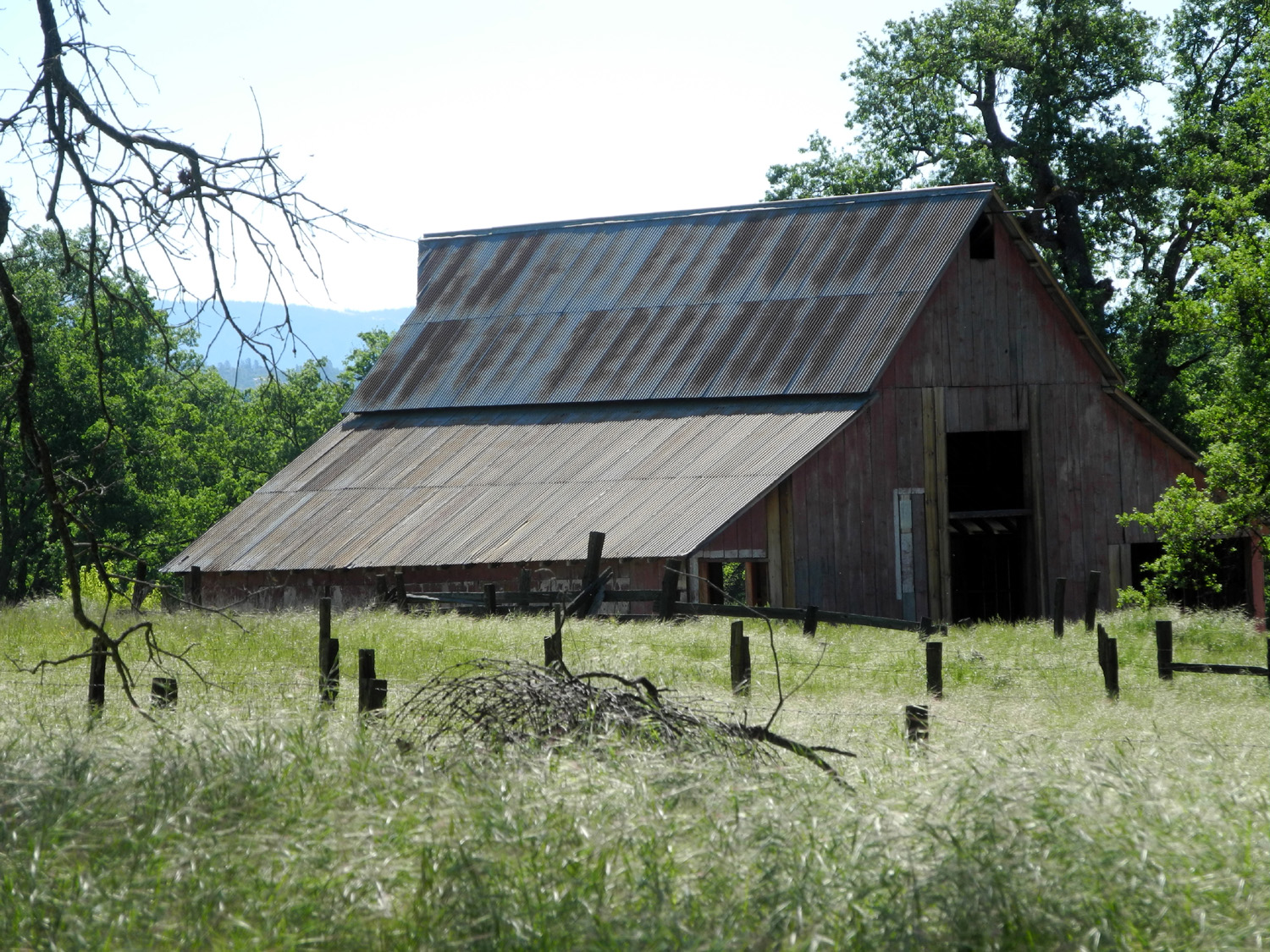
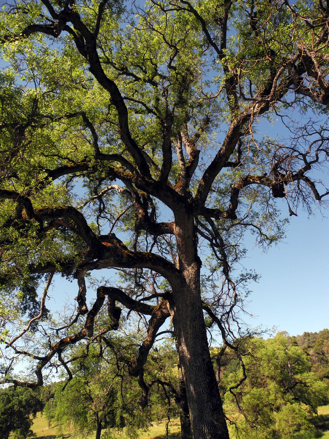
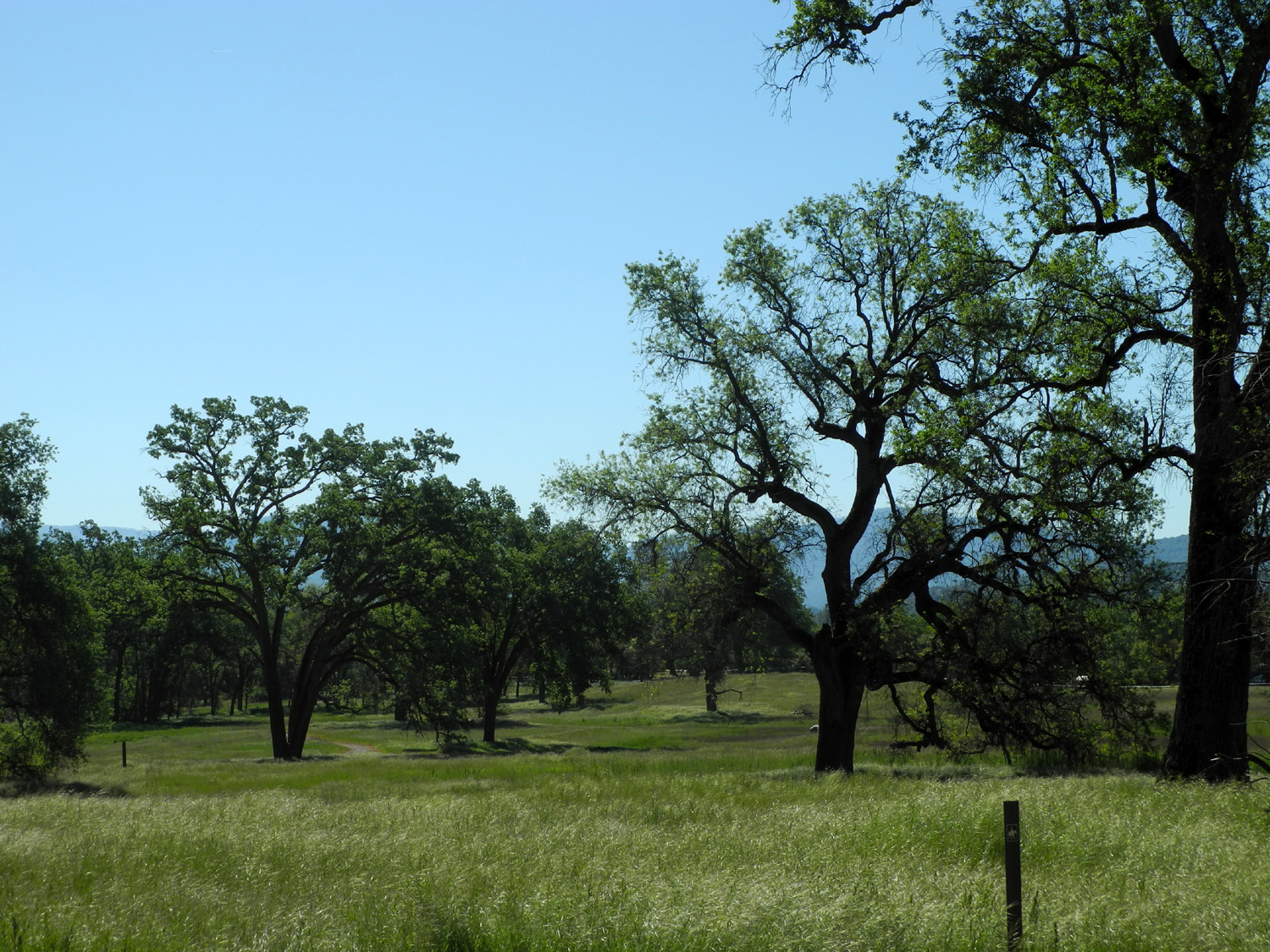
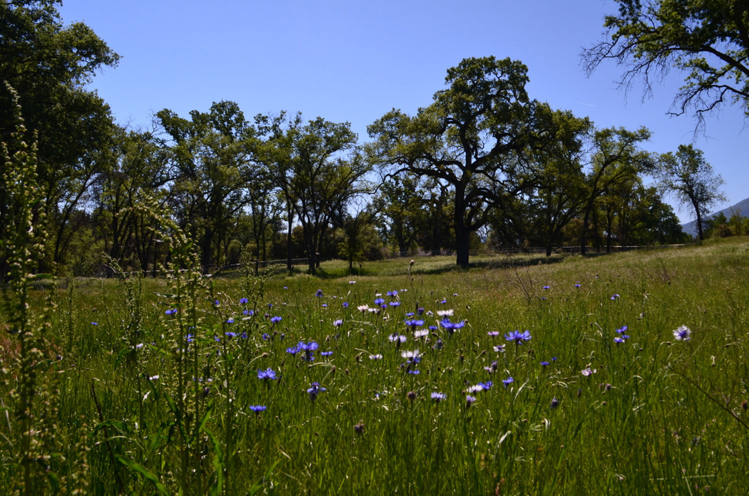
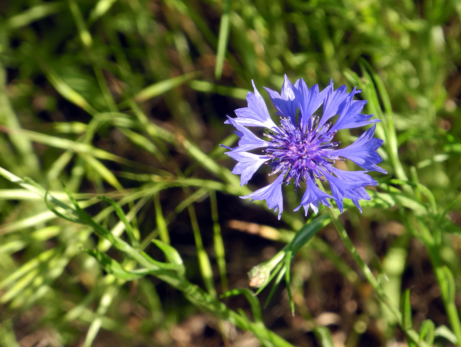
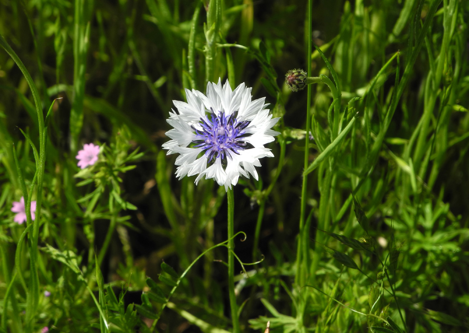
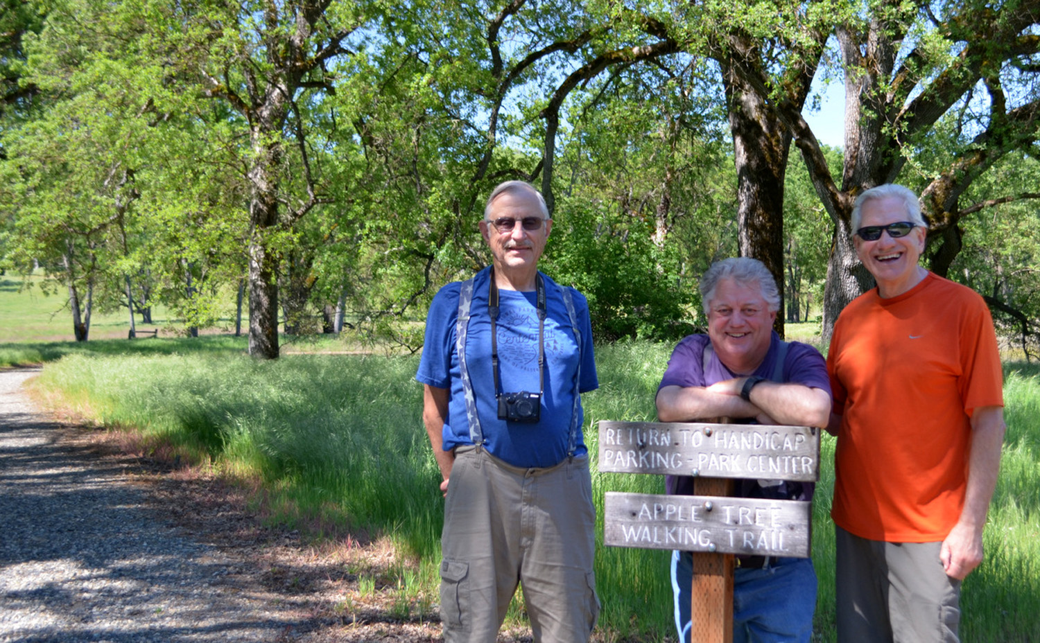
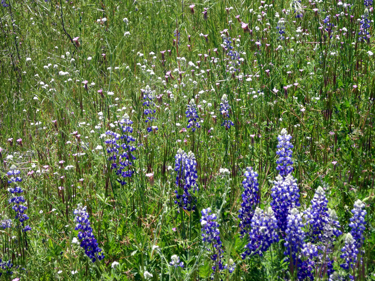
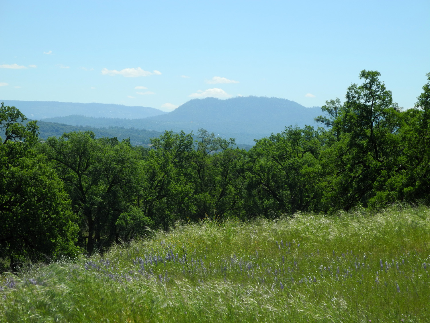
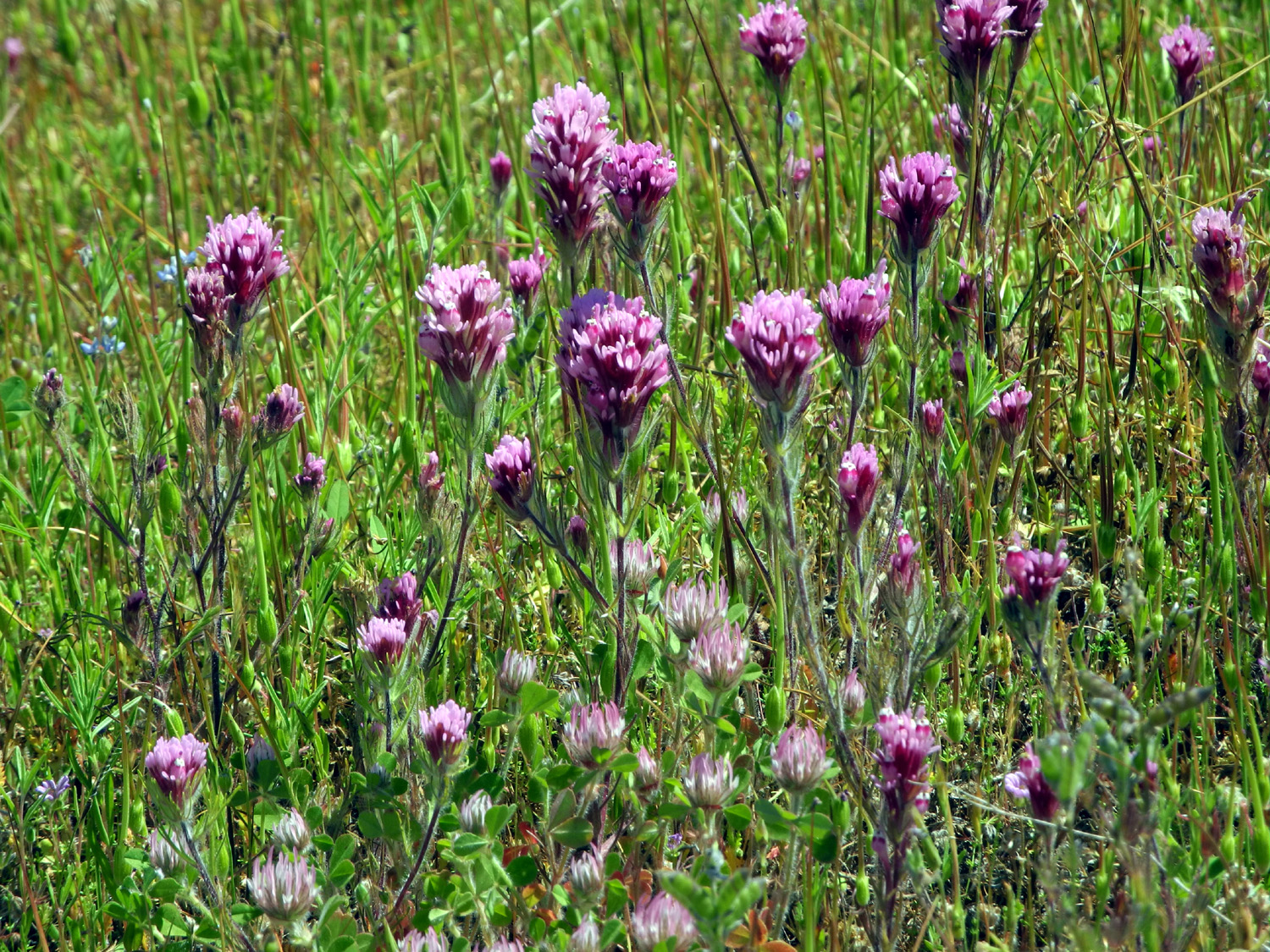
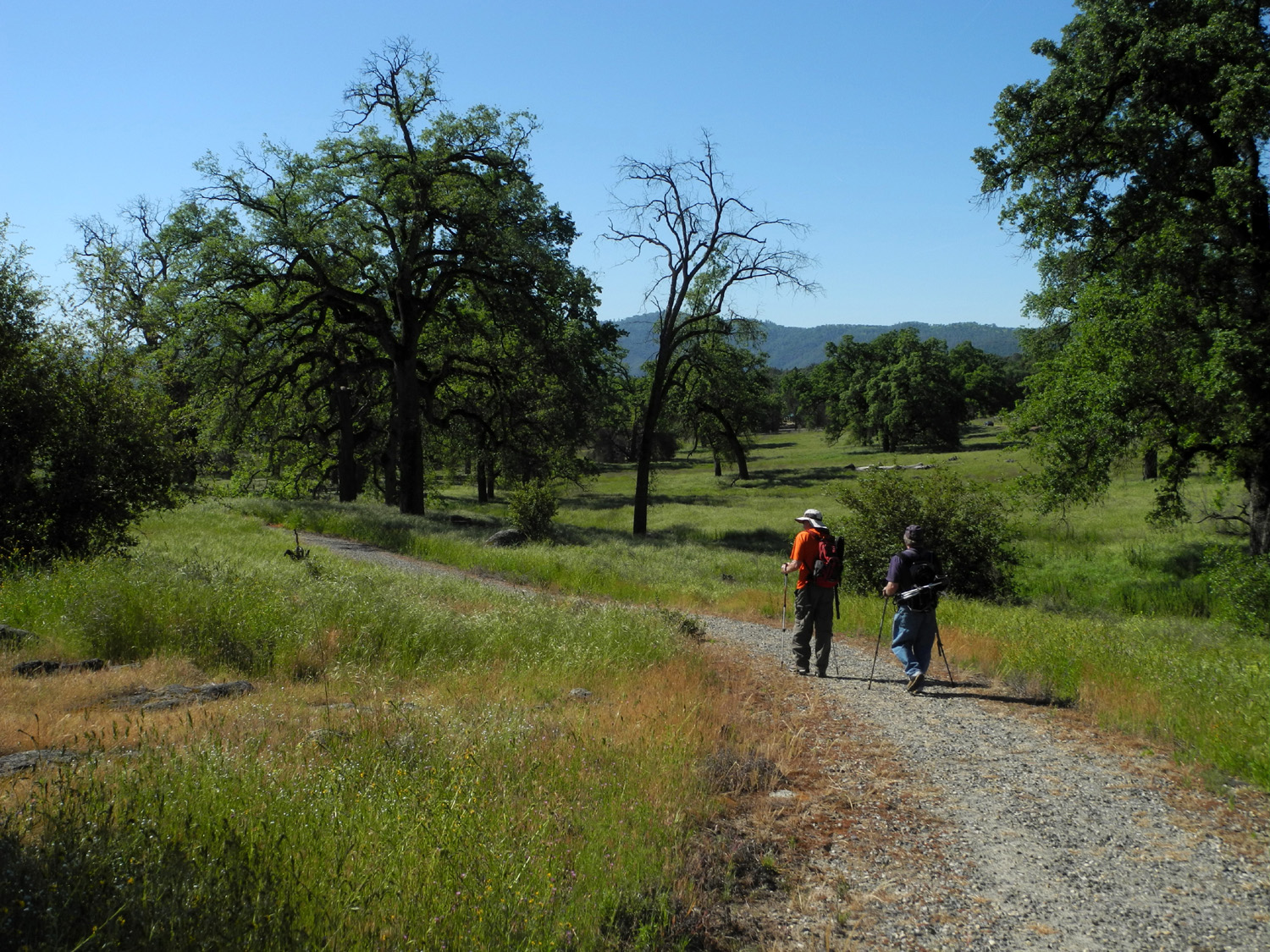
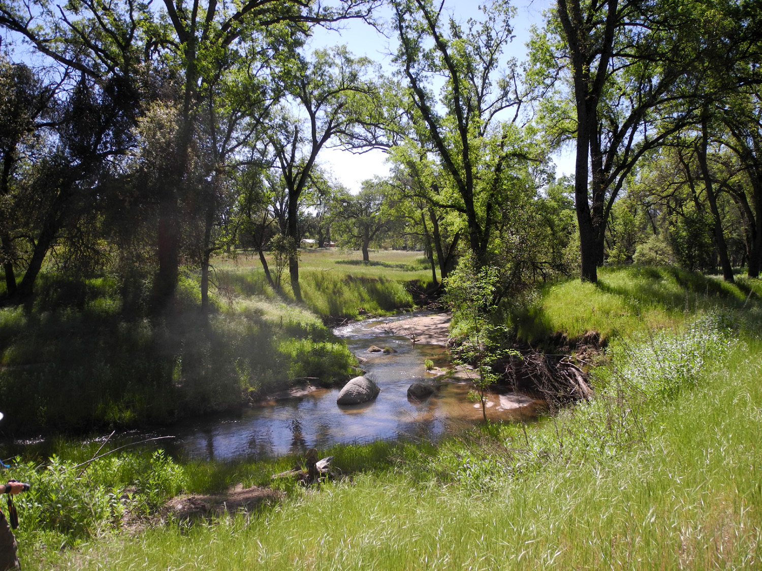
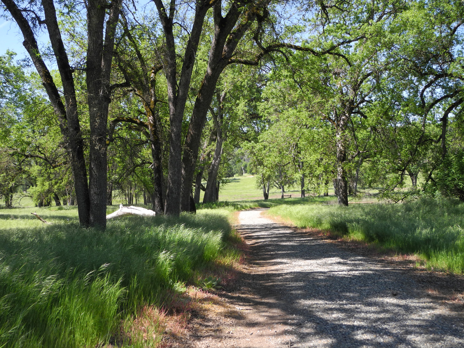
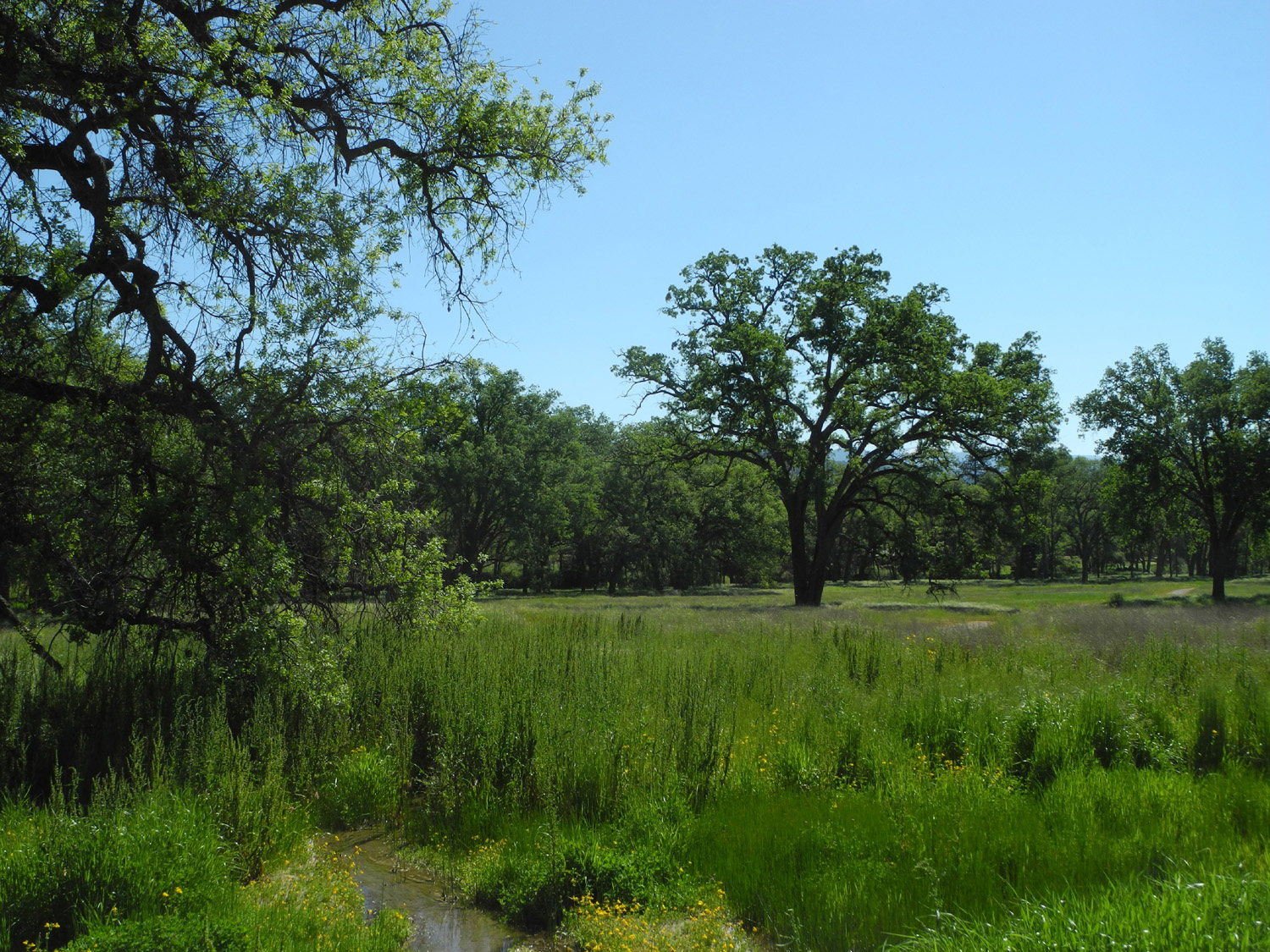
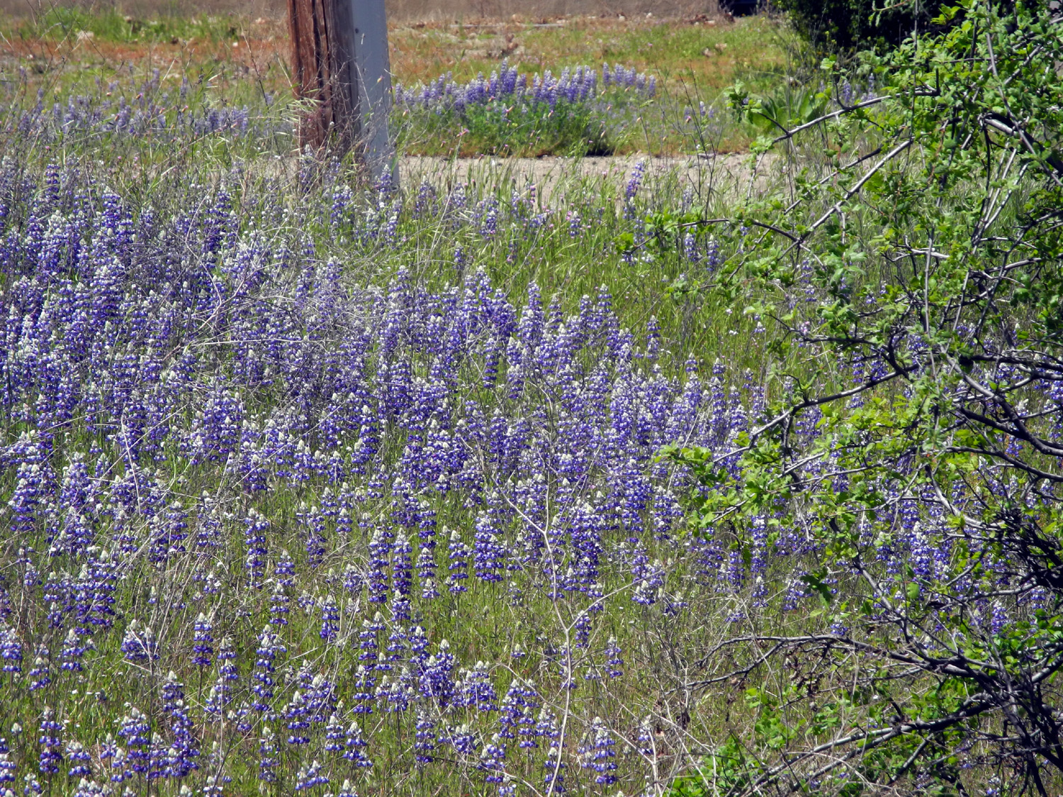
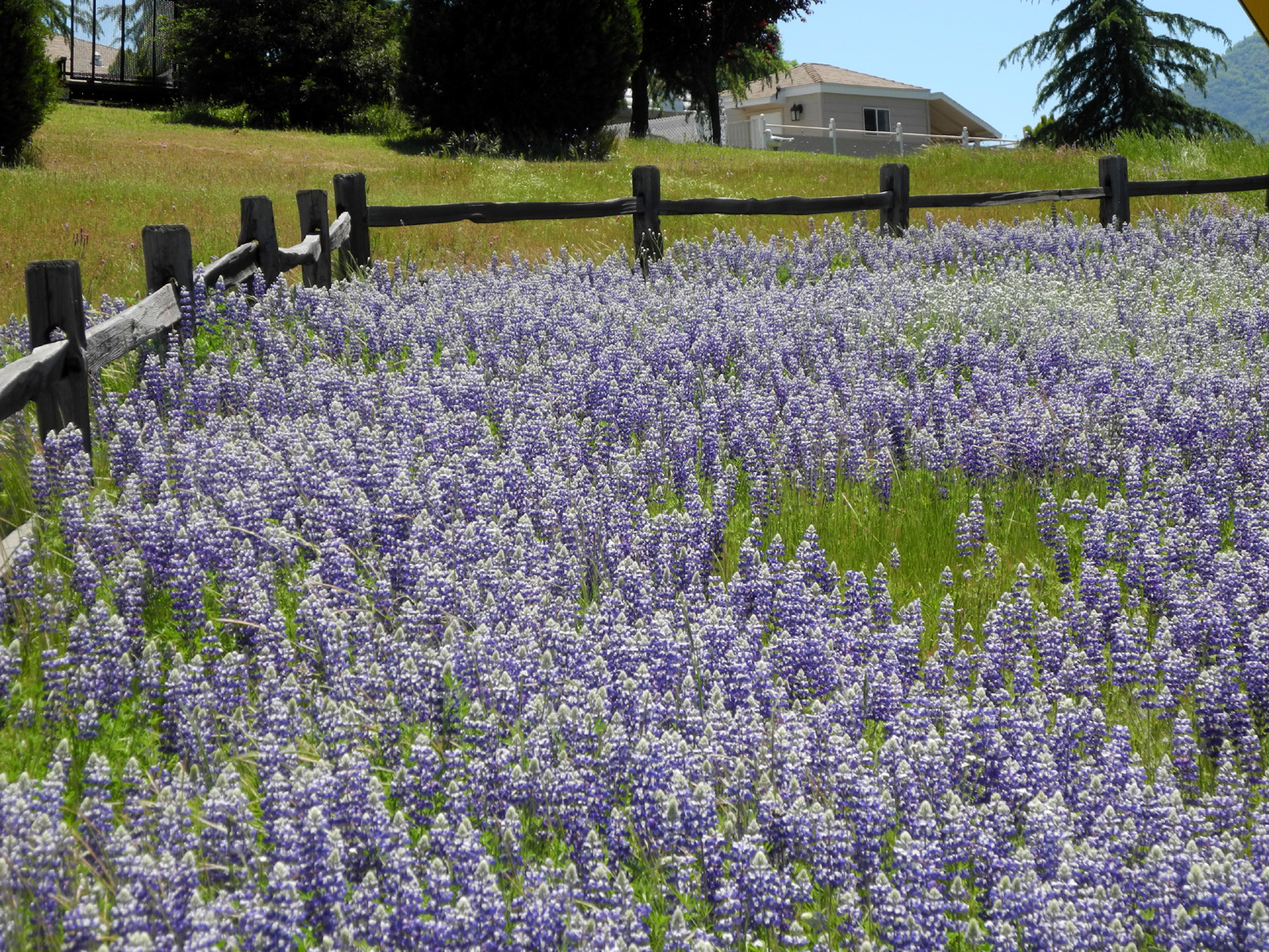
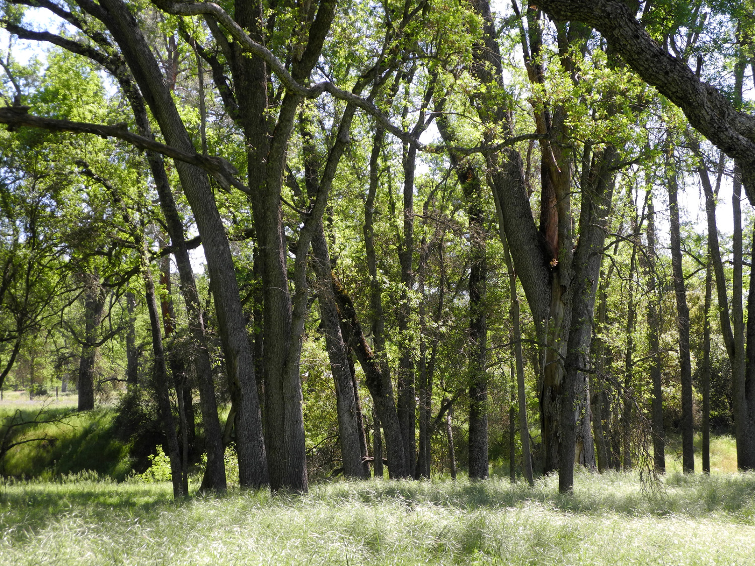
Ahwahnee Hills Regional Park Once again we had one of our "all boy" hikes, with all the ladies having other obligations or situations that kept them from joining us. Once again we were in Madera County, giving credence to Wes's theory that there's something off-putting about that jurisdiction for the girls. Nevertheless, on May 4 Wes, Don, and Dick were ready to go anywhere for hiking, and set off for the foothills in Wes's Highlander, after picking Don up at a Park and Ride near his home 20 miles north of the city. Our destination was a fairly new hiking venue, Ahwahnee Hills Regional Park, located near the community of that name on Highway 49 about six miles west of Oakhurst. From 1918 to 1969 this 400 acre property was a tuberculosis sanitarium. As the need for such facilities declined, the property became a school for (bad) boys, and in 1985 passed into the hands of Madera County, which hired a caretaker to live on the ranch. Soon local residents began pushing to establish a park on the site, and in the first decade of the 21st century most of the old buildings were removed, a water system was installed, and trails were built, resulting in a peaceful place of wildflowers, oak trees and wildlife that is a delight to visit. This was the first time for all of us, although my daughters had hiked there earlier this year and provided a report on conditions, including the fact that the trails are all easy walking. The trail goes down from the parking area on a small hilltop, then winds around though open fields, among big valley oak and blue oak trees, and wanders beside a nice little creek. The trails branch off in various places, so the hike can be as long as you like. The junctions are not well-marked, but you are in view of the headquarters buildings most of the time. Near the start the trail goes past an old barn, or perhaps it should be called a new-old barn. We went inside, and it was clear that some of the siding dated back many years, but it had also been reinforced and renovated with modern building techniques and new lumber. New or old, it was a picturesque feature of the landscape. In places along the trail we were treated to views of distant hills and snowy mountains, and everywhere it was still green and peaceful. In addition to the large creek, there is water running through several swampy channels, lots of moisture-loving plants, and several kinds of wildflowers none of us could recall ever seeing before. Wes explored a section of trail that was roped off, and discovered something that was no surprise in this wet year - a place on the trail that had been washed out. However, there were other routes, and after a rest stop, some snacks, and a group photo, we made our way back toward the parking lot. On the way we encountered a spectacular sight, a field of lupines along the short uphill part of the trail just before the parking lot. These were the medium-sized blue ground lupines, the ones that are called bluebonnets in Texas. In fact, in a number of places along Highway 49 between Oakhurst and Ahwahnee we had seen fields of blue where nature had provided the best display of these flowers that I've seen in many years. Heading back to Oakhurst, we made a stop at Sunrise Drive, where there was an especially good field of lupines, and took photos from several angles. Back in Oakhurst, we went to one of our favorite stops there, Pete's Place, and enjoyed a great lunch. I finally used the gift certificate my daughter had given me when I was cat-sitting for them in mid-April. Now, you are probably wondering if Wes had any final thoughts on the trip. No you're not, you KNOW he had some: How can I describe this morning's hike? Beauty, fun and laughter. Maybe it was just the three guys bantering back and forth. No, it wasn't "guy talk." Just old stories from the welfare department. Or it may have been the morning breeze or the colors of the savannah and valley oaks that made it a great day. It was short but very nice. This was the last foothill hike for the Ramblers for the season. At the end of this month we travel to the high country of Kings Canyon National Park to hike the Buena Vista Trail. Conditions for our hike were not as hot and dry as I feared. Since it's May in Central California, the weather may do just about anything. At 2,300 feet, it was warm but pleasant, with a predicted high of 88, but we finished our hike before noon. At home in Clovis, elevation 300 feet, we had a high of 99. Two days later rain was expected, I huddled in a flannel shirt as I did my morning walk with a cold breeze in my face, and the high was 69.
|
||
|
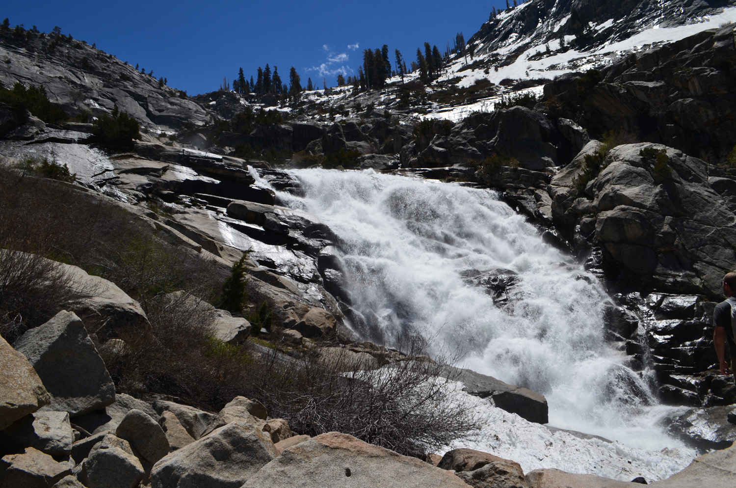
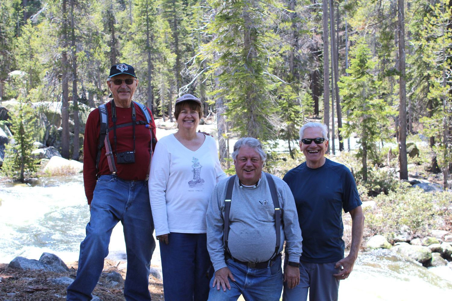
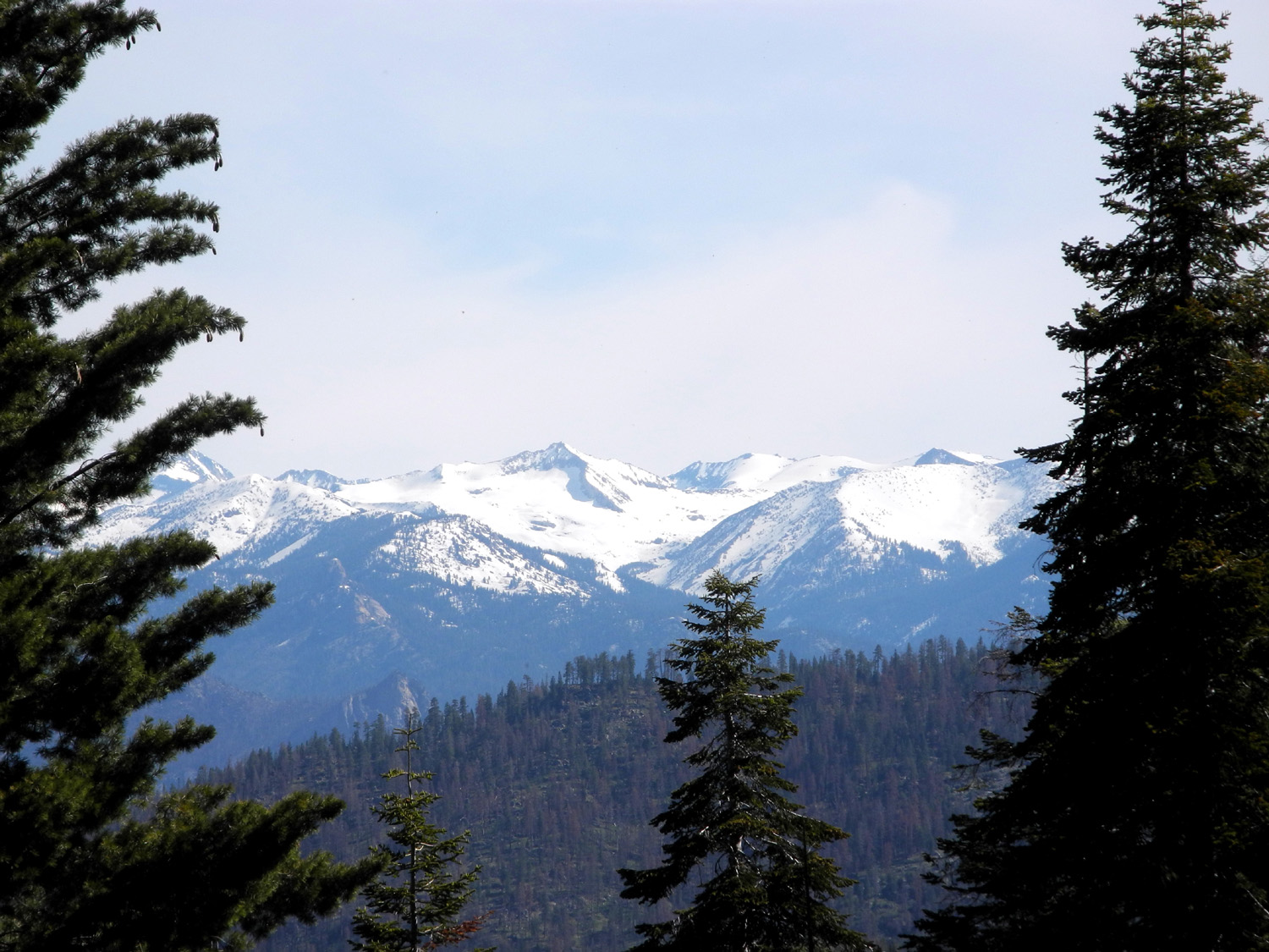
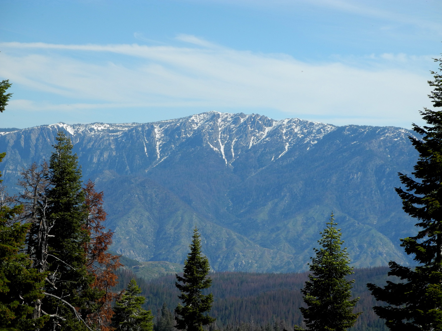
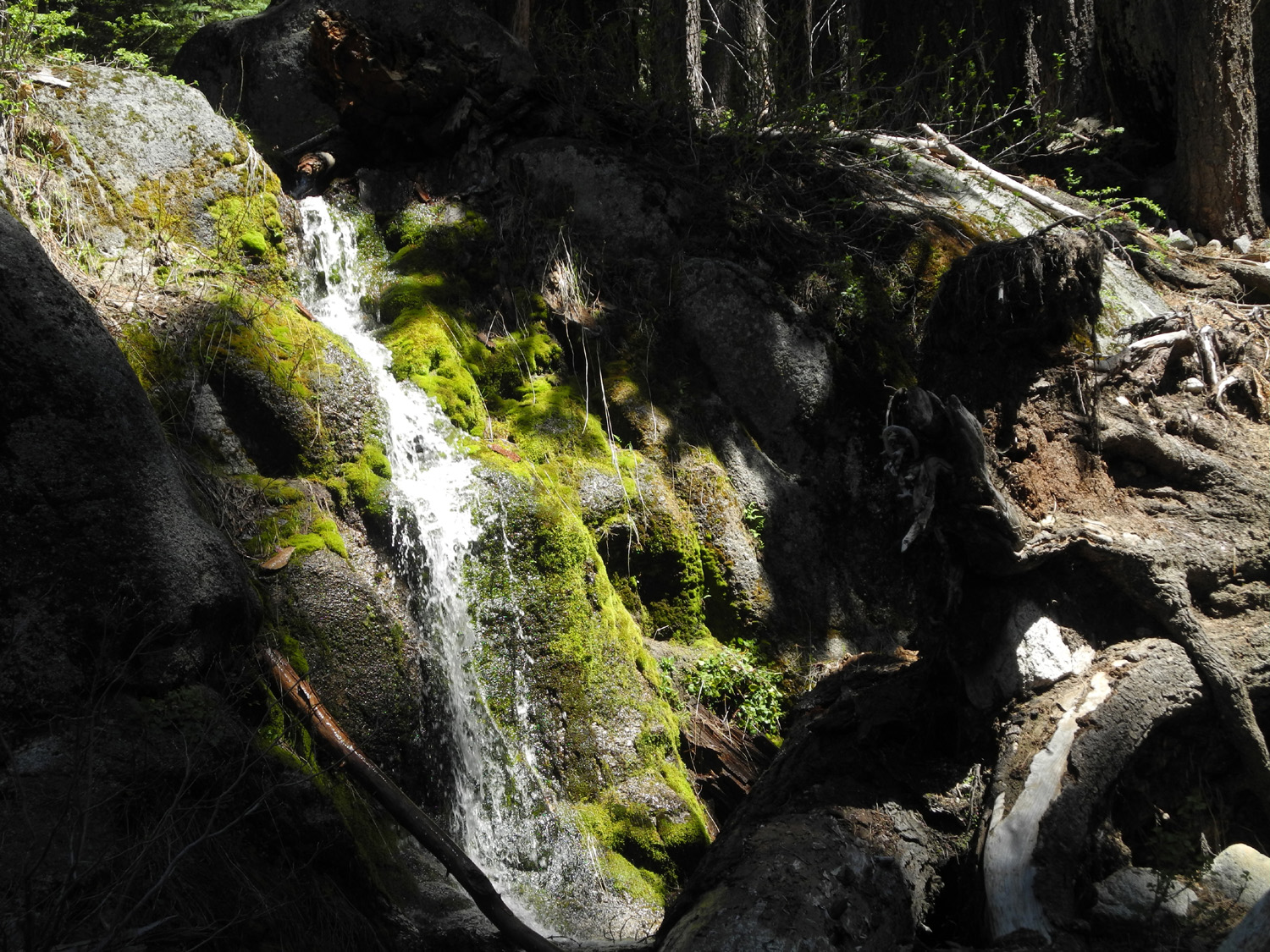
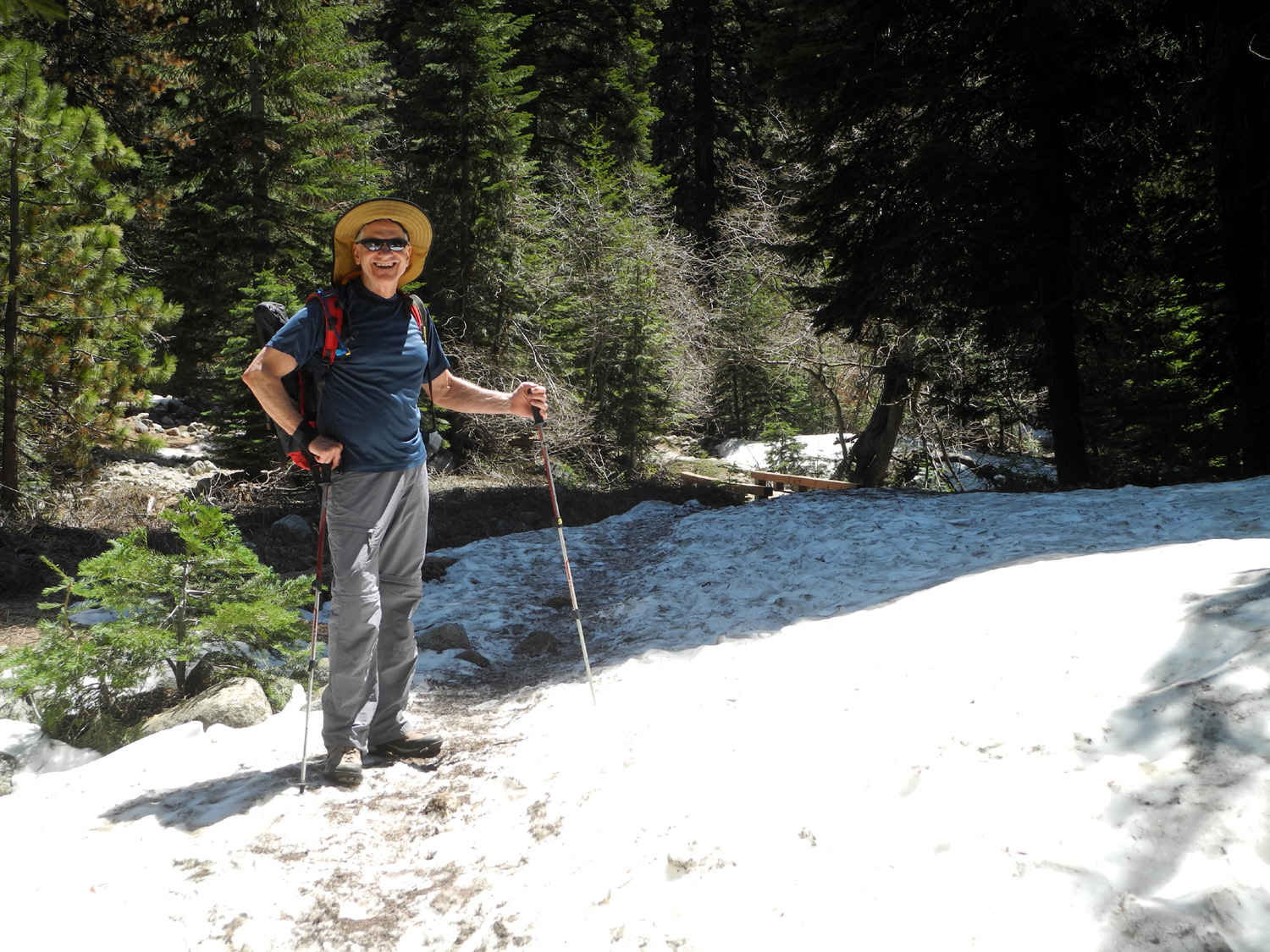
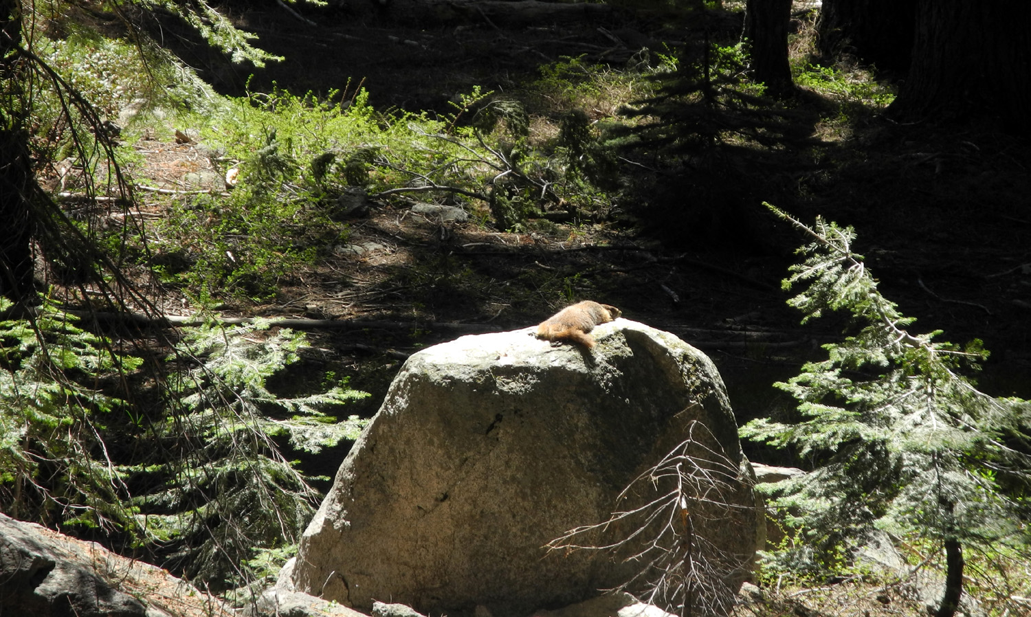
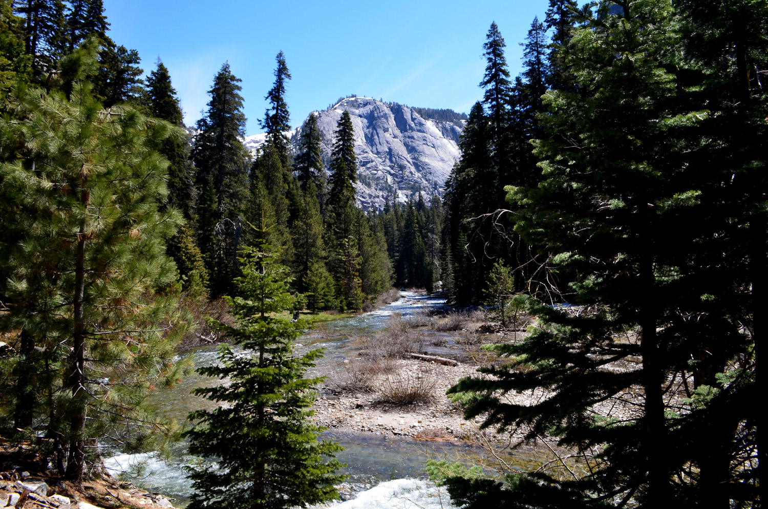
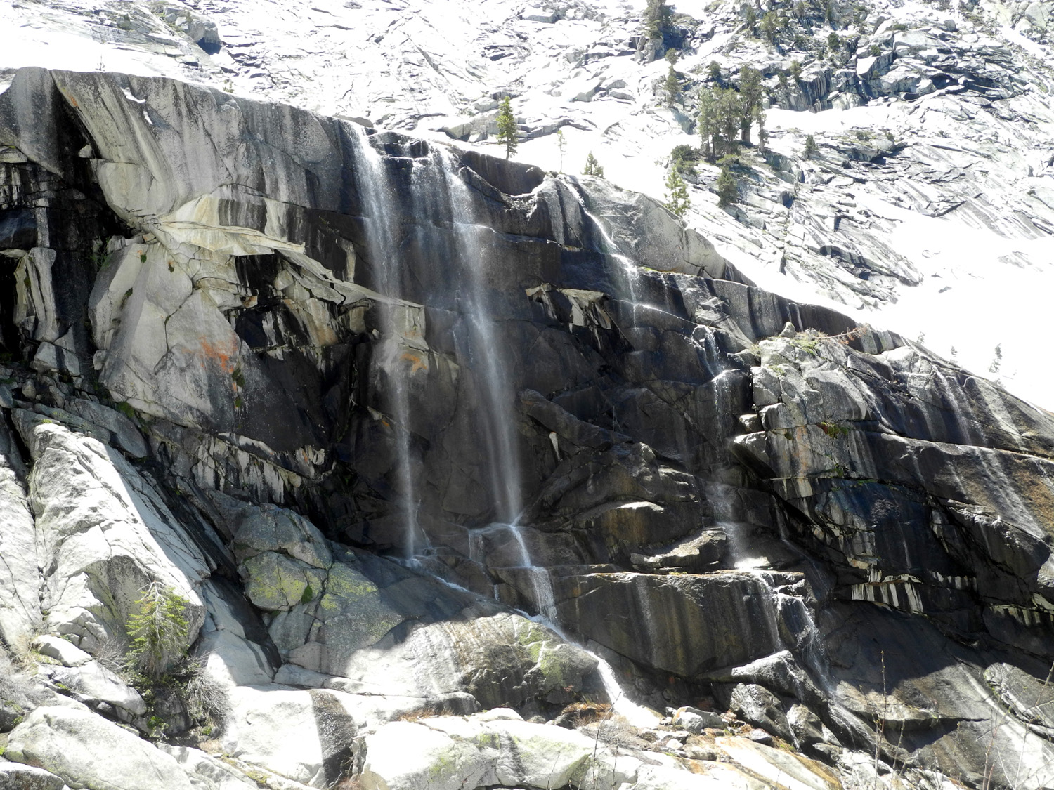
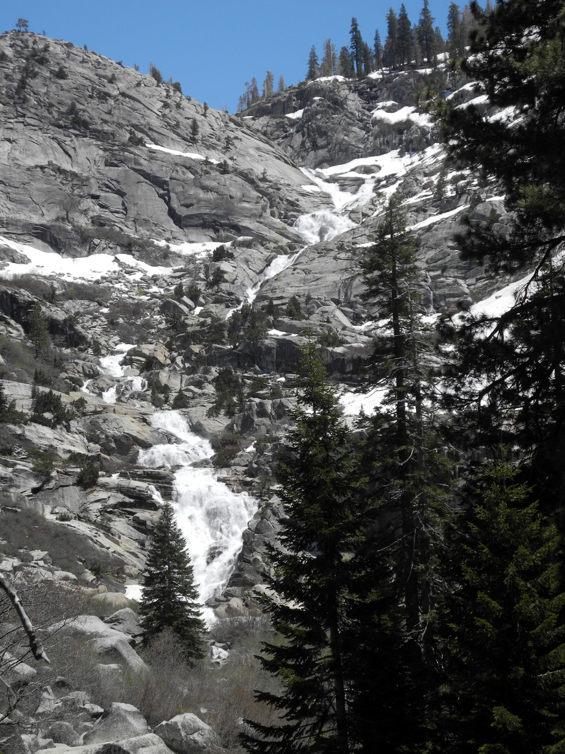
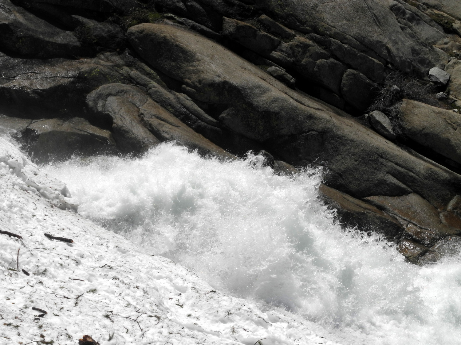
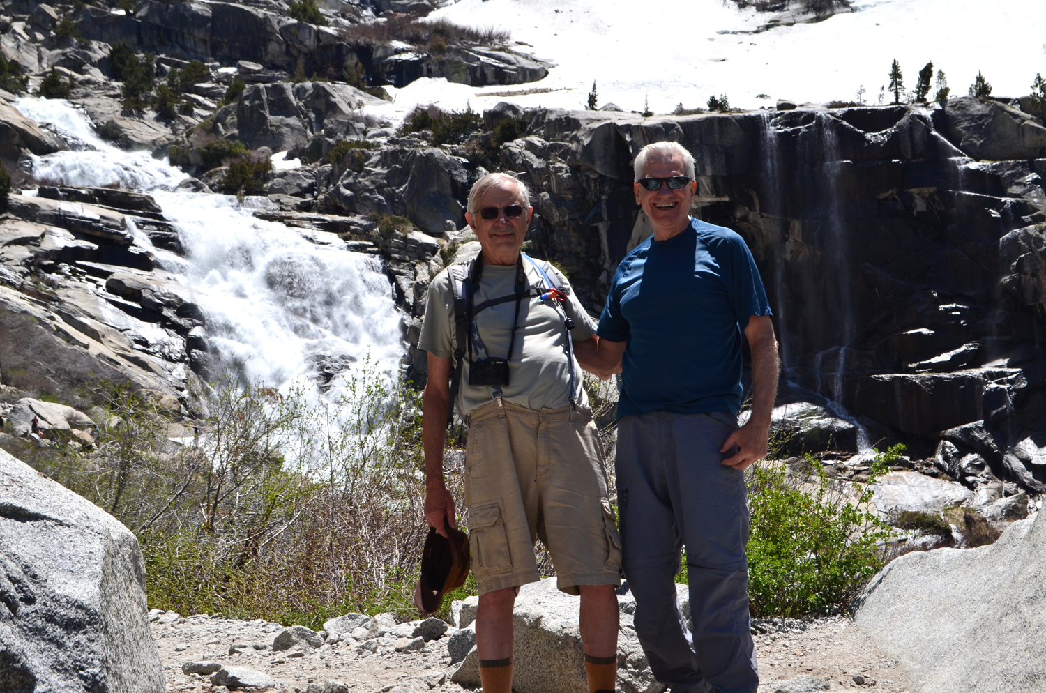
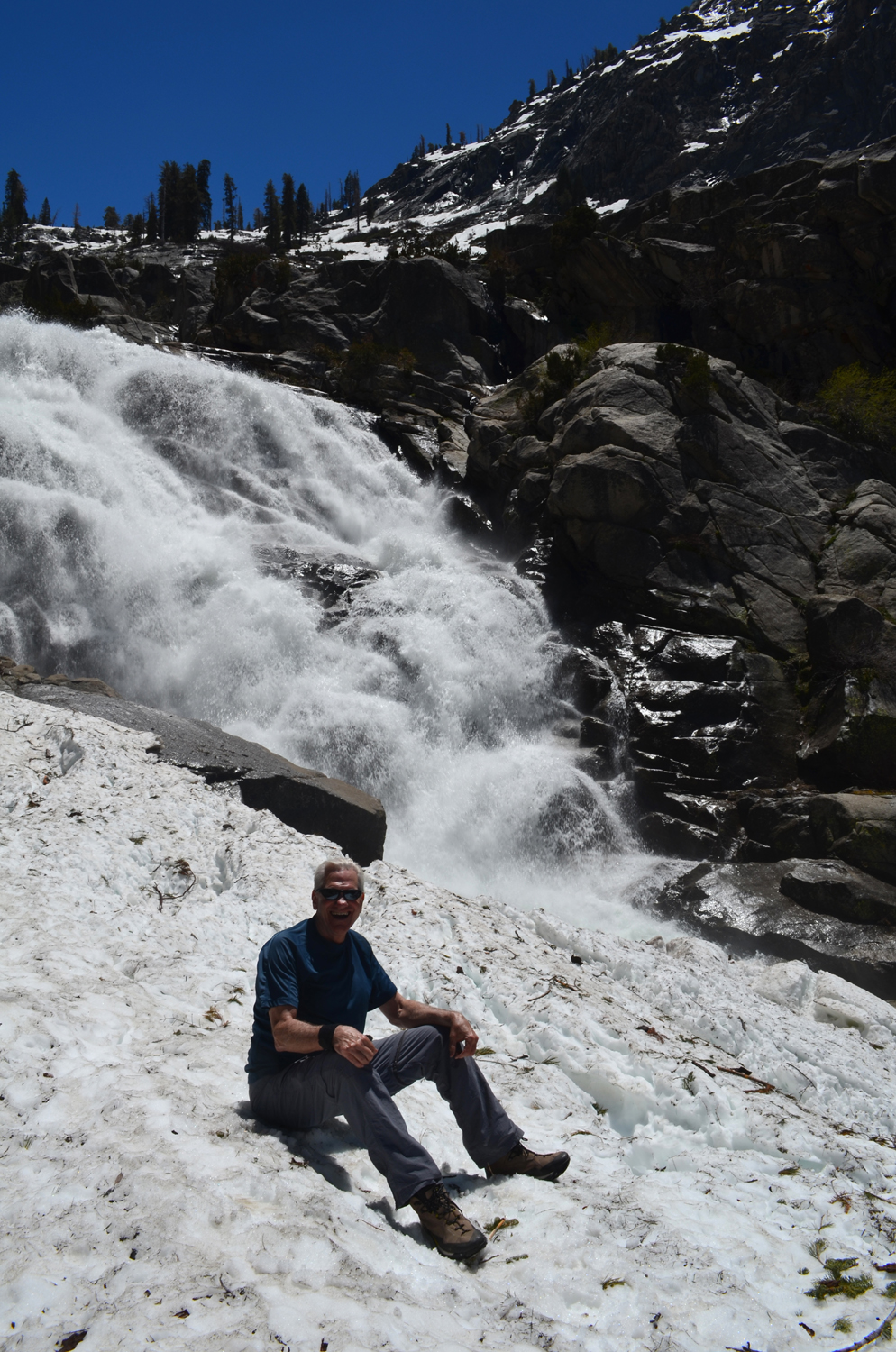
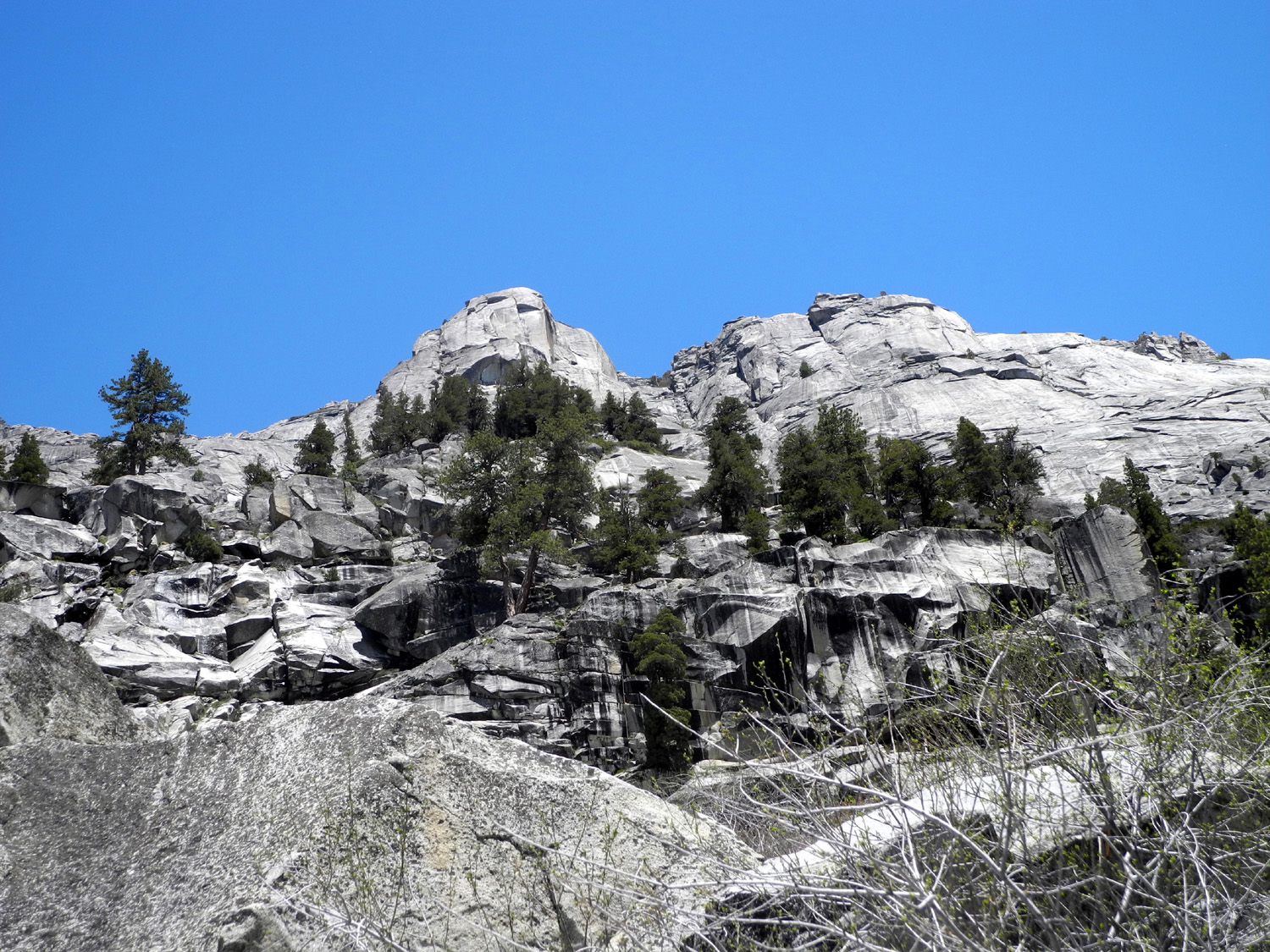
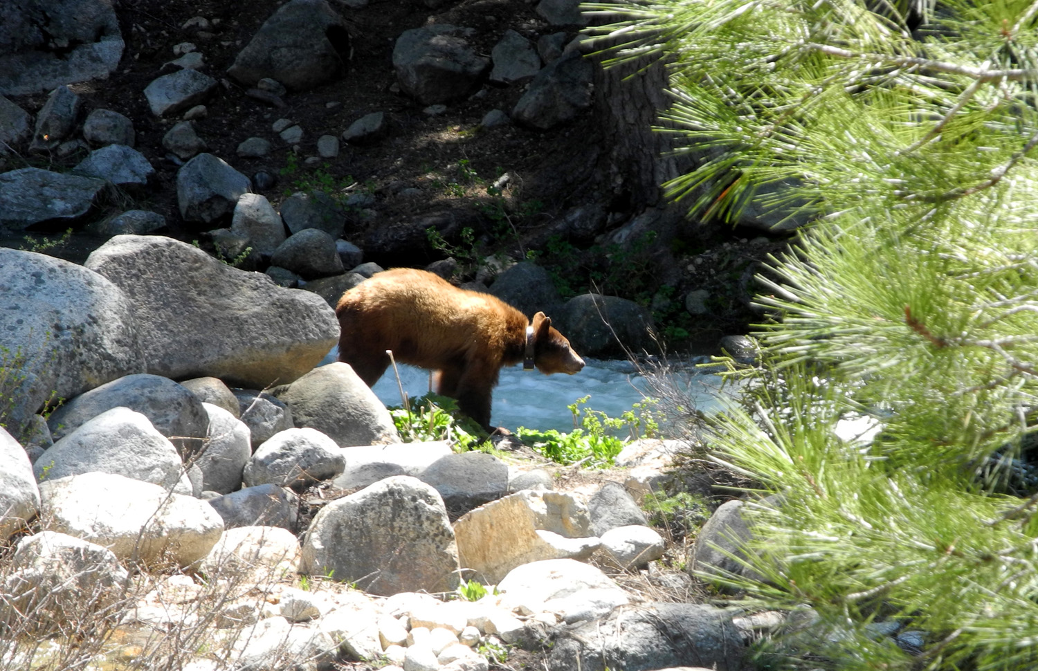
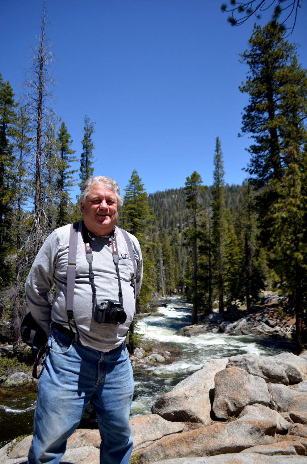
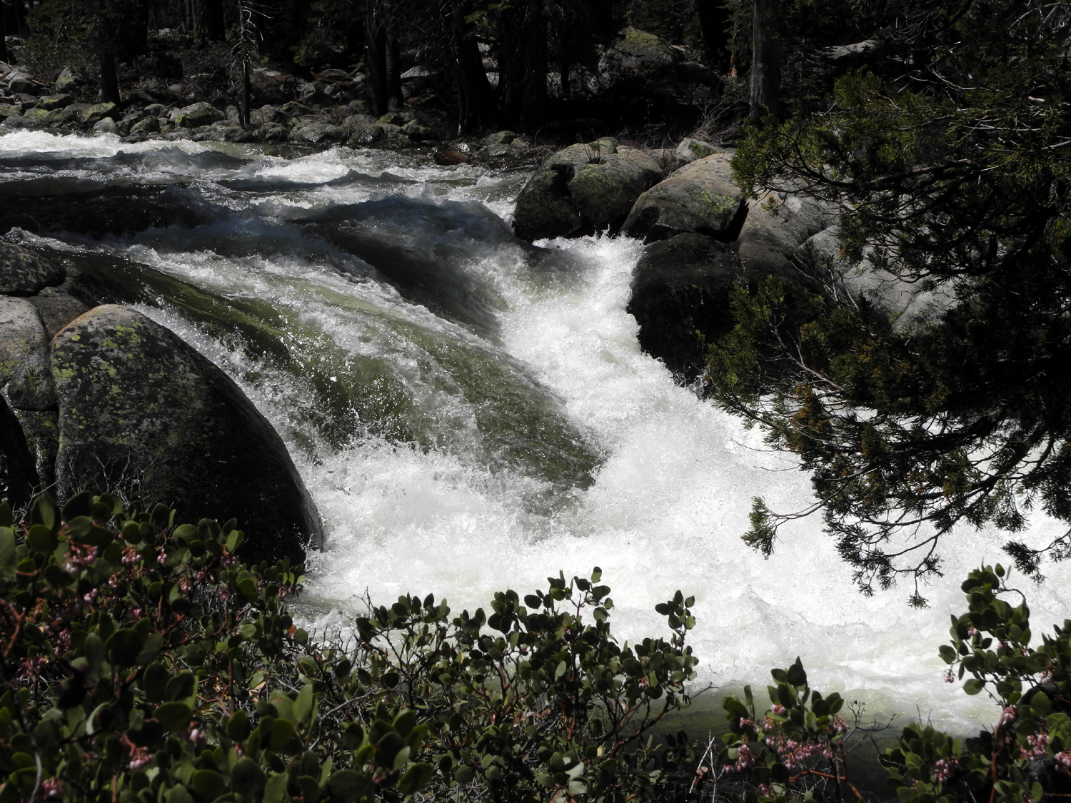
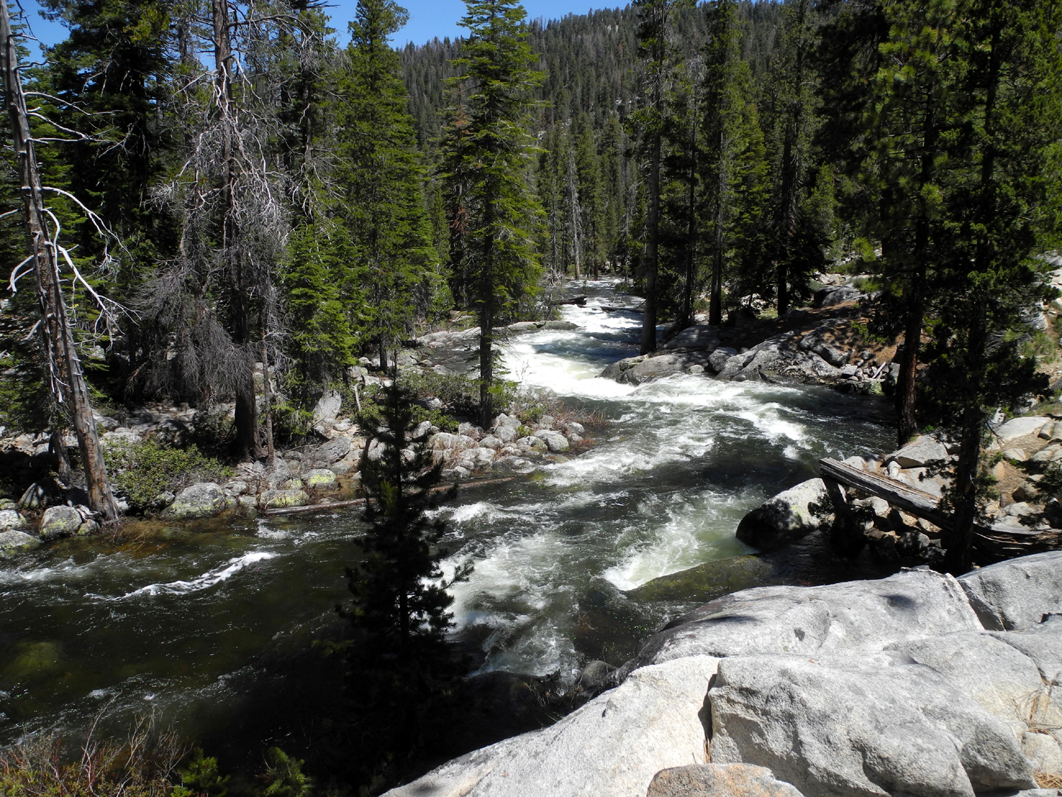
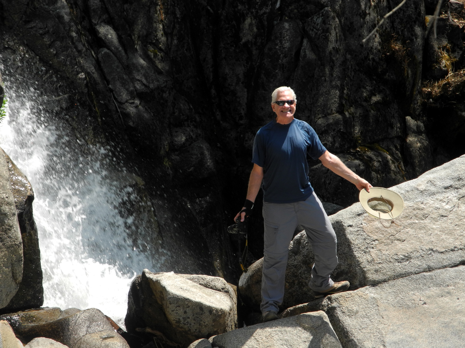
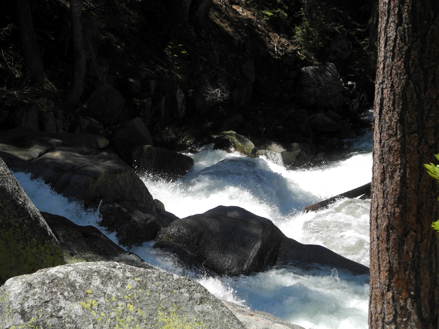
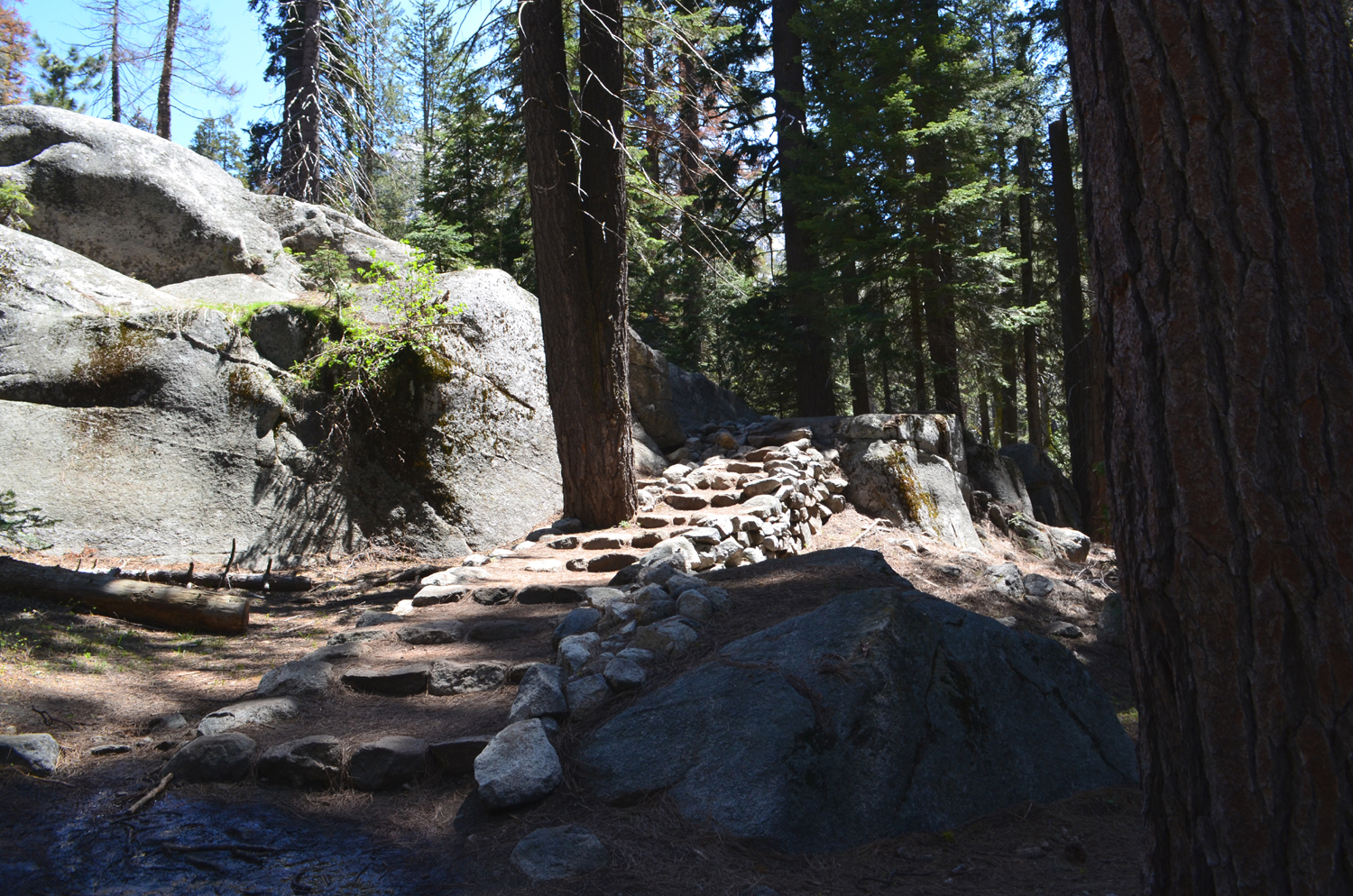
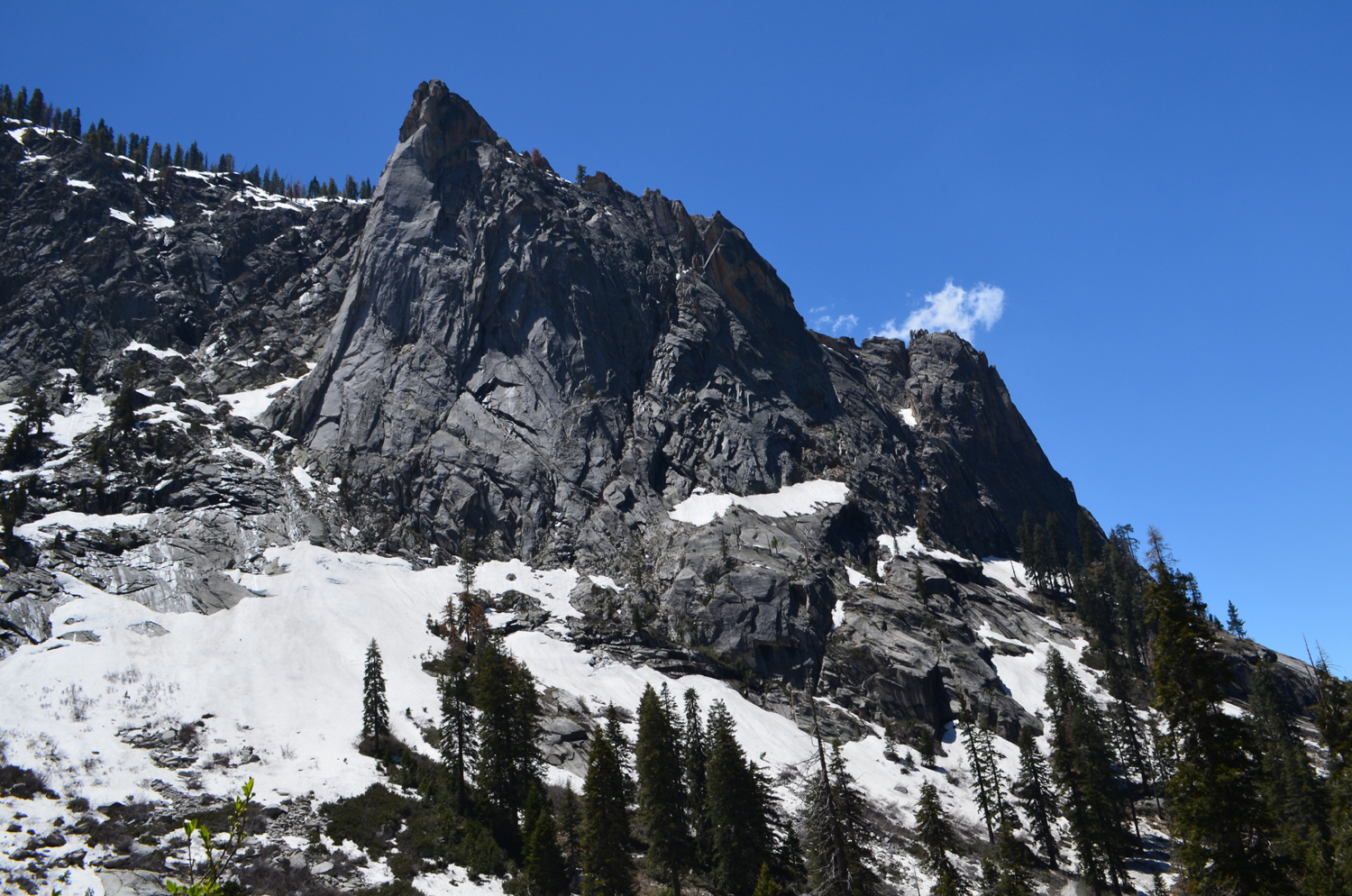
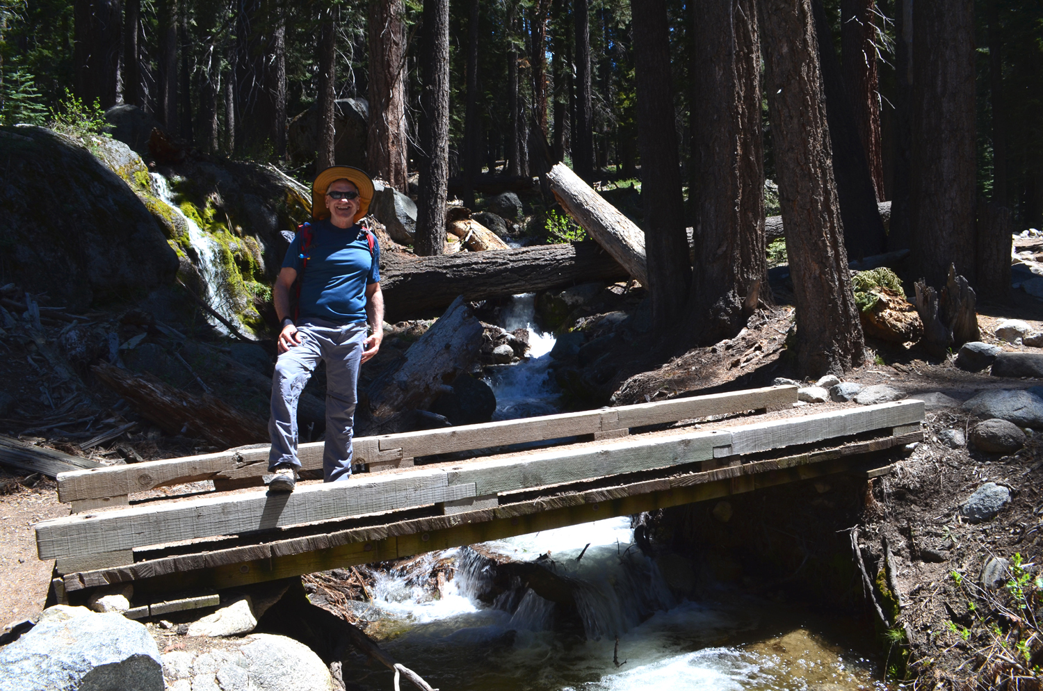
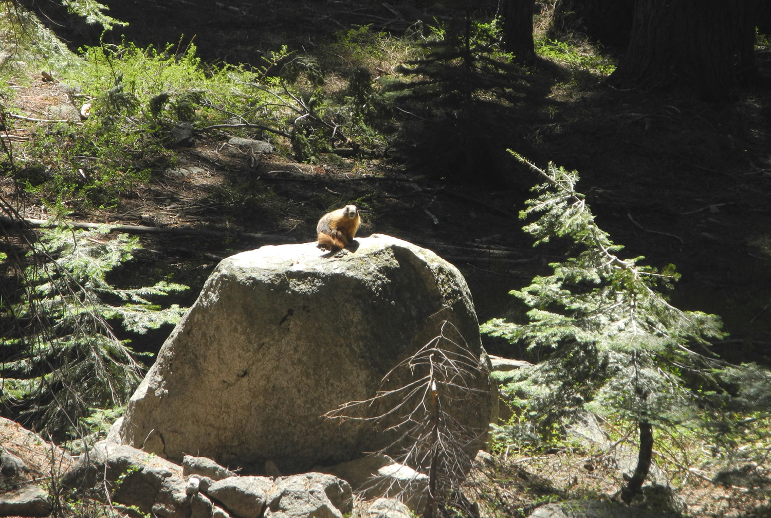
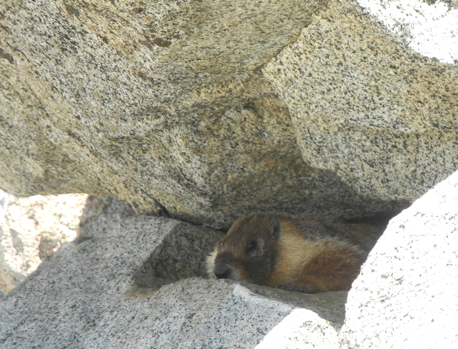
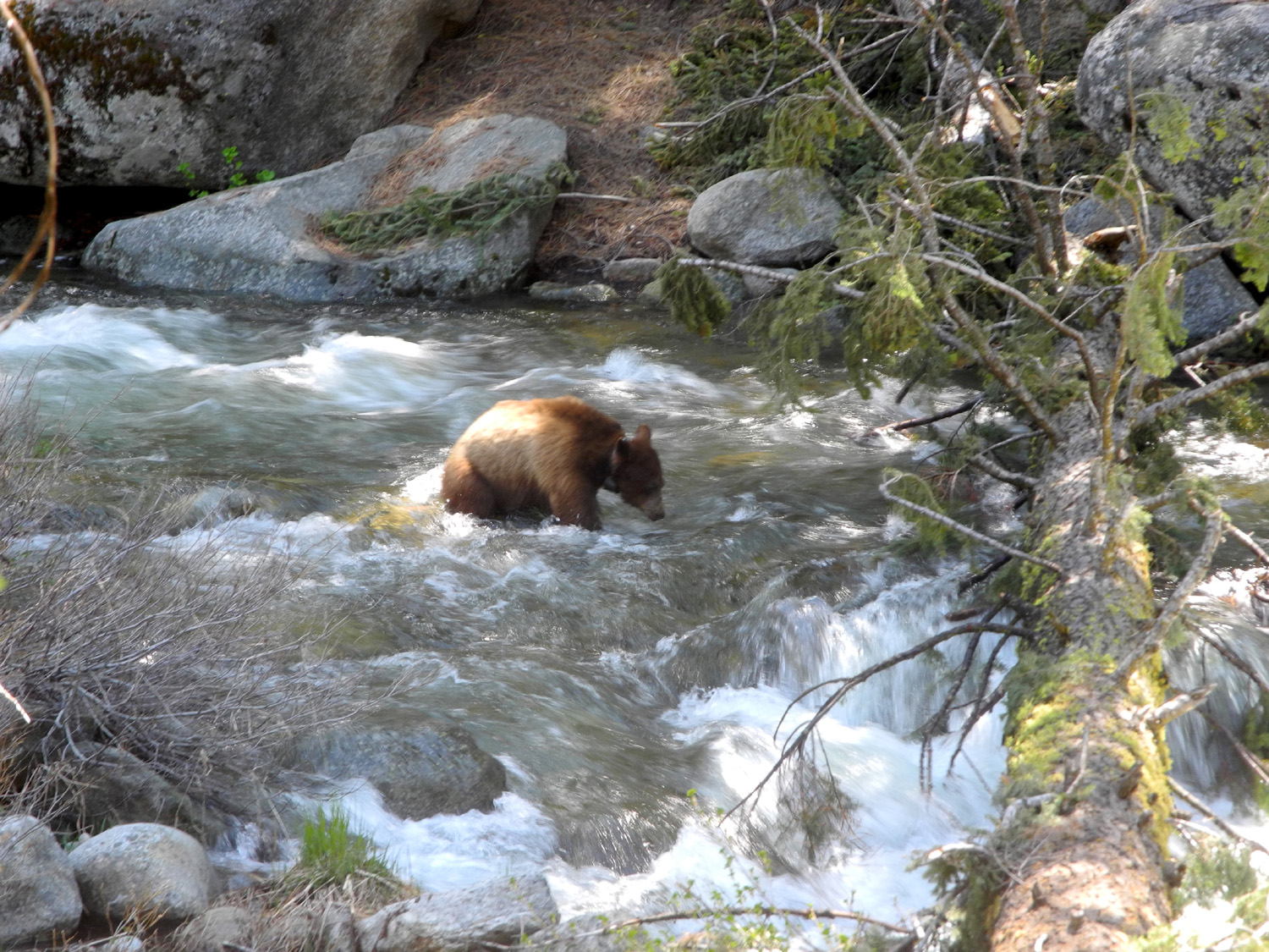
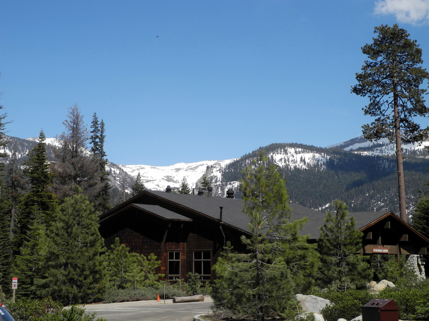
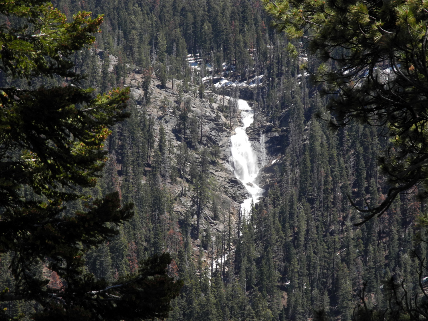
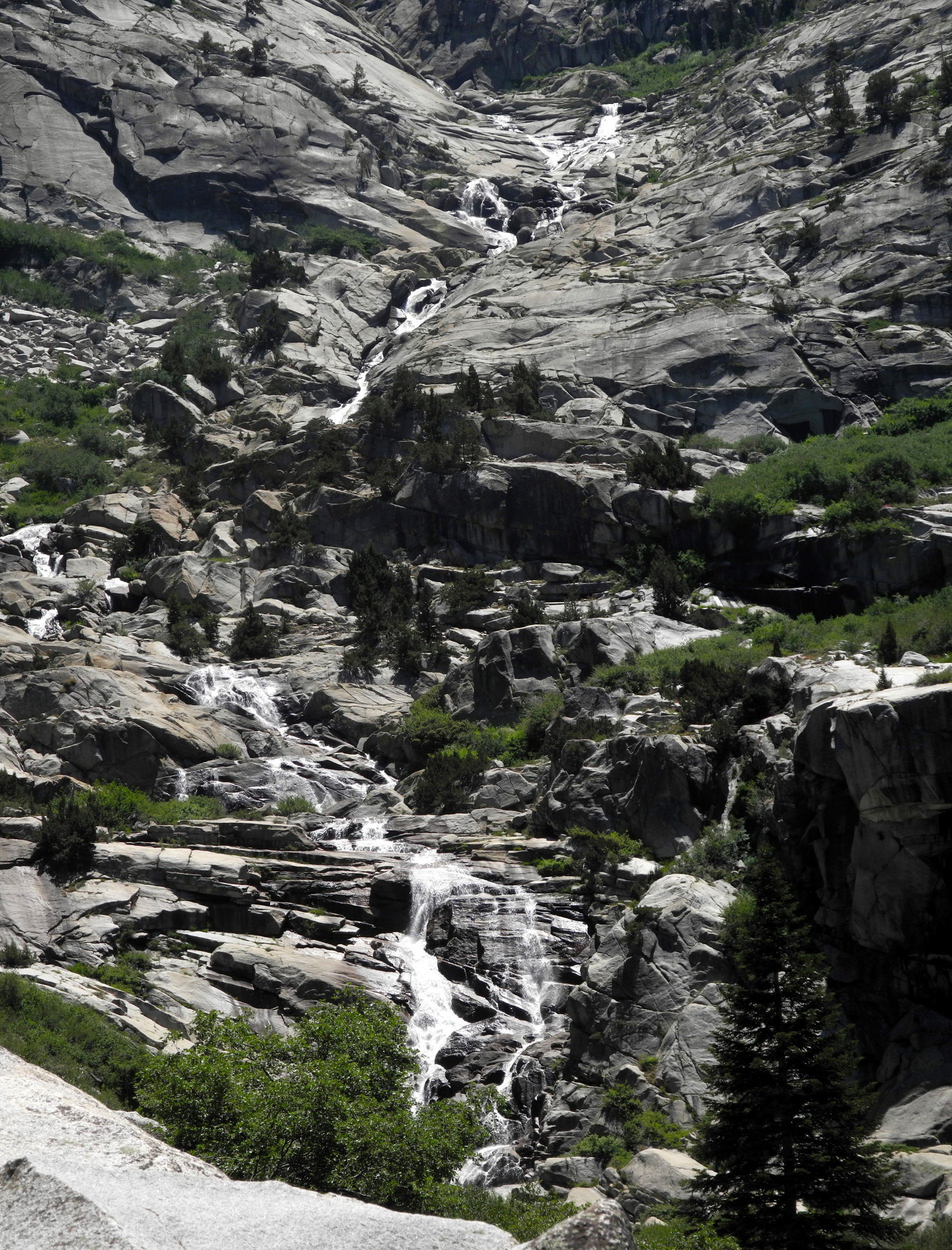
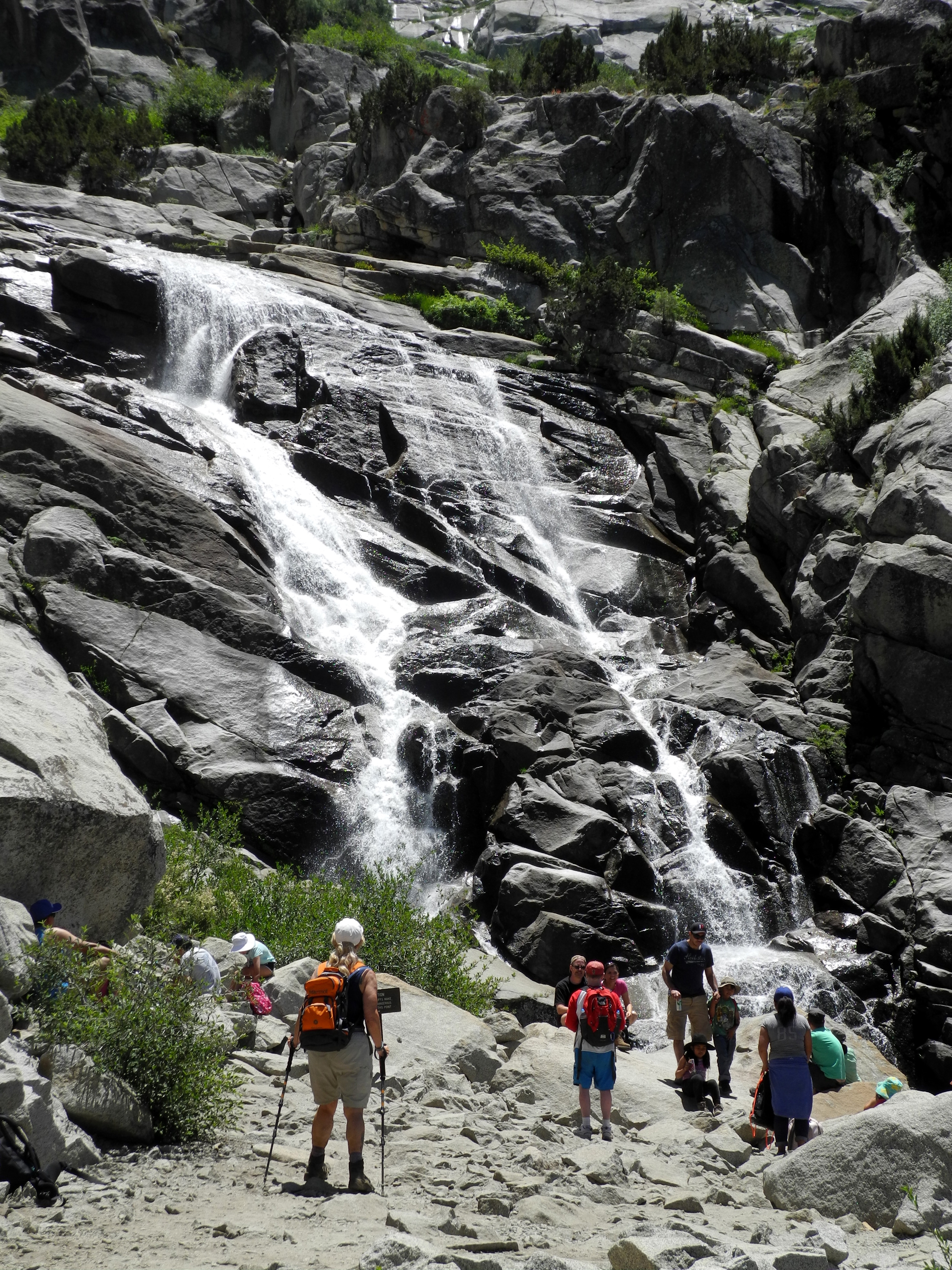
Tokopah Falls Trail First Carolyn had to help her father while her mother recovered in a rehab center from recent surgery. Then Julie's daughter, in a last-minute decision, bought tickets for the U2 concert at the Rose Bowl the night before our hike. Don received word that workmen would be at his place Monday morning to replace his ailing air conditioner. This reduced the Ramblers to just Wes and me, recalling memories of our first hike together, on the Hite's Cove Trail in March of 2014, pre-Rambler days. This time our original destination was Buena Vista Peak, a two-mile round-trip in Kings Canyon National Park. However, in a quick email discussion we decided to try a trail that is a bit longer than the rest of our group prefers. Thus it was that the Dauntless Duo set out early on the morning of May 22, heading for the Tokopah Falls Trail in Sequoia National Park. This four-mile round-trip trail follows the Marble Fork of the Kaweah River from Lodgepole, to a magnificent falls that descends 1,200 feet down the steep upper canyon in a series of cascades. Lodgepole is the site of a popular campground, as well as a visitor center and market. Although Wes had done extensive longer hikes in the vicinity, he had never gone to Tokopah Falls. I made the hike with daughter Teri in July of 2016. I also went there once long enough ago that I can't recall the details. I thought it was with some friends I worked with in the 60s and 70s at KJEO-TV, but in a list of camping trips with no details, there's a reference to "Tokopah hike" with Teri, her husband-to-be Tim, son Johnny and son-in-law Rod. Perhaps I have been there four times. Or maybe we didn't go all the way to the falls. There's some saying about the memory being the first thing to go, but I can't recall it. (None of the others can remember either, so now I don't feel so bad.) A short distance into the park we stopped at the Kings Canyon Overlook, which provides views of the high peaks of the backcountry, including 10,000 foot Spanish Mountain, across the canyon. It was streaked with snow, and the high peaks were still completely covered. Like all Sierra rivers in this year of record rain and snow, the Kaweah out of Lodgepole was a raging white water stream, deadly to anyone foolish enough to enter the water, but a scene of dramatic beauty from the safety of the trail. The route goes up almost continuously, with a total elevation gain of about 600 feet. There are only a couple of moderately steep places where the river goes down a steeper than usual place in a cascade of white water and foam, and the trail winds around and climbs up a comparable distance. Although it was very warm, and pretty much spring at that elevation, there were very few flowers - a couple of manzanita bushes in bloom, and yellow violets at a dozen places along the trail. Throughout the hike we had views of a glacier-carved rock formation, part of which is the Watchtower just off the Lakes Trail. And for the last quarter mile we had several good views of the entire falls as it crashed down the cliff above us. The last few hundred yards of the trail are steeper than the rest, and very rocky, but nothing really difficult. And finally we approached the lower section of the falls, which drops almost straight down for about 50 feet. At this point you can see only the bottom half of the falls, but every view is breathtaking. There were perhaps ten or twelve people there, taking photos of themselves, the falls, and both together. We did the same, with the cooperation of another hiker. Although we didn't get the usual "Wes on the rock" photo, he did climb down just past the end of the trail to pose in a large patch of snow. In addition to the river, there was plenty of other water. We crossed four or five large creeks that cascaded down the north side of the canyon, and walked through a half-dozen spots where water ran across the trail. We also had to make our way across short sections where there was still snow on the trail, never more than 20 feet or so. And it was clear that water will continue flow at a high level, since there were large areas of snow along the trail and the river, and the higher peaks above us were completely white with the record snow pack. It was also a good day for wildlife. The first marmot we saw was sprawled out on a rock about 50 feet from the trail. A passing hiker asked if it was dead; someone else explained it was just normal marmot behavior. Hearing this, he raised up and gave us an indignant look. We saw a second one in a crevice between boulders by the falls, where he rested and posed for photos for five minutes or so before retreating back into his hideout. Our favorite wildlife spotting came as we were almost back to the trailhead at the end of our hike. Wes was about 20 feet ahead of me and called out that there was a bear. "Is he across the river?" I asked. "No, he's in the trail!" I hurried forward to see the furry brown fellow wandering leisurely down the trail 50 feet ahead of us. He then climbed over a log and down to the river, and started across. At one point he seemed to hesitate about getting into a deep, fast-moving section and backed up, but soon scrambled up on a log and finished crossing, disappearing up the slope into a section of the campground that appeared to be unoccupied. On the road heading toward home, in Kings Canyon Park, I spotted movement in a shadowy area ahead. Wes saw that it was a deer and came to a stop. The deer did also, standing there with her back end in the roadway. We then realized she was waiting for a friend who was a little more cautious. Soon they both ran down the bank and into the trees. On Highway 180 well down into the foothills, we spotted a snake crawling off the pavement, a wise move considering that on the way up we had seen a dead one in the road. After the hike, Wes offered his usual take on the day's activities: What a hike Dick and I had to Tokopah Falls! I know the other Ramblers were busy with "life" and could not join us. It's the way of all flesh. Maybe it was Karma? After all, we had scheduled the Buena Vista hike. But with just the two of us, we decided to fulfill one of Dick's dreams: See Tokopah Falls in full force. I must say, we were not disappointed. Dick could not wipe that smile off his face. It's the closest to heaven I think he's ever been. Although he's 77, he looked like a little boy in a candy shop. In short, he was having way too much fun. There was water, water everywhere. And we climbed through amazing rock formations. Enjoy our photos...or should I say "eat your heart out for not coming." Ha! Back at the parking lot, we took off our packs, changed out of our boots, and headed back south and west on the General's Highway, to the Wuksachi Lodge, where we had eaten when we hiked at Crescent Meadow in June of 2015 However, the dining room was closed till 3:30, more than an hour away, so we continued on to Grant Grove Village. The restaurant we had enjoyed there in 2014 was closed last year, but was scheduled to be open by April of this year. Since the weather had delayed many construction projects down in the flatlands, it was no surprise to find that the restaurant was still not open. We made do with sandwiches from the market, a meal that was reasonably good. Well fed, tired and inspired by the magnificent views we had enjoyed, we headed down the mountain and back to the 100 degree heat of Clovis, Fresno and home. We agreed that our next few hikes should all be at 7,000 feet elevation or higher.
|
||
|
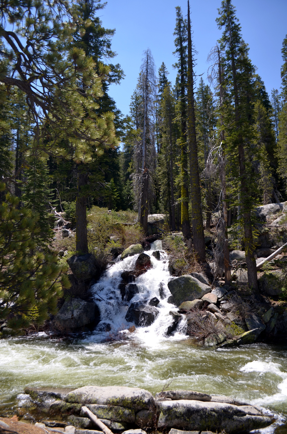
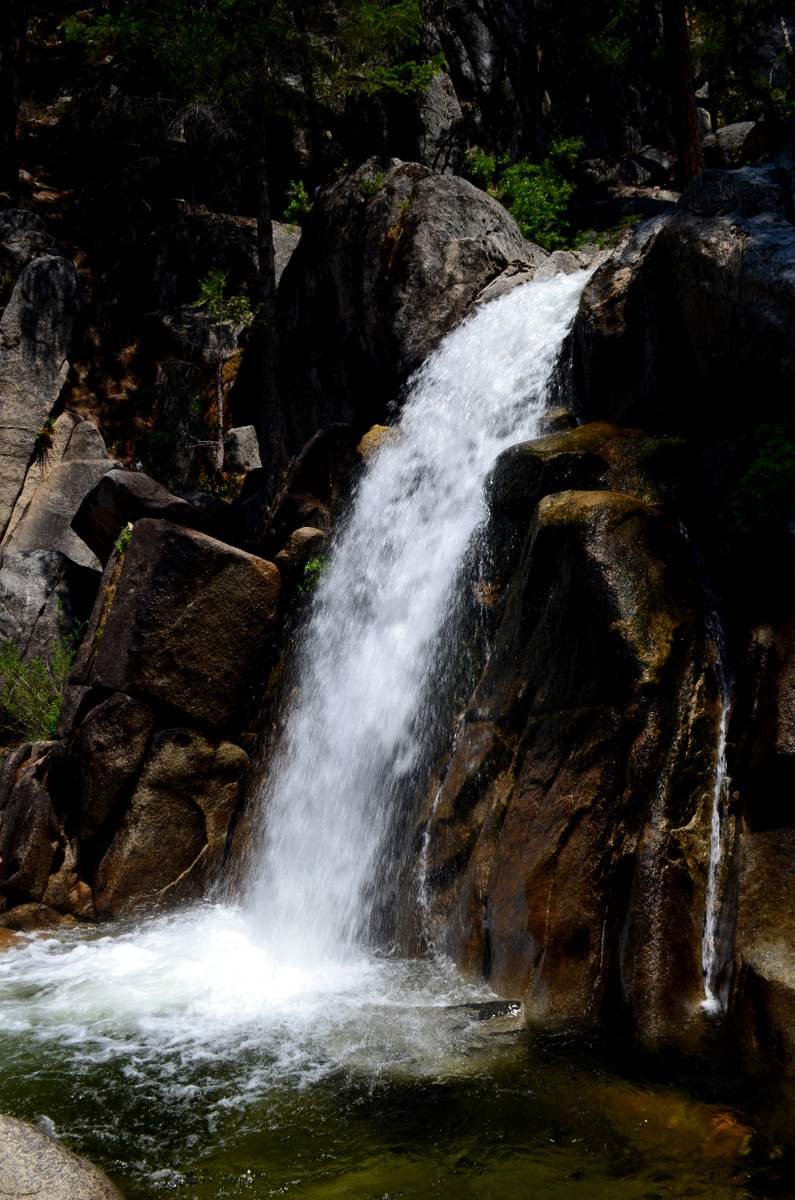
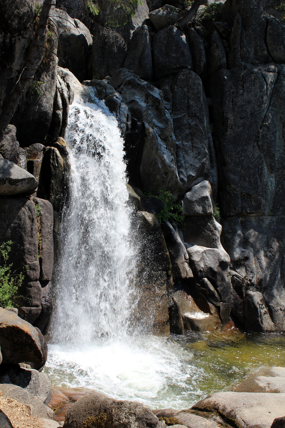
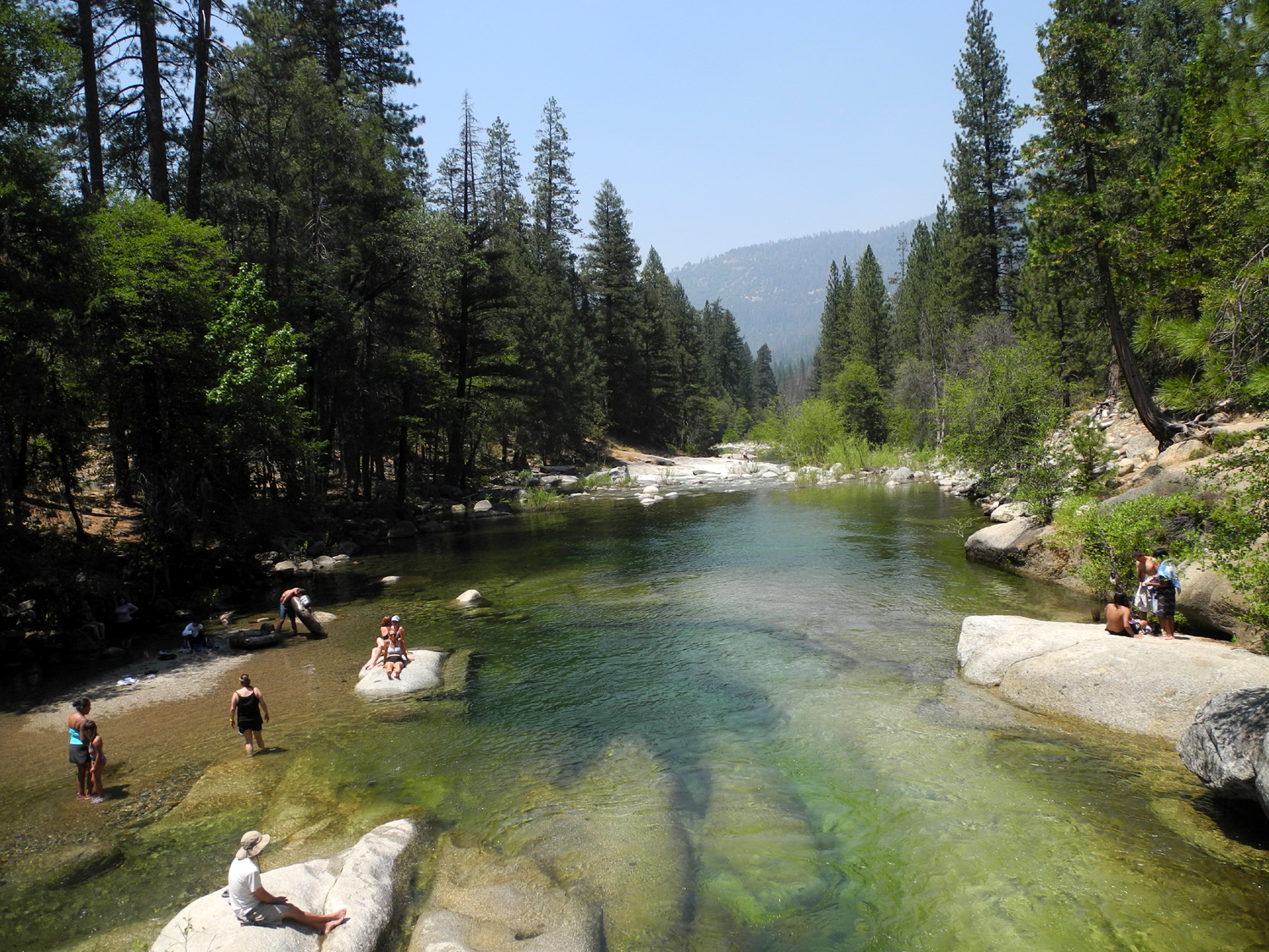
Indian Pools Although the destination we reached was not our first choice, like many forced changes, it turned out to be a most excellent adventure. Julie, Wes, Don and Dick walked up from Huntington Lake, to Indian Pool and Falls, enjoying the crashing water of Big Creek, striking rock formations, spring wildflowers, and a delightful little falls. Actually there is nothing on the map to indicate that the falls has a name, but we're going to give it the same name as the trail and swimming hole nearby. |
||
|
|
|
|
|
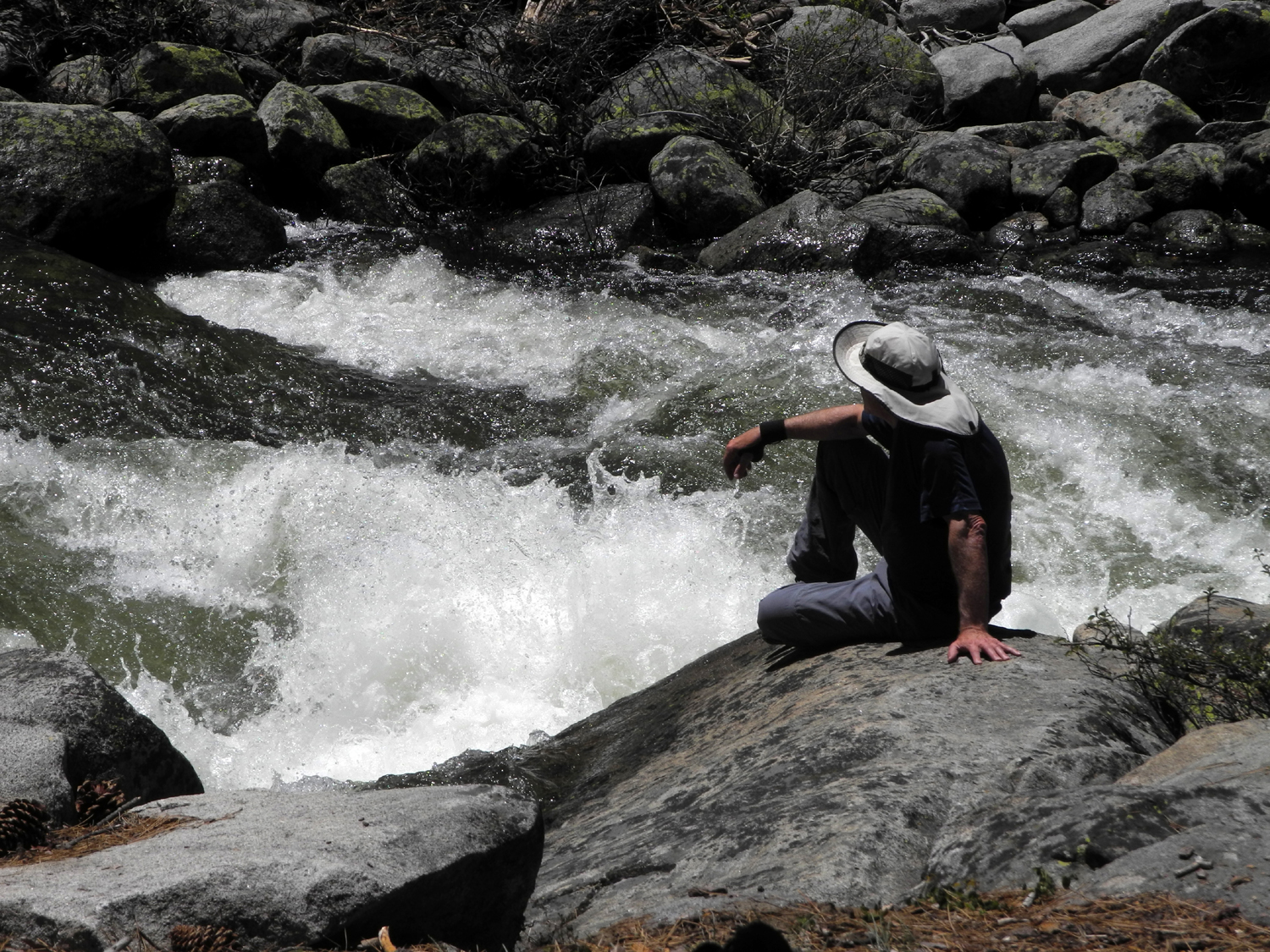
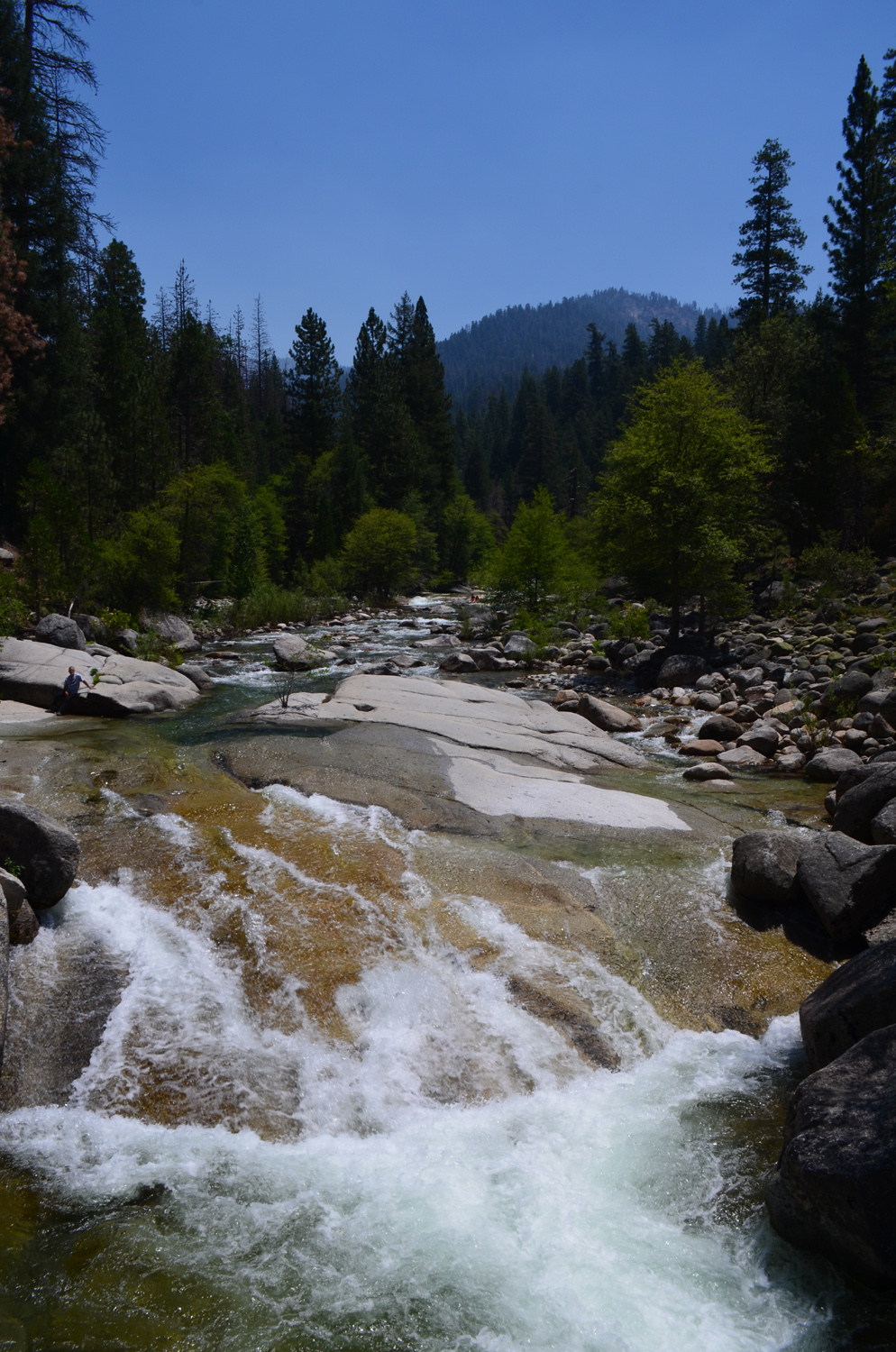
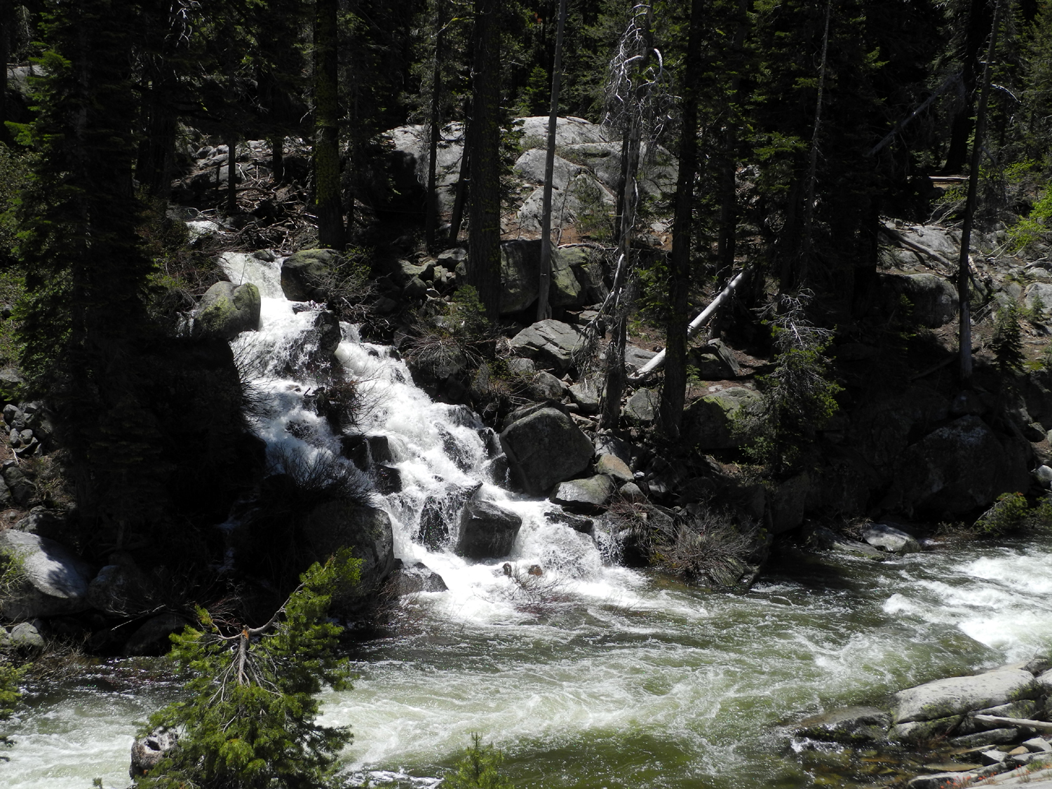
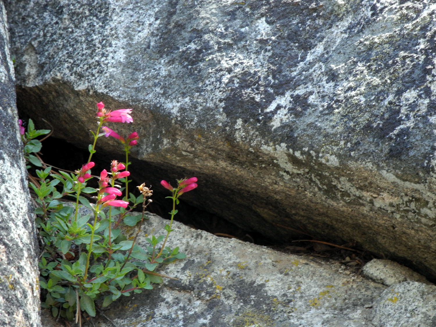
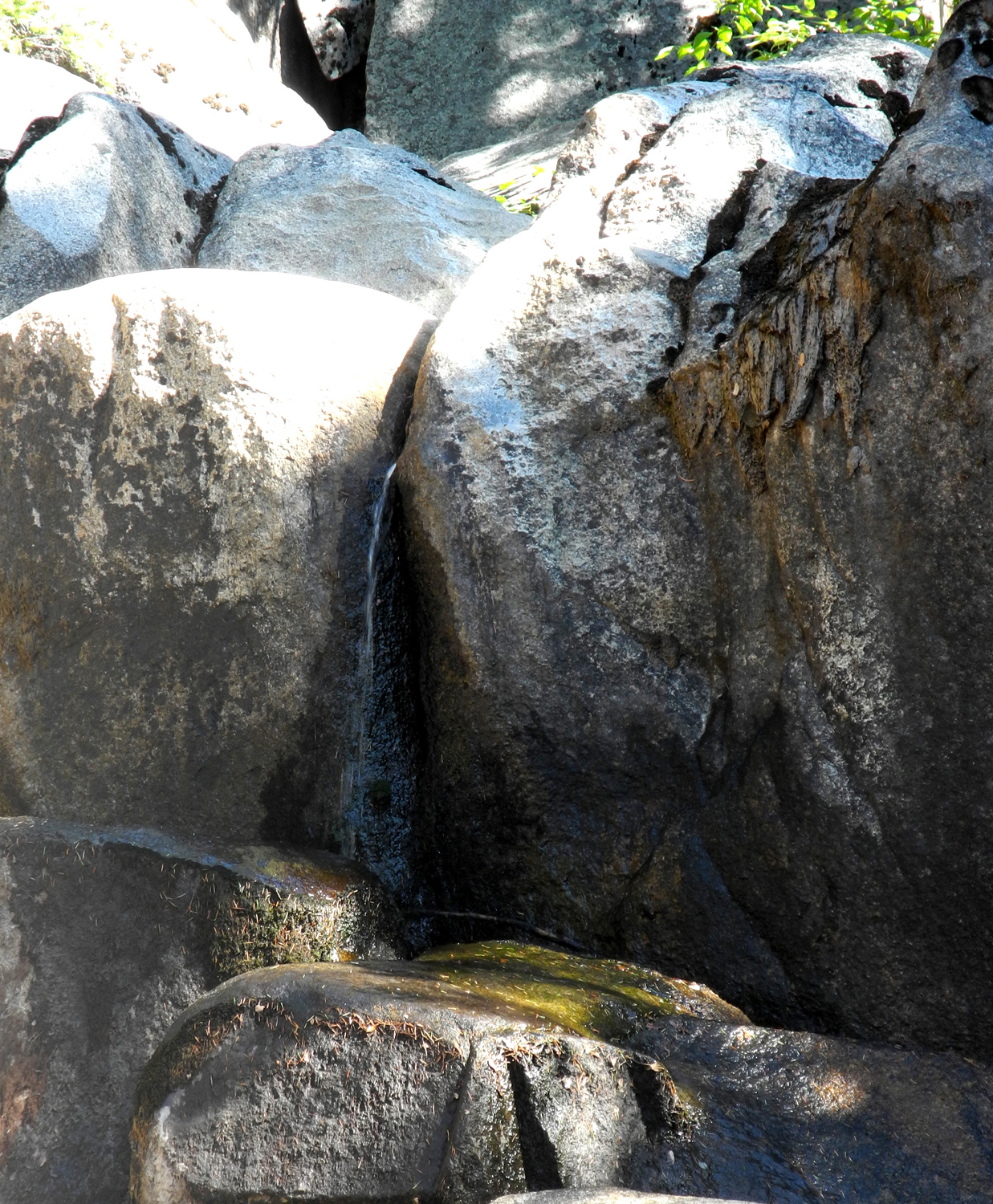
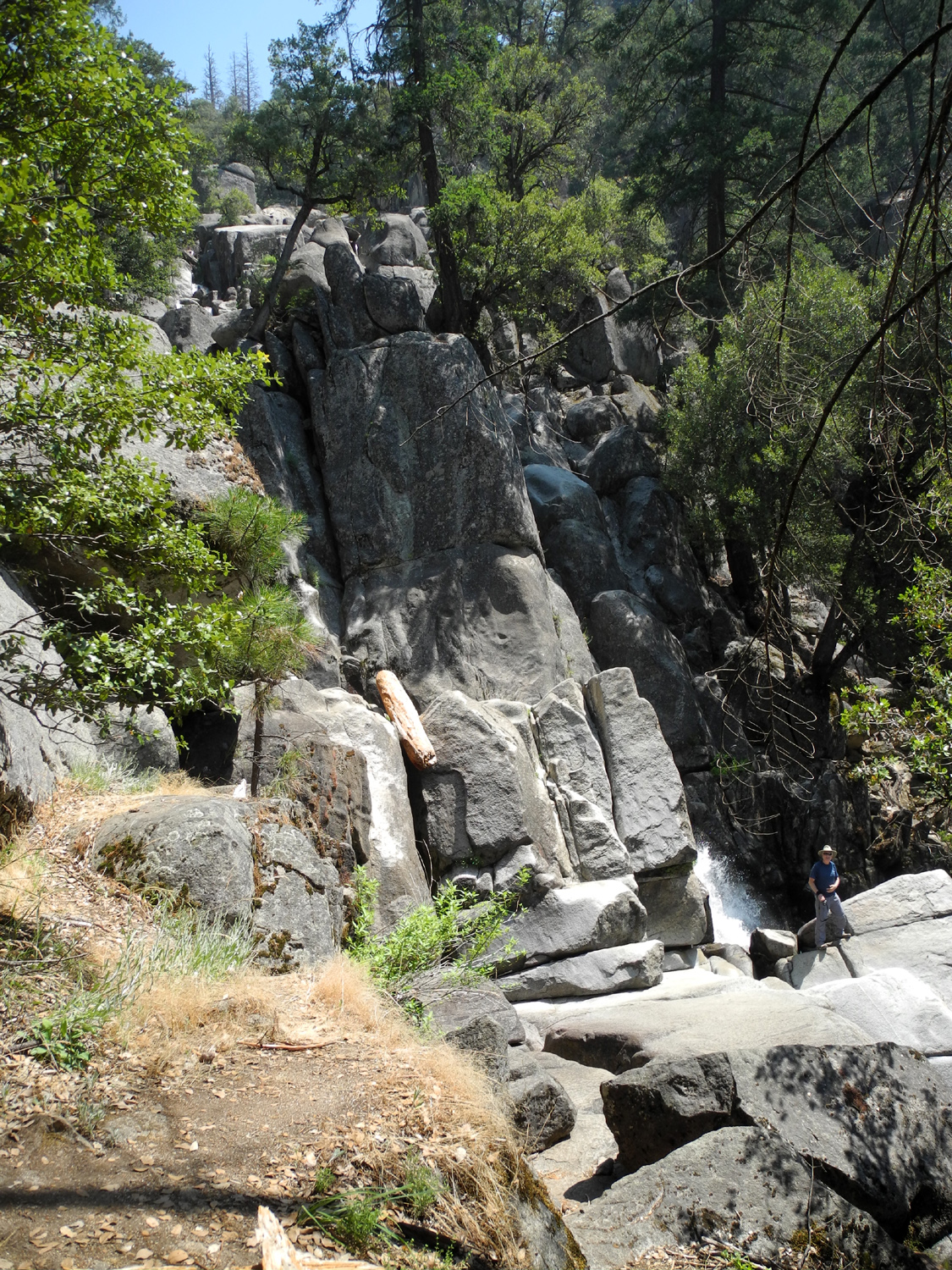
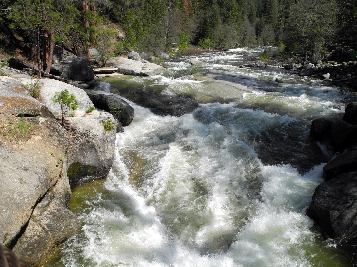
An outing last year took the Ramblers to Rancheria Falls near Huntington Lake. We were duly impressed with this magnificent falls, and I returned about three weeks later for a second look. With streams and falls at record levels, it seemed only natural to make another visit this year. We took my truck, the better to navigate the dirt road to the trailhead. However, the road was closed to vehicldes, which would have turned a hike of just under two miles into a four mile trek, a bit more than some of the Ramblers are willing to undertake. It was only a mile or less to China Peak Ski Resort, where the road past the lodge and through the parking lot leads to a trailhead right next to Big Creek, the main stream flowing into Huntington Lake. Like most Sierra waterways, this normally sedate creek was a raging white water river on June 14. Although our destination was a waterfall, what draws most visitors is a series of large pools, suitable for cooling off in summer weather. Right now entering this stream would render you permanently cool. The trail is fairly easy at first, but becomes tricky to follow after the first pool. It is rocky and moderately steep in places, but there are rock cairns to show the way. There are actually TWO ways, one of which leads to a view of a tributary that cascades down directly into Big Creek in a sliding fall about thirty feet high. The elevation is above 7,000 feet, where the typical trees include fir, Jeffrey pine and lodgepole. At the highest point on the trail we even saw a few junipers. The terrain above the trail, opposite the creek, includes some views of big rock cliffs. Naturally there were high elevation wild flowers in bloom, particularly the bright pink bridge penstemon that seem to pop out of every crack in the rocks all summer. Julie has a very good sense of when she's gone far enough, and when the trail became more than she was comfortable with, she found a shady spot to rest beside the creek and wished us well. Where the trail divides Wes and Don went right and I went left, but they eventually caught up with me to tell me the falls was on the trail to the right. We backtracked a short distance and made our way over a ridge to the creek where we could see the falls. We enjoyed the view here and took many photos, then made our way back, meeting up with Julie again for the final walk back to the car. Although the trail was somewhat challenging and the scenery fantastic, our total walk was only about 1.6 miles, including my "detour." We decided that we needed to get a view of Rancheria Falls no matter what, so we drove up the Kaiser Pass Road, which rises up from 7,000 feet at Huntington to the pass at 9,000. The upper part of the road is still closed, but about three miles up you can stop and look across the canyon at an excellent view of the entire Rancheria Falls and the steep cascades above and below. After we had enjoyed this vista, we started back down, stopping in the town of Shaver Lake for lunch. Here's where the day took a negative turn. When we finished lunch and were ready to leave, my truck would not start. Fortunately we were the beneficiaries of small town hospitality, as a woman soon came to our rescue with her Jeep and jumper cables. We also got some help from Don's brother who lives in Shaver Lake, and answered his call for help within a few minutes. We made it home safely, not turning the engine off until I was parked at my house, a good decision since it failed to start when I tried it a short time later. I got help from Triple A the next day, and now have a new battery to replace the 9-year old one that provided service three years past its original maximum warranty date. For some reason, Wes has already volunteered to drive on our next outing.
|
||
|
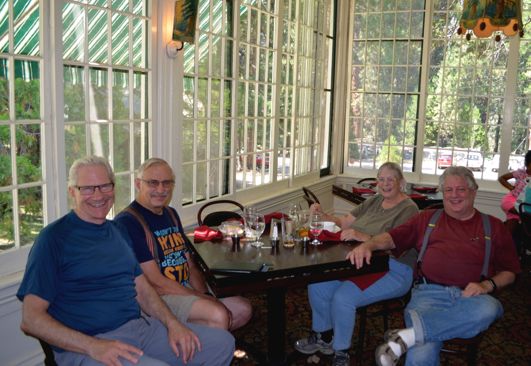
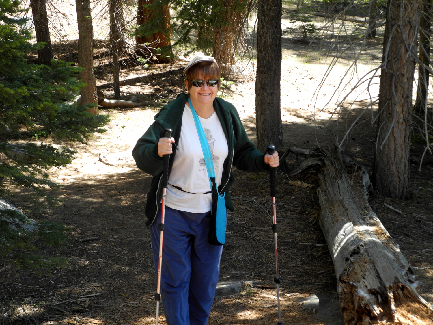
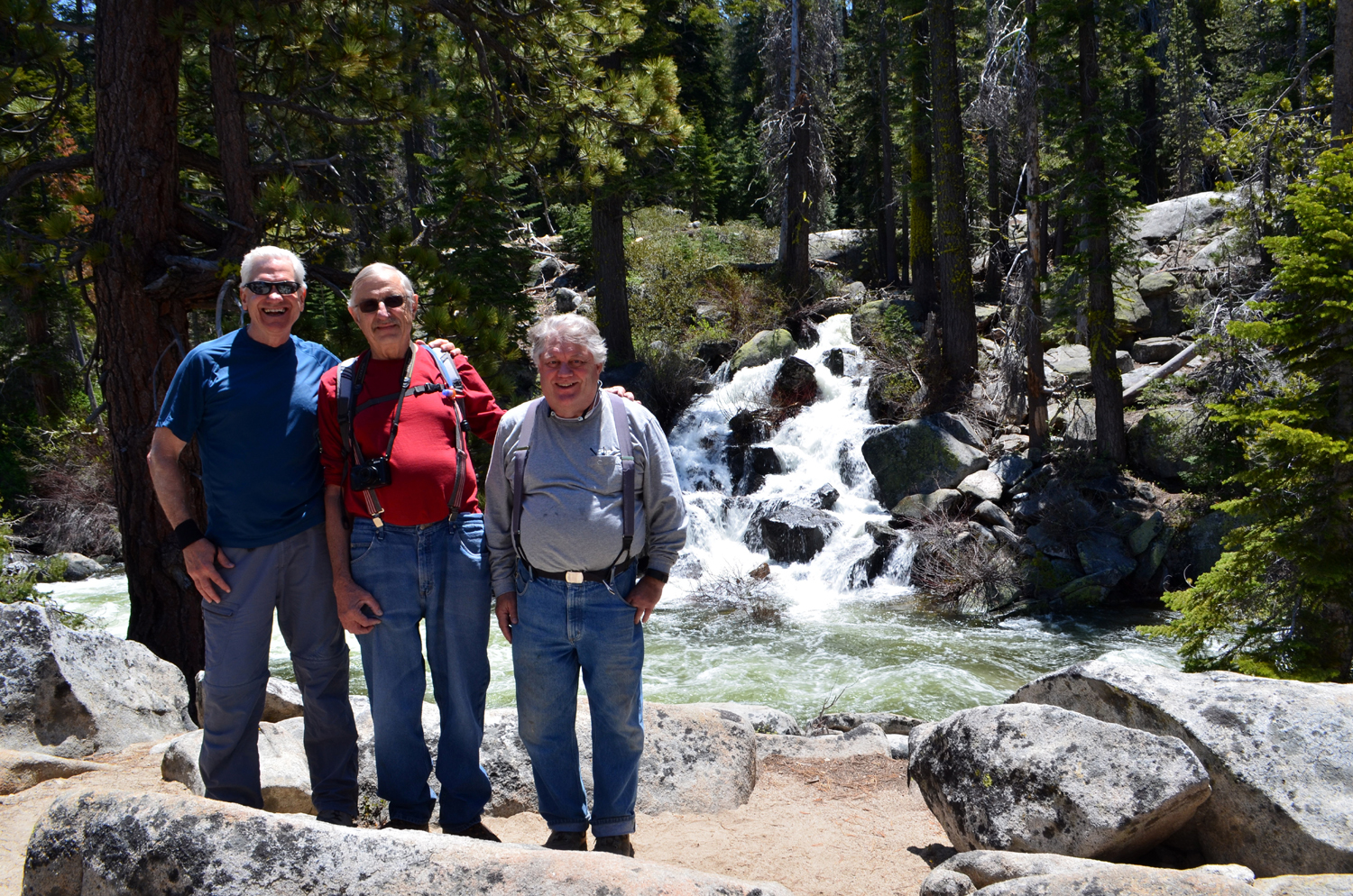
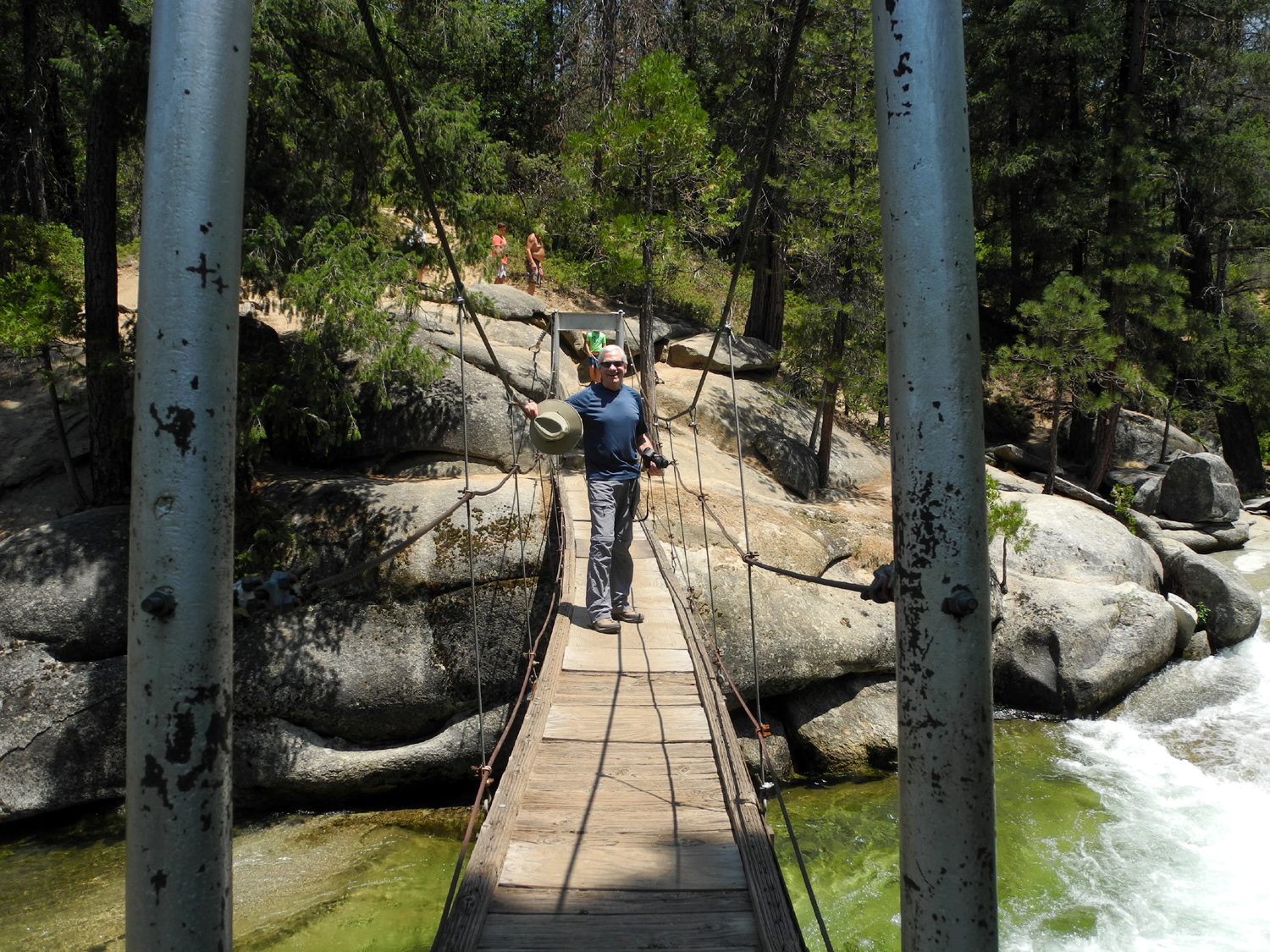
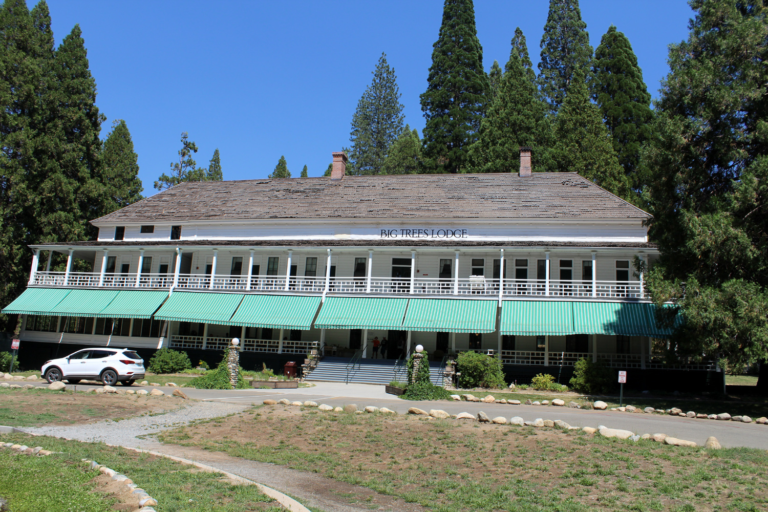
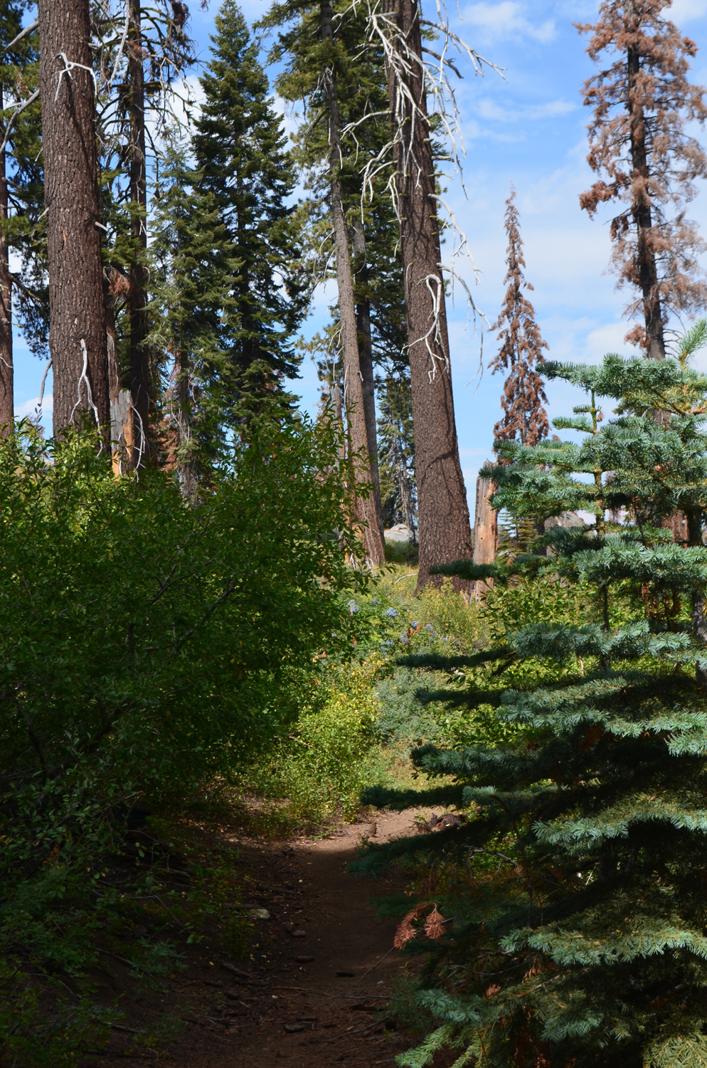
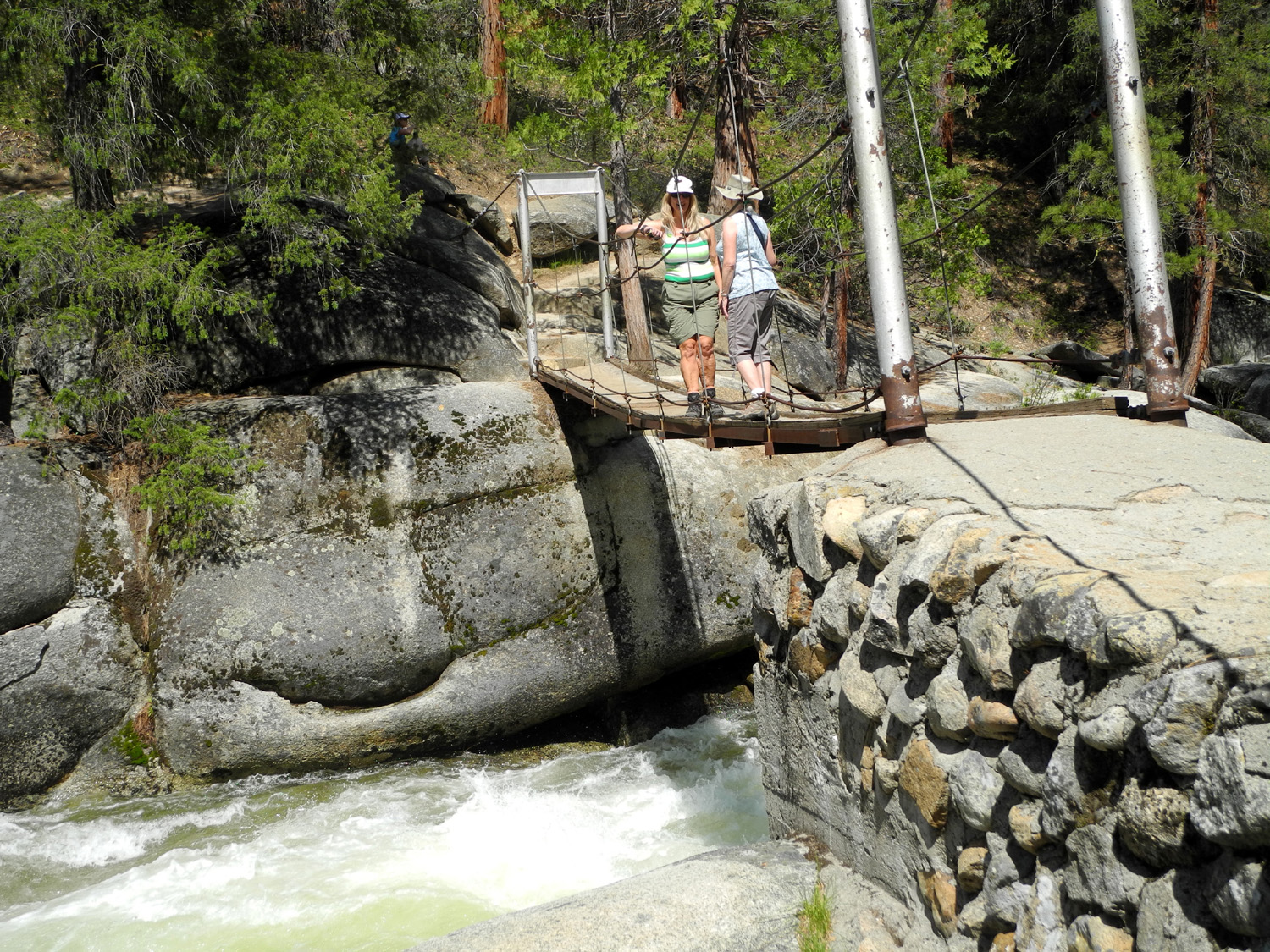
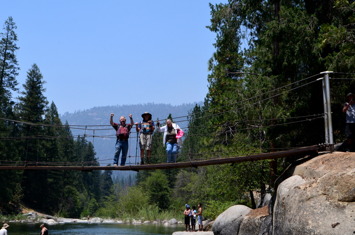
Wawona Trails This was the Ramblers' third outing at Wawona, and in terms of effort, it was half way between the previous two. The size of our group also fell in between the others. In September of 2015, just Wes and I were present, hiking to the first falls on the Chilnualna Falls trail, where we found only a small trickle of water. We then walked a short distance on the Wawona Meadow Loop Trail. In May of 2016 the original Ramblers, Julie, Wes, Carolyn and I, plus my daughter Teri, did the entire four mile Meadow Loop, plus the eight tenths of a mile round trip to the swinging bridge. On July 19 of 2017 Julie and Carolyn had other obligations, but Wes, Don and I were joined by another former work colleague Sue Wirt, who has now been arbitrarily declared an official Rambler, whether she wants the honor or not. Our plan was to hike to the first falls, then do the Swinging Bridge trail, which added up to just a mile and a half total. Wes, Sue and I left from my house a little after 8:30 and picked up Don at the Park & Ride at Highways 41 and 145, made a pit stop in Oakhurst, and got into Yosemite by about 10:00. There was some road work just outside the park where we had to stop for a short time, but the line at the entrance station was short and we were soon on our way. Don bought his Senior Pass, which gives free lifetime entrance to most parks and discounts on camping for life. The price is going up to $80 at the end of August, a much more reasonable price for what you get - but none of us are complaining that we only paid $10. We got to Wawona, crossed the bridge over the South Fork of the Merced, turned right, and followed the narrow road past rental houses and little stores to the trailhead. There was really no "official" parking left, but we found a spot and got into our boots and packs for the short hike. It is only seven tenths of a mile round trip to the first fall, but for more ambitious hikers, the full route to all five significant falls is four miles one way. Access to the trail requires a short but very steep hike up the paved road from the parking lot. The dirt trail goes off to the right, and is still fairly steep for 100 yards or so. It then levels off and goes close to the creek and the first fall, which I estimate at about 30 feet. This is where we stopped, with Wes making his way down close to the falls, and Don and I carefully stepping out to a couple of good viewing points off the trail, while Sue kept watch, probably ready to rush back and make a 911 call if we ventured too far. The trail from this spot begins a series of switchbacks, and obviously goes up fairly steeply again, since we could see the creek coming down in a series of cascades through the rocks above the top of the falls. Leaving this route to more adventurous souls, we returned to the car, and drove down to a bridge across the creek for a quick look. We then returned to the main highway, crossed to the south side of the river, and followed Forest Drive for about two miles to the trailhead to the Wawona Swinging Bridge. This is a very easy, almost 100% flat trail that we measured at eight tenths of a mile, although the web site speaks of a 1.5 out and back trail. This probably includes crossing the bridge and continuing upstream to where the trail more or less disappears. You can turn this into a four mile loop hike by turning left after crossing the bridge, which will take you through much of the terrain next to the road to Chilnualna. We did not do this. Instead we crossed the bridge and then walked back, while Wes went down by the river to photograph the rest of us on the structure. When we were here last year the river was running quite high, and it would have been dangerous and foolish to get into the water. By this time, the snow melt has decreased, river levels are dropping, and there were a dozen or so people cooling off in the water or sitting on the riverside rocks. It was warm enough that we might have been tempted to join them if we had brought the proper swimwear. Instead we returned to the car and drove to what should be called the Wawona Lodge, but is officially Big Trees Lodge. This is always our ultimate destination when we hike here, since the restaurant serves very good sandwiches. Sue had never been in the dining room; Don had not been there for decades, and I was making my third visit, having been there first with Wes in 2015. Wes has been there too many times to count. That evening Wes emailed us a few of his photos, along with his usual summary of our adventure: What a day we had following the rapids of several creeks and rivers around Wawona in Yosemite National Park! The aim was to experience and enjoy the majestic trees, rocks and boulders and walk along several tributaries of the mighty Merced. The invitation was broad but only four hikers were able to make the trek. Although we logged less two miles, we were able to hear the sound of water crashing on rocks and see pools of crystal clear water. First we followed the upward trail of the Chilnualna until we reached the first of its many falls. We then motored to our second destination, the trailhead leading to the Swinging Bridge. Finally we returned to the Wawona Lodge where we enjoyed a great lunch before heading back home. It was a day well spent. It is a special treat to travel with companions who love nature and enjoy laughter. With some of us carrying part of our lunch in a box, we reluctantly left the beauty of Yosemite behind and drove back to the 100 degree heat of the valley, already thinking of finding a cool location for our August hike.
|
||
|
Buena Vista Peak |
||
 |
 |
 |
| Rock
artifacts next to the Kings Canyon Overlook |
Buena Vista Peak - our destination | The view from the top |
|
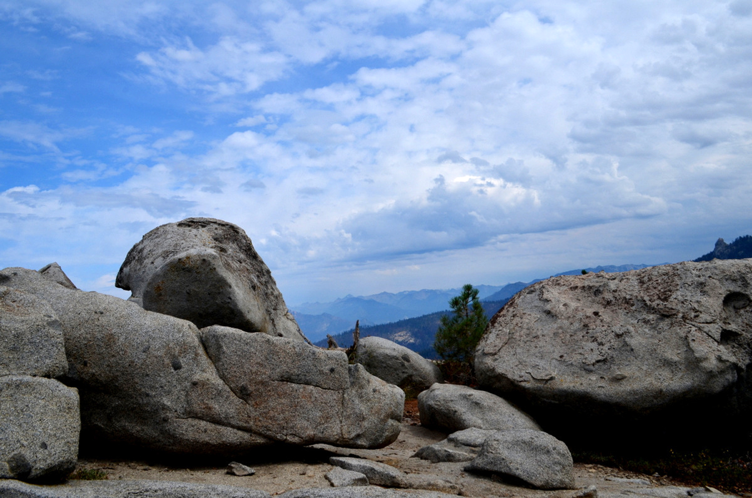
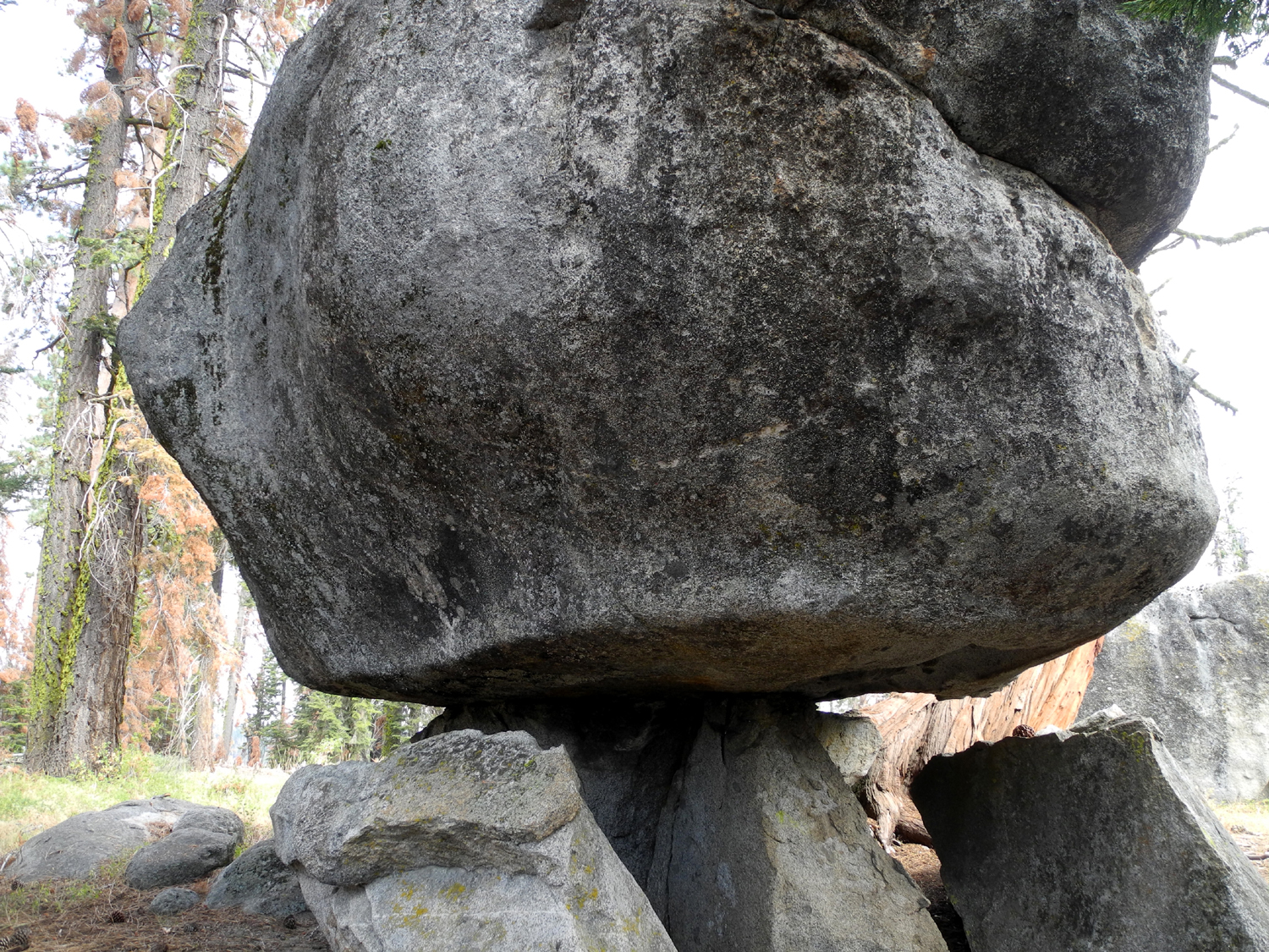
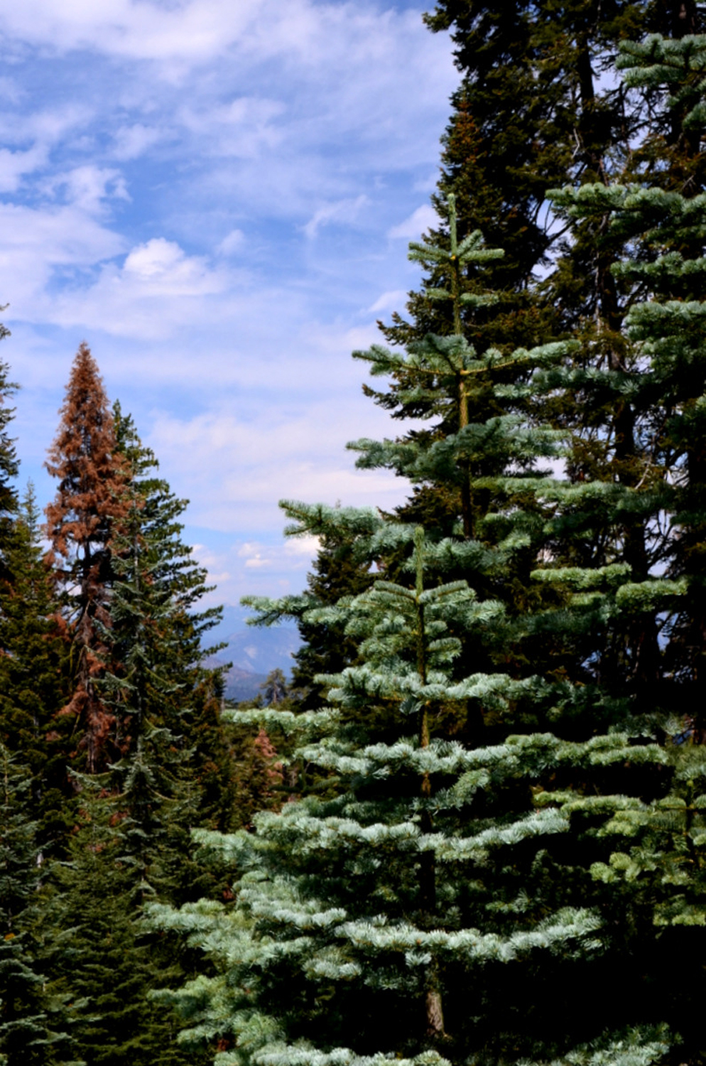
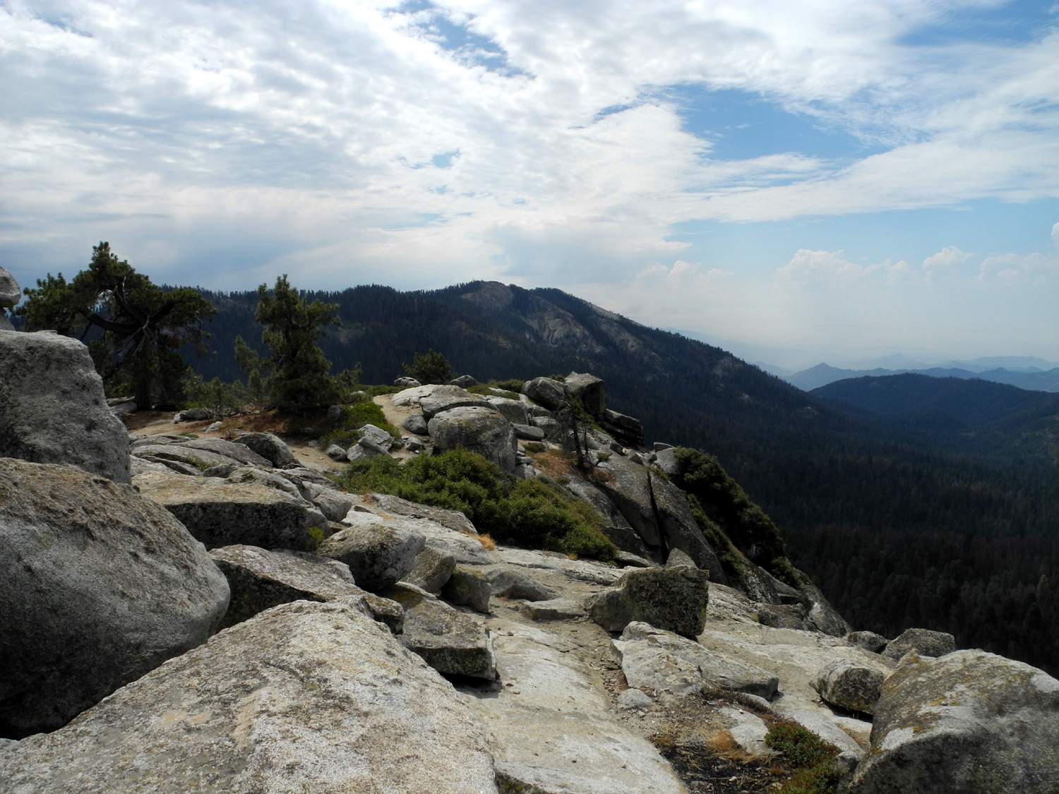
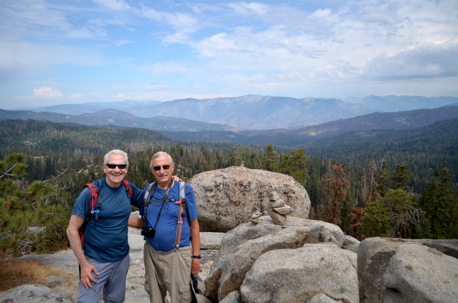
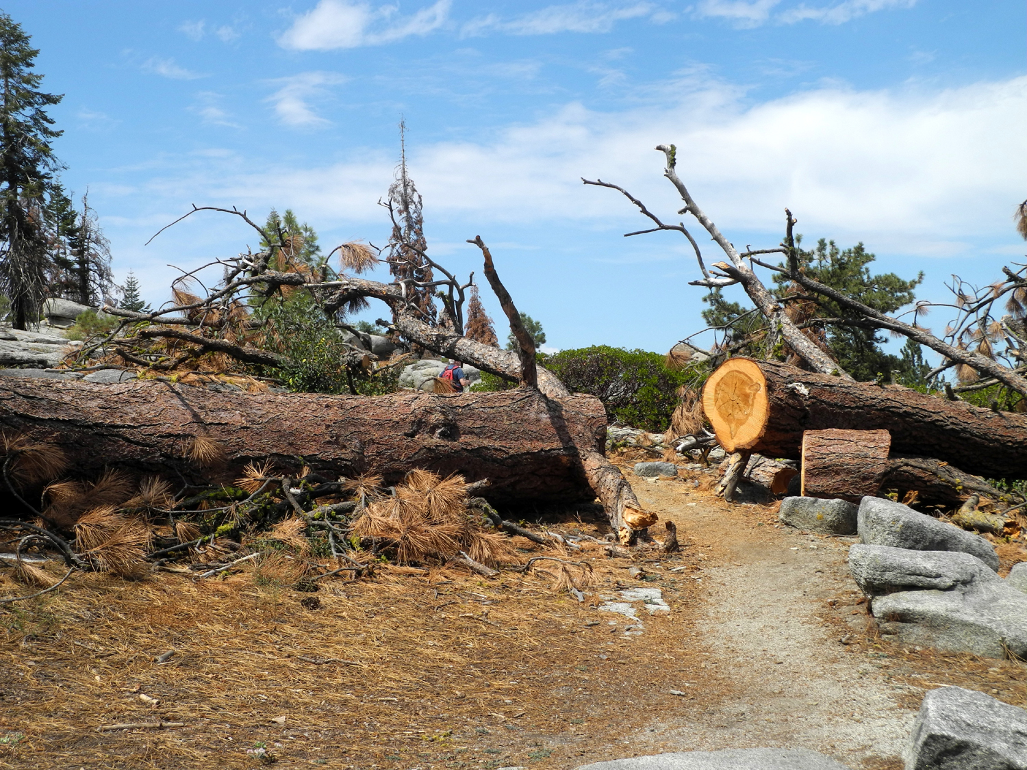
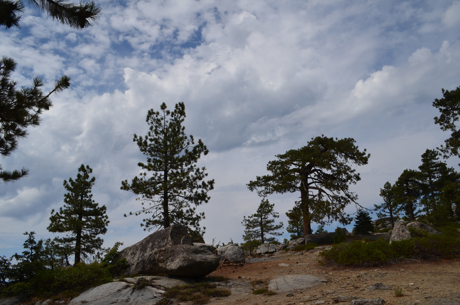
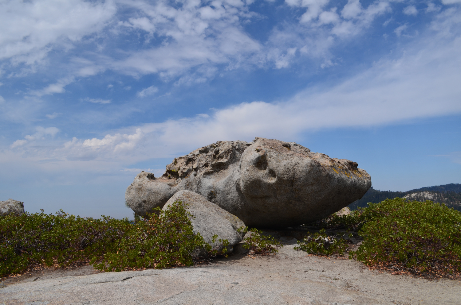
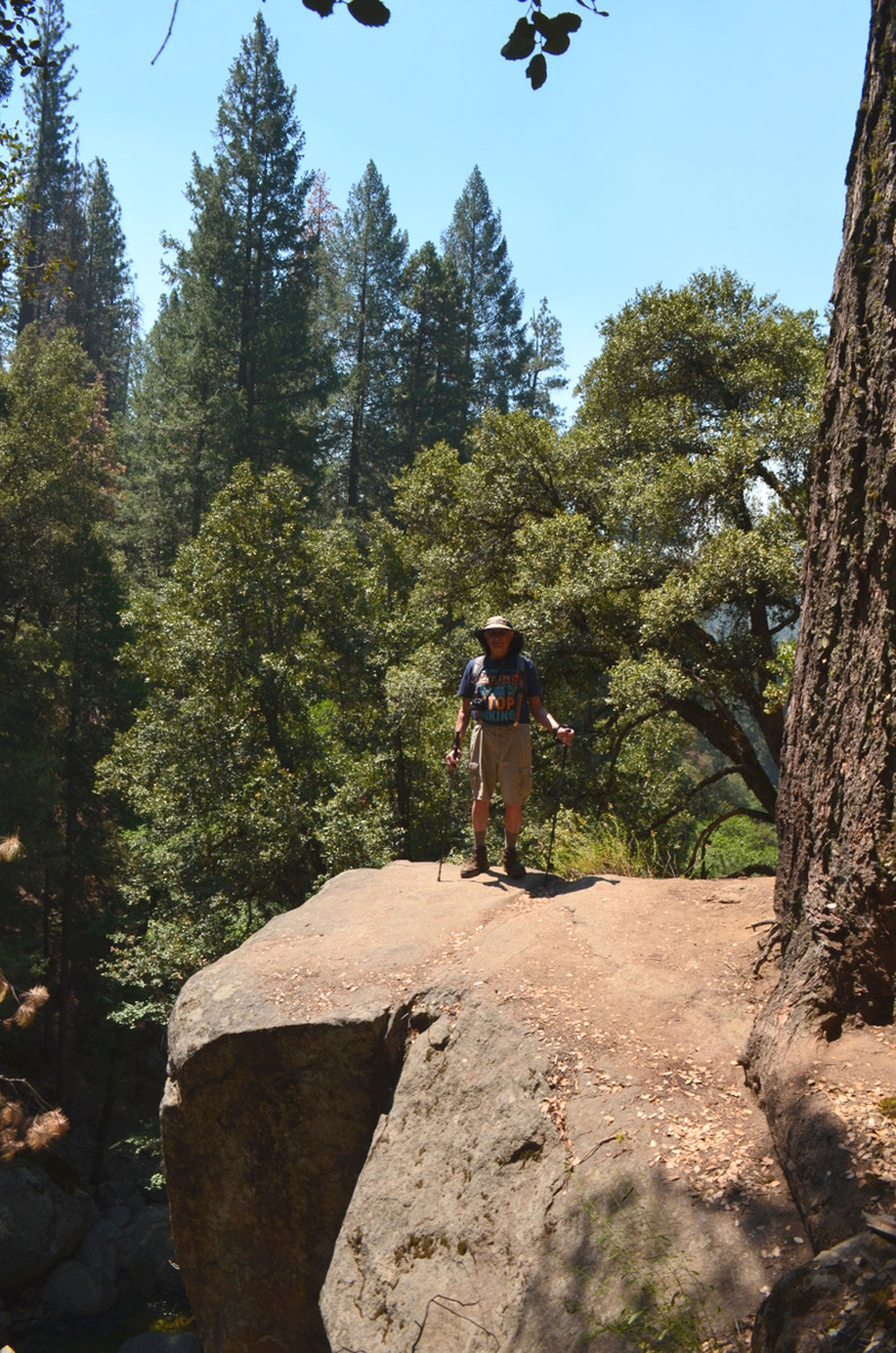
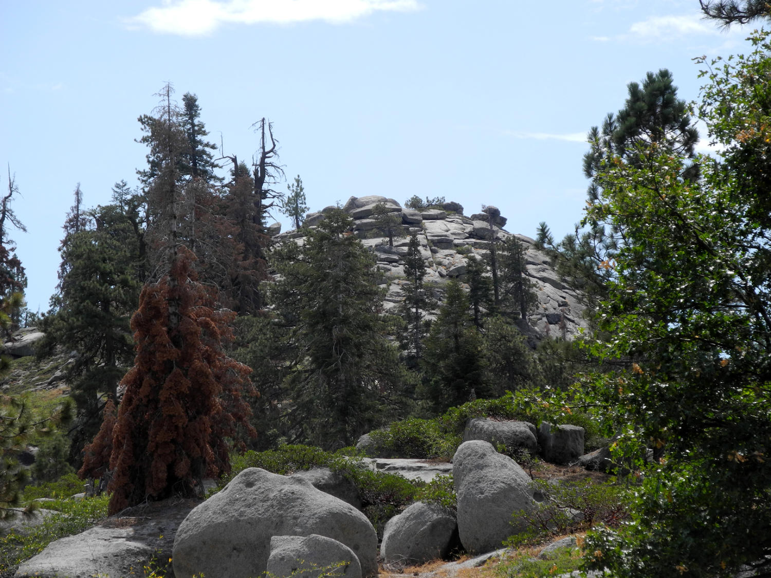
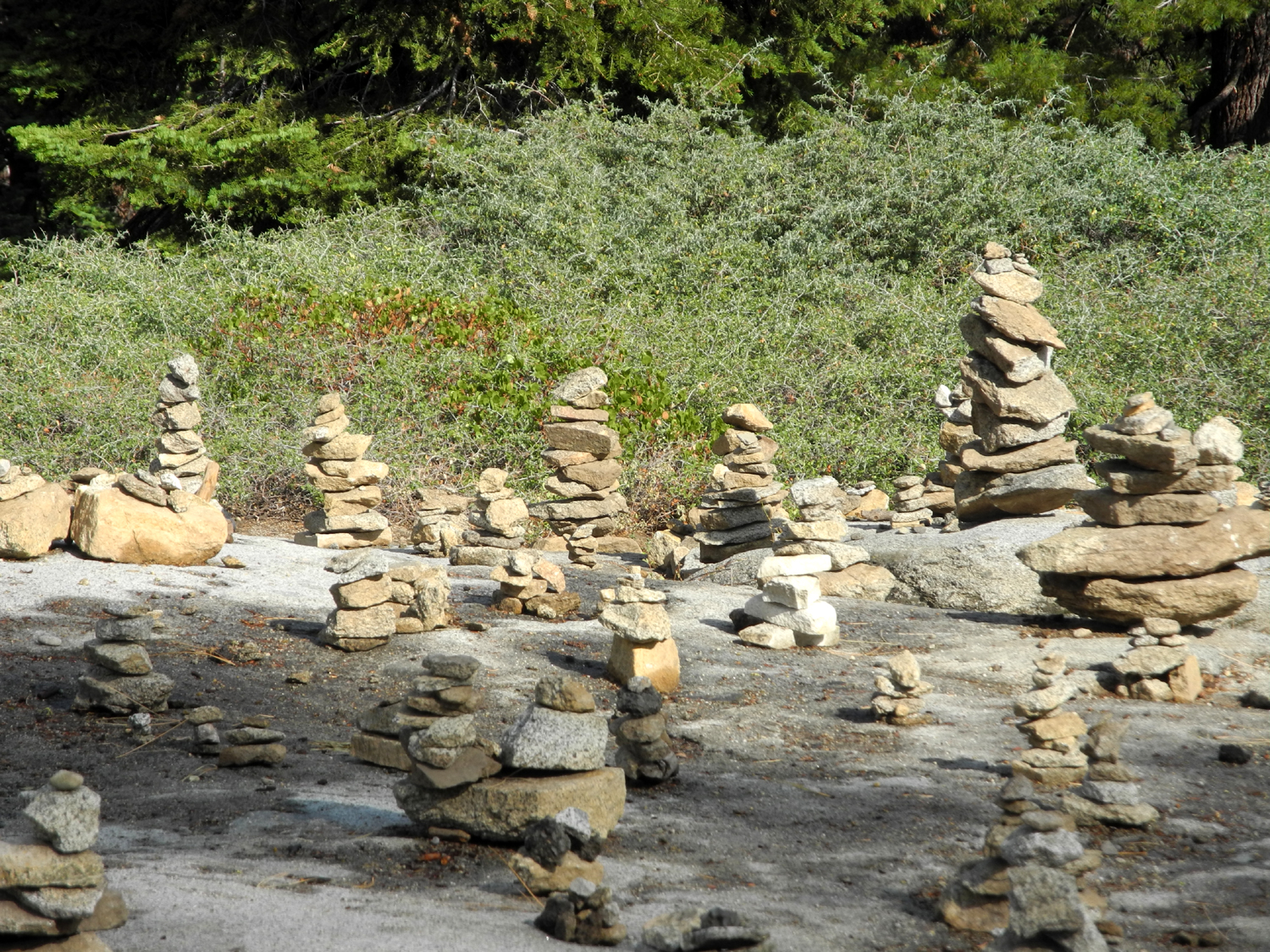
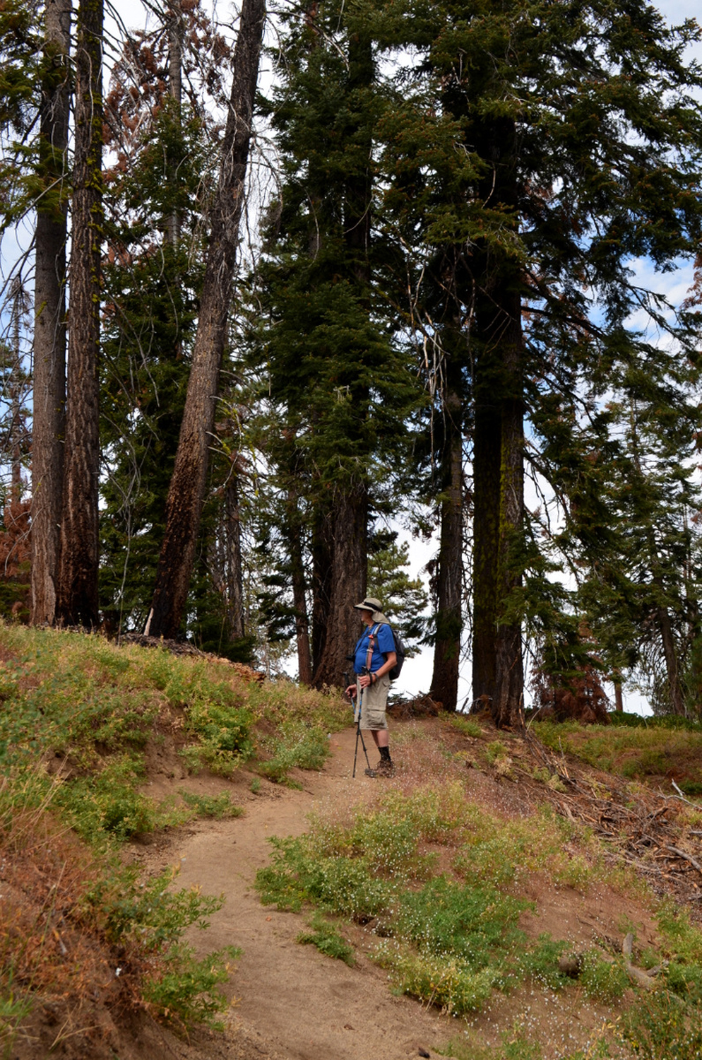
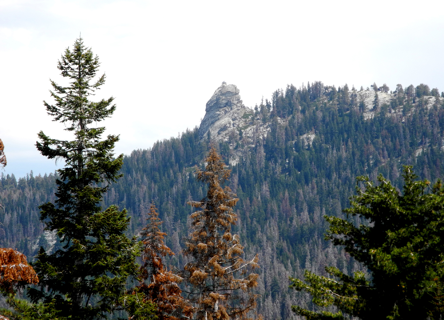
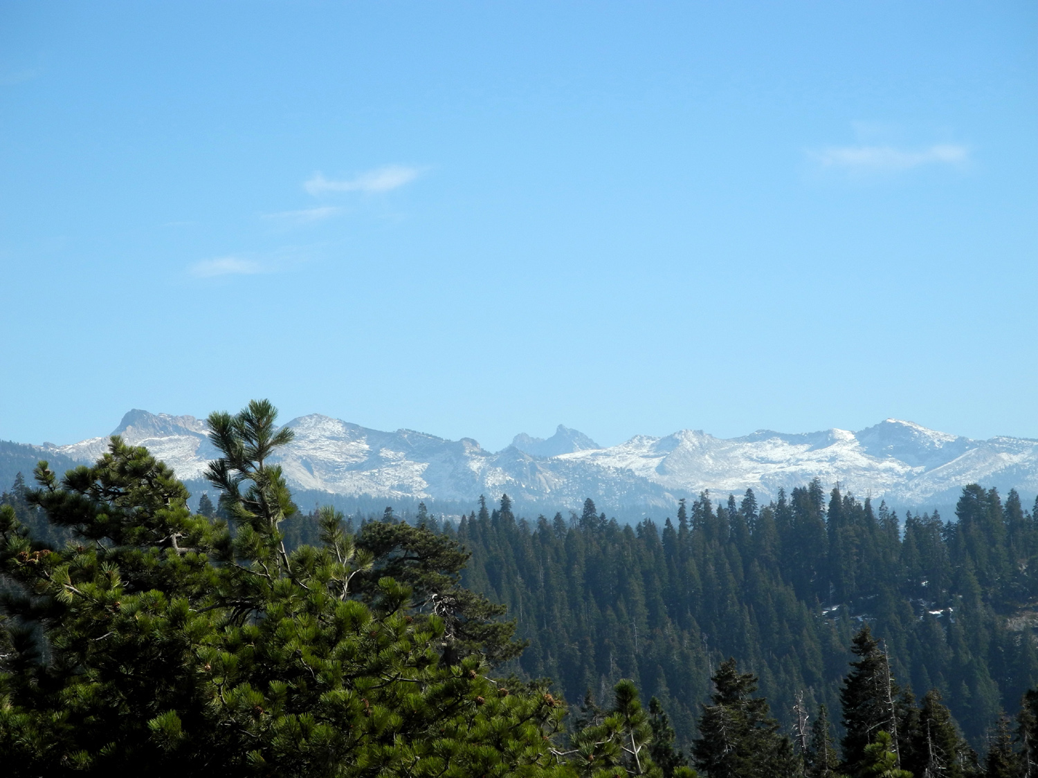
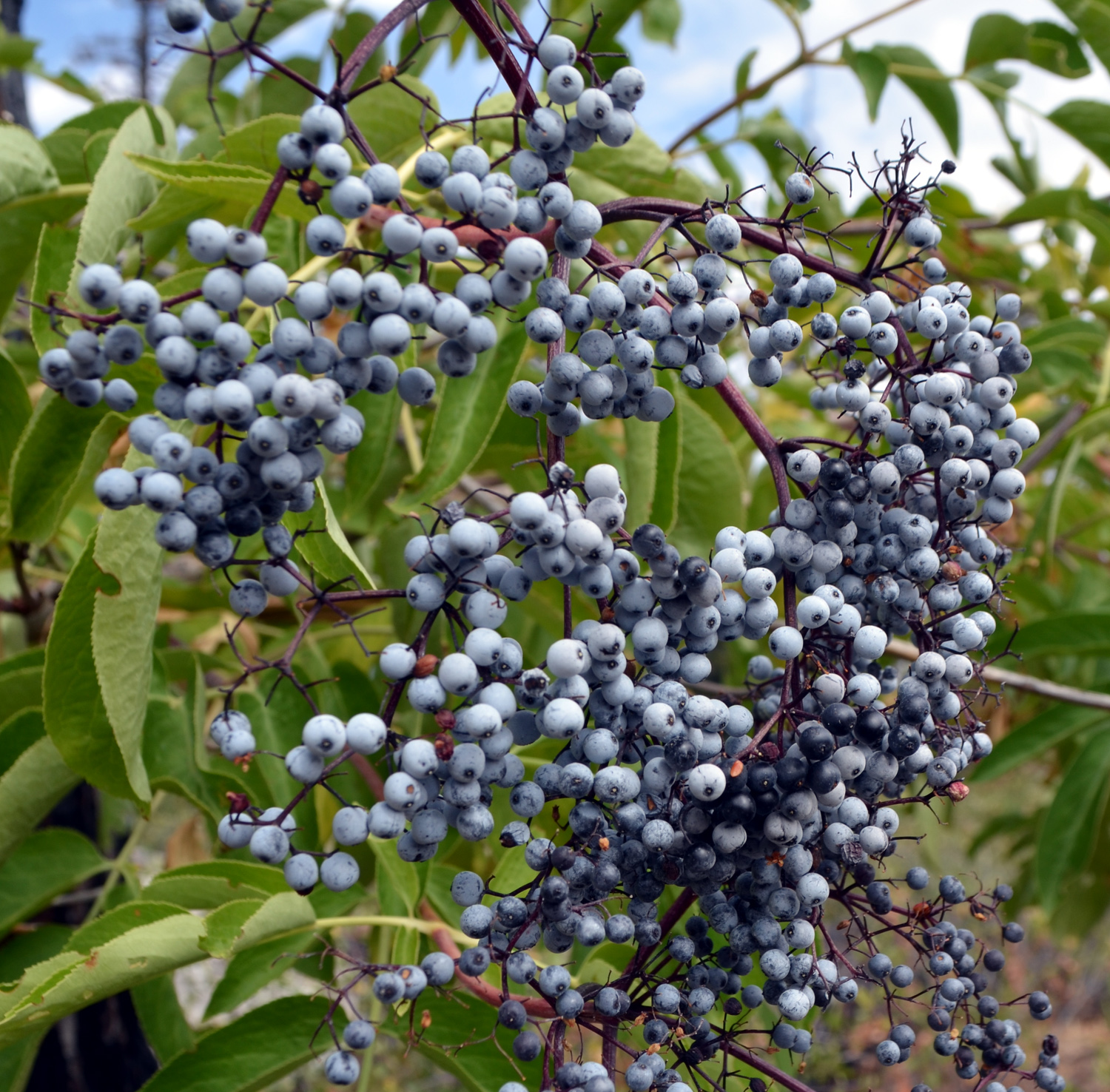
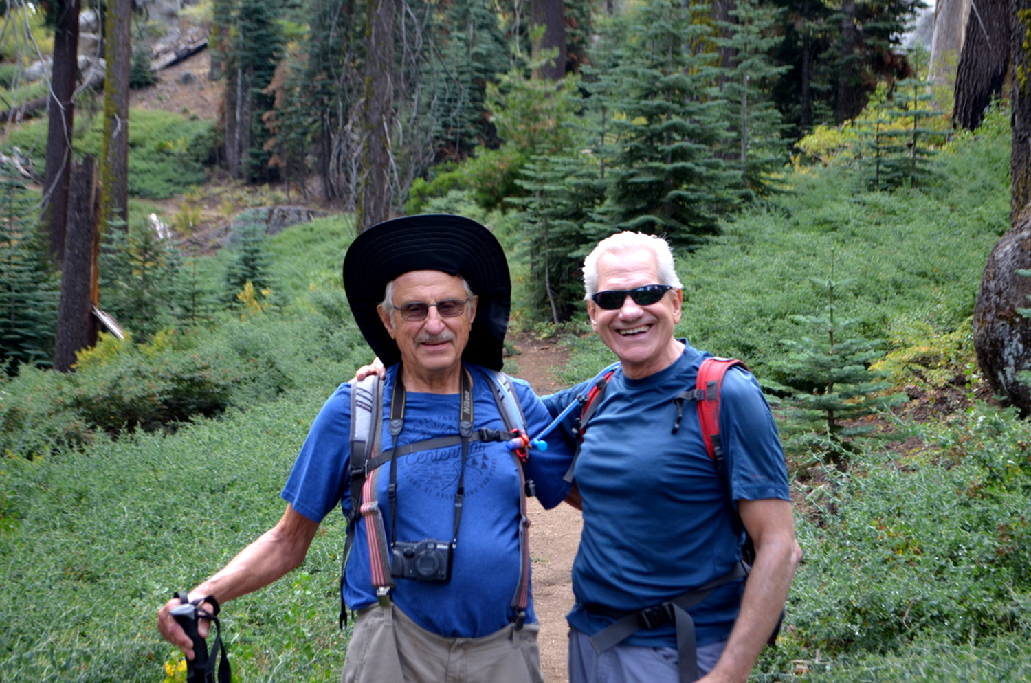
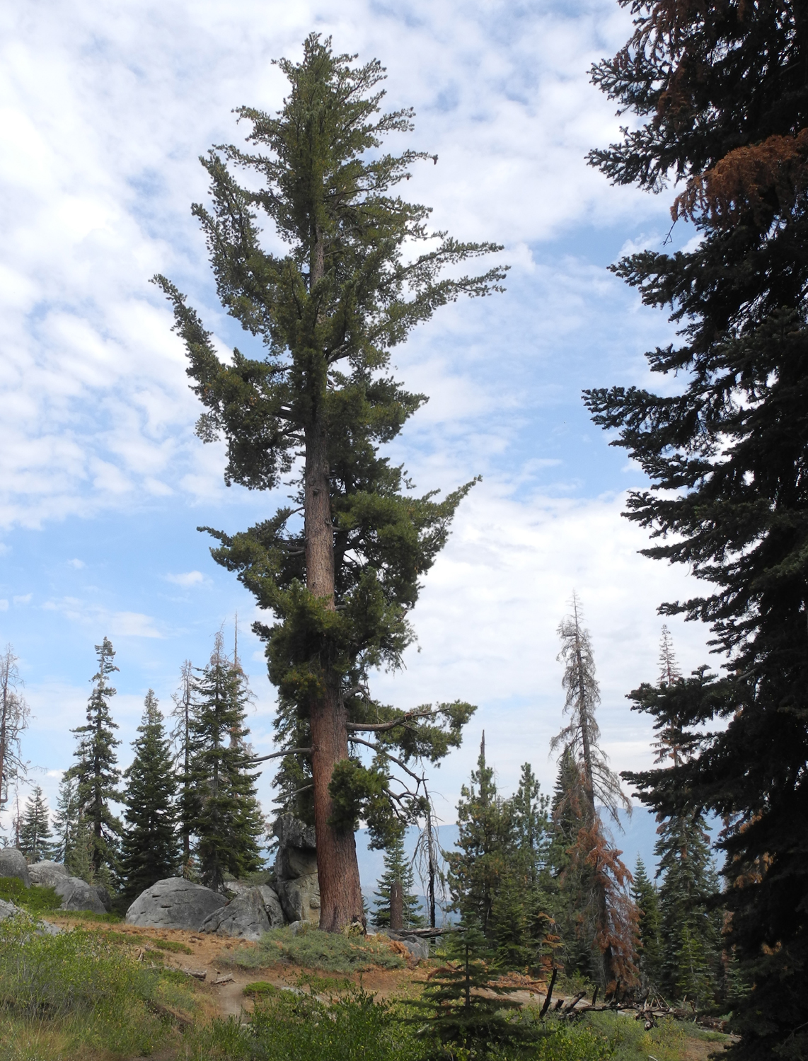
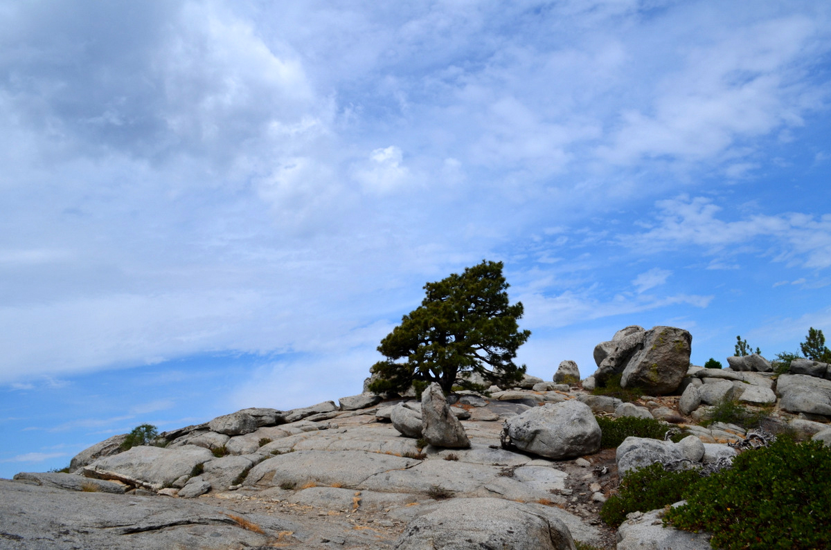
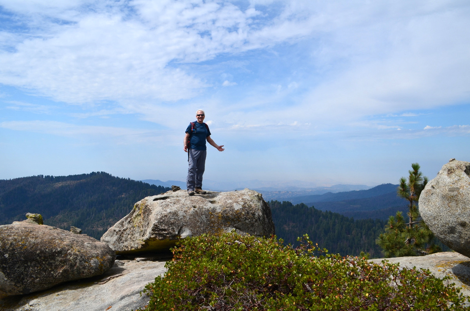
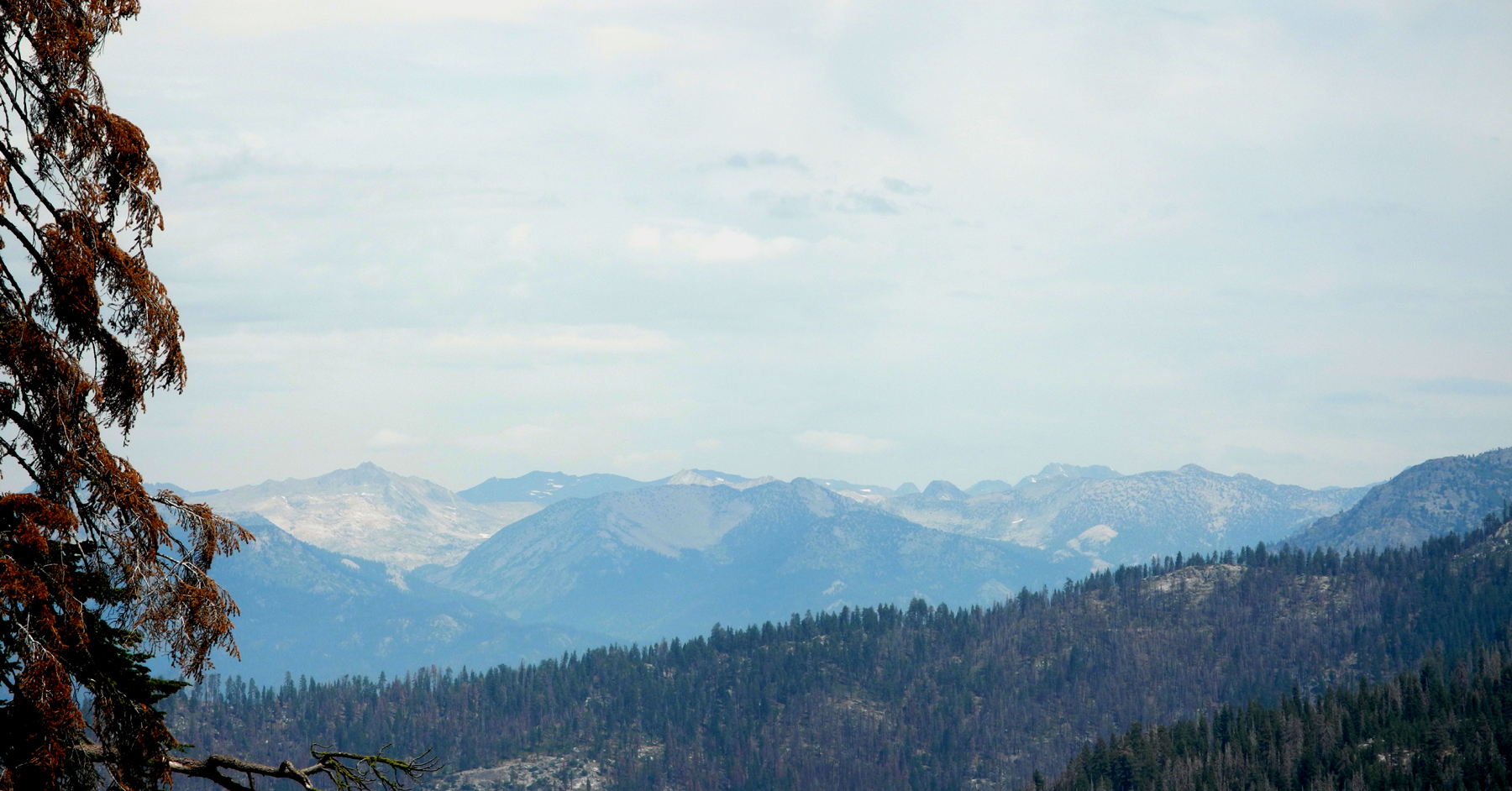
The seeds of the Ramblers hiking group were planted when Wes and I took our first hike together in 2014, on the Hite's Cove Trail in Mariposa County. So it may be fitting that Wes and I were the only ones able to make this hike, on August 30. Our destination was a rocky peak along the General's Highway a few miles south of Grant Grove. The Ramblers went there in 2014, which was in fact the very first official Ramblers hike. We've had thunderstorms and possible rain in the mountains for several weeks, and this day was no different, with a 20% or more chance of rain, depending on which website you looked it. I awoke at 6 a.m. to a ten minute sprinkle in Clovis, but there was no rain where Wes lives, about four miles west in Fresno. When we started east into the mountains about 8:30, we had a few drops of mist on the windshield in the valley, but nothing in the mountains. During our hike it was breezy at times, about 70 degrees, with clouds drifting around all the time adding to the scenery. As we approached the trailhead we stopped at two overlooks to check the sky, since the peak is the kind of place you don't want to be when there is lightning around. The clouds were all in the distance, and when we saw Buena Vista from the road, it was in sunshine, so we had no worries. We stopped at the Kings Canyon Overlook, where normally there is a great view of the high Sierra peaks in the Kings Canyon back country. Clouds and haze blocked the view, but we did see something of interest - people had created dozens of little rock piles or "sculptures" in a large open area below the parking area. We knew that these were not there the last time we visited this area, some time within the last year, and of course, we took a number of photos. The trailhead is across the road and about 100 yards beyond the overlook, so we drove over there, put on our boots, and got started up the one-mile trail. The trail rises fairly steadily, with some leveling off here and there, and along the way offers views of the forested ridges nearby, as well as the distant peaks. The view became a little better as time went on, but was never really clear. There are photos from earlier trips here and here. There was plenty to see right by the trail, however. Elderberries are ripe, although I could not convince Wes to sample them. (They make good pies, but are a little bitter taken straight). We came to a couple of places where dead trees had fallen across the trail since our last visit, but sections had been cut out to allow passage. We met a few people on the trail, including a young man who took our picture at the half-way point, and again on top. This was fortunate, since Wes forgot his tripod for the first time ever. As we came around toward the south side of the peak, where the trail makes its final uphill run, I saw a young sugar pine, about eight feet tall. The elevation here, about 7,400 feet, is above the usual habitat of this species, and a little farther up the trail we spotted the parent tree, a venerable 100 footer. The trail comes up on top of a ridge that runs south from the peak, where we had our first view to the west. Then we followed rock cairns up the final few hundred feet to the top. Like nearly all domes, the top is not a smooth round rock as it might appear from below, but is covered with large boulders, one of which was perfect for the obligatory "Wes on the rock" photo. Between resting, snacking, taking photos, and just enjoying the high altitude view, we probably spent about a half hour at the top before starting back down. This led us to another goal that we've been seeking for some time. A year or two earlier we went to Grant Grove Village, planning to eat in the restaurant there, only to find that it was gone. A new facility was under construction, and there was a sort of food truck with outdoor seating. The completion date for the new place was April of this year, and Wes and I went there in May, only to find construction fencing around the new location, and the food truck nowhere to be found. Heavy rains during the winter of 2016-17 had delayed completion, so we made do with sandwiches from a refrigerator in the general store. This time, the new facility was finally open, and it was probably worth waiting for. It's a very nice building, with heavy wood beams, the type of thing that is common in mountain resort areas. We had an excellent lunch at a table with a view out over a meadow. With our early start and a fairly short hike of just over two miles, we got back home fairly early, only to be blasted by the 100 degree heat that has us ready to head for the hills again as soon as possible
--Dick Estel, September 2017 |
||
|
Photos
(Click to enlarge; pictures open in new window) |
||
Ahwahnee Hills Regional Park Tokopah Falls Indian Pools Wawona Trails Buena Vista Peak |
||
Ahwahnee Hills Regional Park |
||
|
|
 |
 |
| Wes and Don head down the trail | The area is dominated by big valley oaks | The trail winds
through green fields and trees |
 |
|
 |
| One of those unidentified flowers | The old-new barn | Fence near the barn |
 |
 |
 |
| Flowers in the field | None of us had ever seen this flower before | Nor this one |
 |
 |
 |
| Running water,
aquatic plants and a swampy area |
The "big" creek | Tall oaks are thick in this spot |
 |
 |
 |
| This part of the trail leads out to an open field | The Ramblers: Dick, Don and Wes | The last part of the trail was lined with lupines |
|
 |
 |
| Just more blue beauty | Looking across the
Oakhurst valley toward Goat Mountain |
Lupines at Highway 49 and Sunrise Drive |
 |
||
| Near the lupines we also saw owl clover | ||
| Tokopah Falls | ||
 |
 |
 |
| High Sierra peaks from Kings Canyon Overlook | Spanish Mountain | Looking down river
from the bridge by the trailhead |
 |
 |
 |
| White water everywhere | This little waterfall is part of a larger tributary | One of two places
where we had to hike on snow |
 |
 |
 |
| Marmot, relaxing | Marmot, wondering why we disturbed his nap | One of the few "steep" places on the trail |
 |
 |
 |
| Looking up the
Marble Fork of the Kaweah River |
Wes
on the bridge across a |
Snow on the rocky canyon wall near the falls |
 |
 |
|
| Not the main falls -
just a little trickle off to the side |
Tokopah falls,
top to bottom (compare June 2016) |
Middle part of the falls |
 |
 |
 |
| The very bottom of the falls is foam and whtie water | Marmot in his hideout near the falls | One of the steep cascades on the river |
 |
 |
|
| Dick and Wes and Tokopah Falls | Wes on the snow |
The 50-foot drop at the bottom of the falls (compare June 2016) |
 |
 |
 |
| Duck your head when
you walk this part of the trail |
The cliffs on the north side of the canyon | The Watchtower on the south side |
 |
 |
 |
| Our bear struck a perfect pose here | Crossing the river
was a challenge even for this guy |
The mountains above Wuksachi Lodge |
| Indian Pools | ||
 |
 |
 |
| Dick, where he belongs | Don, happy to be hiking | Julie, off to a good start |
 |
 |
 |
| Bridge penstemon | Wavyleaf Indian paint brush | Big creek, living up to its name |
 |
|
 |
| Looking downstream | We are calling this Indian Falls | A longer view |
 |
 |
|
| Wes, Dick and Don at the falls | Wes contemplates the power of water | The Ramblers: Dick, Julie, Don and Wes |
 |
||
| A long-distance view of Rancheria Falls | ||
| Wawona Trails | ||
 |
 |
 |
| Chilnualna Falls (compare 2015 water flow) | Another view of the falls | The creek drops down
a series of cascades above the falls |
 |
 |
 |
| Wes by the falls | This time it's Dick on the rock | Wes on the swinging bridge |
 |
|
 |
| Water
just above the bridge (compare last year's scene) |
Visitors enjoy the
cool water of the Merced River's South Fork |
Don, Dick and Sue on the bridge |
|
 |
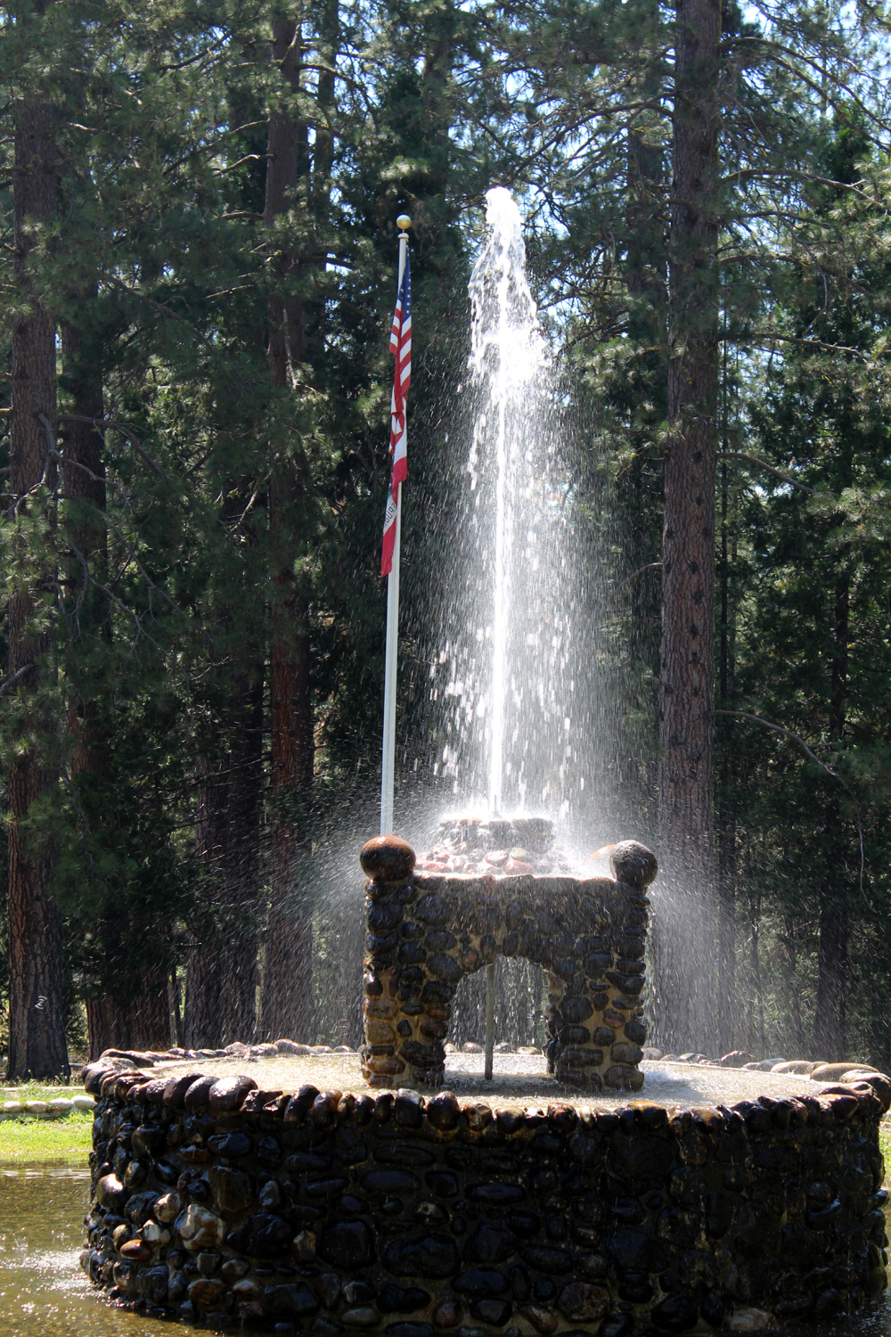 |
| Lunch in the Wawona Lodge | The Wawona Lodge, misnamed | Fountain in front of the lodge |
| Buena Vista Peak | ||
 |
||
| An unexpected sight - dozens of rock artifacts next to the Kings Canyon Overlook | ||
 |
 |
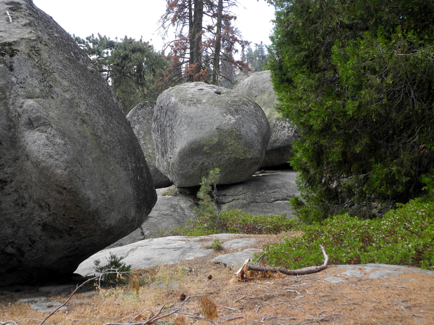 |
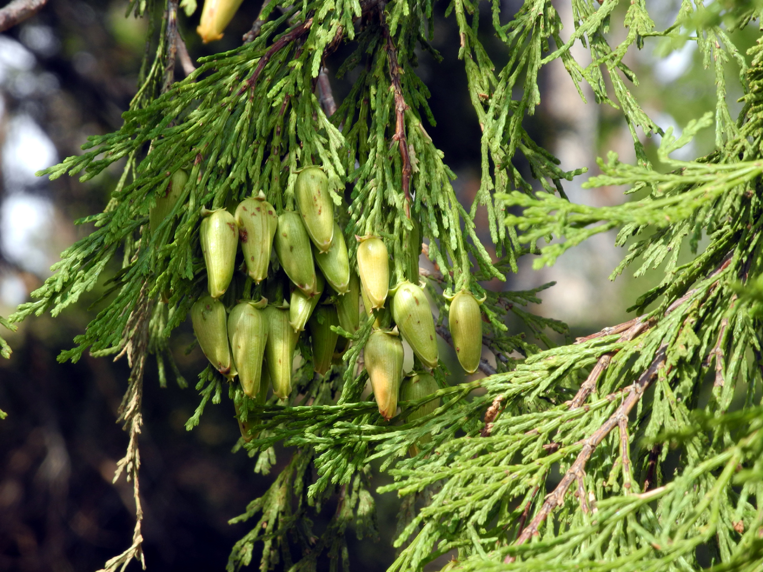
| Cedar cones | Dick on the trail | A most excellent rock formation |
|
 |
|
| Big boulder, complete with cedar tree | This rock sits on a pedestal | Dick and Wes, half way up |
 |
 |
 |
| Red firs | The out of place sugar pine | Ripe elderberries |
 |
 |
 |
| Smoke from a fire in
the distant Tule River canyon is visible at center right |
Stunted tree near the top of the peak | Wes and Dick on top,
with Spanish Mountain in the background |
 |
||
| A bit hazy, but the high Sierra peaks look good in any circumstance | ||
 |
 |
 |
| Wes on the rock,
with Redwood Mountain in the background |
Thank goodness for the trail maintenance crew | Buck Rock, just
across the road a short distance |
 |
 |
 |
| Jeffrey pine near
the top shows typical "pruned" top |
Clouds over the rugged boulder at the top | Red firs, large and small |
| Related Links | ||
| Ahwahnee Hills Unofficial Site | History of Ahwahnee Hills | Town of Ahwahnee |
| Oakhurst | Pete's Place | Golden Chain Highway 49 |
| Tokopah Falls trail | Lodgepole | Kaweah Rvier |
| Sequoia National Park | Tokopah Falls Video | Big Creek Video |
| Indian Falls Video | Rancheria Falls Trail | Indian Pools Trail |
| Huntington Lake | Chilnualna Falls | Wawona Hotel |
| History of Wawona | Wawona | Town of Wawona |
| Wawona Swinging Bridge | Chilnualna Falls Video | South Fork of the Merced Above Bridge Video |
| Buena Vista Trail | Grant Grove Restaurant | Buck Rock Lookout |
| Shaver Lake | ||