


2016 Ramblers Hikes Page 3 (September to December) |
||||||
|
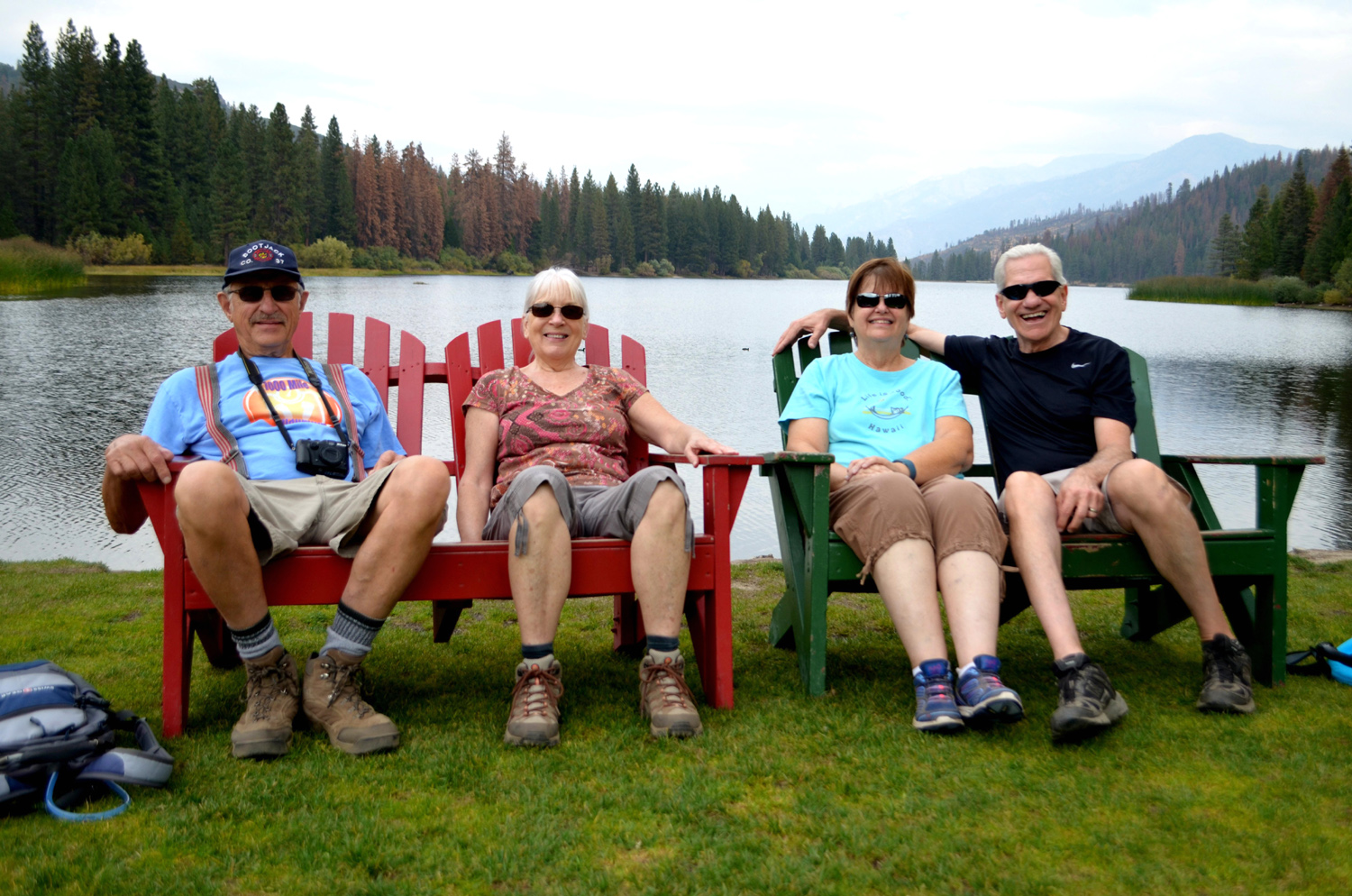
The Ramblers are Carolyn Amicone, Julie Hornback, Wes Thiessen, and Dick Estel, former colleagues at the Fresno County Department of Social Services. Effective in December of 2016, we have declared Don McClellan our official Fifth Rambler. Every month or so we get together for a short hike, good conversation, and lunch. |
||||||
|
|
||||||
|
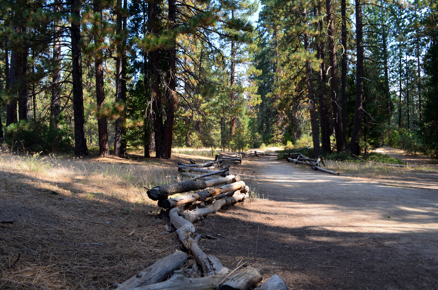
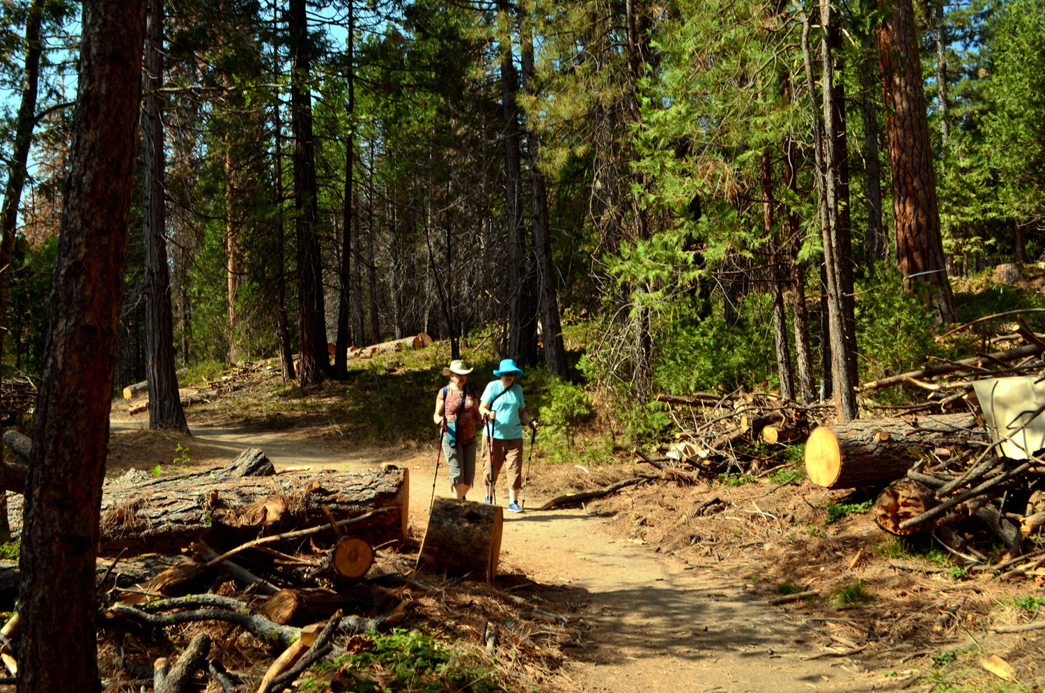
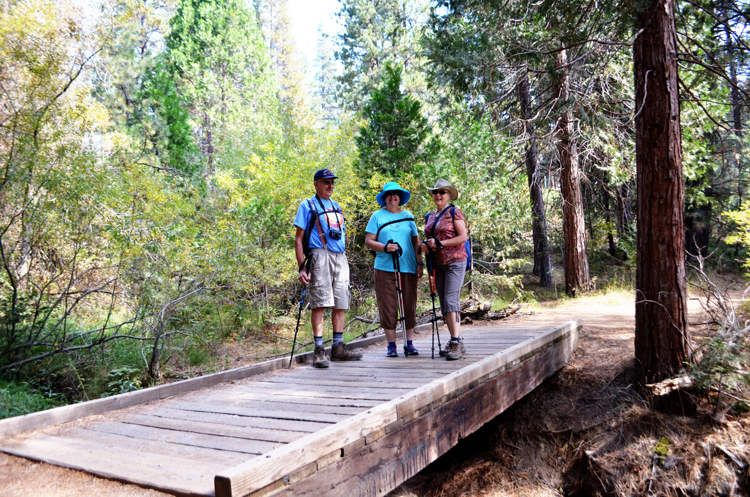
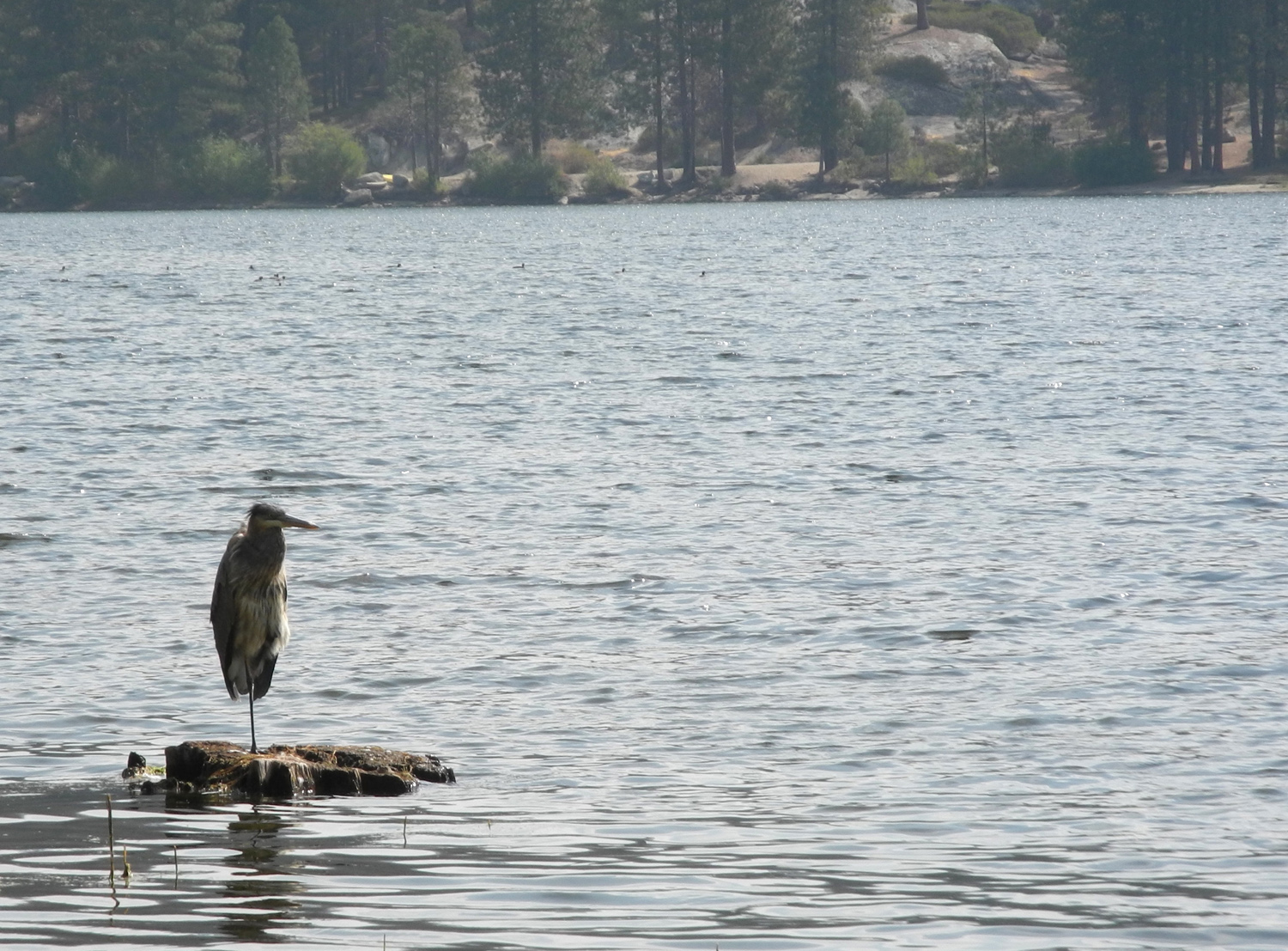
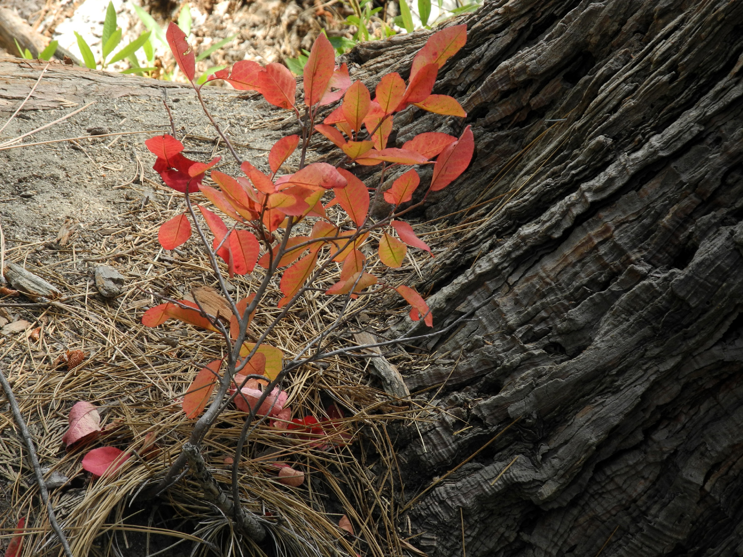
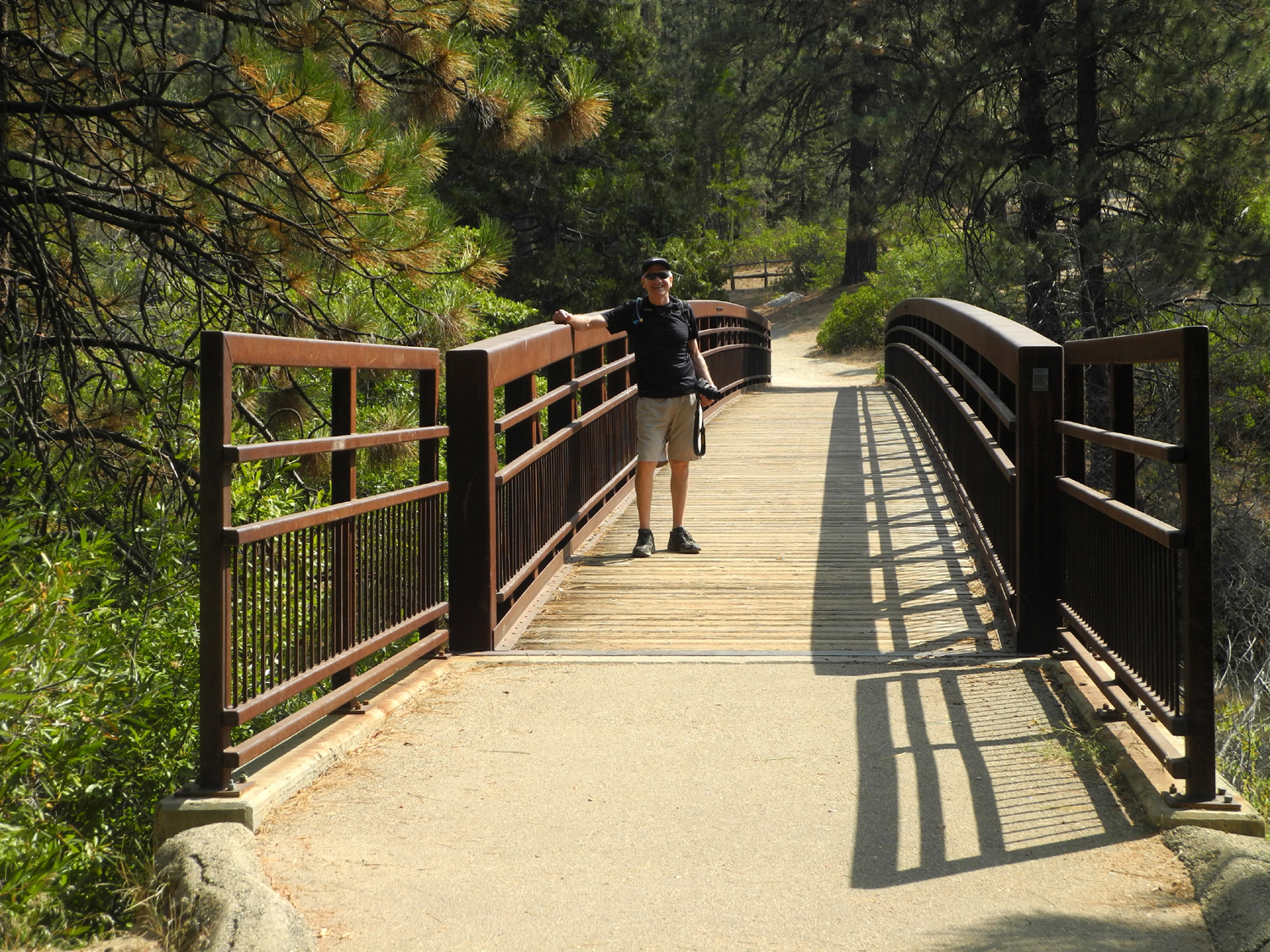
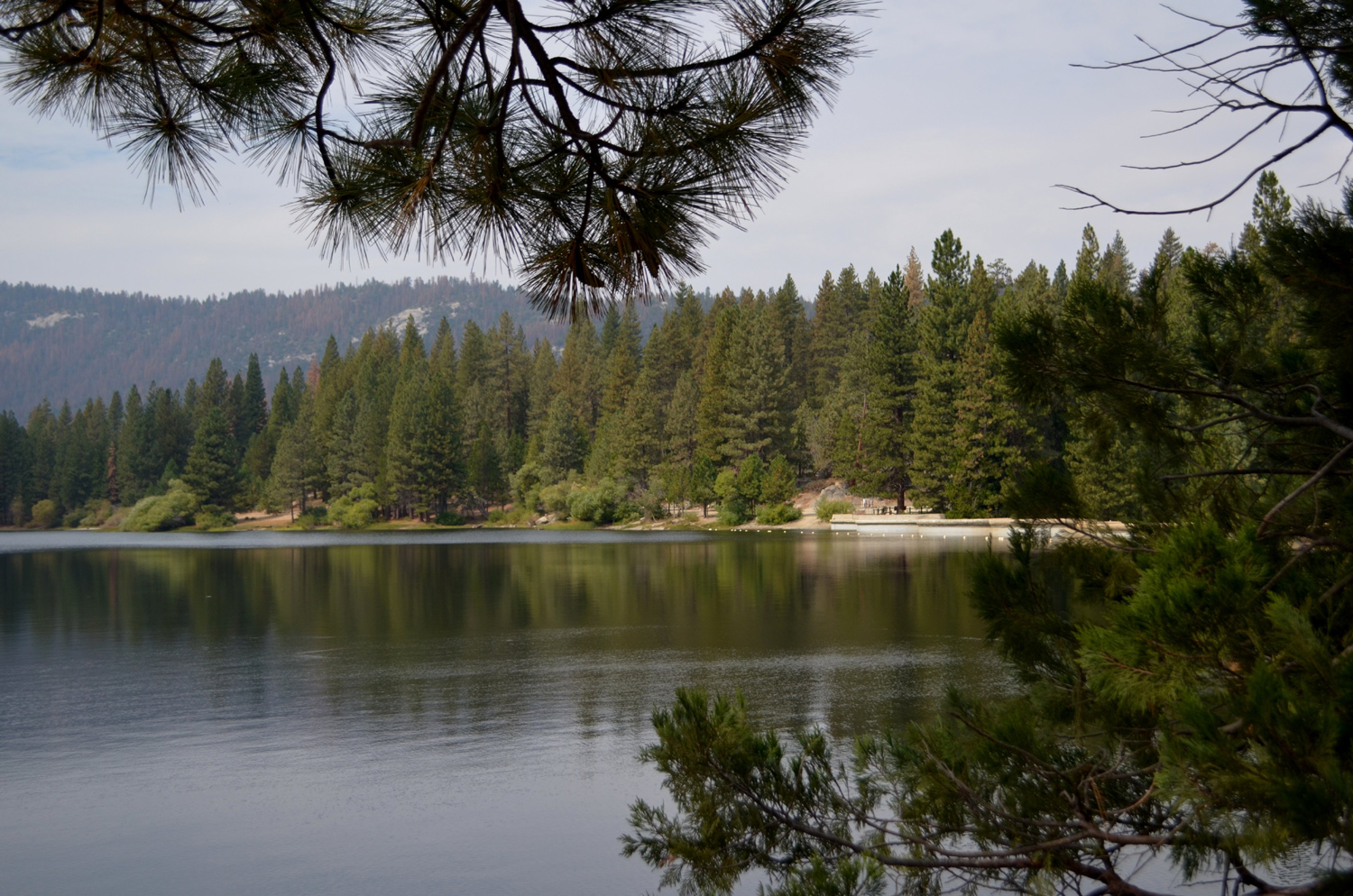
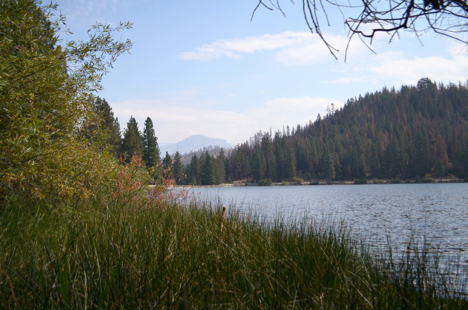
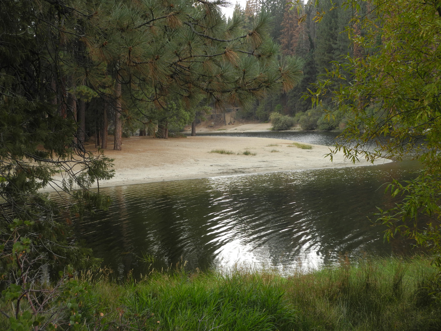
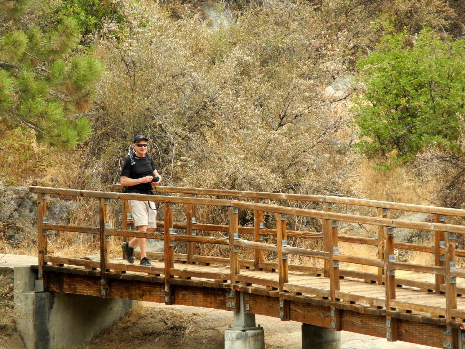
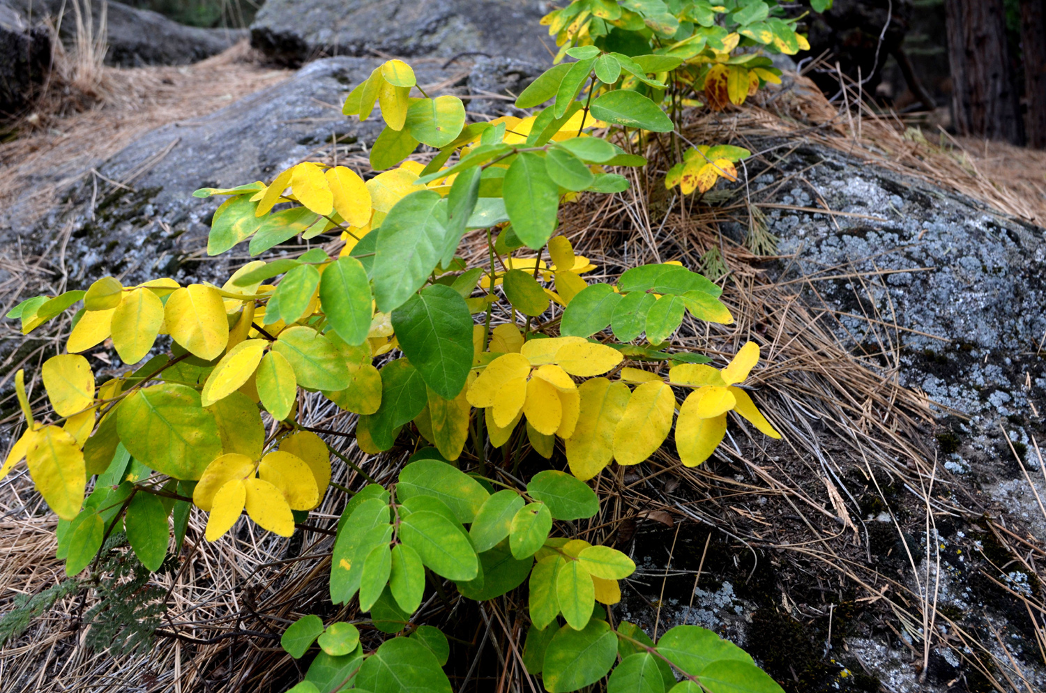
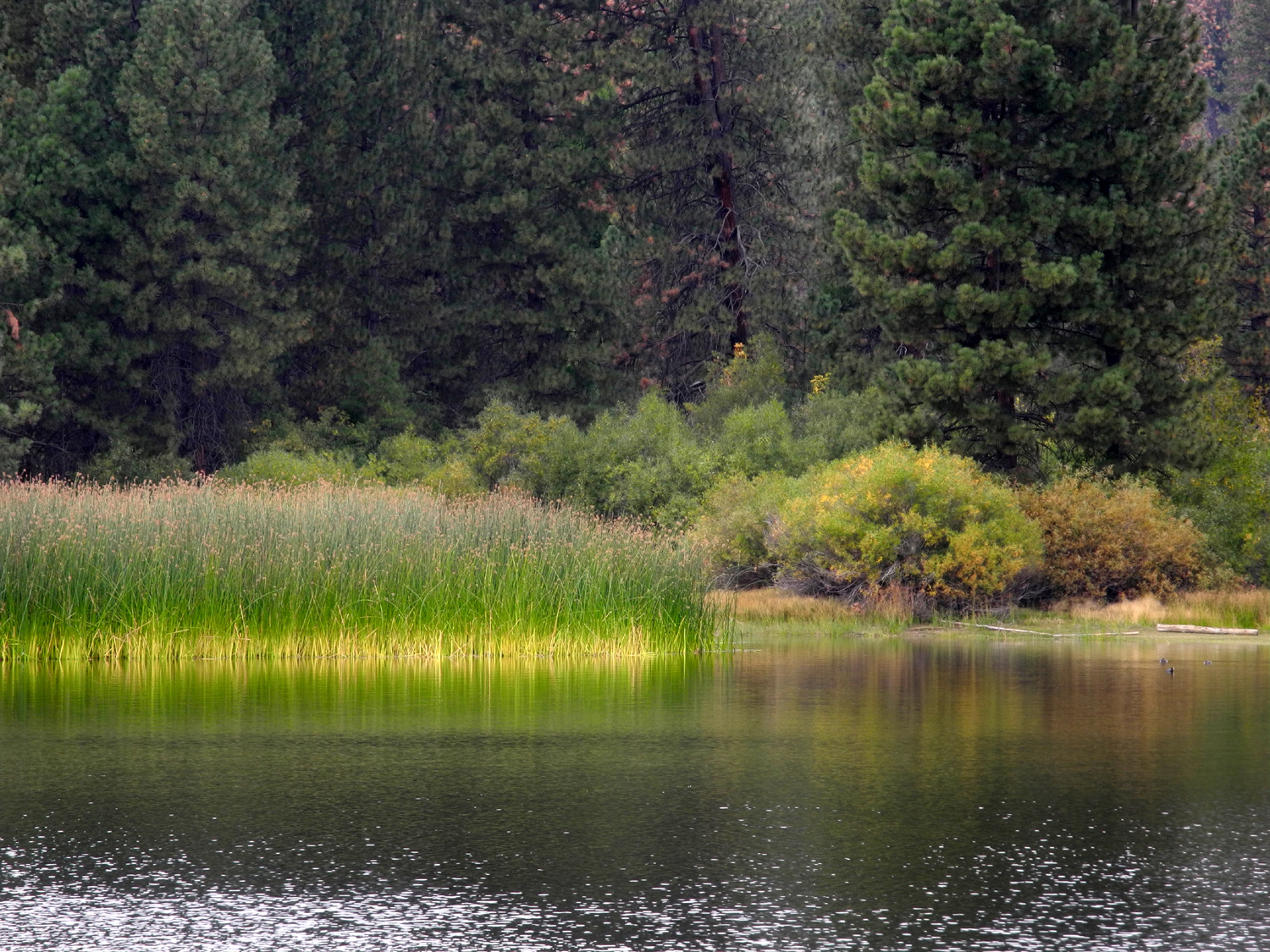
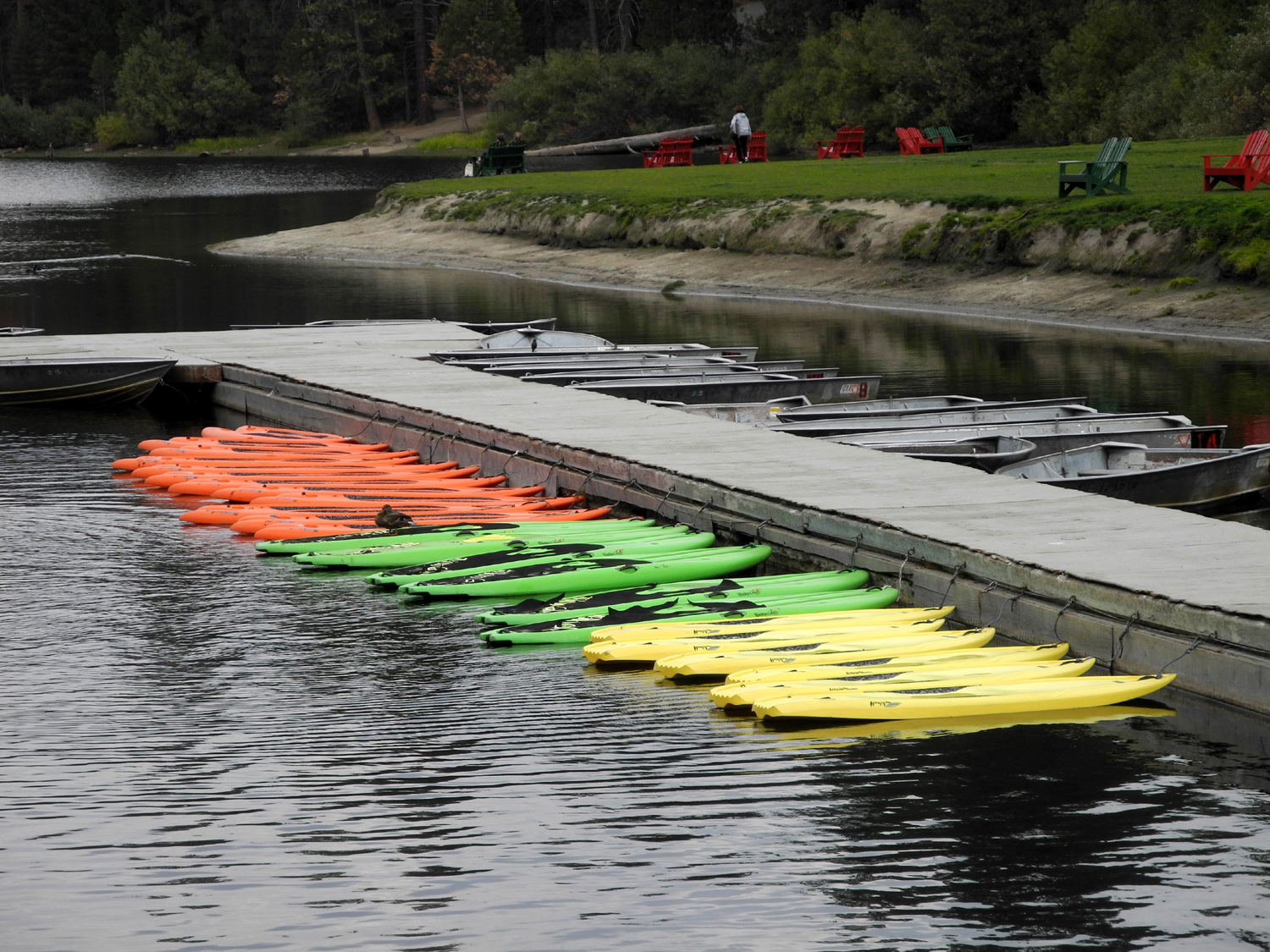
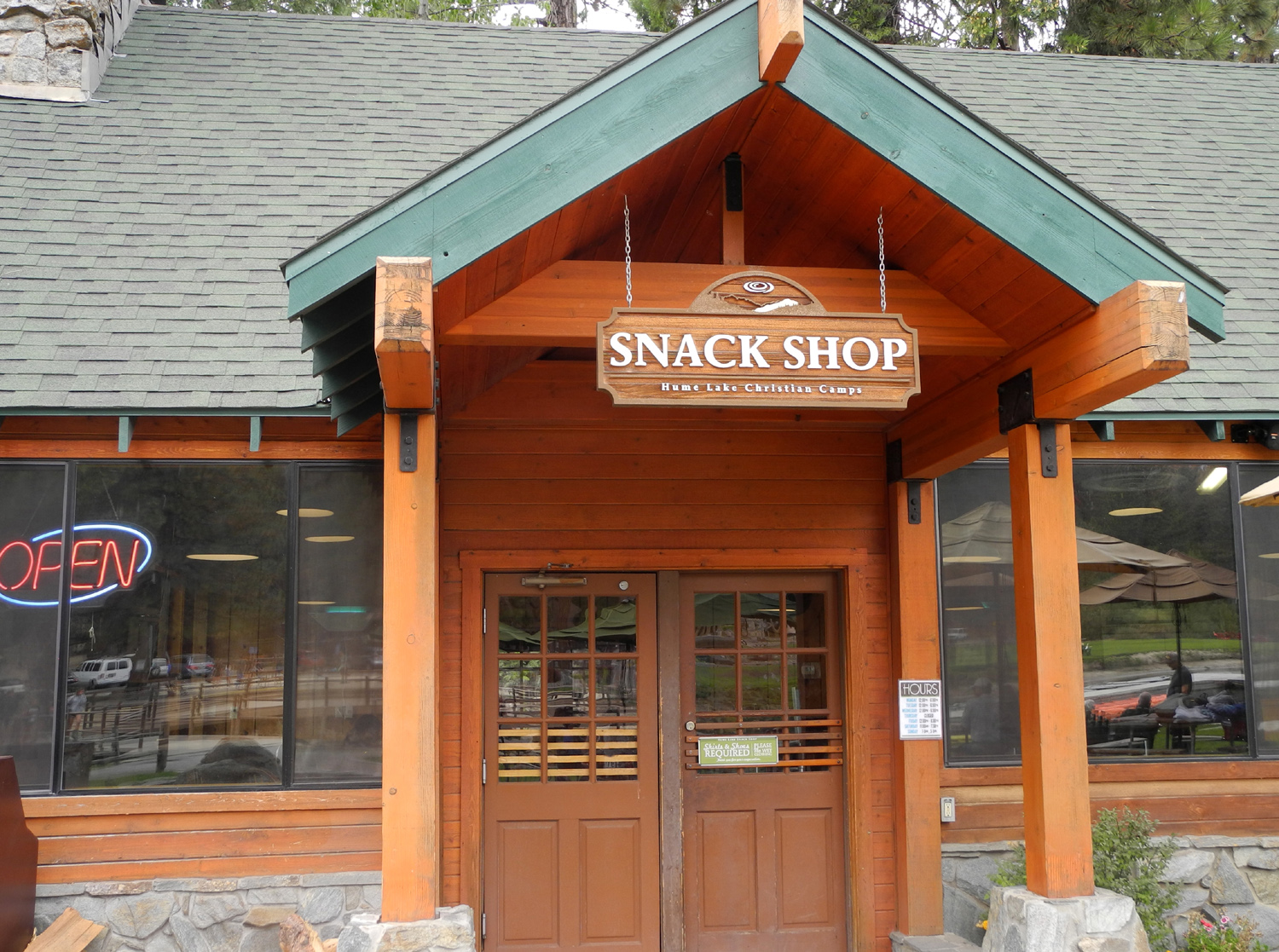
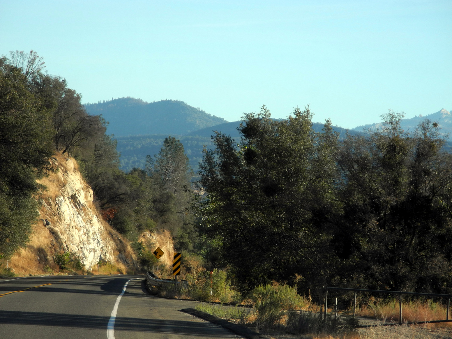
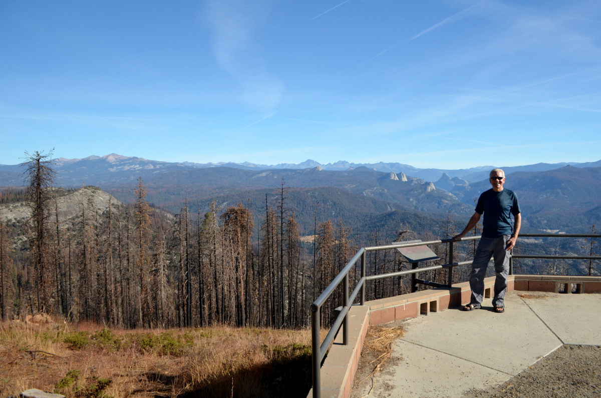
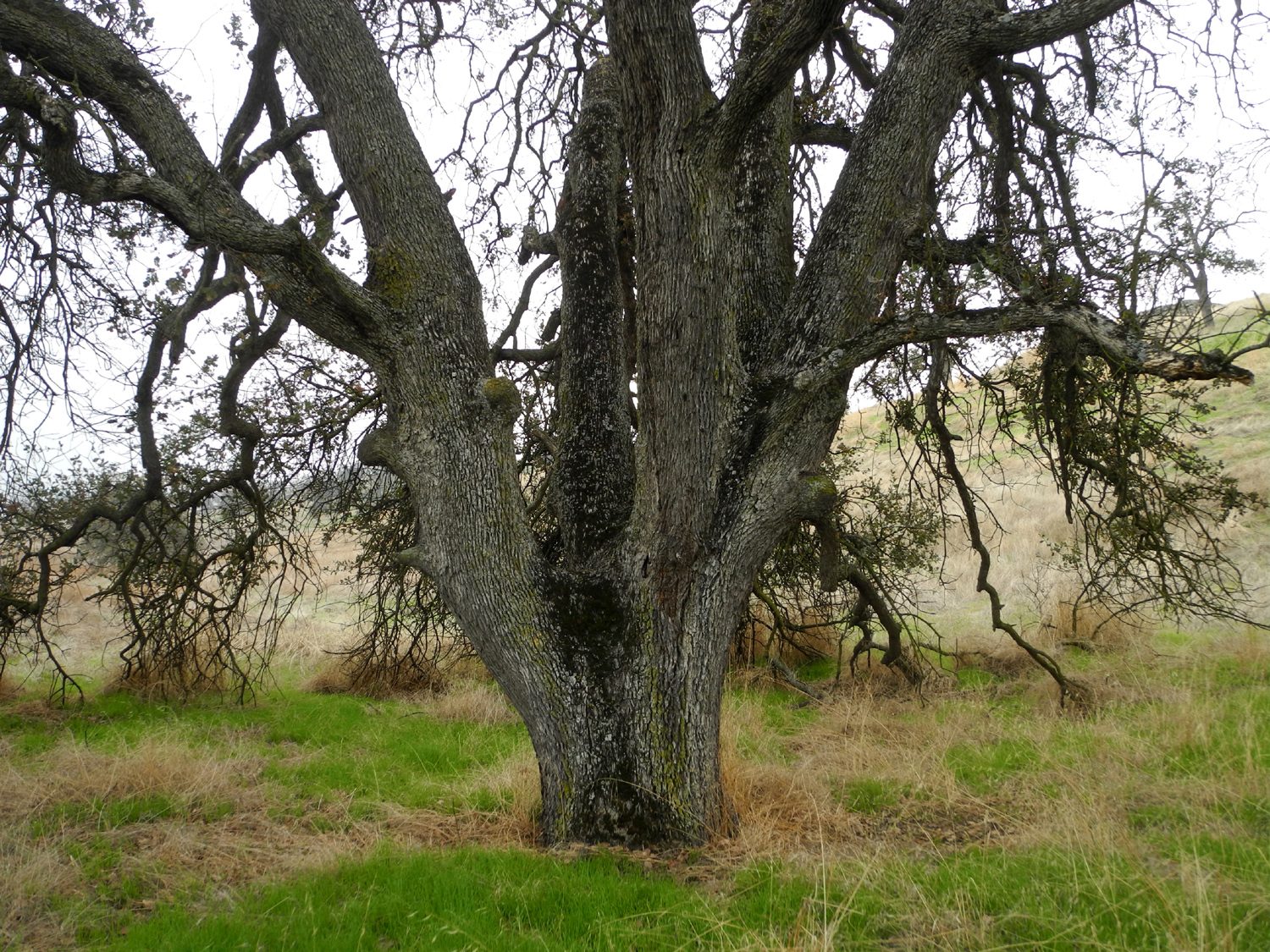
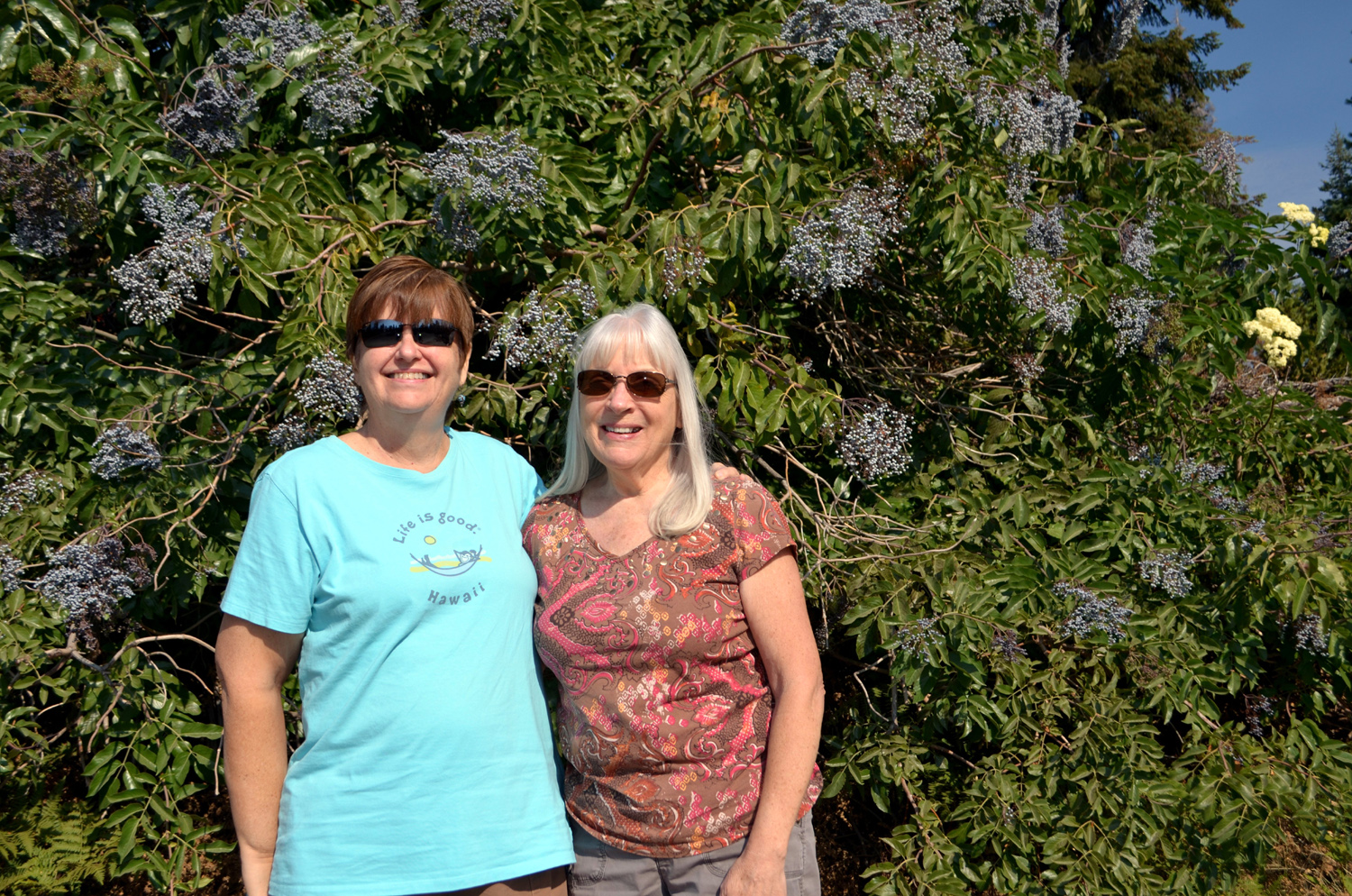
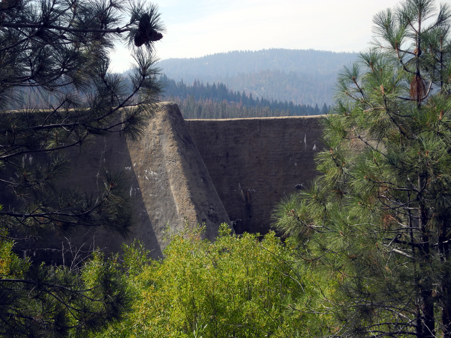
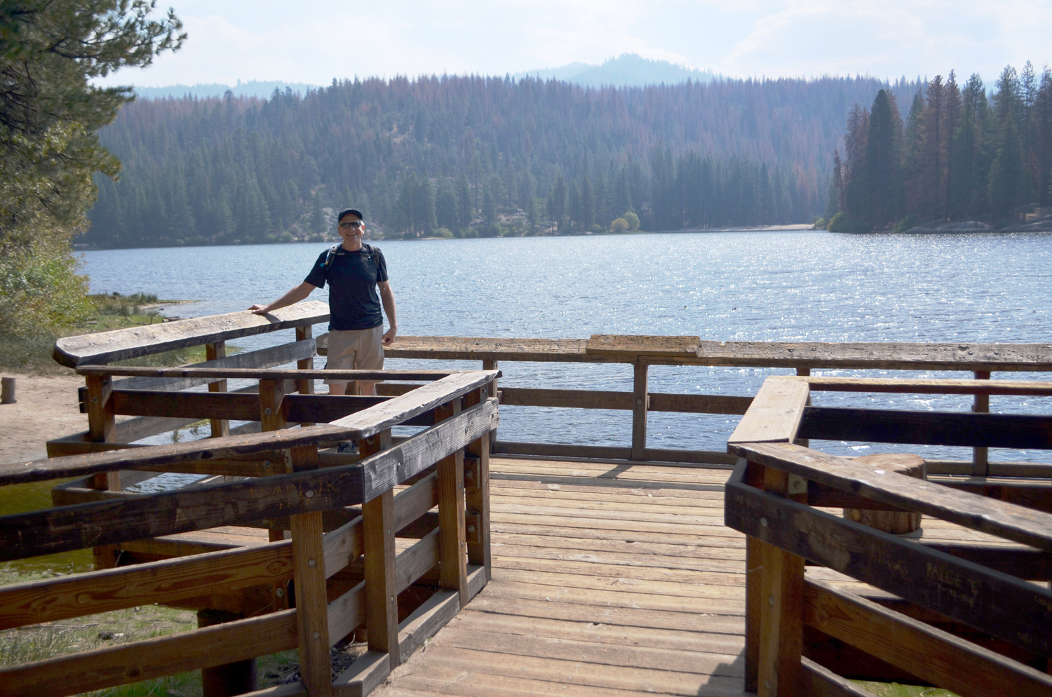
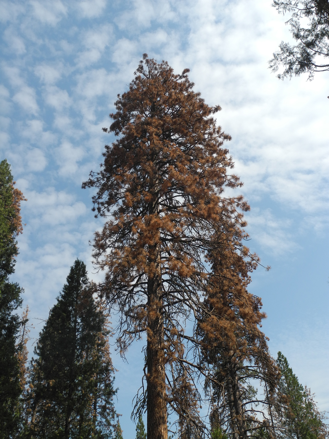
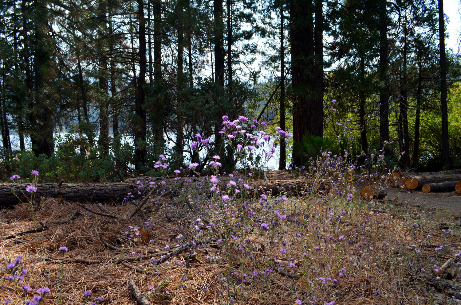
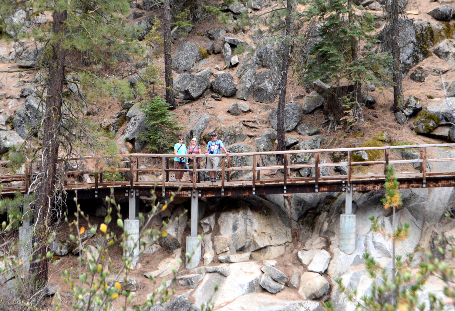
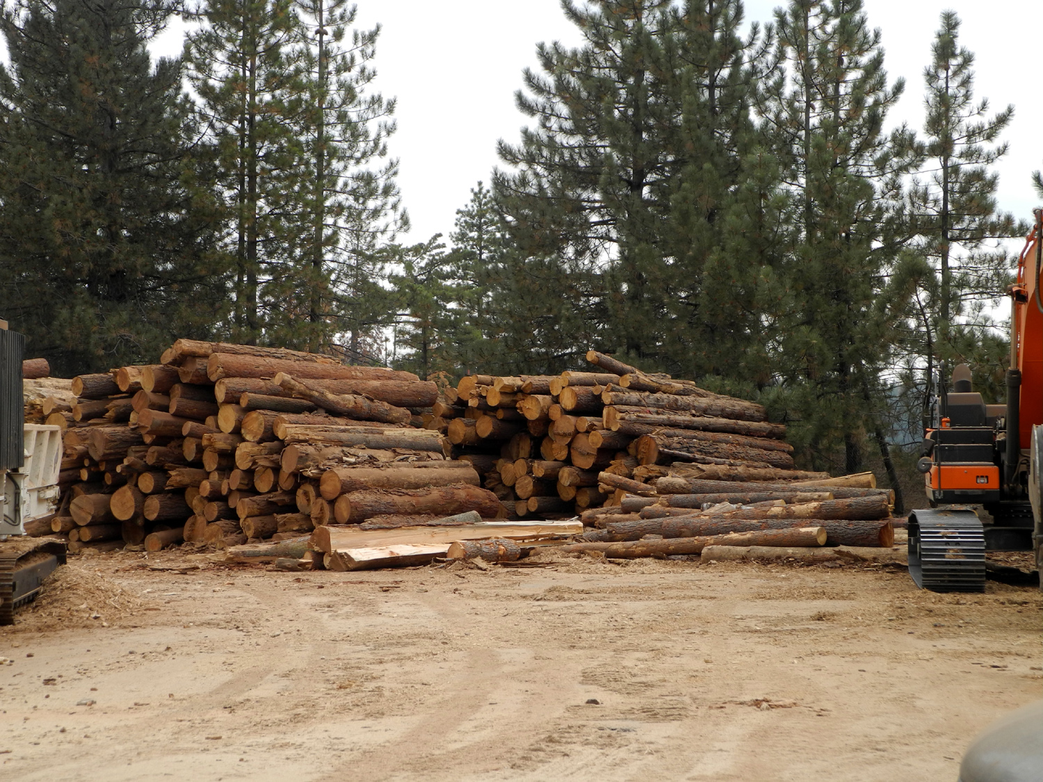
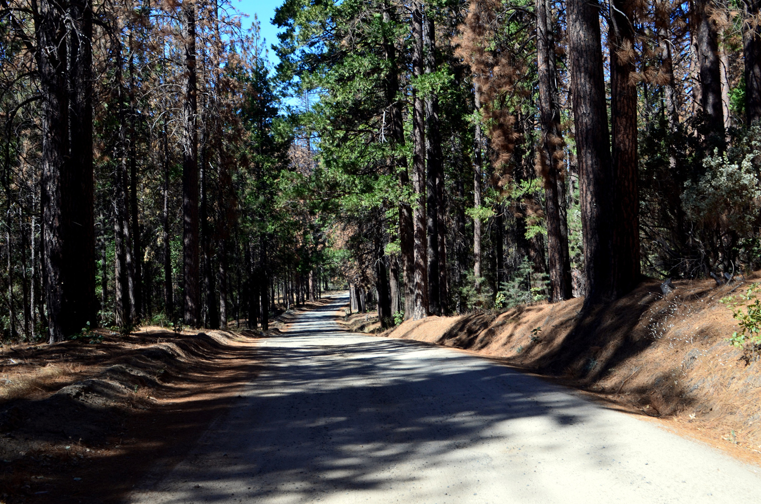
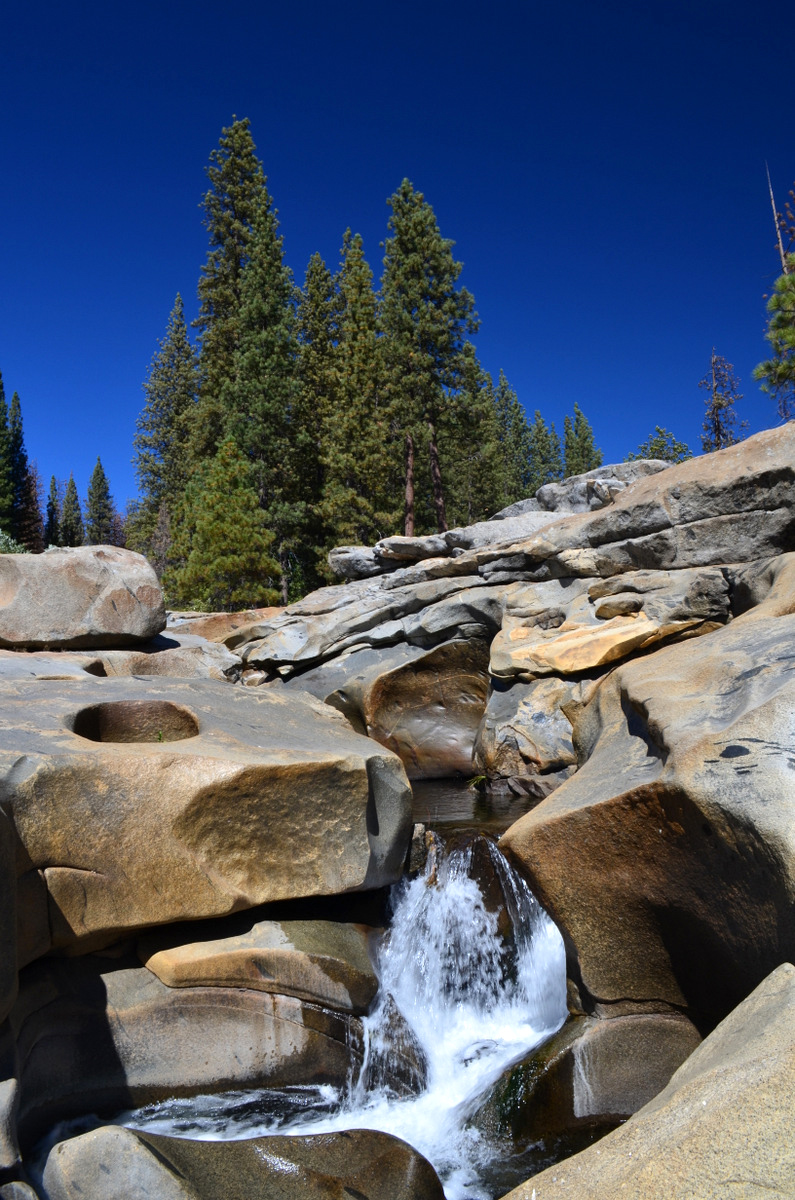
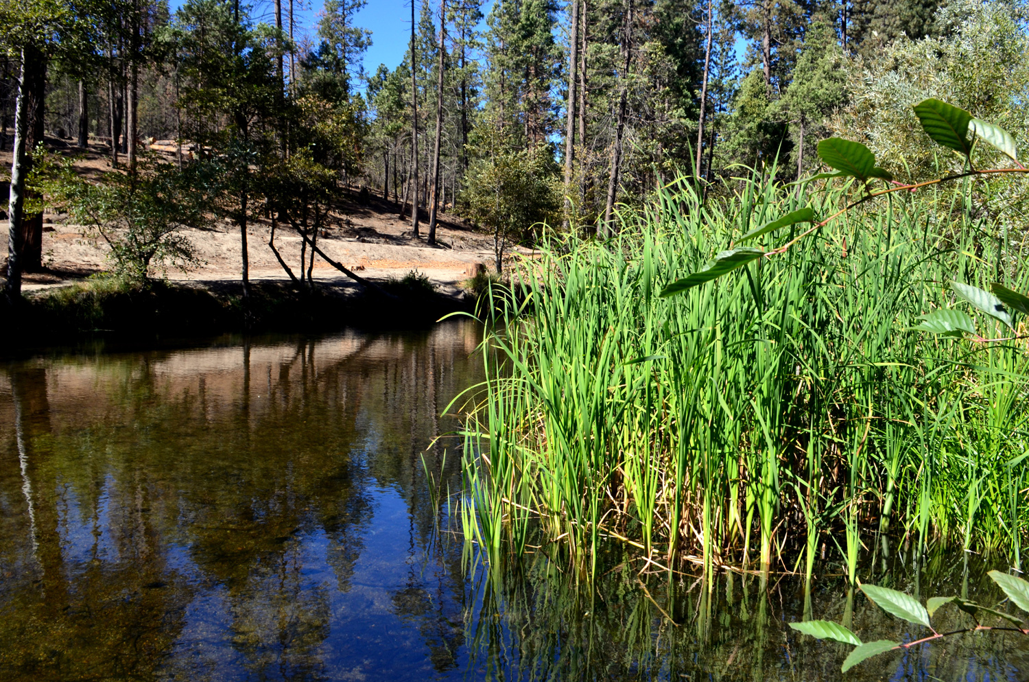
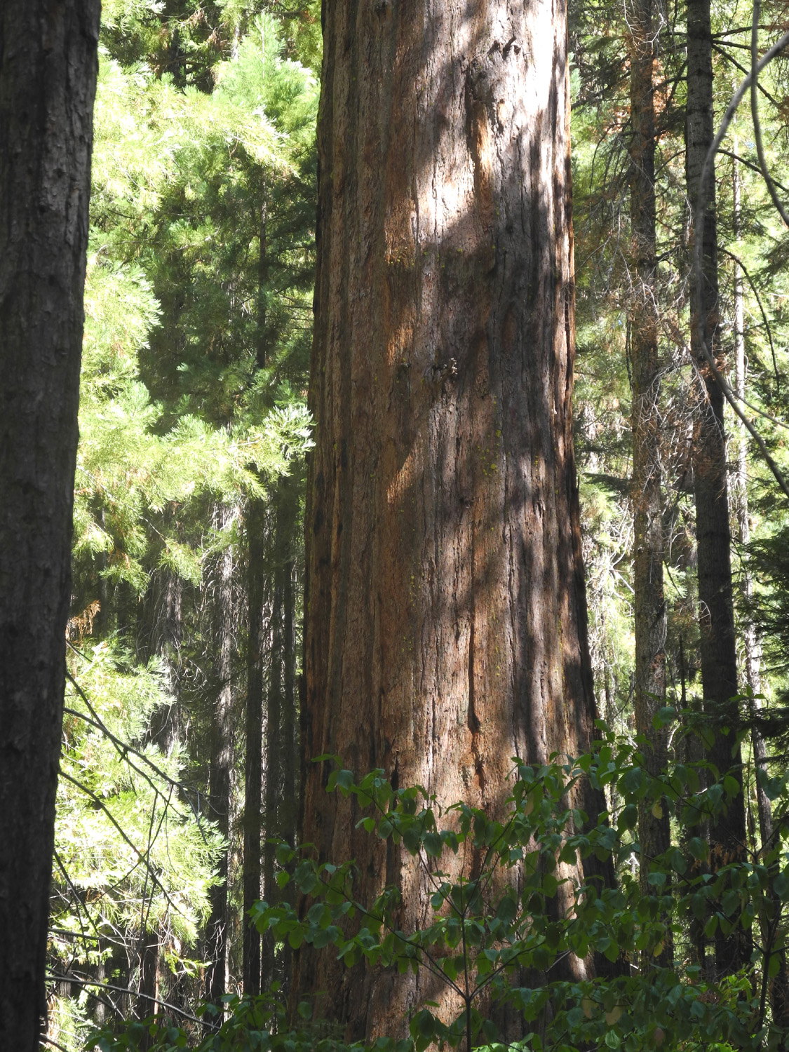
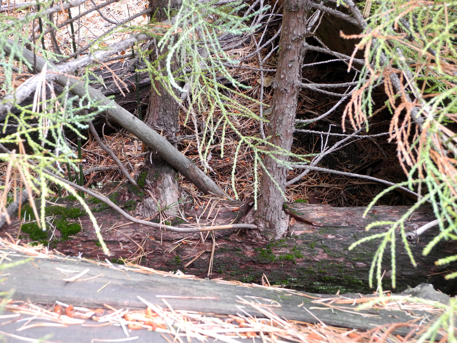
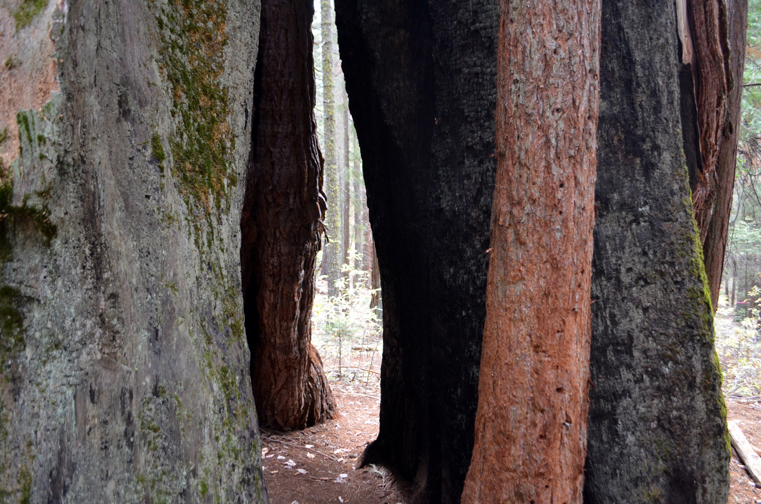
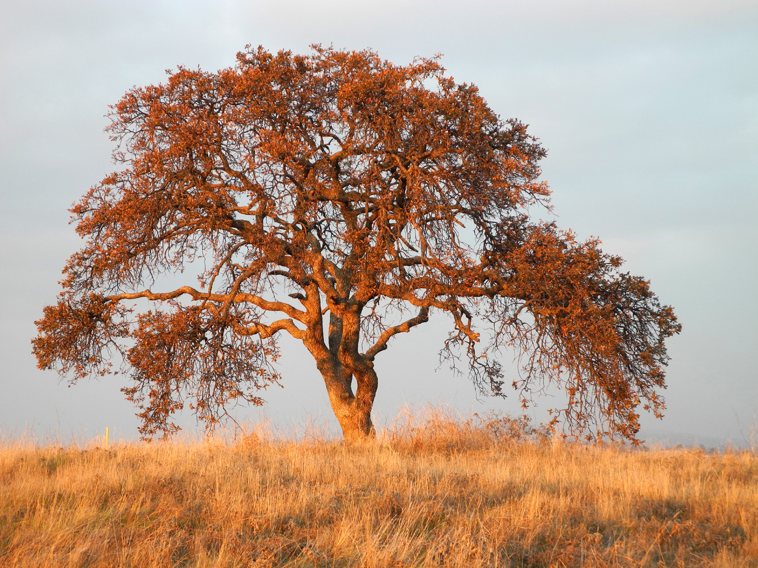
Hume Lake Loop Trail For a change of pace, Wes gets the FIRST word this time: The Ramblers are back in full force and ready for the Fall season of hiking! This summer, Julie was occupied with vacations and helping commitments. She is now back and looking good on the trail. We discovered a three-mile trail that circumnavigates Hume Lake. This trail follows the shoreline and offers wonderful lake and mountain views. Hiking boots were appropriate but the flat terrain was also suitable for tennis shoes. For those not familiar with the location, Hume Lake is in the Giant Sequoia National Monument, close to Kings Canyon National Park. From Fresno we traveled east on State 180 into the park. There are two routes from there to the lake. The highway goes north past Grant Grove, then out of the park and descends to the Kings River, and on to Cedar Grove, where the road ends. Off the highway, a road goes about 4.5 miles to the lake. You can also take the General's Highway south toward Sequoia National Park, and after a short distance, turn on Ten Mile Road, which goes past several campgrounds and then to Hume Lake. We took the latter road, which Wes had traveled recently by bicycle, and it gave us an appreciation of the effort he and his fellow rider put forth. The Ten Mile route was mostly down hill, but the lake is at 4,000, and the road out to the highway and the exit from the park rises up to nearly 7,000 feet. It made us tired to hear about it! At the lake there is a resort and a Christian camp, but the reservoir was originally the log pond for the Hume-Bennett Lumber Company, which logged in the area in the early 1900s. The dam was the first concrete multiple arch dam ever built, and was completed in 1909. Lumber was carried down to the San Joaquin Valley town of Sanger via 72-mile flume. Like all the early lumber operations in the area, it was never financially successful. The parking area for the trailhead is next to the resort, so we noted the location of the snack bar, where we planned to eat at the end of our hike, and got underway. As Wes mentioned, this is a relatively level trail, with an up and down section where it crosses the creek below the dam, and some gentle inclines near the end. Throughout the hike you are near the lake, with views of the water 90% of the way. In some locations you can also see up the Middle Fork of the Kings River, although the peaks and rock formations in that area were obscured by smoke the day we hiked. The lake is surrounded by forest, with mostly firs, cedars and ponderosa pines. There are fewer of the latter than there used to be, with huge sections of trees having been killed by drought and beetles over the last few years. Many of the dead trees are being cut down as a safety measure, so we saw log sections all along the way. Very early in our hike we spotted a blue heron sitting on a stump in the water, watching for his lunch. Throughout the day we enjoyed excellent weather, with clouds most of the time and a slight breeze. There are some late season flowers blooming, and a few leaves starting to change color. At the upper end of the lake, where Ten Mile Creek flows in, there is another bridge with a long boardwalk to get you past a rocky slope. All in all it was a beautiful, restful hike - a little over three miles total, but the level terrain was easy on the legs. Nonetheless, we worked up an appetite and were ready to eat when we arrived back at the snack bar. We sat outside, enjoying the view across the lake, and watching people going out in boats from the rental stand. Wes recalled that he and his family rented a boat there when he was young, and the entire family - mom, dad, and five kids, set sail. At a couple of places along the road, we had a short wait where logging operations were going on. We talked with the flag woman at one stop, who told us that some trees are taken to the mill at Terra Bella, some are stored for biomass projects, and some are shredded and returned to the forest. We also stopped where there is a huge pile of logs stacked up at the road to Sequoia Lake, just west of the park entrance. We talked with the contractor there, who said the logs that come from the Giant Sequoia National Monument must be returned there, so his company has a long-term project to shred the logs and haul the material back in. He had a shredder and a loader that he had recently bought, for a total investment of $750,000. All of us had been to Hume Lake in the past, but none of us knew this trail existed until we started researching places for our September hike. Part of being a Rambler is the joy of discovery!
|
||||||
|
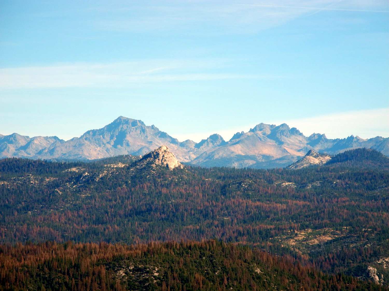
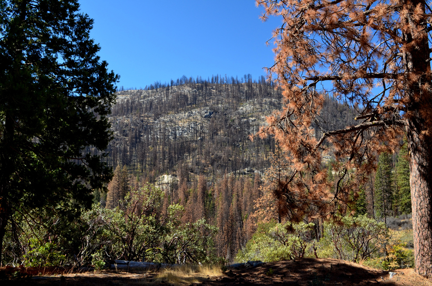
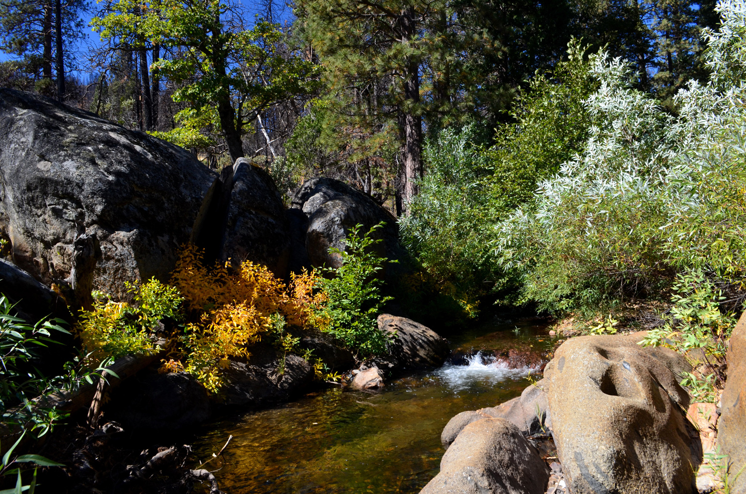
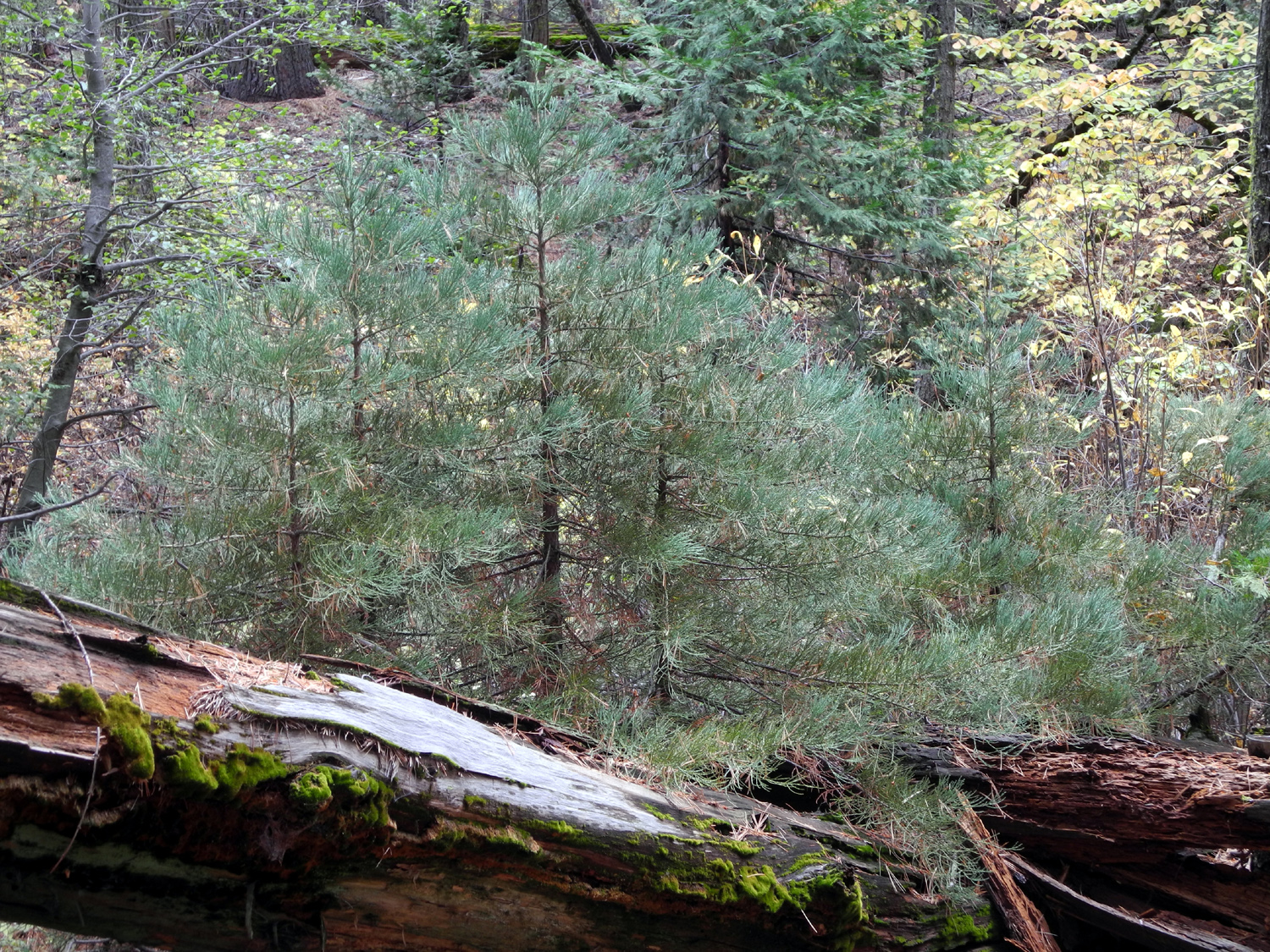
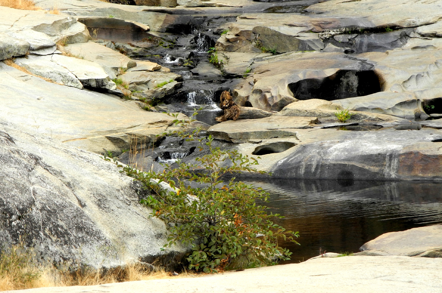
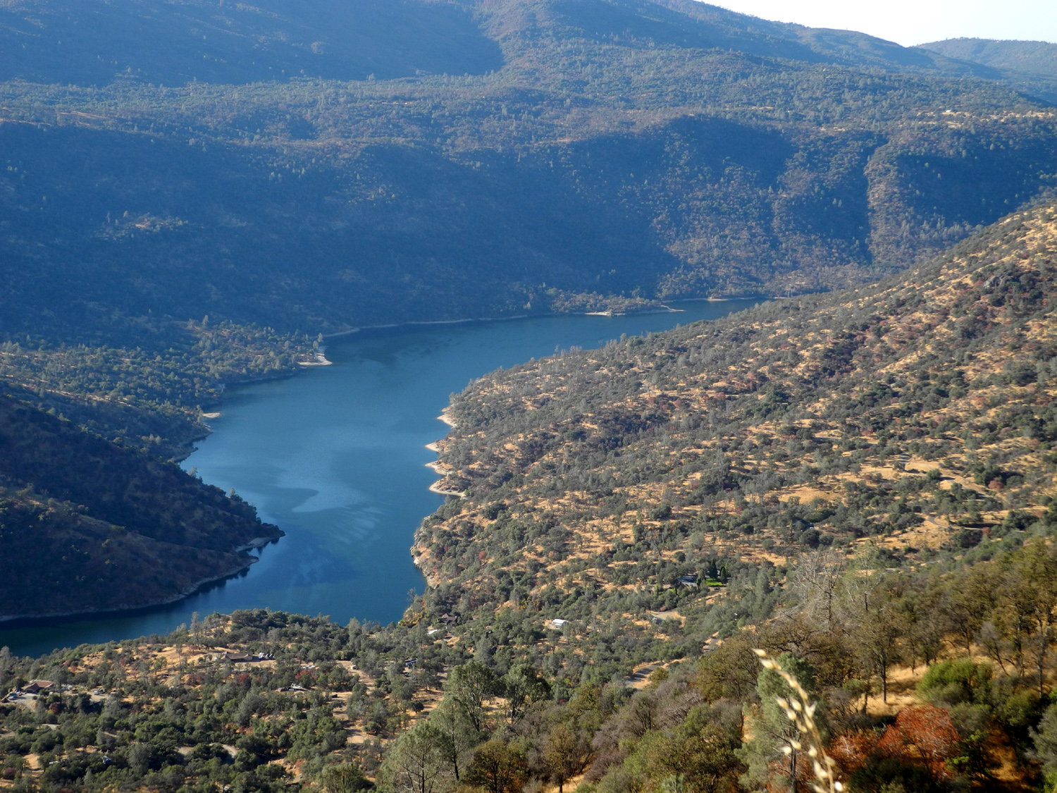
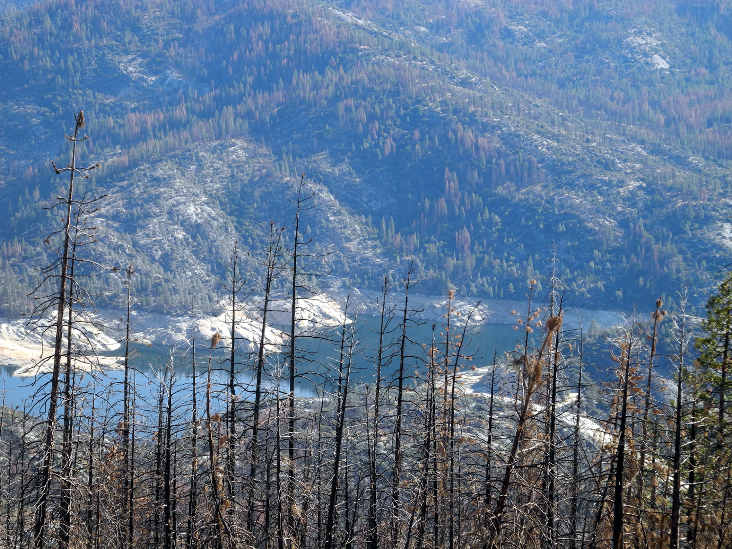
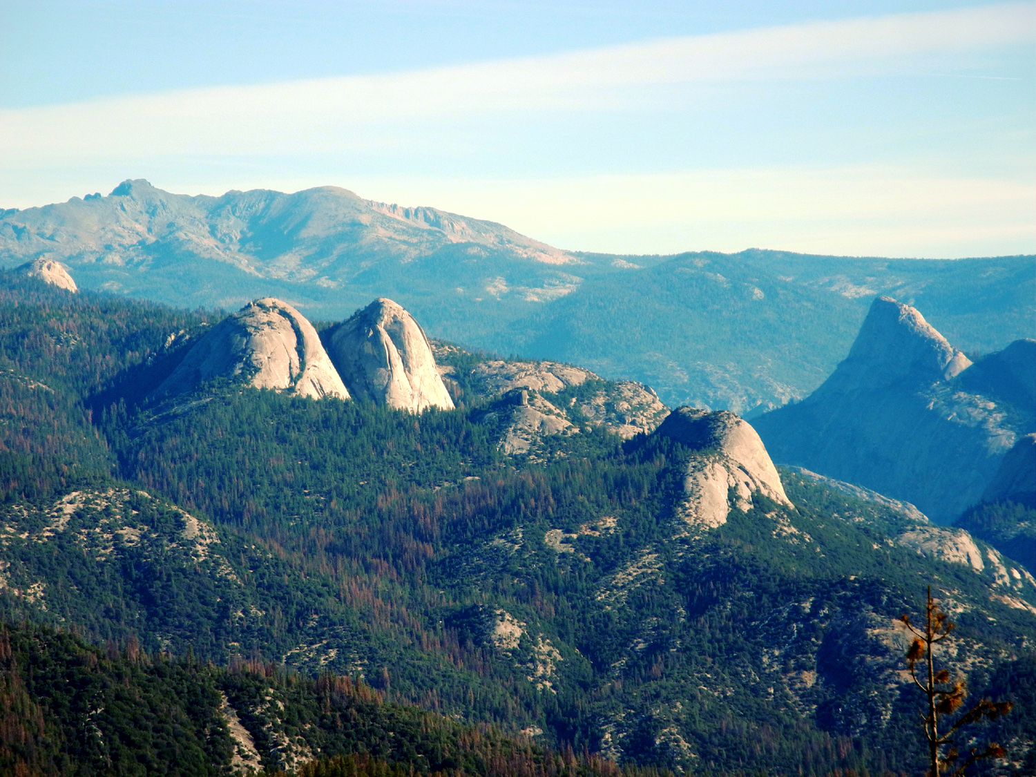
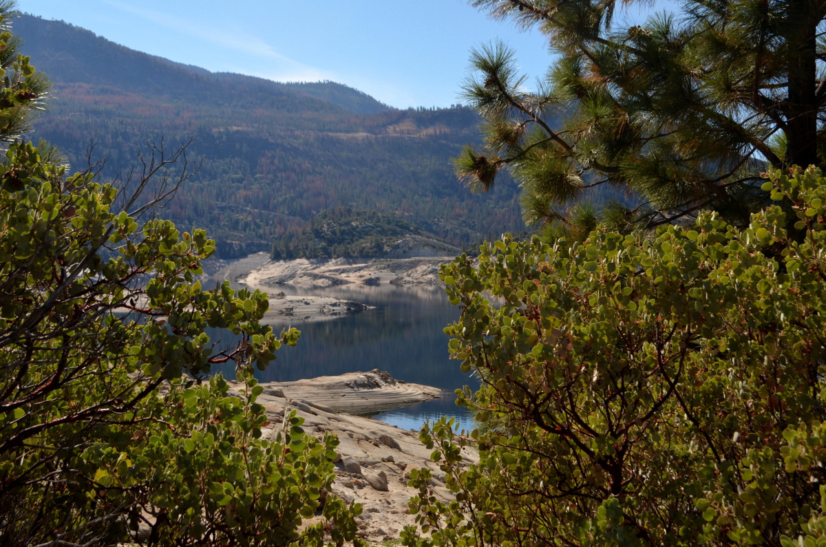
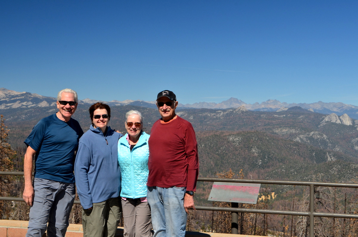
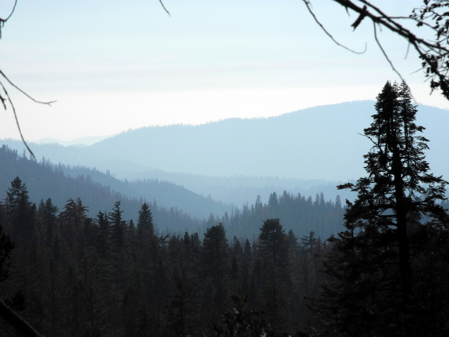
Mammoth Pool Reservoir Hike Sometimes an outing does not turn out exactly as planned. Then it's called an Adventure. Our particular adventure started early on the morning of October 6, when we gathered at Julie's for the 90-mile trip to Mammoth Pool Reservoir on the San Joaquin River. Our journey was north on state highway 41 a little over 20 miles to North Fork Road, which goes east into the Sierra. We passed through the small town of North Fork, with many more miles to go. Beyond this point the road is known by several names, including Minarets Road, Mammoth Pool Road, and most appropriately, the Sierra Vista Scenic Byway. This road winds around through the mountains at around 4,000 to 5,000 feet, high above the canyon of the San Joaquin River. Along the way there is a good view of Redinger Lake, one of two small lakes between Mammoth Pool and Millerton. There are also views down into the steep canyon much of the way. Eventually the view became much less delightful; in fact, it could be called heartbreaking. Along a good part of this area the forest was virtually destroyed by the French Fire of July and August 2014, which burned nearly 14,000 acres. The devastation was particularly disturbing at the Mile High Vista, which offers a fantastic view of the nearby Eagles Beaks, a granite outcrop that is part of the ridge extending from Shuteye Peak above the road. Below the vista, the view of the domes and other rock formations, as well as the Ritter Range and the Minarets, is as good as ever. In fact, it's actually more visible, because most of the trees along the west side of the canyon have been reduced to blackened sticks. The adventure part of our journey started when we arrived at the lake. We had researched the hiking possibilities in the area, and had read about a 3.5 mile loop trail "primarily used for canoeing." We drove in to the boat launch area, reasoning that if there was a loop trail, we would have to cross it, but didn't see anything that looked like a trailhead. We looked around there and took some pictures, then decided to go back to the store and ask about the trail. However, on the way in, a half mile past the store, we had crossed the French Trail. This trail was a route used for thousands of years by the Mono people, and was developed as a wagon road by John French, a mining promoter from San Francisco, starting in 1879. The trail starts high up the canyon along the road we had driven in on, and drops down to river level where Chiquito Creek runs into the reservoir. We decided to walk a short distance on this trail, then turn back when we had gone half of "far enough." The trail went up hill for a short distance and crossed a dirt road that came in from the paved road. Not long after this, we came to a very steep section, which had a lot of loose leaves and dirt. Wes and I went up this, and he went on a few hundred feet to see what it was like ahead. I waited where the trail leveled off and took some photos. Carolyn tried the trail, then retreated, and Julie elected not to attempt the slippery section. When Wes returned, we chose to backtrack a short distance and walk on an old dirt road that led into the surrounding forest. This route wound around the hill, with no steep sections, and back to the paved road. We were traveling through the usual low-elevation forest vegetation, mostly ponderosa pine, cedar, black oak and live oak. The was also a LOT of manzanita. With the exception of a little white thorn chaparral, manzanita was the dominant shrub. A good number of the pines are dead due to drought and beetles, and we talked with a man who was marking trees for removal. He works for the company that does this for Southern California Edison, similar to my son-in-law Rod's work with ACRT for PG&E. He was numbering each tree, and documenting the height. We reached the paved road and walked to the car, then decided to walk a little farther, to the store which Wes asserted was "just around the bend." Just after we got started Wes went down to get a good look at the creek which ran beside the road. Carolyn and I continued on the road, while Julie stayed to make sure Wes did not get lost. After going around the bend and two or three more bends without arriving at the store, Carolyn and I decided to head back toward the car. We soon met Julie, who despite her best efforts had lost Wes. However, he soon came up through a campground from the creek, which he had followed upstream a short distance looking for perfect photo ops. Despite the unplanned nature of our hike, we got in nearly two miles. Assuming we would be many miles from the nearest place to eat, we brought our lunch, although it turned out there was a restaurant and store at Wagner's Resort. We wanted to find a cool, peaceful place for our lunch, so we decided to take advantage of the picnic tables at Mile High Lookout. However, when we got out of the car, the wind was blowing up the river canyon with great force, so not only was the scenery less than desirable due to the fire, it was too cold to sit outside. We continued on down the road a few miles to Rock Creek Campground, which is on a small tributary of the river, and well out of the main flow of wind. This area was not burned, although the campground was officially closed due to danger from dead trees. We stepped over the ribbon barrier and walked to the closest table to eat, enjoying the many still living trees, and the very gentle breeze. Luckily, no trees fell on us, and once we finished eating, we piled into Wes's Highlander and made our way safely back home. A few more thoughts: After looking at the "loop trail map," I began to wonder if it is a trail for canoes only. Is there such a thing? Is the trail actually in the water? Wes did a bike ride through this area two years ago, before the fire. He provided a photo from that trip to show the contrast at Mile High Lookout as it is today.
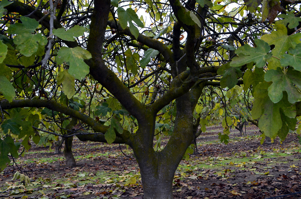
We were all disappointed with the condition of the forest (destroyed), none more so than Wes, who reported as follows (but undaunted, he ended his comments on a positive note): It would be wonderful if every trip into the Sierras resulted in seeing nature's beauty, amazing vistas, lush forests and lovely flowers. That didn't happen for us today as we drove three hours east of Fresno into the Sierra National Forest all the way to Mammoth Pool. We had heard and seen photos of that beautiful body of water surrounded by thick forests of pine trees. What we found was almost total devastation. When we did find small forests untouched by fires, the pine bark beetles had finished the job leaving many brown, dead trees. Julie noted pictures of these forests could be used at Halloween. It was heart-breaking. Unfortunately, this scene is becoming far too common all over California from the coast to the mountains. Believe it or not, we did have a good day. It was an adventure with no guarantees. The four of us were in good spirits and grieved together for the environment, laughed at ourselves and at each other and listened to some great music. We plan to continue these hikes as long as one good tree is left standing. The Sierra Vista Scenic Byway Association, which doubtless has a financial interest in visitation to this area, took this view of the fire on its website: "Views at Mile High overlook are enhanced with additional scenic views of Eagles Beaks and the high Sierra. Burned area in the foreground and across Mammoth Pool add a change in the scenery; welcome or not." 2021 Update: Wagner's Mammoth Pool Resort was destroyed by the Creek Fire of 2020, and re-building is underway. Some misleading information on their web page, discussed in the original version of this report, has been removed. --Dick Estel, October 2016 |
||||||
|
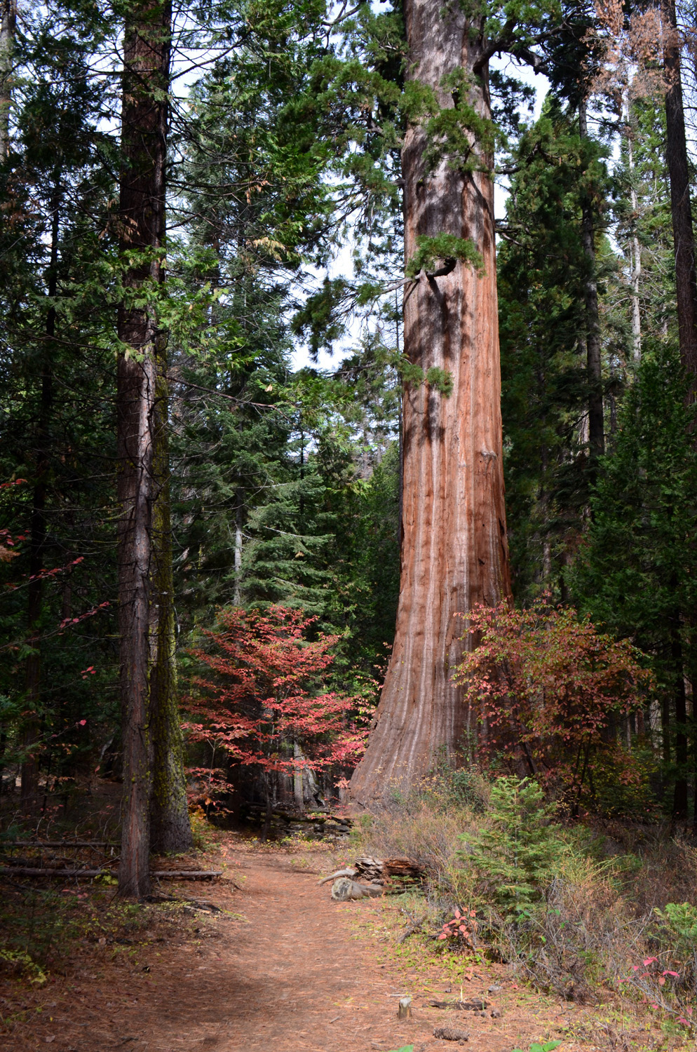
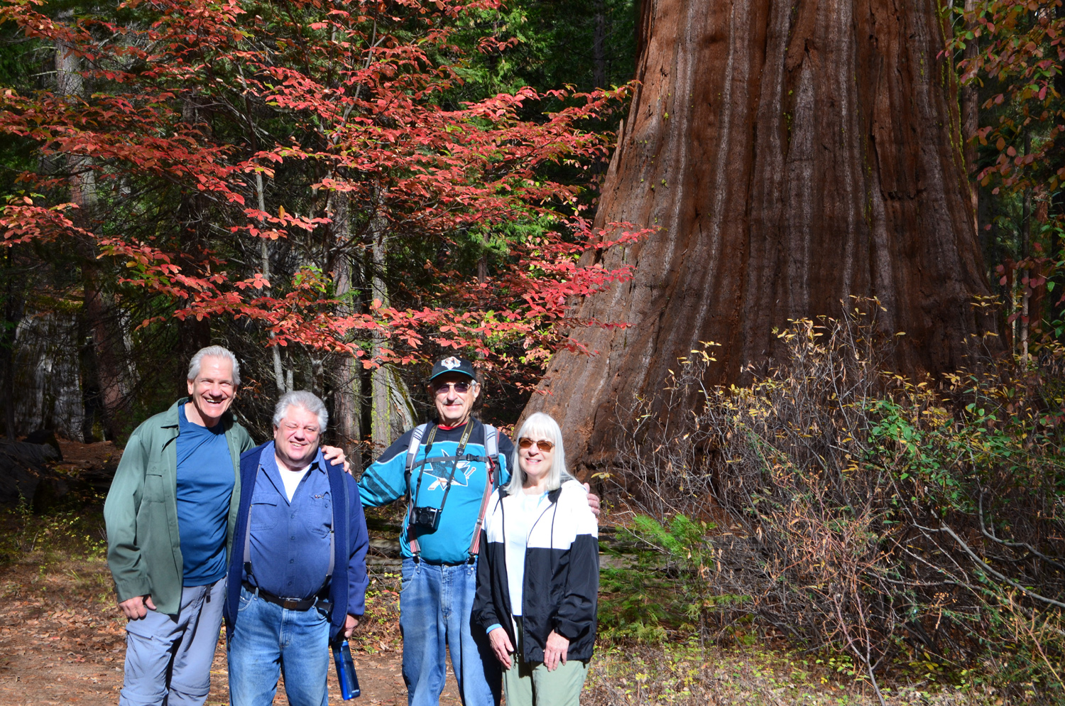
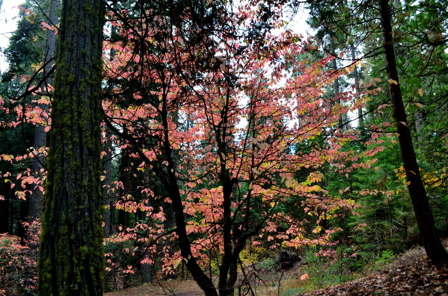
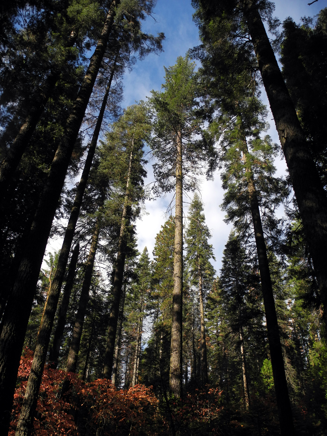
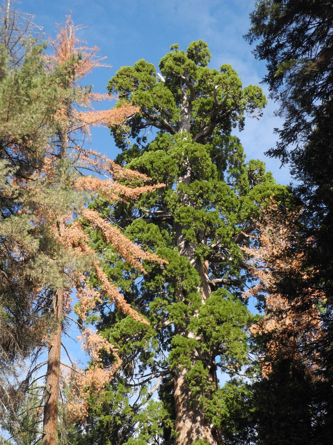
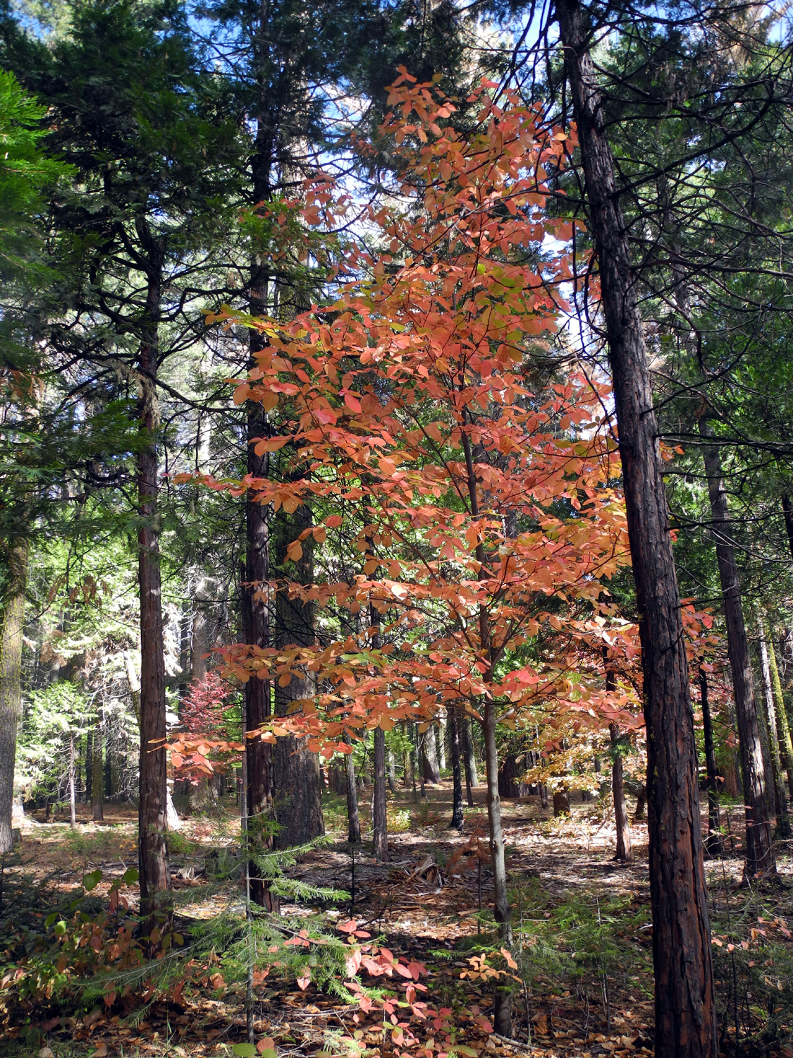
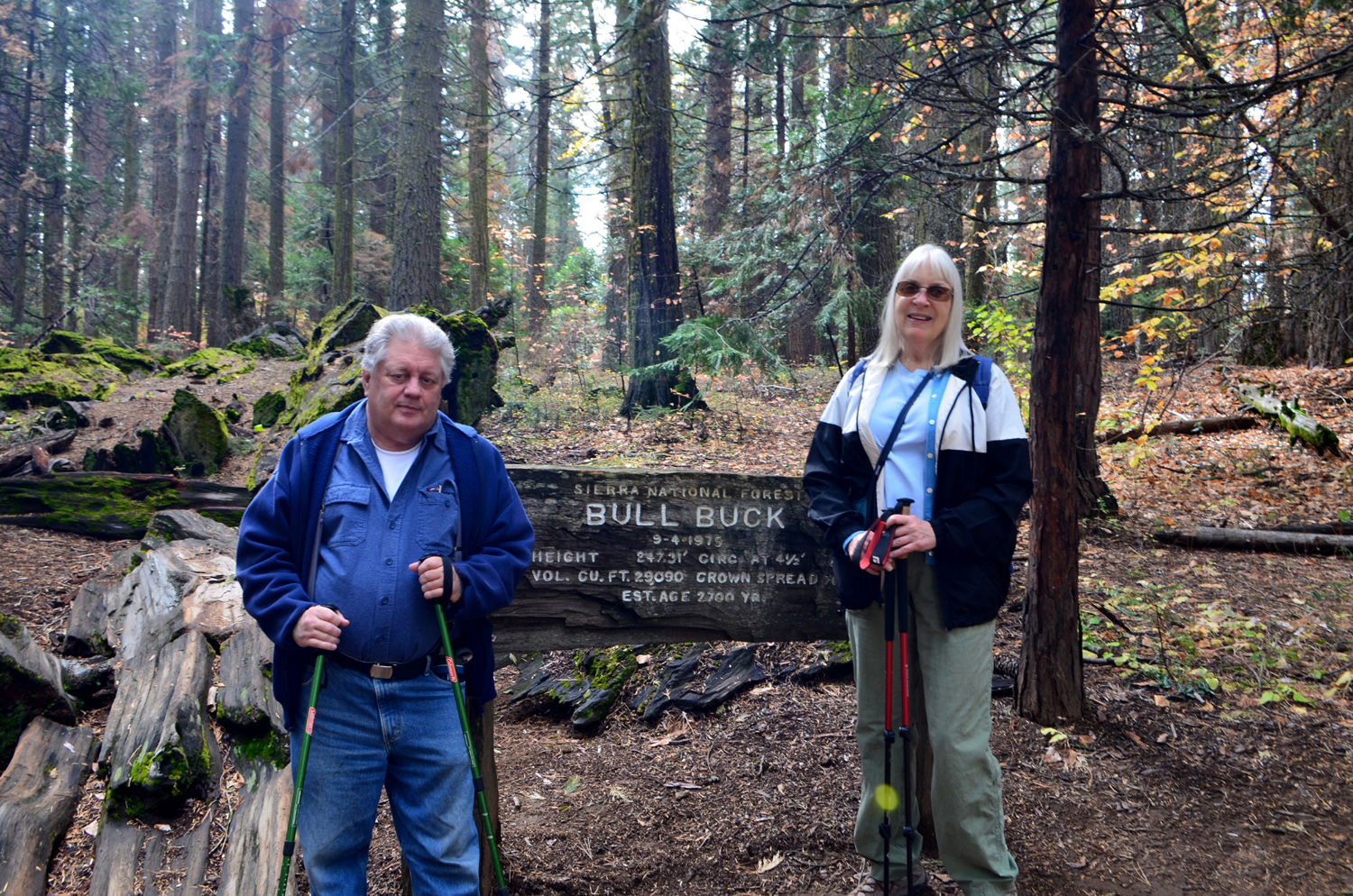
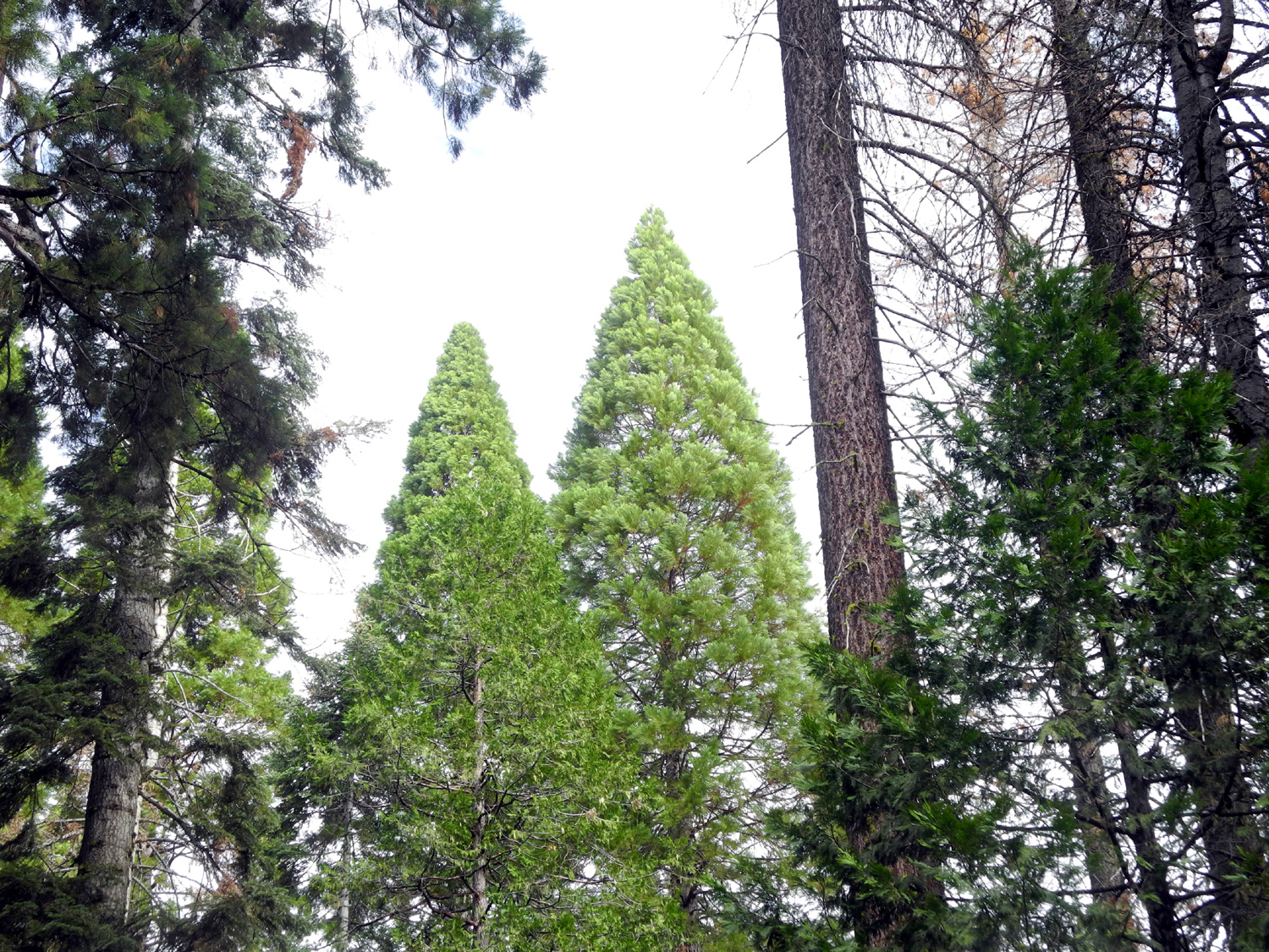
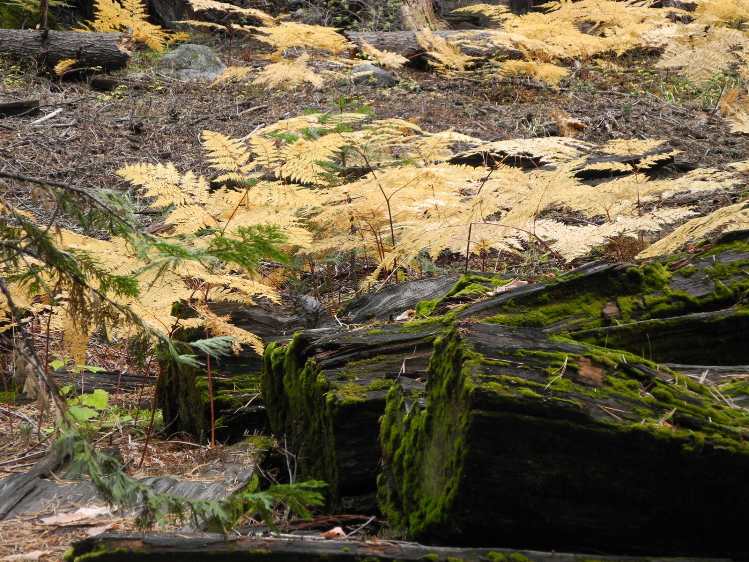
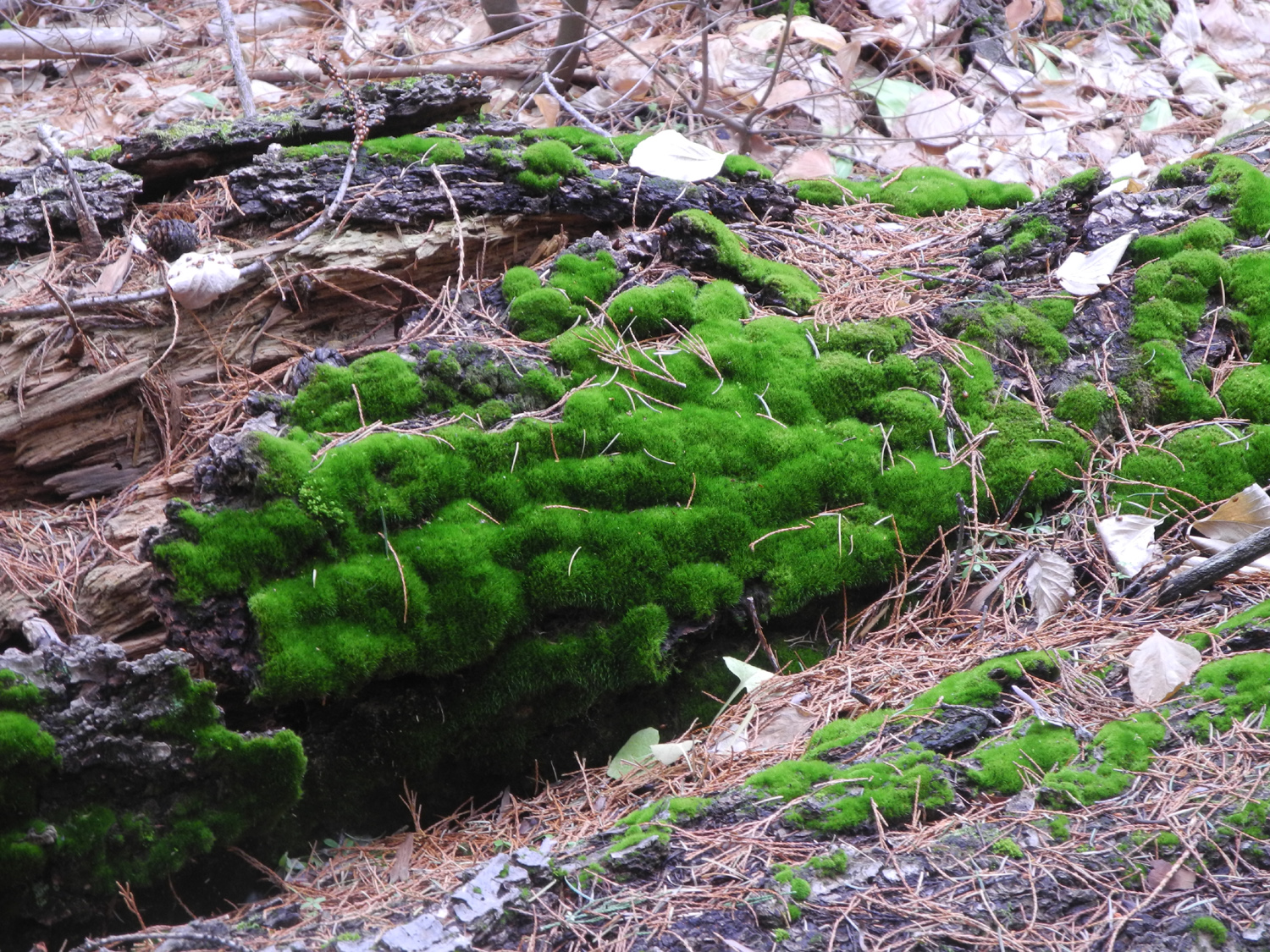
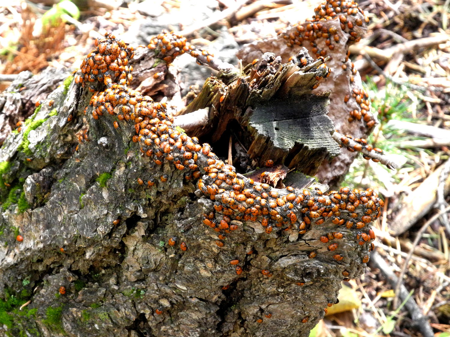
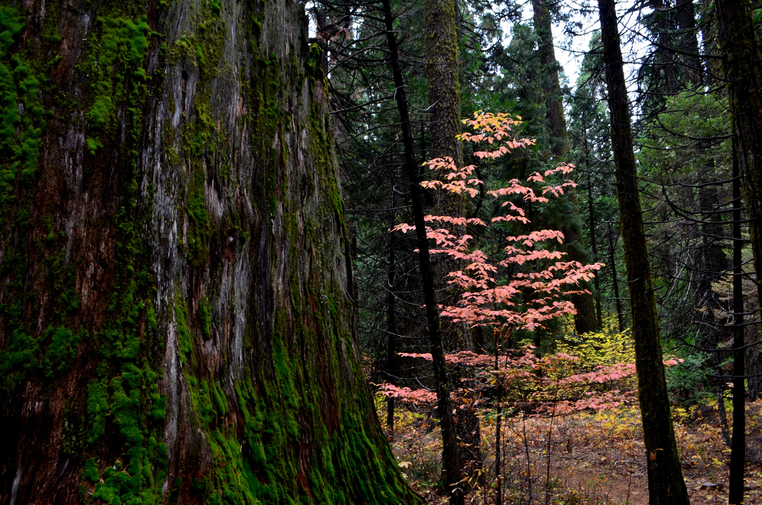
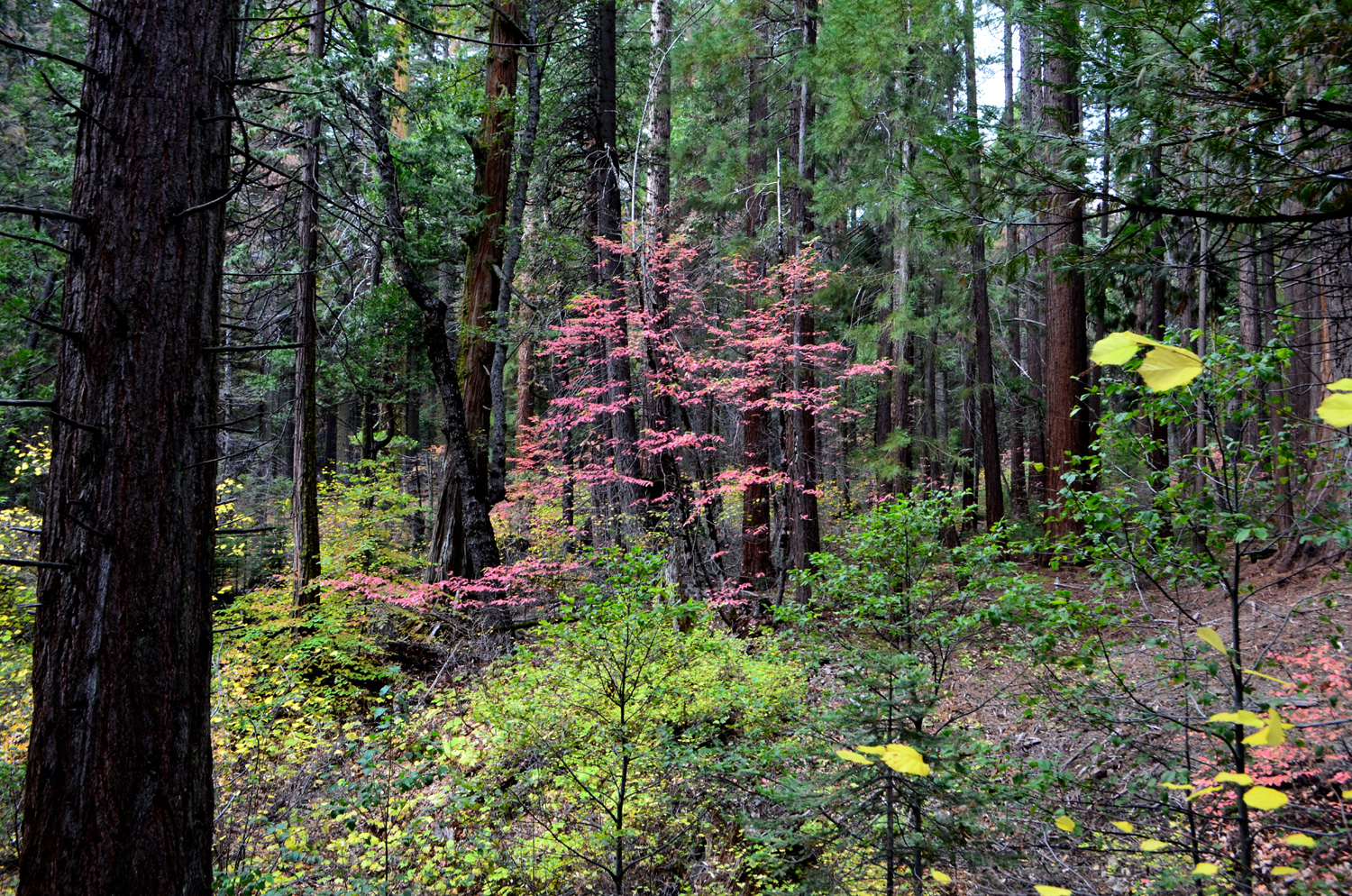
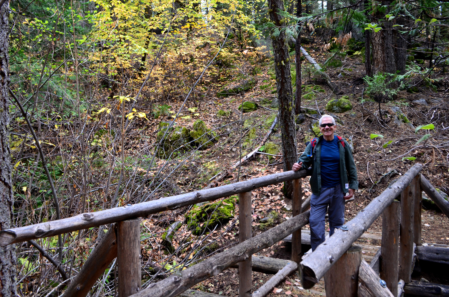
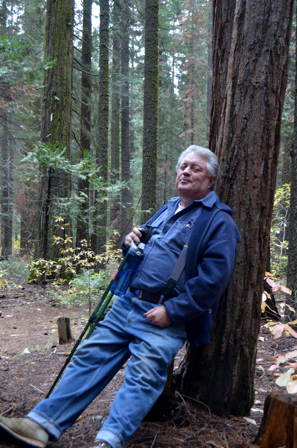
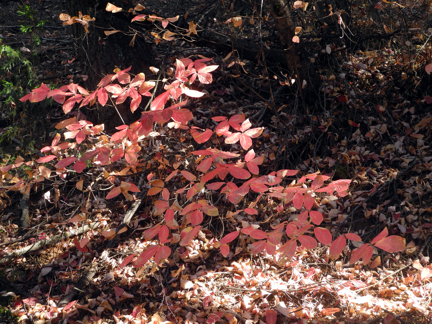
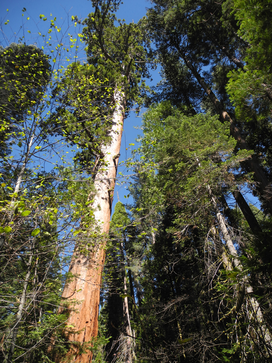
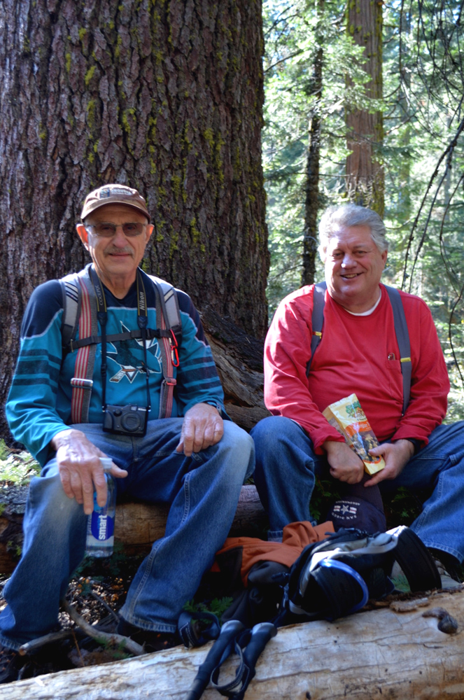
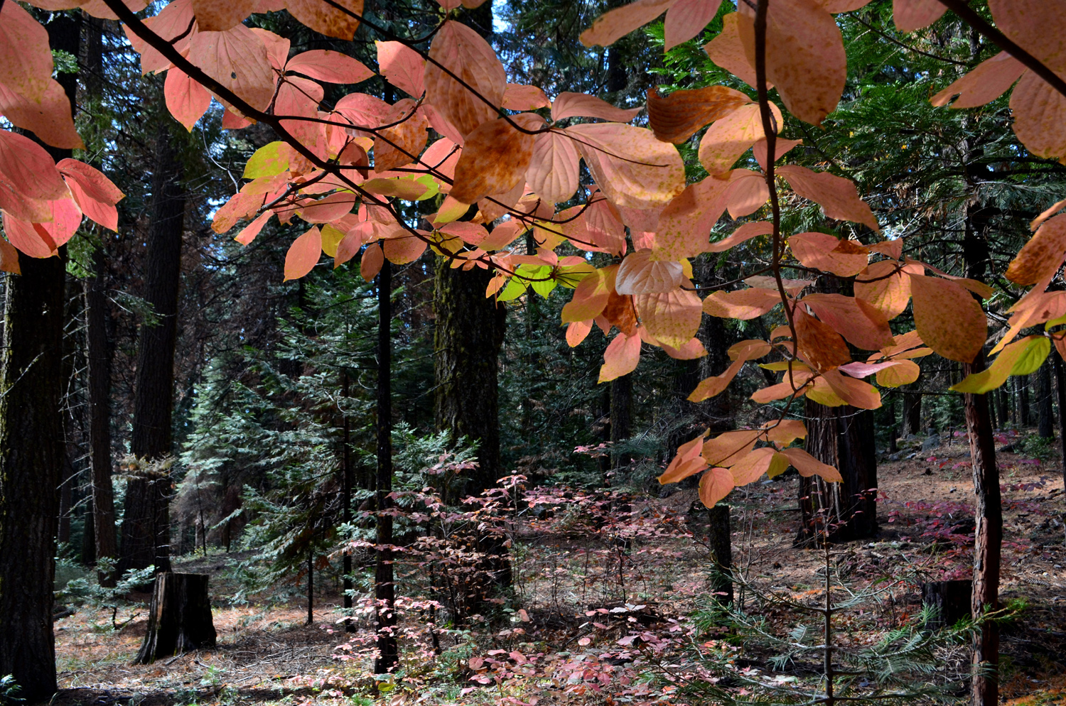
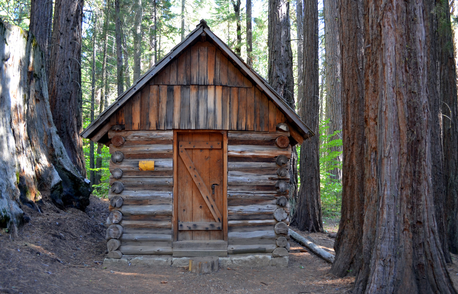
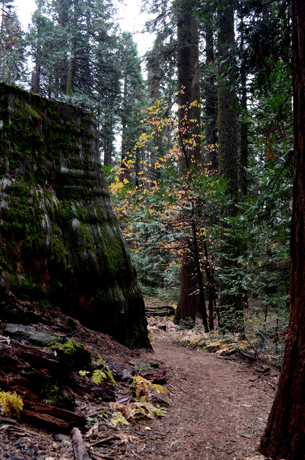
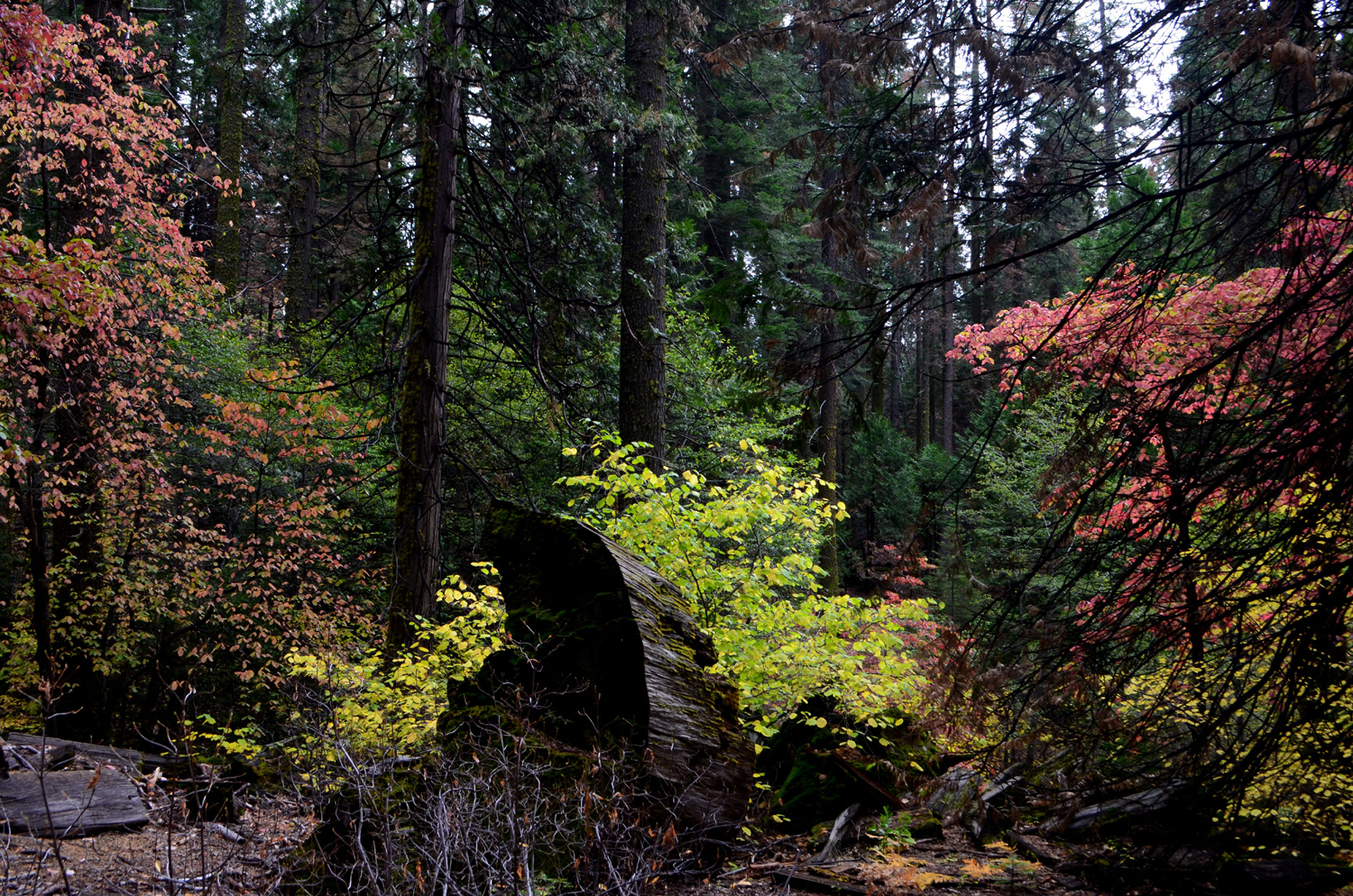
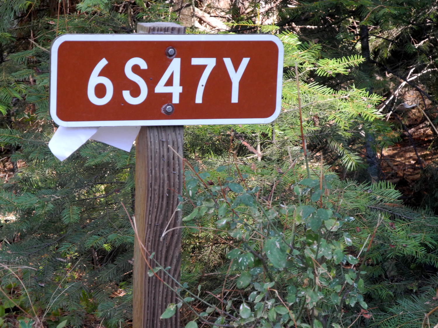
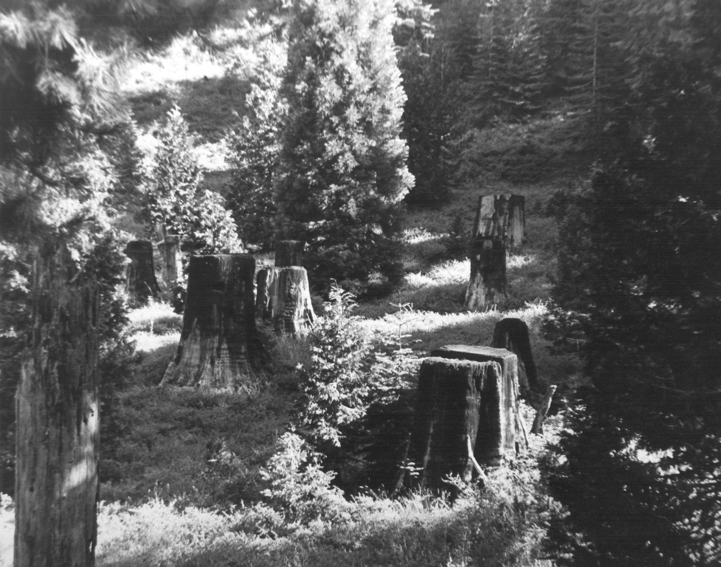
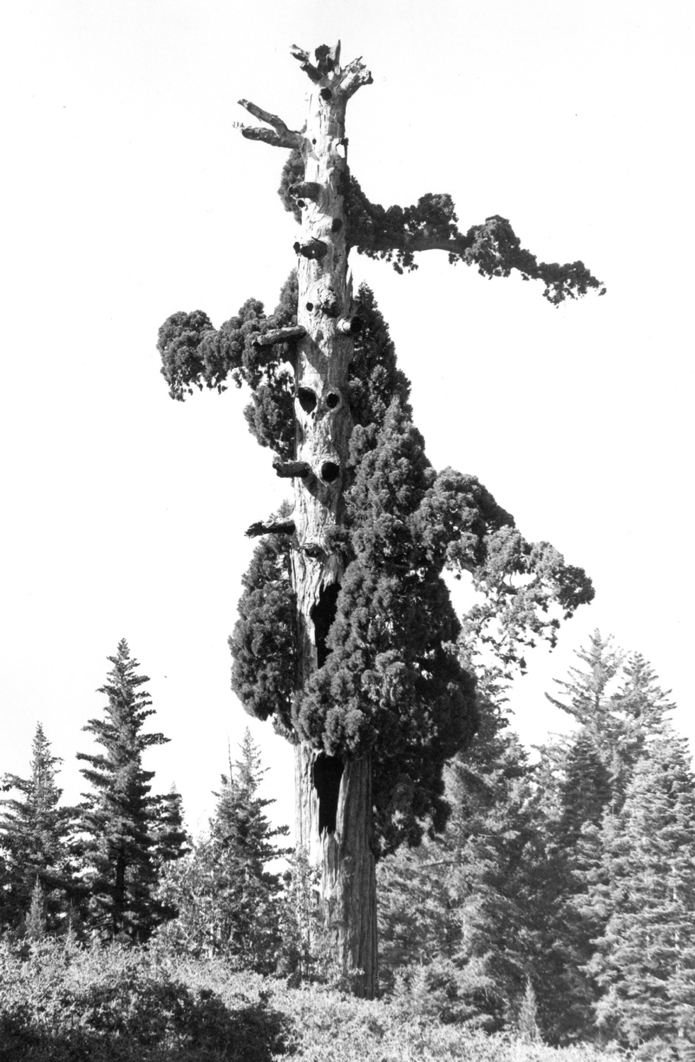
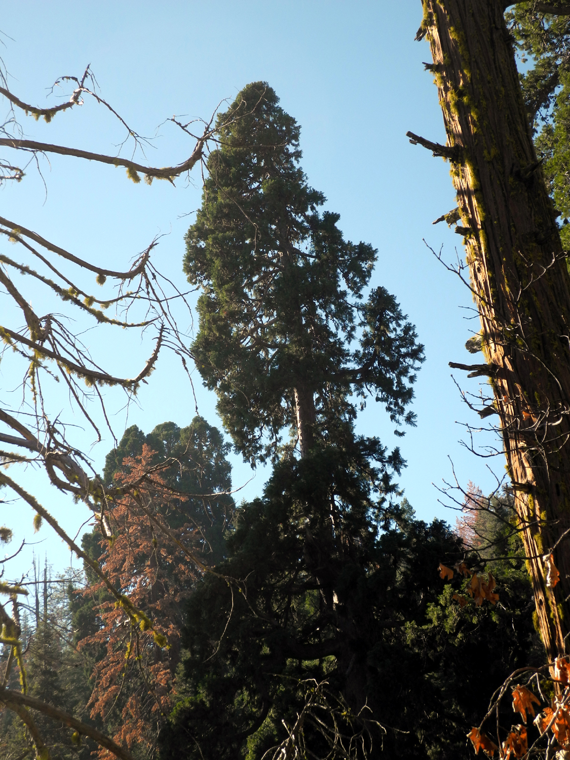
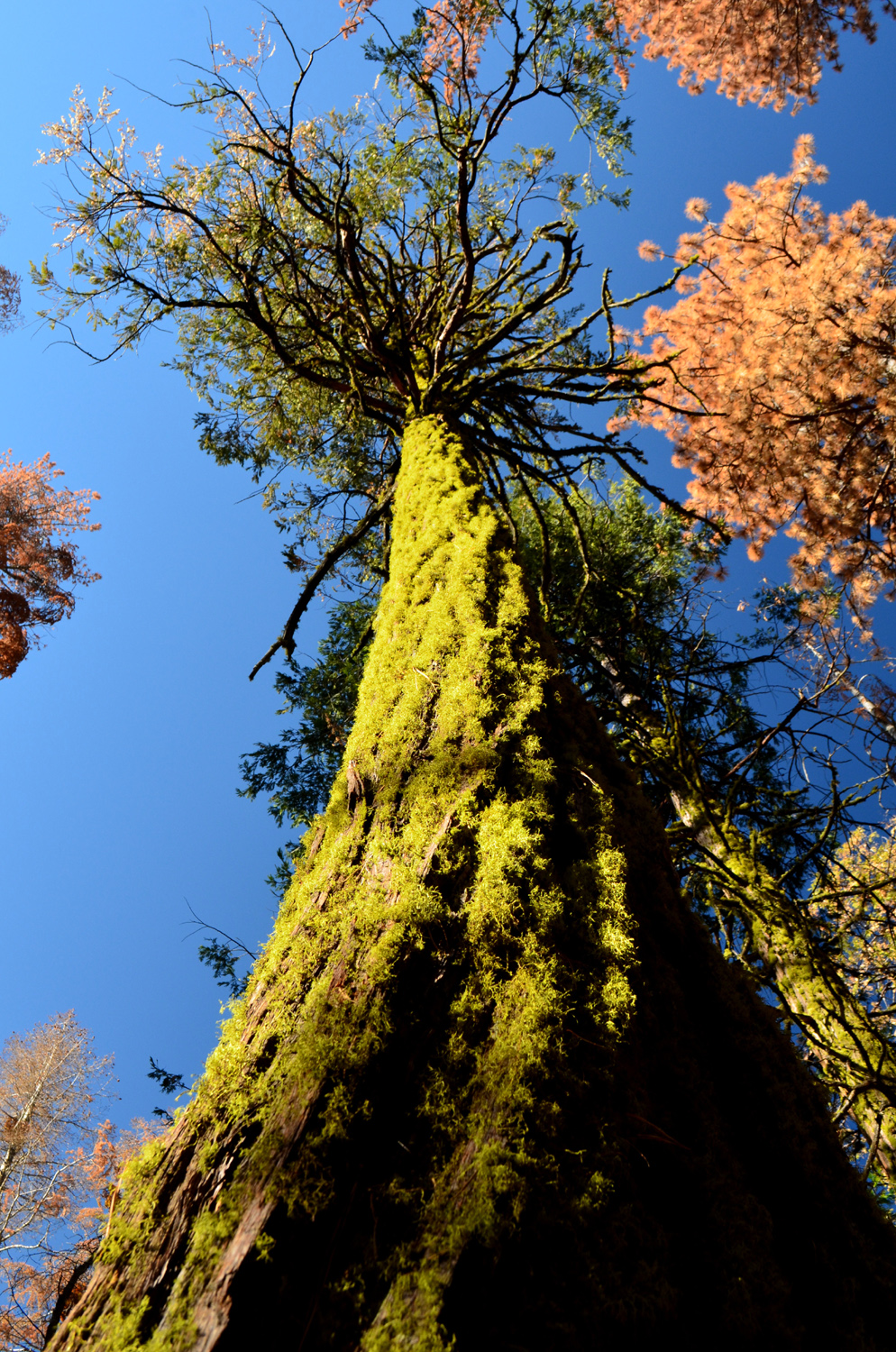
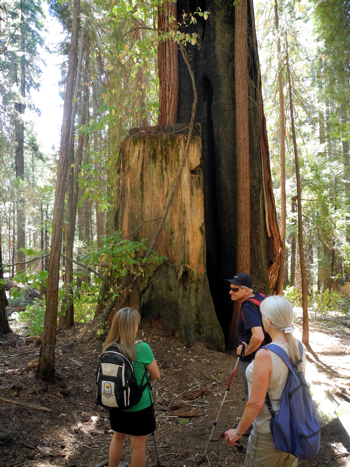
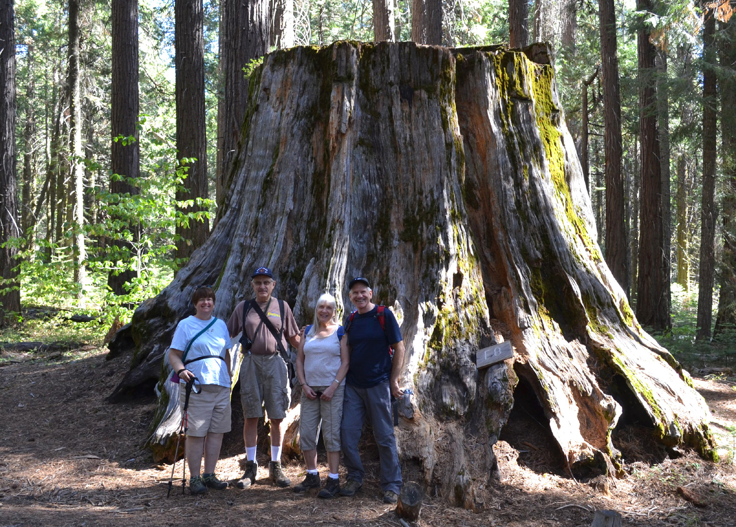
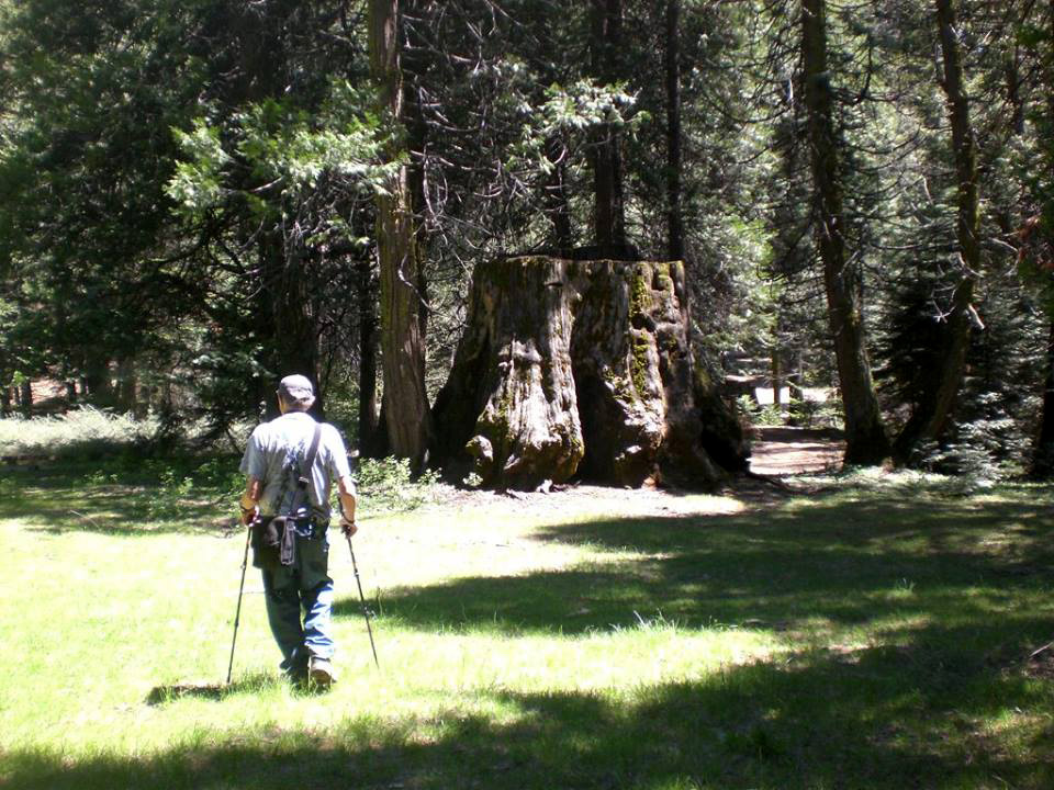
Nelder Grove Hike It's my contention that you can't go to Nelder Grove too often. Since I have been there probably 30 times or more since 1969, I'm walking the walk. My fellow Ramblers, who went there for the first time two years ago, agree with me. And our special guest for this hike, who had not been there for 25 years or more, doesn't plan to wait that long for his next visit. A relative scheduled an unexpected visit on the day of our hike, so Julie was not able to join us, but we were able to recruit Don McClellan, another retiree from the county Social Services department, who has long been an enthusiastic camper and hiker. The day before our hike we had a little rain in Fresno, which usually means a lot of rain up in the mountains. In fact, barely 10 miles north of town, where Don lives, there was thunder, lightning and a lot more rain. There was only a slight chance of rain on the day of our trip, and October 25 started out with mostly blue skies. Because of possibly less than optimal road conditions, we took my pickup, although any passenger vehicle would have worked fine. We drove north on Highway 41, picking up Don at a Park and Ride not far from his house, and continued on to Oakhurst, where we made a quick rest stop. Beyond this small mountain town, we took Sky Ranch Road, a good paved road that goes through a small residential area before entering the Sierra National Forest. In the yards along the road we saw that at least eight deer had decided to stop in and see what the residents had planted for their dining pleasure. About seven miles up this road, we took a left turn on Forest Road 6S47Y, a dirt road that runs from Sky Ranch Road to another road that comes in from the highway through Sugar Pine. Road 6S47Y crosses California Creek at a location where I have camped several times. We stopped there briefly to check out the creek, and more importantly, to take photos of the dogwood trees, which were at their fall best with red and yellow leaves. We continued on to the connecting road, turned right, and soon were at the entrance road to the Nelder Grove Campground. We were surprised and delighted to see that the road into the camp had been graded, the first time this has happened to the best of my knowledge. It was now good enough that I would consider taking my motor home to the camp. Don had not been in the area since before the logging exhibit had been constructed and cabins brought in from a nearby meadow, so we stopped at that point for a look at the old cabins, some big stumps, and the Big Ed Tree. Back in the truck, we drove the very short distance to the main campground and got ready to hike. There are now a number of official trails in the grove, none of which existed when I first visited the area in 1969. Parts of today's trails were roads then, and the Shadow of the Giants trail, about a mile from the campground, might have been there, but I can't recall. The trails we usually take are the Bull Buck, which is a half mile from the campground to the tree, and the Chimney Tree Trail, a loop that starts near the Bull Buck and goes a little over a mile back around to the campground. For a shorter hike, you can also take the old road a quarter mile from the camp to the Bull Buck. We took the longer Bull Buck route, which climbs gradually up through a forest of cedar, sugar pine and fir trees. There are few if any sequoias of any size along this section until you reach the Bull Buck. This massive giant, estimated at 2,700 years of age and nearly 250 feet high, is accompanied by many young sequoias, a hundred feet tall or more, but only two to three feet in diameter at the largest. There are also a lot of big stumps from giants that were cut down in the late 1800s, next to the Bull Buck, and scattered around the woods along the Chimney Tree Trail. In the 1970s the Bull Buck was surrounded on all sides by bushes and smaller trees, but then a section of the forest was cleared, giving a good view of the tree from top to bottom, with a bench at the upper end of the viewing area. We rested and took pictures at this spot, enjoying the view of the tree, the big stumps next to it, and the brilliant red of the dogwood. The previous day's rain had left the ground damp, but there were no puddles or muddy spots, and the foliage of the trees was washed clean of dust and the air was sparkling clear, making it a perfect day for hiking. We left the Bull Buck and turned on to the Chimney Tree Trail, which passes a number of big sequoias, old stumps, and smaller trees of various species. Several unusual sights caught our attention. First was a large wasp nest, about a foot in height, hanging in the branches of a dogwood. Nearby we saw ladybugs by the hundreds clumped together on fallen limbs, bushes, and young fir trees. We had seen something similar when we hiked to a nearby meadow last year. Beyond the bridge across California Creek, I noticed a row of young sequoias, about 10 to 15 feet high. I walked over for a closer look, and found that they were growing out of a larger tree that had fallen, but apparently still had roots in the ground, allowing a crop of former branches to start a competition to replace the main trunk of the tree. It will be interesting over the next few years to see how many of them survive. The trail goes through the forest, gently rising to its high point near the Chimney Tree, a sequoia that's been damaged by fire (but not killed) so that you can walk through the trunk and look up at the sky. This is where we took our long rest and enjoyed a snack. Near this area we also met and talked with a number of other hikers, including people from Santa Cruz, Michigan, Maine and Belgium. The rest of the hike was mostly down hill, but not steep, just a gentle grade back to the trailhead. There was one person camping in the campground with a large tent, a comfortable chair, and a nice fire. It looked like he might have been there for an extensive stay. However, we were not, so we changed out of our boots and got ready for the ride home. Not long after we got back on Sky Ranch Road, it started to rain. It didn't last long, but was hard enough that we were glad we had finished our hike before it started. As we have done a few other times, we stopped for lunch at Pete's Place, an excellent restaurant in Oakhurst. Our adventures were not over. When we arrived at the Park and Ride, Don's car would not start, even though the battery is only a few months old. We were only 20 minutes or so from his house, so he called his wife June, who brought over cables and a battery jump device, and soon we were all on the road back home. Wes summarized the day as follows: I felt as if I were in a wonderland of color today as the Ramblers hiked the Bull Buck Trail in Nelder Grove. The dogwood trees are receding into dormancy causing their leaves to turn from green to yellow to dark red. The ladybugs have stopped flying and have started their deep sleep in preparation for winter. This hike was ideal to initiate Don McClellan into the Ramblers. His knowledge of the Sierras and their forests will add much to our treks. My sense is we were all hypnotized by the beauty of Nelder Grove. Quite frankly we didn't want to leave. Our photos just barely capture what our eyes will never forget.
|
||||||
|
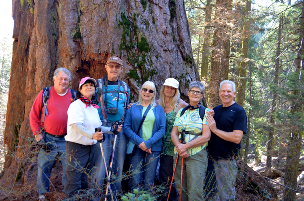
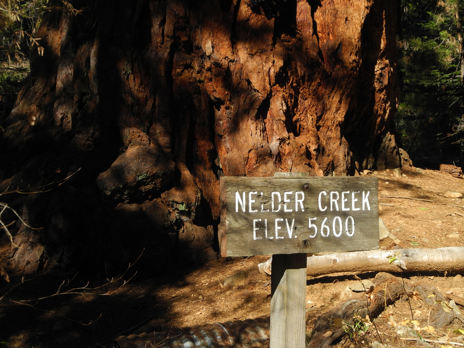
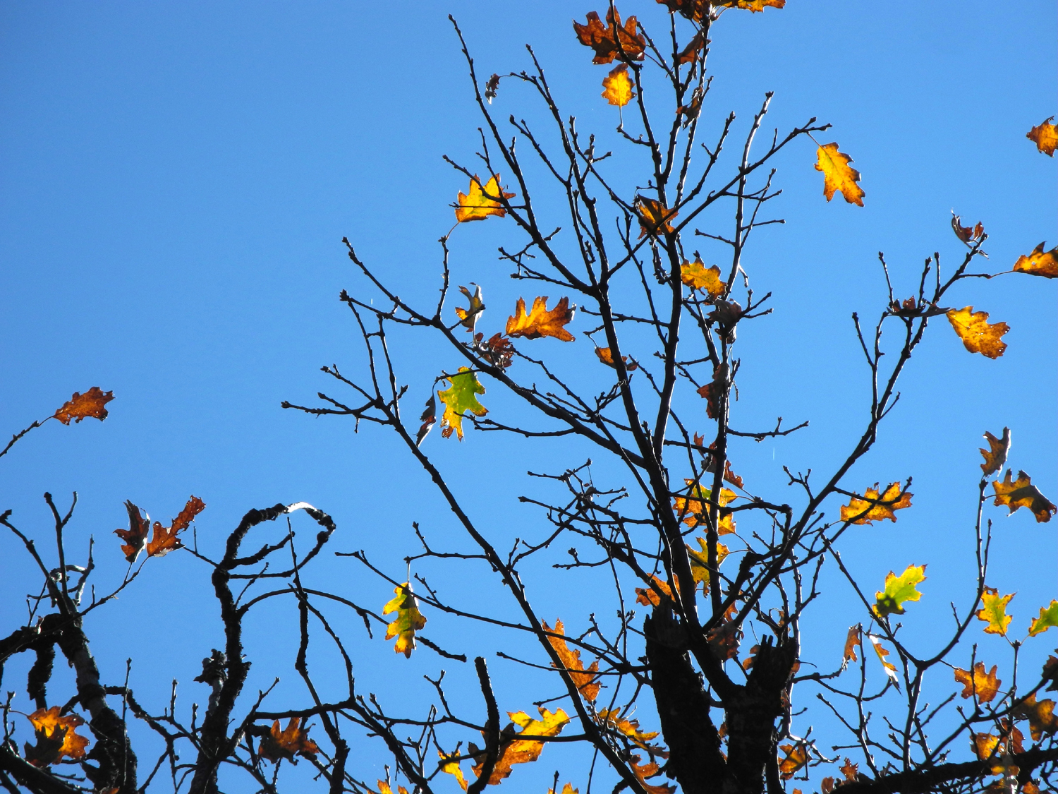
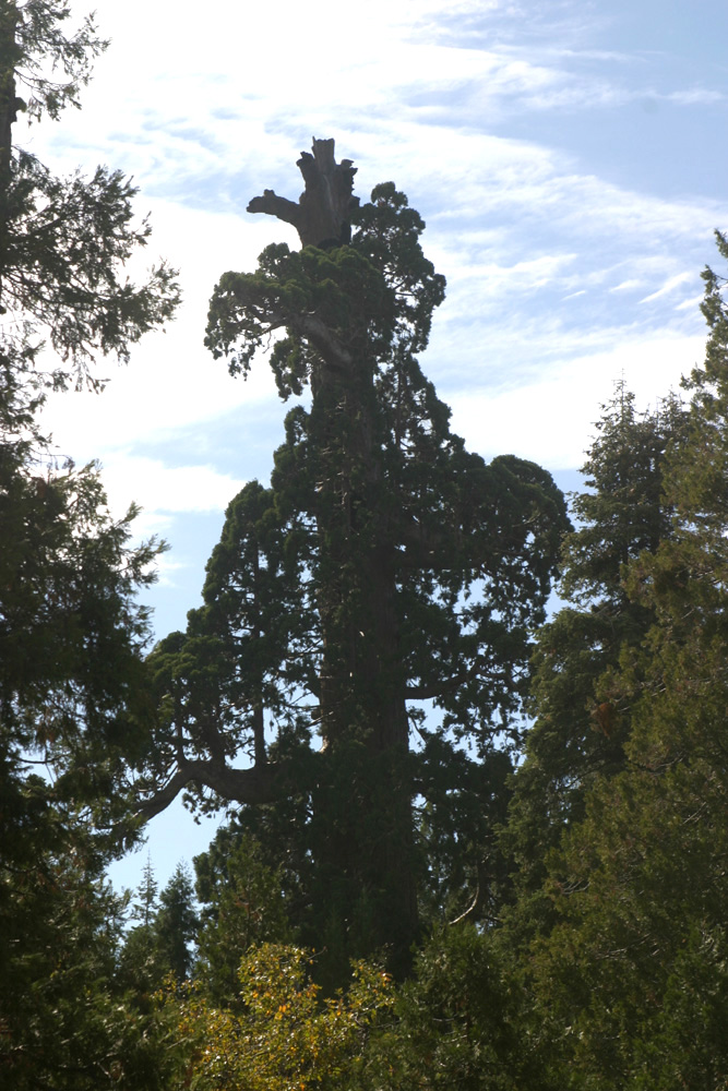
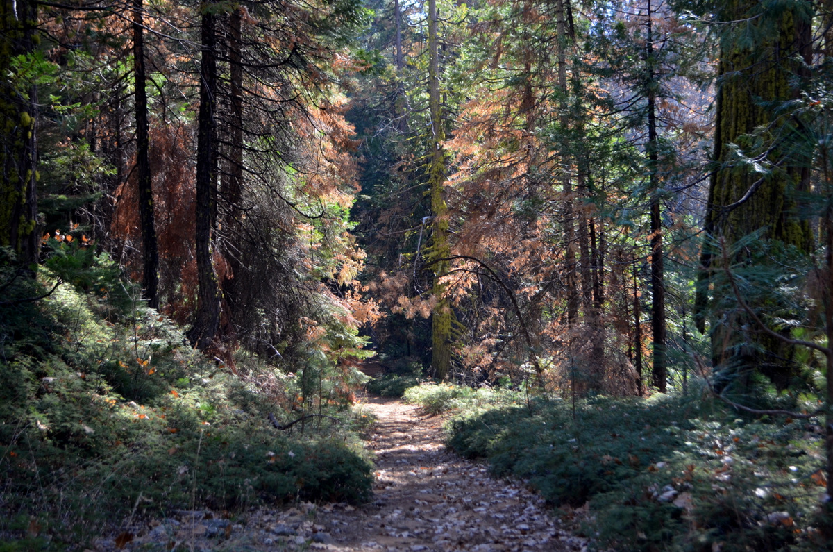
Nelder Grove Again This hike was part of a 4-day camping trip with my daughter Teri. The complete report, including the Ramblers hike discussed below, can be found on my Adventures of 2016 page. Teri and I arrived on Monday, November 14, and set up camp where Road 6S47Y crosses California Creek. We did a couple of hikes near camp that day, enjoyed pork chops for dinner by the campfire, and got to bed early. The next day was to be our hike with the Ramblers, so we made sure to eat a good breakfast to provide energy for the nearly 100% uphill hike that was in store. Teri had invited a couple of her friends to join us, and they were going to meet us at the Nelder campground. There was some confusion over whether Wes and company were meeting us there or at our camp, so we went to the grove and they went to our camp, but eventually we got everyone together and ready to hike part of the longest, hardest trail in the area. To fully explain this trail I need to go back in time a bit. When I first started coming to Nelder Grove in 1969, there was a road that went uphill from the campground. It crossed Nelder Creek and continued up and around the side of the mountain, where it leveled off for about a mile. Rounding a bend, I saw a small basin with six or eight sequoia stumps of various sizes, blackened from a fire. They were surrounded with low brush and young trees. Just above the road to the right there was a dead sequoia, broken off about 100 feet above the ground and completely devoid of bark. Another similar snag rose up below the road, and another dead redwood, with no foliage but still with a few top branches, stood guard at the lower side of the stump basin. There were a couple of good size giant redwoods, and a number of young sequoias. Up a dirt track from the road, there was a top to bottom view of the most rugged and impressive living sequoia I had ever seen, known as the Old Granddad. This road has been closed to vehicles for decades, and I walked the three miles one way to the top in 2008, only to face massive disappointment. The firs, pines and cedars had grown up so thick and tall that I was walking right by the upper snag before I realized I had reached the area. The stumps were almost impossible to see, and only the top of the Old Granddad was visible. There does not appear to be any plan to thin the excessive growth and restore the view, so for now, this hike is not worth the effort. The area has been named the Graveyard of the Giants, and this name also applies to the trail that has replaced the road. After the first mile, the road crosses Nelder Creek, where there are several nice sequoias close to the trail, and this was our destination. Our group included regular Ramblers Wes Thiessen, Carolyn Amicone, and Dick Estel; Don McClellan, a sort of "Rambler in training," Teri, who is a "Rambler when she can be," and two of Teri's friends Sandy and Yvette. Julie Hornback was unable to be with us for this outing. Teri and I had hiked with Sandy several times, but it was my first time meeting Yvette. The trail goes uphill most of the way, with a couple of short level spots. It was warm enough that everyone was shedding a layer by the time we got to the top, and we looked for shade for our rest stops. After the creek crosses the trail, it drops down through a fairly steep canyon, and big sequoias are visible along the slopes. Where the creek levels off again is the Shadow of the Giants Trail which the Ramblers have hiked and which I've written about a few times. As you approach the creek, you are looking down the canyon, and ahead, right by the road, is the Leaner Tree. This big redwood is about 10 degrees off the vertical, and since I've never seen another sequoia like it, I'm pretty sure it used to be straight. Probably a year of heavy rain softened the ground around it enough that it started to lean, but the roots held, the ground dried out, and it appears to be anchored firmly in place (for now). Everyone rested, hydrated and wandered about a little at our turnaround spot. Teri and her friends continued up the trail a short distance to another big tree, while Don, Wes and I followed a trail a short distance up the creek toward Nelder Basin. Due to time considerations, we did not go as far as we could have, but I suspect that we could not have gone much further. However, I hope to make another trip up there and prove or disprove that theory. A final look at Nelder Basin would be a special experience. We started back down, mostly an easy walk. There is one stretch near the top that is very rocky, and we had to be careful in order to safely navigate this part. Once past this section we just enjoyed the fall leaves, big evergreens, and the companionship. From the trailhead we drove to our camp, where I had pizza waiting to be heated in the microwave. Wes provided a green salad, making for a very nice and well-deserved lunch after our 2.31 mile hike. After lunch, our guests departed, and Teri and I continued our four-day, three-night campout. When we got back home, we would find Wes's usual "final words" in our In Boxes: This month the Ramblers returned to Nelder Grove for another taste of paradise. We hiked part way along the trail of the "Graveyard of the Giants." It was a green tunnel of trees and shrubs all around and at times overhead. I must confess, I fell in love with moss. It seems as though every tree in every direction was covered with this beautiful green organism. As we reached our turn-around point, Terri quoted a saying of John Muir as a meditation focused on the importance of silence. We visited a cathedral of light and green beauty.
|
||||||
|
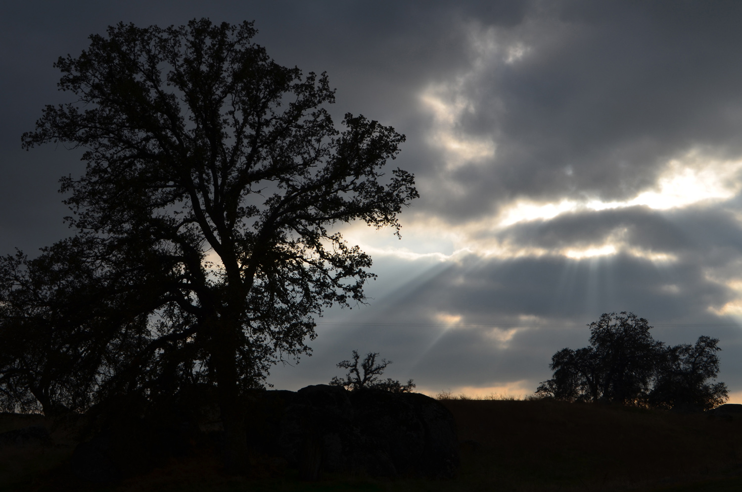
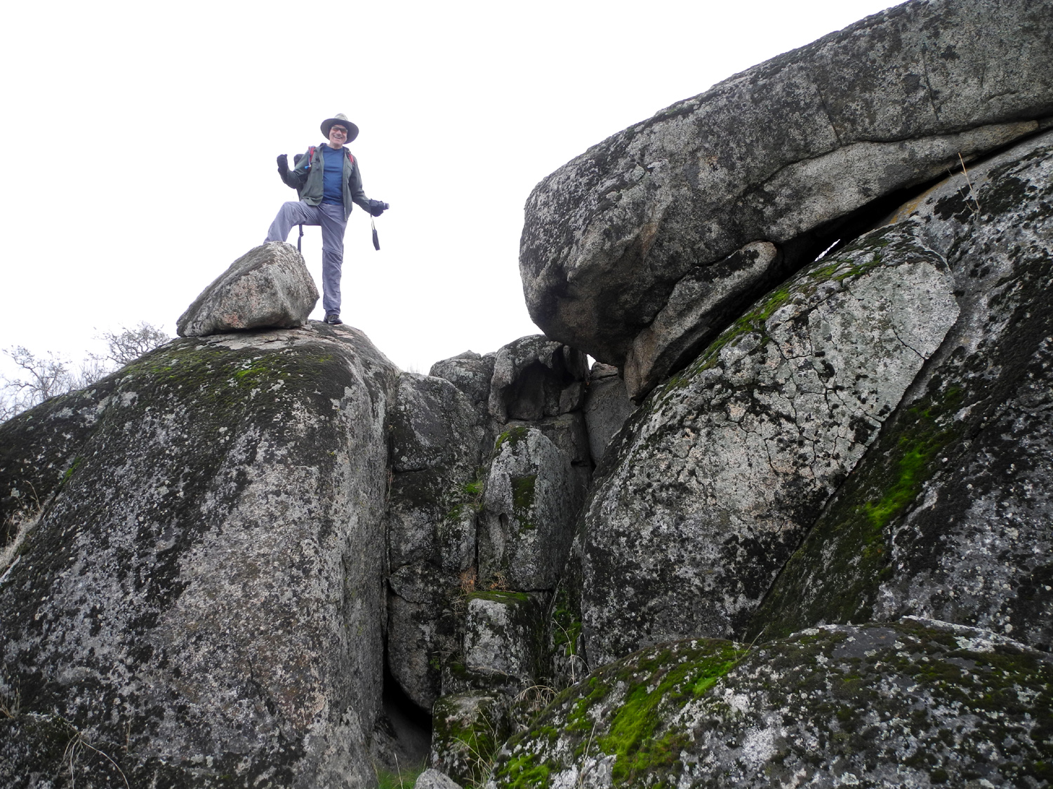
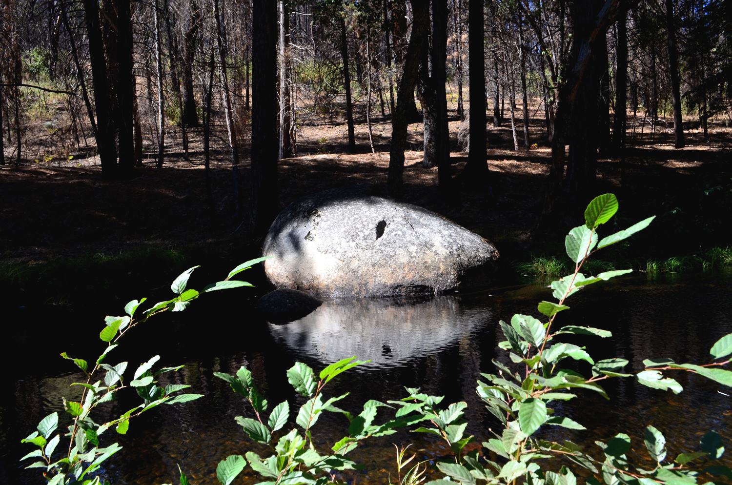
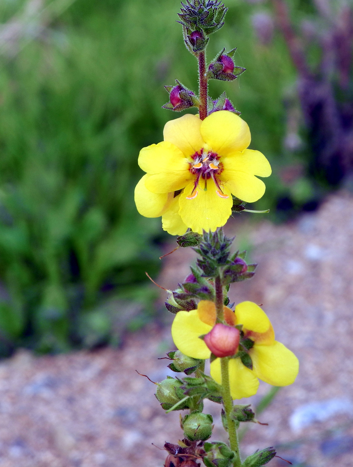
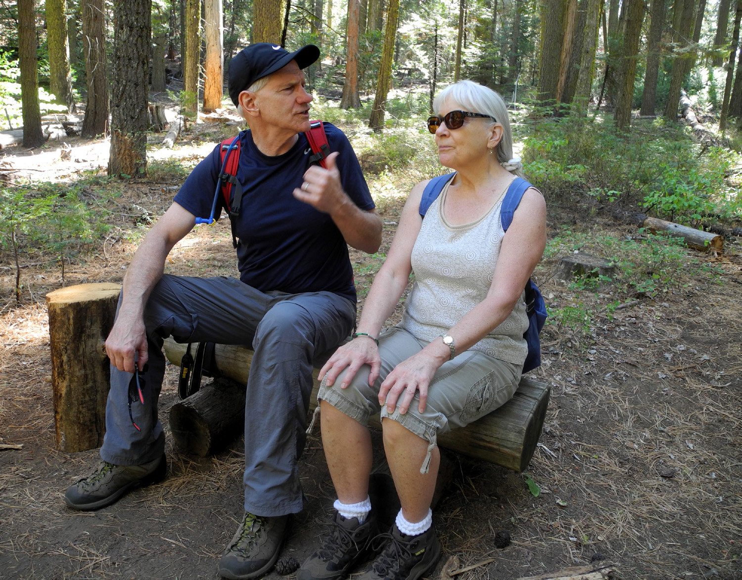
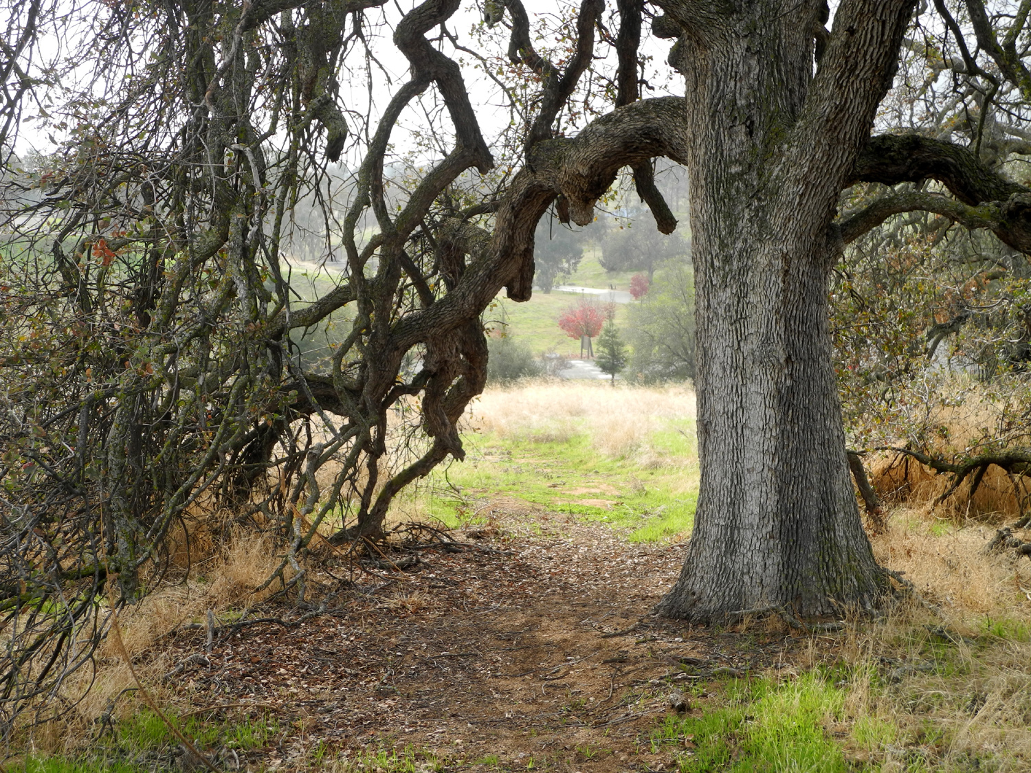
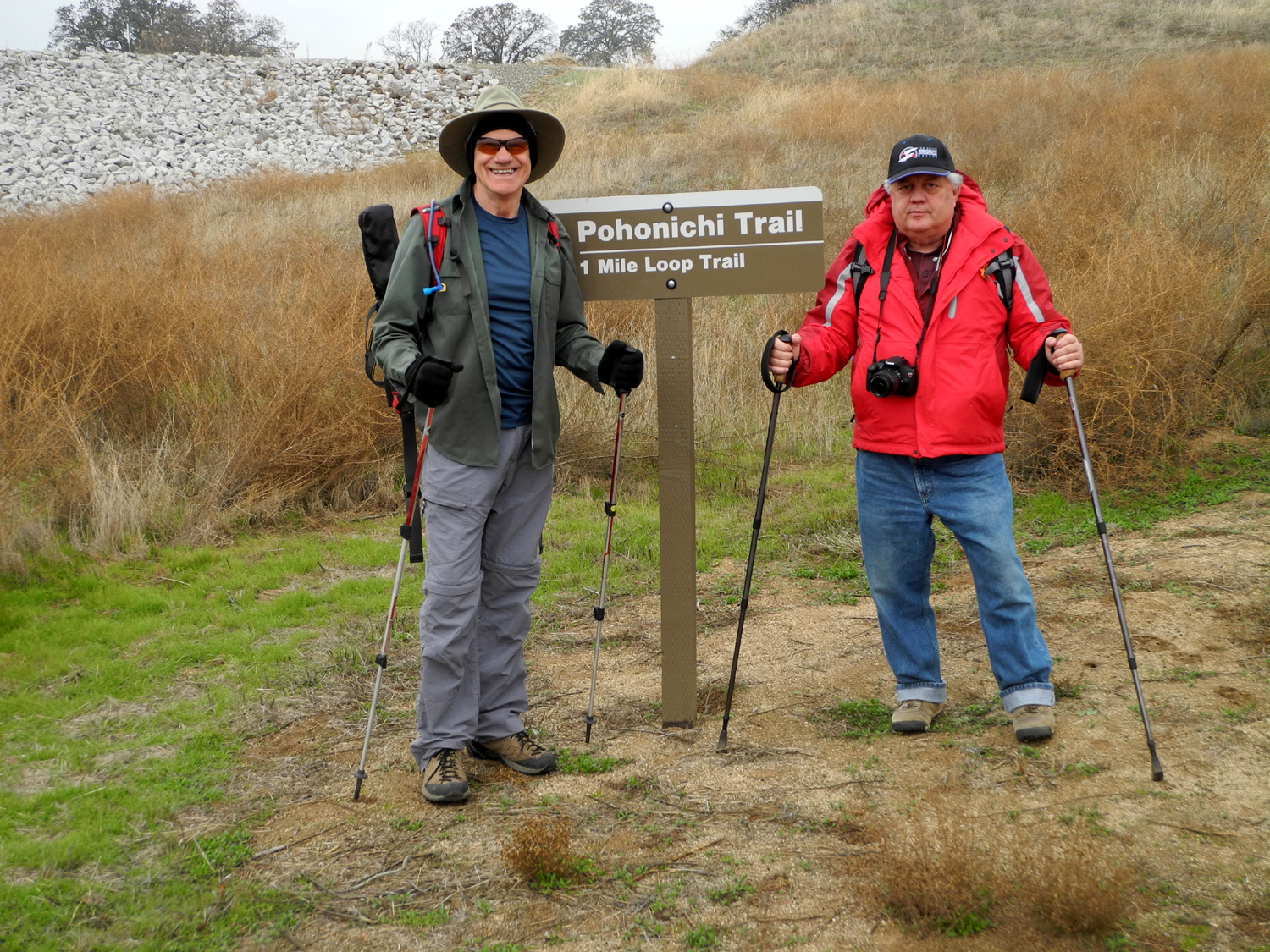
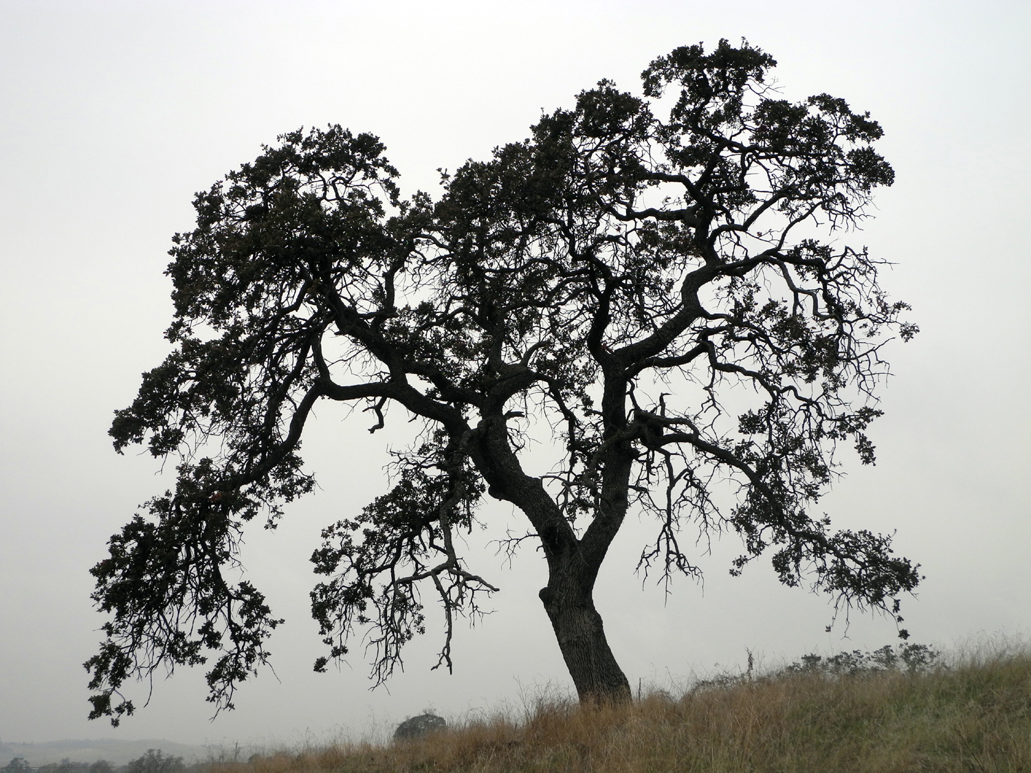
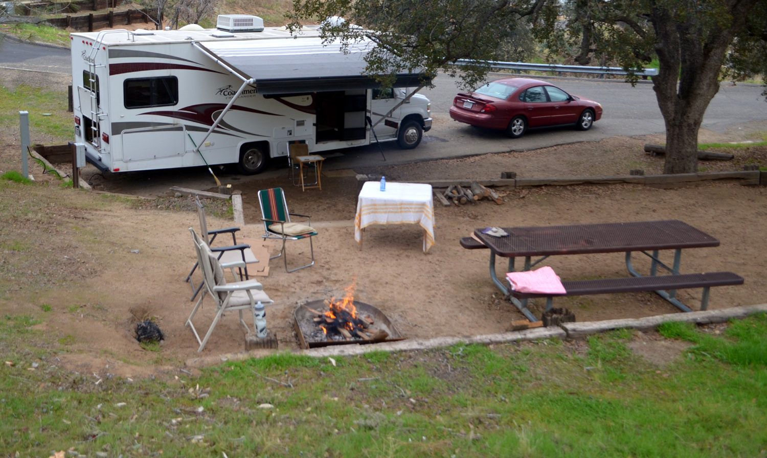
Hensley Reservoir This hike was contained within a solo camping trip, but for purposes of simplicity, I'm putting the entire report on the Ramblers page. I think the word that will stick in my memory about this trip will be "COLD." The weather forecast consistently said it would be around 50 degrees with wind, cooling down to the 40s at night. On the plus side, there was only a very slight chance of precipitation. The weather and the fact that the lake is quite low no doubt contributed to the fact that I was one of only four groups camping there. Having reserved a campsite with electrical power, I made the 38-mile trip in my motor home early on Monday, December 5 and got everything plugged in and ready. This included getting out my card table and a few chairs, plus putting leveling blocks under the wheels on one side. Then I was ready to hike. There are only two official trails at this facility, although there are plenty of places to wander on the roads, on old cow trails, or cross country. I chose to start with the Shaw'-Shuck trail, a half mile loop that goes up from near the park entrance to the top of a knoll, then up and down a couple of short sections, and back to the starting point. When I got to the top, I did not return on the trail, but instead walked down the fairly steep hill toward the road that goes to the boat launch ramp. This road passes only a few feet from several campsites, but does not lead directly into the campground itself. A few feet off this road opposite the camp is what I call Rabbit Rock, a large granite formation with several species of bushes in and near the rocks, providing perfect cover for the local rodents. I saw a quick-moving small animal, but I think it was a squirrel rather than a rabbit. More often than not, I DO see rabbits in this area. This walk was a little under a mile, but when I returned I was ready to relax in my lawn chair and read a while. The rest of the day included more walking and pizza for supper. I walked on the roads that lead through the camp ground, the A and B loops that gave me another .9 mile. Late in the day I did what came to be known (based on it happening two nights in a row) as "The 4:30 Wander." This was just a matter of going up on the hill behind my camp, down to the ramp road, up a nearby hill through some campsites, and back "home." By this time being outside was no longer fun, so I plugged in my electric space heater and settled in for the night, watching a few TV shows on DVD, and doing some more reading. As usual when camping, I went to bed before my official bedtime, this time about 9. For many years it was my habit to go outside to check the temperature and look at the stars at least once during each night. I rarely do this any more, blaming laziness, old age, and the limited sky view at my condo. However, I still do it when camping. There are two reasons - the star view is good in places where I camp, and I like to show off how hardy I am, surviving cold temperatures. Keep in mind that experience has shown that without the heater on, the inside of the motor home will be about ten degrees warmer than the outside. That first night I went out two or three times, enjoying a fairly clear sky, and observing a low temperature of 37 at 6:15 a.m. However, it had been 40 at 7:45 p.m., 9:20 p.m. and 2:30 a.m. The stars were only fair, since the day's overcast had not completely disappeared. I got up some time between 7 and 8, plugging in my heater, and enjoying the view out of the window of blue sky with some white clouds. This was not to last. I finished breakfast, then laid kindling and paper in the fire ring, since we planned to eat outside, and it was already obvious that the fog was drifting back in and the temperature was not going to get up very high. Although we started with five or six planning to join the hike, Julie and Carolyn both had last minute issues and had to cancel. Don McClellan lives only about 15 minutes from Hensley, so he drove his own car and arrived first. As we visited in the comfort of the motor home, we began to wonder if Wes had become lost. Eventually he arrived with a very good excuse - the fall leaves in the fig trees, and the rolling countryside along the way issued their siren call to him and his camera, and he stopped several times to take photos. However, we got our hike started with plenty of time for walking, taking the mile-long Pohonichi loop. Along the way we stopped to take photos and just generally enjoyed the oak savannah countryside. I've described this trail in other reports, so I'll just say that it is one of those "perfect" trails. Just as you get tired of going uphill, it crosses a ridge or hilltop and starts down, and when you've had enough of that, it heads back up hill again. The area is covered with dried grass and plants from last year, but the new crop of green grass is getting a good start. The blue oak trees offered the usual variety - some with most of their leaves still on, some with no leaves, and some just dead skeletons silhouetted against the sky. In places the trail has become very overgrown and has not been maintained for a year or two. Only the numbered posts along the trail kept us on the right path in some spots. There was a lot of moisture on the grass, and before we returned, our boots were wet and carrying a bit of mud. We stopped and rested on all the benches that have been provided for this purpose except the one that has no seat, just legs. We took the usual photos of Wes climbing on things, and of course had a fine time conversing about everything that needed to be settled. One thing we didn't do was get too warm - it remained foggy throughout our walk, and when we returned to my camp, the first thing I did was get the fire started. I had bought a box of wood at the supermarket, but there was a big pile already there, so I had split the bigger pieces, and used only one piece of my own wood. "Free" leftover wood is sometimes too wet to burn well, but this was nicely dried out, and we soon had a warm fire going. The breeze carried the smoke across the nearby picnic table, but we set up lawn chairs on the upwind side and enjoyed our sandwiches of sourdough bread, smoked ham, cheddar cheese, beefsteak tomatoes and fresh lettuce, accompanied by potato chips and optional Cokes. We topped it off with homemade ice cream with homemade hot fudge sauce, the greatest dessert ever created. After enjoying the fire and good conversation, Wes departed, followed soon after by Don. I kept the fire going as long as the wood lasted, while catching up on my reading. As the sun began to set, the fog opened up, providing some spectacular views. On his way home Wes captured a dramatic shot of sunbeams reflecting off moisture in the atmosphere. On the "4:30 Wander" I walked up to the top of the highest hill in the campground, right above my motor home, and was rewarded with the sight of the sun turning the leaves on nearby blue oaks to gold. I then went up another hill above the boat launch area, and captured a perfect brilliant red sunset. As it got dark, I went inside and kept the electric heater going until bedtime, checking the temperature from time to time, and of course, during the night. After dark the fog and clouds disappeared completely and it was brilliantly clear and very cold. It was down to 39 before 7 p.m., 33 at 1:30 a.m., and 29 at 6:00 a.m., at which time I turned on the propane heater before getting back in bed. I set it fairly low, about 60, because the tank is nearly empty, and switched to the electric heater when I got up. Once again it was sunny at the start of the day, and once again the fog moved in. I had thought about doing a final short hike, but the weather discouraged me, so I had a leisurely breakfast, took a very short walk, and got the motor home ready to go. By 10:15 it had "warmed up" to 41 degrees, with very hazy sunshine, conditions that prevailed throughout my short drive back to Clovis. As usual, Wes would not be denied a final word: We started with six and then were down to three who actually made the hike at Hensley Lake. I must confess, I have a little paranoia in me. When I discovered the three women of the group had cancelled leaving just three men in participation, I wondered. Maybe these three wonderful gals took a hard look at the three rough, wrinkled old men and said, "no way" (ha!). Perhaps it was just Karma that three guys had a wonderful morning hiking and sharing in conversation and fine food. We were all captivated by the beauty of the blue oak trees. All of us carried cameras and couldn't capture enough of these wonderful specimens in digital format. Winter had stripped them of most of their foliage exposing large tangled branches, dark against a cloudy sky. It was wonderful! We ate al fresco around a roaring camp fire. It was all way too good! Maybe the ladies will want to come back. Let's hope.
--Dick Estel, December 2016 |
||||||
|
Photos
(Click to enlarge; pictures open in new window) |
||||||
|
Hume Lake Loop |
||||||
|
|
 |
 |
||||
| Julie
and Carolyn, near the junction of General's Highway & Ten Mile Road |
Wes,
Julie and Carolyn, checking out the big elderberry bush |
Rail fence along the trail | ||||
 |
 |
 |
||||
| Late season wild flowers | Downed logs along the trail | Wes on the viewing platform | ||||
 |
 |
 |
||||
| Dick, Julie and Carolyn on a bridge | Blue heron watches for lunch | Signs of fall | ||||
 |
 |
 |
||||
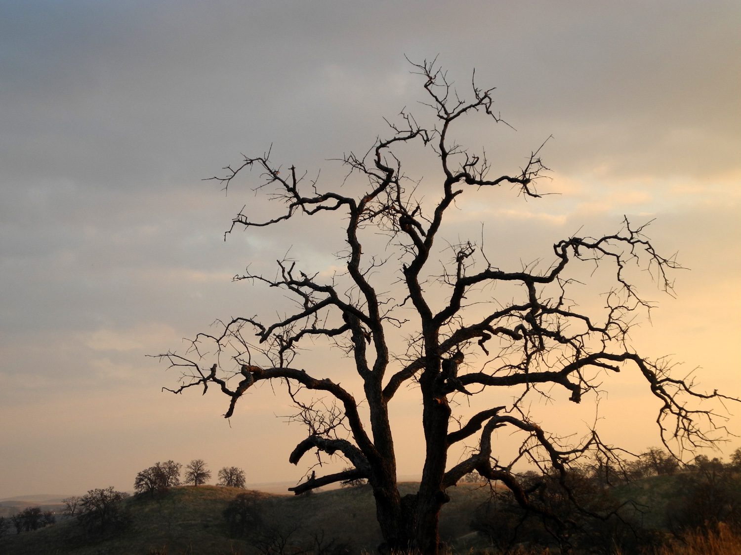
| This one's dead, but not yet down | Wes
on the bridge that crosses the creek below the dam |
View of the lake near the dam | ||||
 |
|
 |
||||
| The
distant mountain lies between the Middle and South Forks of the Kings River |
Front of the concrete arch dam | The lake and the dam | ||||
 |
 |
 |
||||
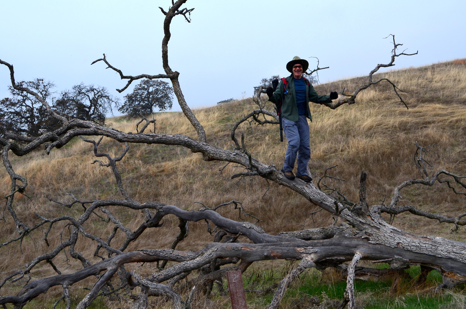
| Wes on the rock | A quiet cove | Crossing
the bridge over Ten Mile Creek at the lake's inlet |
||||
 |
 |
 |
||||
| Wes on the bridge | Ten Mile Creek | A study in green and gold | ||||
 |
 |
 |
||||
| Dead
pines contrast with the green around them |
A view with plenty of green | Reeds in the lake | ||||
 |
|
 |
||||
| Kayaks for rent | The Ramblers at rest | We
enjoyed good food and good service at the Snack Shop |
||||
 |
||||||
| Logs awaiting the chipper | ||||||
| Mammoth Pool Hike | ||||||
 |
 |
 |
||||
| Along
the road from State Highway 41 to North Fork |
Redinger Lake on the San Joaquin River |
The Eagles Beaks from |
||||
 |
 |
 |
||||
| Fuller
Buttes on the left; Balloon Dome on the right |
Ritter Range and Minarets | Mammoth
Pool, with the scars of the French Fire |
||||
 |
 |
 |
||||
| The
poles are ready; where are the hikers? |
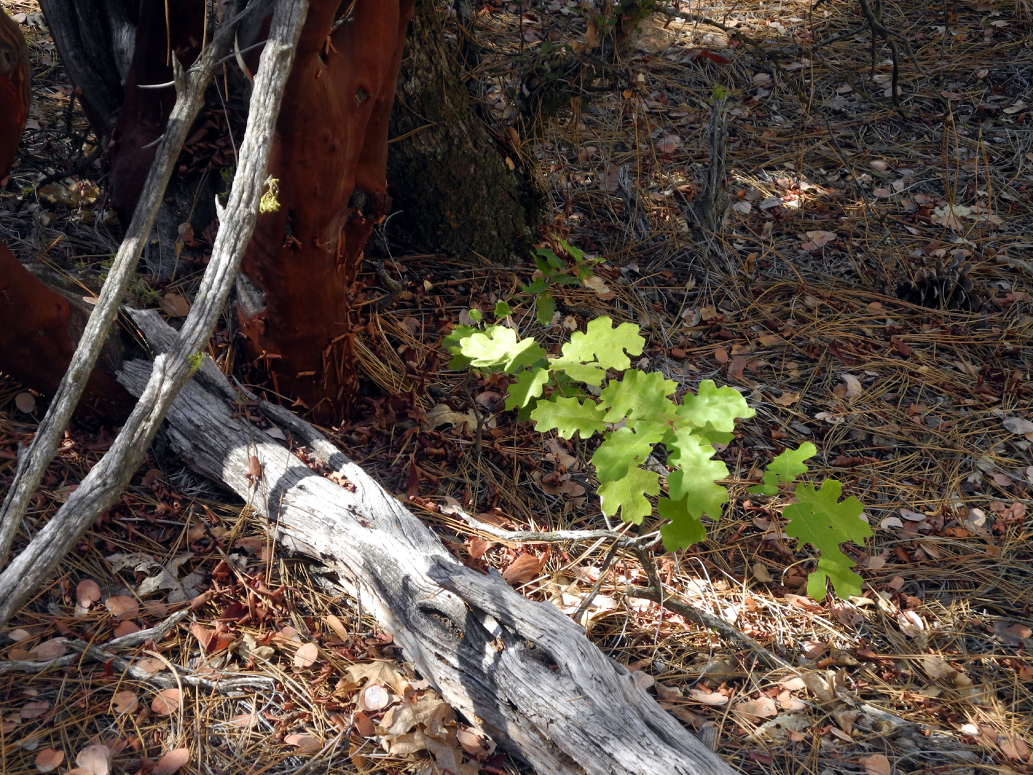
Approaching Mammoth Pool | A young black oak | ||||
 |
|
 |
||||
|
The red trunks of a manzanita forest |
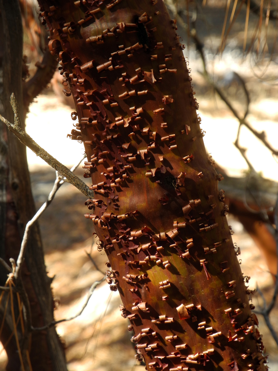
Late
in the season, the bark peels off in curls |
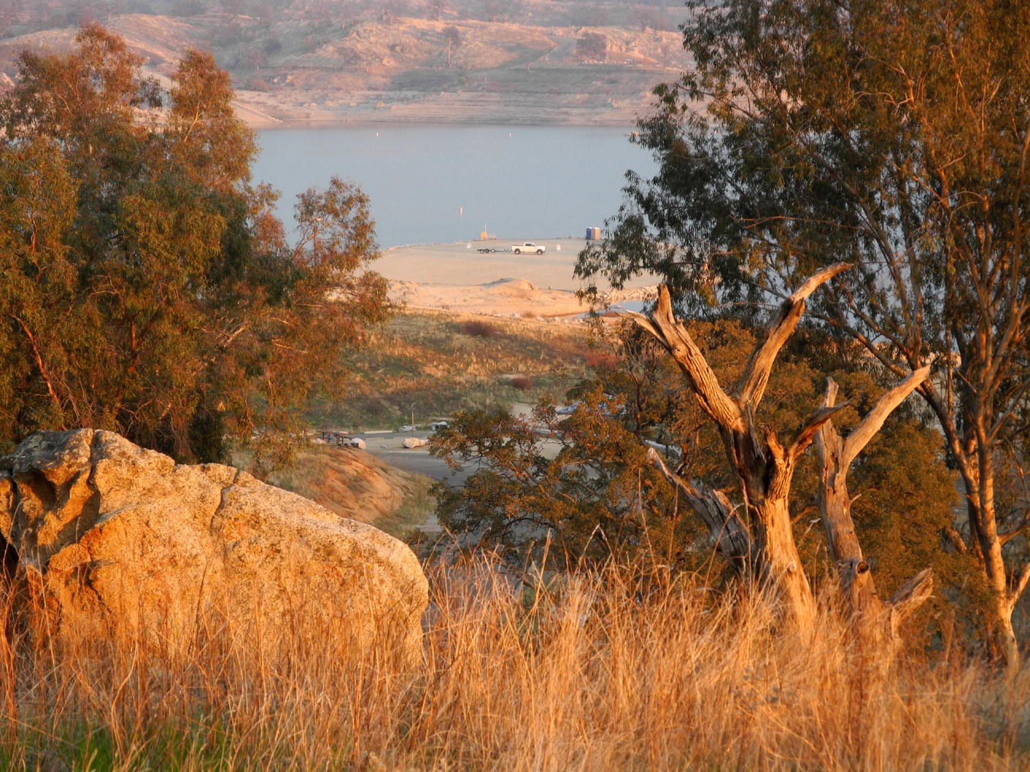
The
road between Wagner's Resort and the reservoir |
||||
 |
 |
|
||||
| A cascade on Chiquito Creek |
Reeds in the creek add a bright spot |
The
windblown Ramblers at Mile High Overlook |
||||
 |
 |
 |
||||
| Wes at the overlook in 2014, before the fire | And in
October 2016, with the forest missing |
Sierra Vista Scenic Byway map | ||||
 |
 |
 |
||||
| Burned hillside above the lake | Another view of Chiquito Creek | Rock and pool in the creek | ||||
| Nelder Grove | ||||||
 |
 |
 |
||||
|
Dogwood at California
Flats |
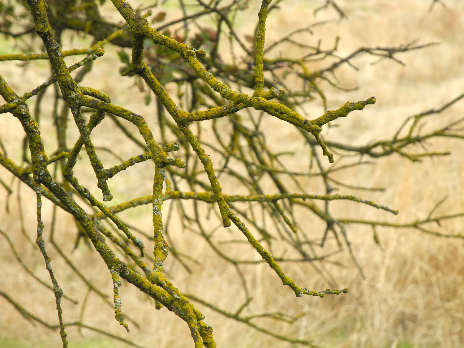
Close-up of a branch | Tall firs and pines | ||||
|
 |
 |
||||
| The Bull Buck, age 2,700 years | Middle of the trunk |
Top of the tree, with dying pines for contrast |
||||
 |
 |
|
||||
|
Dogwood along the trail to the Bull Buck |
Don and Carolyn beside the informational sign | The
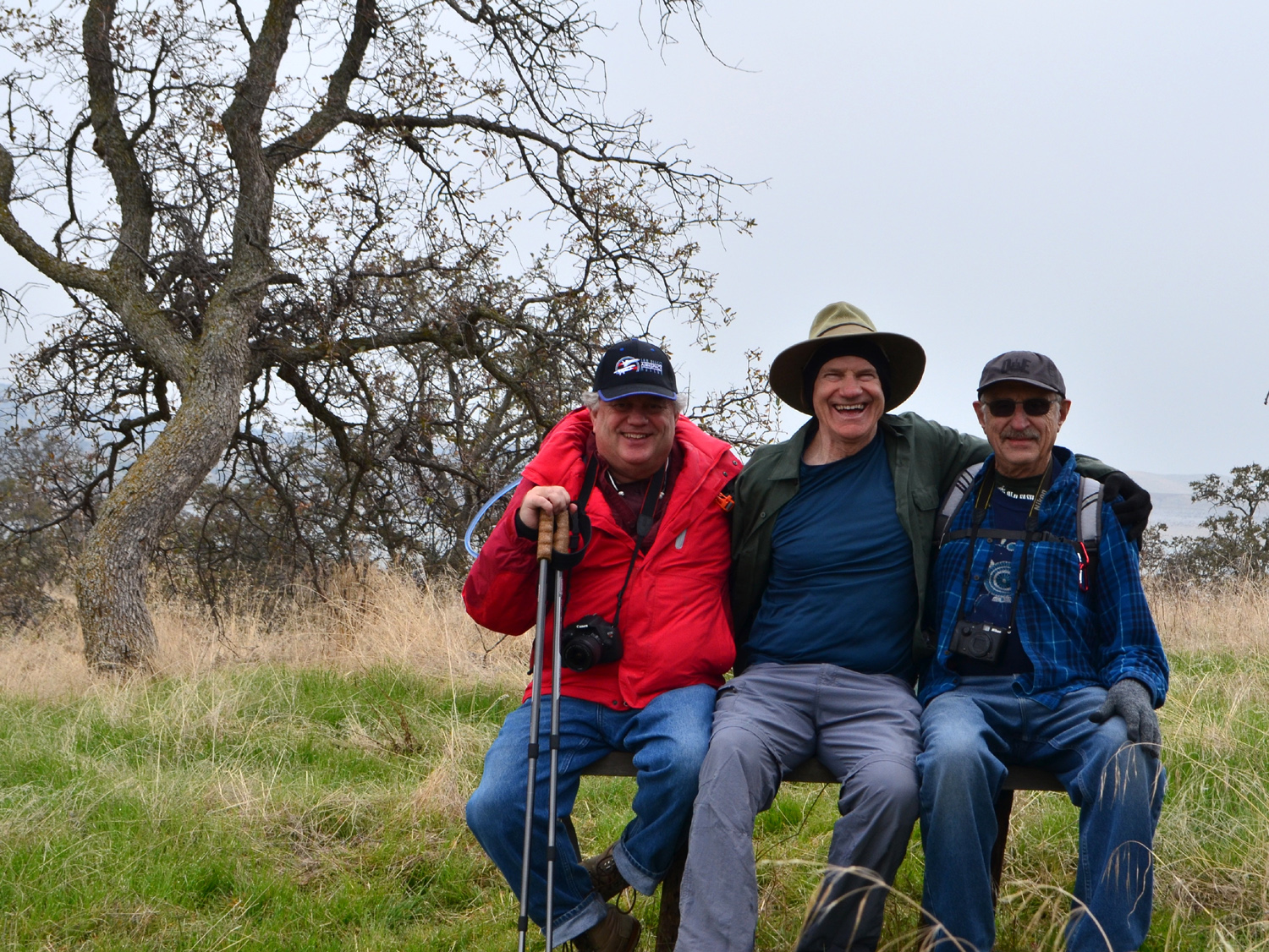
late October Ramblers: Wes, Don, Dick and Carolyn |
||||
 |
 |
 |
||||
|
Two young sequoias near the Bull Buck |
Ferns
fading away, with mossy log segments in front |
"Tuck and roll" moss | ||||
 |
 |
 |
||||
| Ladybugs
mass together in preparation for winter |
We were careful not to get too close to this! |
The trail winds past an ancient sequoia stump | ||||
 |
 |
 |
||||
|
Dogwood stands out in the dark forest |
A study in red and green | Wes on the bridge across California Creek | ||||
 |
 |
 |
||||
| Abandoned
chunk of sequoia log makes the bright green stand out |
An unusual grouping of young sequoias | Closer
inspection showed they were all growing from a fallen log |
||||
 |
 |
 |
||||
| Don takes a well-earned rest | Looking through the Chimney Tree |
Pine needles carpet the trail in this location |
||||
| Nelder Grove Again | ||||||
 |
 |
 |
||||
| A few dogwood leaves remain in Nelder Grove | Dead fir on the Graveyard of the Giants Trail | The Leaner Tree | ||||
 |
 |
 |
||||
| Top of another big sequoia | Our hiking destination; we started at 5,000 feet | Looking down the canyon of Nelder Creek and beyond |
||||
 |
|
 |
||||
| The last of the black oak leaves | The Graveyard of the Giants Trail | Even in fall, moss remains bright green | ||||
 |
|
 |
||||
| Dick and Don resting | Don, Yvette, Dick, Carolyn, Teri, Sandy, Wes | Moss grows all the way up the trunk of this tree | ||||
| Hensley Reservoir Hike | ||||||
 |
 |
 |
||||
| No matter the season, we always see a flower or two |
The lower branches of blue oaks often touch the ground |
In death, this tree becomes even more dramatic | ||||
 |
 |
|
||||
| Wes and Don, ready to hike | Wes climbs a tree | We challenged Wes to climb this rock formation, so he did |
||||
 |
 |
 |
||||
| Blue oak silhouette | This huge oak shelters one of the benches where we rested |
Moss on the blue oak | ||||
 |
 |
 |
||||
|
Don and Dick enjoy a well-earned rest |
A small group of ramblers: Don, Wes and Dick | The campsite and the fire | ||||
 |
 |
 |
||||
| A dramatic sky accented this leafless tree | Setting sun turns this blue oak to gold | More gold, with the lake as background | ||||
|
 |
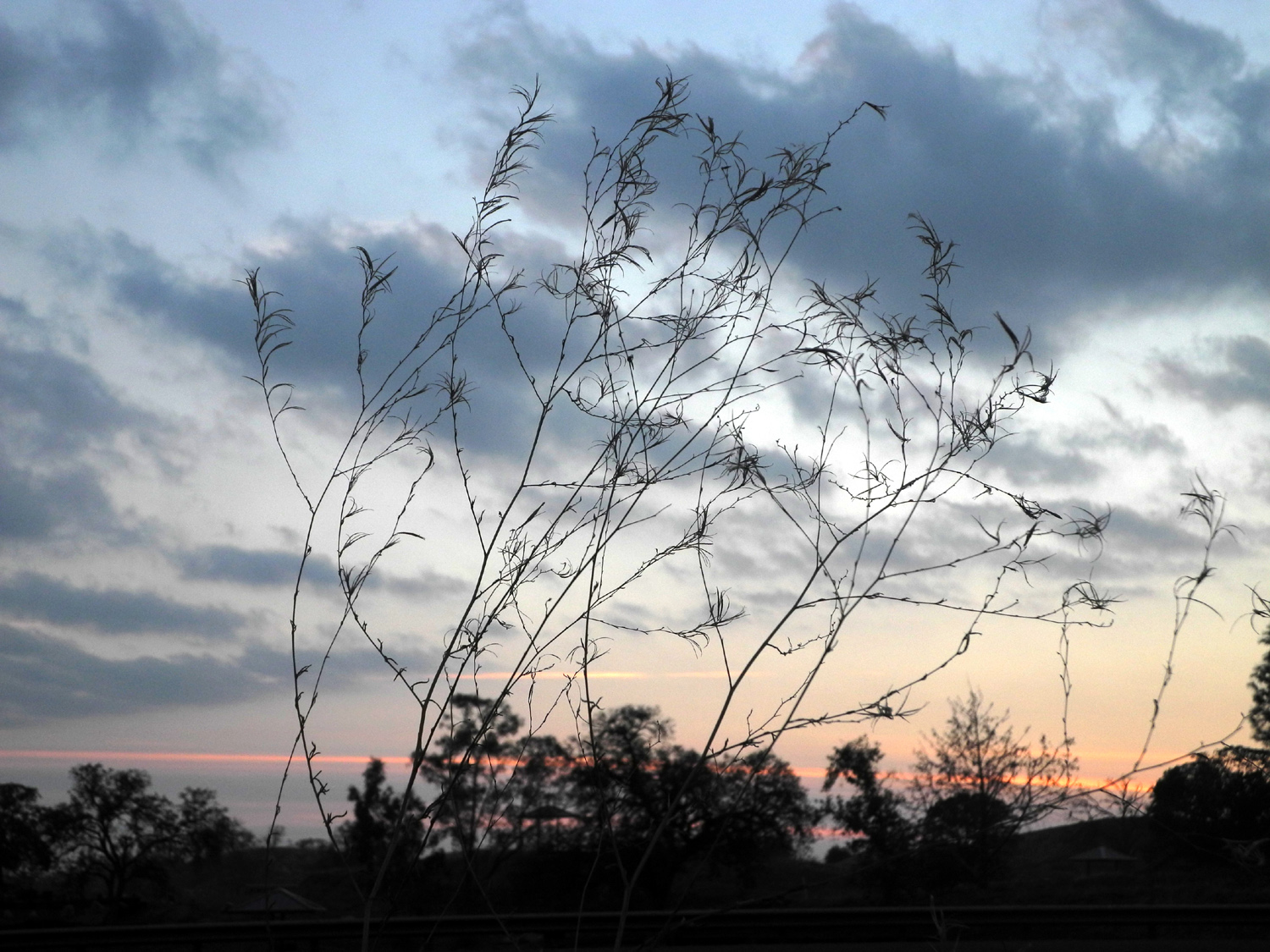 |
||||
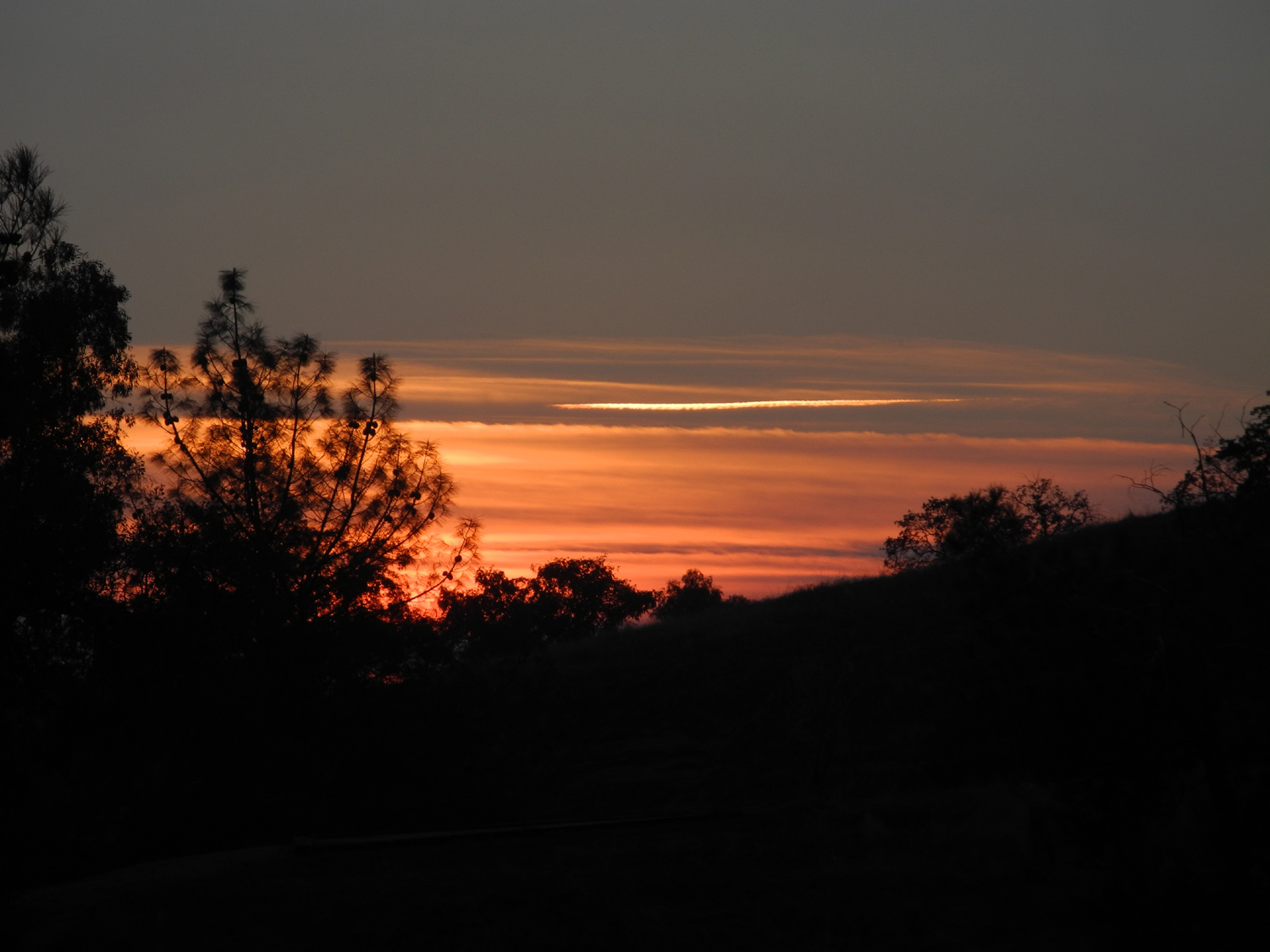
| Wes captured the most dramatic view of the day | One of those perfect sunsets | Dry plant against the sunset | ||||
| Related Links | ||||||
| Hume Lake | Giant Sequoia National Monument | General's Highway | ||||
| Hume Lake Loop | Hume-Bennett Lumber Company | Hume Lake Dam | ||||
| French Fire Restoration | French Fire News Article | Wagner's Mammoth Pool Resort | ||||
| Wagner's Resort (Facebook) | Sierra Vista Scenic Byway | Byway Area Interactive Map | ||||
| French Trail | Redinger Lake | Mammoth Pool Reservoir | ||||
| Friends of Nelder Grove | The Complete Nelder Grove Story | More about Nelder Grove | ||||
| Dick's Redwood Gallery | Nelder Grove Slide Show | Sierra National Forest | ||||
| Chimney Tree (2014) | Big Stump near camp (2014) | In the campground (2015) | ||||
| Brenda's Nelder Grove Book | Hensley Lake | Creek Fire | ||||
| MAMMOTH | Scenic Byway Sights | |||||