
| Dick Estel's 2006 Oregon Trip | ||
| Photos Related Links More Travel Reports | ||
|
July 1, 2006: It’s cooled down from 105 to around 100 in We left We’re
getting ready to microwave some pizza, and in the morning will take
US 97 through Klamath Falls and to Crater Lake OR. Other planned
stops include the It was
in the high 90s most of the day, but slid up around 100 going
through Through
the central valley, which was pretty much the first 300 miles of the
trip, we saw very familiar territory – flat agricultural land, big
and small cities, and plenty of traffic. Once we got past July
2:
Today’s drive was much shorter, about 160 miles, and we made a
couple of long stops, the last one just 25 miles from our
destination to fix lunch. This was my first time on this section of
US 97, which goes northeast from Weed into We were
hoping to stay at the only campground in Mikie and I did some bike riding, played a little hockey, took a shower, and are ready to fix supper. He’s having a good time, and is a much better traveler than he was two years ago. Tomorrow we’ll go to Crater Lake, since the west side of the park is open, which includes the visitor center and the all-important gift shop. July
3:
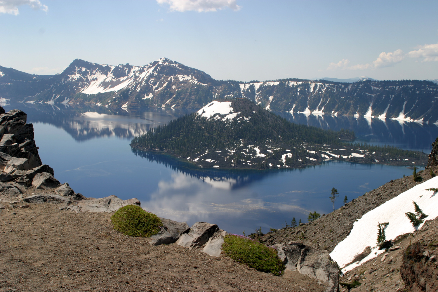
Crater Lake
was great – lots of snow around as soon as we got up near the rim,
but warm enough for shorts and t-shirts. We stopped at several vista
points around the rim, and visited all the gift shops (five,
counting those in the Crater Lake Lodge and in the visitor centers).
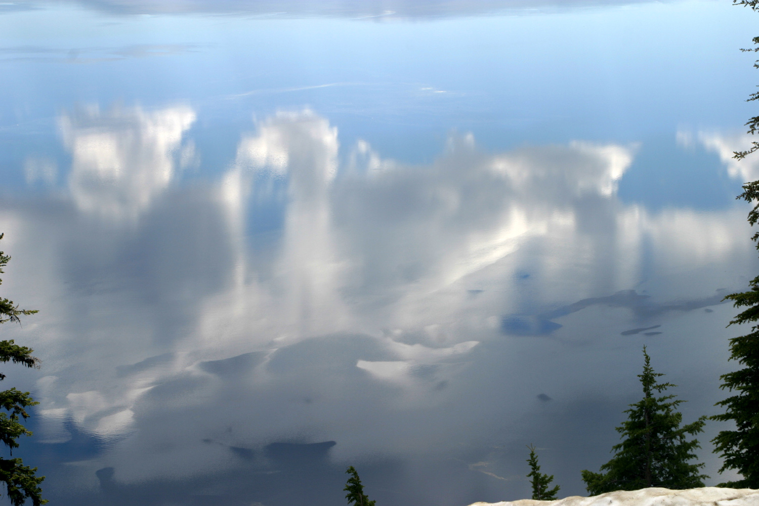
We brought our lunch and ate at It was breezy across the lake most of the day, so the bright blue was less evident, but the reflection of clouds in the water looked like an abstract painting, and it was quite beautiful. When Tim & Teri (Mikie’s parents) were here last year, the lake was very smooth, with sharp reflections that looked like a perfect mirror image. Probably every visit to the lake reveals different moods. This evening we had a few very brief rain showers, just enough to get the truck really dirty. Most of the time before, in between, and after, it was clear.
July 4: We’ve been sleeping in pretty good (after all, it IS vacation/retirement). I’m usually up around 8, but Mikie has slept till 8:45 or later every day. So we get a late start, but after the first day, we have only had to go 125 to 150 miles per day. We retraced our path back to US 97 today, then headed north. We made
a stop at the We
arrived at the Crooked River RV
Park, near Terrebonne and Redmond,
about 4 p.m.
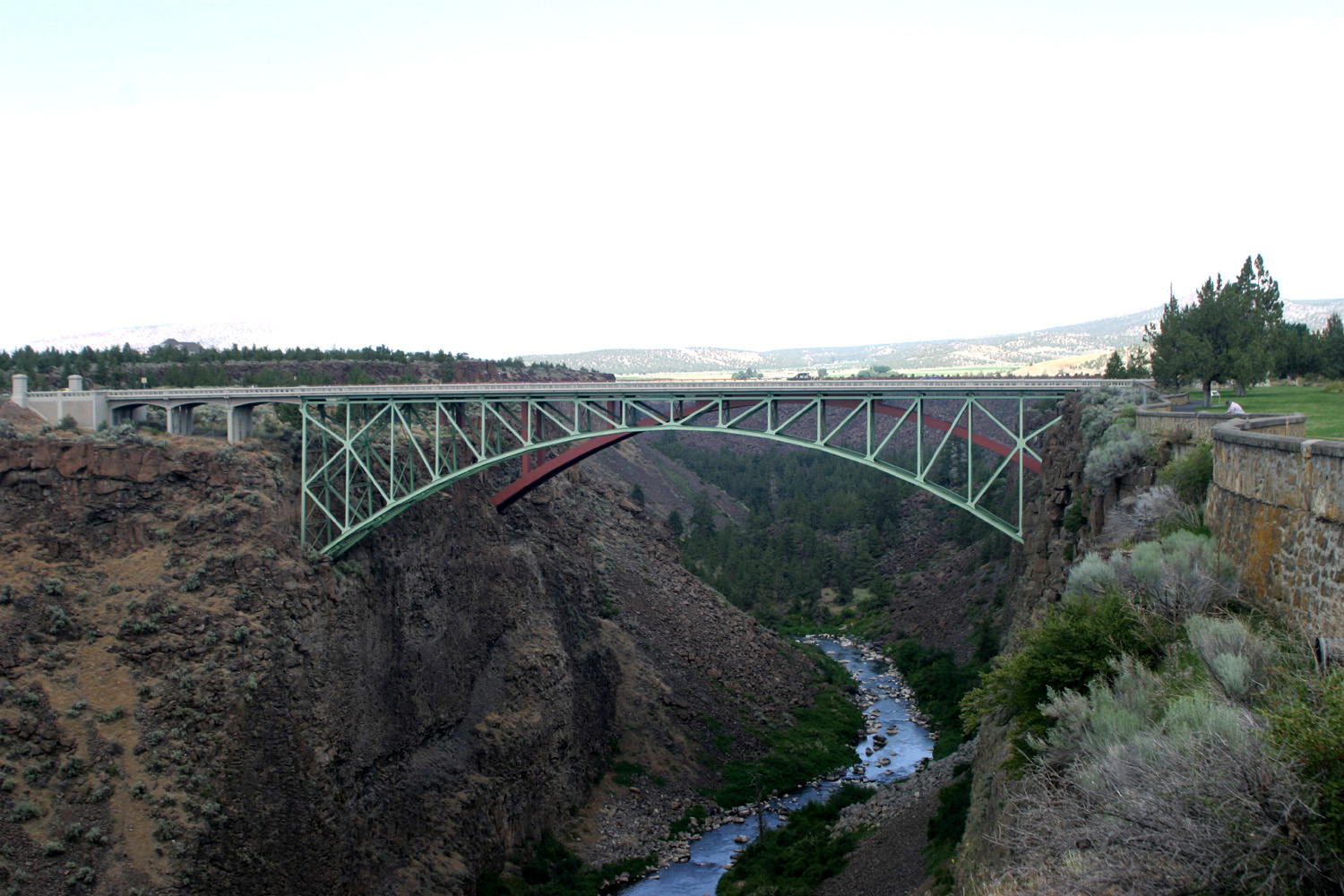
On my trip in 2002 I had the experience of looking down into the This is the first RV park with a swimming pool, so after setting up, Mikie and I headed for the pool. I swam a few minutes, then read; while he swam for at least an hour and a half. We’ve now finished dinner and it’s time for a little TV. It’s nearly dark, but still a lot of light over the river cliffs at 9 p.m. July
6:
Yesterday we drove to one part of the The
area is quite remote; it’s the type of country the word
“hinterlands” was invented for. We turned off US 93 on state
highway 293, which doesn’t even have its number on the map
(although it’s in my Rand McNally trip planner program). This
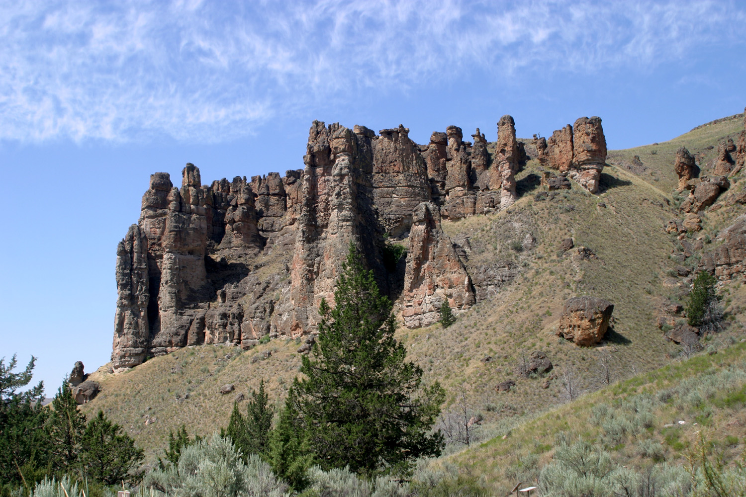
connected to This area of the monument has a couple of short trails, with markers along the way to point out fossils in the rocks. These are all plant fossils, but it was still an interesting experience. Both on
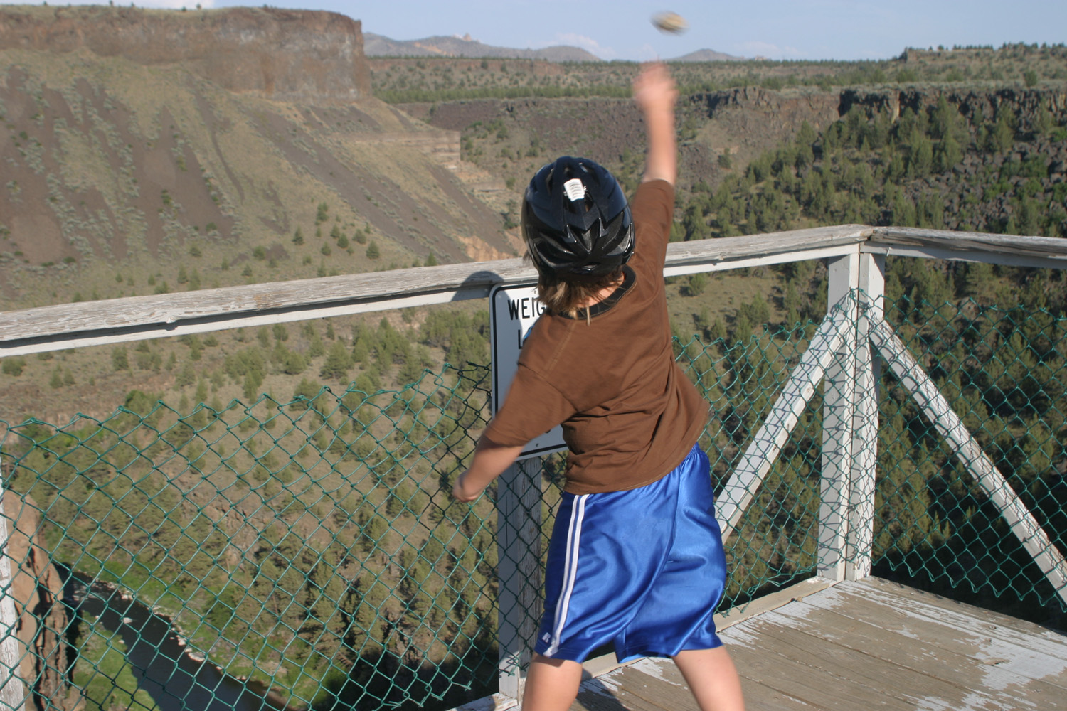
our way up and back we stopped at the Our camp is down a cliff of 50 feet or so to an ancient flood plain of the river, with a couple of square miles of flat land south of the main gorge. In addition to the RV park, there is a golf course, residential areas, and a small village with restaurant, real estate offices, etc. By the camp there is a viewing platform that gives you another breathtaking view into the gorge. When I was there the last night, there was a couple there who had been watching through binoculars as a doe suckled two fawns down by the river. Our trip took a good part of the day, but there was still time for swimming and our usual evening TV watching. Today
was mainly a travel day. We went back south a few miles from where
we were camped, then headed west thorough the Cascade Mountains
toward Interstate 5. A good part of the way we followed the We’re set up in a tree-filled RV park with plenty of privacy, and the one feature that rates four stars from Mikie, a swimming pool. July
7:
Today we drove up the coast about 40 miles to At the visitor center we watched a slide show about tide pool life, then went down to the ocean, about two tenths of a mile, where there are some really nice tide pools. We saw purple sea urchins, many anemones, dozens of starfish in several colors, probably millions of mussels and barnacles, one fish, some pollywogs, and a few crabs. Tide pool exploring is one of Mikie’s favorite things, so he had a great time. Driving
back, we stopped at the Aztlan Restaurant in Many miles of the coast in this area feature large sand dunes; it’s officially the Oregon Dunes National Recreation Area. We drove in to a view point, but dune recreation is not really my thing; it just looks like big piles of sand to me. July
8:
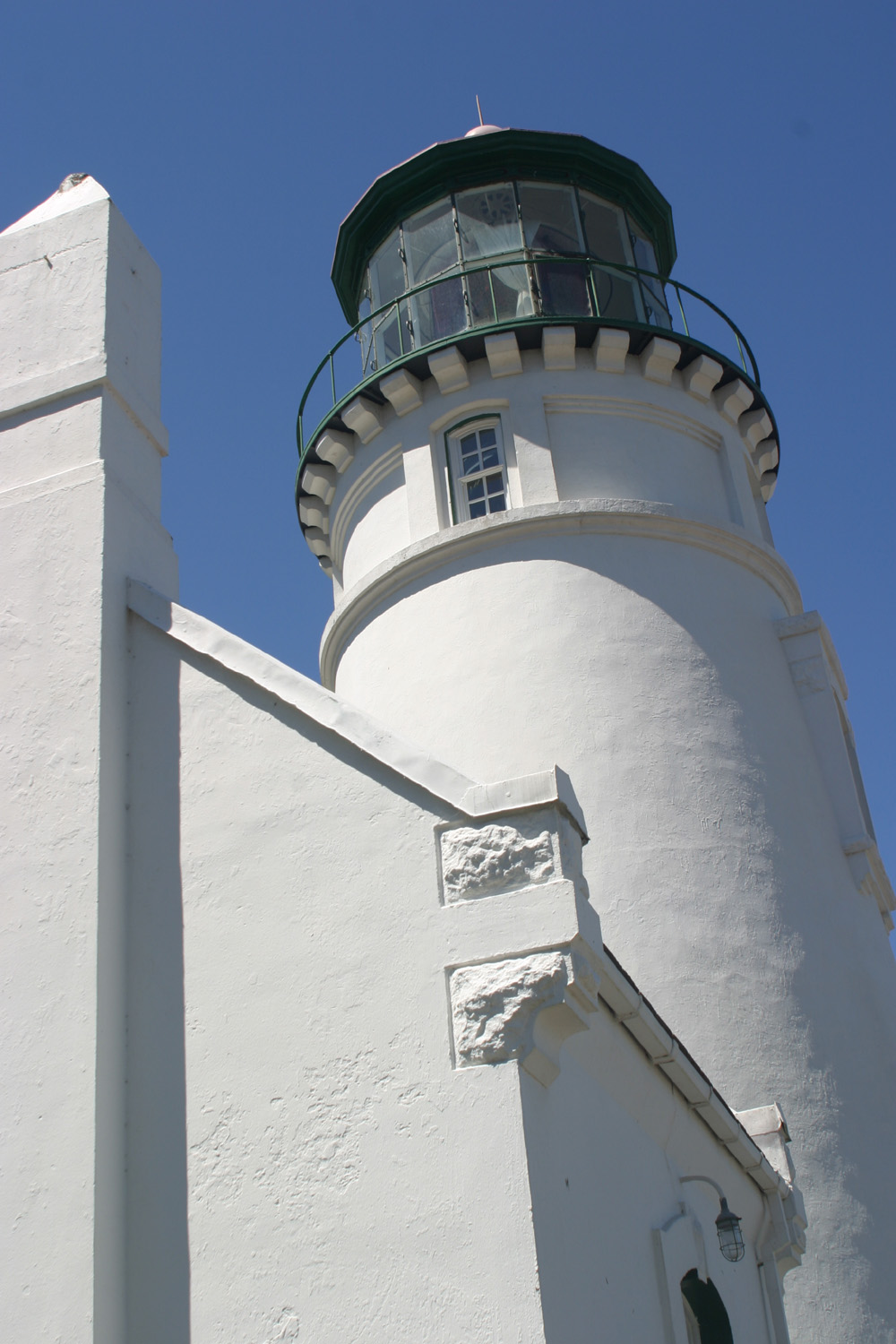
We’re still at Reedsport for a third night. Today we went to the
Umpqua Lighthouse on Then we drove up the coast about 30 miles so Mikie could play in the tide pools; these were not as good as the ones we went to the day before – mostly anemones plus lots of barnacles and mussels. We ate at the Aztlan restaurant again; I had enchiladas and a taco, and Mikie had the same thing as the day before. We’ve been having great weather, sunny nearly all the time, and about 65 degrees.
July 9 & 10: Today we headed south on US 101 from Reedsport to Whale's Head Resort, seven miles north of Brookings. I stayed at this same RV park in 1999 with my older grandson, Johnny. A lot
of the trip was slightly inland through forest, but there were also
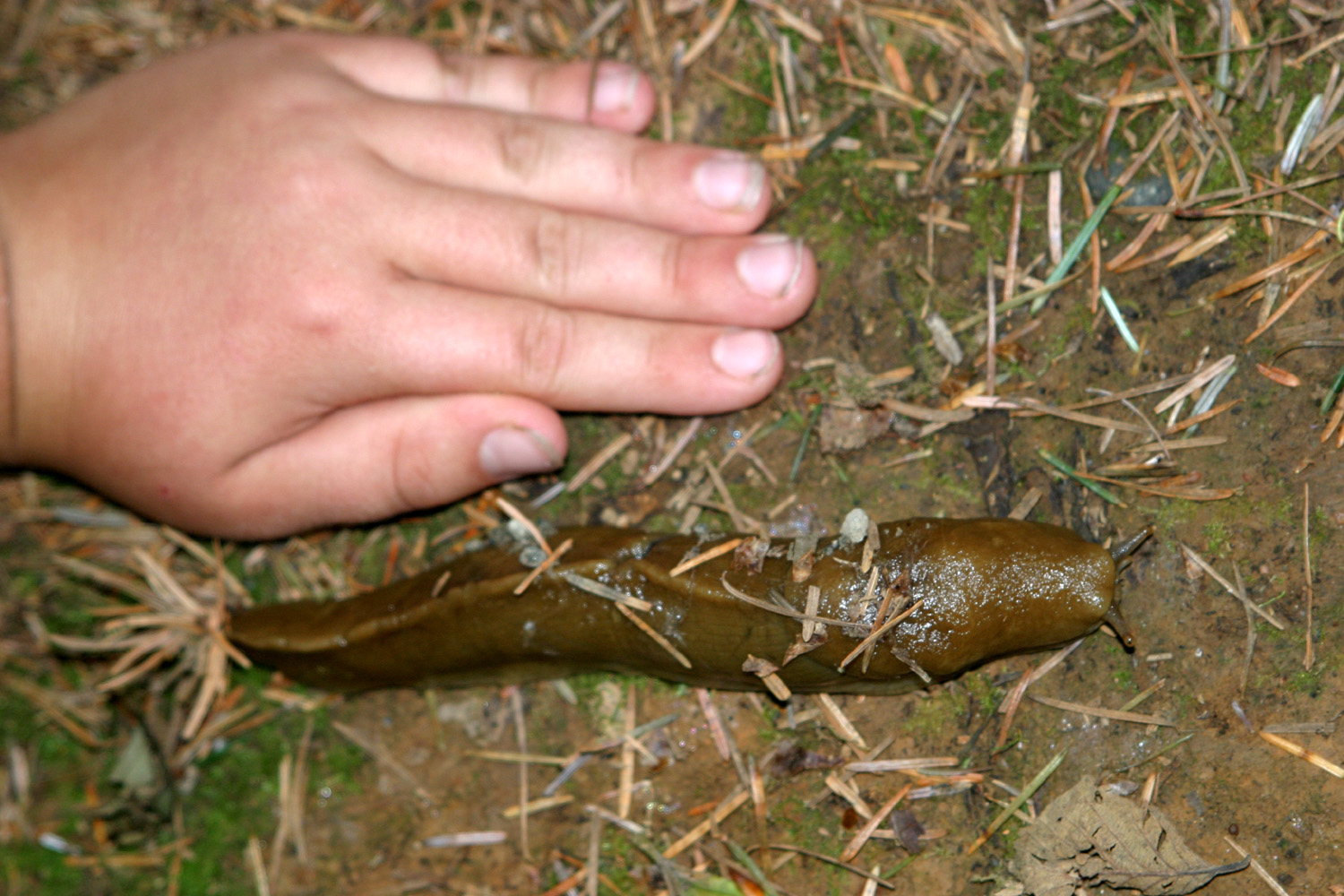
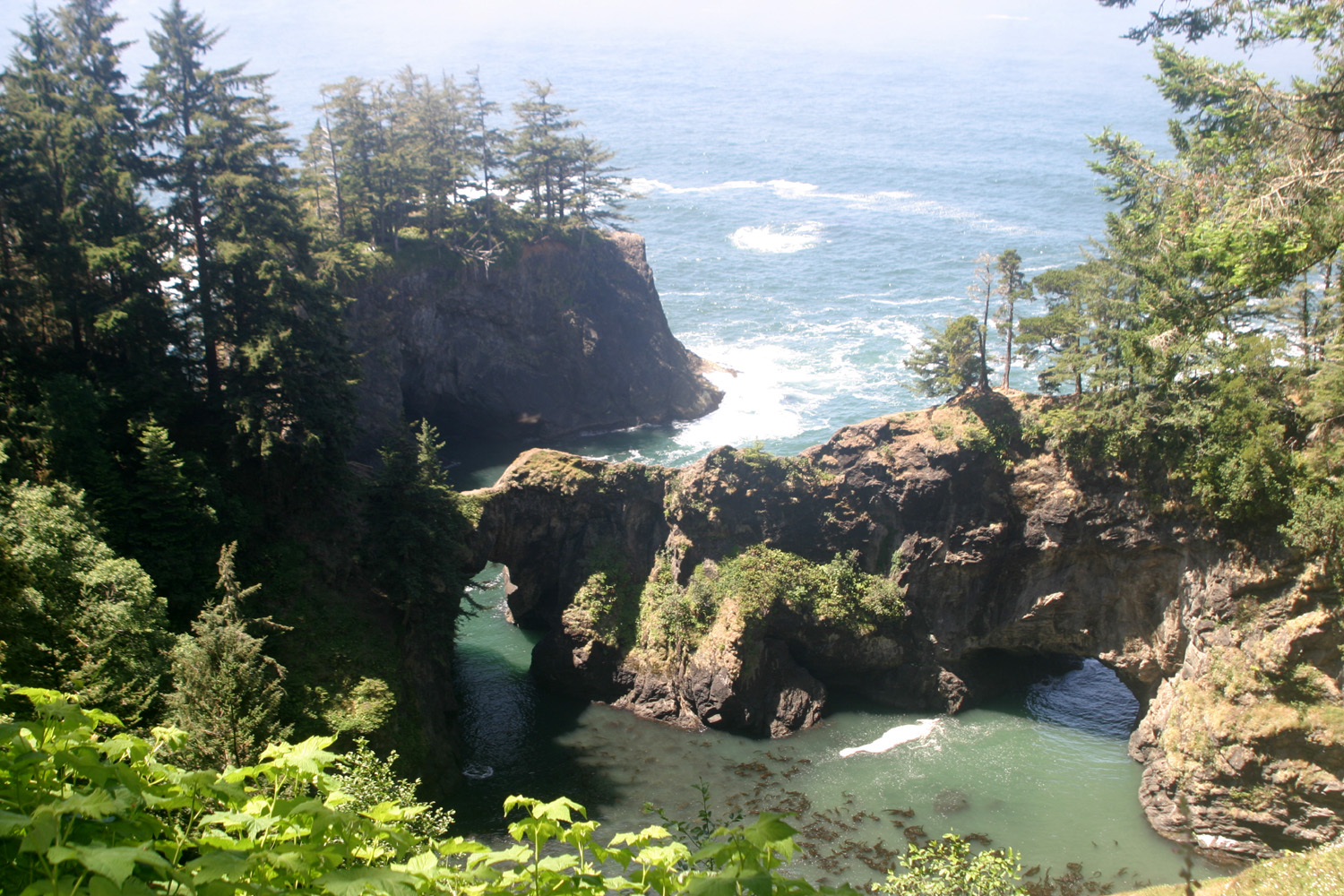
a lot of great ocean views. Of the parts of the About two miles north of the resort is the Thomas Creek Bridge, the highest bridge in Oregon at 345 feet. The creek itself is not much more than a trickle, but the view from the bridge gives you that weird feeling in the pit of your stomach. The creek joins the ocean just a few hundred feet from the bridge, winding through a smooth sandy beach. The big attraction to me at Whale’s Head is the Oregon Coast Trail. This trail is a wonderful resource for old, tired, sore or lazy hikers, all of which applies to one or both of us. The trail consists of many short segments that begin and end at parking areas along US 101. Some are “official” stopping points; others are just wide places along the road. When you step away from the highway, within a few paces you are deep within a dimly lit spruce forest, with a thick ground cover of plants and bushes. Most segments are about a half mile, and wind down the hillside a ways, then return to the highway, often just a few hundred feet from where you started. Some segments have views of the ocean, and most have side trails that lead out to headlands or down to the beach. During the two days, we covered about six different sections. When I was here with Johnny in 1999, we found one tiny secluded beach where he drew a picture I call the Sand Alien (check it out here). We also went down to some natural bridges, and went across the narrow neck from one side to the other. Mikie and I decided to go down there also. Either we followed a different trail, or the path is no longer being maintained, because the trail Mikie and I took was thickly overgrown, so that it was like forging your way through the jungle. Nonetheless, we made it down to the bridge and back with no mishaps and no scratches. I shudder to think of a similar hike pushing through the kind of thick growth we have in the Sierra foothills near home, with thorny chaparral and spiny oak leaves at every step. The rain forest is known for huge banana slugs, and Mikie was anxious to see one. He was not disappointed, as we saw them on almost every trail segment, counting up nine or ten altogether. We also saw one snake, a tiny creature that quickly disappeared into the thick growth. On our
second day, in addition to hiking, we drove into Brookings, seven
miles south of here, and seven miles north of the July 11 & 12: Tuesday and Wednesday’s trips were dedicated solely to getting home, so we drove longer distances (322 miles on the 11th and 246 on the 12th). Aside from 397 miles the first day of our trip, our longest drive was 227 miles from Crooked River to Reedsport, and other days we never went over 160 miles. The
weather was foggy and misty and maybe even rainy for the first fifty
miles or so, requiring windshield wipers off and on. We soon left
that weather behind, and most of the day we were in warm, sunny
terrain a few miles inland. Much of US 101 winds along the Eel
We stopped for the night at
a somewhat rundown RV park in We got an early start both days, getting on the road by 8:15 each day. Normally Mikie is asking about lunch by 11:30, but the last day he was so anxious to get home he did not want to stop, so we arrived at my house about 2:30, tired and hungry, glad to be home, and happy that we had missed the 105 degree heat of a few days earlier. It was
interesting to observe some of Mikie’s growth and development and
changes in attitude on the trip. Back in 2004 on our long trip to I’ve found that logical explanations are of little interest to people under 20, but I mentioned that many medicines come from plants. Even this would not have meant anything, but I told him about my mother’s two brothers who died in childhood of diseases that are now readily curable, and this personalization seemed to get across. In any event, his attitude improved for the rest of the hike, and he ended up having a good time. On our hike at the fossil beds, he also started out complaining; however, after we saw fossils he made a 180 degree change and even agreed to go on an additional half-mile section of the trail. Always a fussy eater, he has become more adventurous in this area lately. He has always avoided hot spicy foods, but began eating radishes on the trip, and at the Mexican restaurant dipped his chips in salsa for the first time. He also ate several bites of my burrito, which contained chopped up onions and jalapeños. The following day he ate about half of one of my enchiladas. And though he ALWAYS picks olives off pizza, he ate a piece of combo pizza without removing anything, including the artichoke hearts (don’t tell him about these). He also put crushed chili peppers on one slice, but decided he did not care for this. We have
several ways to pass the time during long drives. Of course, he has
his Gameboy and I have the CD player, but more often we discussed
one of his current biggest interests, ancestry and origin of names.
He’s a mixture of Swedish, Irish, English, German, Hungarian and
who knows what, and as a hockey player is deeply disappointed that
he’s not part Canadian and/or Russian. He went through nearly all
the names in his school yearbook, asking what kind of names they
were, and was unhappy to hear that most were English. Of course, I
explained early immigration patterns and the fact that The other thing we do a lot while driving is the hockey player initial game. Each person takes turns giving the initials of an NHL player, and the other has to guess who it is. When we can’t come up with the answer quickly, we can then ask which team he plays for, whether he’s North American or European, and if the latter, which country he comes from. Although there are a bit more than 600 men playing major league professional hockey, it’s hard sometimes to think of a name that isn’t too easy, or hasn’t been used over and over. On the
2004 trip I taught him the capitals of all the states, the Canadian
provinces, and the countries of South America. We review these once in a while, although I’ve been very lax
about Statistical
Notes: We
traveled a total of 2,037 miles, 1,602 of that pulling the trailer.
We spent a little over $500 on gas (OUCH!). By way of contrast, we
spent $920 traveling 5,200 miles in 2004. The highest price was $3.60
per gallon at a tourist stop in the Mileage
was generally around ten to eleven miles per gallon. This figure is
pretty close, but again, I have some doubts. In Our
camping costs were generally around $20 to $25 per night, which has
been the norm for several years. This includes water, electrical and
sewer hookups. Most of the parks provided free cable TV, although we
did not use it. At several parks, I got a discount due to my
membership in a travel club. The lowest cost was $18 at Surfwood
RV in Reedsport; the highest was $27 at I could do a Mastercard joke here, but I’ll spare you and just say that the scenery, the cool weather, and the long discussions with Mikie during our daily driving made it well worth the cost. (2026 Update: The Mastercard joke related to a series of TV commercials that were well known in 2006; now in 2026 I can't remember what they were about.) --Dick Estel, July 2006 |
||
 |
 |
|
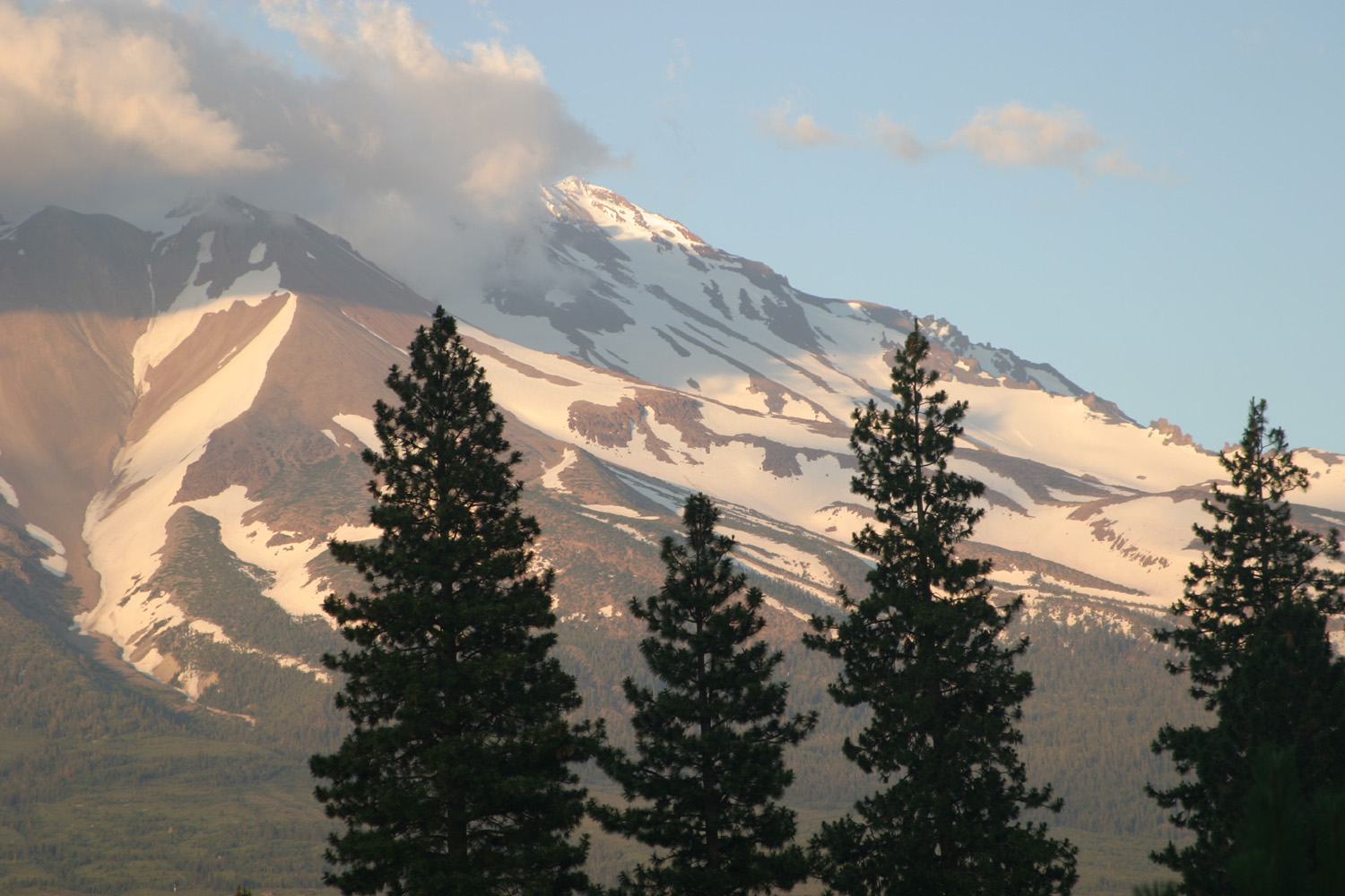
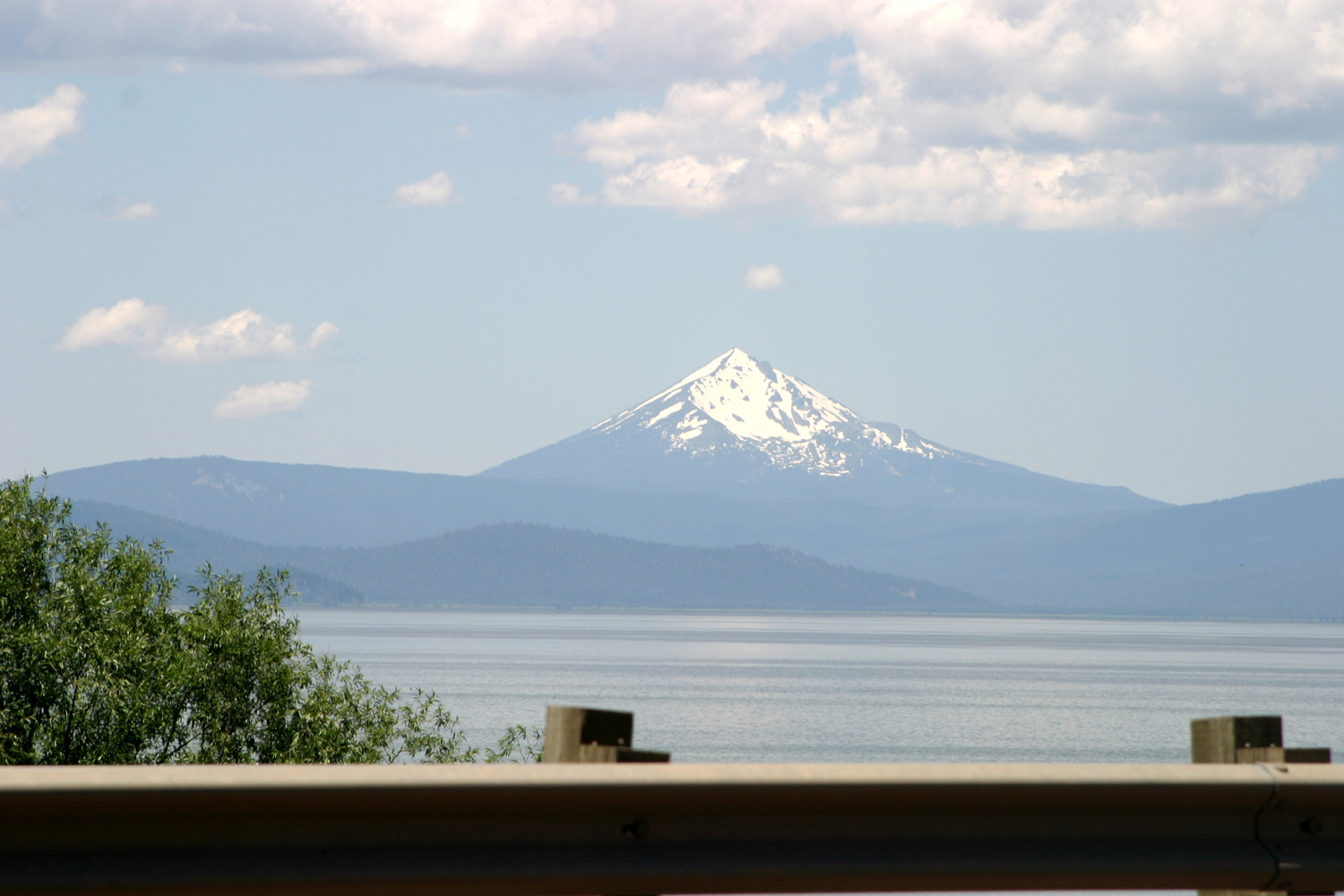
| Mt. Shasta | Klamath Lake & Mt. McLauglin (?) | Crater Lake |
 |
|
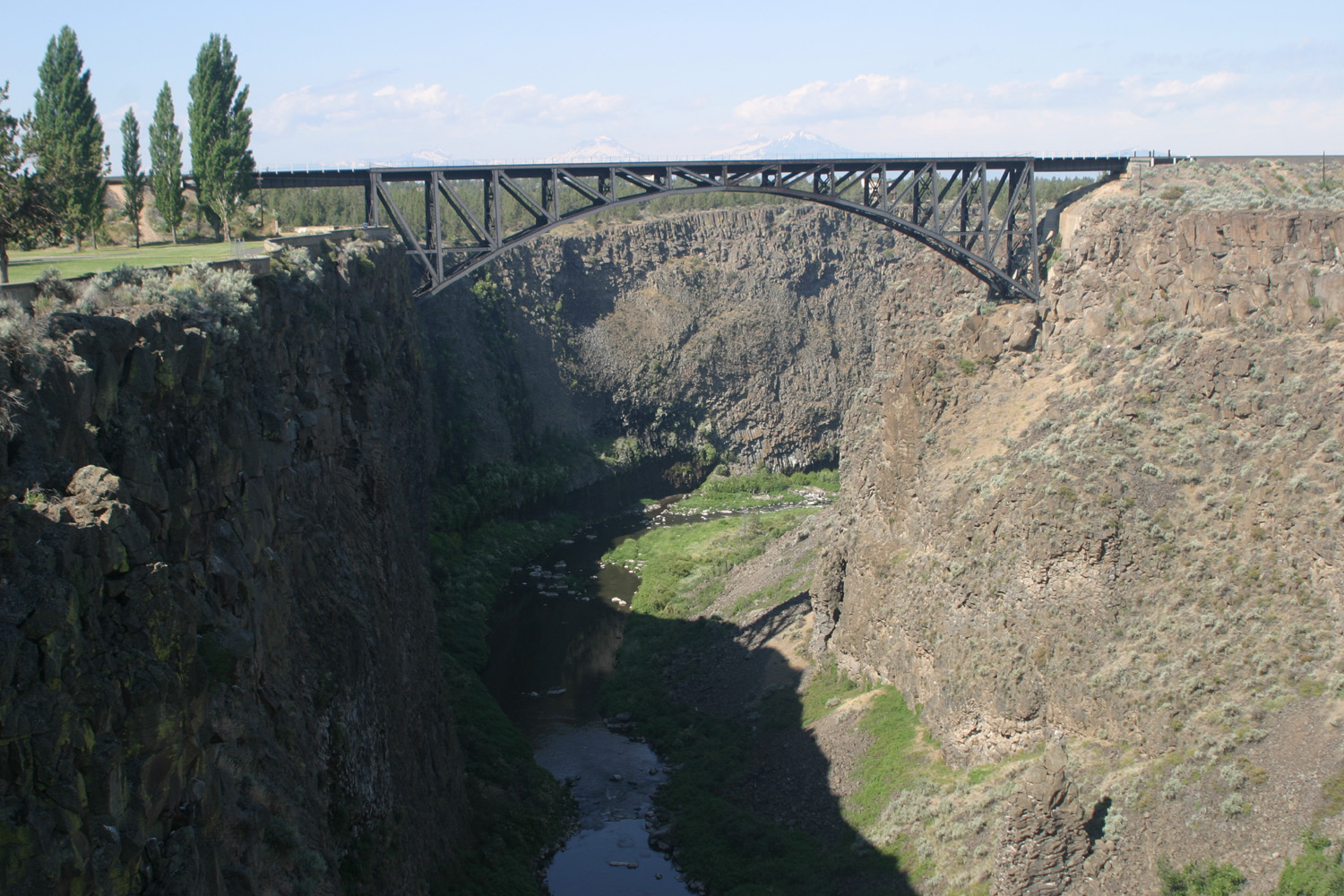 |
| Wind-smeared reflection on Crater Lake | Crooked River gorge (green old bridge; red new) | Railroad bridge over Crooked River |
 |
 |
 |
| Rock toss at Crooked River RV park viewing platform | Rock formations from ancient mud flows | Leaf fossil at John Day Fossil Beds |
 |
 |
 |
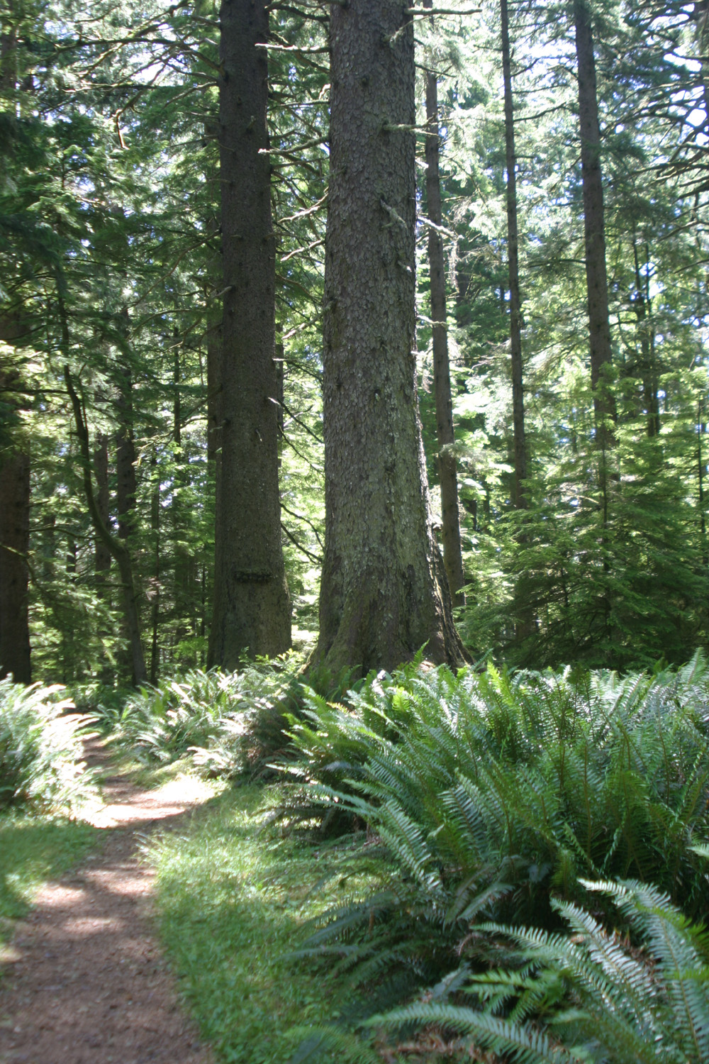
| Old growth rain forest at Cape Perpetua | All green, all the time | Sea stars in tide pool at Cape Perpetua |
 |
|
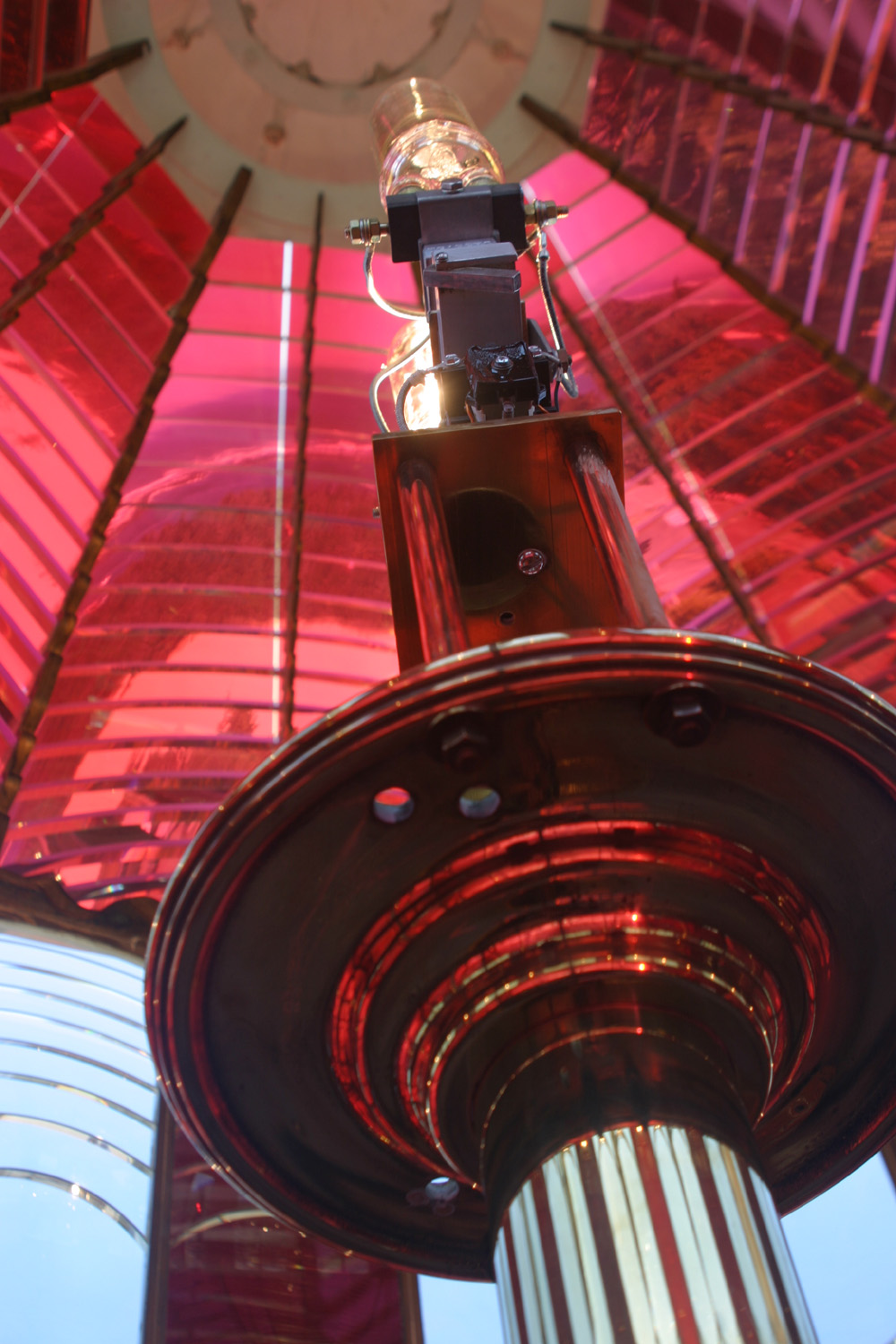 |
| Sea anemones in tide pool | Umpqua Lighthouse | Inside the original Fresnel lens |
 |
 |
 |
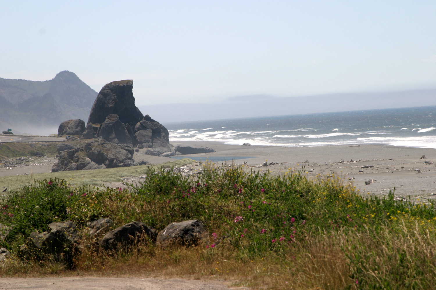
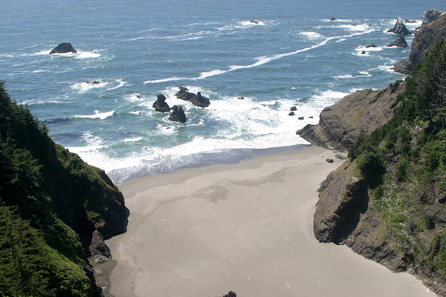
| Southern Oregon coast | View from the highest bridge in Oregon | Natural bridges |
 |
 |
 |
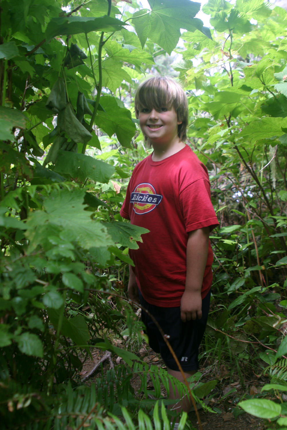
| Mikie on the Oregon Coast Trail |
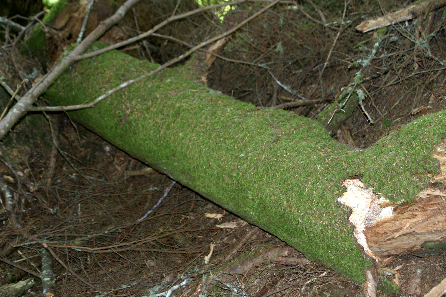
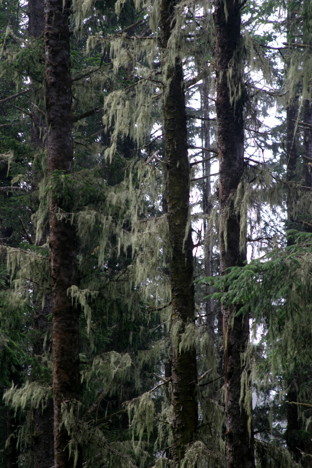
Spanish moss - a sign of a wet climate |
Banana slug |
| Klamath Lakes | Crater Lake | Diamond Lake |
| High Desert Museum | John Day Fossil Beds | Cape Perpetua |
| Oregon Dunes | Umpqua Lighthouse | Thomas Creek Bridge |
| Oregon Coast Trail | Sand Alien | Hockey Players |
| Bend | Crooked River RV Park | Crooked River |
