
Lake Almanor 2017 |
||
|
Fishing in a beautiful lake, hiking in a national park, and just enjoying time with family - this was the prime purpose of this trip. We also celebrated Father's Day (again) and three birthdays, all in a low-key way. Of course, first we have the story behind the story. In July, 2010 my grandson Mikie, his dad Tim, and I traveled to Lake Almanor in northern California for fishing and sight-seeing. We spent the first night at Caribou Crossroads on State Highway 70, where the East Branch of the Feather River runs into the North Fork. Tim and Mikie had good luck fishing there, and even better luck going out with a guide at Lake Almanor. Then we took a quick drive through Lassen National Park, enjoying the sight of lakes with ice on them in mid-summer. Three years later Mikie and I repeated part of the trip, spending one night at Caribou Crossroads, and then fishing at Almanor, with the same guide, again with good luck. So it was no surprise when my daughter informed me that Mikie had requested a repeat of the journey for our summer vacation/birthday celebration. This time it would be Teri, Mikie, his girlfriend Lizzie, and I, with Teri and I in her motor home, and Mikie and Lizzie in my pickup, newly equipped with a camper shell. The day of departure was Teri's birthday, and Mikie and Lizzie got an early celebration of their 20th birthdays, coming up in July. |
||
|
|
|
 |
|
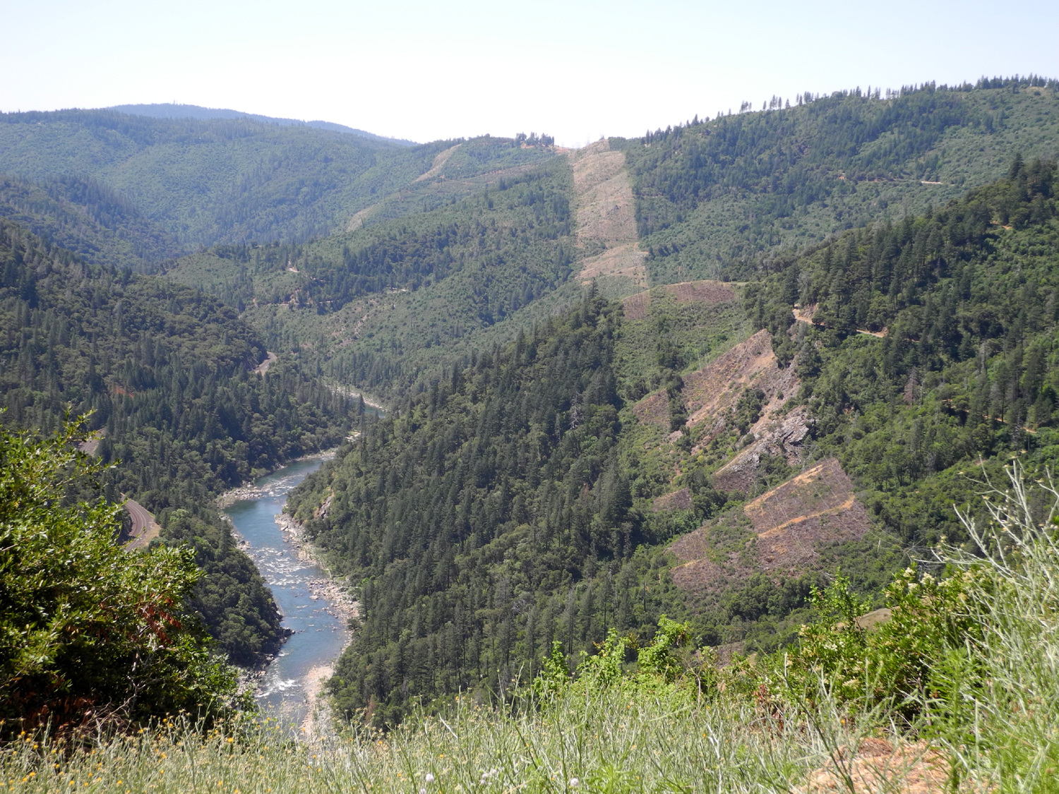
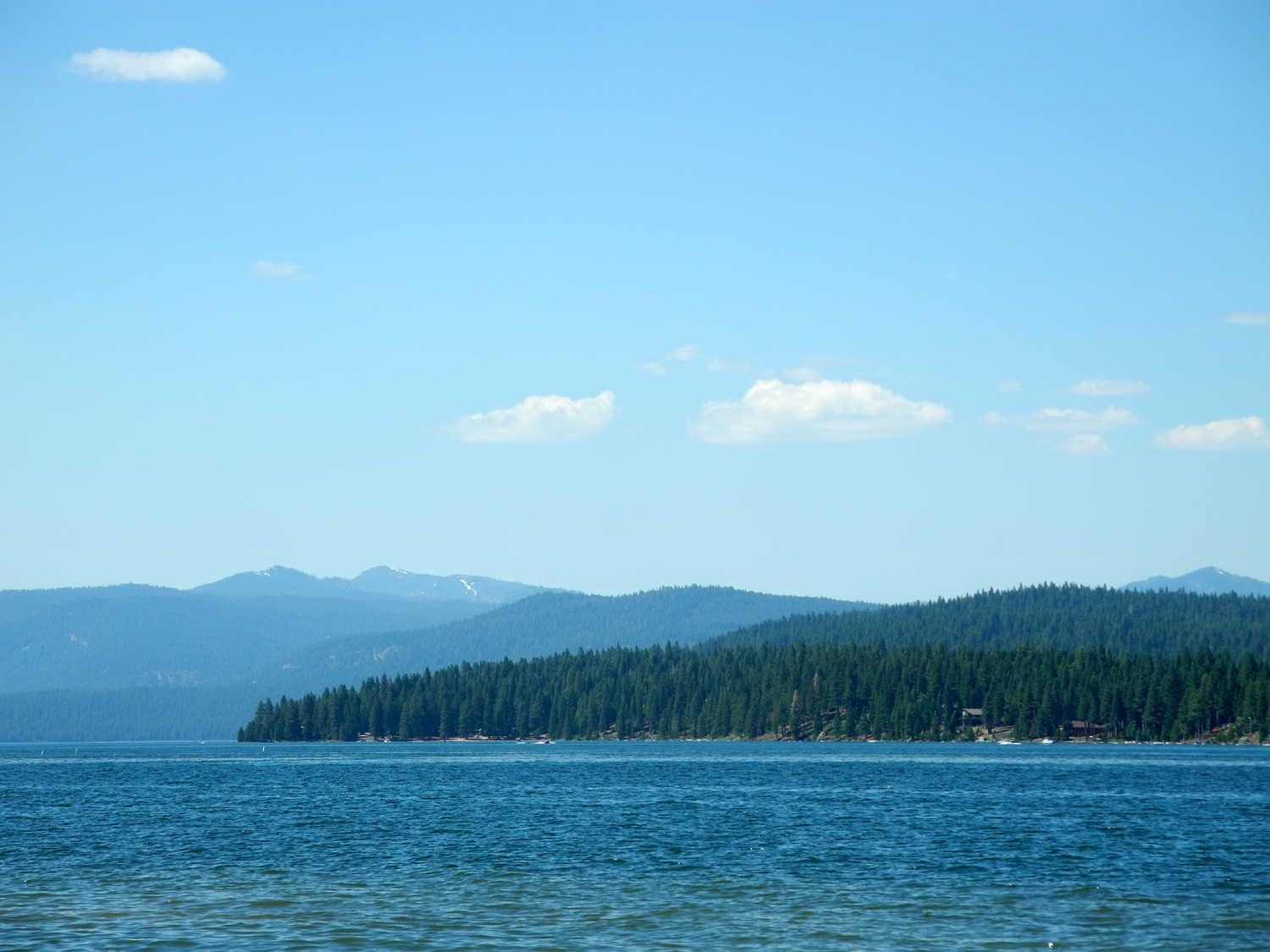
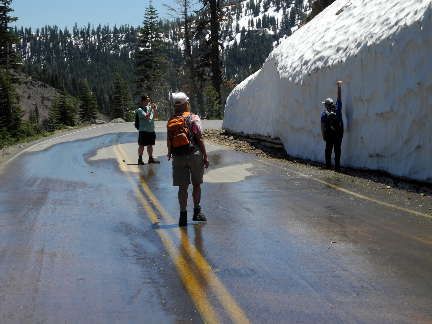
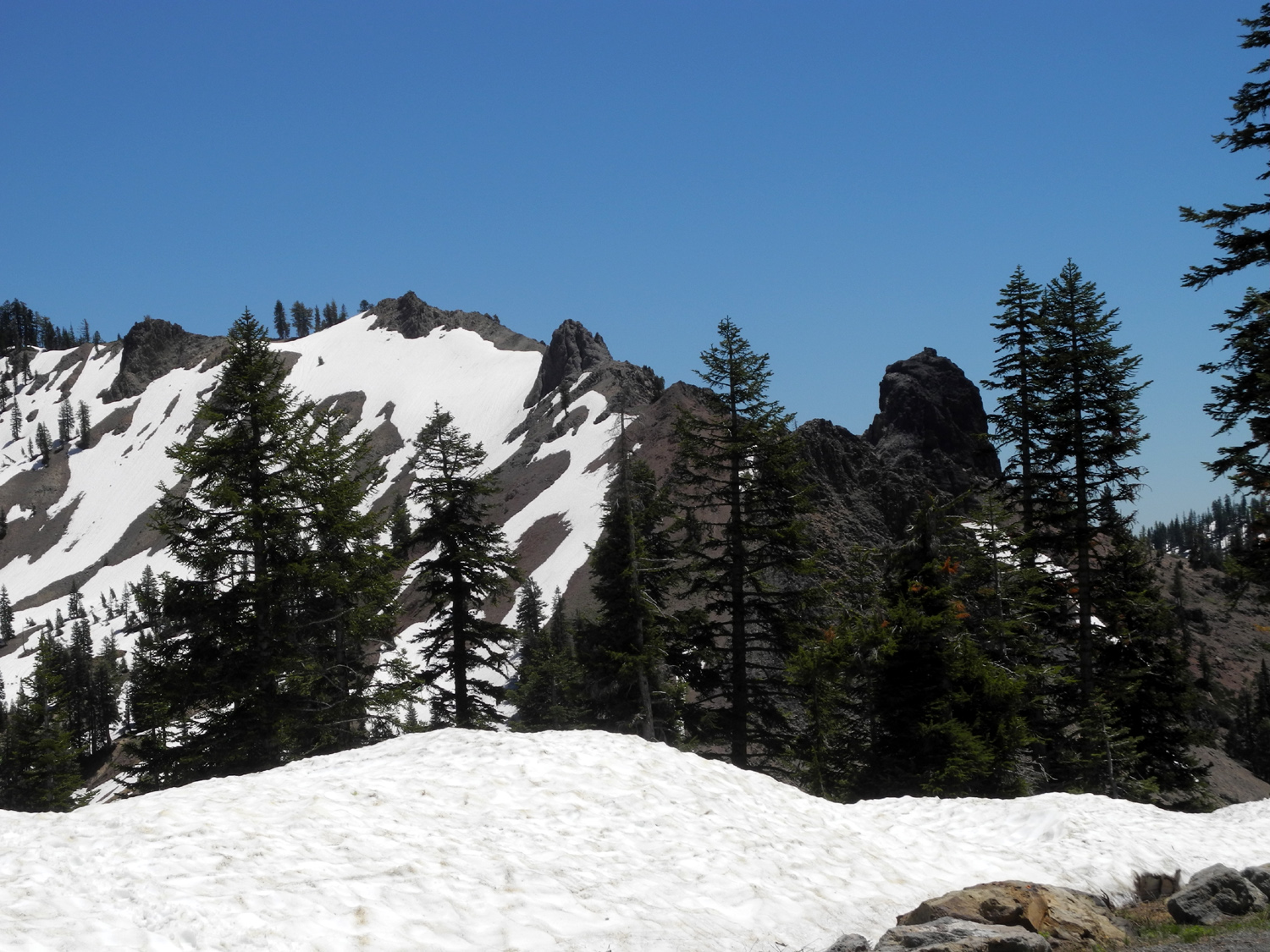
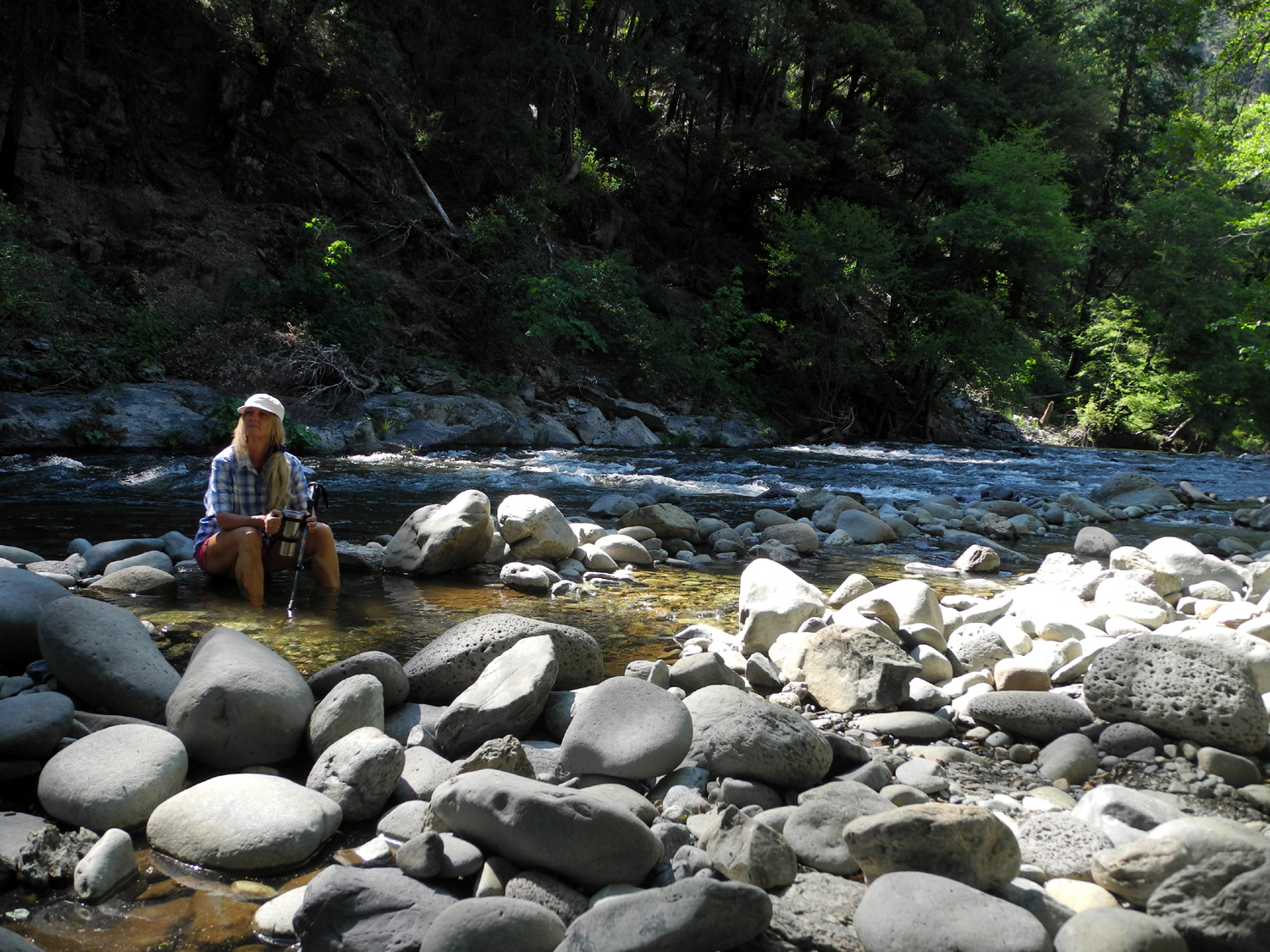
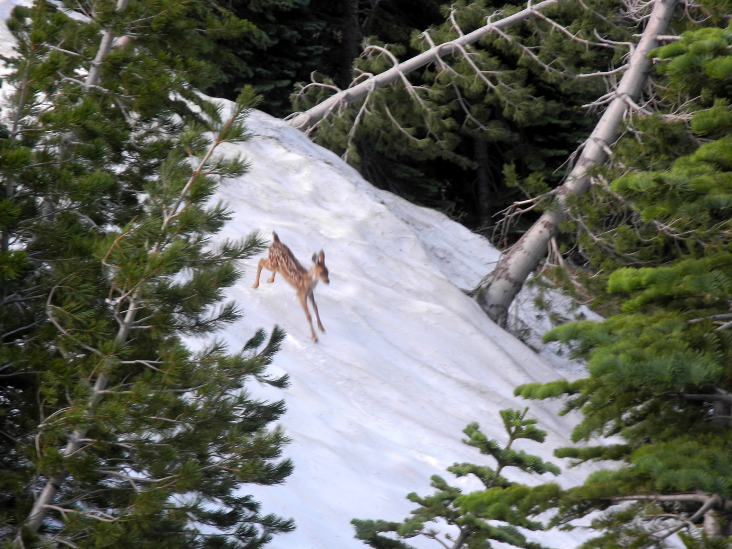
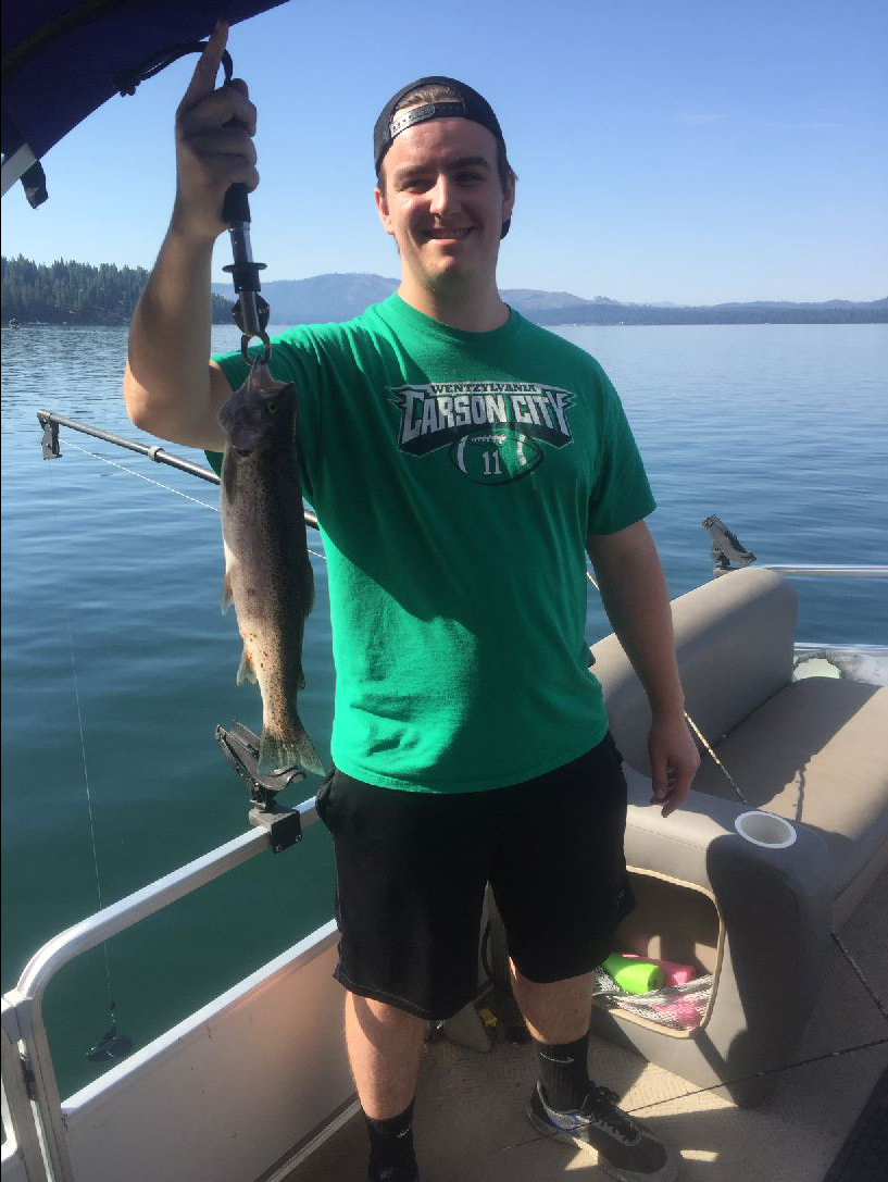
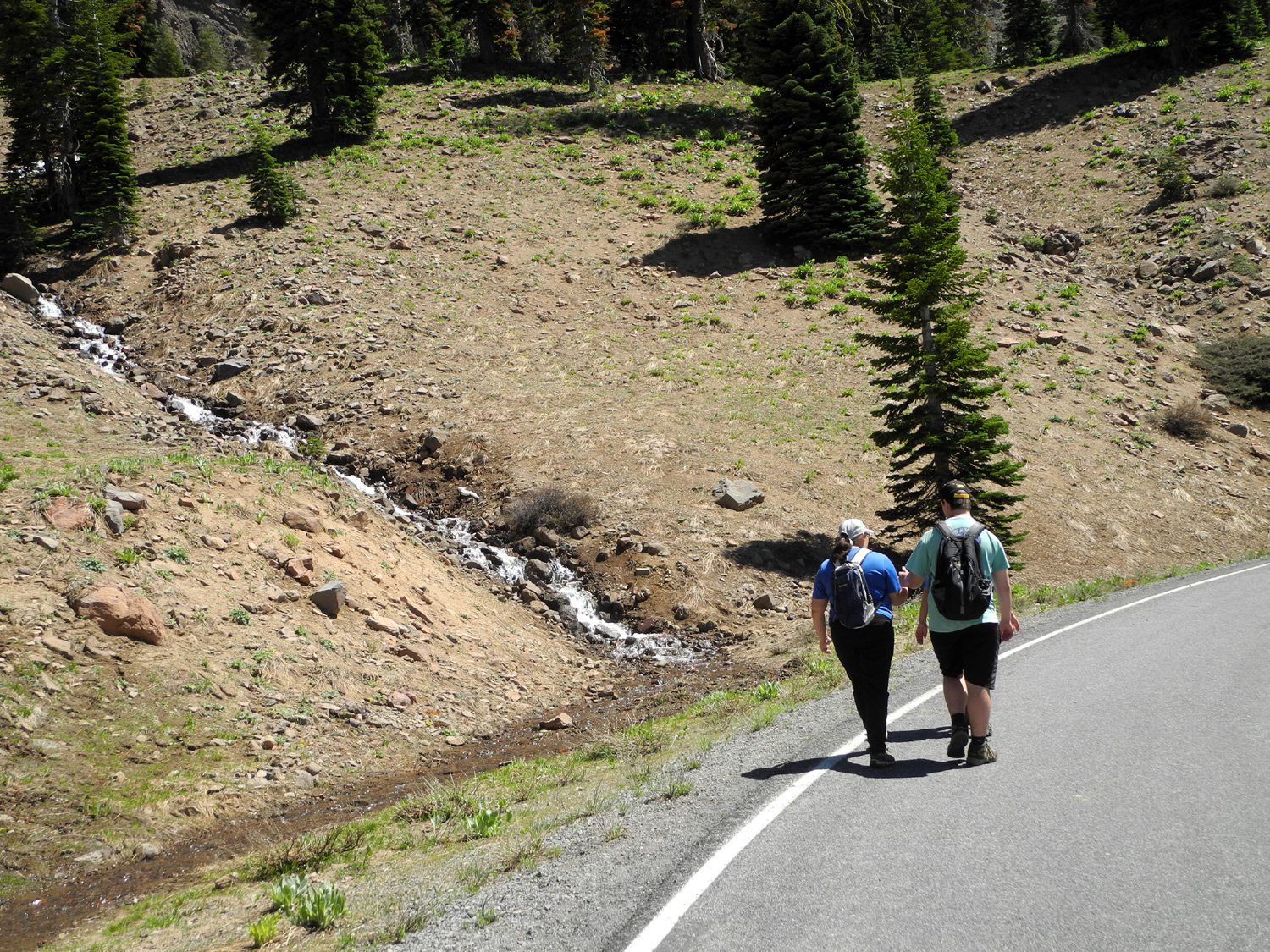
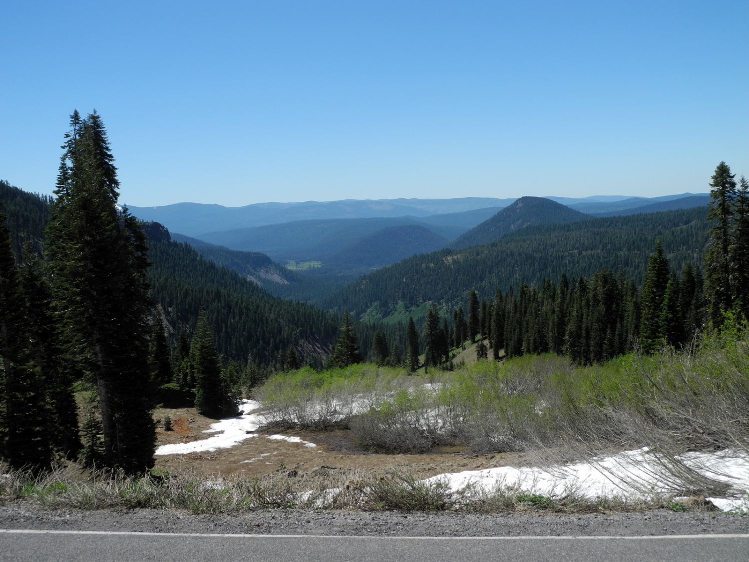
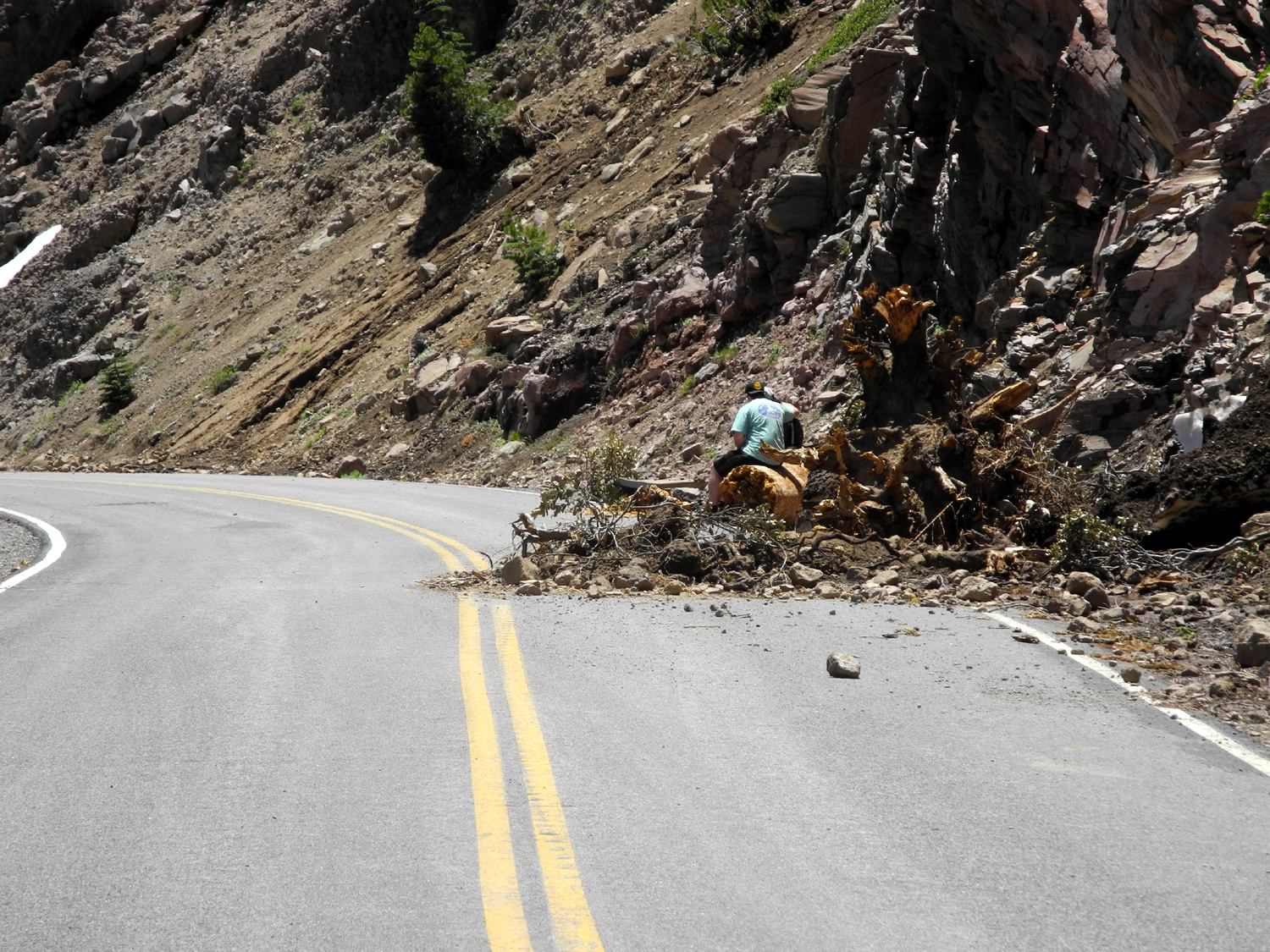
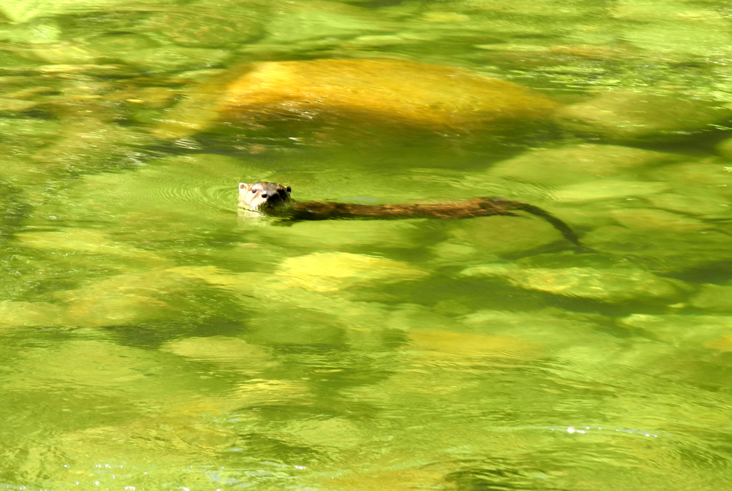
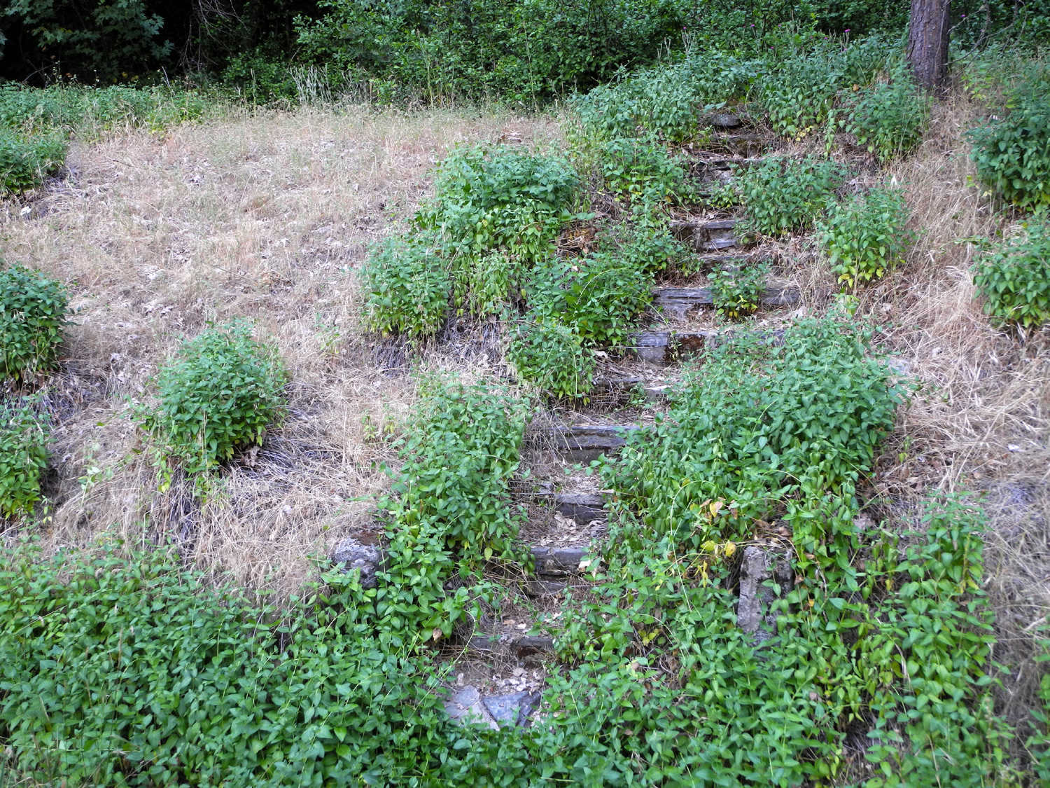
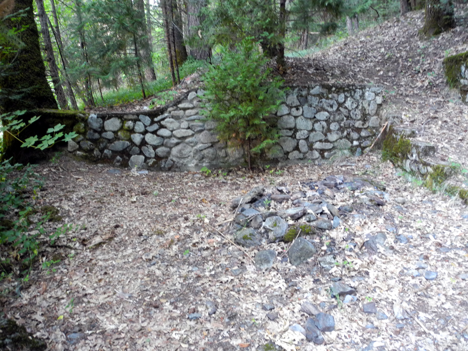
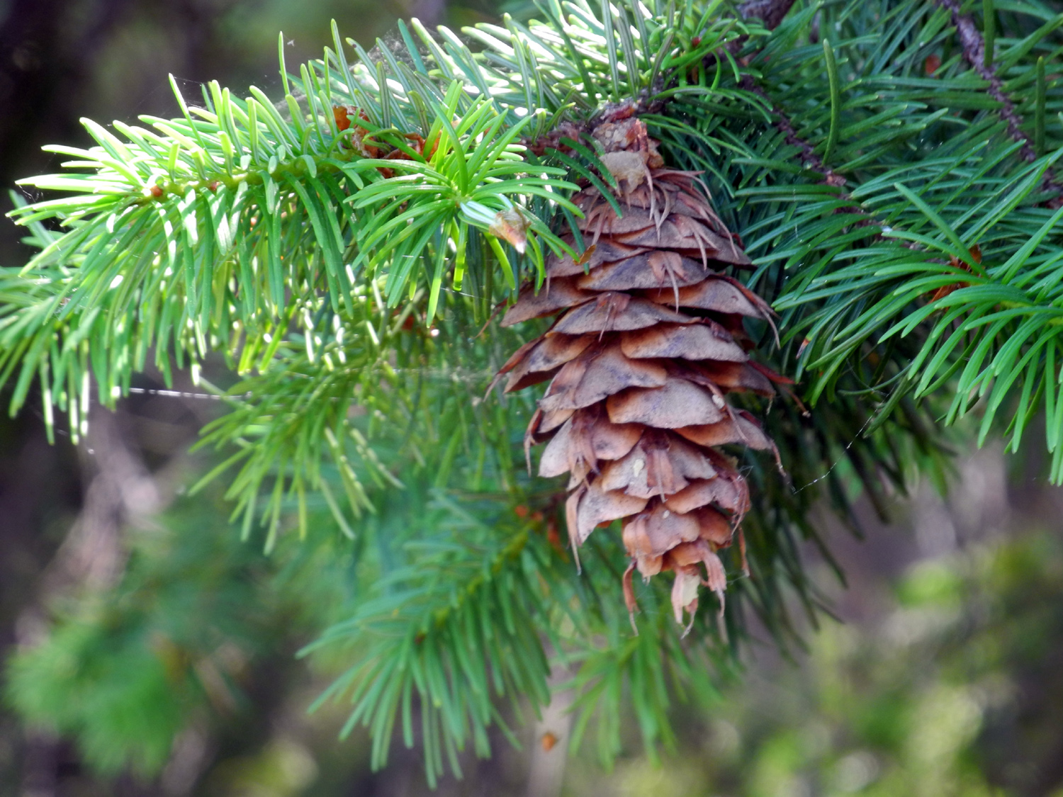
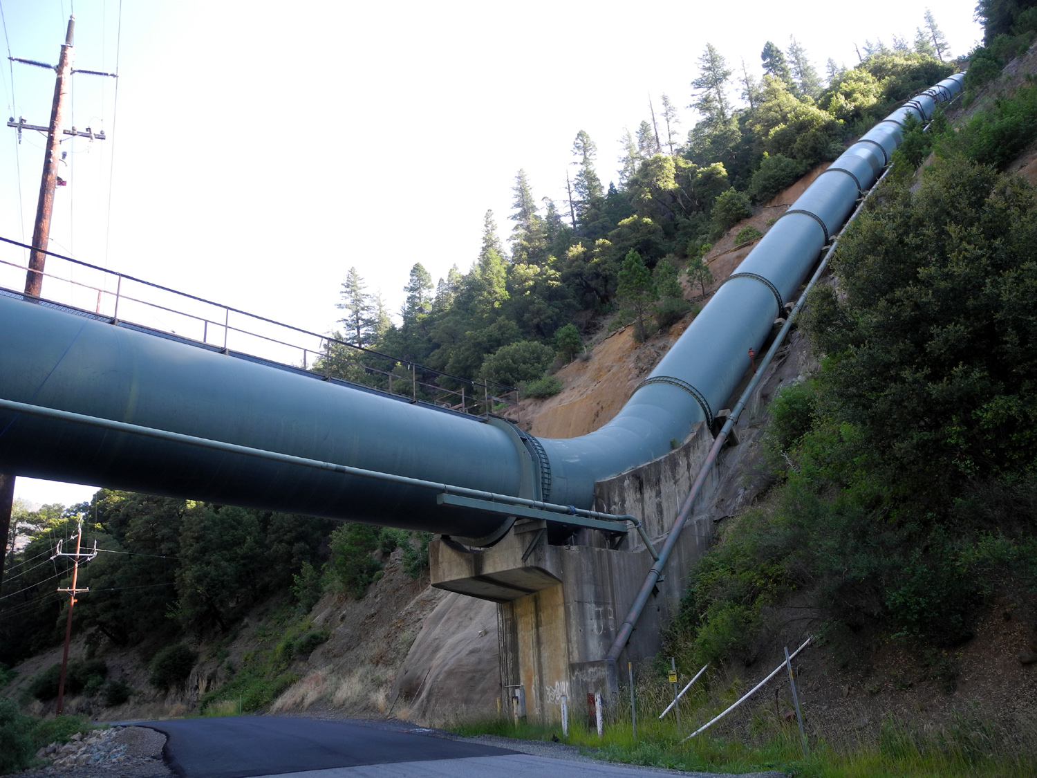
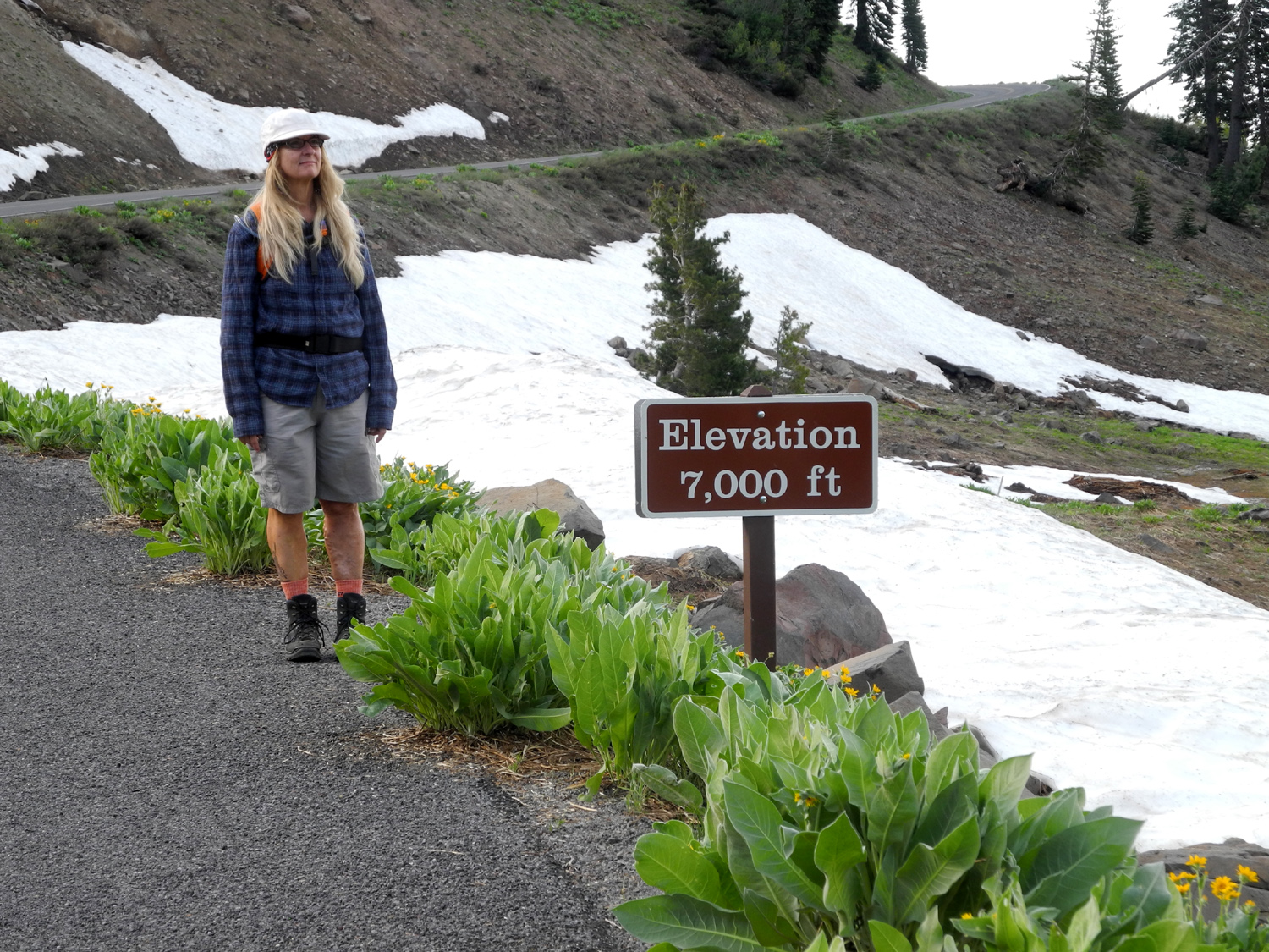
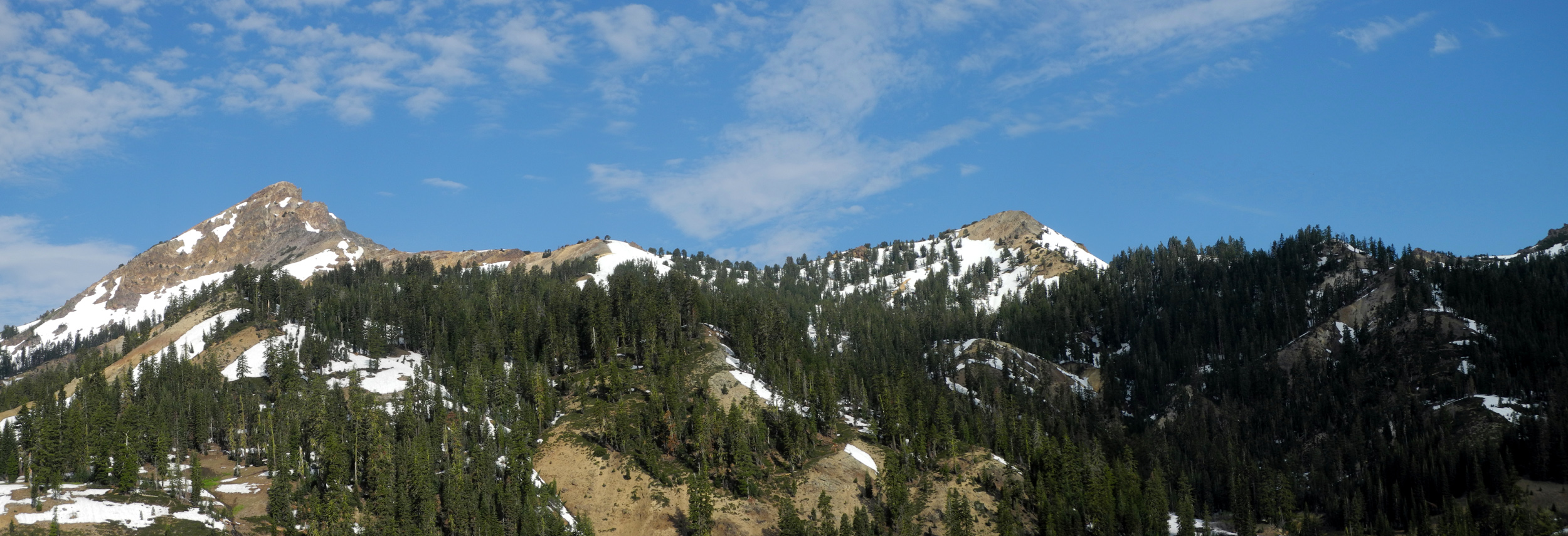
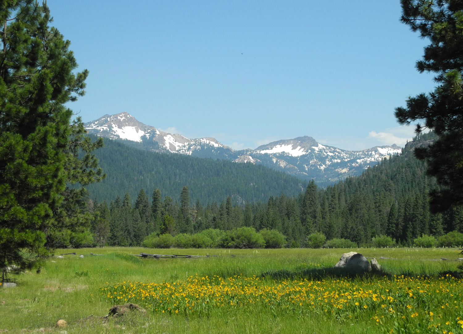
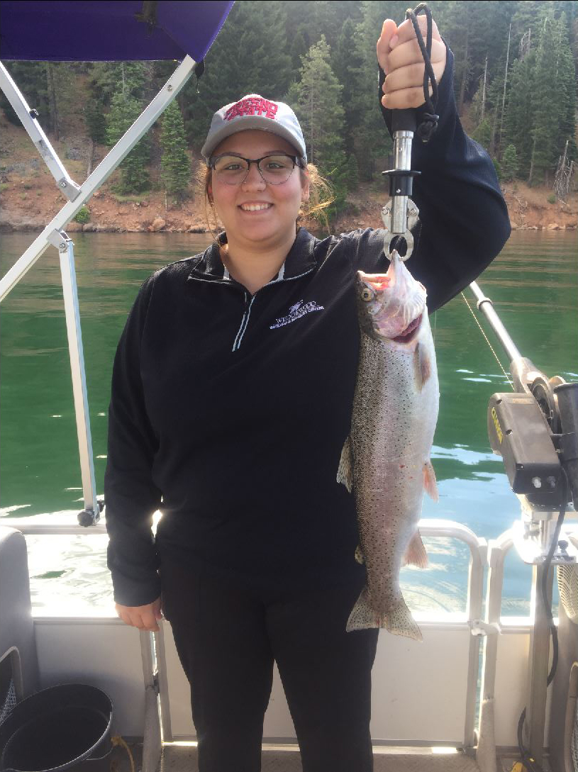
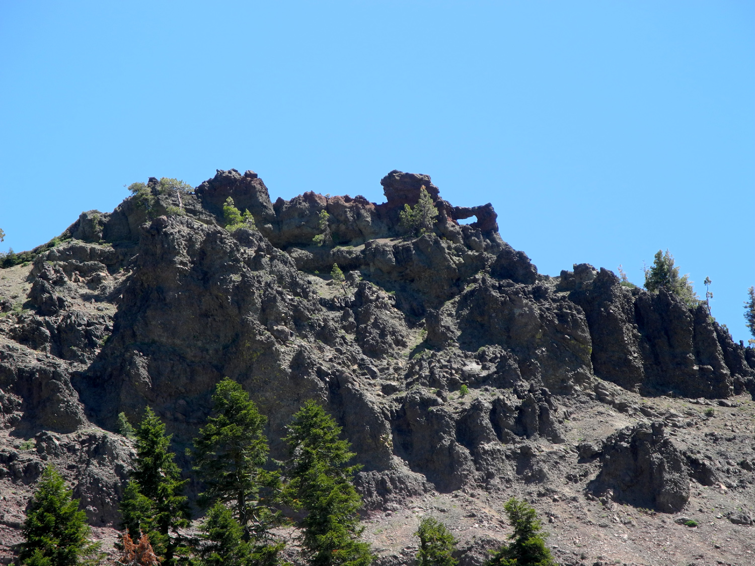
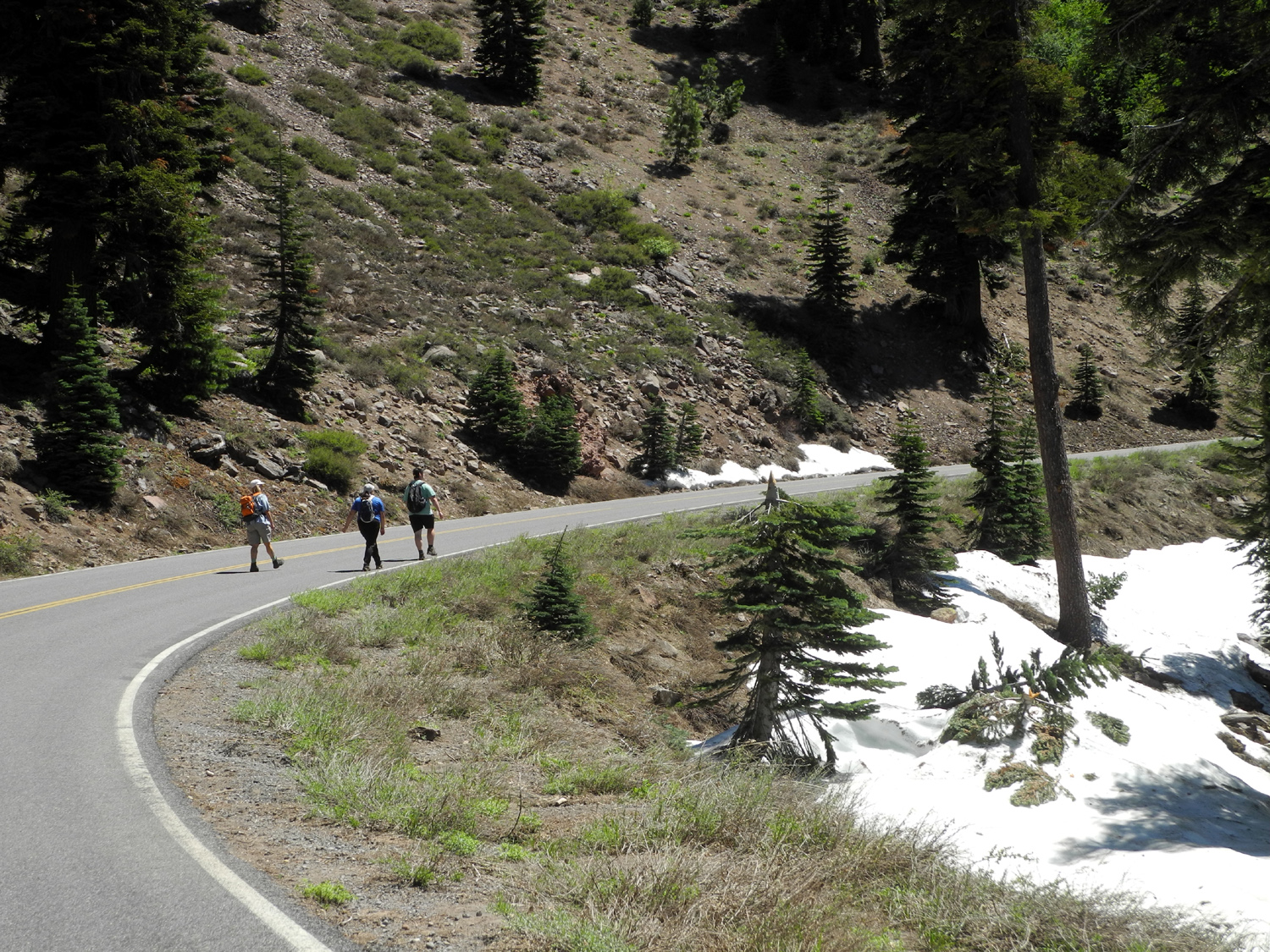
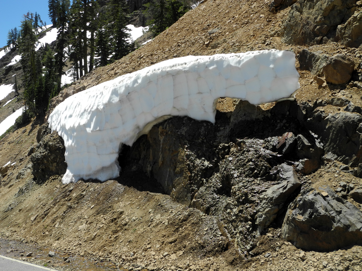
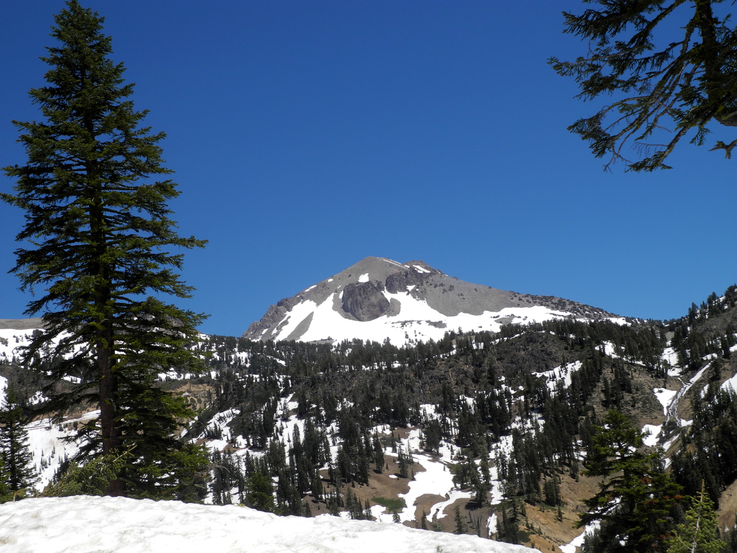
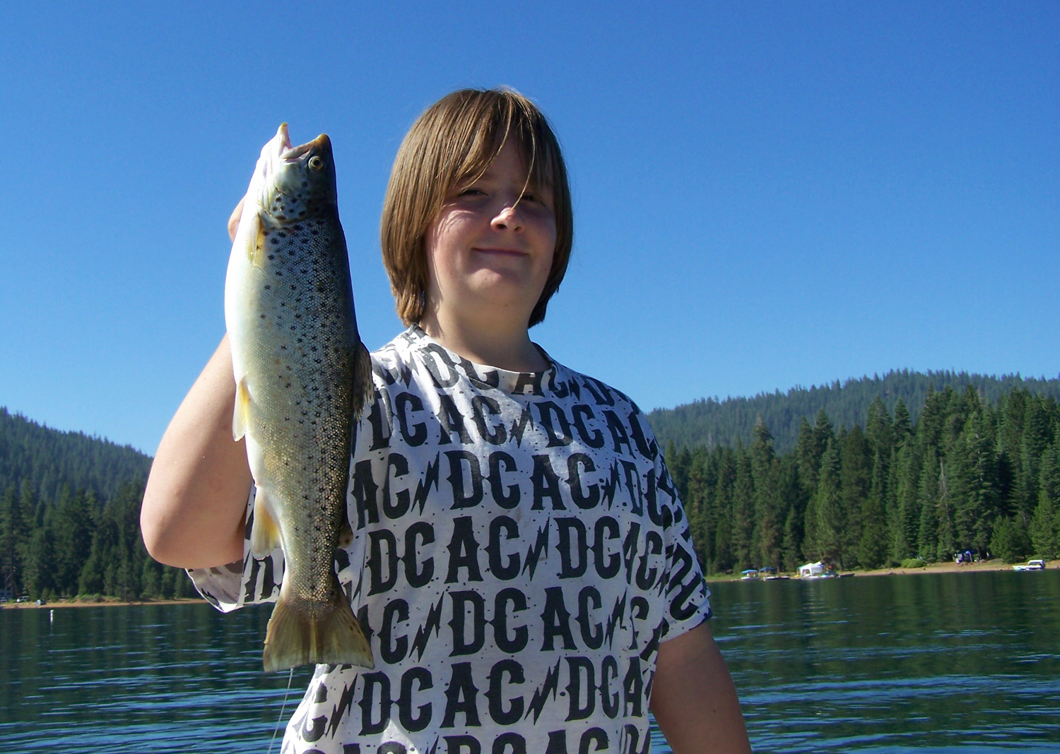
We got started from Teri's at 6:30 a.m. on June 23. The first two reports give the details of the route (including an alternate route we took by accident), so I'll skip right to our drive through the Feather River Canyon, a place of great scenic beauty and amazing views of river, canyon and forest. Once you start up from the Central Valley at Oroville, you are soon high above the river. Although the elevation at the start is fairly low, about 2,000 feet, it's farther north than our usual mountain haunts, and the trees are what we would see at 4,000 feet in the central Sierra. There is a railroad running parallel to the river, and at various places both highway and railroad go through tunnels, cross over on bridges mostly built in the 1930s, and drop down to river level, then rise up again. Thanks to our early start, we arrived at Caribou Crossroads a little before 1 p.m., and got checked in and set up. After fixing some lunch, we wandered around the area, with Mikie and Lizzie doing some fishing. Late in the afternoon we walked up the road that goes past the resort to a Forest Service campground and eventually to a lake on the river. We went only as far as the campground, looking for promising fishing spots. Back at the RV park, we were sitting by the East Branch when we spotted an animal swimming downstream. At the time we thought it was a muskrat, which I have seen in the canals of Fresno a number of times, but after looking at photos on line back at home, we decided we had enjoyed the rare treat of seeing a North American river otter. In other animal sightings, Mikie saw two snakes while fishing, and we all saw several deer in various locations. Since it was only a little more than a two-hour drive to Lake Almanor, we deliberately got a late start on Saturday. After breakfast, Mikie and Lizzie fished, while Teri and I walked up the road about two miles. A short distance from the resort we noticed a set of steps, made of local slate rock, going up the bank. We climbed up, and found more rock work, presumably the site of a cabin or similar residence from earlier times. We also took advantage of the opportunity to take a close look at some of the evergreens that we don't normally see in the central Sierra closer to home. Teri had a tree identification book with her, which helped us spot hemlocks and Douglas firs; and later at Lassen, western white pine and red firs that differed somewhat from the ones we are used to. Above us on the higher hills we could see scars from the CHIPS Fire, which charred 75,000 acres in 2012. When I started thinking it was time to go back, we used a technique that I often call on - we said we would walk "to that next bend." Then if we saw something interesting beyond the bend, we would walk farther. In this case, there was a large penstock that came down the hill on our right, crossed above the road, and rose up on the other side of the river, so of course we walked that far. We also enjoyed various flowers, rock formations, steep cliffs above the road on both sides of the narrow canyon, and the sound and sight of a good-size river. When we left Caribou, we continued on Highway 70 along the river for a few more miles, then turned on Highway 89 along Indian Creek. At one point this canyon becomes a wide, level valley, where we stopped in the town of Greenville to get a few items. A highlight of this stop was a dairy case that mooed at us when we opened the door to get milk. We arrived at the lake, and started looking for Almanor Drive West, which the directions warned us not to confuse with West Almanor Drive. This was not a problem, but the lack of a clear sign caused us to miss the turn. We were able to turn back after a short distance and got on the right road; then went past the poorly signed entrance to our campground, and made another U-turn. Once in the campground, we found our spot with no difficulty and got everything set up. We had a quiet space in a section of the camp where there was plenty of room between camps. We were also surrounded by huge, tall ponderosa pines as well as firs and various small bushes and plants. After we got organized and had lunch, we drove along Almanor West Drive till we saw a place we could get to the lake without being surrounded by mobs of people. Mikie and Lizzie fished, and everyone but me got wet in the lake. We spent about an hour or a little more here, then returned to camp for our evening activities - playing cards, reading, eating, and loafing. Mikie had called Duncan McIntyre, the guide he went with on the two previous trips, and arranged to meet him Sunday morning at Big Cove dock, where we had camped the first time. Since fish apparently get up earlier than civilized people, this meant getting up, eating breakfast, and making the 30-minute drive in time to arrive by 6 a.m. The first part of our route was north on Highway 89 to its junction with Highway 36. To the west, this road goes through Red Bluff on I-5 and on to the coast; to the east it goes through Chester on the north shore of Almanor, then on to Susanville. A short distance past Chester is the road that takes you down into the peninsula that juts into the northern side of the lake, and to resorts, residential areas and boat docks. After dropping the kids off, Teri and I set out on our own adventure. Before the trip, she had checked on conditions at Lassen Volcanic National Park, which often has deep snow well into summer. A few days before we left home, access was very limited, but we had hopes that things would be open by this time. After determining that the fishermen would probably return around noon, we decided to drive to Lassen and check things out for ourselves. As we had expected, only the first mile of the road was open, but people could hike up the road beyond that point. After getting advice and information at the entrance station we drove to the Sulfur Works, a thermal area with steam vents and a bubbling, boiling mud pot. There is a large parking lot here, and despite the early hour, we were not the first to arrive. After looking around this area, we started up the road beyond. We had just got across a bridge when some other hikers pointed out a doe and fawn in a snow field beside the road just above us. We watched and took pictures as they made their way down the snow, across the creek, and up the barren slope on the other side. We continued up the road for about three quarters of a mile, amid bright yellow mule's ears blossoms on both sides of us. In many places water running down the hills and along the road went through snow bridges, and there was a large one in the parking lot, created by the melting process. One bridge we saw the first day had collapsed by the time we returned the next day. As Teri and I walked up the road, we passed the sign marking the 7,000 foot elevation point. We went up to where we had a good view of Brokeoff Mountain, which is a remnant of Mt. Tehema, a huge volcano that rose to 11,000 feet (higher than Lassen) and was eleven miles wide at the base. Eruptions and explosions and lava flows between 600 thousand and 400 thousand years ago reduced the giant mountain to a circle of remnants. Although there were no human witnesses to Tehema's demise, Mt. Lassen had a period of eruptions, steam explosions and lava flows between 1914 and 1921, and there are photos and even movies of these events available. By the time we got back to the car it was 9:30, and the visitor center was open, so we went there to shop for souvenirs and study the various exhibits. I had been to Lassen three times previously, but it was Teri's first visit, and the limited activities we were able to do that day and the next only made her want to return again. On our way back we stopped at the Child's Meadow Resort, where I had stayed both times with grandson Johnny in the 1990s, and in 2010 with Tim and Mikie. This location has a huge meadow, several miles long, filled with flowers and boasting dramatic views of the snow-covered peaks in the national park. We got back to the fishing dock a little before noon, and parked next to a shaded picnic table, where we had our lunch. Eventually we received a text that the sailors were coming in, and before long we were admiring the five fish they had caught, a mix of rainbow trout and salmon. The guide service included filleting the fish, so we headed back to camp with a large bag of fresh fish, some of which went into tacos for that night's dinner. It had already been decided that we would all go to Lassen Park the final day. With no deadlines to meet, we got up when we felt like it, enjoyed a leisurely breakfast, and started up the highway. We had decided to hike to Mill Creek Falls, a four mile round trip starting near the visitor center. However, the first 50 feet of the trail were covered in snow, and we slipped and slid as we made our way down. We called a halt, and with little discussion and no dissenting votes, decided to abandon this potentially hazardous trail and hike up the road from the Sulfur Works parking lot. Rangers had told us that most people hiking there were seeing bears down in the canyon along the road about a mile or so up. Although four miles on pavement left us a bit footsore, we all realized we were getting a much better look at things along the way than we could have from just driving through. This included a ridge of volcanic material with a window in the rock which Teri spotted the previous day, and which I had never noticed driving past it three or four times. We also had a distant view of Child's Meadow, a green patch in the midst of the dark green evergreens that cover most of the land in this part of the state. The road went up hill gently with a steep slope above us on one side, and the canyon of a little creek on the other. We didn't see any bears, but the bottom of the valley was probably a quarter mile below us, so they could have been lurking behind any bush. We did see a deer feeding on the slope just above us, and of course throughout the hike, we were in upper elevation forest, with red firs the predominant tree. This bark of this species was not quite as noticeably red as we are used to, but a study of the foliage and a look at Teri's tree book showed that we had identified them correctly. We also saw lots of snow and water, with little creeks running down the hillside and along the road, and snow banks sculpted by the sun everywhere along the road, some of them rising higher than our heads. Of course, the most dramatic sight was Mt. Lassen, rising nearly 3,000 feet above us to more than 10,000 feet. Johnny and I hiked the trail to the top back in the 20th Century, but it was clear that the trail would be blocked by snow for at least another month. We saw quite a few other hikers, some of them going well beyond where we turned back, and chatted with some of them. It seemed that everyone was making the best of the situation, just as we were. When we returned to the truck, we drove to the visitor center so Lizzie and Mikie could get a look and buy some t-shirts. Here we observed a number of small children playing in the snow and throwing snowballs. As previously planned, we drove into Chester on our way back and had dinner at a restaurant. We drove through all the way through town looking at various possibilities, then made another of our famous U-turns and went to the Kopper Kettle, which proved to be an excellent choice. After dinner we planned to go to a place that had ice cream, but it was closed, so we were forced to drive to the little store just beyond our campground to get something to take home for dessert. Lizzie and Mikie drove down to the lake, and took advantage of the campground's shower facilities. They took their poles, but didn't do much more fishing. The next day was Tuesday, and time to head for home. Mikie drove my truck and I rode with Teri both coming and going. We left camp together, but they got ahead of us, and ended up taking a slightly different route home, having located their new favorite deli franchise, Mr. Pickles, in Yuba City on a highway that ran parallel to the one we were on, just a few miles farther west. One of the more unusual sights seen while driving through the Central Valley north of Sacramento is the Sutter Buttes, a small complex of eroded lava domes rising from the flat valley floor in Sutter County. Going up I-5, I had seen them from the west side when I made my first trip north of Sacramento about 1970. From Highway 70 or Highway 99, you get a look from the east side. I was able to get only a hazy photo, but there are plenty of views on the Internet. We arrived back in Fresno to find that the weather had cooled off somewhat from the 105 and higher levels we had experienced before our trip - barely 99 degrees. At Teri's house we moved all my stuff from the motor home to my pickup, and said goodbye until our next adventure.
|
||
|
Photos (click on the picture for a larger view) |
||
|
 |
 |
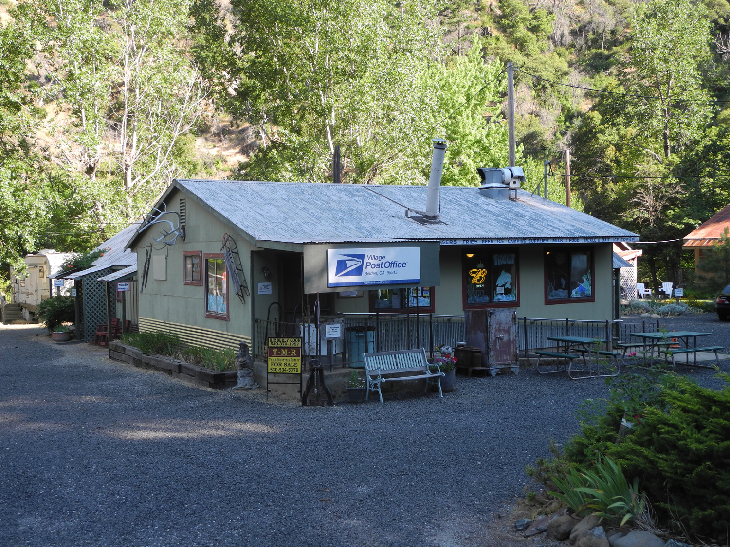
| North Fork of the Feather River | Caribou Crossroads store and office |
Mikie
fishing where the East |
 |
 |
 |
| Teri by the East Branch of the Feather River | Lizzie and Mikie cool off | North American river otter |
 |
 |
 |
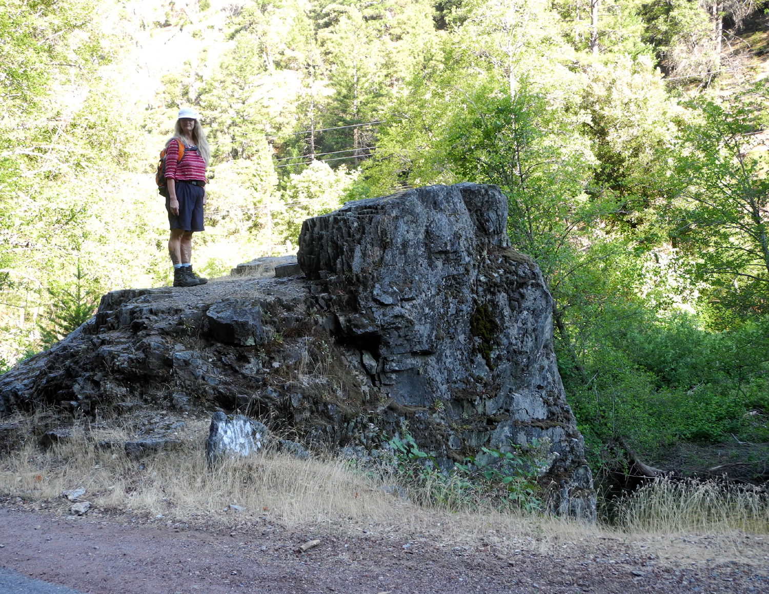
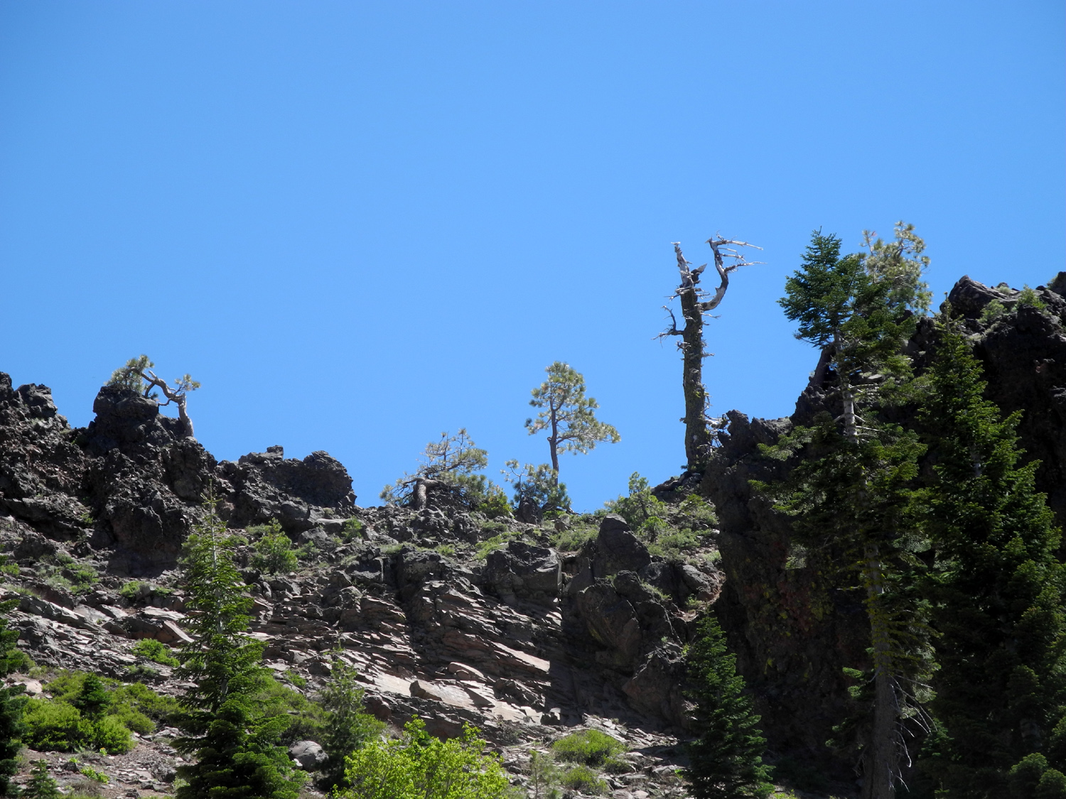
| Rugged cliff above the East Branch | Teri on a rock overlooking the river | Stairway to ??? |
 |
 |
 |
| What we found up the stairs | Penstock above Caribou Road | Scars from the CHIPS Fire of 2012 |
 |
 |
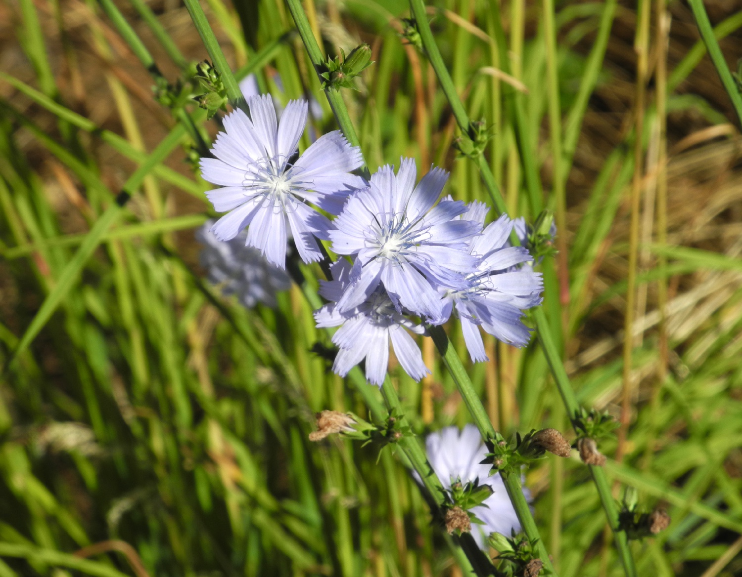 |
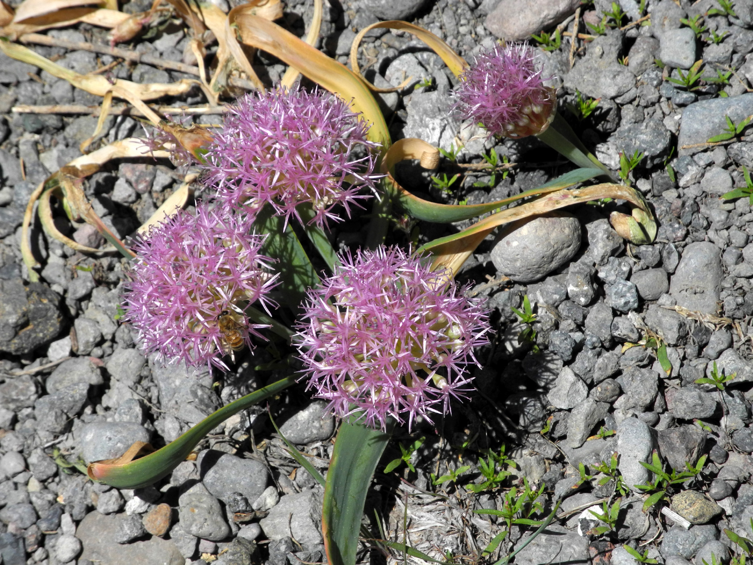
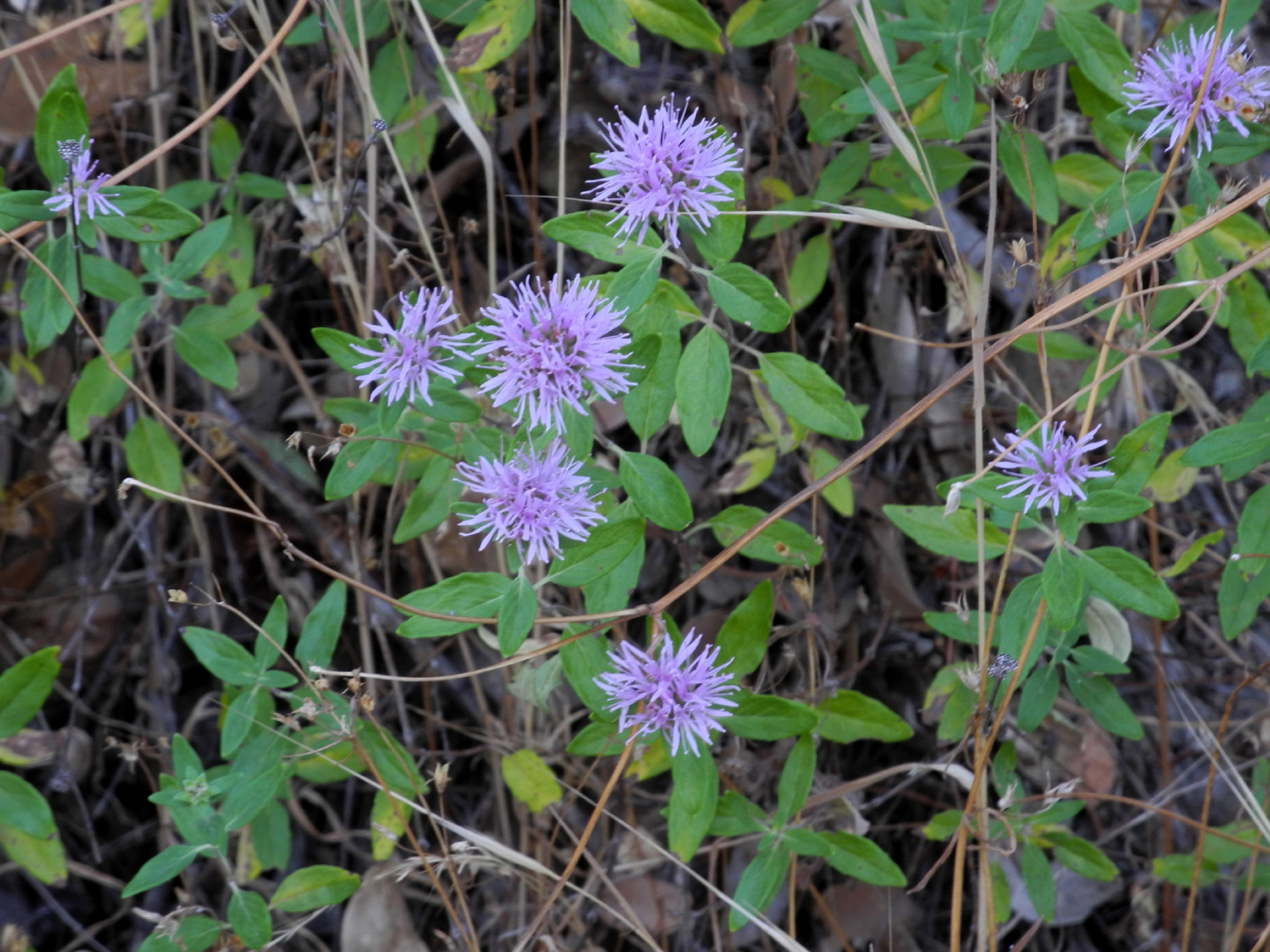
| Douglas fir | Unidentified flowers along Caribou Road | More unidentified blue flowers |
 |
|
 |
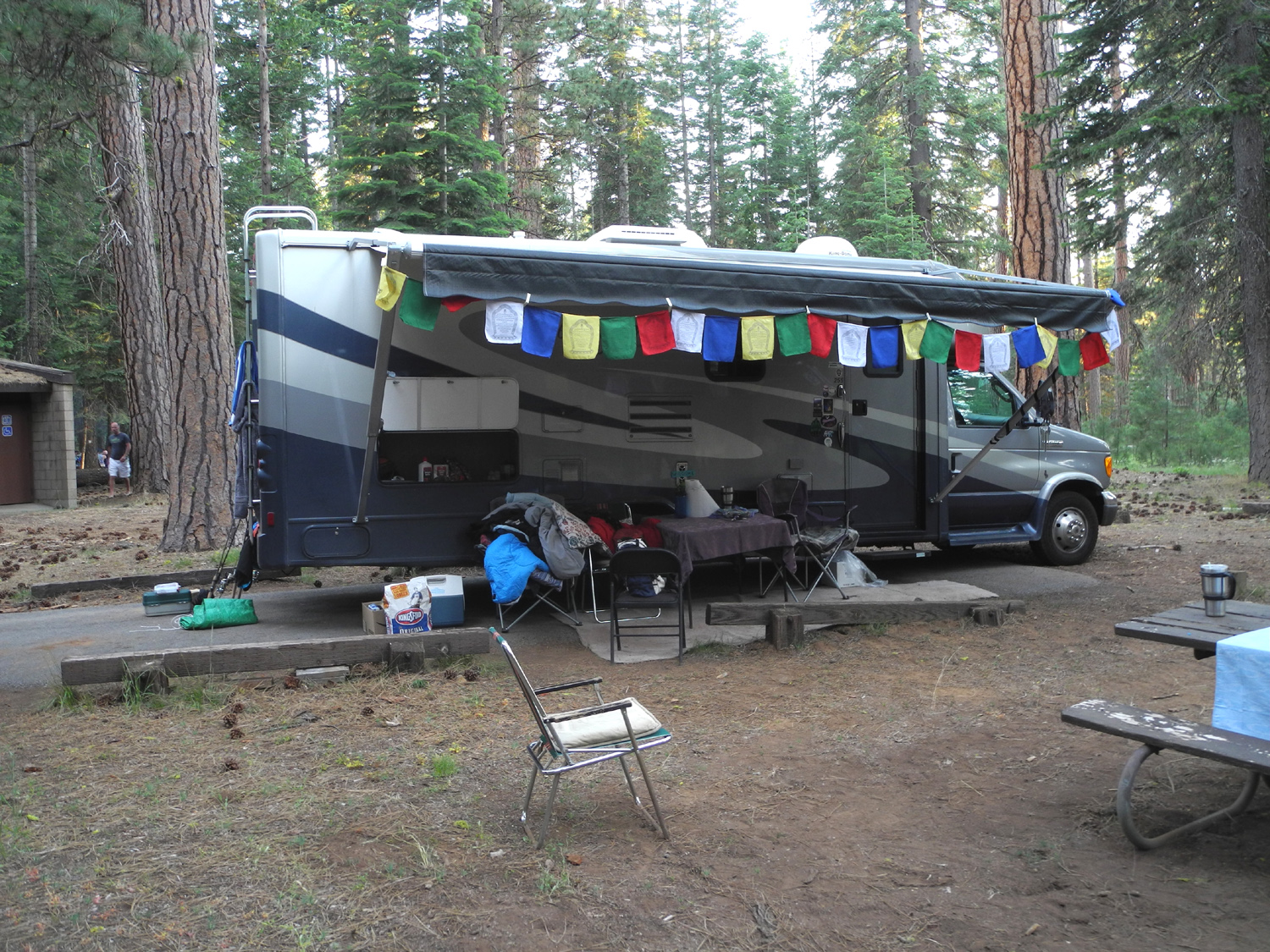
| Our camp at Lake Almanor | Almanor has over fifty miles of shoreline | Teri and Mikie in the lake |
 |
 |
 |
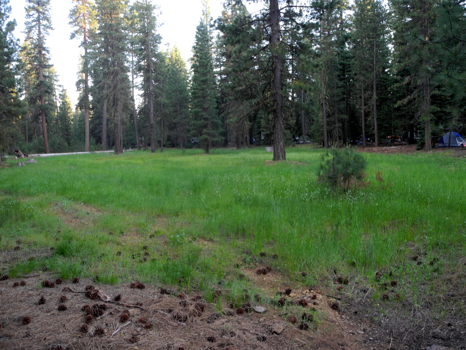
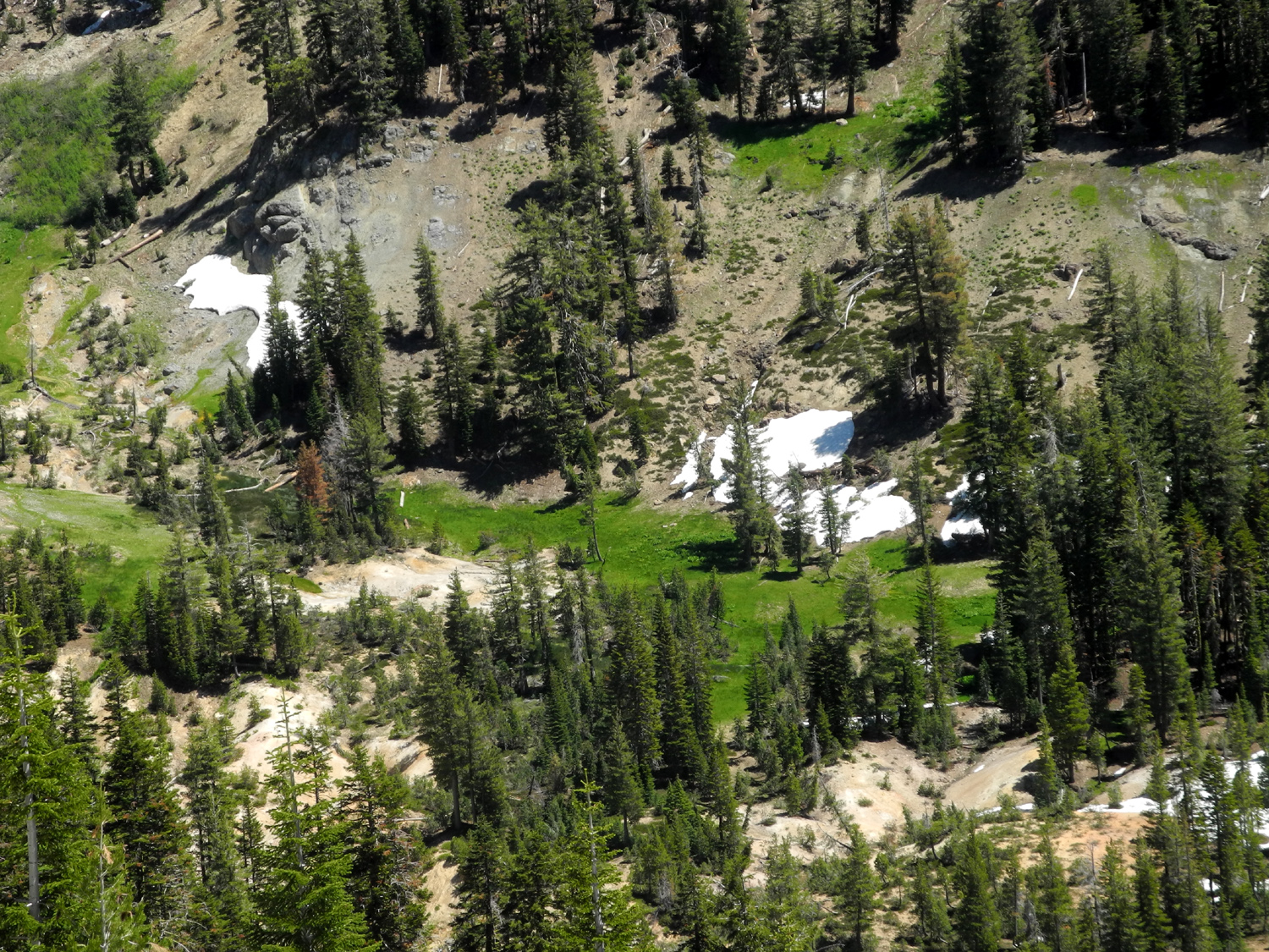
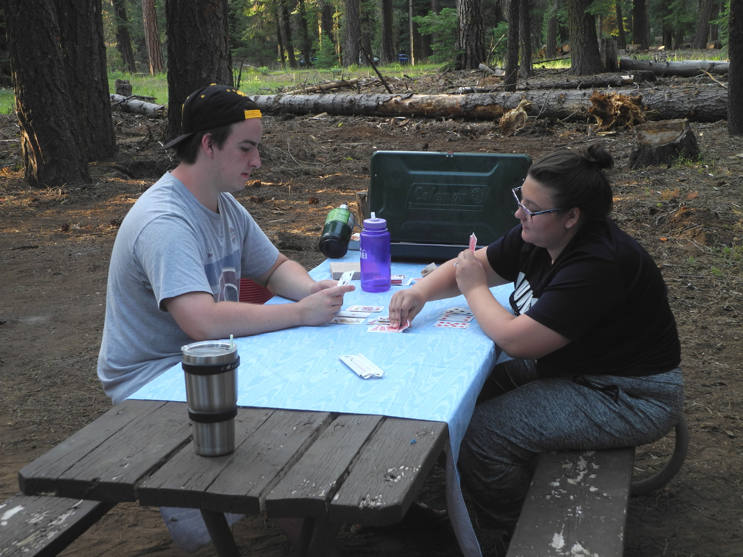
| Game time | Part of the meadow
that runs through the campground |
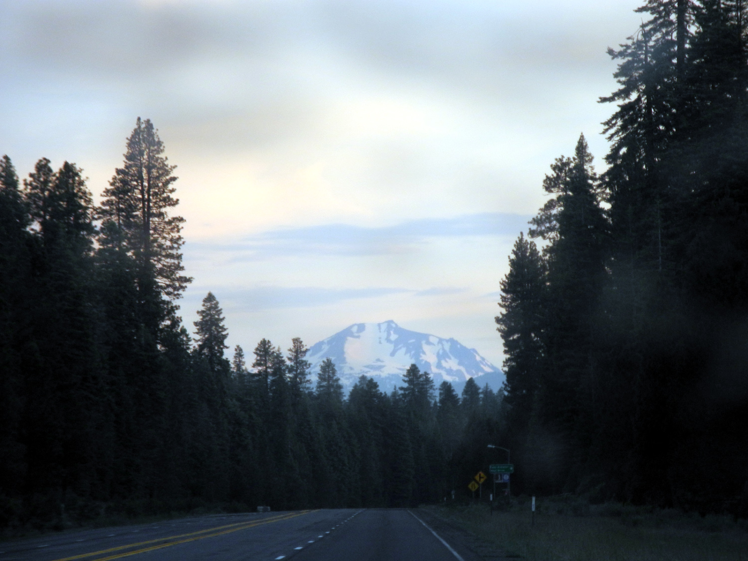
Mt. Lassen from Highway 36 |
 |
 |
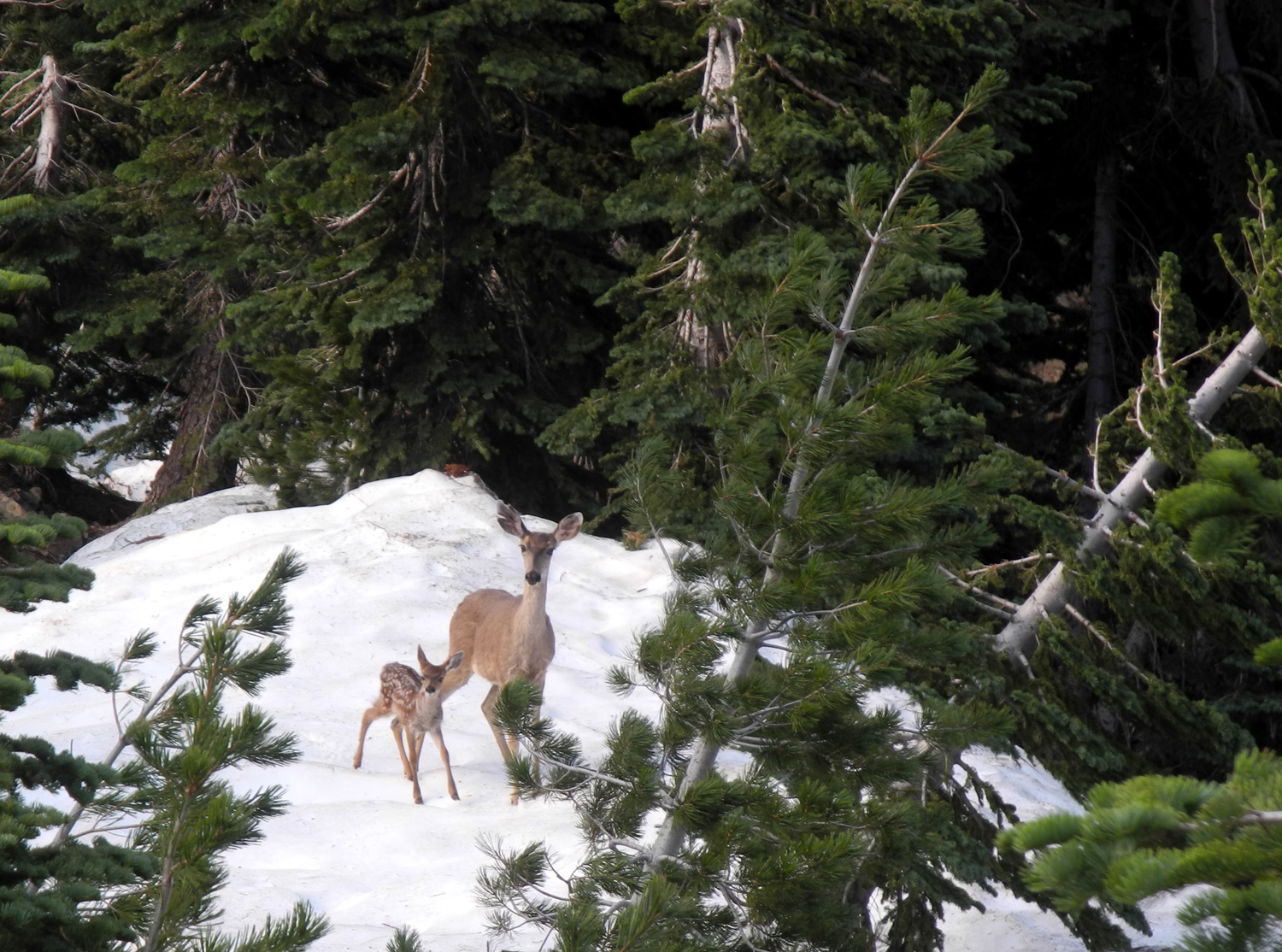 |
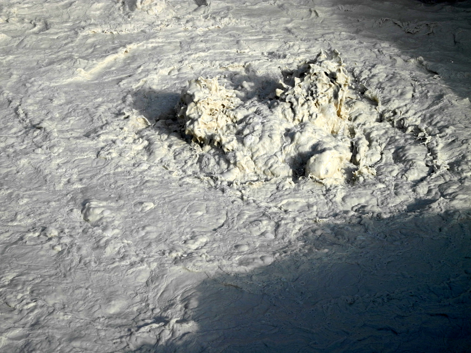
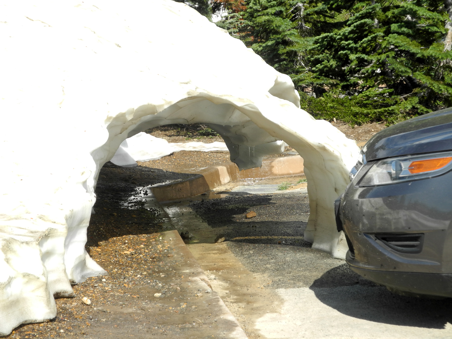
| The boiling mud pot at Sulfur Works | Dramatic snow tunnel at Sulfur Works parking lot | Mom and child, out for a morning walk |
 |
 |
 |
| "Wait up, ma!" | A few hundred feet up the road from the parking lot |
Bright yellow mule
ears were |
|
 |
 |
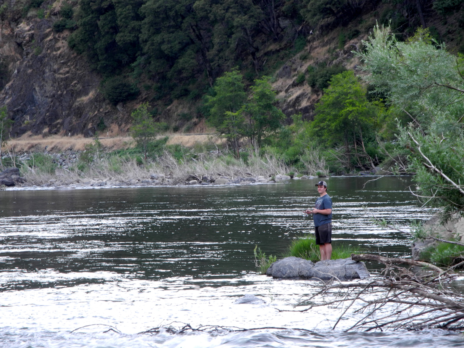
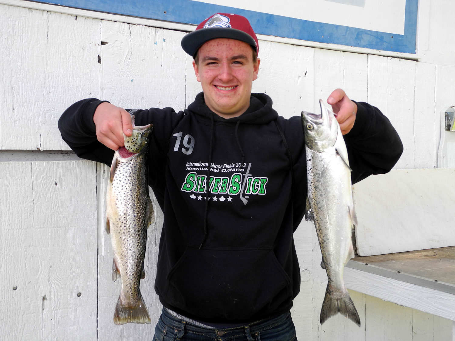
| Peaks in Lassen Park from Child's Meadow | Lizzie had good luck fishing | Mikie
and Lizzie caught five big fish between them |
 |
||
| Brokeoff Mountain and friends | ||
 |
 |
 |
|
One of three lively
creeks crossing |
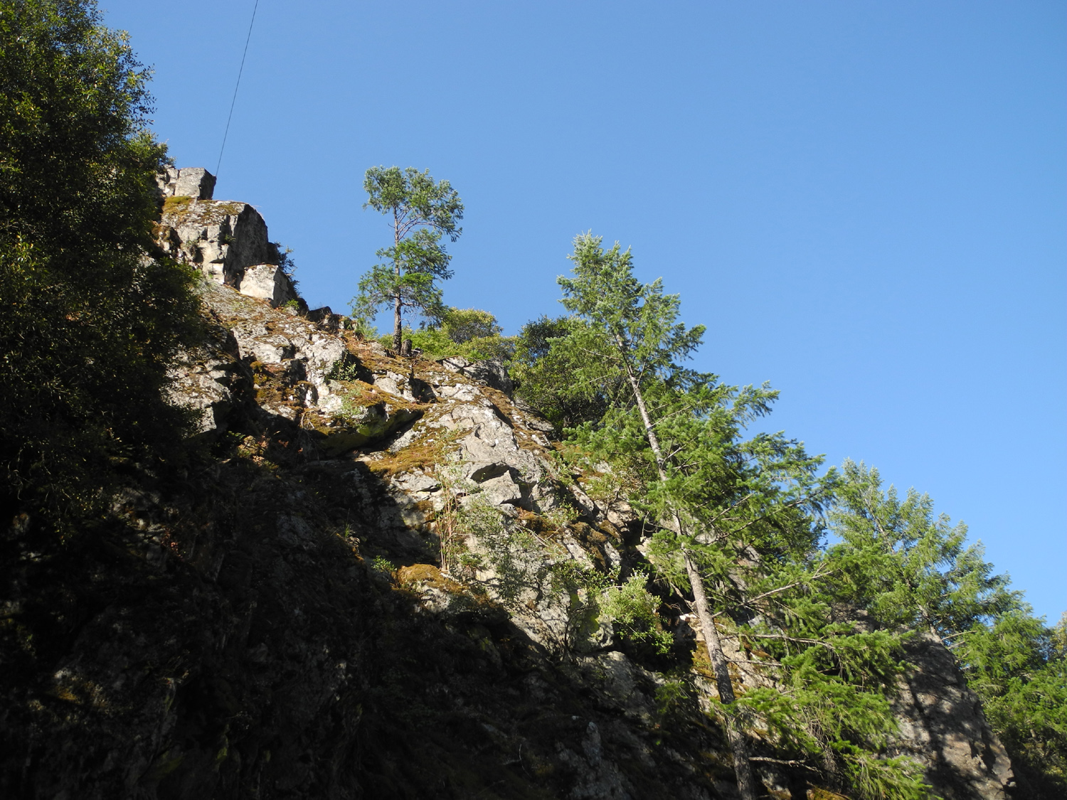
We named this Window Rock Ridge | Lizzie and Mikie
pass one of many little creeks tumbling down the steep hillsides |
 |
 |
 |
| Child's Meadow is
the tiny green patch in the middle of the picture |
Typical scene along the "hiking road" | Rugged trees and rocks |
 |
 |
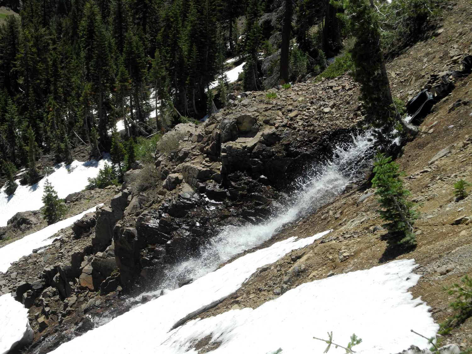 |
| There ARE bears down there somewhere! | Mt. Lassen - dormant but not dead | Snowmelt rushes down the hillside |
|
|
 |
| Still plenty of snow left | A snowy scene along the road | Snow sculpture, disappearing fast |
 |
 |
 |
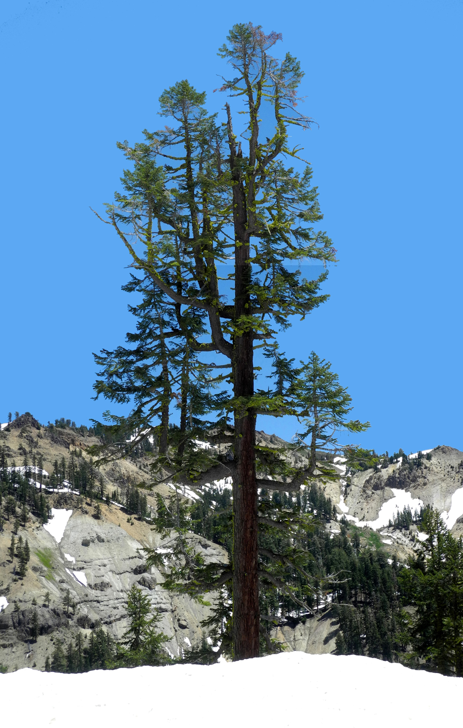
| This big red fir has
stood up against many winters |
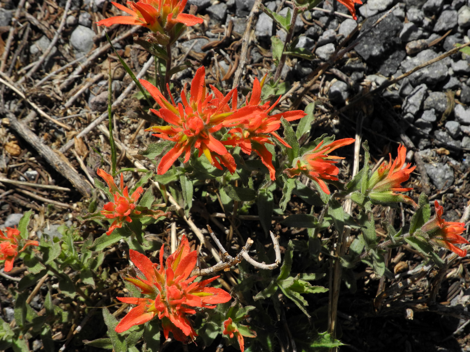
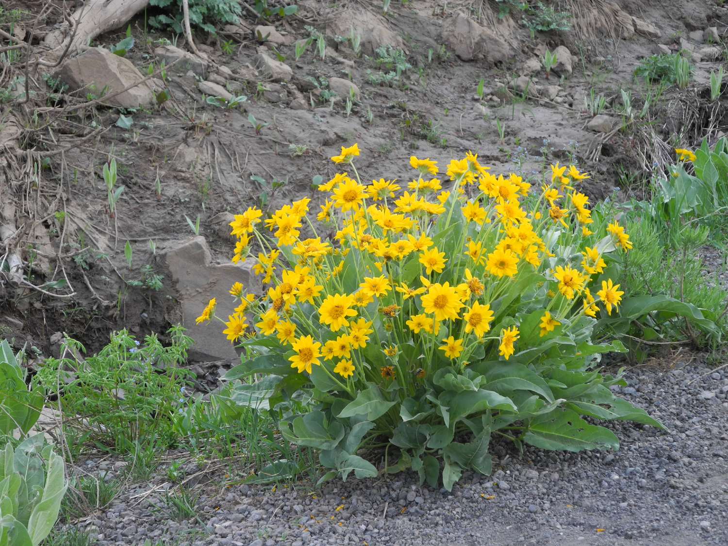
Flowers along the Lassen Road | This one is wavy-leaf Indian paint brush |
 |
 |
 |
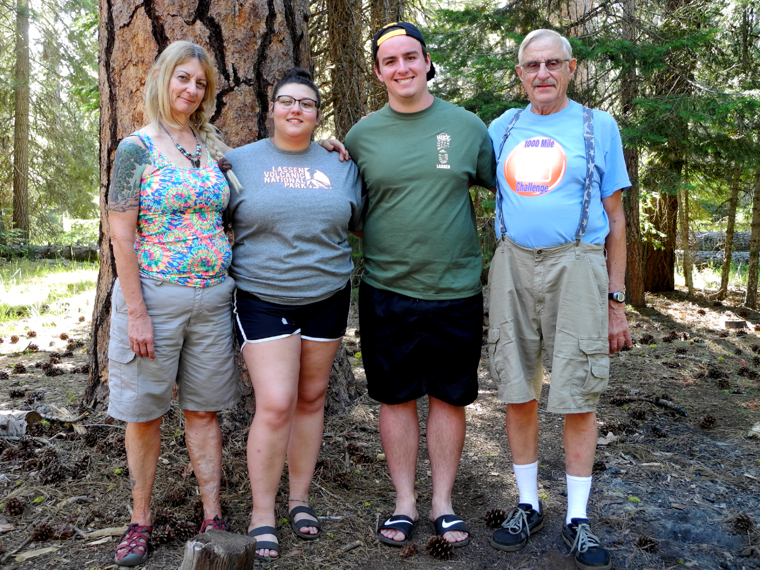
| Still lots of stuff blocking the road | Teri, Lizzie, Mikie
and Dick next to a big ponderosa pine at our campsite |
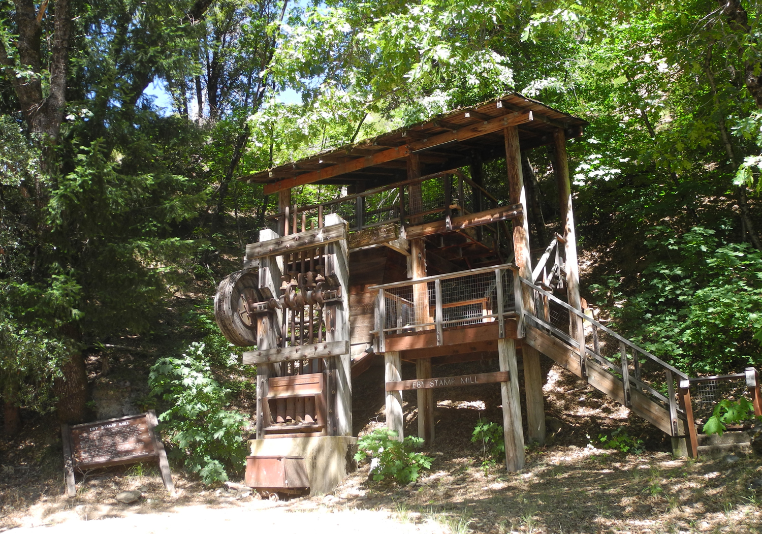
Eby stamp mill at
Belden Rest Stop, just down the river from Caribou Crossroads |
 |
 |
 |
| Fly wheel and shafts
of the heavy stamps, used for crushing gold ore |
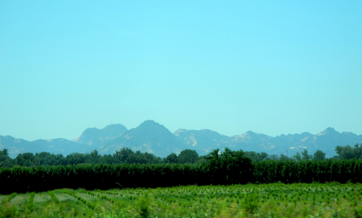
Bridge across the Feather River at Belden | The Sutter Buttes |
 |
||
| This country is the northern edge of the Sierra | ||
| Other Links of Interest | ||
| Mikie's fish in 2010 | Mikie's fish in 2013 | Sulphur or Sulfur |
| Lassen Volcanic National Park | Otters | Lake Almanor |
| Sutter Buttes | Caribou Crossroads | Camping at Lake Almanor |
| Lassen August 1993 | Almanor & Lassen 2010 | Caribou Crossroads & Almanor 2013 |
|
|
||