
2016 Ramblers Hikes Page 2 (May to August) |
||
|
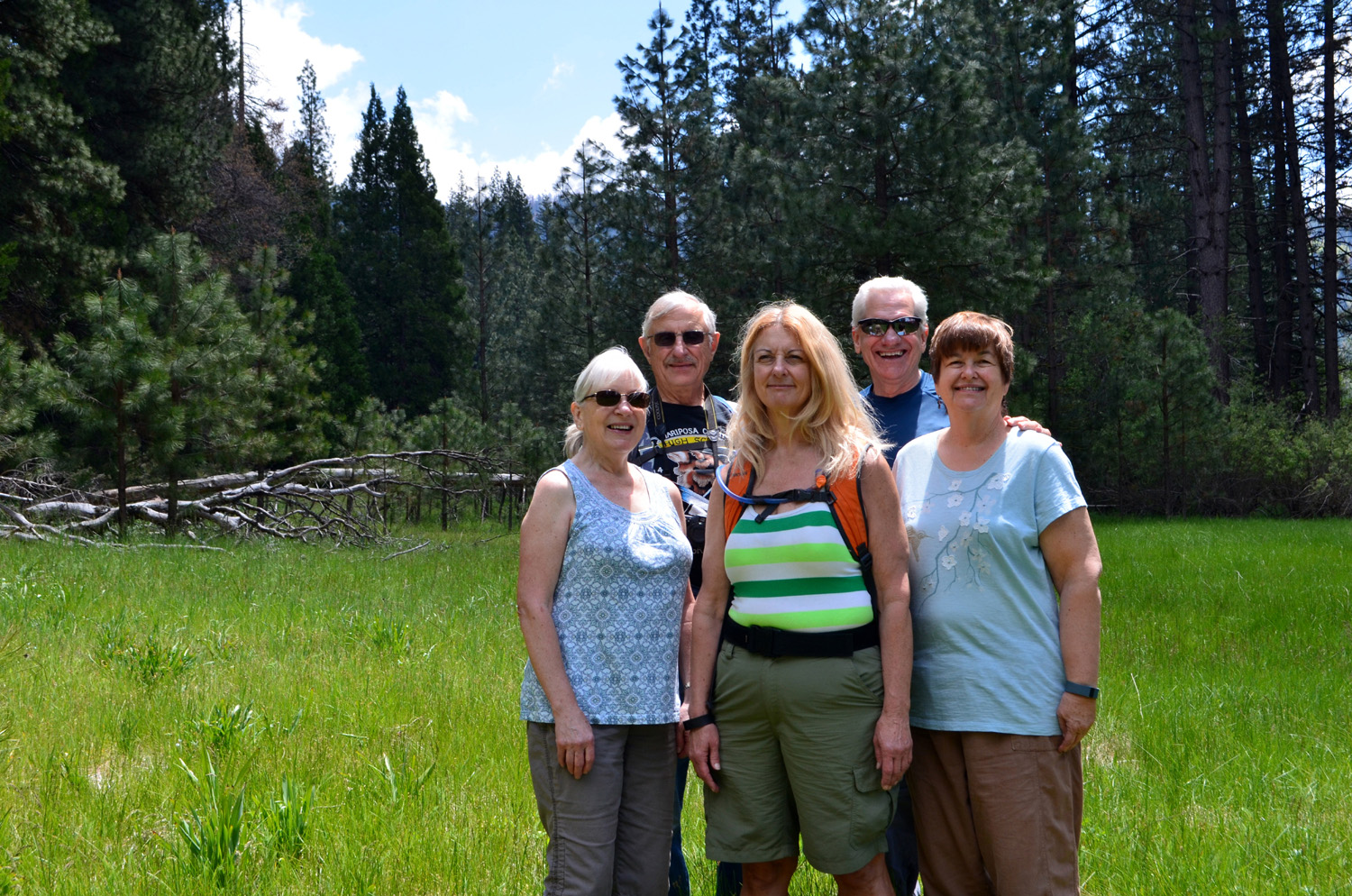
The Ramblers are Carolyn Amicone, Julie Hornback, Wes Thiessen, and Dick Estel, former colleagues at the Fresno County Department of Social Services. Every month or so we get together for a short hike, good conversation, and lunch. Sometimes we're lucky enough to have a guest hiker with us. |
||
|
|
||
2016 Hikes Page 1 2016 Hikes Page 3 2015 Hikes Page 1 2015 Hikes Page 2 |
||
|
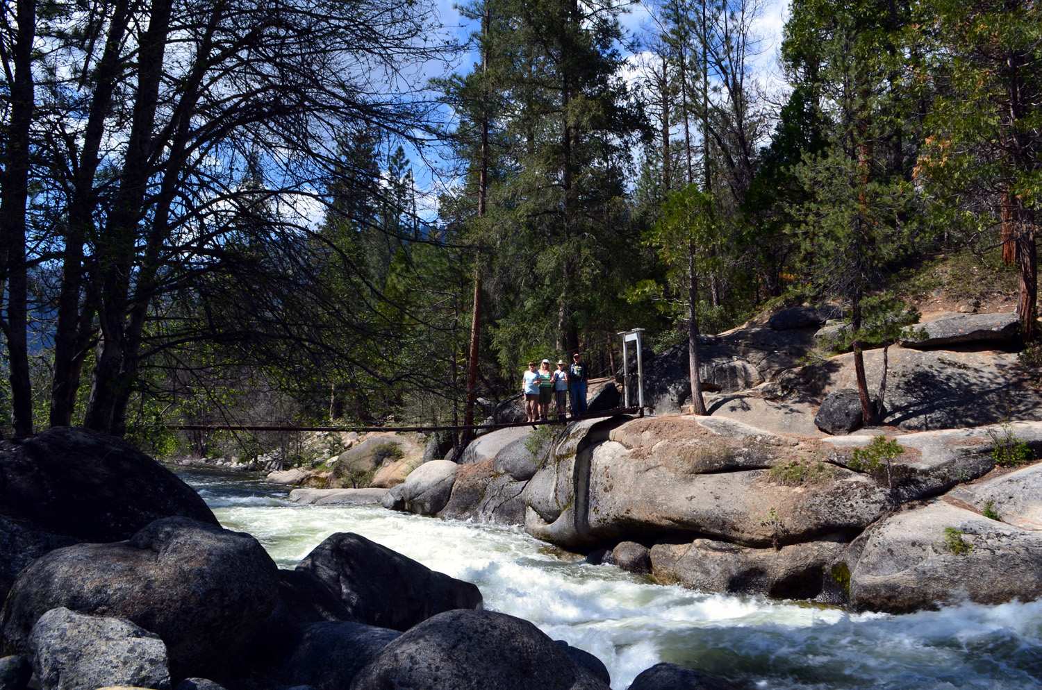
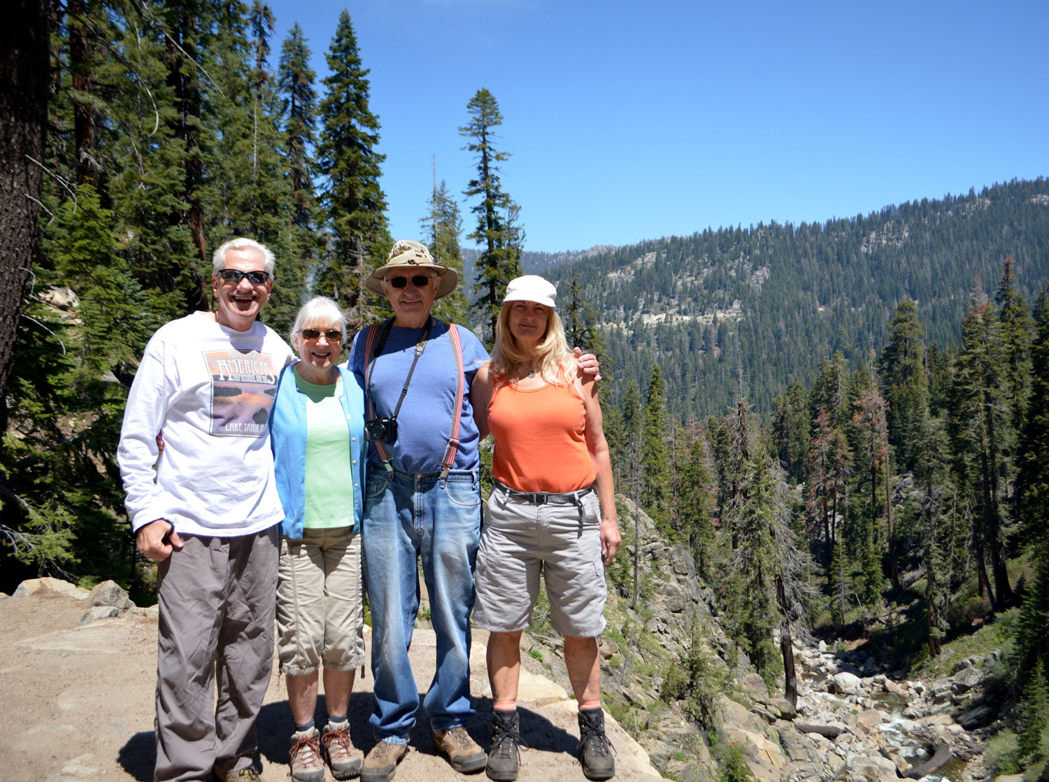
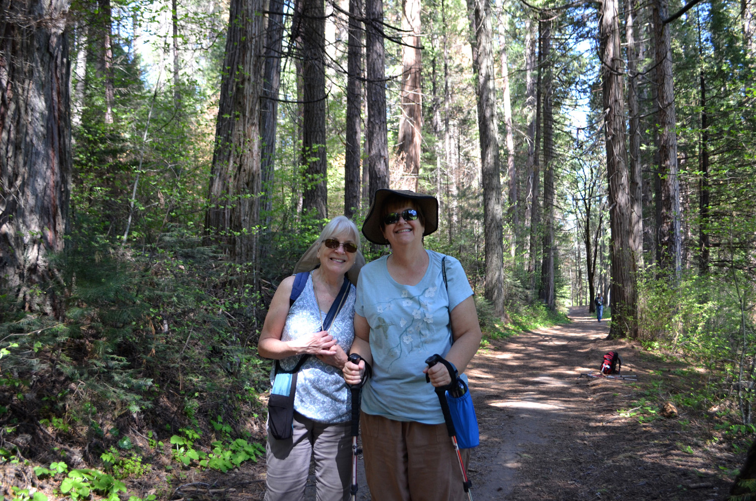
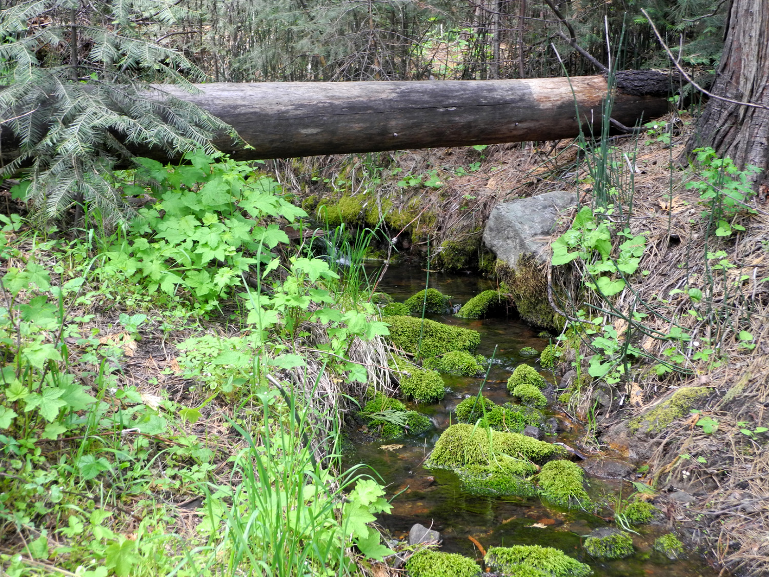
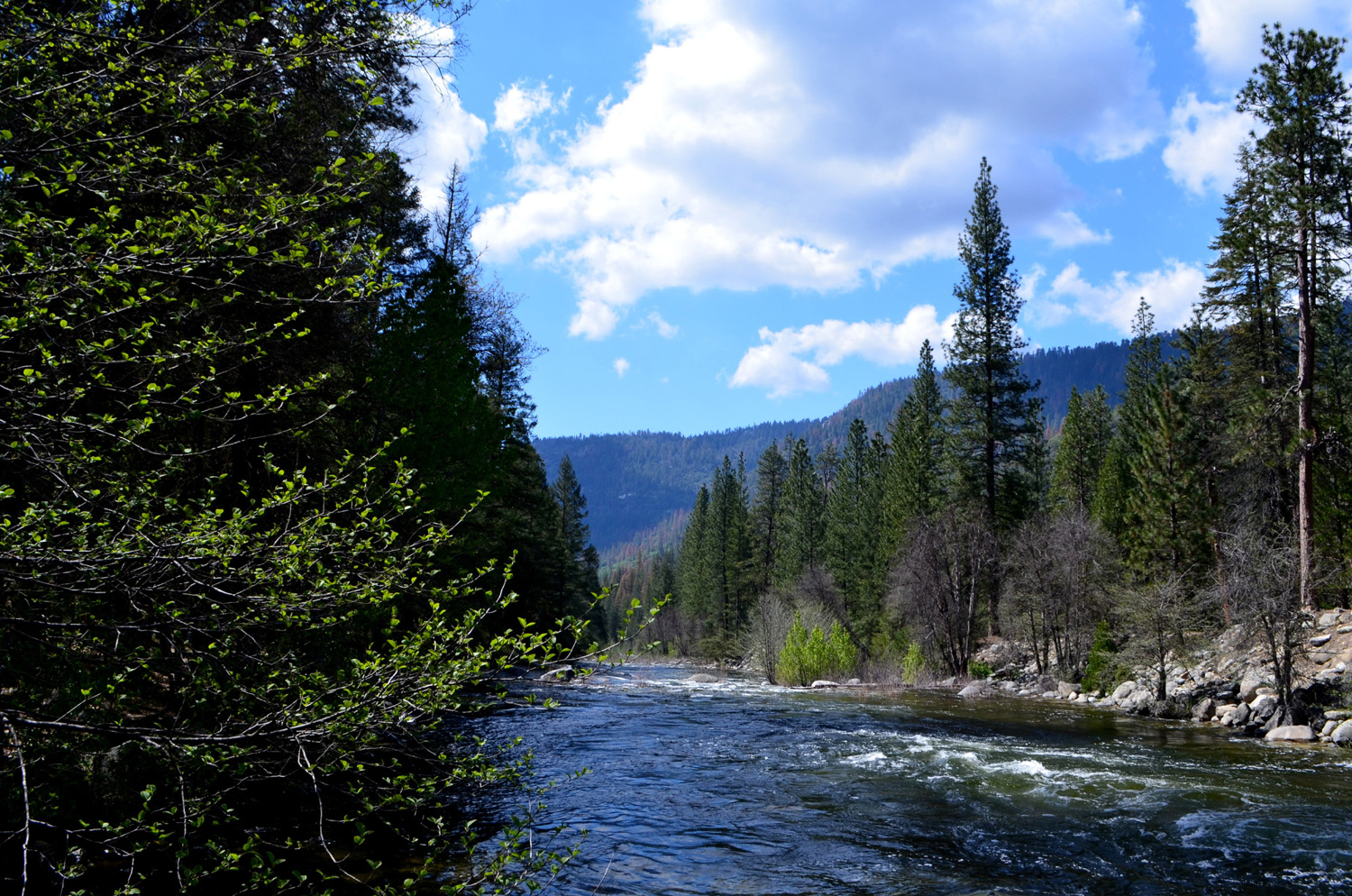
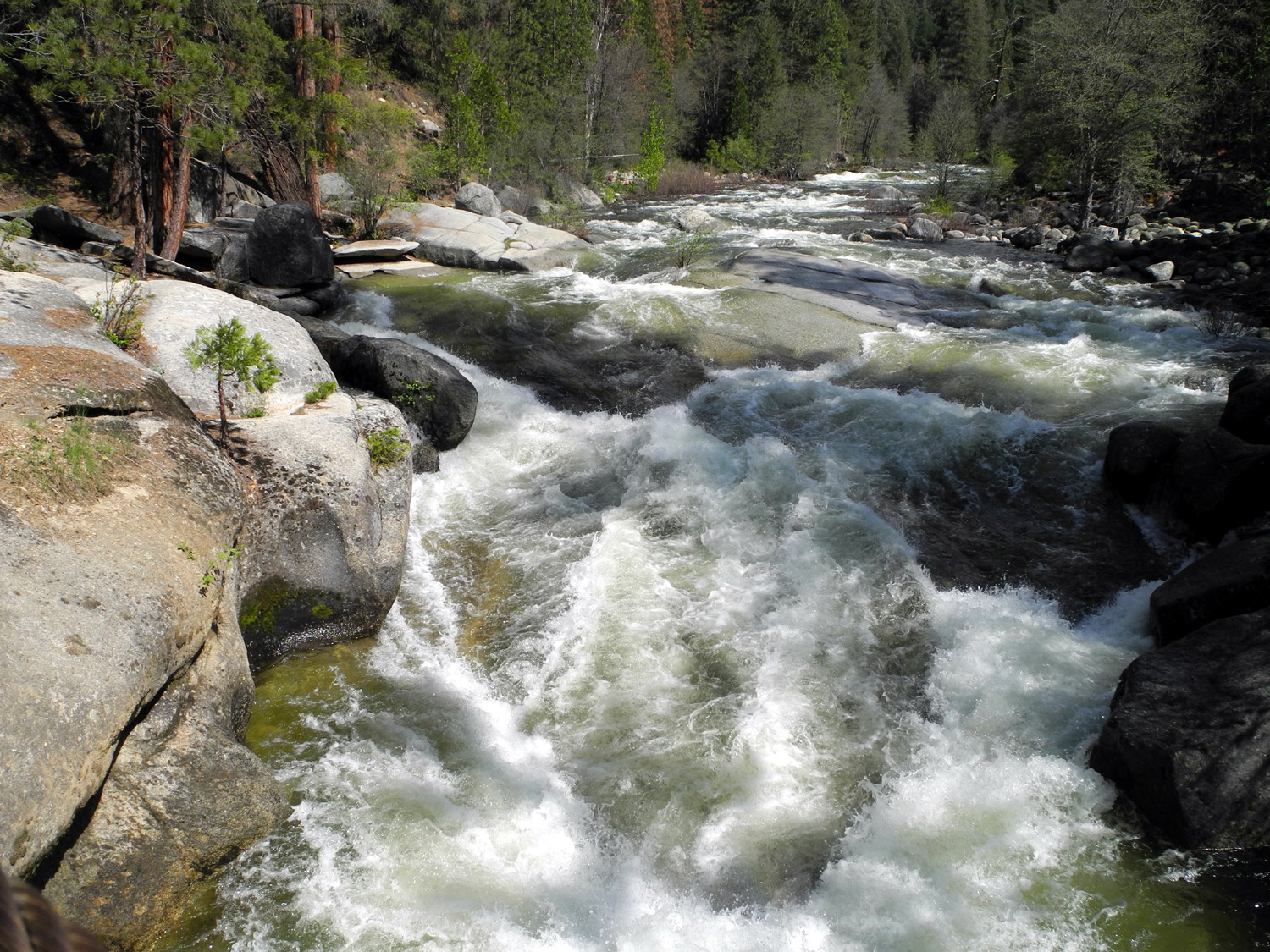
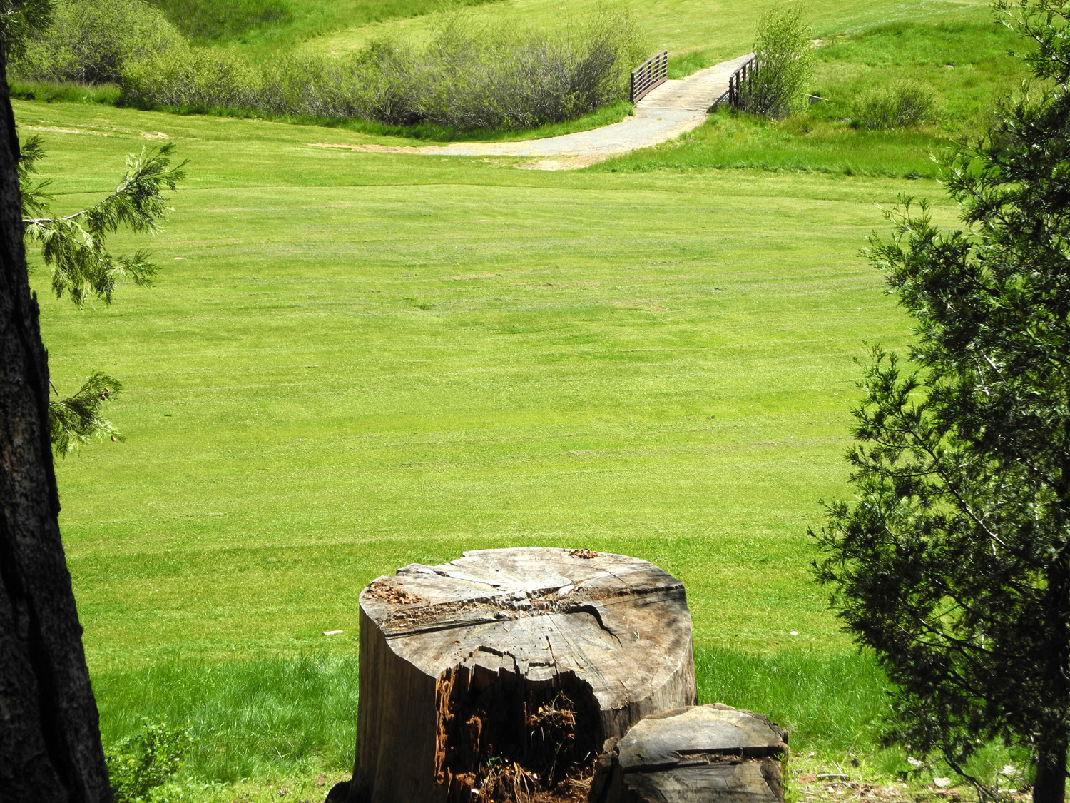
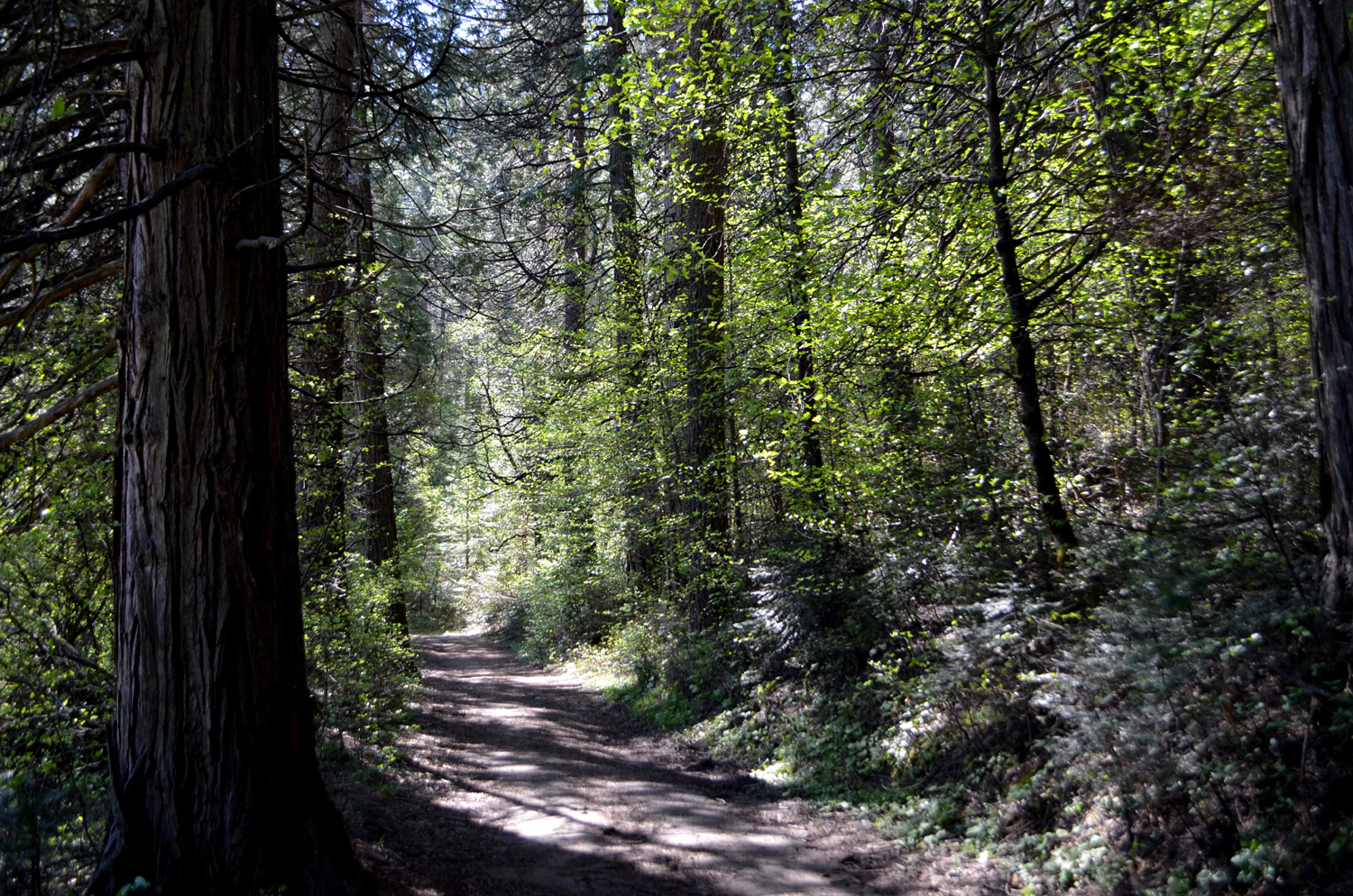
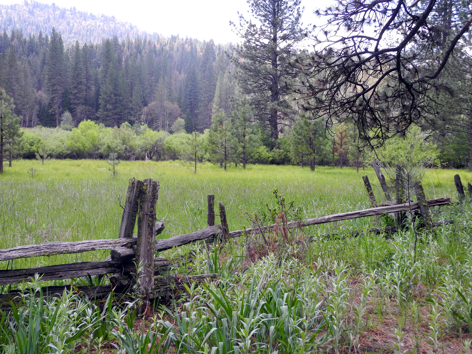
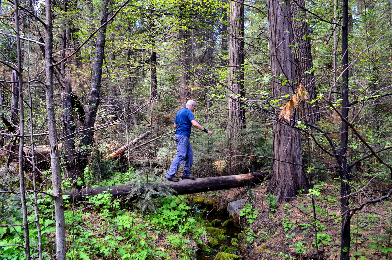
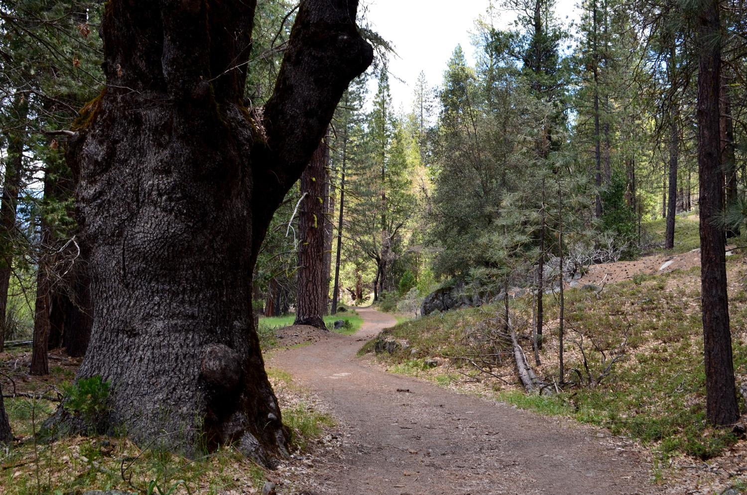
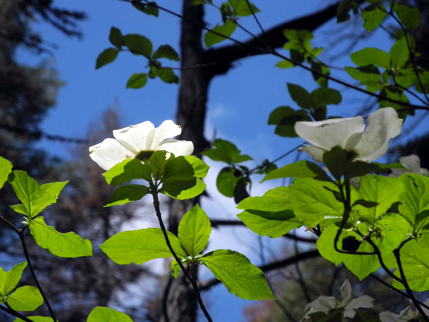
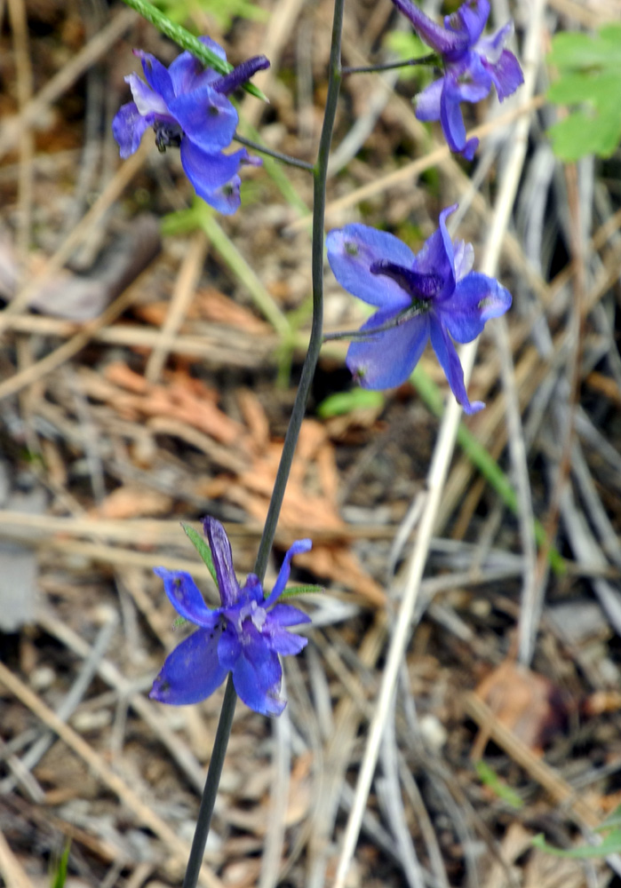
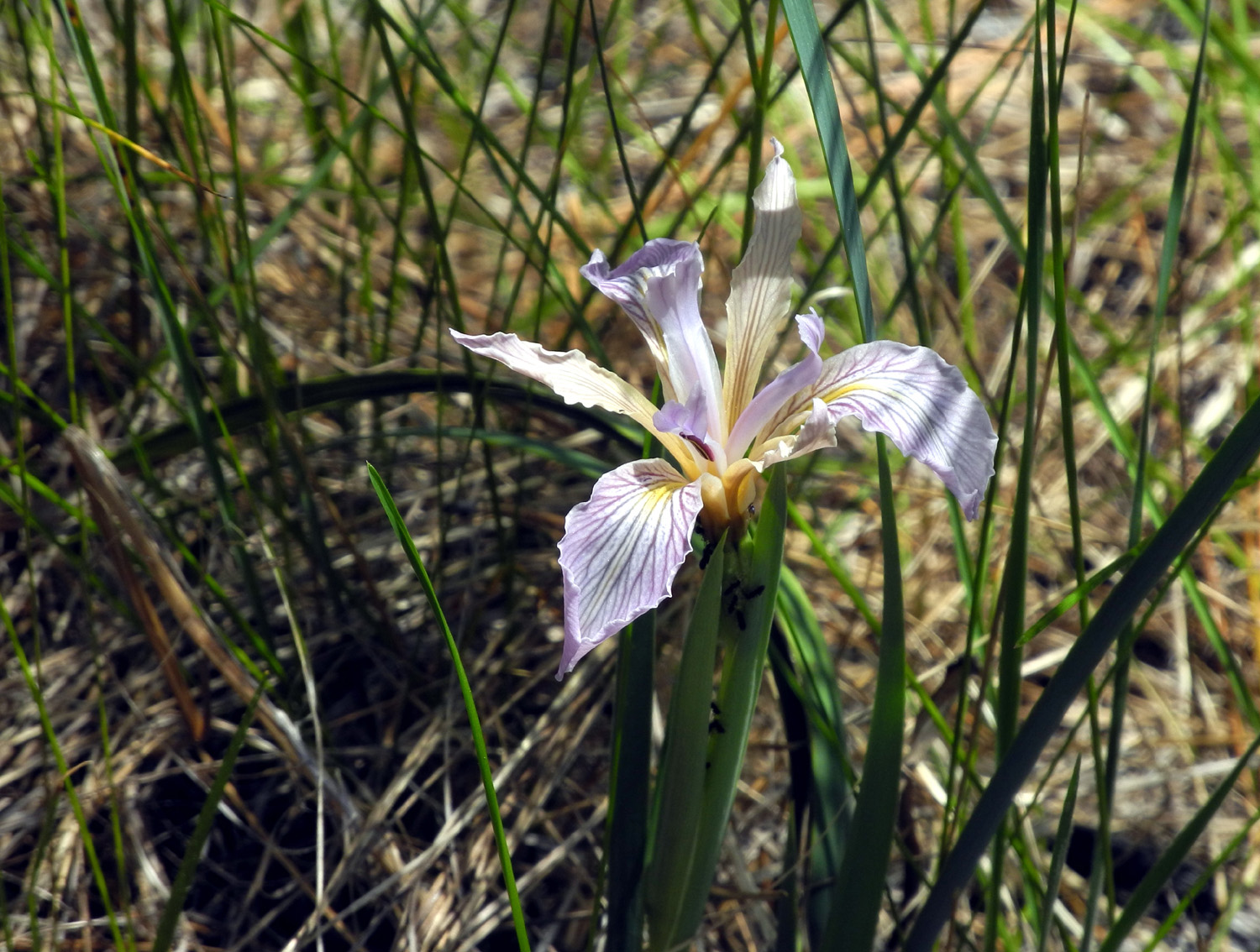
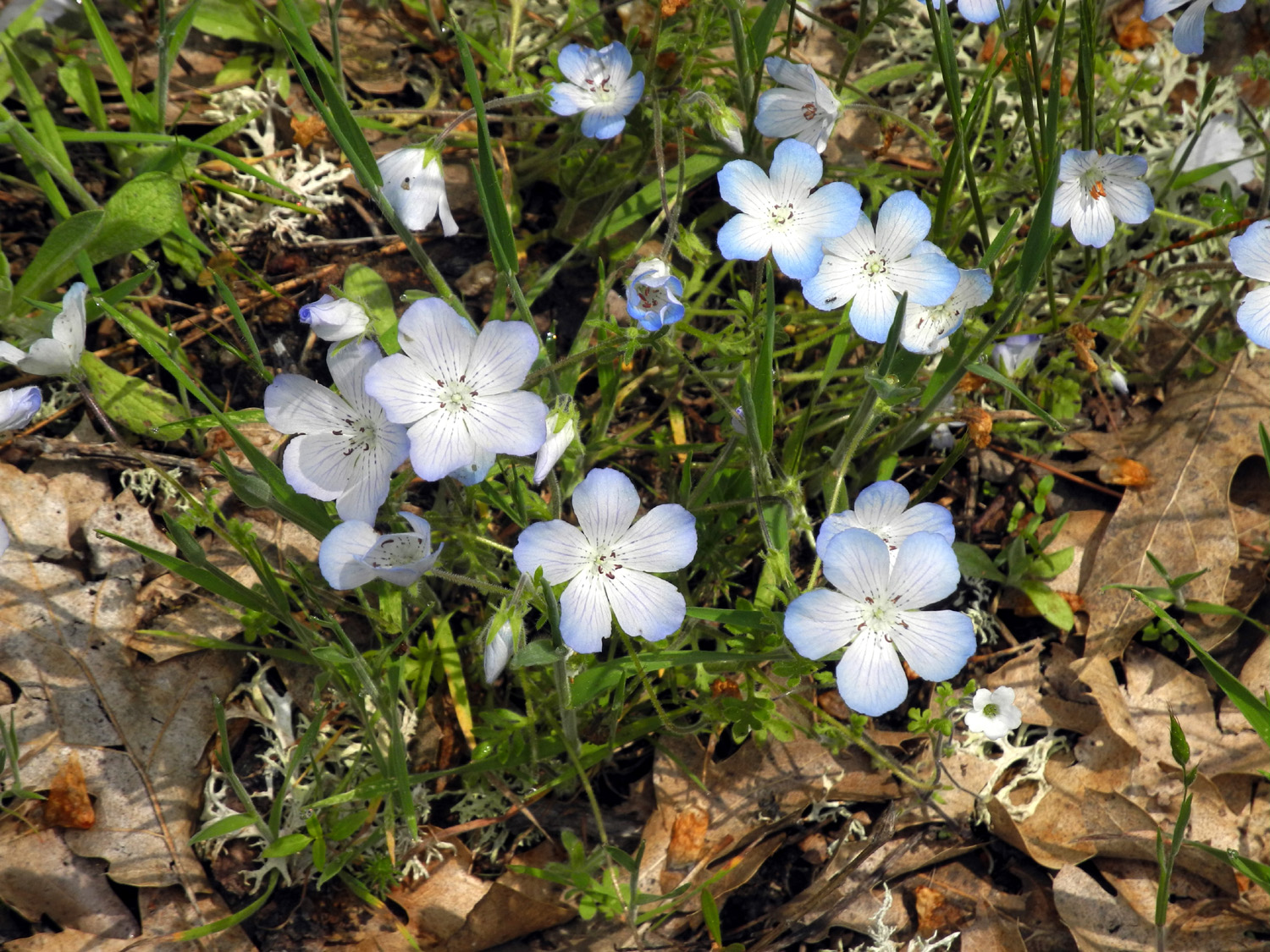
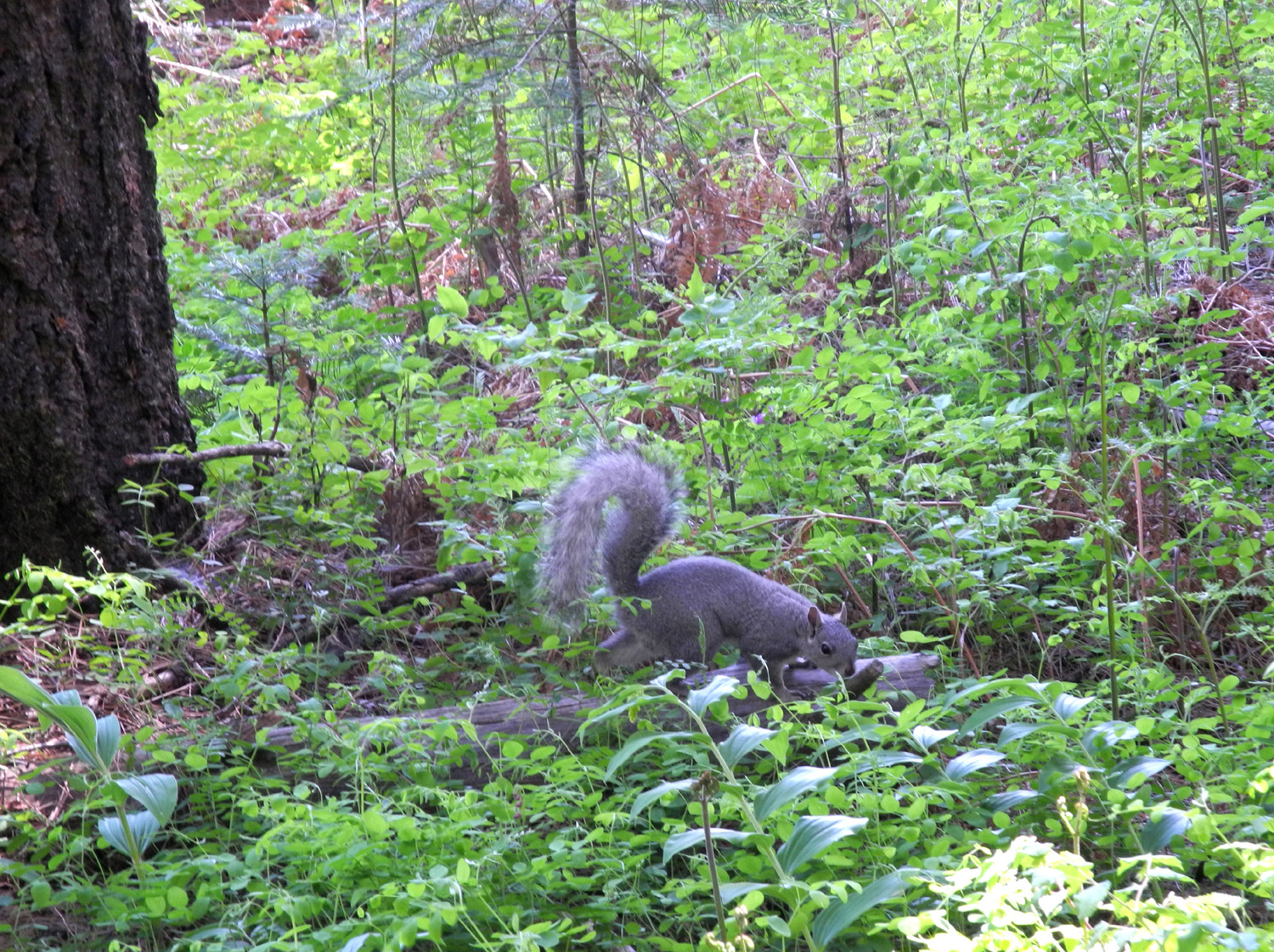
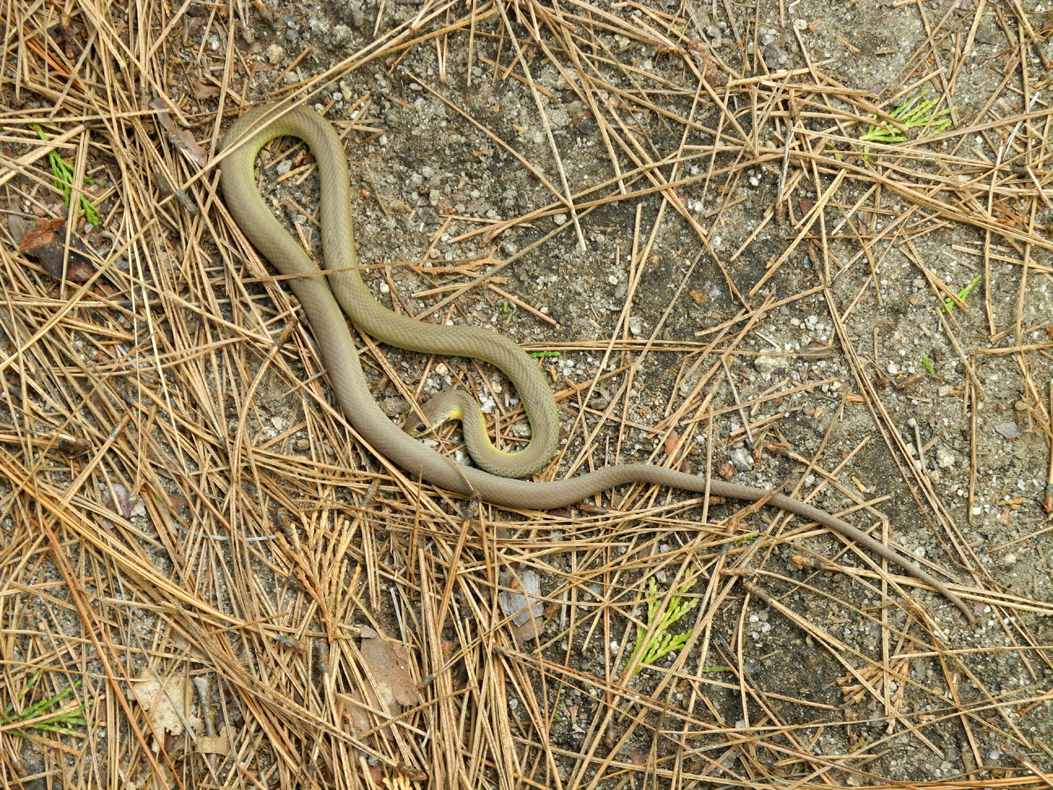
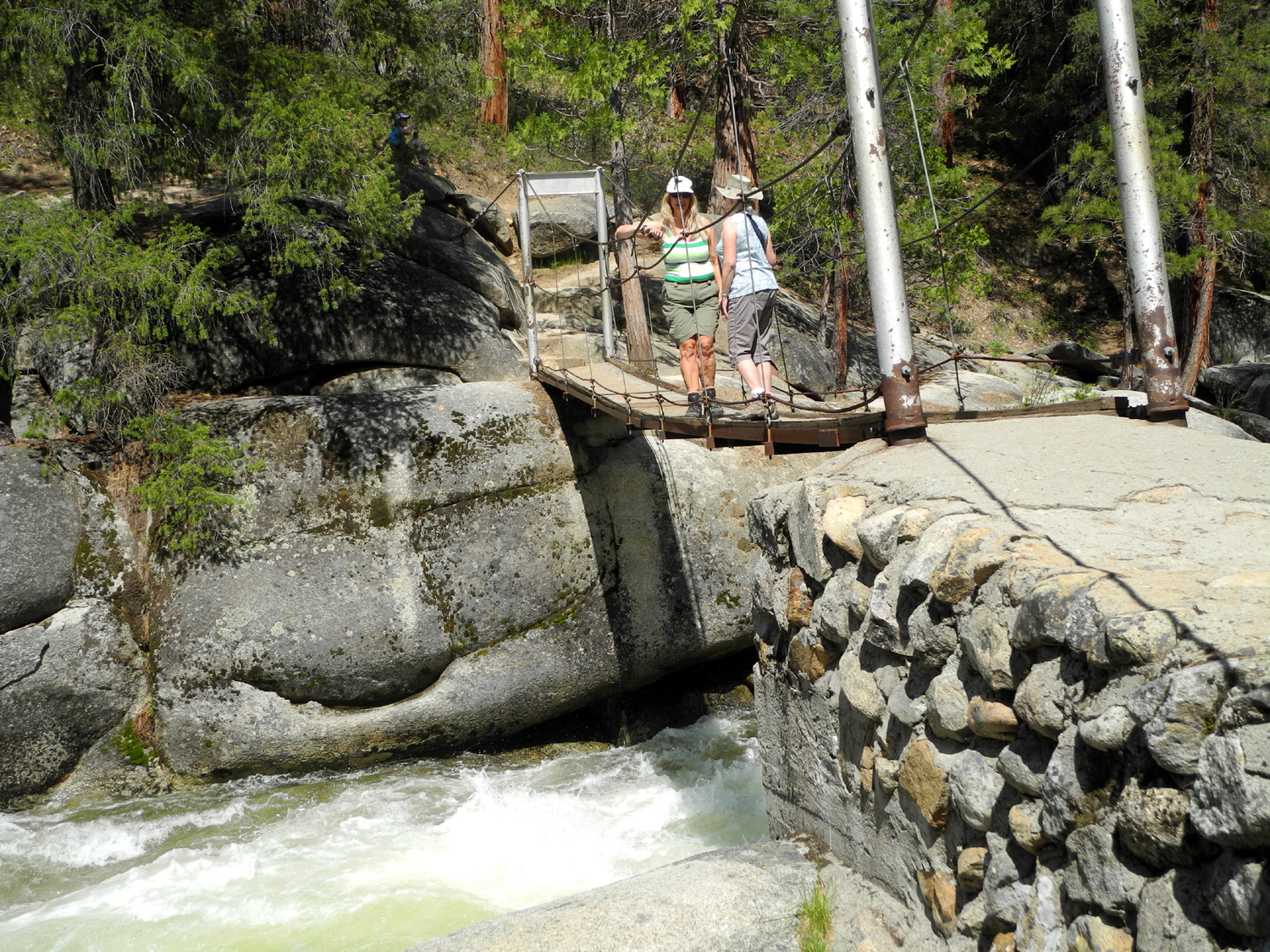
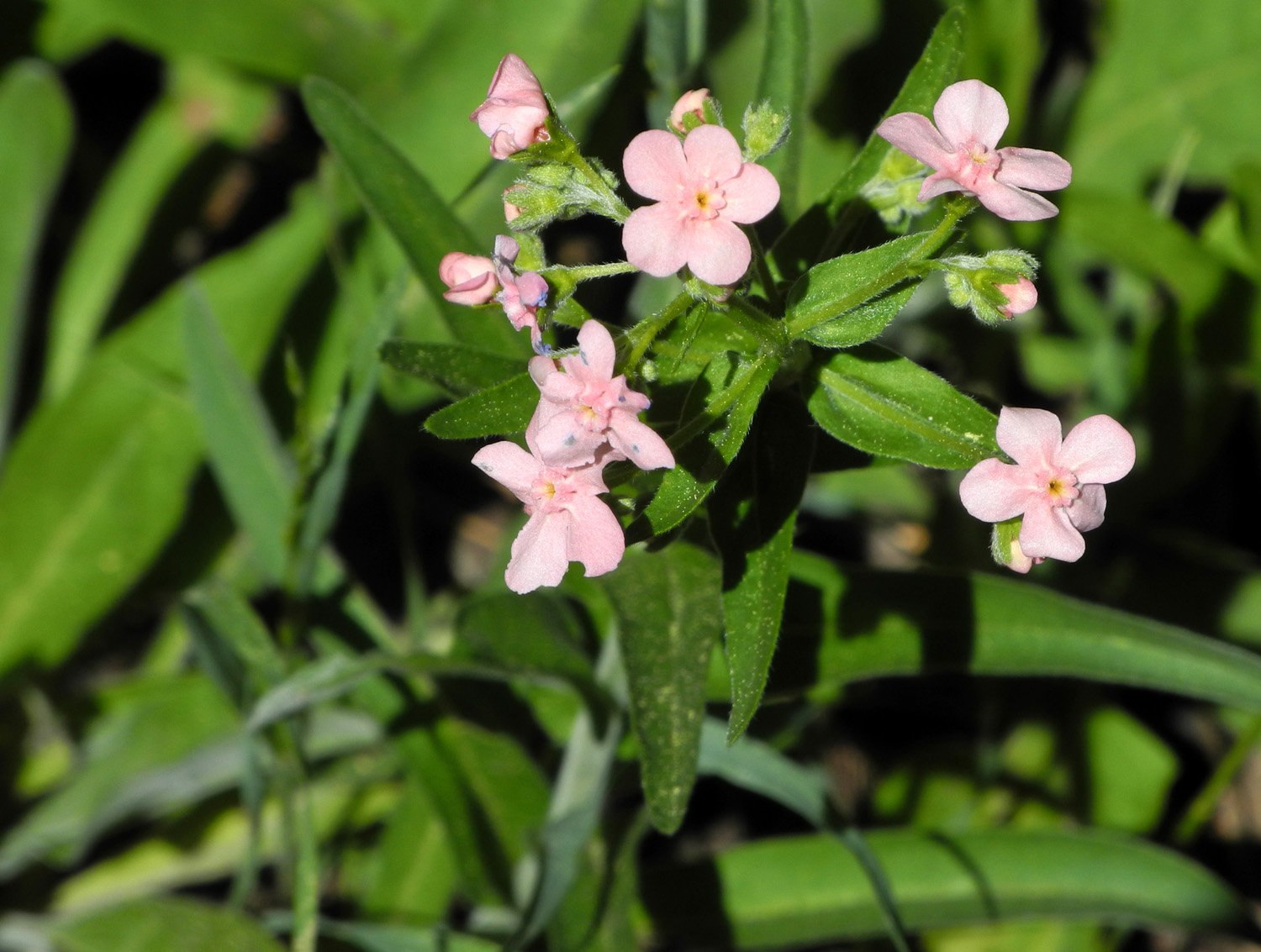
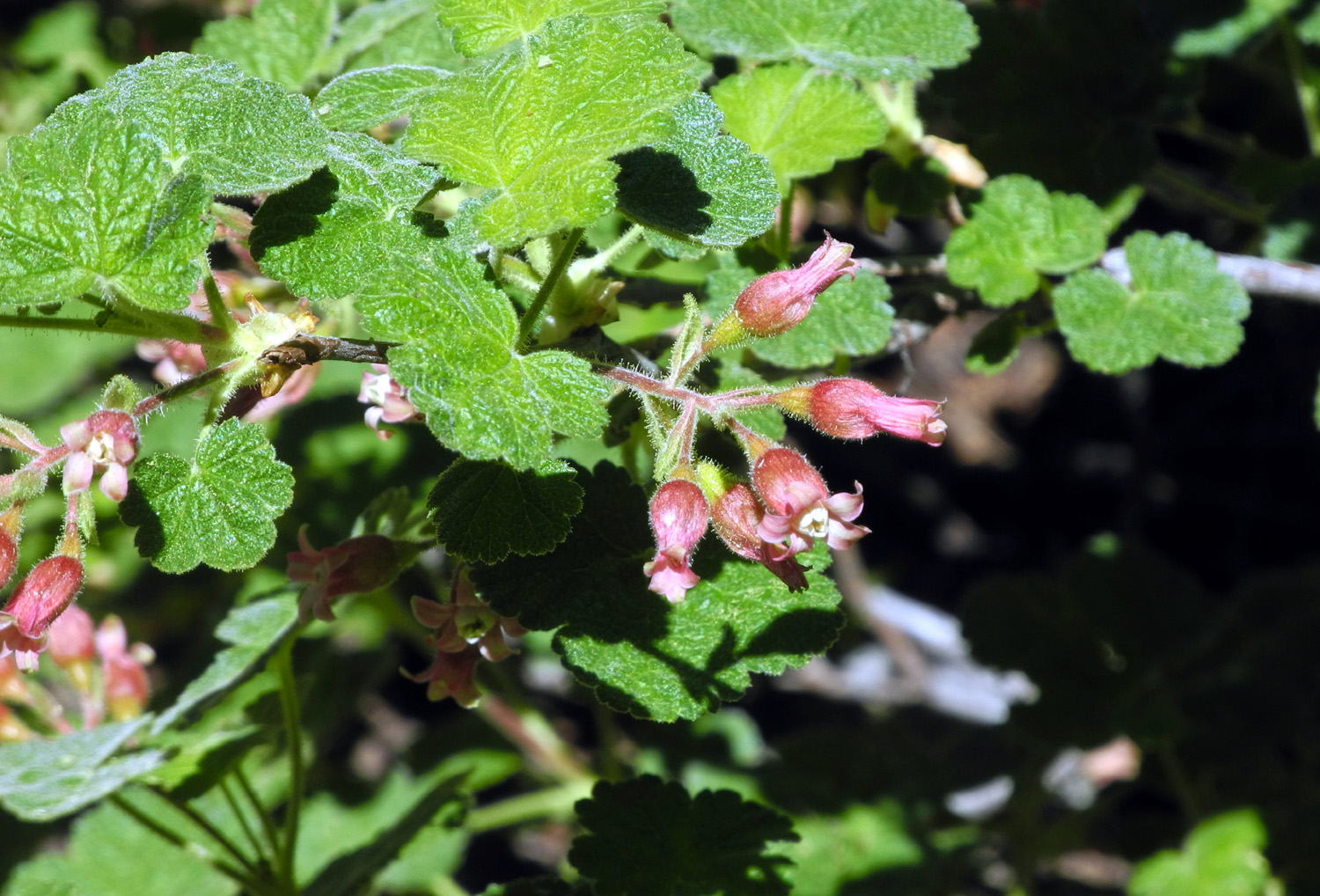
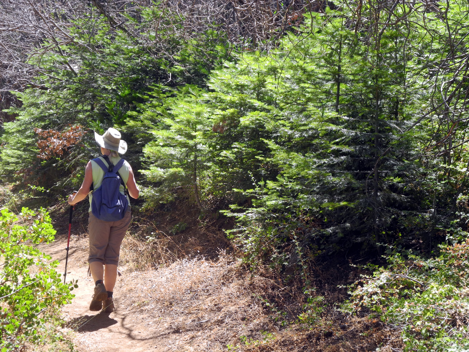
Wawona Meadow This outing consisted of two separate hikes - a long, LONG, LOOONG easy hike that became difficult at various points near the end for some of us, depending on our capabilities, and a short, easy hike that was hard for some of us because of the preceding LOOOONG hike. The Ramblers plus my daughter Teri gathered at Julie's house at 8 a.m. on May 10, and with Wes and Dick driving, headed north on State Highway 41. After 45 miles, we made a rest stop in Oakhurst, then continued on to Wawona in Yosemite National Park. Wes and I did two brief hikes here last year, including a short part of the Meadow Loop Trail. This time it was our goal to walk the entire 3.5 mile loop, and maybe try to take another walk to a nearby swinging bridge a short distance up the river from the highway . We parked in the big lot next to the historic Wawona Hotel, then crossed the highway to a path that runs past the north end of the golf course. Just beyond this very inappropriate facility, the official trail starts, with a sign giving the mileage as 3.5. The trail runs through the trees along the west side of the meadow, then loops around the upper (south) end of the meadow, and returns on the east side, crossing the highway some distance from the hotel. More about that later. Although the open, sunny meadow is in sight most of the way, the trail is shaded, with big cedars, fir and ponderosa pine. There are also lots of flowers. Perhaps the most common was wild strawberry, which we saw all along the trail. But were there any ripe berries for us to sample? Not a one! Actually it's just as well. The berries are edible and have a good flavor, but they are tiny, and it would take a half-dozen to make a decent teaspoonful. There are a number of small streams crossing the trail. The most scenic one had a log across it just upstream from our path, and it proved to be perfect for the traditional "Wes on the Log" photo. In addition to the large conifers, this is the perfect location for black oaks, and we saw some huge ones, along with many smaller trees and bushes. The dogwood trees were blooming, although not as spectacularly as we have seen in some areas on previous hikes. We saw a large variety of flowers, some of them fairly rare or unusual. These included wild iris, Indian pinks, yellow and blue violets, and a yellow flower that looks almost identical to violets but with much different foliage. (We later learned that these are Shelton's violet.) One unusual sighting was a field of baby blue eyes, which we did not recognize at first because they were almost white. We did not know if this was a natural variation, or if this may be what happens as they start to fade. There were a few specimens with the normal blue color. They were growing in a small meadow separate from the big one. Teri had hiked this trail a week earlier, and had claimed this spot as her own, so of course, we got a photo of her in what must now be called Teri's Meadow. We heard and saw birds all along the trail, and saw a lively gray squirrel who kindly posed for us. We also came across a dead brown snake in the trail who looked to be alive except for the complete lack of movement, even when nudged with the toe of a boot. As the trail neared the road crossing, we spotted a nice place for a group photo at the edge of the meadow, so Wes set up his tripod and we recorded our presence for the enlightenment of future generations. Around this time several of us began to think it was time for the hike to end. Wes and Teri could have continued for another two miles, but Julie, Carolyn and I all reached our limit at different times during the final half mile or so. Where the trail crosses the road, there is another sign, also describing it as a 3.5 mile hike. However, it was at least another quarter mile from this spot back to the parking lot. When we reached the cars and I checked the hiking app on my phone, we had actually walked 4.15 miles. The usual Ramblers hike is two miles or less, so even with the mostly level terrain, this was an extra workout for some of us. Perhaps you picture the Ramblers walking in a tight group, all together, but this is not really the case. Because there are times when each of us walks slower or faster, and because Wes and I stop a lot to take photos, we get spread out, and can be found in groups of two and three. The groups are not the same all the time; one person will fall behind, then catch up and form a new "alliance" with whoever was farthest back. Thus we all spend time with each of the other hikers, with the groupings changing a number of times during a hike. At the cars, we took off our packs and stretched for a few minutes, before going into the restaurant. After a short wait, the host was able to accommodate our request for a table by the window, and we had an excellent lunch while enjoying the view of the huge lawn, beautiful trees, and fellow tourists coming and going. Wawona is more than just the hotel and restaurant. There is an art gallery/gift shop, a gas station, a couple of stores, and a residential area. The South Fork of the Merced River crosses the highway here, and roads run parallel to the river on both sides, heading east from the highway. Along one road is the Pioneer History Center, with an open air shed where some old wagons and buggies are displayed. Nearby is a covered bridge across the river, built by Galen Clark and covered by the Washburn family in the late 1800s to remind them of their home back east. Teri was here some time ago, noticed that road, wondered where it went, and decided to follow it (I like to think I taught her that). At the end of the road was a trail, and a little less than half a mile up the trail, there was a swinging bridge across the river. None of us had been aware that this existed. After lunch we decided to visit the bridge, and drove up to the parking area. The trail is fairly level and goes through beautiful country along the river, although after our earlier hike, that short distance seemed long to some of us. We reached the bridge, walked across it, photographed each other on it, and were awed by the amazing amount of water pouring down the river, which had been a mere trickle for the last year or two. Teri had been there a week earlier, and thought that the water was a bit higher this time. (Video of the South Fork here. Depending on your computer and browser, this may be sent to the Download folder on your computer. Be patient; it may take a minute to download.) We had also considered doing the short hike to Corlieu Falls, on a trail that starts a few miles above Oakhurst. However, it was already 4 p.m. when we left the bridge, and some of us had other obligations in the evening, so we said our goodbyes, and headed for home, with Carolyn riding with Teri and me, and Julie accompanying Wes. Our two hikes added up to more than five miles, so we were all tired, but also were looking forward to our June hike. As usual, Wes sent out an email that evening that summarized the day perfectly: What a day! We enjoyed two rather different hikes in Wawona separated by a great lunch at the Lodge. We spent most of our time on the 4-mile trail that circumnavigates the golf course and meadows. It's the season for dogwood, offering us a visual feast of those flowering white beauties. I stopped frequently, but Dick stopped even more. Our goal was not to complete the hike but to be "overwhelmed" by the natural setting. And we were. We took the law into our own hands, tiptoeing into one of those meadows for a group photo. For an encore, we drove to one of the far corners of Wawona for a short walk to the Wawona Swinging Bridge. It was a full sensory experience with the sight and sounds of rushing water and the kinesthetic feeling of a rocking bridge. It was way too much fun! PS: Due to the greed of the prior concessionaire and the laxity of the park service, the Wawona Hotel is officially known as Big Trees Lodge. Those of us who grew up in the area will never speak that name, and there is legal action under way to remedy this travesty. (Eventually an agreement was reached to restore this and other historic names in Yosemite National Park.)
|
||
|
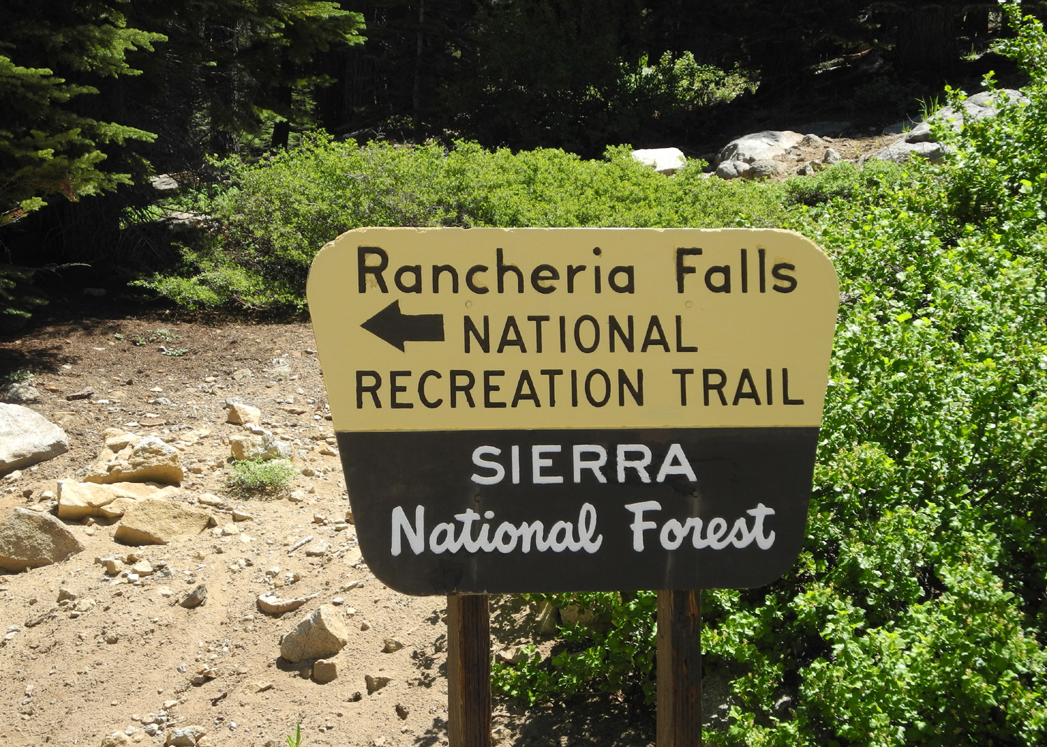
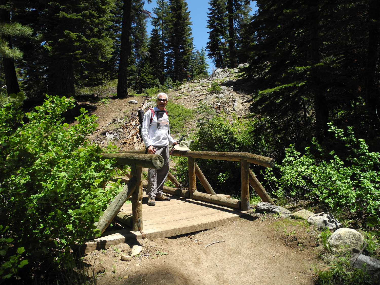
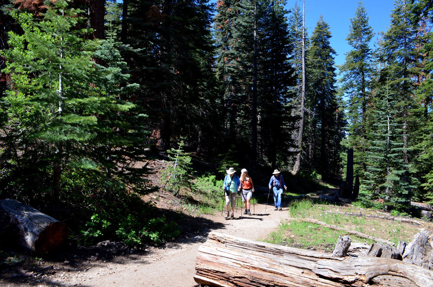
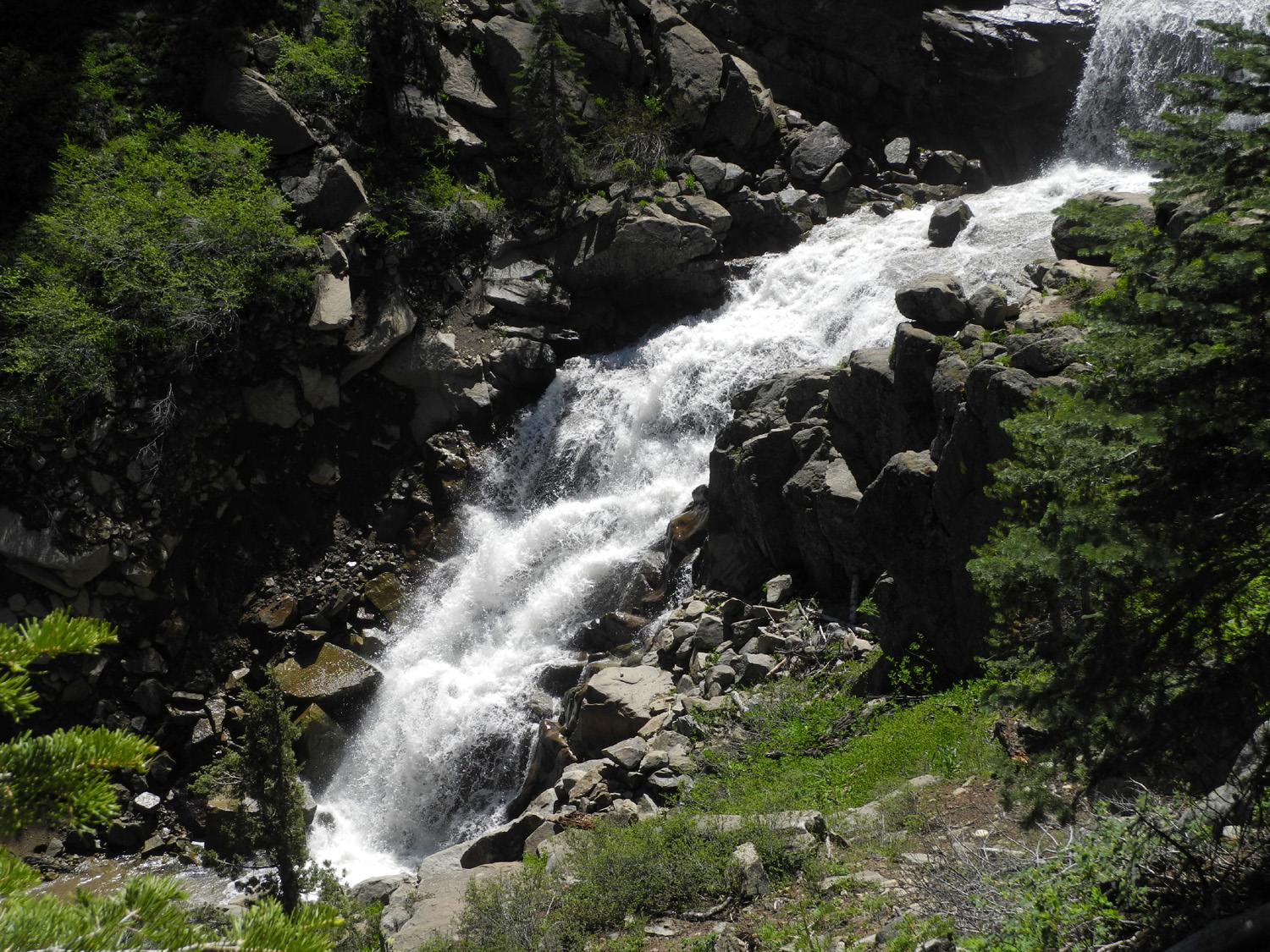
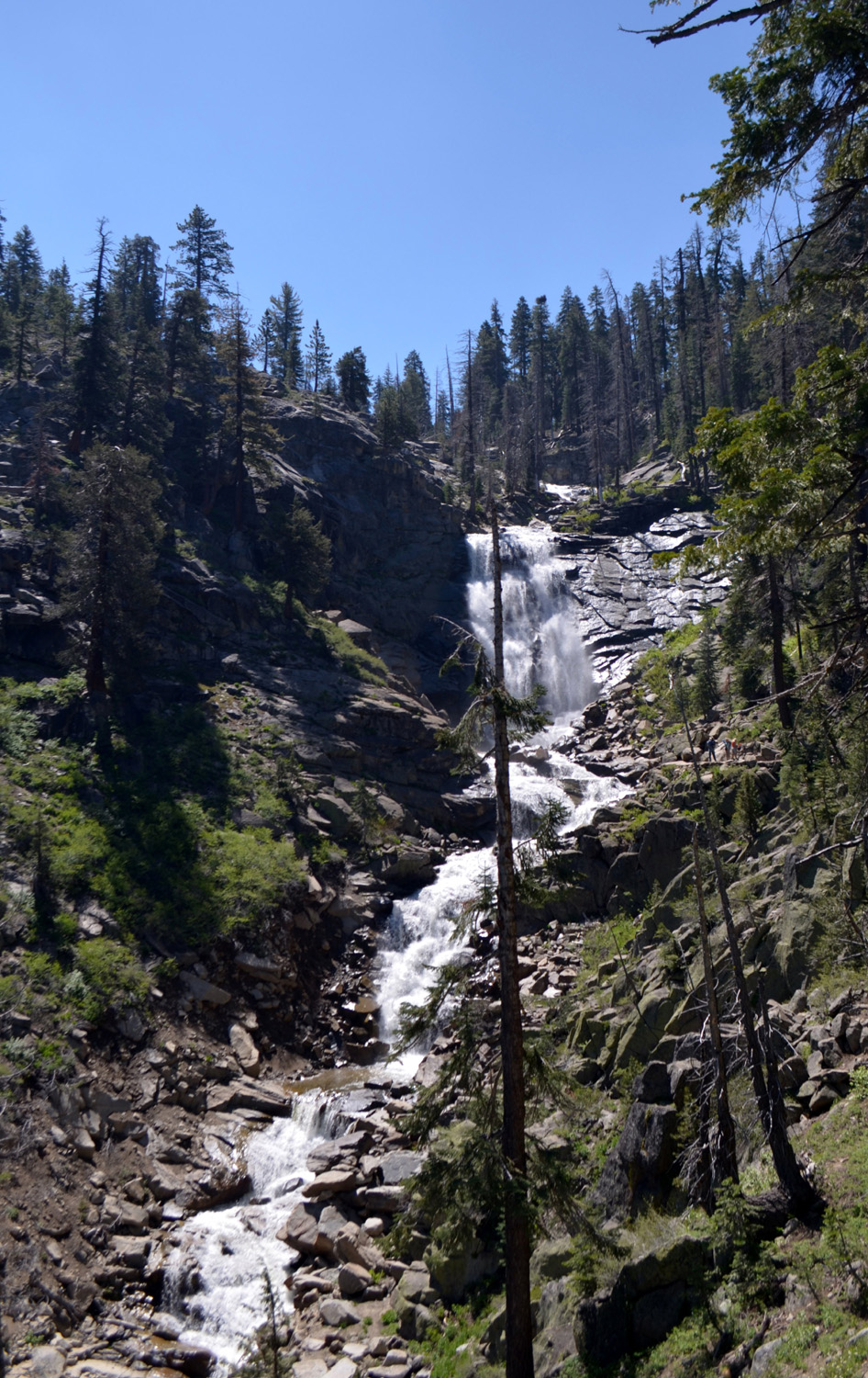
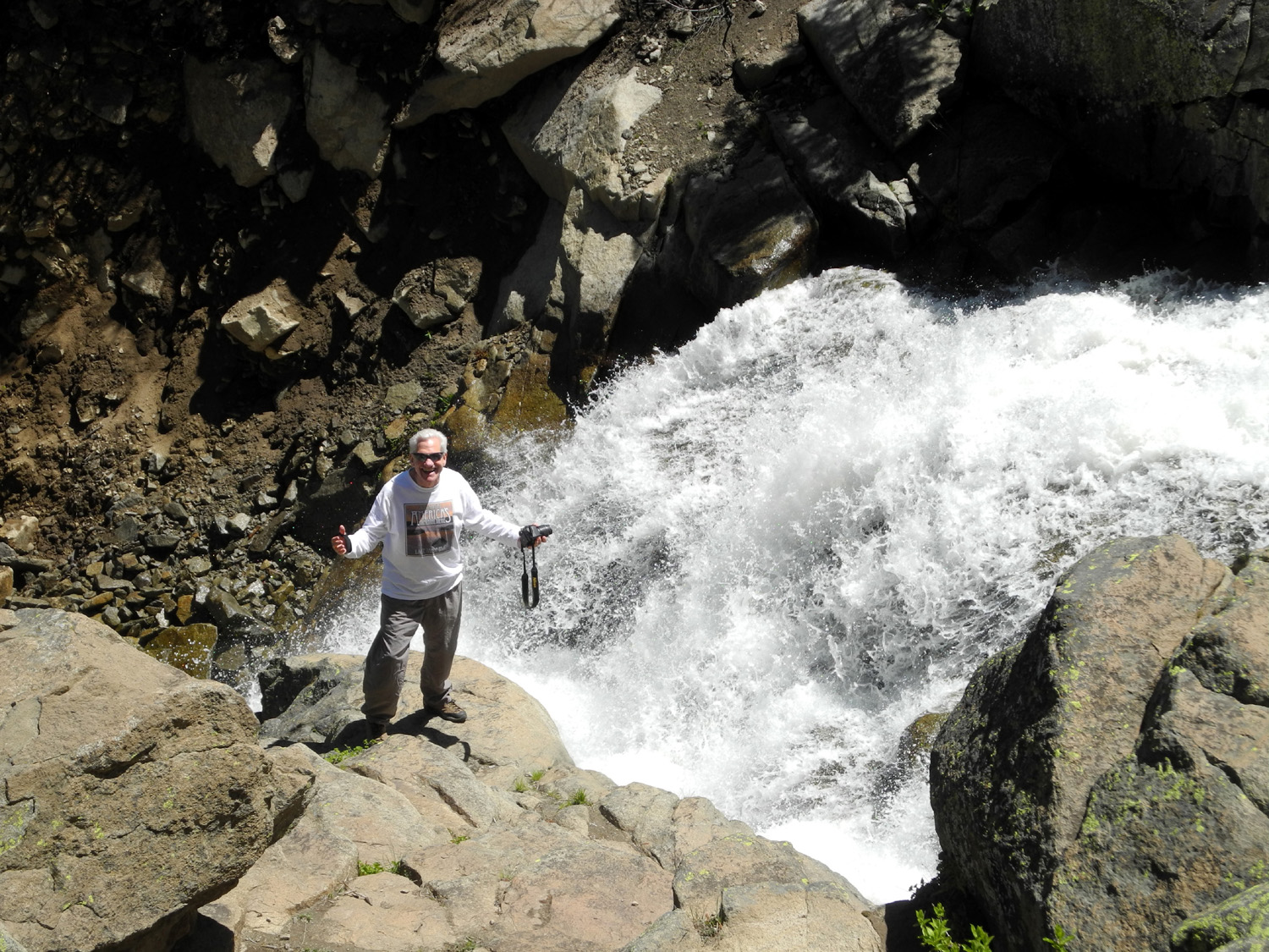
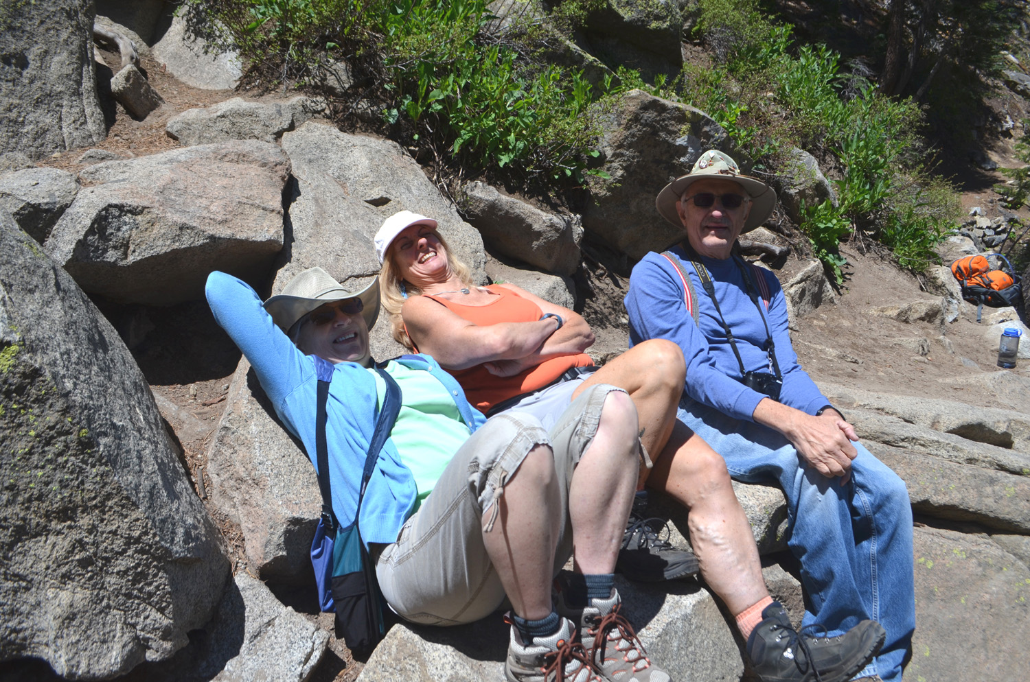
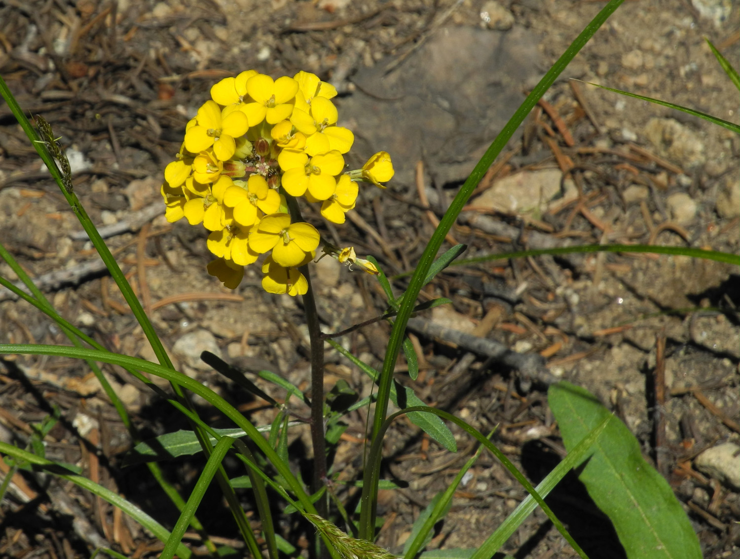
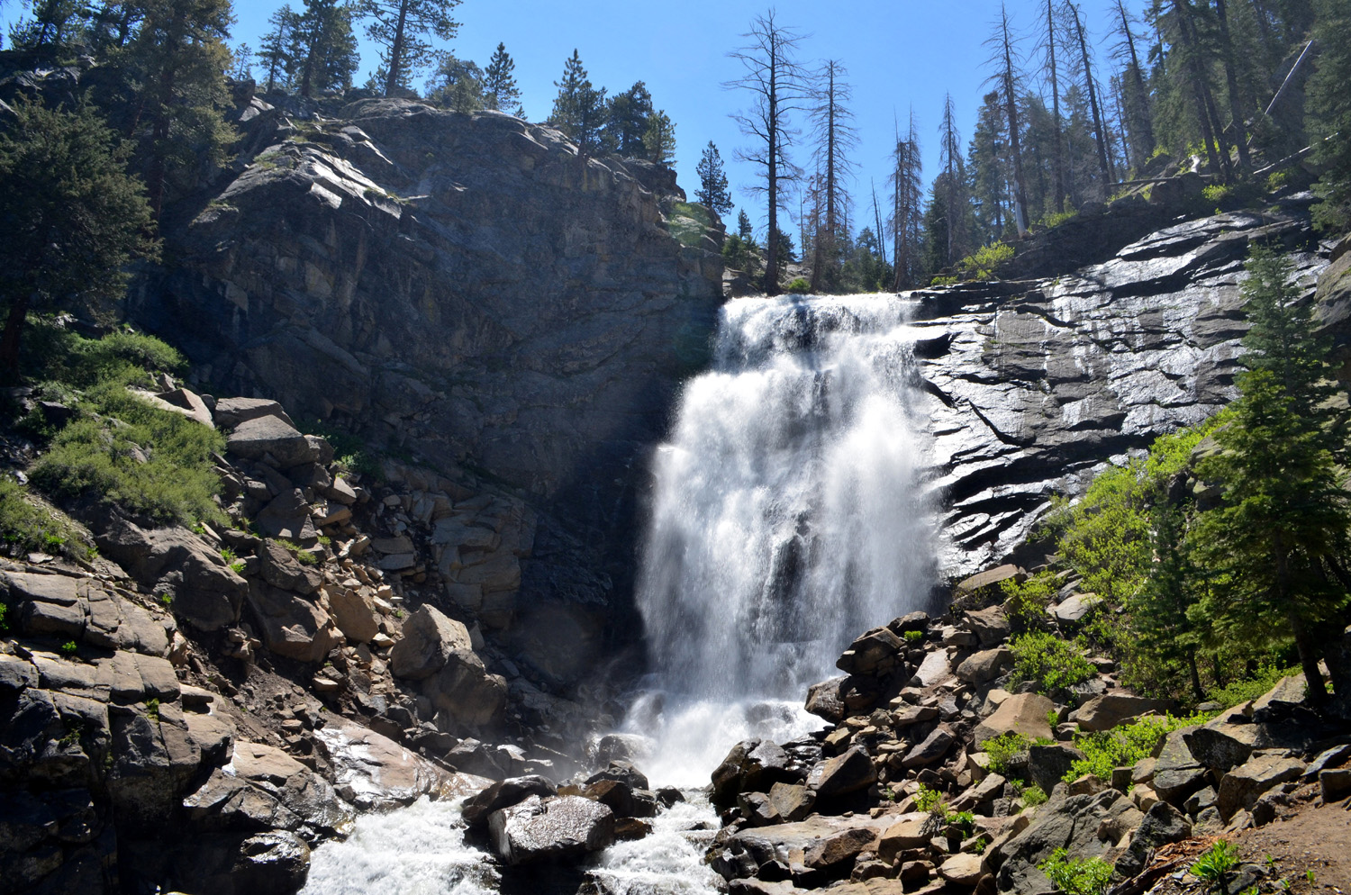
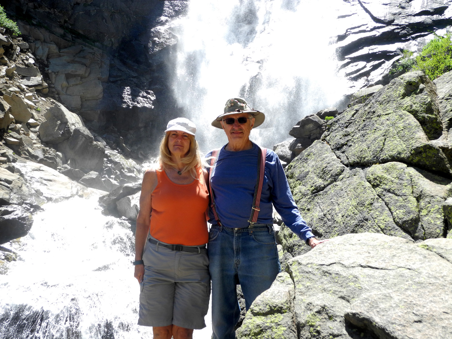
Rancheria Falls: Julie was absent for the Ramblers' June 15 hike, but we did not feel sorry for her. She was traveling across the upper middle of the country, including stops at Mt. Rushmore, Wyoming, Minnesota, Iowa and Missouri. She was joined by her daughter and and a friend that we all worked with, as well as another couple who were traveling separately but meeting up occasionally. When we left my house at 8:15 a.m., we still had a full car, with my daughter Teri able to join us. She was the only one of us who had made this hike before, but it was many years ago, so it was almost like new for her. After several days with temperatures well above 100 degrees, we were enjoying a cool spell, with highs in the low 80s at home. This meant that our hiking area above 7,000 feet would be 60 degrees or less, which turned out to be perfect weather. Our destination was Rancheria Falls near Huntington Lake. Our route took us up Auberry Road to the foothill community of Prather where we joined Highway 168, leading up into the higher mountains and the Sierra National Forest. The road goes past Shaver Lake, and reaches Huntington after a total drive of about 70 miles. Here there is a one-mile dirt road to the trailhead at 7,500 feet. We were the second party to arrive, and got on the trail a little after ten. The hike was fairly steep at the start, but soon turned to a gentle climb up to 7,780 feet. Then we dropped down into the canyon of Rancheria Creek, and after less than a mile we arrived at the falls. There is a good flow in the creek, and the main falls drops about 150 feet, with rushing water going over a series of cascades above and below. It was a very impressive falls, and we all agreed that we had walked farther to see lesser sights. I would consider it the best small waterfall I have seen. Just in case the duplication of place names throughout the Sierra is not confusing enough, there is a Rancheria Falls near Hetch Hetchy Reservoir in Yosemite National Park, and another not far away in the canyon of the North Fork of the Kings River. Also on one trail web site the falls we visited is described as being "near Shaver Lake," which is a bit misleading since the trail starts right across the road from Huntington Lake. The falls is partially visible from the Kaiser Pass Road across the canyon, but that distant view does not even begin to provide the dramatic experience we enjoyed as we stood close enough to feel the mist. Three young men had gone past the end of the trail and climbed up the rocks to one side, about half way up the height of the falls. This is not recommended, but they were obviously in shape and capable and made it back down without incident. Never one to be outdone, Wes made his way DOWN into the canyon a short distance below the trail to get some photos from a different angle. The pictures of him probably make it look more dangerous than it actually was, but his hiking companions always worry about these adventurous excursions. After all, he has the car keys in his pocket! As usual, we saw a number of flowers along the trail. The most common was a bush with reddish bud-like flowers and somewhat rounded leaves an inch and a half across. Another frequent flower I recognized from previous research as scarlet gilia. We stayed at the falls for at least a half hour, enjoying the dramatic view of falling water. Teri had brought her famous homemade energy bars, a combination of cocoa, dates, walnuts, peanut butter, oats and flax seed, making for a high-protein snack. We had all enjoyed these in the past, and they were consumed eagerly and with gratitude. Finally we made the short hike back to the parking lot, meeting many people coming in who didn't get an early start like we did. As welcome as Teri's snack bars were, we were soon in need of something more substantial, so we stopped at one of our favorite after-hiking spots, Velasco's Mexican Restaurant in Prather. This business has moved from an old wooden building into the former Foster's Freeze location, with more room and the same great food. The place was virtually full when we arrived just before 3 p.m., but was nearly empty when we finished eating and started for home. The word "rancheria" appears all over the map in the Sierra, being applied to at least three waterfalls, who knows how many creeks, and various meadows, roads, and other features. It is also used in connection with several local Native American groups, in particular the Table Mountain Rancheria and Big Sandy Rancheria in Fresno County. I did some research and found the following definition: "A small settlement often consisting of huts occupied especially by Amerindians or Mexicans." It is a standard designation for Indian tribes of California. Wes gets the final word: It's amazing to see and feel the power of water! It's loud, swift and breathtaking. Today the Ramblers trekked a short distance to Rancheria Falls above Huntington Lake. It was a pleasant stroll through white fir trees in the cool of the morning. As the trail rounded south we first heard it and then saw the tremendous force of water being pulled down by gravity to a lower place. It was amazing!
|
||
|
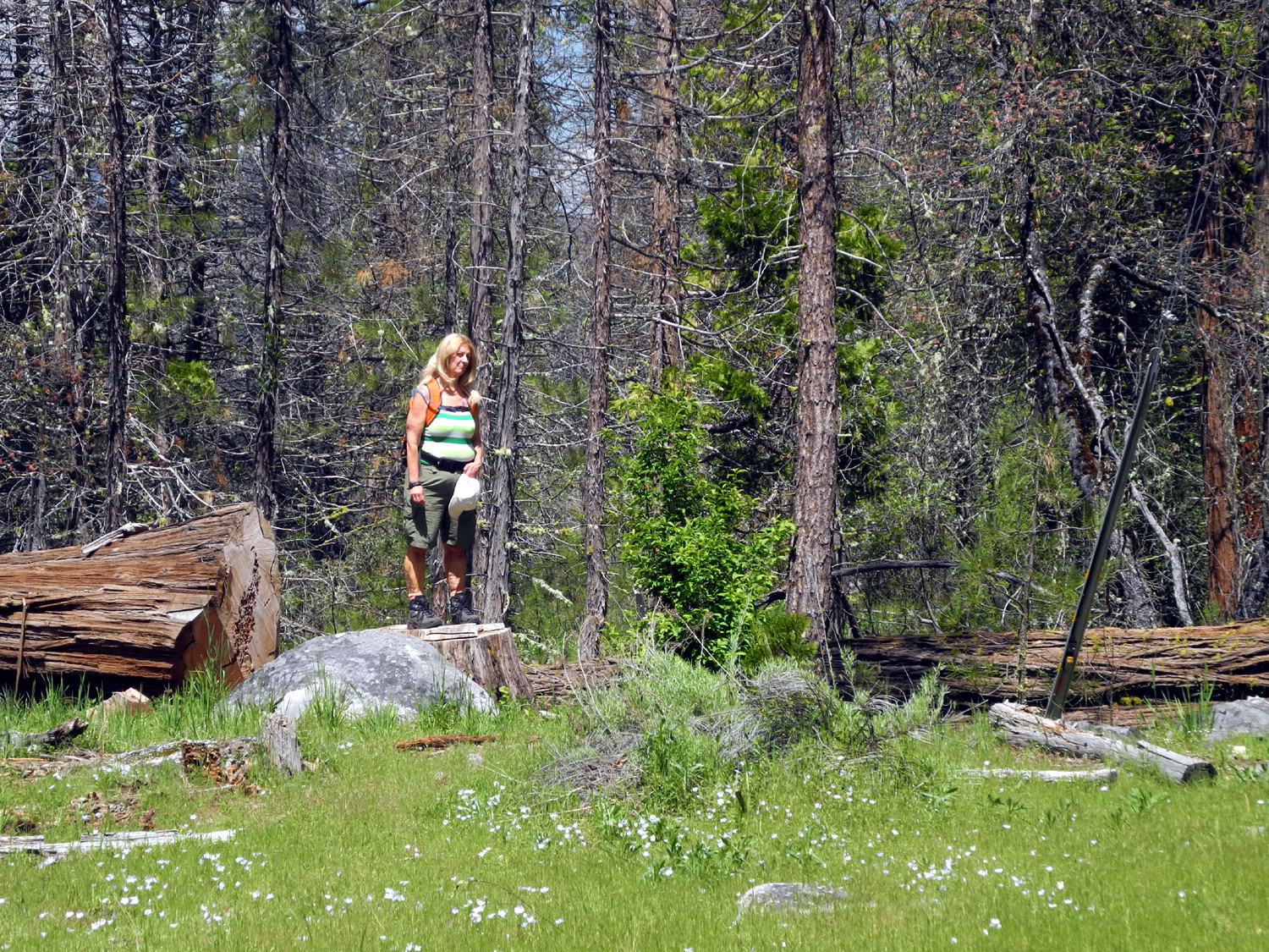
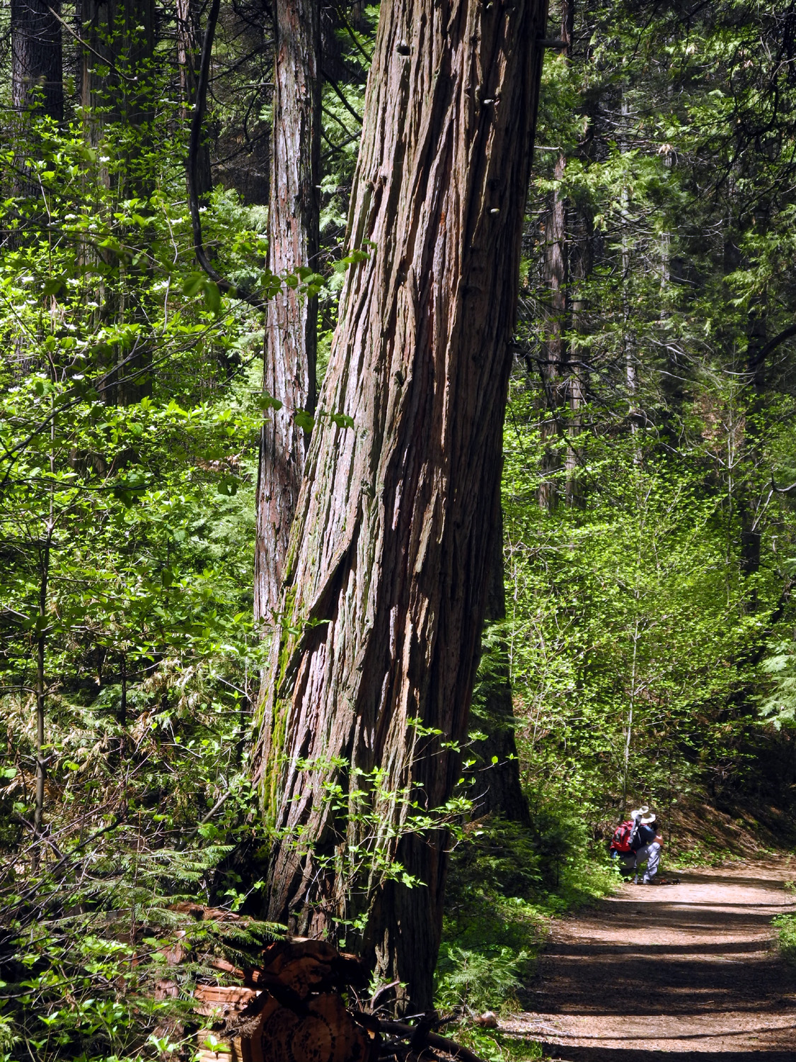
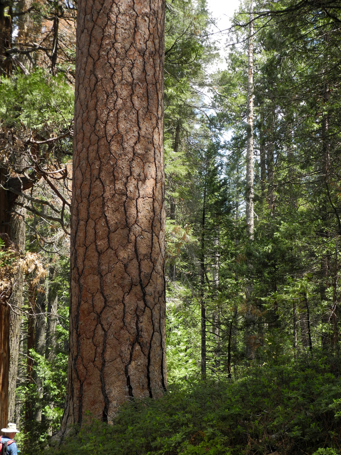
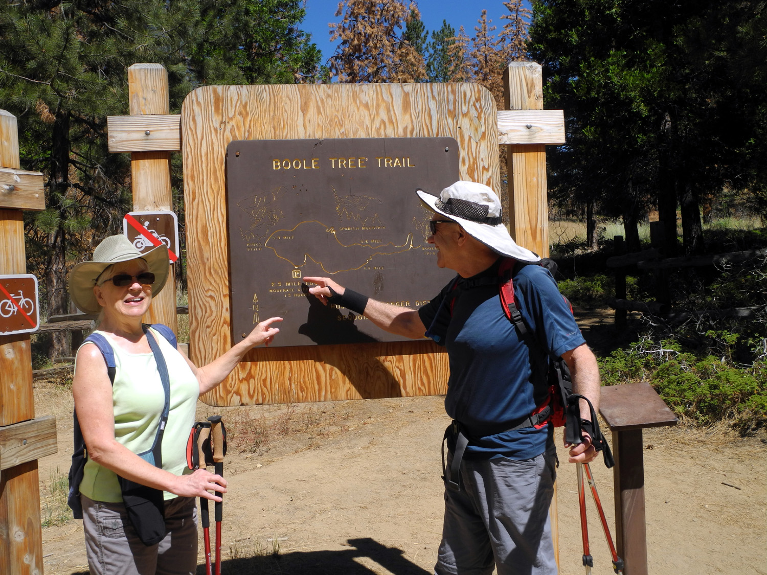
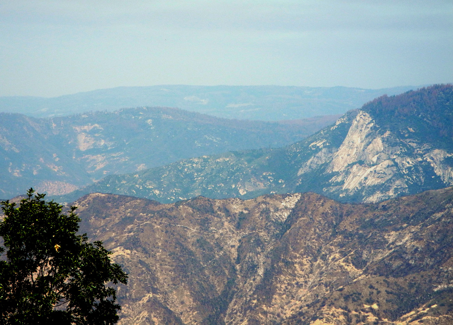
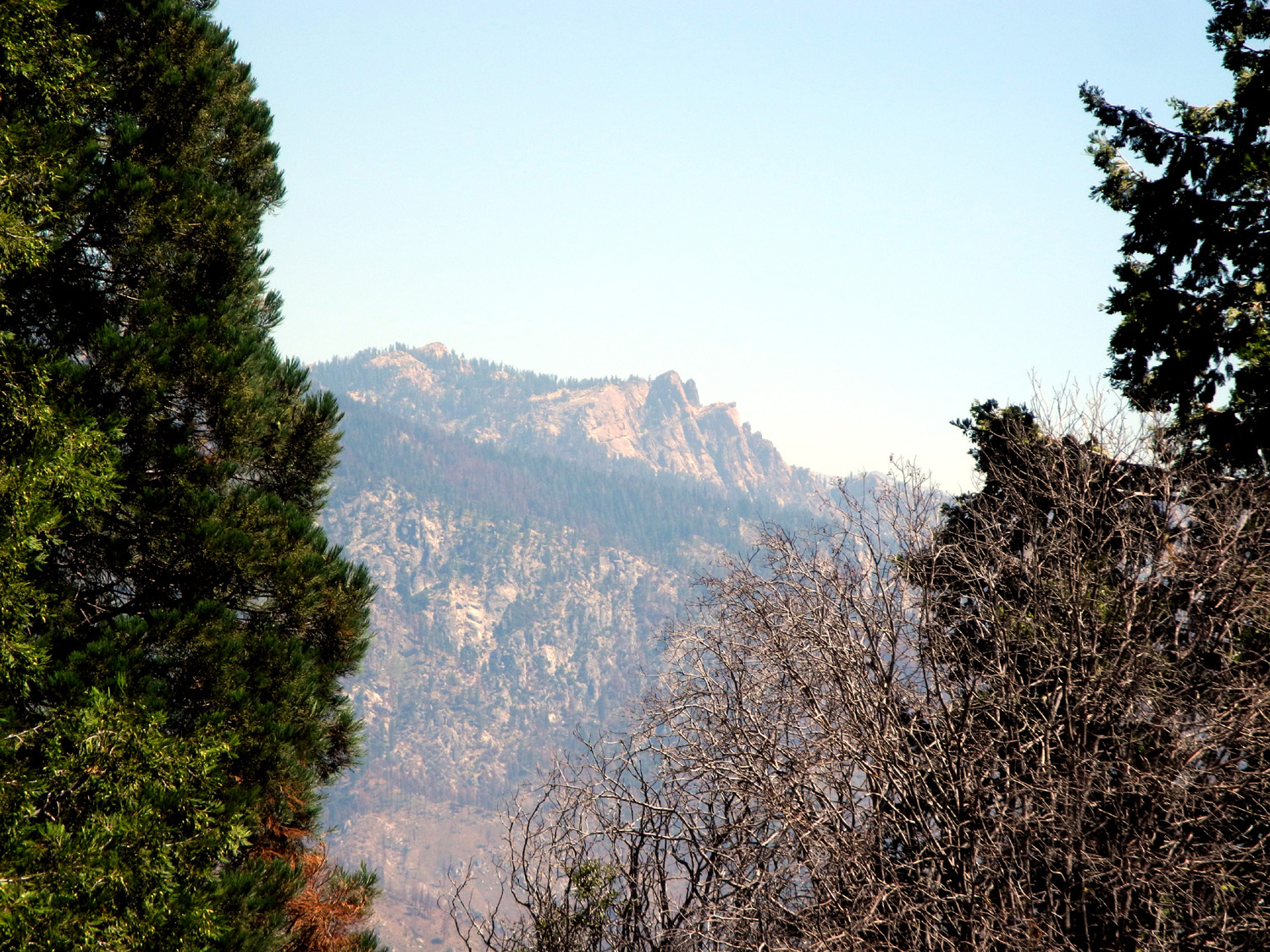
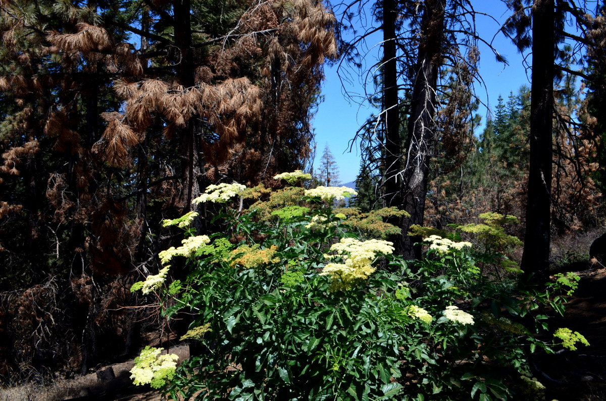
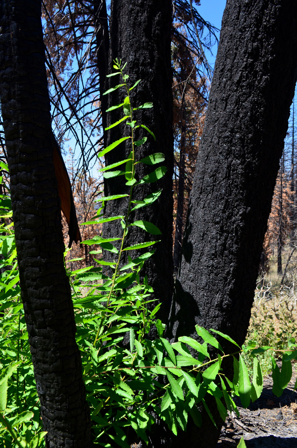
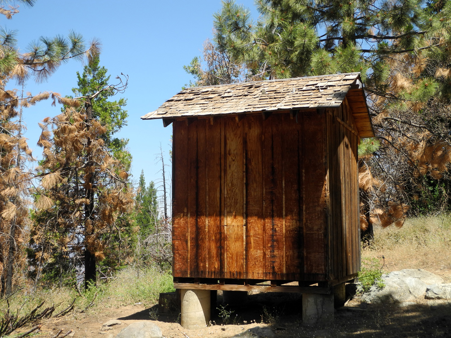
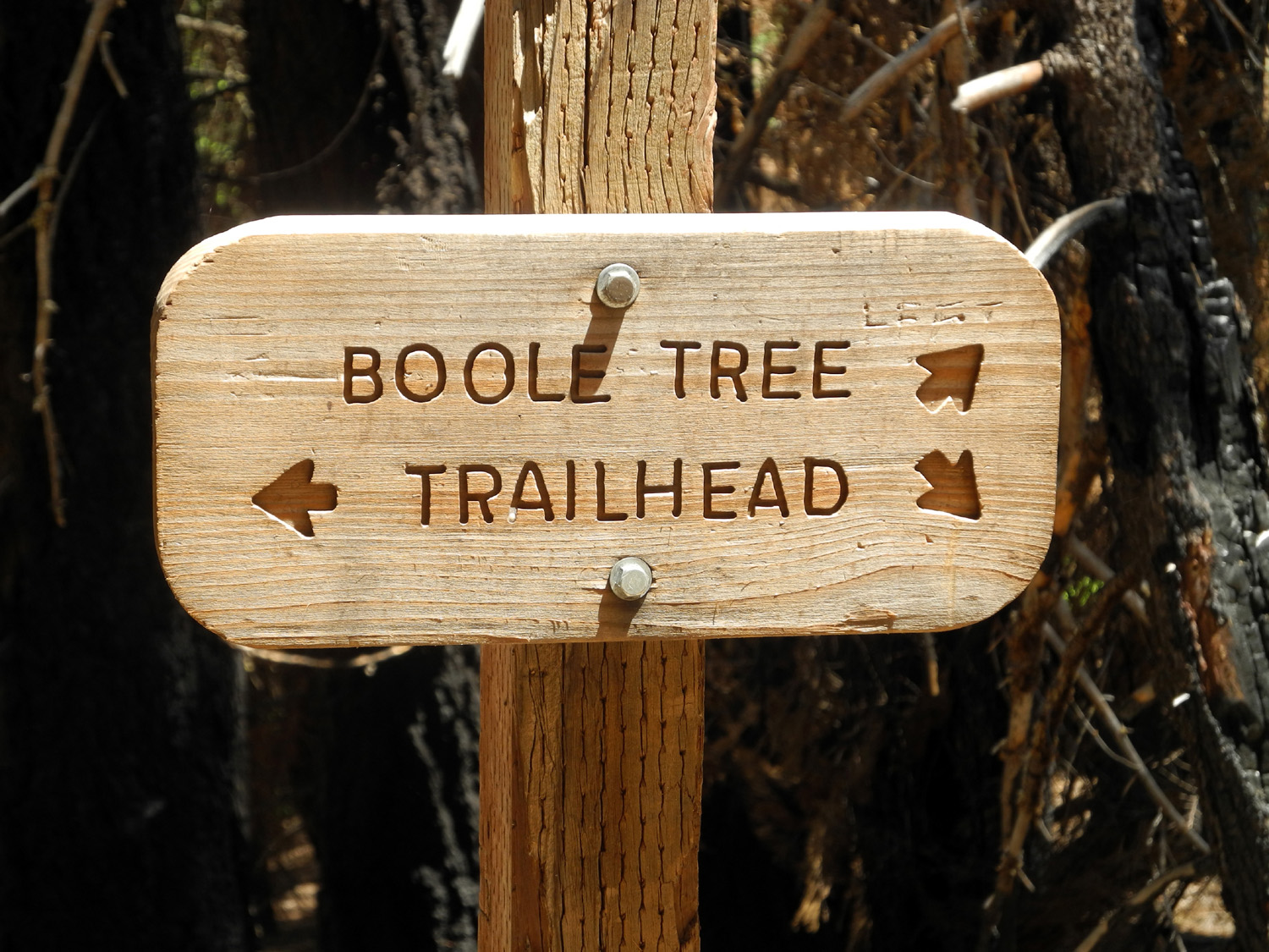
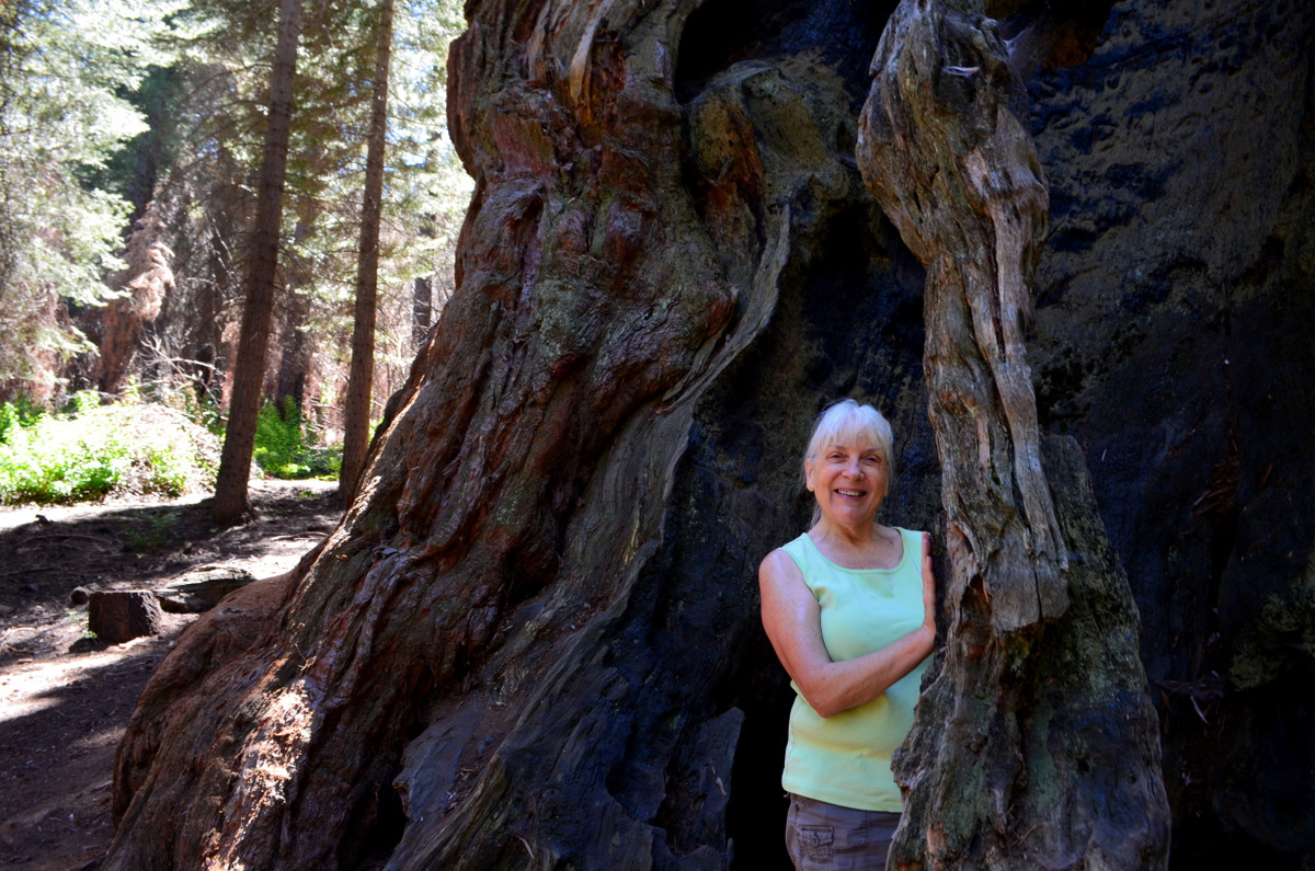
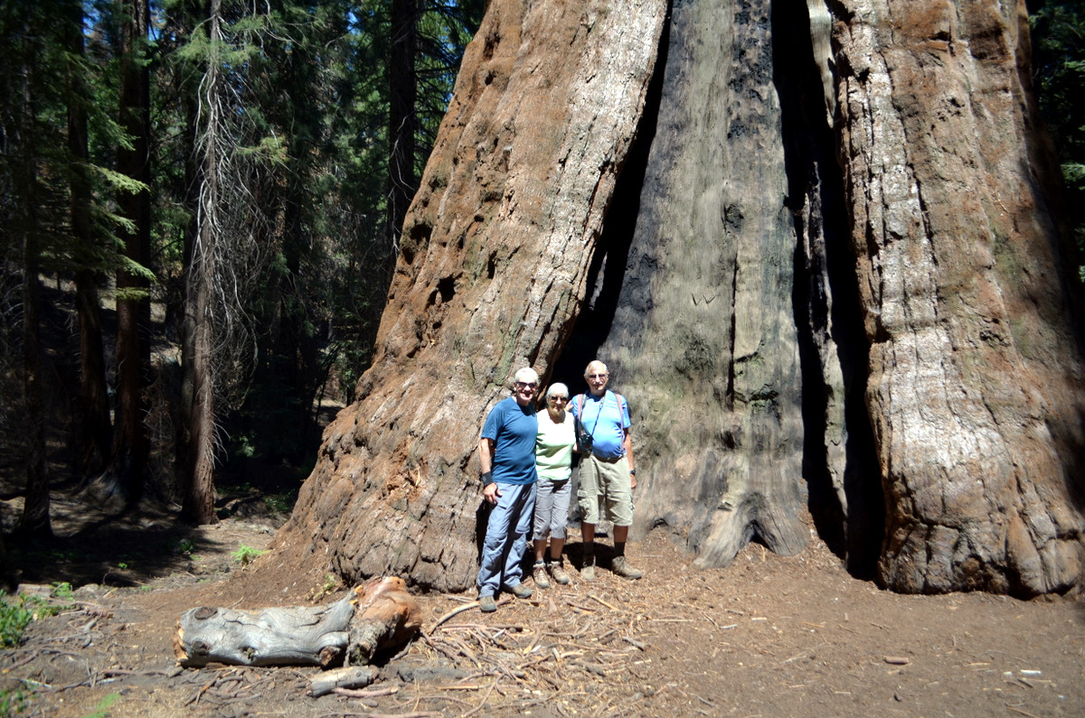
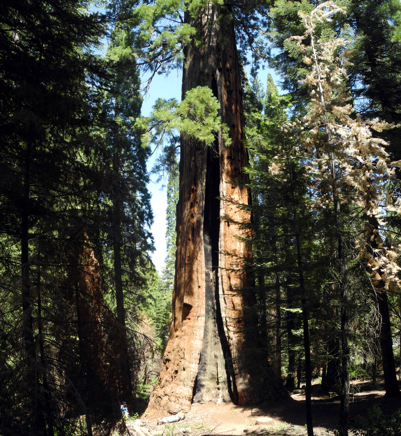
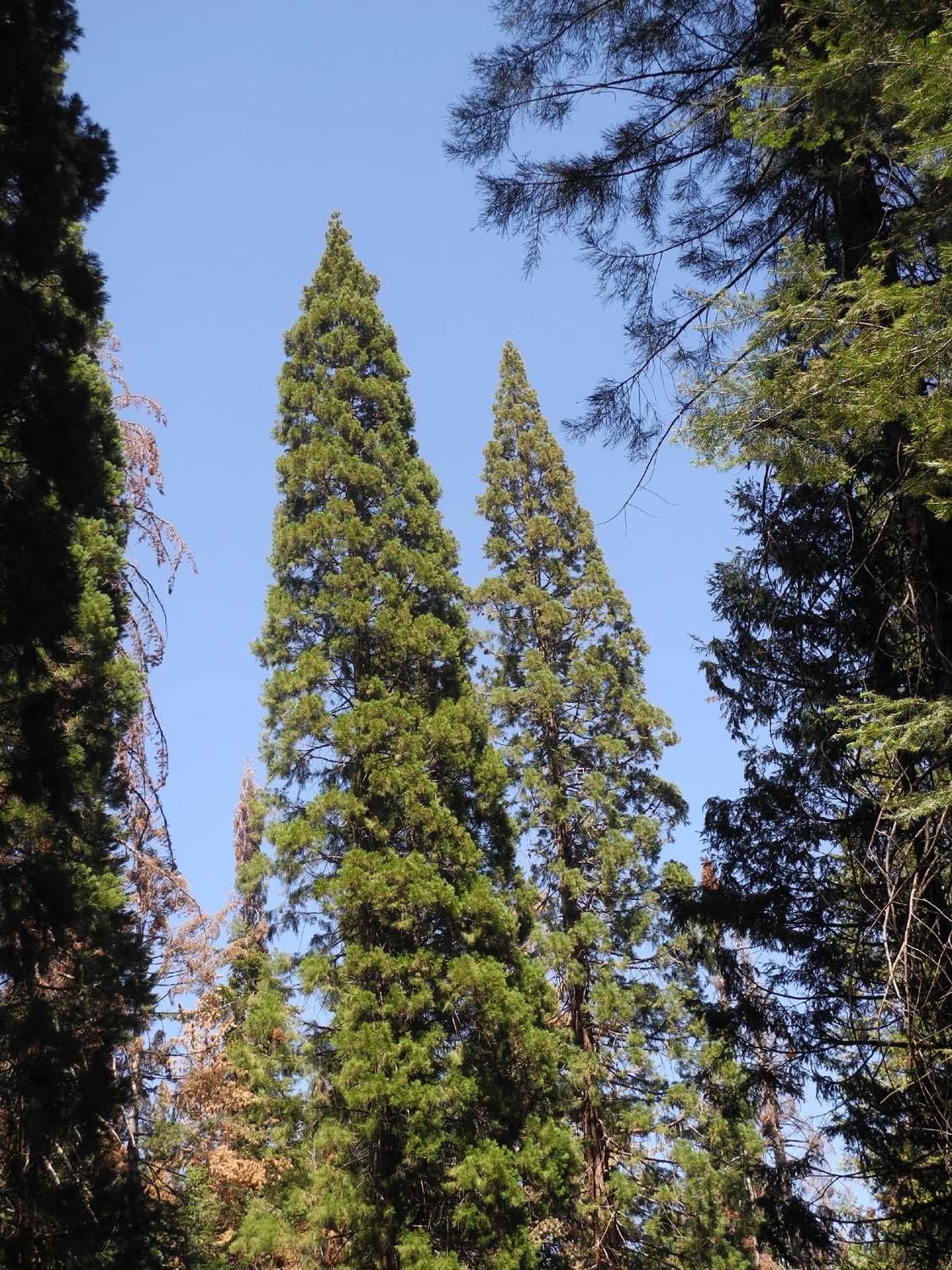
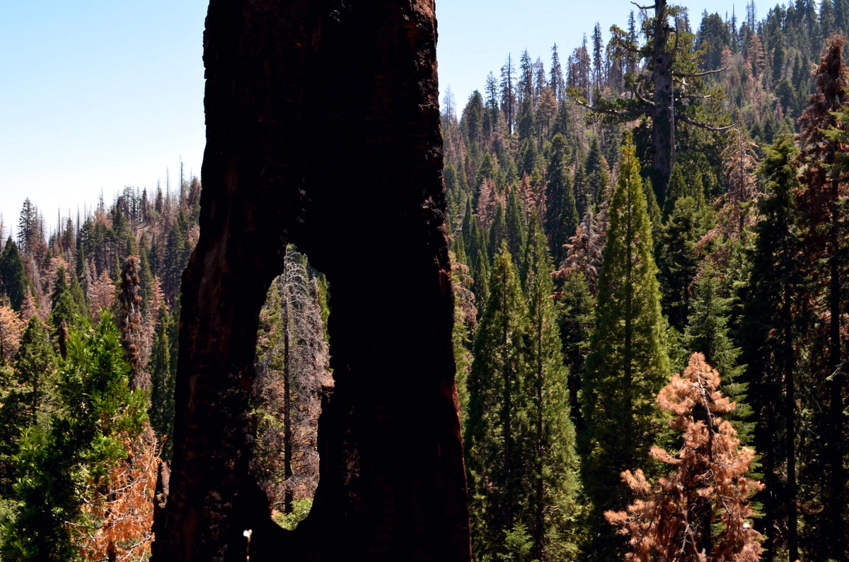
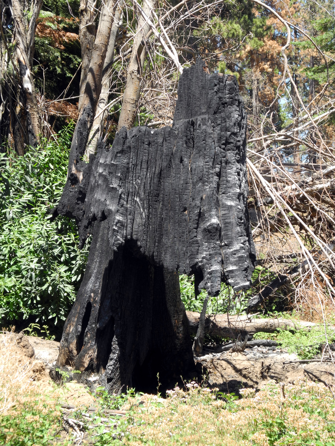
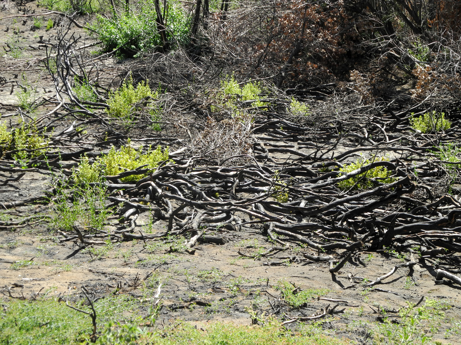
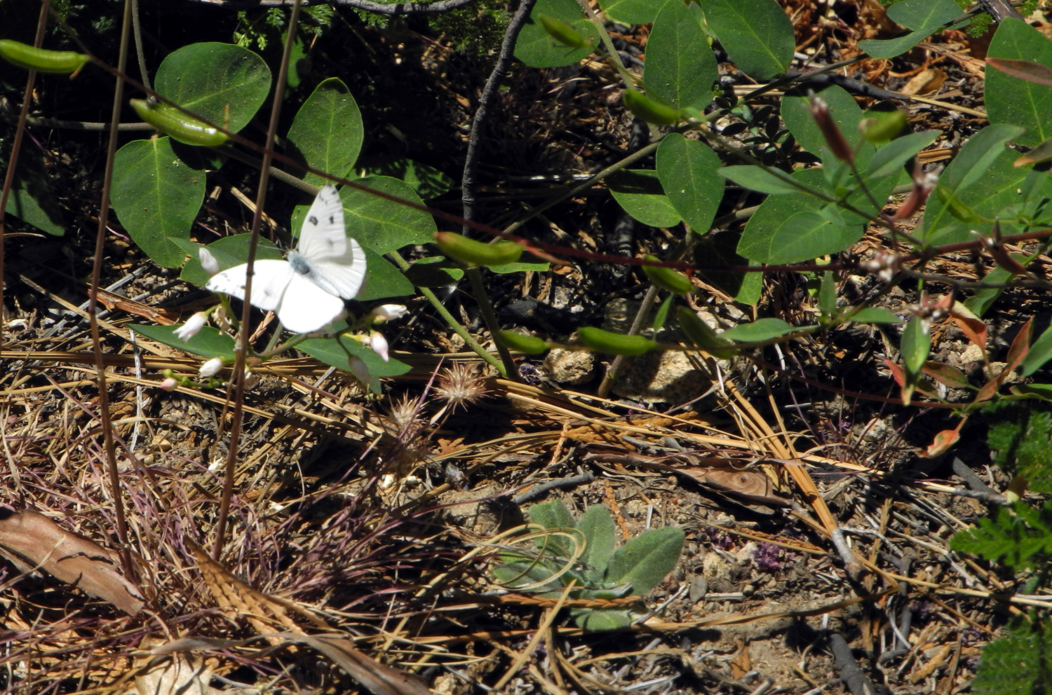
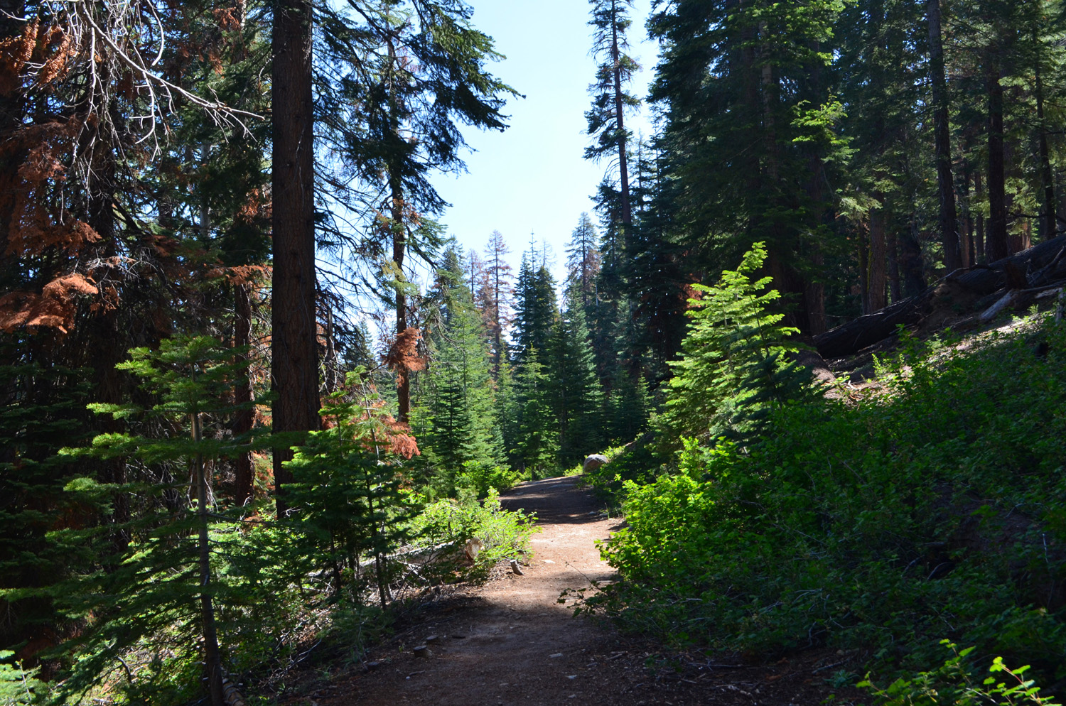
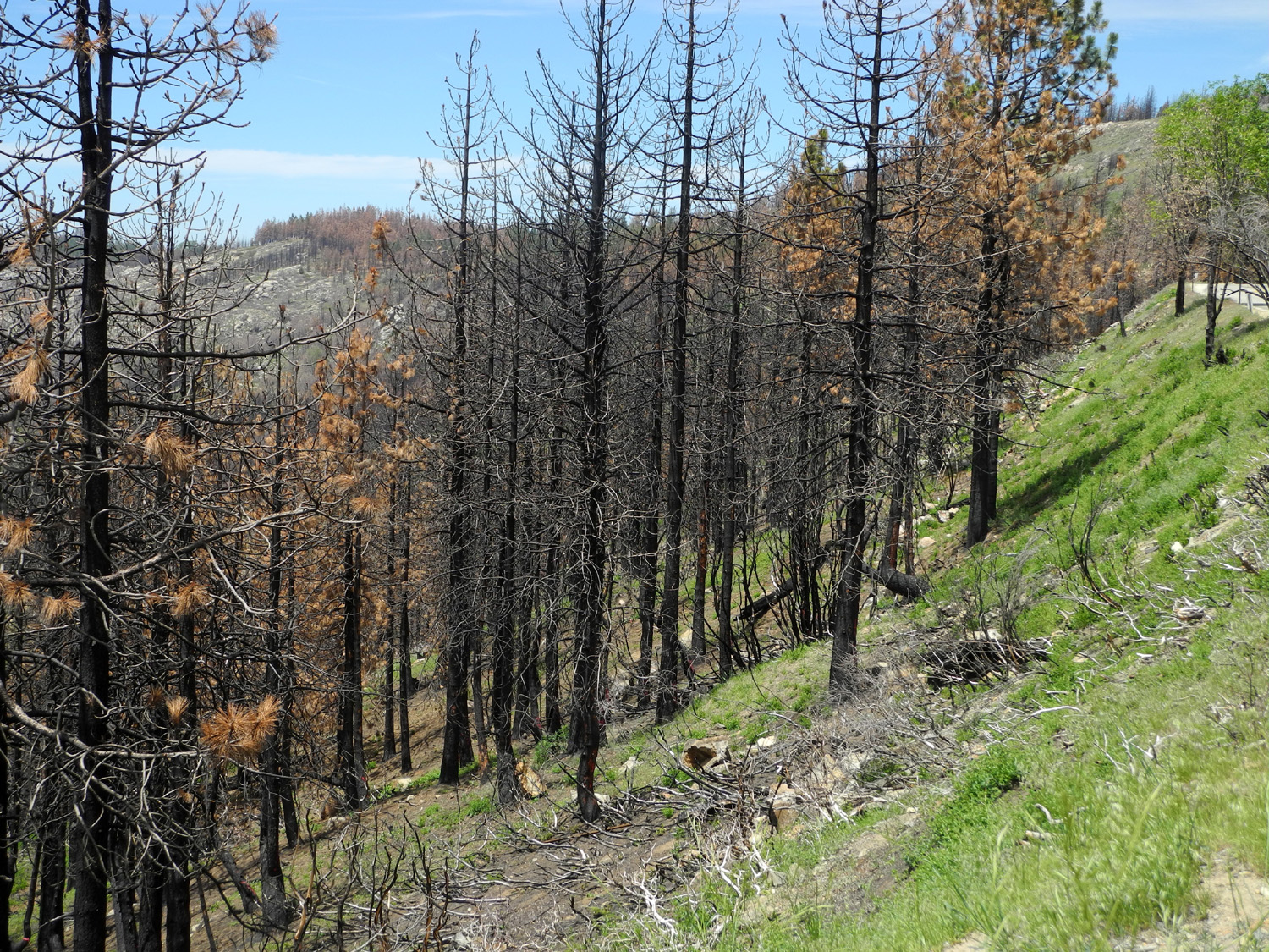
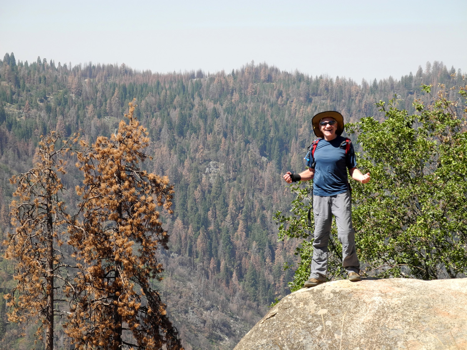
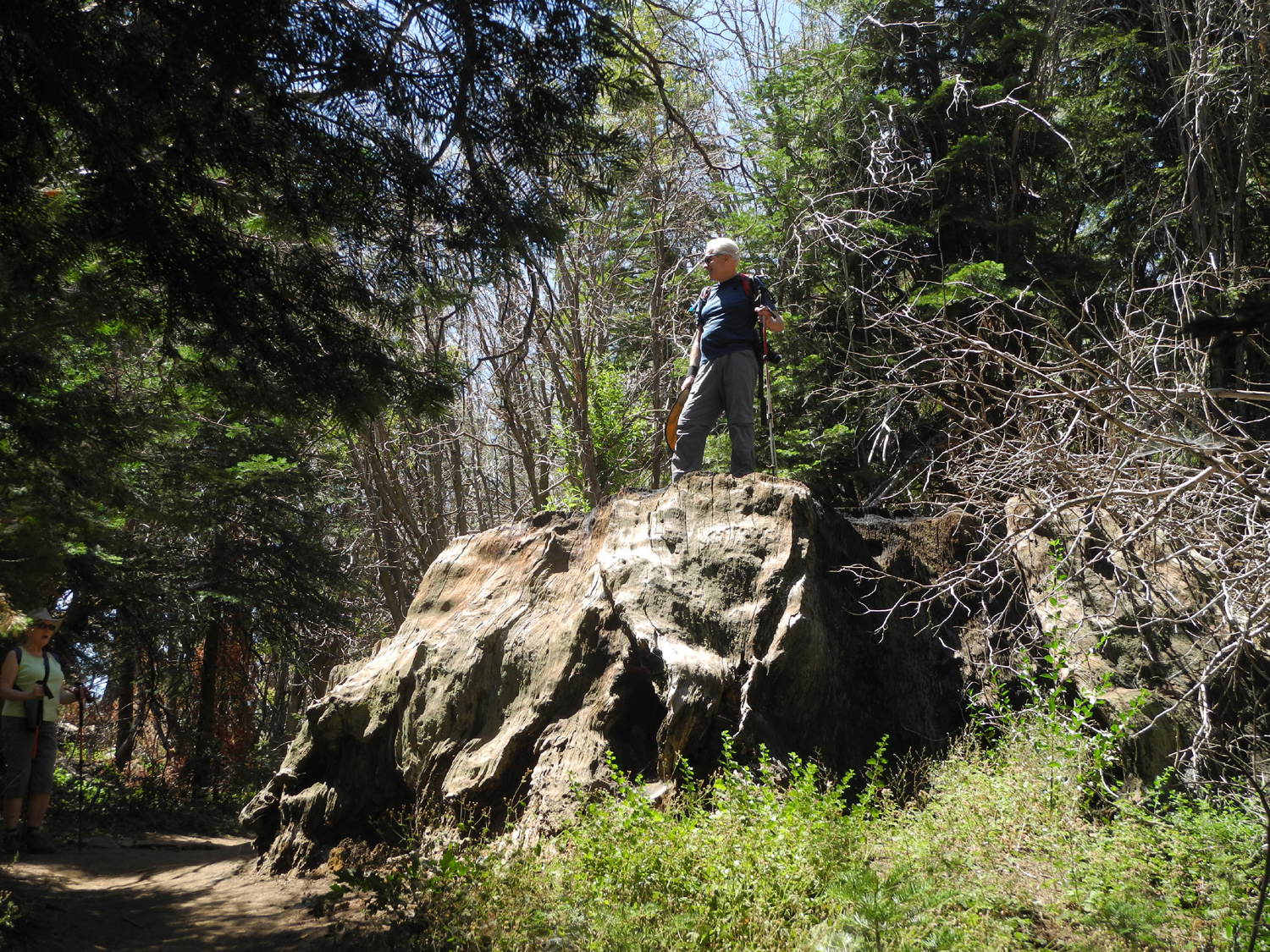
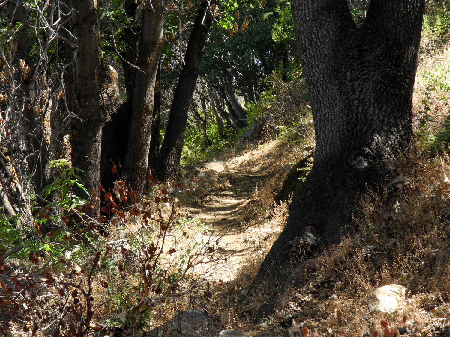
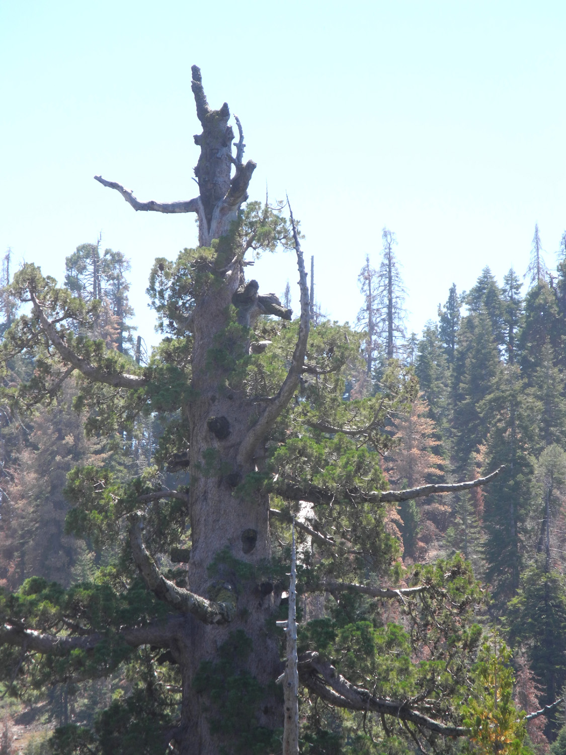
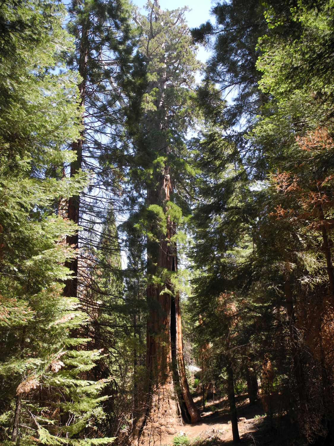
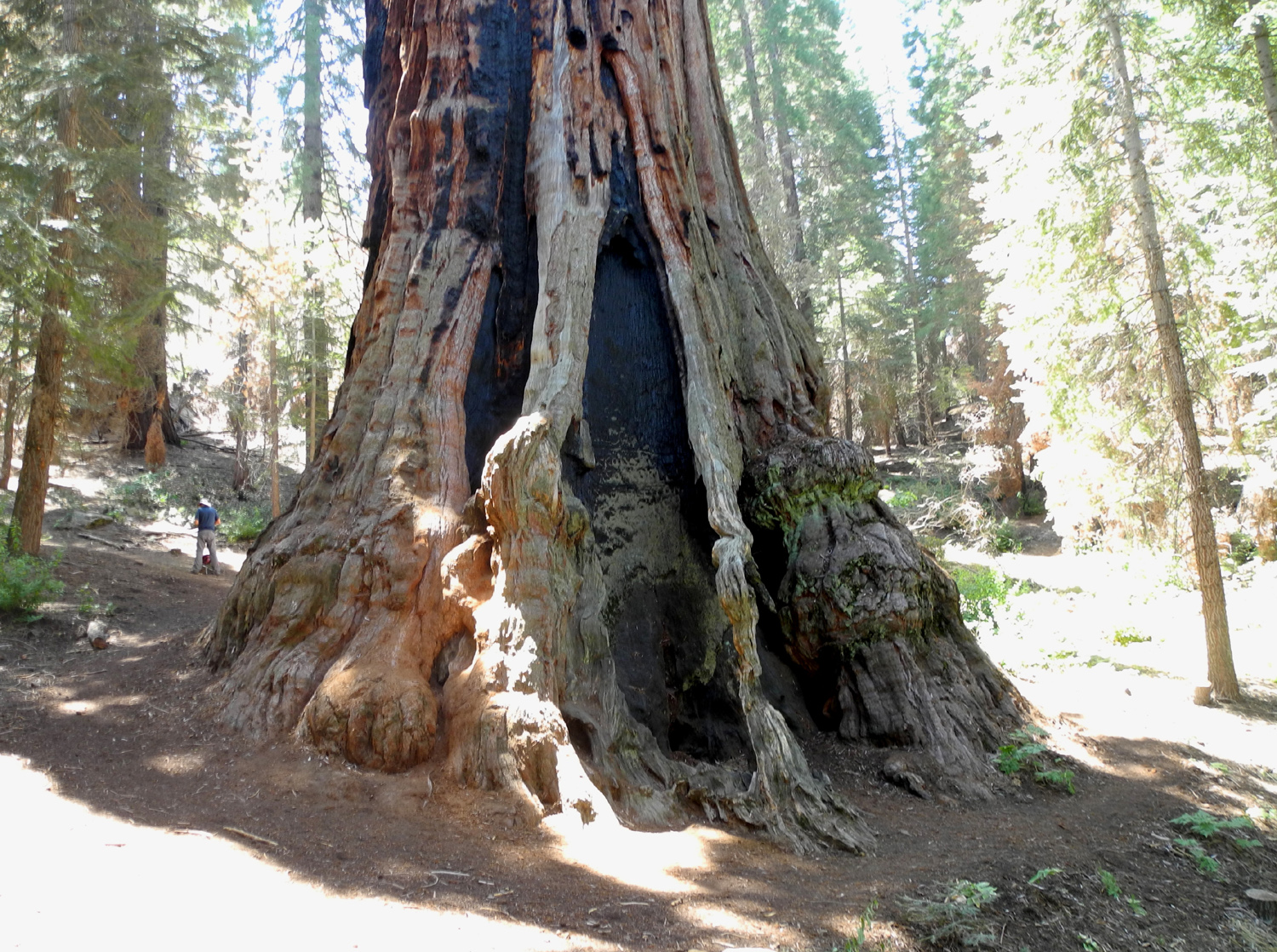
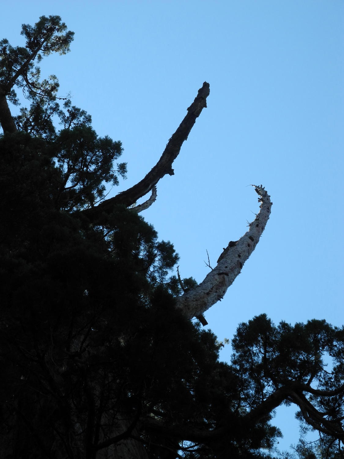
Boole Tree Trail July got by us with no Rambler hikes. Everyone's schedule was so busy that we could not find a date that worked for more than two of us at a time. Carolyn spent time with her siblings on the northern coast; Wes hiked the High Sierra Loop, a 50-mile, 5-day trek in Yosemite, Julie was on the go a good part of the month, and I did some hiking, camping, and a trip to Las Vegas. August 9 was an open date for everyone, although it turned out that Julie was not feeling well and could not join us. Our destination was the Boole Tree Trail in Sequoia National Forest, not far past Grant Grove in Kings Canyon National Park. This hike was new to Wes and Carolyn, and I did it so long ago that I could remember nothing except that I eventually arrived at a big sequoia, so it was almost new to me as well. The trailhead is located on a dirt road, 2.5 miles from Highway 180. The tree itself is an ancient giant sequoia, surrounded by many young redwoods in the 100 year age range. These are clearly recognizable as their tops form sharply pointed spires. The Boole Tree's age is estimated at a little over 2,000 years, and it is a truly dramatic example of the species, with the rugged, dead broken top typical of many older sequoias. It is the largest sequoia in the national forests, and in the top ten largest of all such trees. The area where we hiked is part of the Converse Basin, which was heavily logged in the late 19th century. Over 3,000 sequoias were felled, and where there were once thick groves of these giants, the Boole and a dozen or other scattered trees are the only big ones left. Ironically, none of the companies involved in logging this area made a profit. Wes came to my house about 8 a.m., we picked up Carolyn, and drove east on Highway 180 into the mountains. It's about 55 miles to Grant Grove Village, where we made a quick pit stop. The road leaves the Grant Grove section of Kings Canyon National Park a few miles past the village and is then in the Sequoia National Forest. We made a short stop at the McGee Fire Overlook, where thousands of acres were burned in the 1950s. This same terrain was also part of the Rough Fire of 2015, as was much of the area we would be hiking through. We continued on and found Forest Road 13S55, which goes into the Converse Basin north of the highway. This moderately rough road goes past many old stumps and logs left from logging days. A particularly interesting area was Stump Meadow, where there is a trail that winds among at least 20 or 30 large stumps that are visible from the road. Not far past this point, and just as we were asking "are we there yet," we spotted some parked cars and the trailhead. We got on the trail about 10:45, and immediately had to make a decision. The trail is a 2.5 mile loop, so you can go clockwise or counter-clockwise. I vaguely remembered reading on the trail web site that most hikers choose clockwise, so we did also. This proved to be the right choice. The distance from trailhead to tree by this route is 1.5 miles. The trail immediately started uphill, and continued that way in general for a good mile or more. However, it was smooth dirt, with no loose rocks, making for fairly easy walking. The Rough Fire went through this area, but we were delighted to see that along with the burned areas, many plots were still green. Typical fire behavior, unless it's a real firestorm, hits some spots and misses others. Where the fire burned the ground level vegetation the land is covered with elderberry bushes with huge clusters of white flowers. Many of these bushes had long, thick green stems, indicating new growth, so we wondered if maybe the bushes had been burned to the ground, and what we were seeing had sprung up from the roots. We also saw a lot of ripe gooseberries. Their bushes prefer sunny areas, so tend to occupy burned areas, but the ones we saw appeared too mature to have grown since the fire. Despite the many fire scars, there were still a number of areas where full size trees provided shade. Throughout the hike, we seldom had more than 50 feet of trail through the sun before we came to a shady spot. We also were blessed with a nice breeze every so often. In addition, despite the general uphill trend, the trail had a number of short level or downhill spots, so it was not a relentless climb. At one point we came to a wooden building, sitting on cylindrical cement "feet," whose purpose was not clear. There were some electrical panels inside, but all the wiring was disconnected. As always, we tried to get a good photo of "Wes on the Rock." The first rock we came to was very large and would have provided a dramatic shot, but it was also too big and steep for anyone of our age to attempt to climb. We did find a suitable place a little farther up. We also encouraged Wes to get up on one of the large stumps beside the trail. The first one that looked promising proved too high to climb, but on the way out we found one that was readily accessible. The trailhead is at about 6,200 feet, and as we climbed we were going through mostly black oaks and firs. At the top of the hill, the evergreens became predominately ponderosa pine with some cedar. The middle part of the hike was on the north slope of the mountain, where we had a good view into the Kings River Canyon. We could see downstream at first, then eventually came to a place where we could look at the divide between the Middle and South Forks, and even see some of the higher peaks in the back country. During our walk, Wes and I stopped to take pictures as usual. Wes's goal was to show the contrast between the burned areas and the re-growth, a scene captured especially well with this photo. Whenever the pace lagged, Carolyn would stop and wait for us, but made sure to keep going until she was in shade before resting. The highest place on the trail was about 6,800 in elevation, after which we started down a few short switchbacks to the location of the tree. We first spotted the rugged, broken top rising above the surrounding forest a few hundred feet before the trail reached a vista point. A sign at this location gave the history of logging and how the tree was spared, and offered a fairly good top to bottom view of this venerable giant. A short spur trail went down to the tree from the sign, which was also the point where the trail continued its loop back to the trailhead. There was a couple at the tree when we arrived, and a party of three came down the trail while we were there; otherwise we didn't see any other hikers anywhere on the trail. We took pictures at the tree, and made our way around it, which helped us see that this was indeed a larger than usual specimen. The circumference at the ground has been measured at 113 feet, while the diameter at five feet above ground on the upper side is 25 feet. There is a large, deep fire scar on the lower side. Toward the top of the tree a couple of huge, dead branches, probably at least 20 feet long, sweep out and upward. A short distance up from the trail junction is the top of a ridge, with a broad drainage going down on both sides. The tree is located about 200 feet down the eastern side, in a heavily forested canyon. During the Rough Fire, sprinklers were placed around the tree to protect it, and while there is evidence of fire a couple hundred feet from the tree, it does not appear that the flames got any closer. When we had enjoyed the tree for a while and taken our regular group photo, we made the short hike up to the trail junction and took the final section of the loop, which is one mile between tree and trailhead. It is also steeper and a little rougher, requiring careful walking in some places, but for the most part it met the claimed category of moderate. This section went through a lot of burned areas, with lots of elderberries in bloom and ripe gooseberries. Since these berries are covered with stickers we were not tempted to try any, although I would have sampled the elderberries if there had been any ripe ones. Back at the car we removed our packs, changed out of our boots, and headed back toward Grant Grove Village for lunch. The restaurant we ate at there on a previous hike is gone, with a new facility under construction. However, there are two trailers set up to provide food service, and the available menu is pretty much the same. We enjoyed our lunch at one of the outdoor tables in the shade of fir, pines and sequoias, and then made the drive back down to the valley. At two places on the road in the national forest we had delays where they are removing trees killed by fire and/or drought. There are several places where logs have been placed in piles, some of them 15 feet high or more and 20 feet long. We believe these are being saved for use in a biomass energy production facility, since a similar project is underway at Bass Like north of Fresno. Wes had a rather uncharacteristic negative view of the hike before it started, but it was not surprising that he enjoyed it after all, as he explained after we returned home: When Dick identified the August hike as the Boole Tree Trail, I was not excited. I knew this trail was located in that part of Sequoia National Forest that was absorbed in the Rough Fire of last year. In my mind, fire means destruction and I don't won't any part of it! I determined to leave my camera at home. But something inside whispered: "Take it." For the first part of the hike, my camera remained securely in my backpack. And then I saw it. New life emerging in the midst of the destruction. I grabbed my camera and couldn't stop shooting until the end of the trail. It must be in our DNA, new life coming after death. In Greek mythology we see the Phoenix arising out of the ashes. In Christianity we see Christ rising to life after death. And in the Sequoia Forest we saw all kinds of wildflowers, manzanita, elderberry and gooseberry bushes teeming with new life. It was a very exciting day!
|
||
|
Photos
(Click to enlarge; pictures open in new window) |
||
|
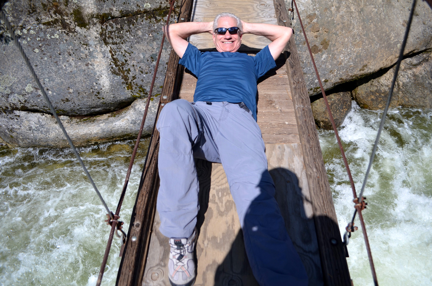
Wawona Meadow Loop and Swinging Bridge |
||
 |
 |
 |
| The golf course and the road across to the trailhead | There's shade almost all the way on the Wawona Meadow :Loop |
Carolyn and Julie |
 |
 |
 |
| Teri and Dick, long time hiking companions | Wes is happy wherever he is | This guy ignored us and went about his business |
 |
 |
 |
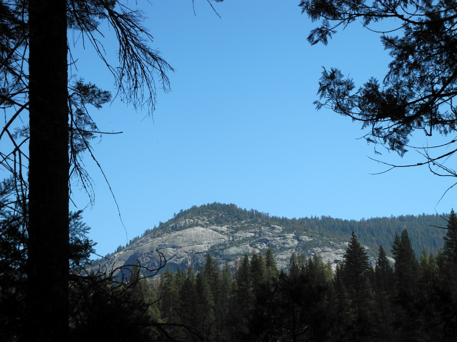
| Wawona Dome stands guard above the little valley | Nature's perfect landscaping | Wes had no trouble walking and even jumping on the log |
 |
 |
 |
| Teri surveys Teri's Meadow | Lots of big cedar trees help provide shade | Ponderosa pines are scattered sparsely along the trail |
 |
 |
 |
| A colorful fungus | Dogwood blossoms are always welcome on our hikes |
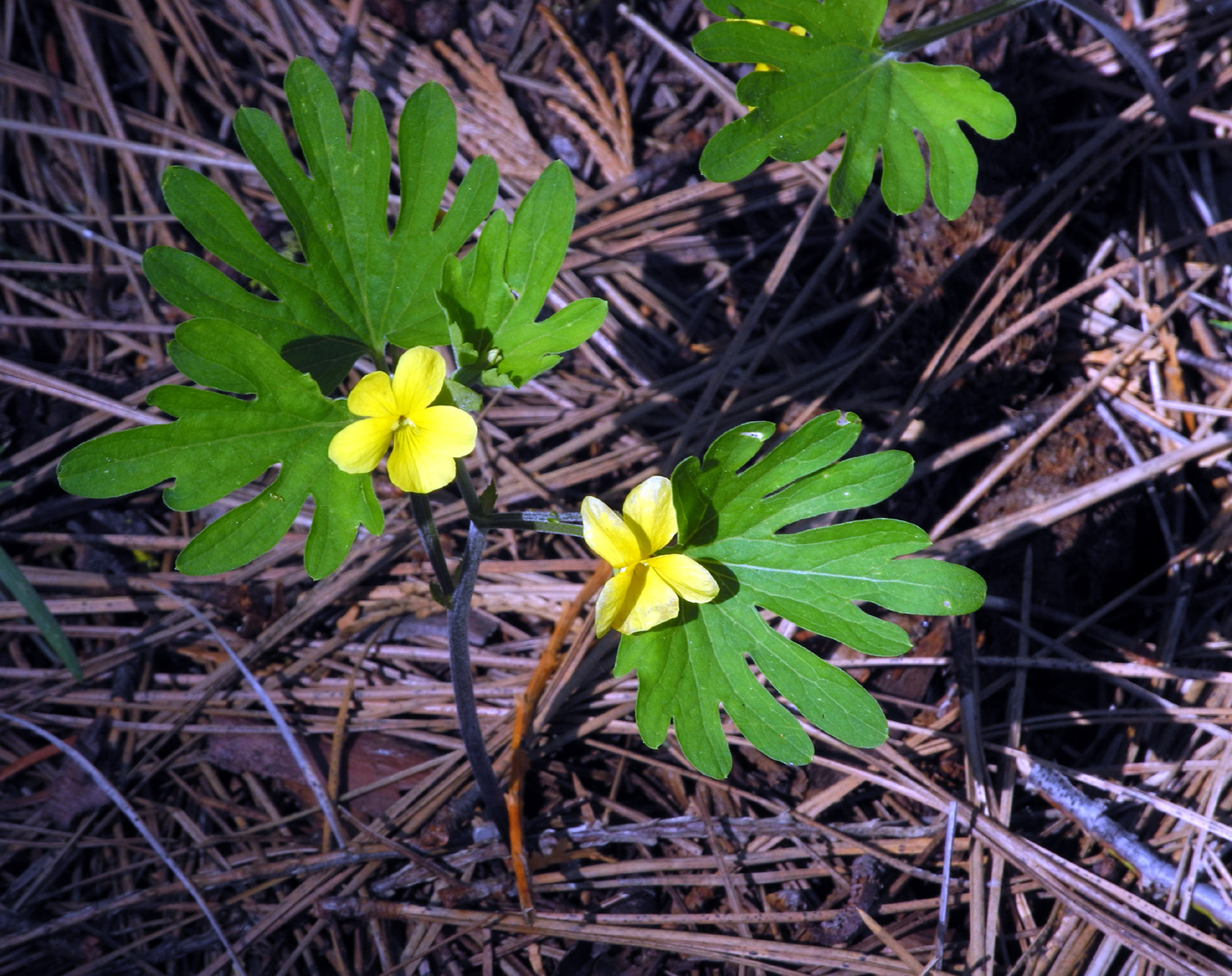
Baby (very pale) Blue Eyes |
 |
 |
 |
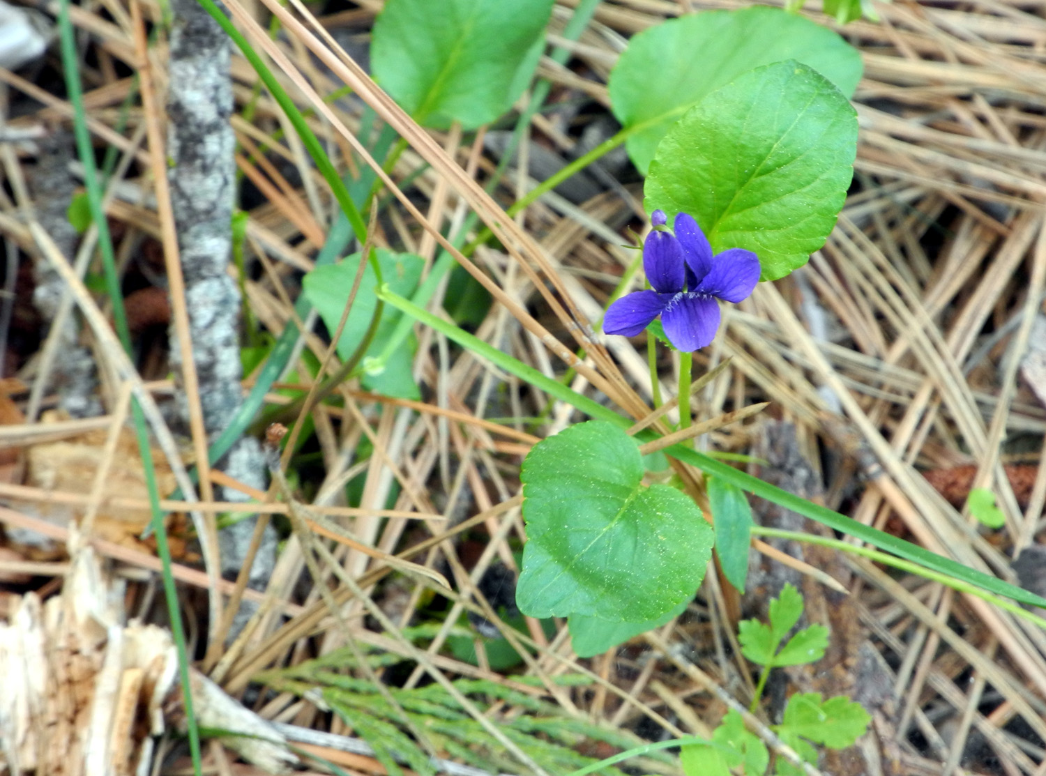
| Blue violet | Yellow violet |
Shelton's violet |
 |
 |
 |
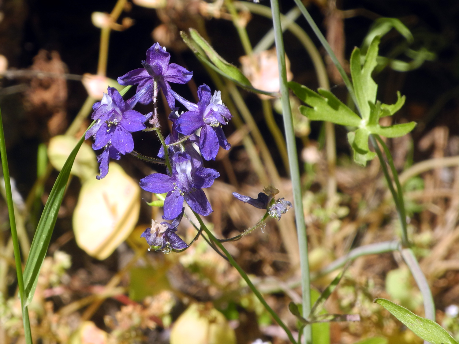
| Wild Iris | Larkspur | Indian Pinks |
 |
 |
 |
| Wawona Meadow from the upper (south) end of the trail |
Massive black oak by the trail |
This rail fence lines most of the meadow |
 |
 |
|
| Dead snake, looking alive | The Ramblers plus Teri |
Most of our group on the swinging bridge |
 |
 |
 |
| The South Fork of the Merced River from the bridge | Raging torrent of water just above the bridge | Teri and Carolyn on the bridge |
 |
 |
|
| Hydrotherapy? | River
Video (downloads to your PC's Download Folder) |
|
| Rancheria Falls | ||
 |
 |
 |
| Sign at trailhead | Wes steps off the bridge to start the hike | Our tree-lined trail |
 |
 |
 |
| Carolyn, Teri and Dick on the trail | Cascade below the falls | A long view of the falls and cascades below |
 |
 |
 |
| Rancheria Falls | Teri and Dick | Wes and Carolyn |
 |
 |
|
|
Wes on the rocks, almost in the creek |
Kicking back | The Ramblers: Wes, Carolyn, Dick, Teri |
 |
 |
 |
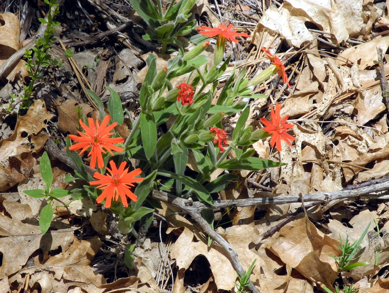
| Western wall flower | Unknown flower | These bushes were everywhere |
| Boole Tree Trail | ||
 |
 |
 |
| Carolyn and Wes check out the trail map | Near the trailhead
was the perfect spot for "Wes on the Rock" |
A section of the trail lined with huge black oaks |
 |
 |
 |
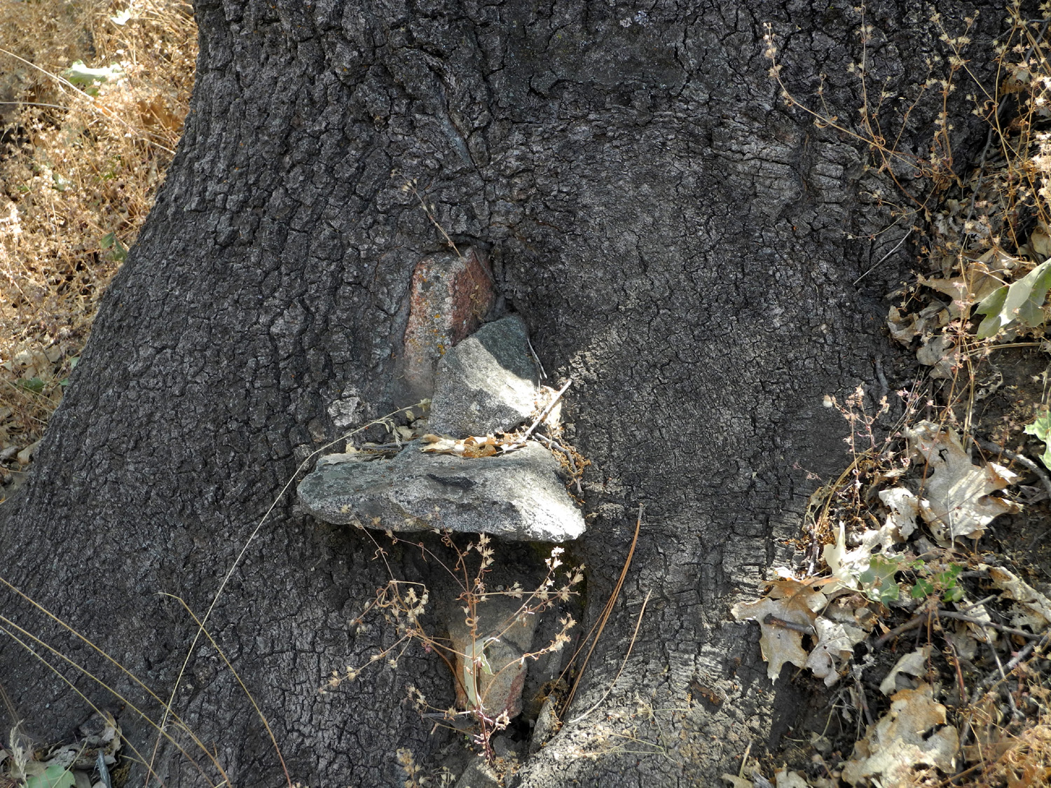
| Manzanita with a parasitic growth | The base of this
tree was under the soil before the trail was built |
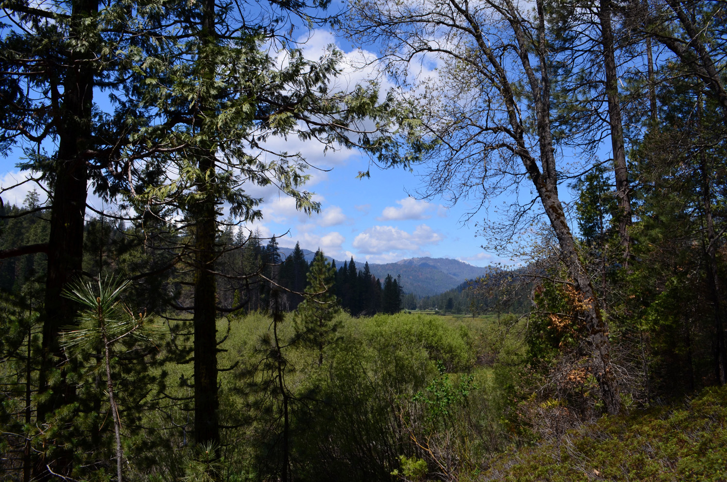
Looking down stream at the Kings River Canyon |
 |
 |
 |
|
High
country above the |
Carolyn strolls
along beside a cluster of young fir trees |
Gooseberries - ripe
and juicy, but covered with stickers |
 |
 |
 |
| Next to dead trees,
elderberries are blooming in profusion |
A perfect example of
new growth rising out of the destruction |
A building of unknown purpose |
 |
|
 |
| The trail junction above the tree | The rugged top of the Boole Tree |
And a view of the entire 268 feet of the tree |
 |
 |
 |
|
The fire-scarred lower side of the tree |
Carolyn poses in the tree | The Ramblers on the upper side of the tree |
 |
 |
 |
|
The upper side has a big fire scar too |
Huge dead limbs
sweep out and upward near the top of the tree |
Young redwoods, probably about 100 years old |
 |
 |
 |
| Wes gets artistic with this burned out snag |
Fire keeps eating away at this old stump |
More residue from the fire |
 |
 |
 |
| Wes on the stump |
Wild roses added color along the way |
We were joined by butterflies in several places |
| Related Links | ||
| Yosemite National Park | South Fork Video | History of Wawona |
| Wawona Hotel | Undiscovered Yosemite | Wawona Swinging Bridge |
| Wawona Covered Bridge | Meadow Loop Trail | Pioneer History Center |
| Rancheria Falls | Rancheria Falls Video | Huntington Lake |
| Prather | Shaver Lake | Velasco's Mexican Restaurant |
| Boole Tree Trail | More about the Boole Tree | Converse Basin |
| More about Converse Basin | Rough Fire | |