


2017 Ramblers Hikes Page 1 |
||
|
The Ramblers are Carolyn Amicone, Julie Hornback, Wes Thiessen, Don McClellan, and Dick Estel, former colleagues at the Fresno County Department of Social Services. Every month or so we get together for a short hike, good conversation, and lunch. |
||
Millerton Lake Trail FINS Trail Sycamore Picnic Ground San Joaquin Gorge Bridge Trail Eastman Lake |
||
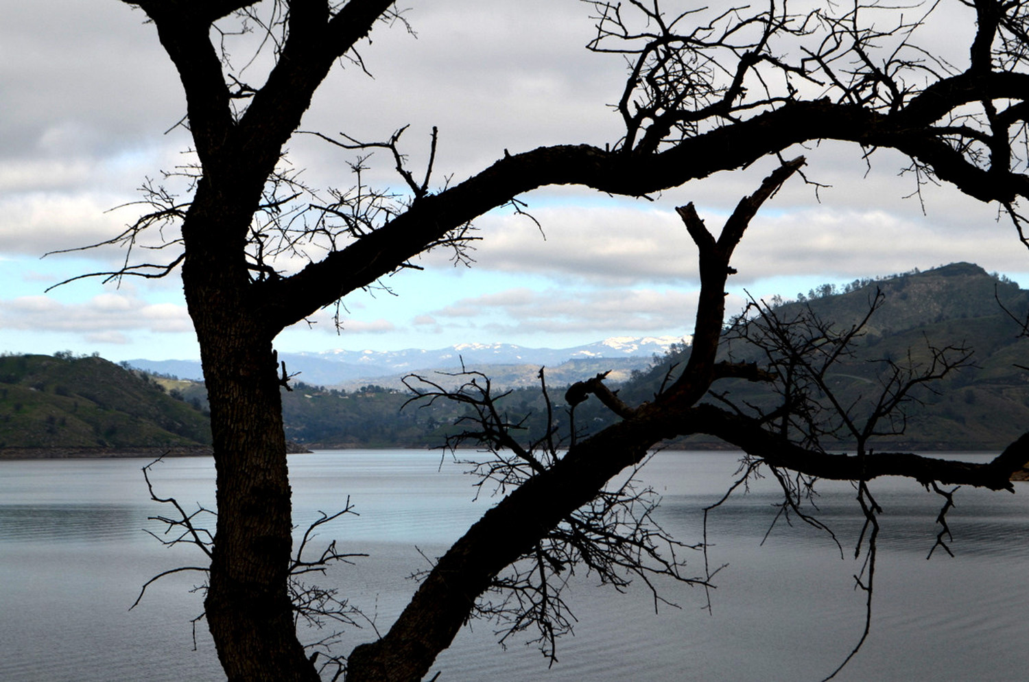
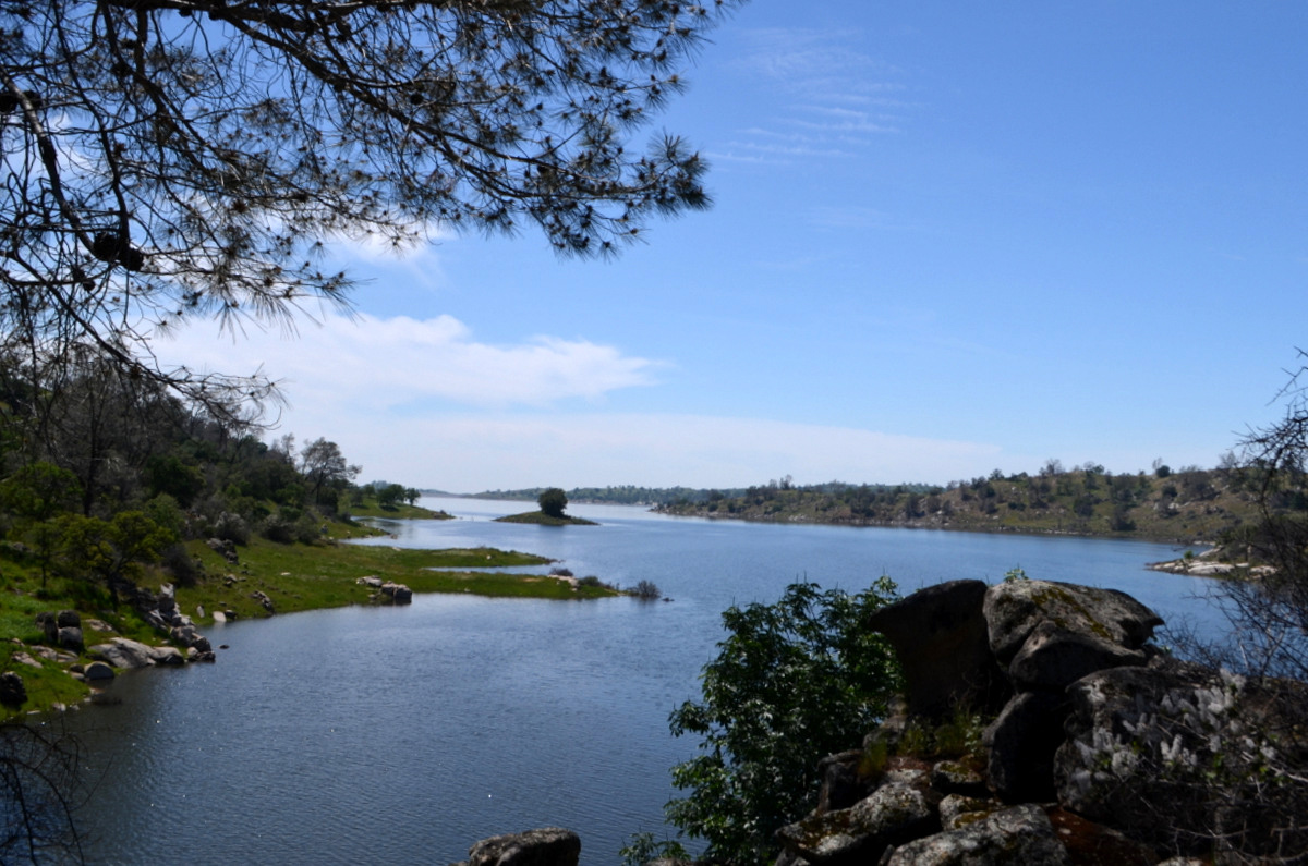
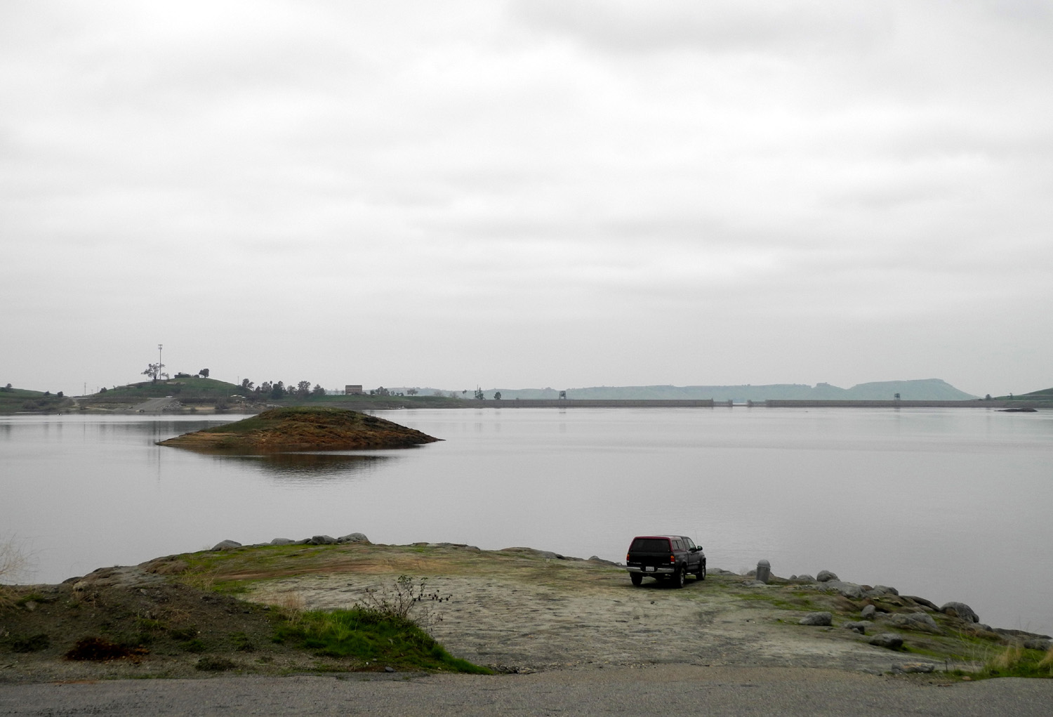
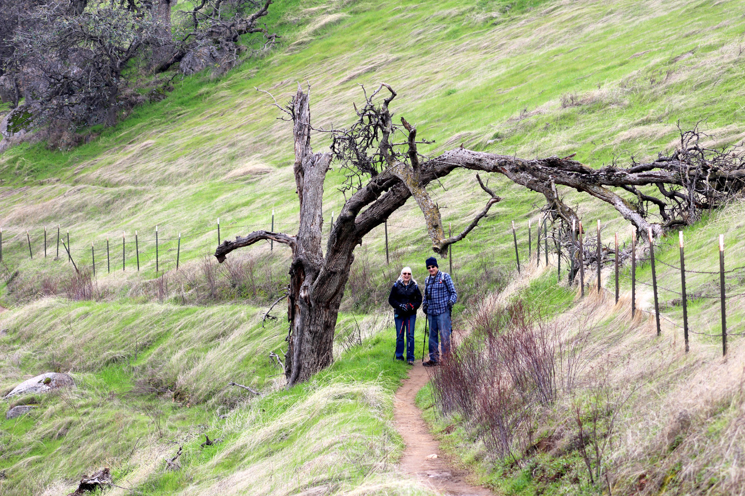
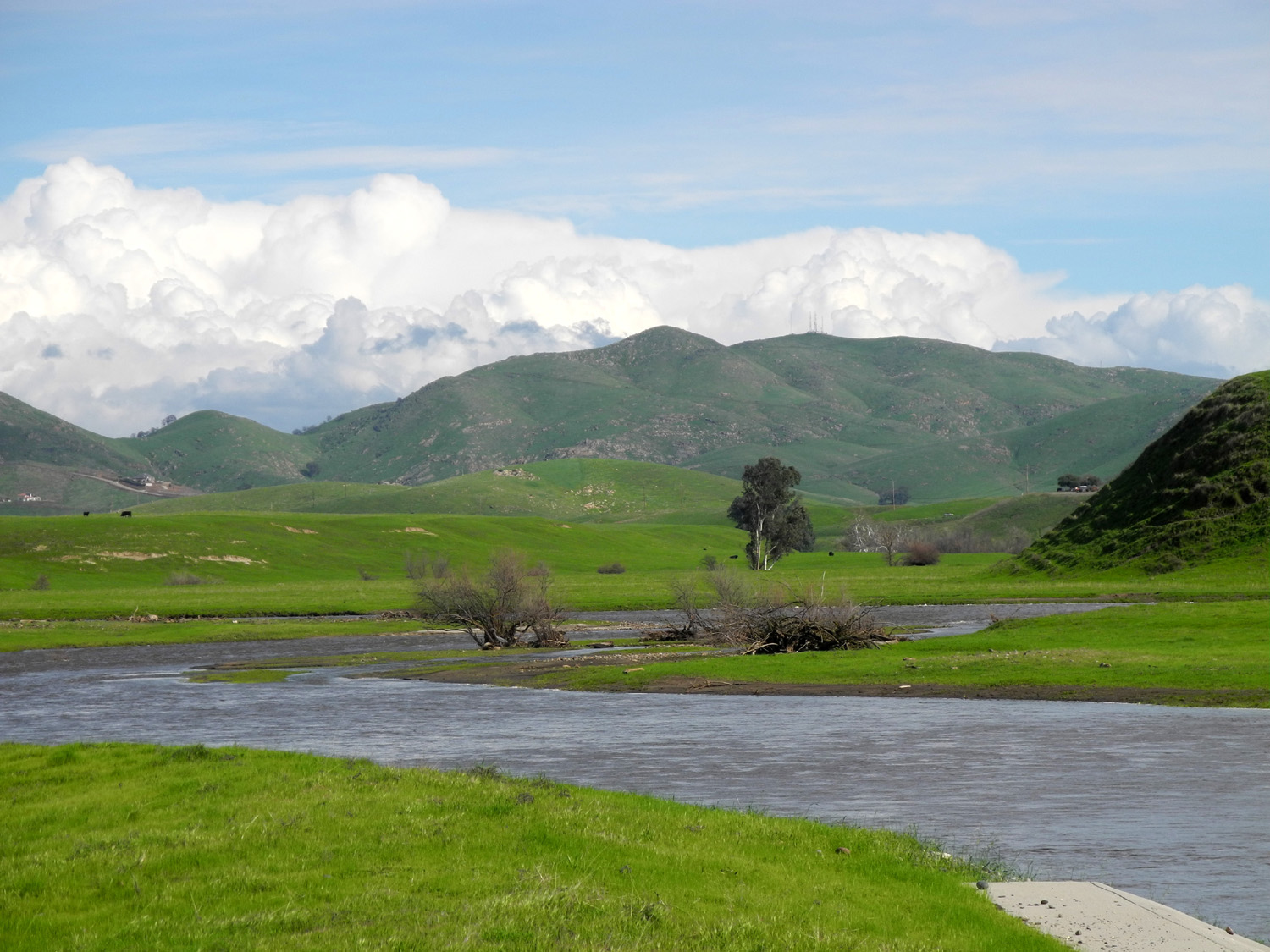
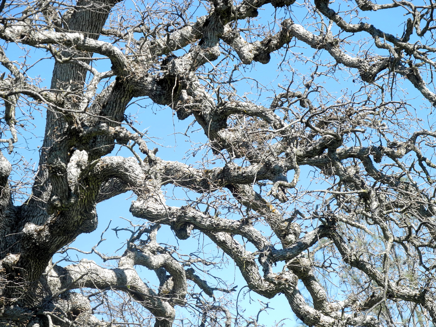
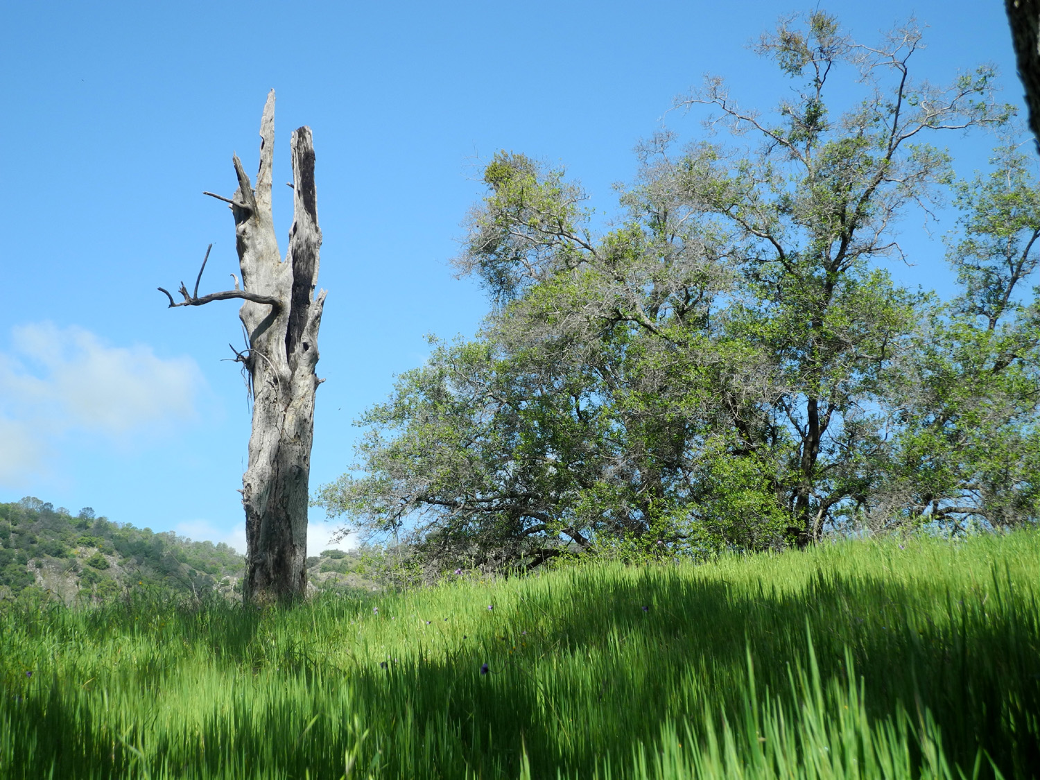
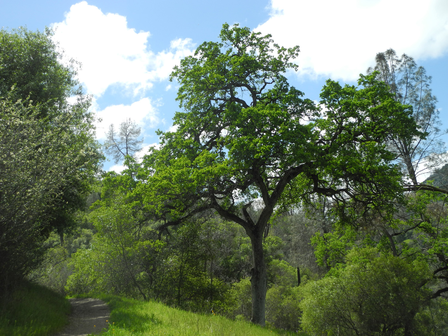
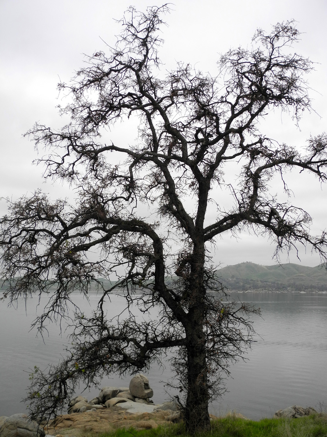
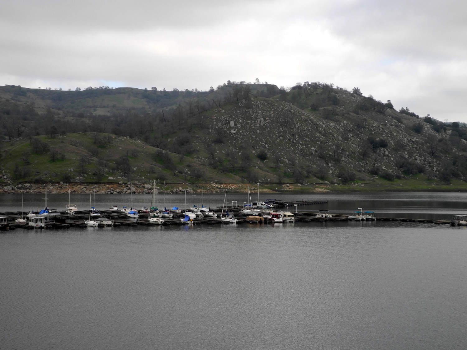
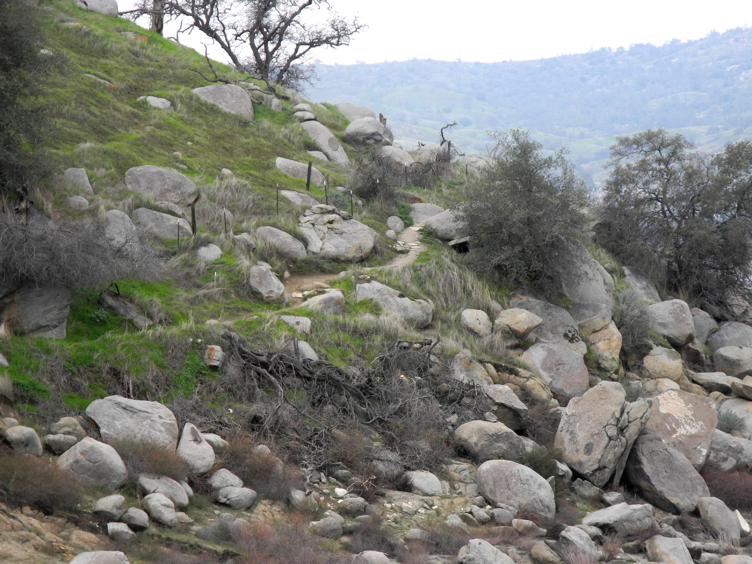
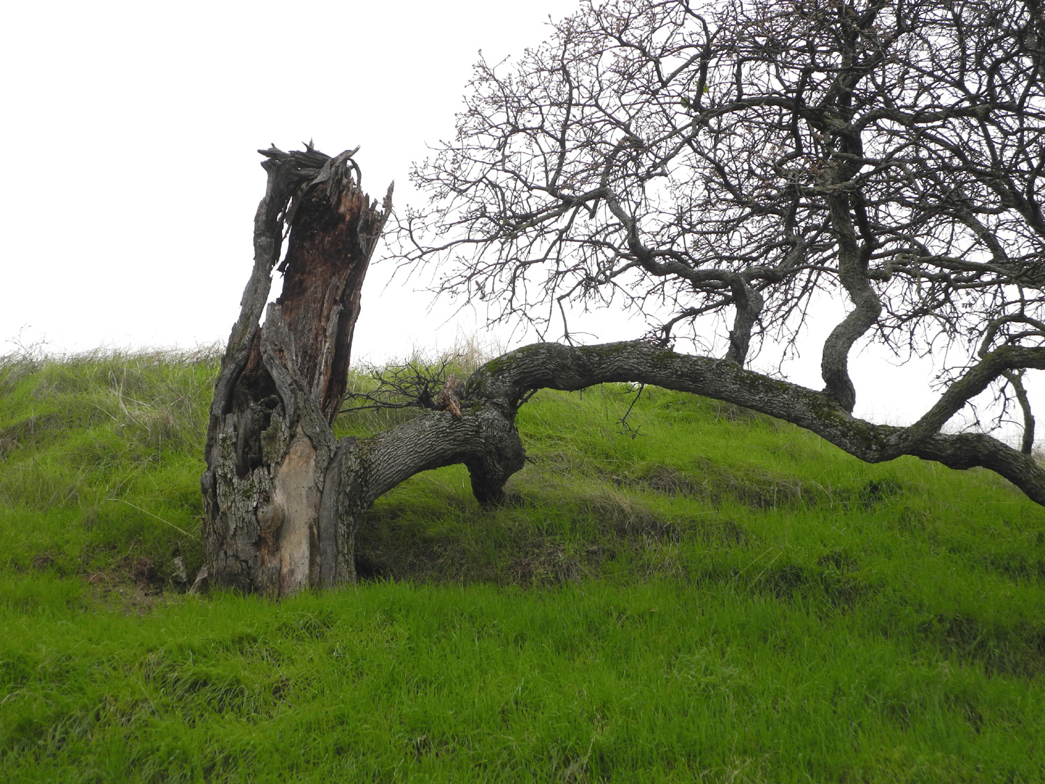
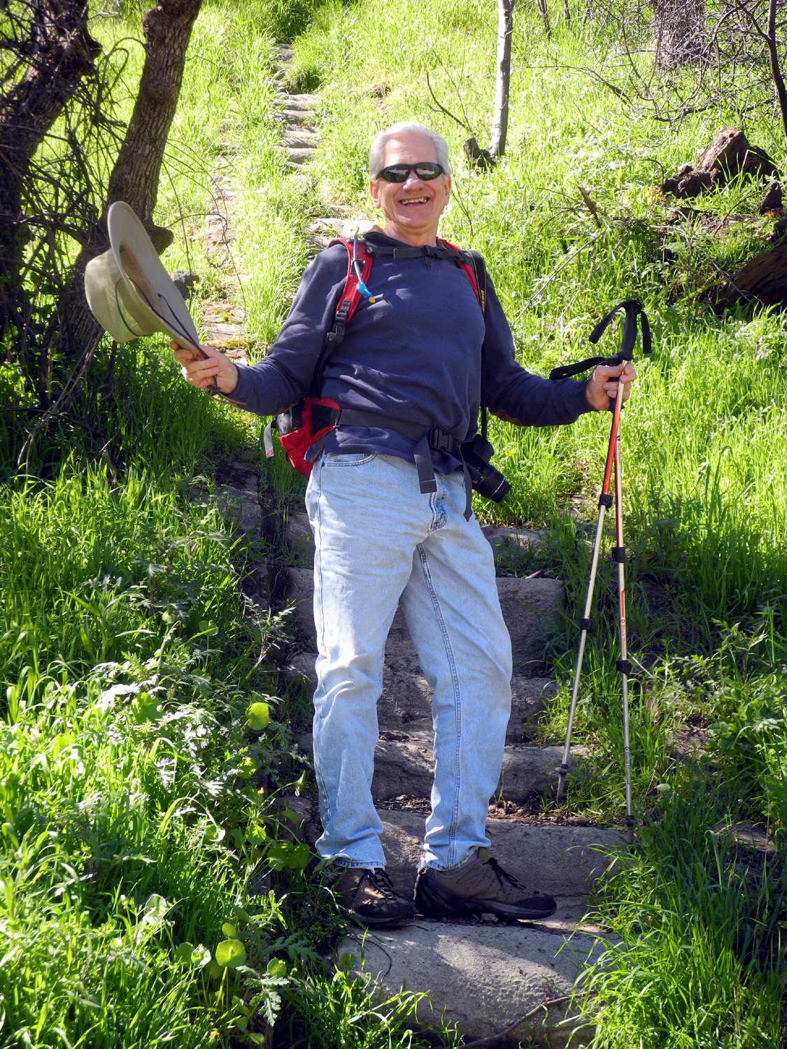
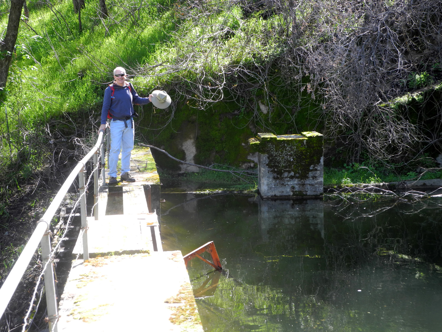
Millerton Lake South Bay Trail To kick off 2017, the Ramblers repeated a hike from just over two years earlier, the Blue Oak Trail on the south shore of Lake Millerton. Julie had a conflicting engagement, so the hikers were Wes, Carolyn, Dick and Don, who is now an official Rambler. The best way to do this hike is to leave a vehicle at both ends of the trail, so we all met at the town of Friant on January 16, then drove to Winchell Cove Marina, left my Honda there, and drove in Wes's Highlander to the state park entrance and into a small parking lot where the trail leaves the road. We had read of groups spotting eagles while hiking or boating in this area, so it was our hope to see one soaring overhead or perched in the branches of one of the many blue oaks along the way. This was not to be, although we saw many small birds, some ravens, and a few ground squirrels. We saw magnificent green hills, lots of blue oaks, and near the end of the trail, a few bull pines. We also saw water - the lake, which had been a large puddle during the drought years, is around 80% capacity, and would be full if the irrigation managers were not releasing a large flow to make room for the snow melt and runoff that are expected from the big storms that have moved across California during January. In the past, getting down to the water line would have been a hike in itself; now it's an easy stroll. Along the trail we met a large group of birders, one solo hiker, and a number of bike riders, all undaunted by the weather, which was cold and overcast most of the time. As we reached the end of our outing at Winchell Cove, the clouds lifted enough to give us a look at snow on a short section of the distant Sierras. As we came in sight of the boats moored at the Winchell Cove Marina, we felt a touch of disappointment, because the hike had been so enjoyable, and it seemed to be over too soon. However, seeing the boats and arriving at the parking lot are two different things, and we were not as close as we thought; we still had to go over the "hardest" part of the trail, a brief uphill section through a rocky passage. In the end, when we came in sight of my Honda, we felt we had hiked just the right amount. We drove back to our starting point, retrieved Wes's Highlander, and headed for the park exit. When we reached this spot, the sun had come out a little more, and we had a view of a longer section of the mountains, sparkling with the white stuff. We caravanned to nearby Friant, and enjoyed an excellent lunch at the Pizza Factory. We also finally enjoying some sunshine right where we were standing instead of seeing it on the distant mountains. Wes provided this summary of our day: January is the beginning of a new year for Ramblers hiking. Dick chose a beautiful hike along the shores of Millerton Lake with waters almost at the spillway of the dam. We had hoped to see eagles nesting in the oak trees or soaring in the clouded skies. That was not to be. Instead we enjoyed the haunting beauty of blue oak trees stripped of their leaves with branches extended like veins or tentacles. The sun was playing a game of peek-a-boo with the clouded skies. Now and again the rays of the sun would highlight the snow covered mountains to the east. This hike of less than two miles on even ground was a needed respite from the confusing sights and sounds of the city. We had a wonderful experience. I wish more of our friends could have been with us. I'm hoping the photos below will encourage them to join us next month.
--Dick Estel, January 2017 |
||
|
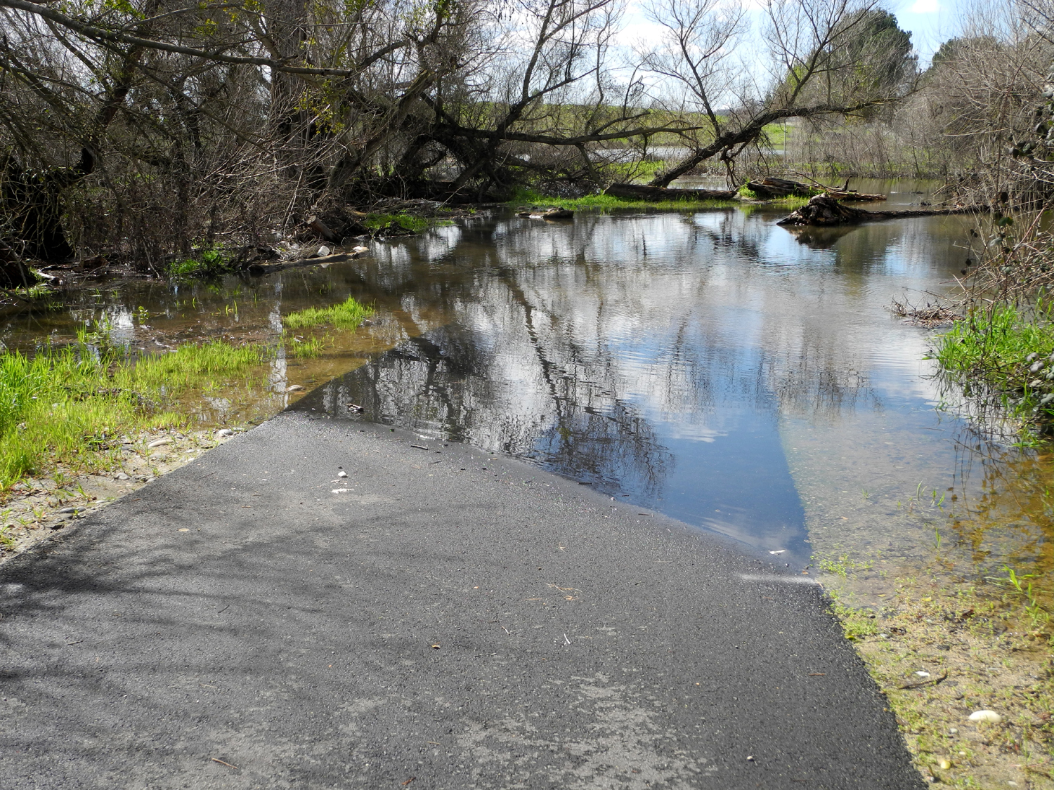
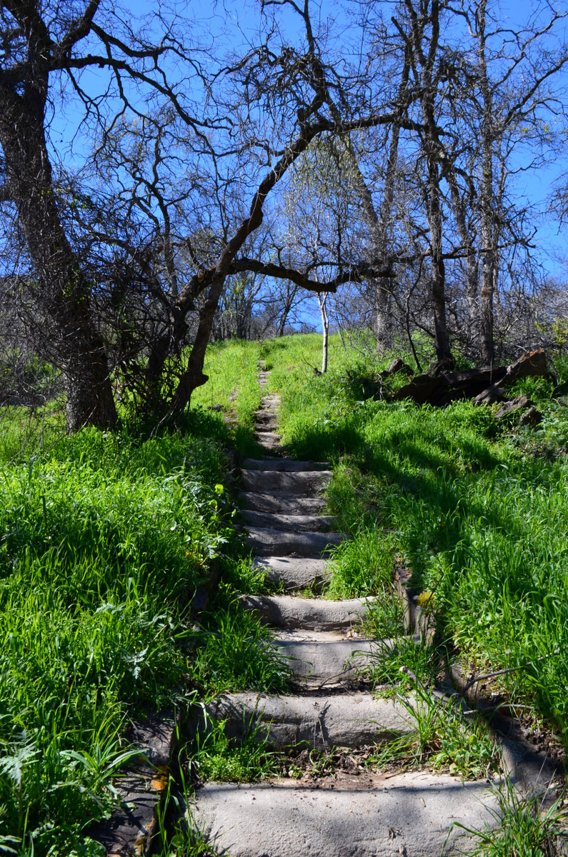
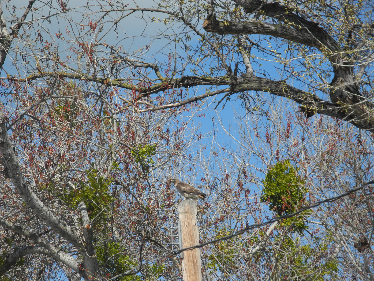
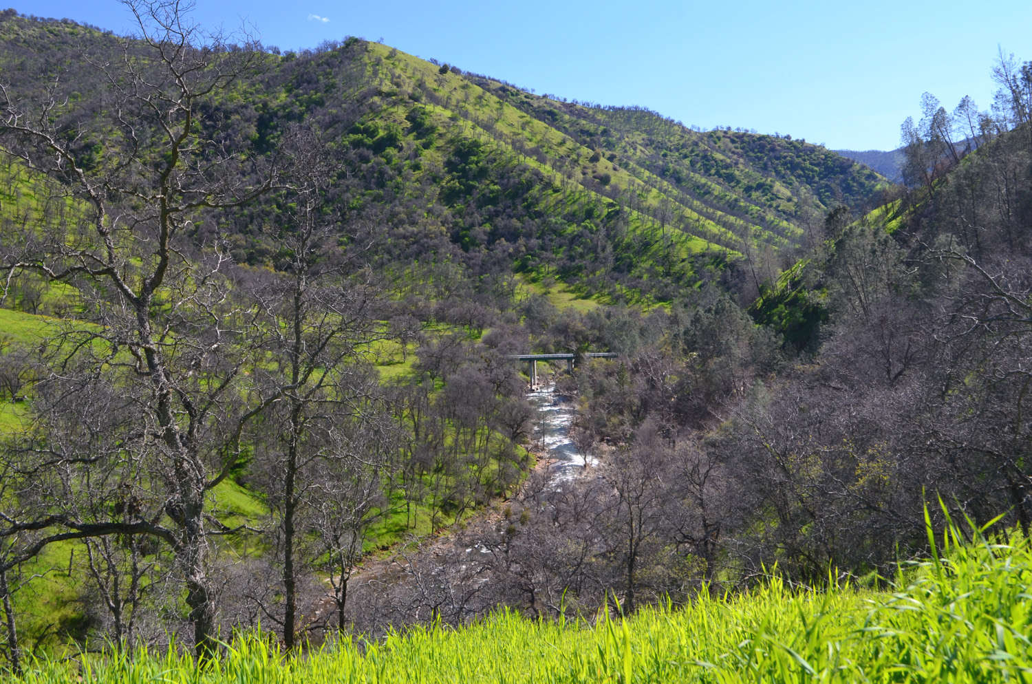
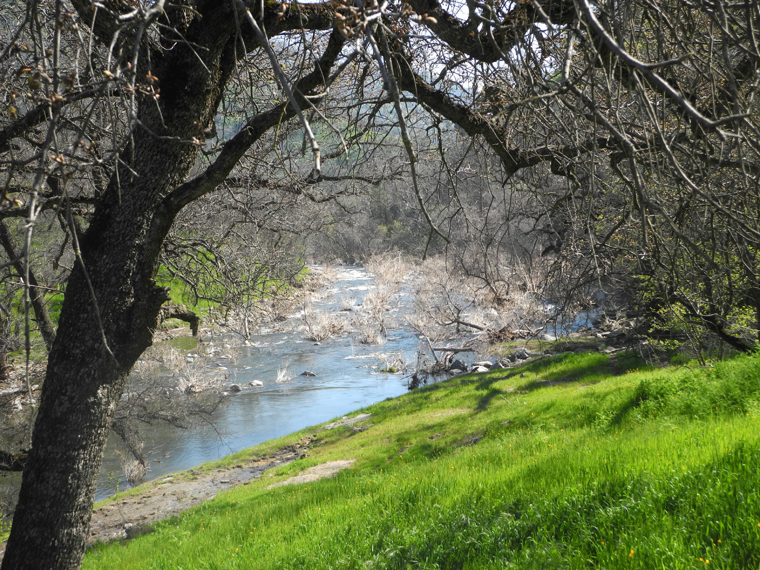
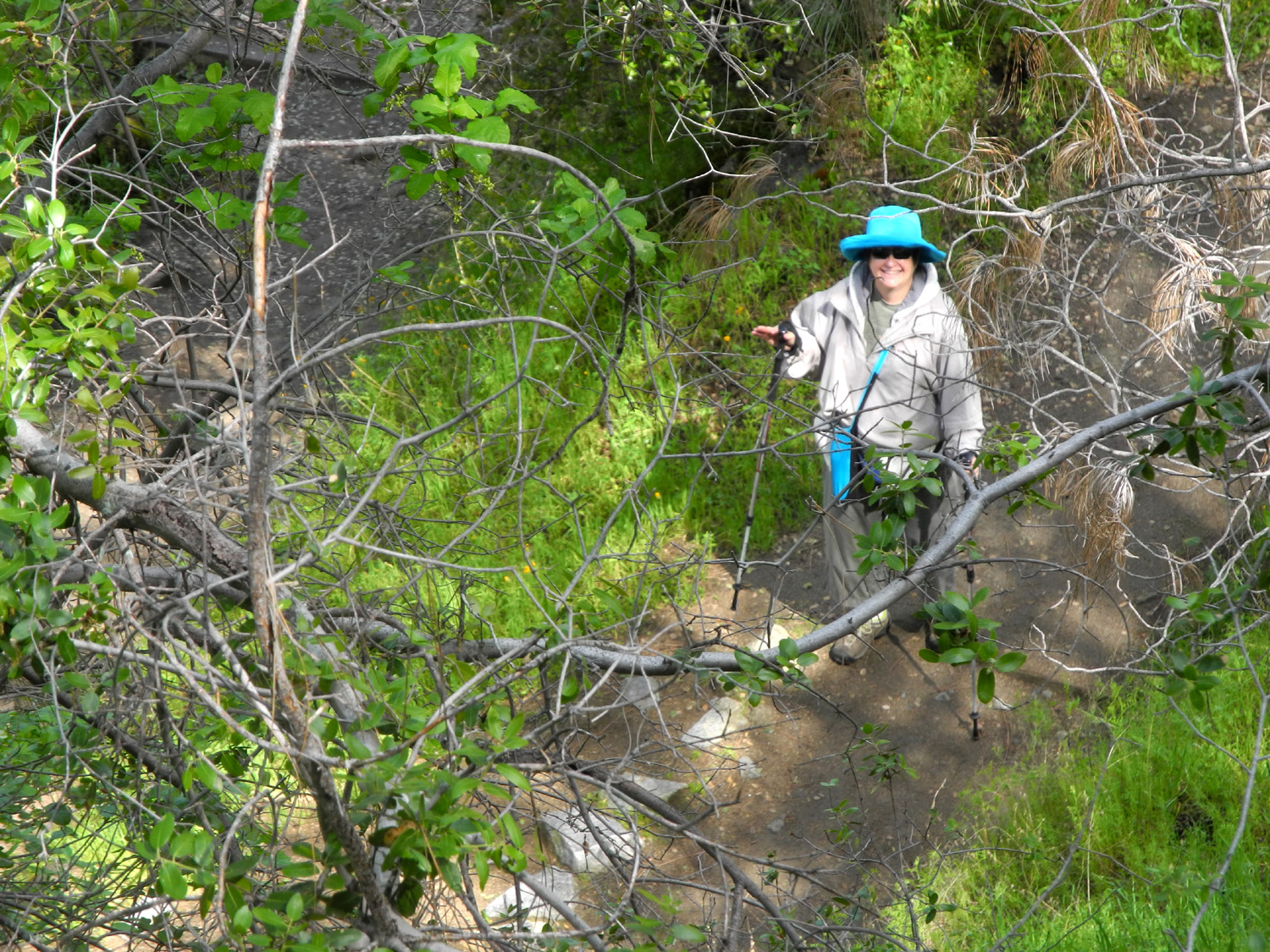
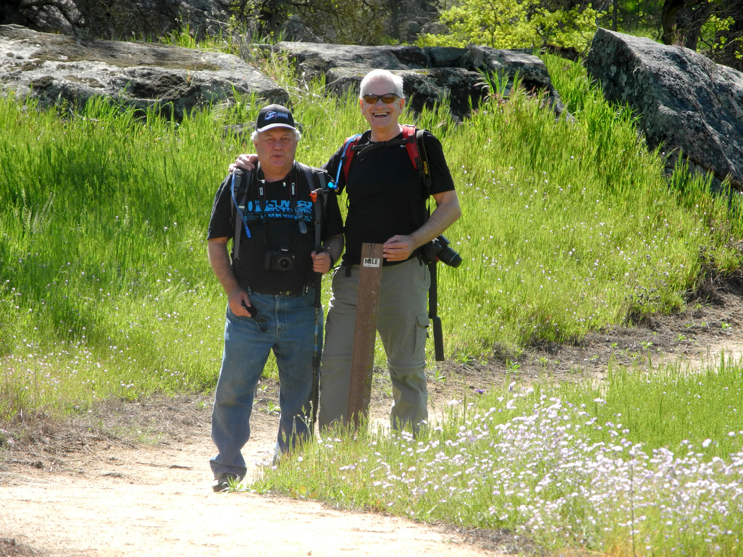
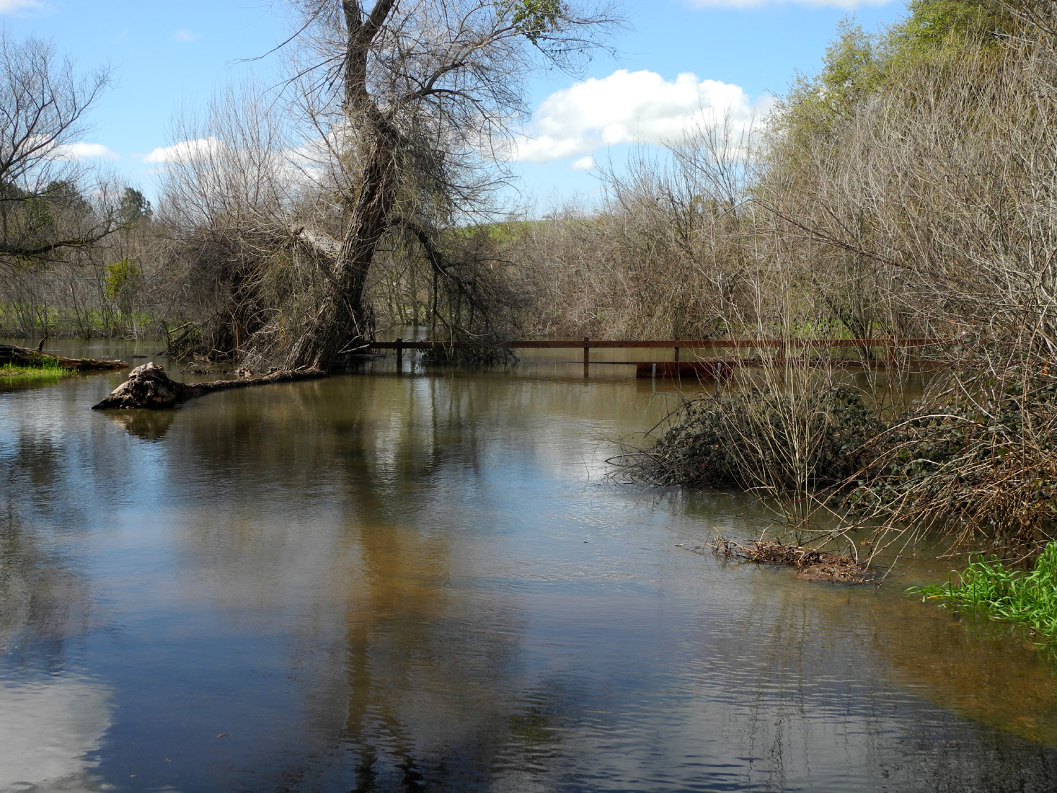
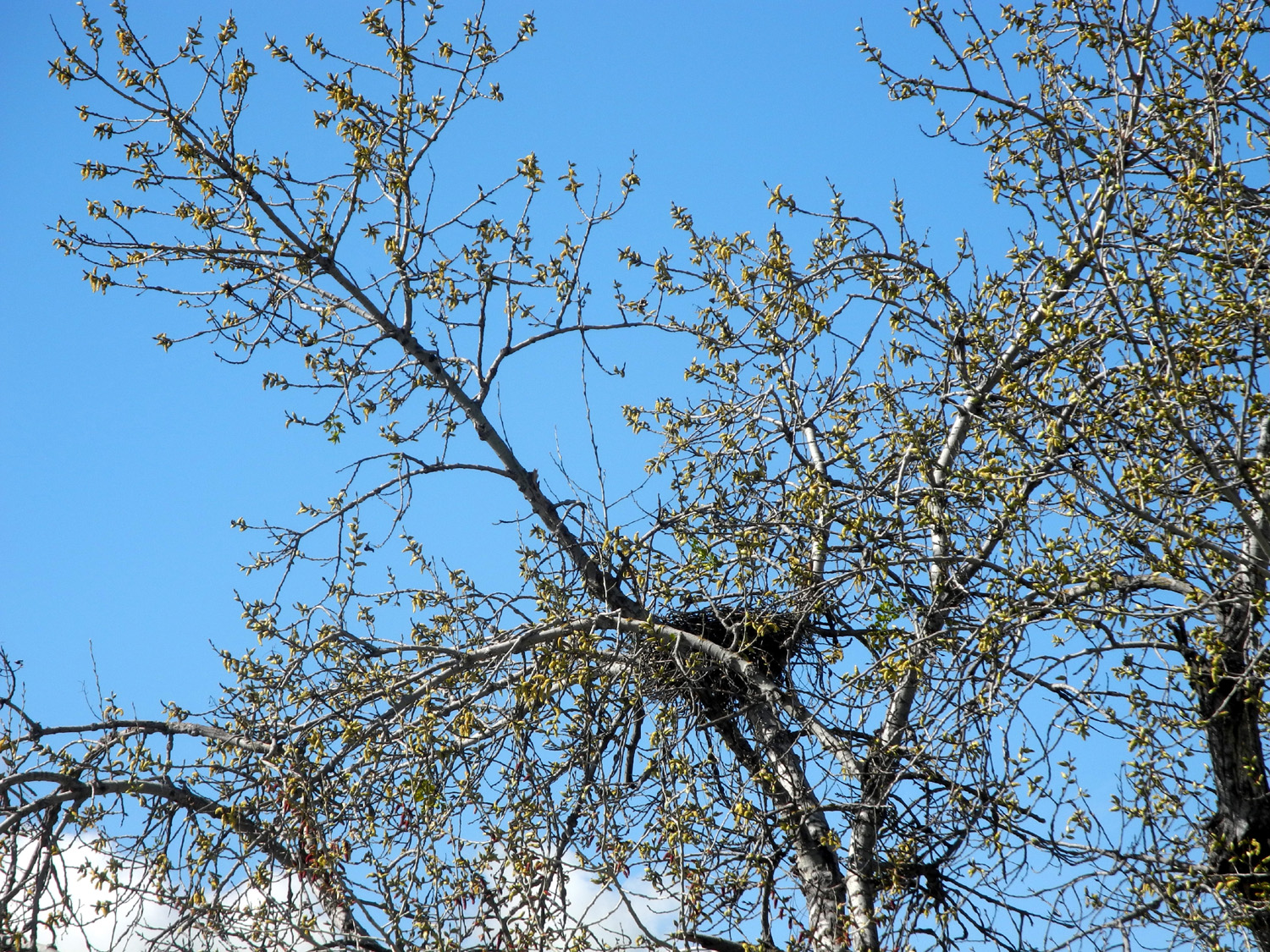
FINS Trail It's possible we may have to call this the FINS Trail and Swimming Hole, but more about that later. First let it be said that I have hiked this almost-new trail once, and Wes has ridden his bike there, both before the massive rains of 2017. Julie and Carolyn were not able to join us, but Don was there, along with another of our former colleagues at the Department of Social Services, Sue Wirt. She is an enthusiastic camper and hiker, and usually when I mention going some place, whether in the Sierra or in another state, her response is, "Oh yes, I was there in 19xx...." So at least this time I had been here first. Since it was a short distance from home to the trailhead in Friant, and a short trail, we met at 11, Don and I driving our own cars from opposite directions, and Wes picking up Sue. Actually Don arrived at 9, having it in his mind that we had a "regular" time for our hikes. No such luck, we adapt the time to driving distance, weather, and whim. At least he had time for a cup of coffee, and a three-course breakfast if he had wanted it. Although an early forecast had predicted a few showers for the day, it was dry and mostly sunny, but very windy - flags sticking straight out at the fish hatchery next to the trail. We all added an extra layer and I wore my gloves. With the wind blowing upstream along the nearby San Joaquin River, it was right in our faces. We walked down the stairs from the parking lot to the hatchery, which offers a bathroom, then walked through one of the buildings, one in which no fish could be seen. Once we got on the level, paved trail, we took a short detour at the Small Fry Trail, a section with lots of stuff that kids like (and we are all kids in some way). There are photos of this area with my earlier report, so I only took one this time. There is no place for a "Wes on the rock" photo, so we substituted "Wes on the cattail." The trail runs about 3/4 of a mile to Lost Lake County Park. We knew that the park was closed because of high water in the river, caused by flood control releases from Friant Dam. What we were not prepared for, half way to the park, was the need to have hip boots or a raft to finish the trail. An overflow channel in the river was overflowing the trail, bringing our walk to a halt. We're not used to such adversity (even very mild adversity such as this), so for a while we just stood around observing the scene and taking pictures. Wes set up his tripod to take our group photo there, and we chatted for a while with a bike rider who came along and was also stopped in his tracks. When we started back, we had the wind at our backs, so it was much more comfortable, and of course, we got a different view of some scenes we had missed on the way in. Where the trail goes by the hatchery, you can go in and walk beside the long outdoor tanks where the larger fish are kept, so we enjoyed that diversion for a while, then headed back toward the parking area. Before ending the hike we sat at a picnic table by the hatchery and enjoyed some good conversation, one of our special skills. As we started up toward the parking lot, we saw a pair of hawks, swooping and diving, and spotted their nest in a tree between the hatchery and the trailhead.. When we end a hike in or near Friant, our favorite lunch stop is the Pizza Factory. This is a chain that got its start in Oakhurst and Mariposa, up in the foothills above Fresno, and puts nearly all its stores in smaller towns. I've patronized them in at least a half dozen places, and they are always very good. Even with with a shorter hike than planned, we did enough wandering about to put in a mile and a half, and to spend two hours in the delightful riparian environment. Wes summed up the day as follows:
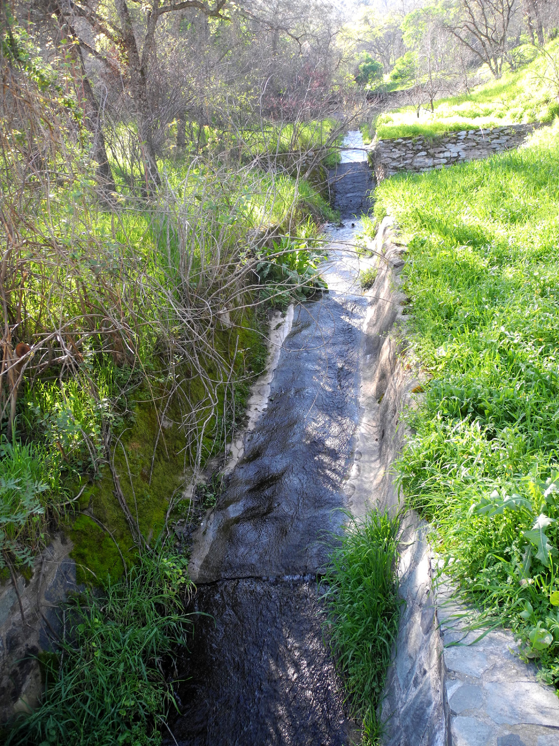
Along the way back home
one of the foothill creeks, Little Dry Creek, crosses Friant Road on
its final run to the river. I've been photographing this creek along
Auberry Road and Millerton Road, so I took advantage of the
opportunity to get some photos of it as it nears the end of its
run. --Dick Estel, February 2017 |
||
|
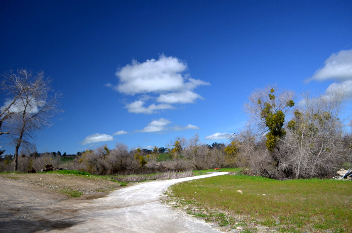
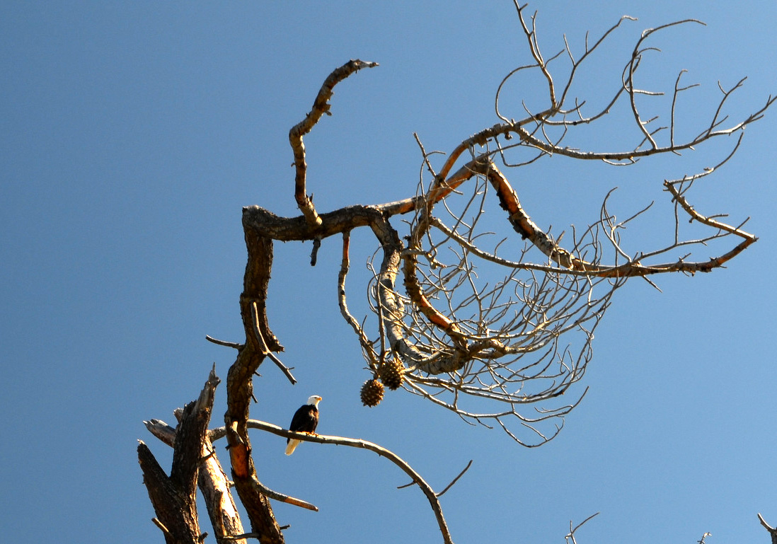
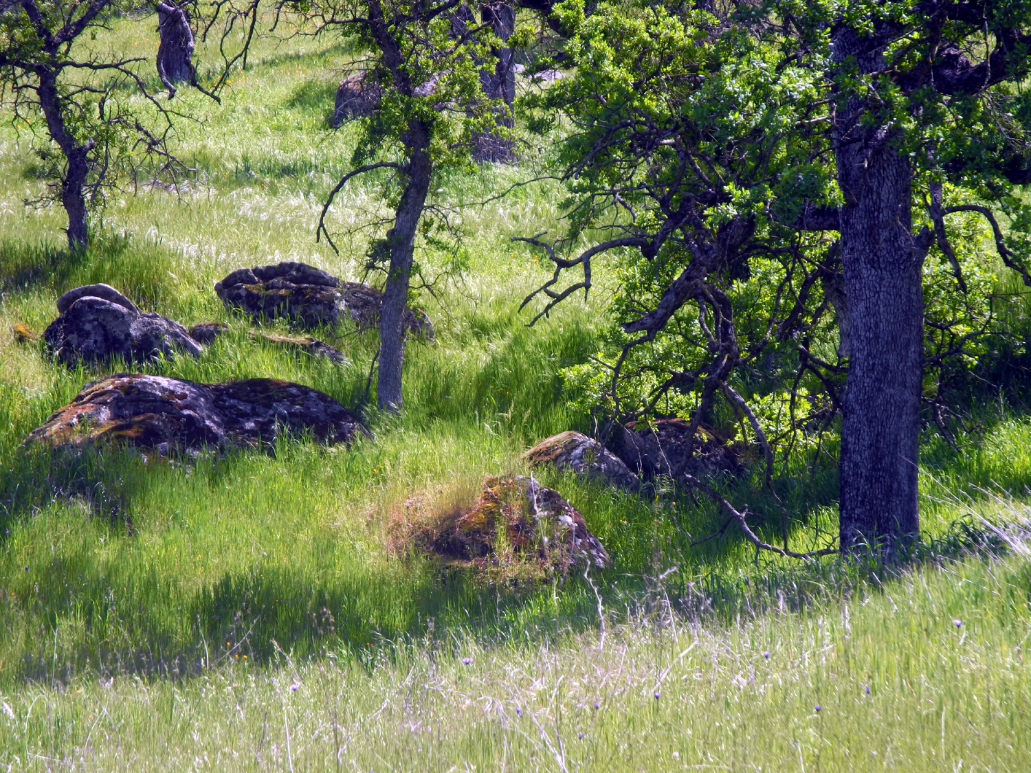
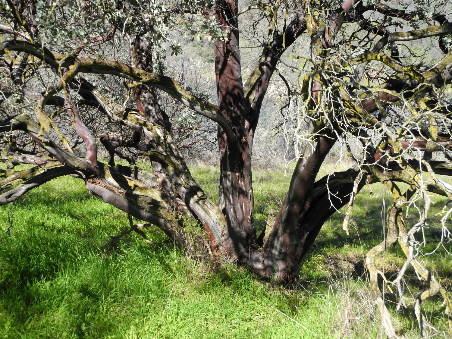
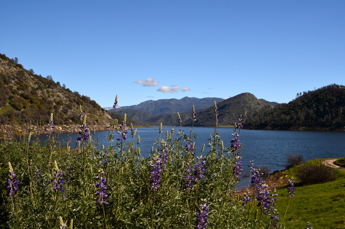
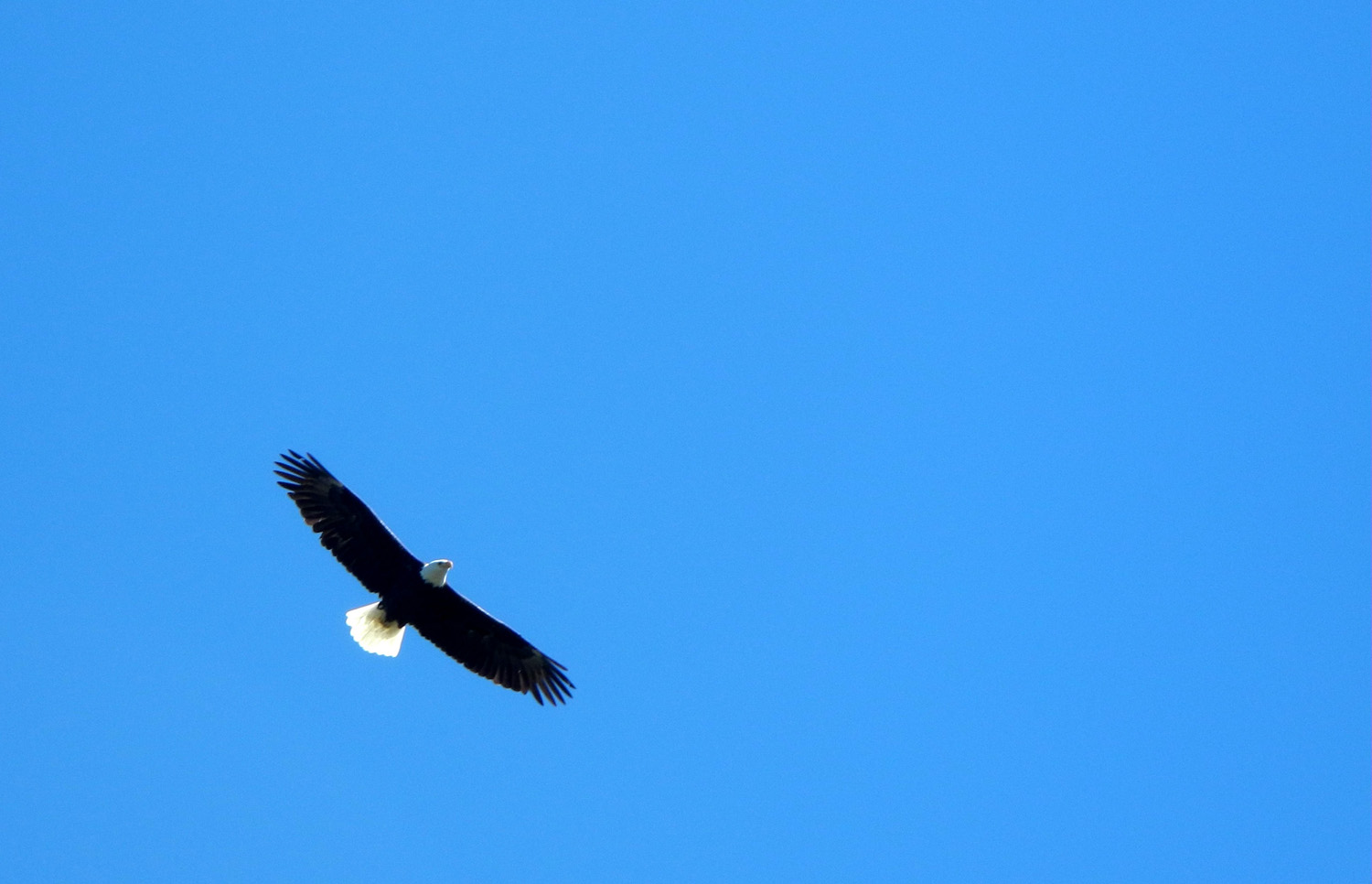
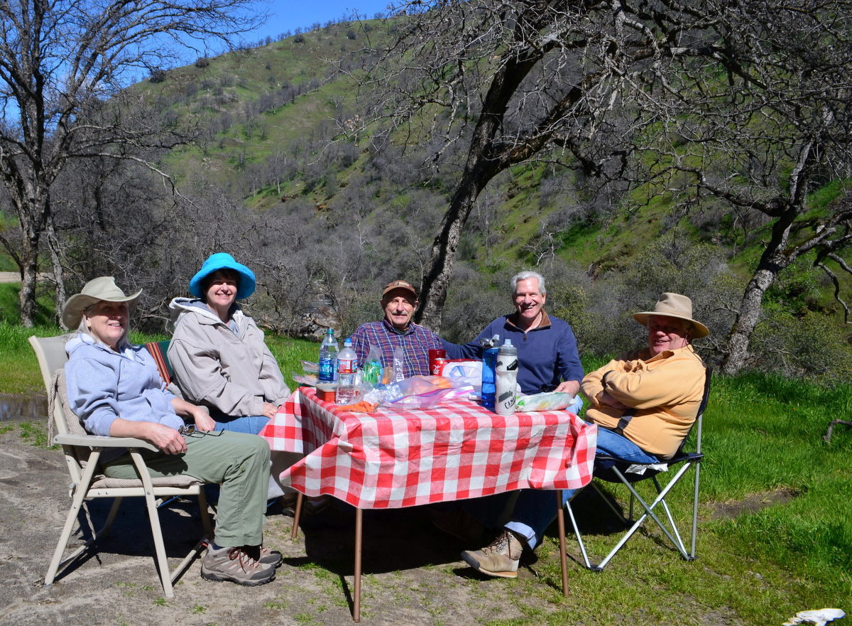
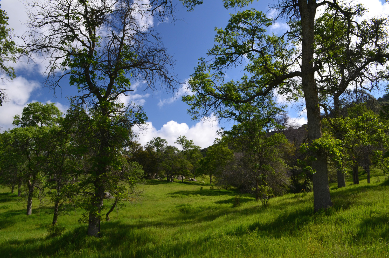
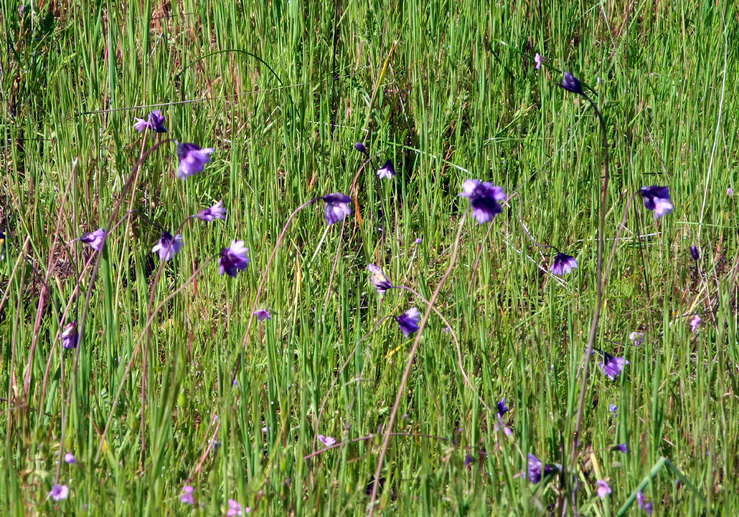
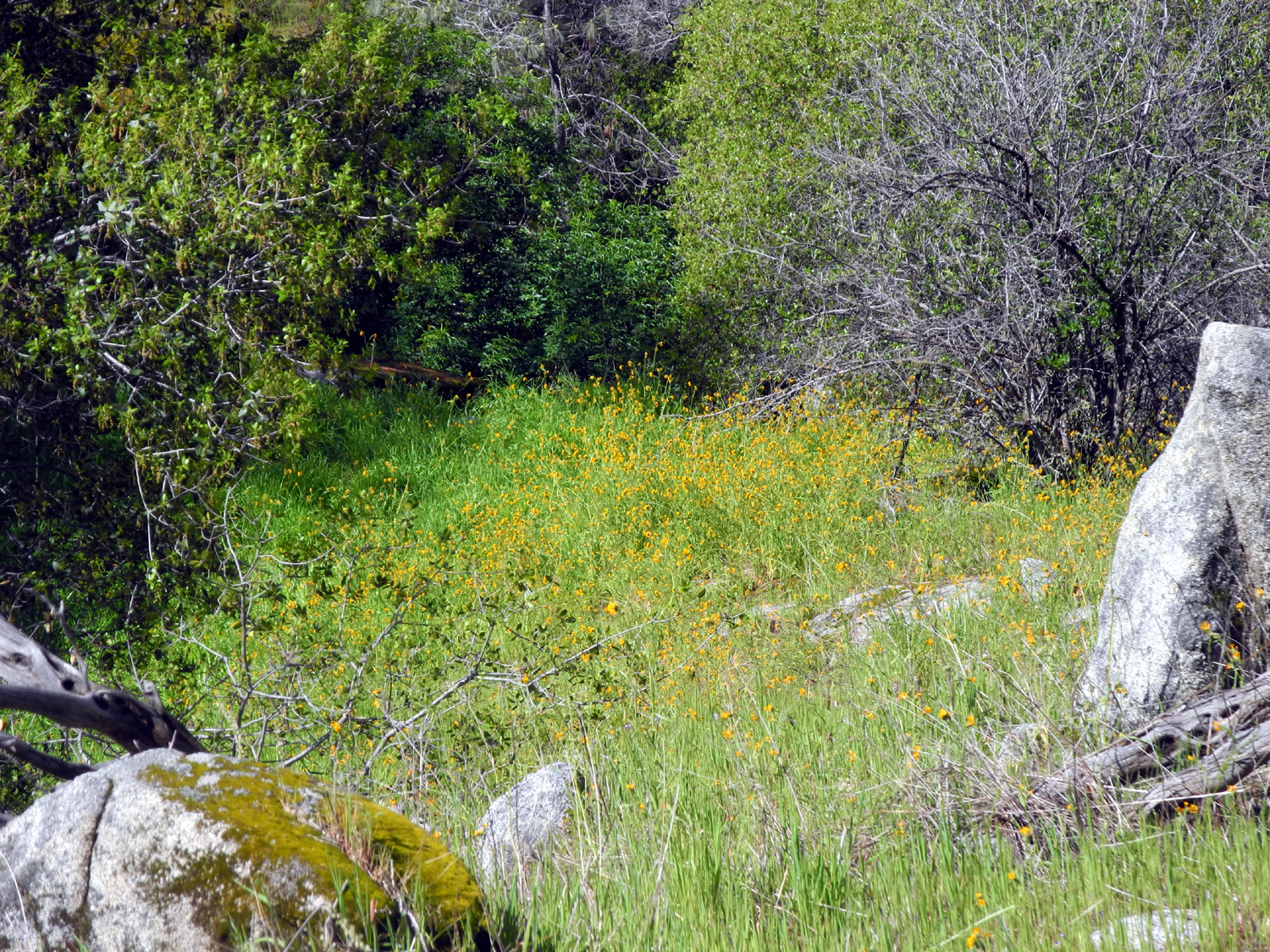
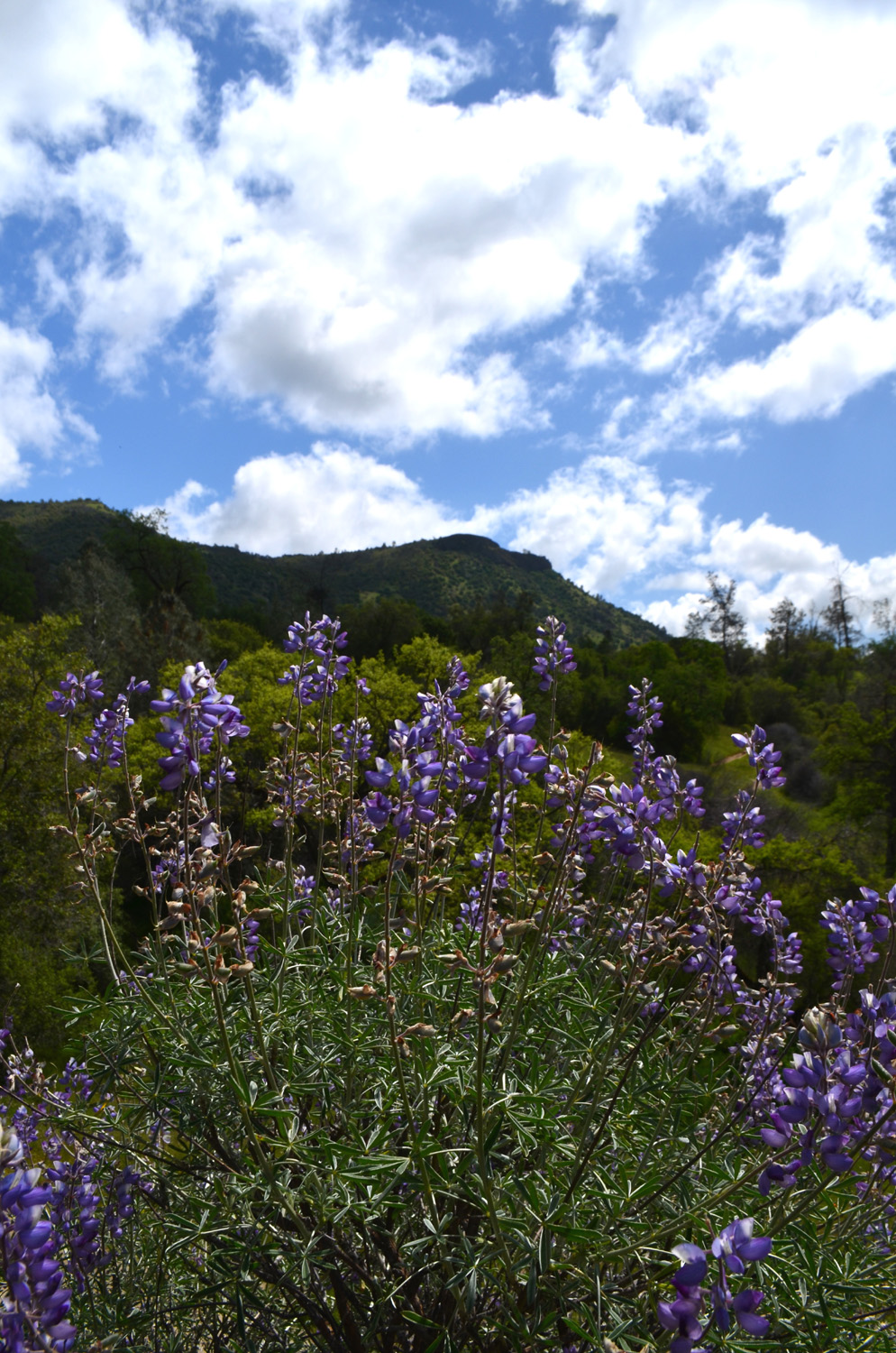
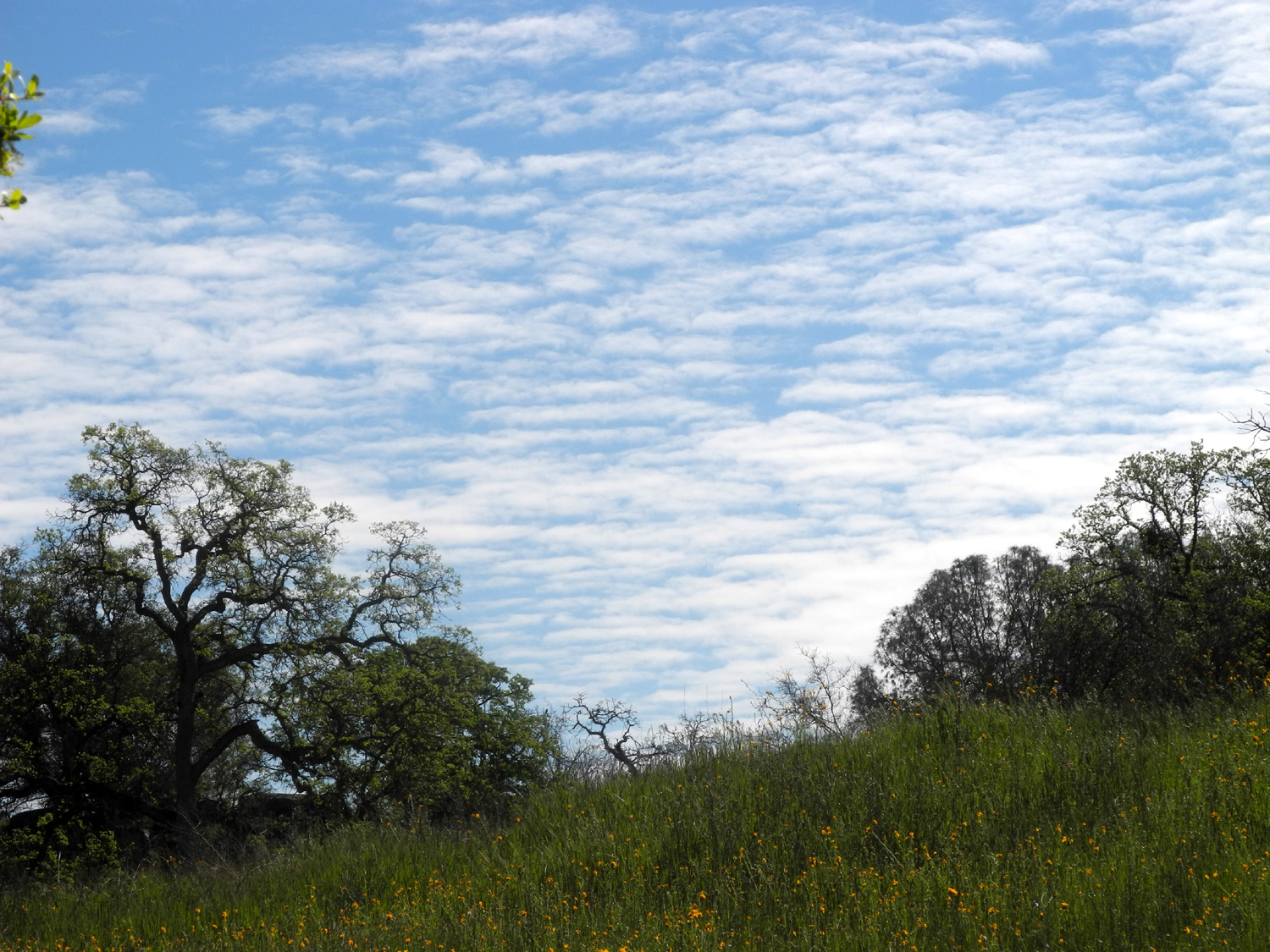
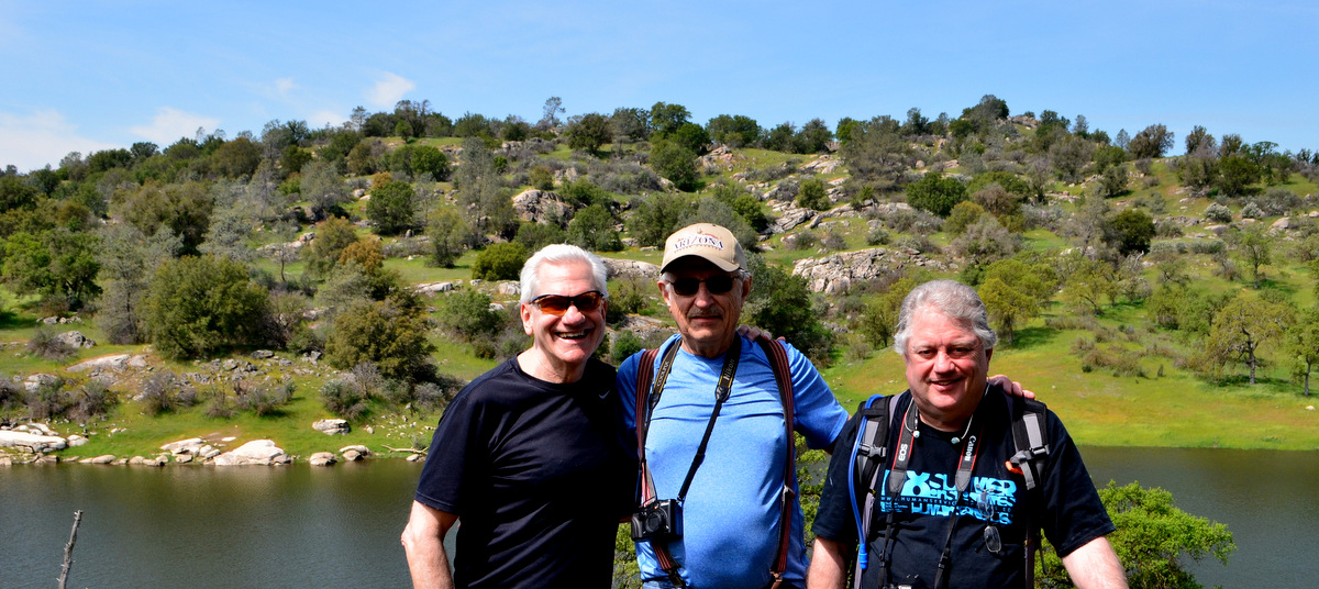
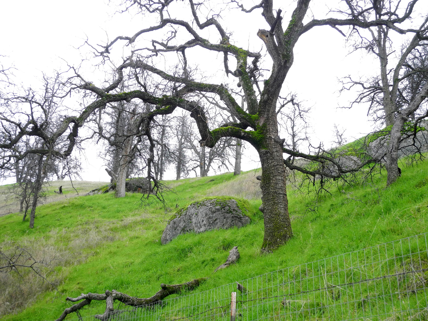
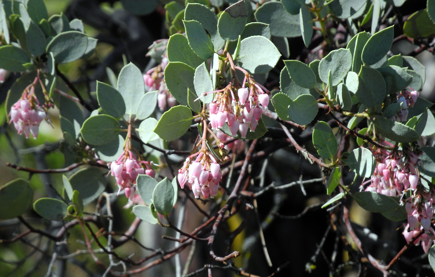
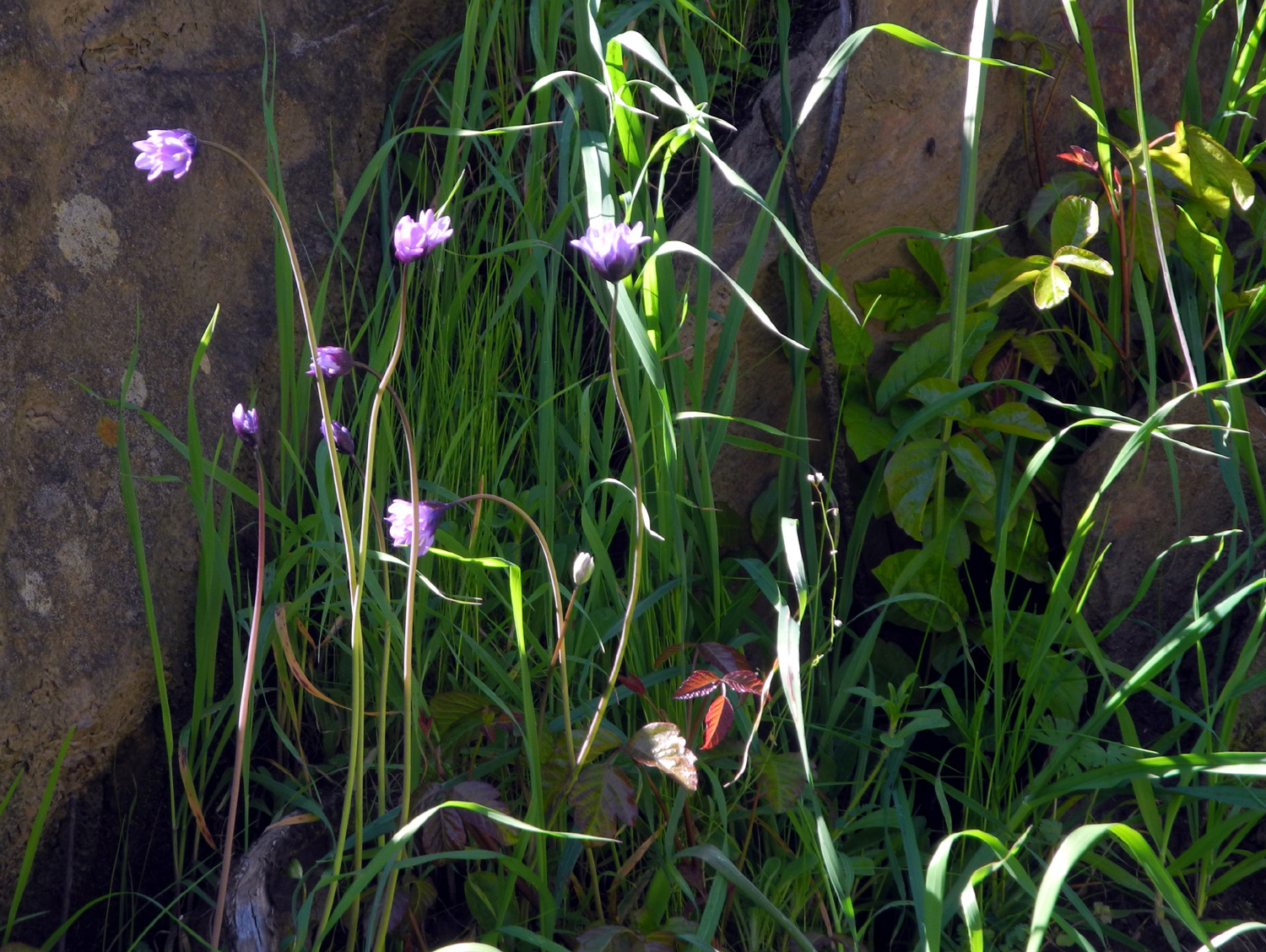
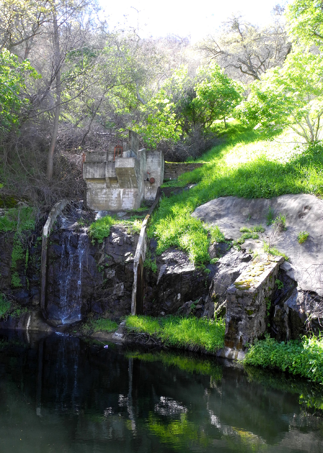
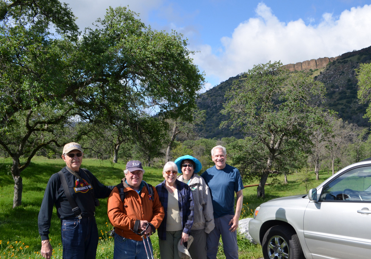
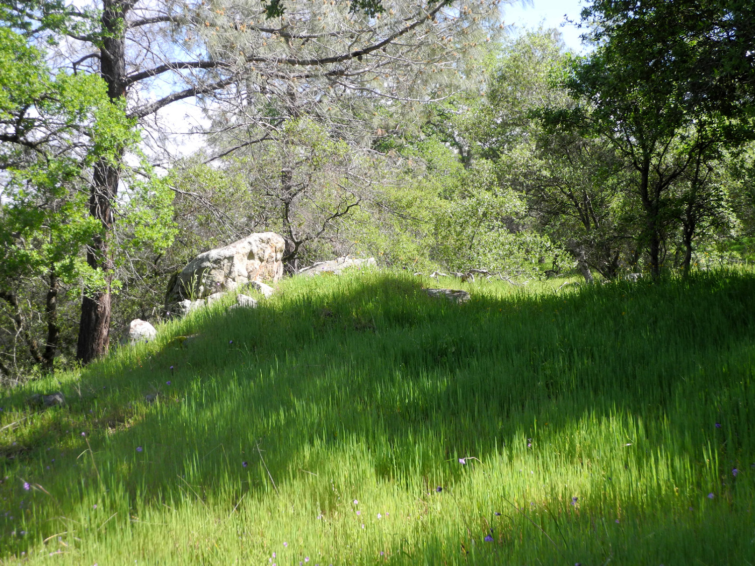
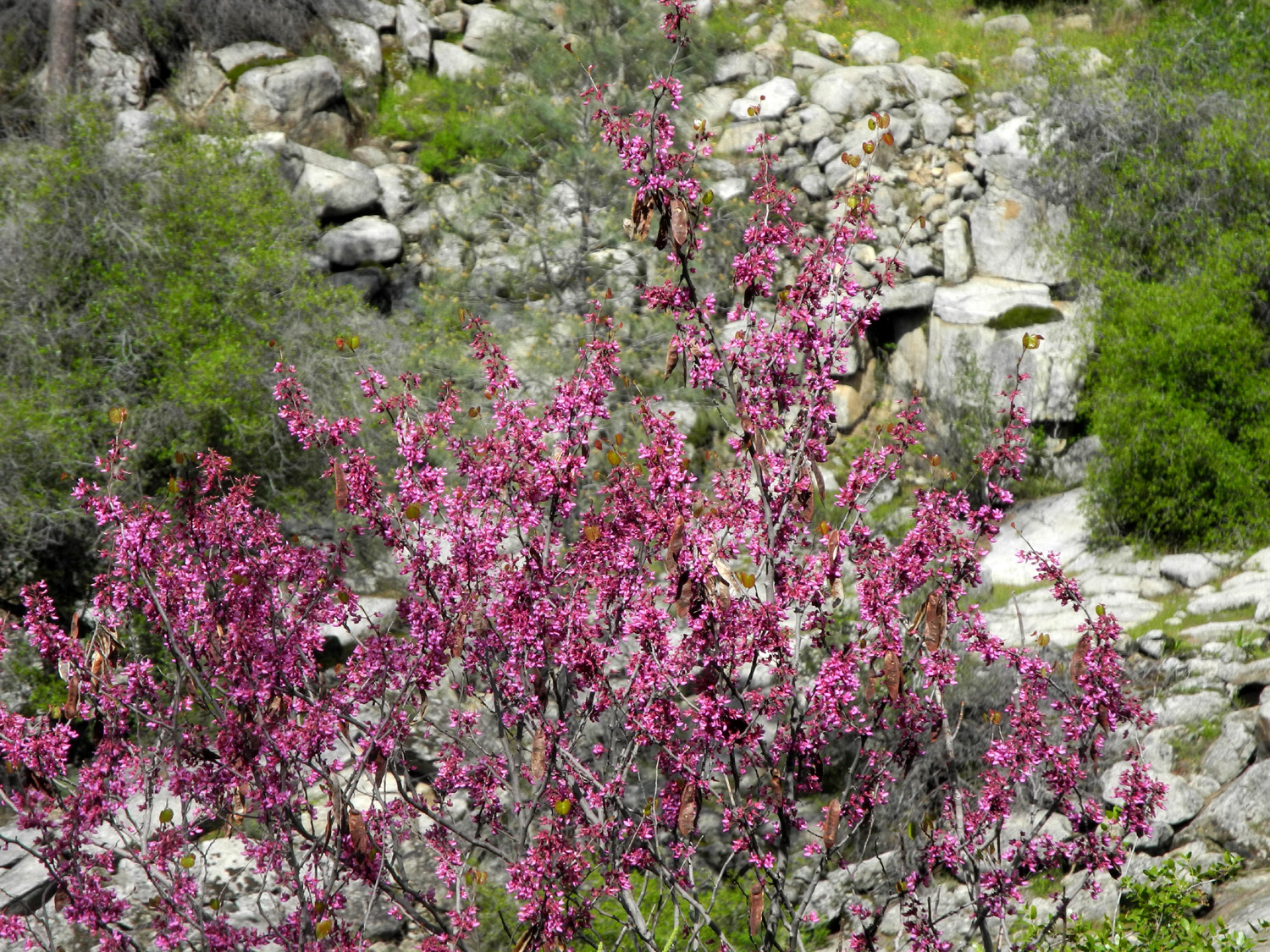
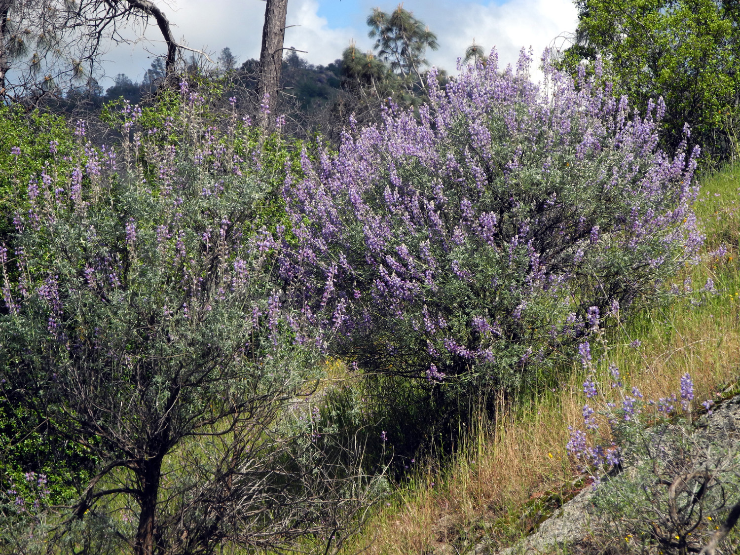
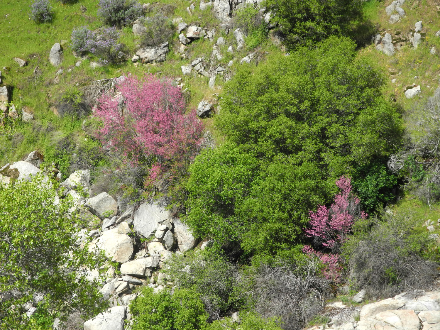
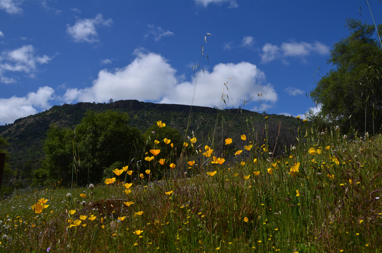
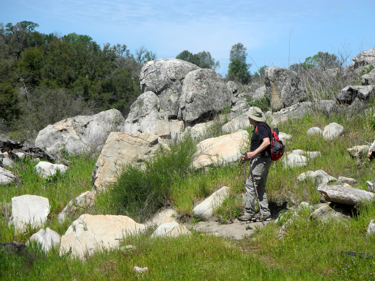
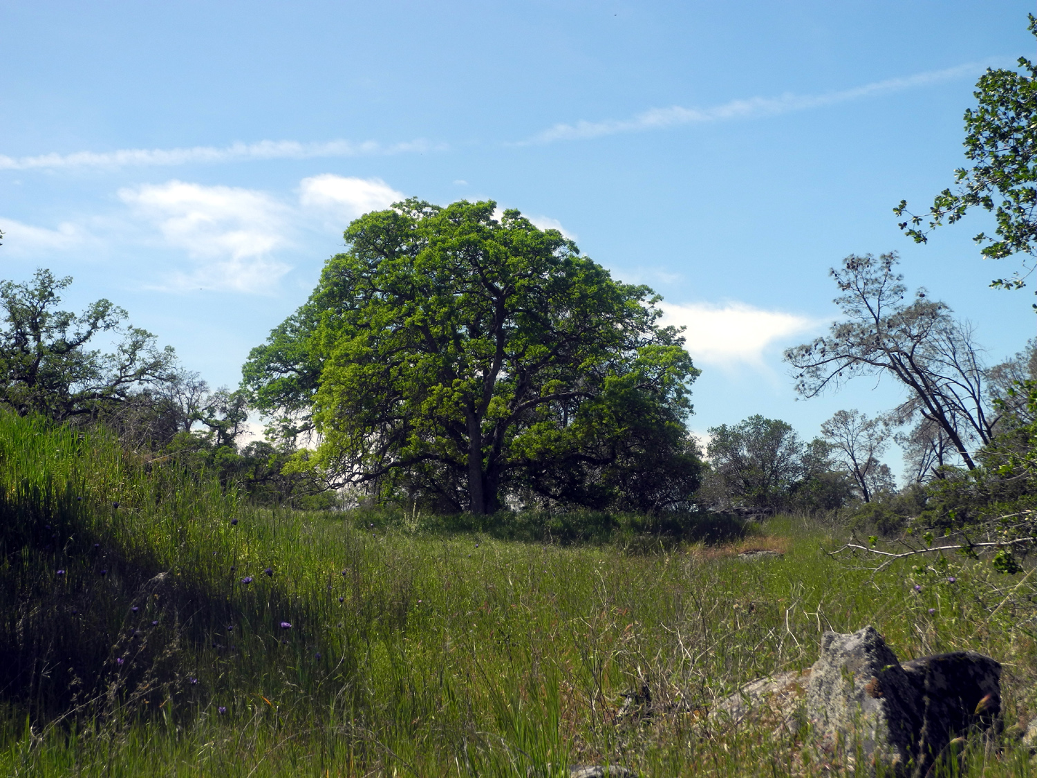
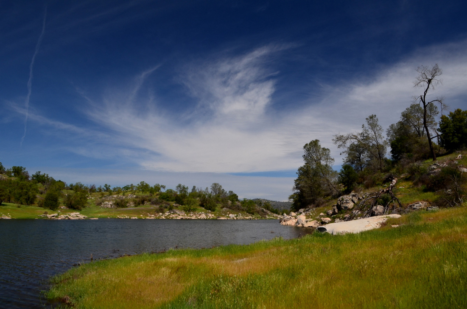
Sycamore Picnic Ground & Big Creek It's that time of year when the Central Sierra foothills demand our presence, and this year the Ramblers plan to do two hikes in March and two in April. Our first one, on March 6, was relatively easy and short, but every bit as delightful as we expected. All the "official" Ramblers were present - Julie for the first time since October, Carolyn after missing our February walk, plus Wes, Don and Dick. I'll let Wes set the stage: Dick has doubled our workload. No, not our caseload. He has scheduled two hikes each month this spring to closely follow the change in seasons. And that is a 100% increase over last year. But the pay remains the same: $0. Today we took a short hike in the Sycamore Creek area. We circled a fence which indicated the area was closed and followed the remnants of an old paved road leading to an abandoned picnic area with a vista of the upper Pine Flat Reservoir. We were all surprised when Don yelled out, "look!" He was pointing to a bald eagle resting on a branch of a nearby tree. We couldn't get enough of that beautiful bird both resting and in flight. We had hoped to see hillsides filled with carpets of wildflowers. They are not there yet. We saw small clumps of various wildflowers including poppies, popcorn flowers, blue Dicks, lupines and others. But we did not find a massive outpouring of these seasonal flowers. We did find bush lupine coming out quite nicely. We finished our hike by driving along the lake to a beautiful rest stop. Dick and I took a second hike up the stairs of a nearby trail. The weather was perfect and the gentle sounds of water over rocks could have lulled us into a natural sleep. But for some strange reason we chose to return to "civilization" and the annoying sounds of way too much traffic. What fools we are! Perhaps next time we will disappear into nature and forget about the return trip. Wes and Don met at Julie's and that trio traveled in Wes's Toyota, while I picked up Carolyn in my Honda. We met at Kirkman Point, the first place on Trimmer Springs Road where Pine Flat Lake comes into view. We reveled in the sight of the water at the highest level we had seen in years, surrounded by bright green grass. We then drove about ten miles to just past Sycamore Creek, the first of two large tributaries that enter the lake on the north side. Just beyond the creek are two closed campgrounds and a closed picnic ground, all of which are accessible for walking. The paved roads in the campgrounds are still mostly intact, but the picnic ground road was more a dirt path. I think maybe the pavement is still there, but the configuration of the land there has allowed soil to wash down over the road over the years, so there are grass and flowers not only by the road, but IN the road. There was a tree across the road, but it was small enough for us to step over. These locations are officially closed, but obviously used by many walkers, so it will be interesting to see if the forest service clears the tree (as of 2021 it is still there). The road goes a little less than a half mile out on a ridge, then loops around. At this point a cow trail leads out to where the ridge drops down to the lake, and we continued our walk on this route. It was good that we did, since it was here that we saw the magnificent eagle that Wes mentioned above. It was also in this area that we actually needed our hiking poles, since the original path, not particularly smooth to begin with, has been blocked by a couple of fallen trees, and the bypass took us over uneven ground. Among the flowers we enjoyed were the tiny, bell-shaped pink blossoms of the manzanita bushes. The white flowers of buck brush were getting a good start, and the usual early spring annuals were represented in small numbers. Back at the trailhead, we drove about two miles farther to where Big Creek enters the lake. Here a dirt road goes mainly north along the creek for many miles, eventually coming out on Highway 168 near Shaver Lake. We went only a quarter mile to a spot where there is a wide, flat area beside the road. We had to dodge the mud puddles here, but found enough room to set up a card table and our chairs, and enjoyed outdoor dining at its finest, with views you never get in the city. The creek is running very full, and Wes went down an old road for a closer look. There is a small drainage running down the hill above the road, and in its small canyon there is an extensive rock structure, consisting of a small dam or weir, other rock and concrete work that defies description, and various valves and gates. The runoff channel itself is paved. There are about five of these structures in the small tributaries that join Big Creek, and I have been told they were used to measure water runoff before the dam was built in the 1950s. Beside the channel there is a rough concrete stairway, steep and with rounded steps. Wes and I walked up to the dam, making good use of our poles on this short but challenging route. The steps end at the level of the weir, and there is a rough trail across the hillside to the rock works. The concrete lined basin behind the dam was full and flowing over the spillway, and we both carefully walked across the dam, one at a time. During our visit here we heard frogs in the pond, but were not able to see them. Once we got back down to the road, we drove up a little farther looking for poppies, and saw one good-sized patch far up on the hill. We found a place to turn around, and headed back to the noise and traffic of civilization. However, we got in about a mile of walking, enjoyed pleasant weather under scattered clouds, and whetted our appetites for more foothill hikes during this extra wet spring.
|
||
|
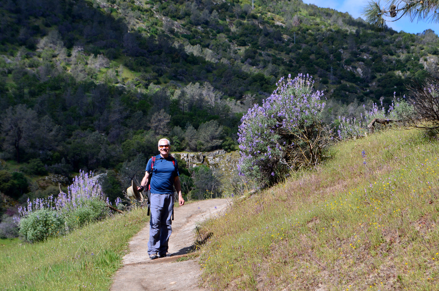
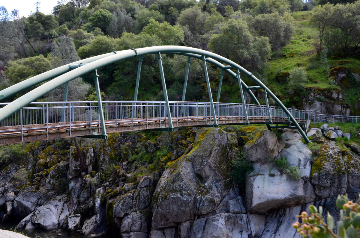
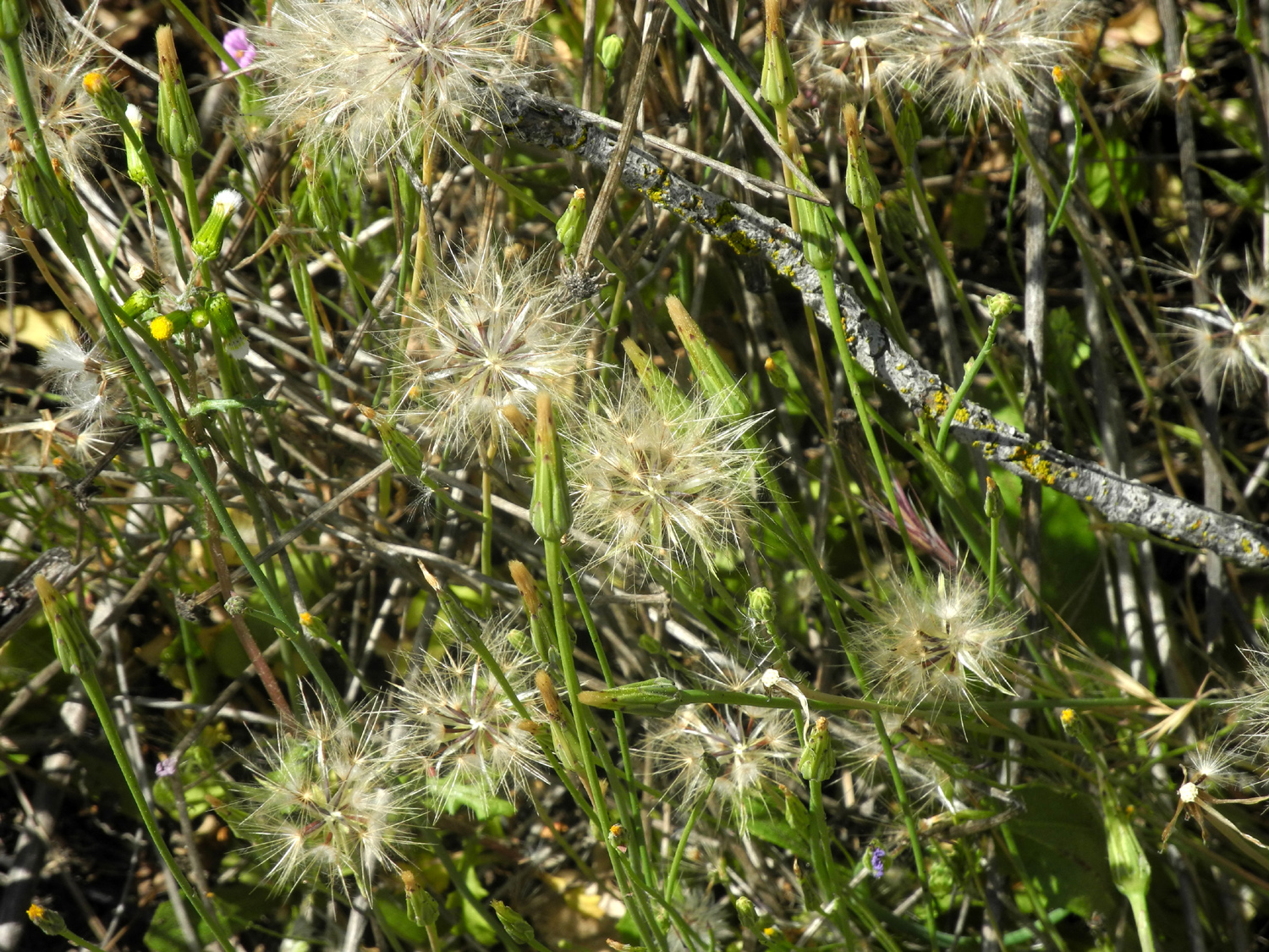
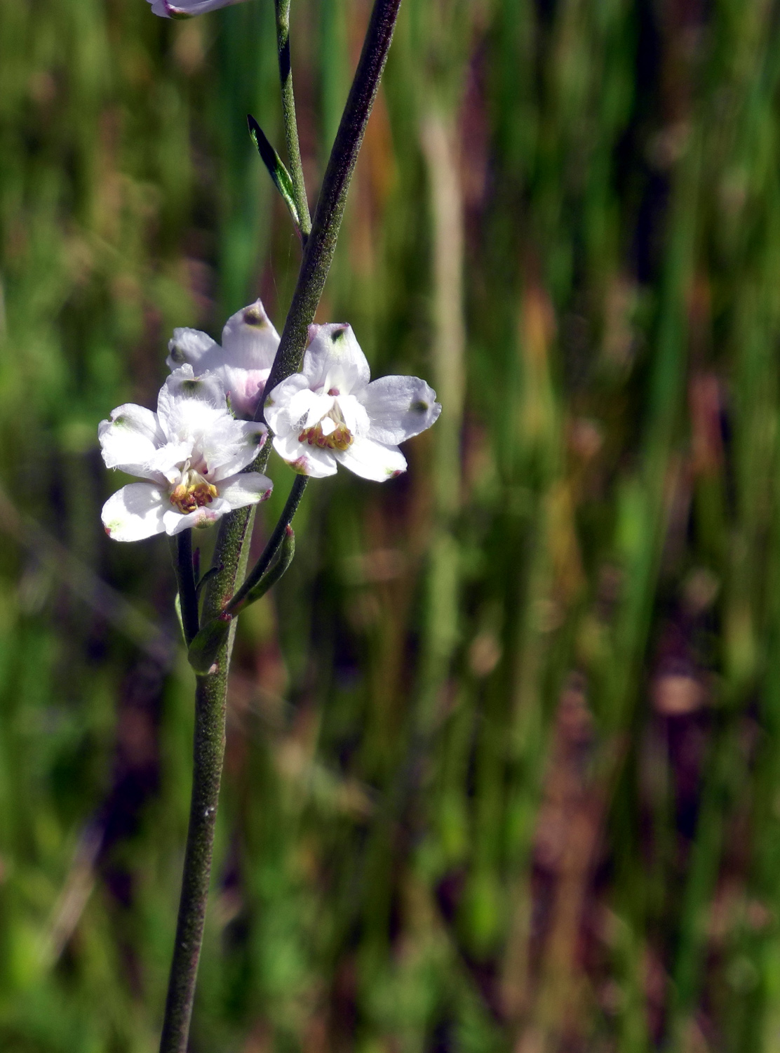
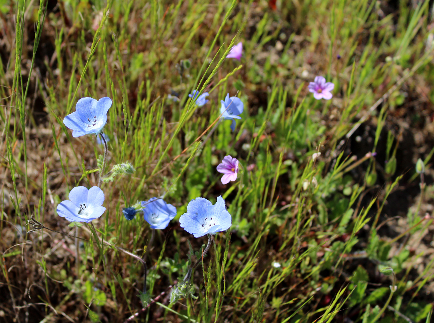
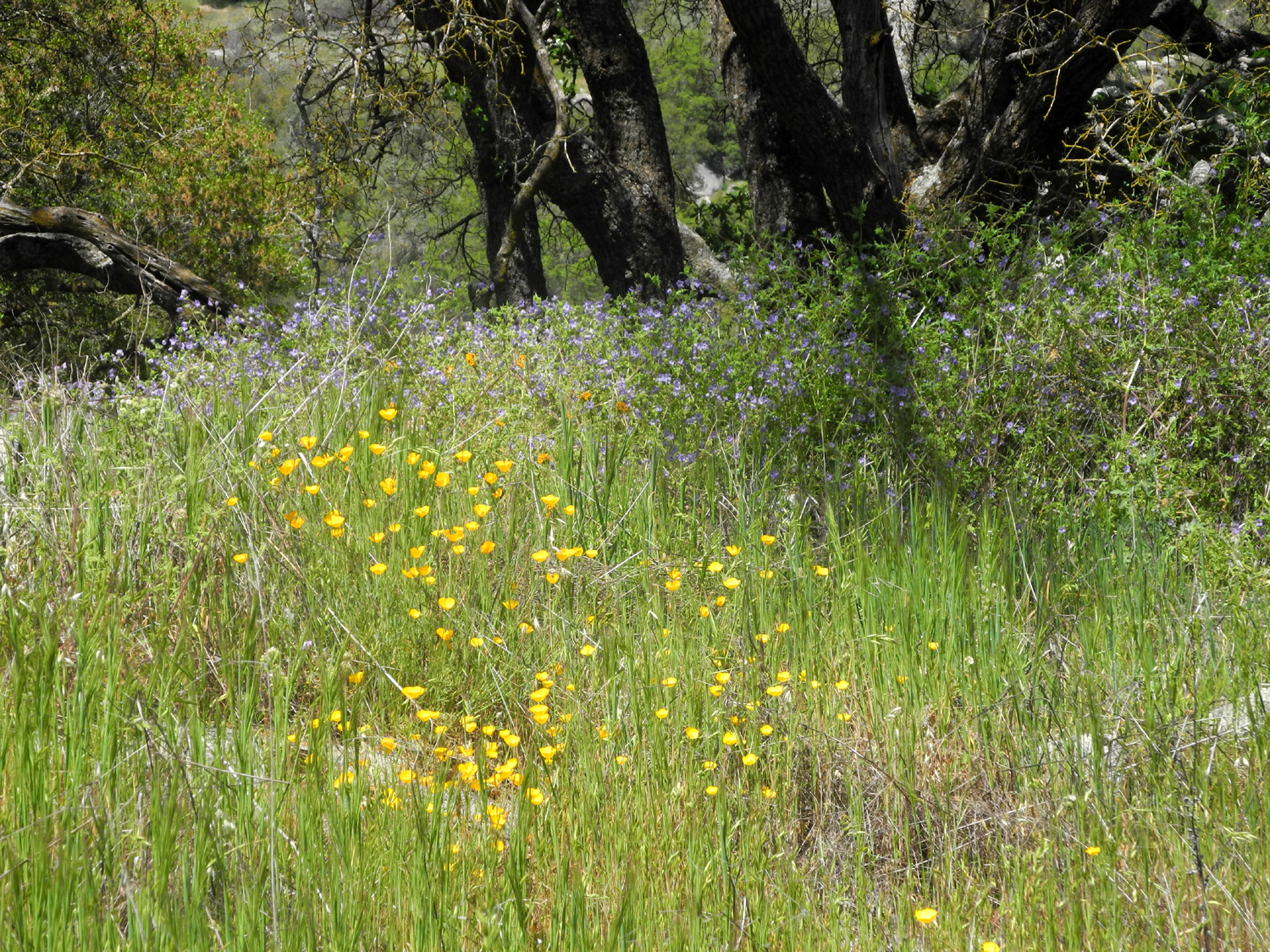
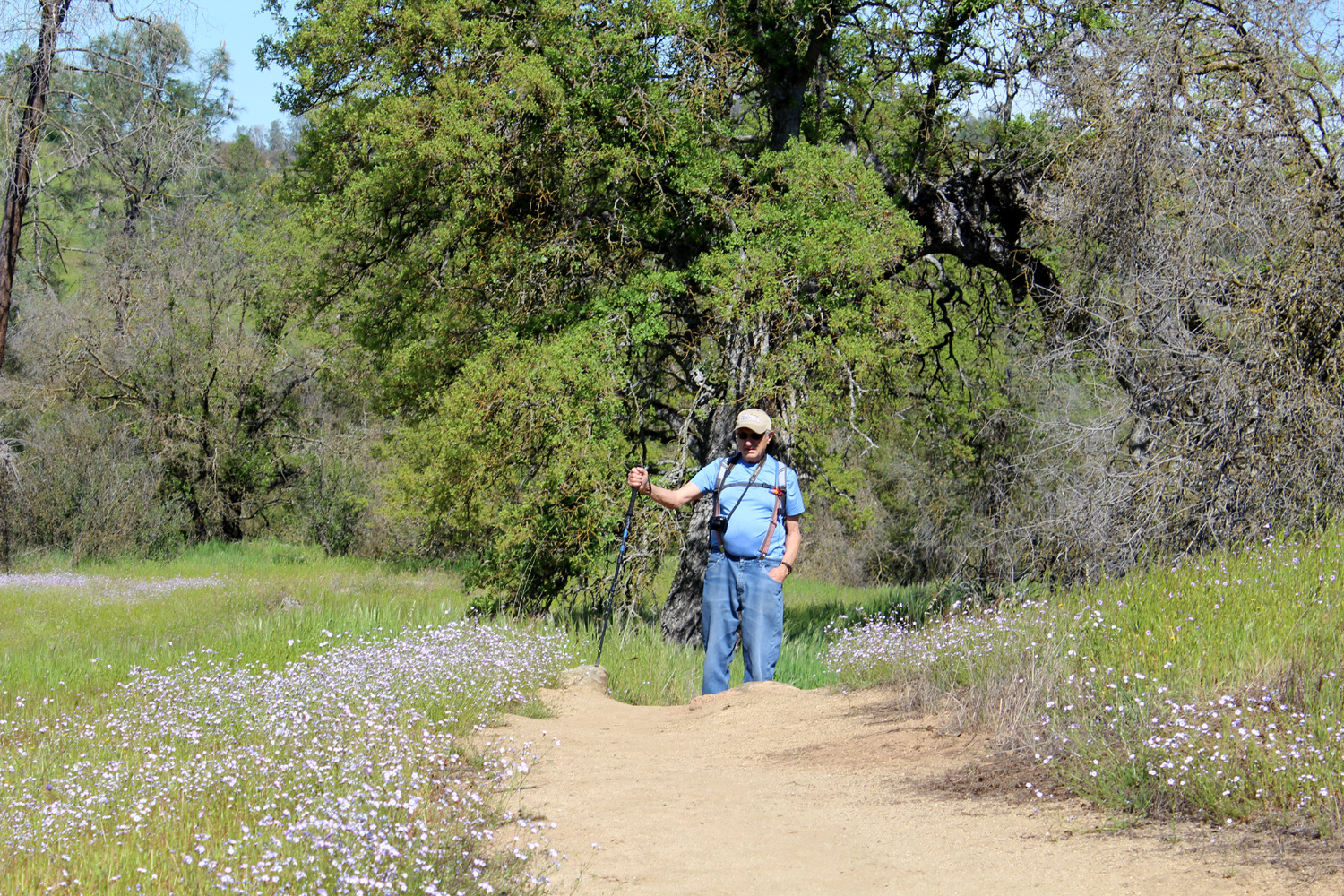
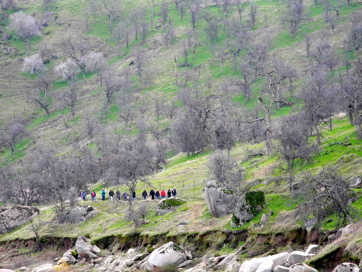
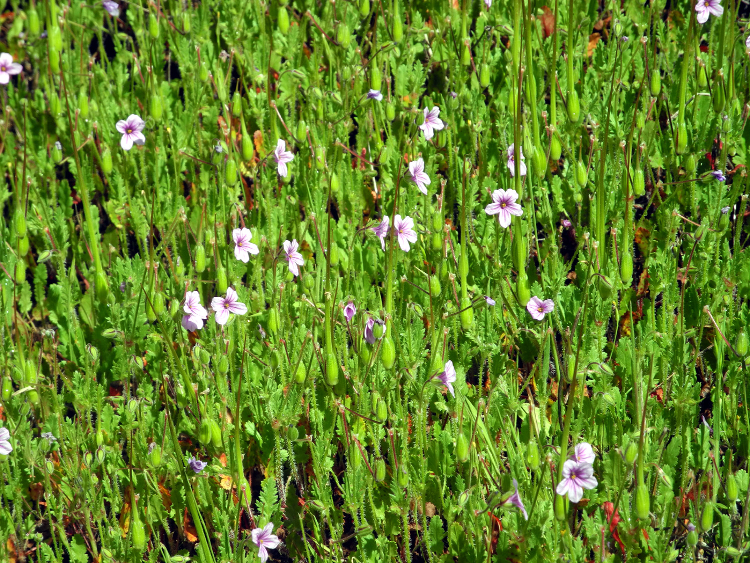
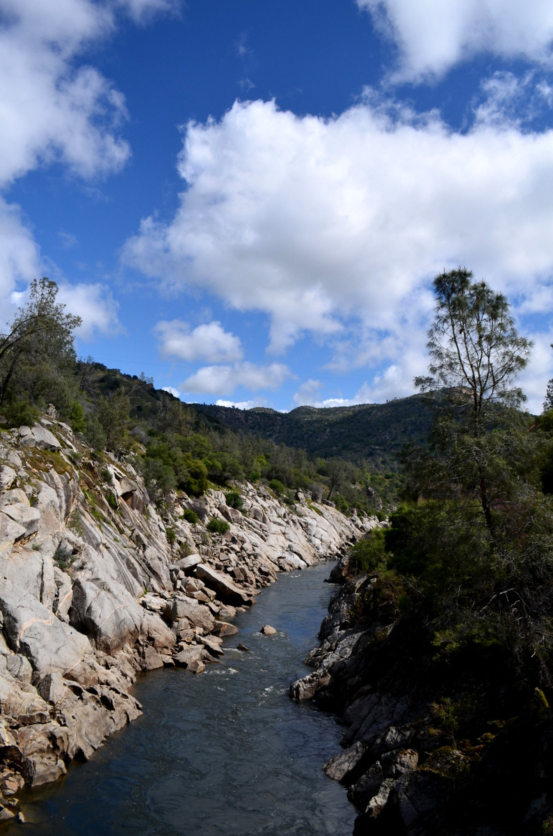
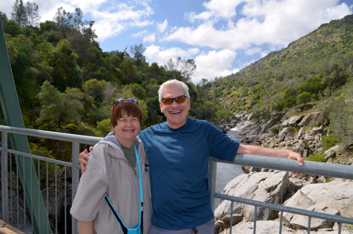
San Joaquin Gorge Bridge Trail In the spring it is the Ramblers' mission to seize the day and go out among the green grass and wildflowers as much as possible. Last year we scheduled two hikes in February; this year it's two in March AND two in April. So it was that on March 27 Wes, Carolyn and Dick arrived at Julie's and rode in Wes's Highlander up the road toward one of our favorite spots, the San Joaquin River Gorge, a Bureau of Land Management property located on both sides of the San Joaquin River, just upstream from the upper end of Millerton Lake. We stopped first in Prather where we picked up Don, who had driven there from his home north of Fresno in Madera County. For hikes north and east of the metro area, it's more convenient for him to meet us somewhere like that, rather than driving into Fresno. We managed to squeeze three people into the back seat for the final short leg of our journey. A few days before our hike, the forecast was for a 60% chance of rain, but the predictions changed daily, and by Sunday it was supposed to rain during the night and be done by 6 a.m. In fact, this is exactly what happened in Clovis, and it was a very piddly little rain. It did not look as if any significant rain fell at the Gorge either. More of a concern was the wind, which was blowing hard in town when we left. But the hills tend to moderate the wind, and we had only gentle breezes during our hike. We got started down the Bridge Trail about 11 a.m., and immediately saw the changes in wildflower conditions since my previous visit on March 4. Some flowers were done for the season, most notably shooting stars, which were nowhere to be seen. Redbud and buck brush were nearing the end of their run, and there were fewer fiddlenecks and popcorn flowers. Baby blue eyes, Sierra star, blue dicks and bush lupine were going strong. Just getting started, and sure to increase in numbers before my next visit, were phecelia, owl clover, tall ground lupines, dove lupines and birds eye gillia. Poppies have a limited presence at the Gorge, but there were quite a few in the one area where they grow, near the bridge. Filaree thrives from January to May all over the foothills. As usual we each walked at our own pace. Wes and I became districted by flowers and clouds, and stopped a number of times to take photos. Near the bridge, where the trail makes its final descent in a series of short switchbacks, I spotted Julie on the section below me. When I got where I could see the bridge, Carolyn and Don were already on the other side, taking it easy. We finally all came together at the bridge and enjoyed a snack and a rest. On our last visit here, we had not gone past this point, so I encouraged everyone to make the short but somewhat steep jaunt to the trail junction, less than a quarter mile past the bridge. It was here that we had our best display of poppies, and Wes got an outstanding photo. Had I been alone, I would have kept going another half mile or so, but everyone was ready to start back up the hill, so we returned to the bridge, and walked our final mile. We decided to pay a short visit to the visitor center, but the gate was closed, so we began our journey back to the valley. In keeping with our usual habit on this hike, we stopped in Prather and enjoyed lunch at Velasco's Mexican Restaurant. Wes provided his usual post-hike comments: What a wonderful day for a hike to the Gorge. Dick has accused me over and again of having "my head in the clouds." I'm glad he wasn't my supervisor at DSS or I would have been written up over and again. Clayton had enough trouble with me (ha!). But today I was glad my head was in the many cloud formations that peppered the sky above the Gorge. We had a great walk to the Bridge! I just couldn't stop shooting photo images of those wonderful clouds. Julie and I were on the bridge when a young man in camouflage attire came near with rifle in hand. He had trekked over ten miles looking for wild turkey. Although he found no turkeys, he took a great shot of me and Julie. He indicated it was the best shot he took all day. All in all it was a great day, we were glad we had doubled our hiking efforts in March, and looked forward to two outings in April.
|
||
|
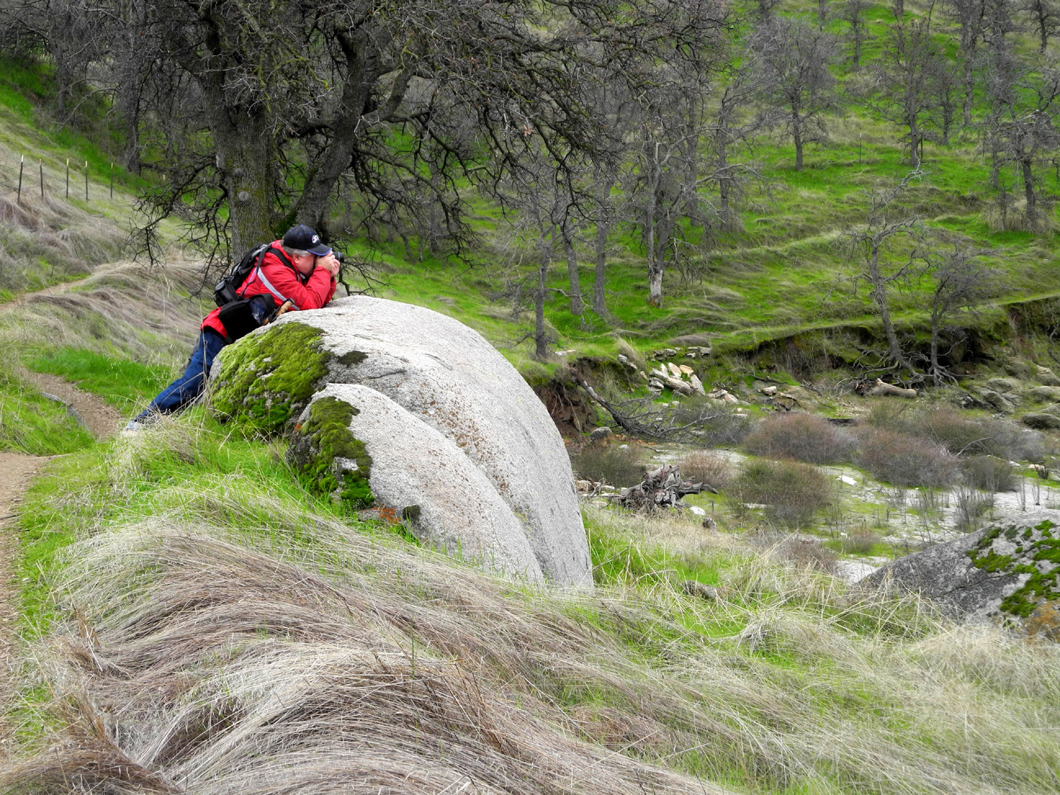
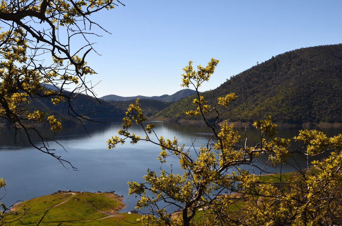
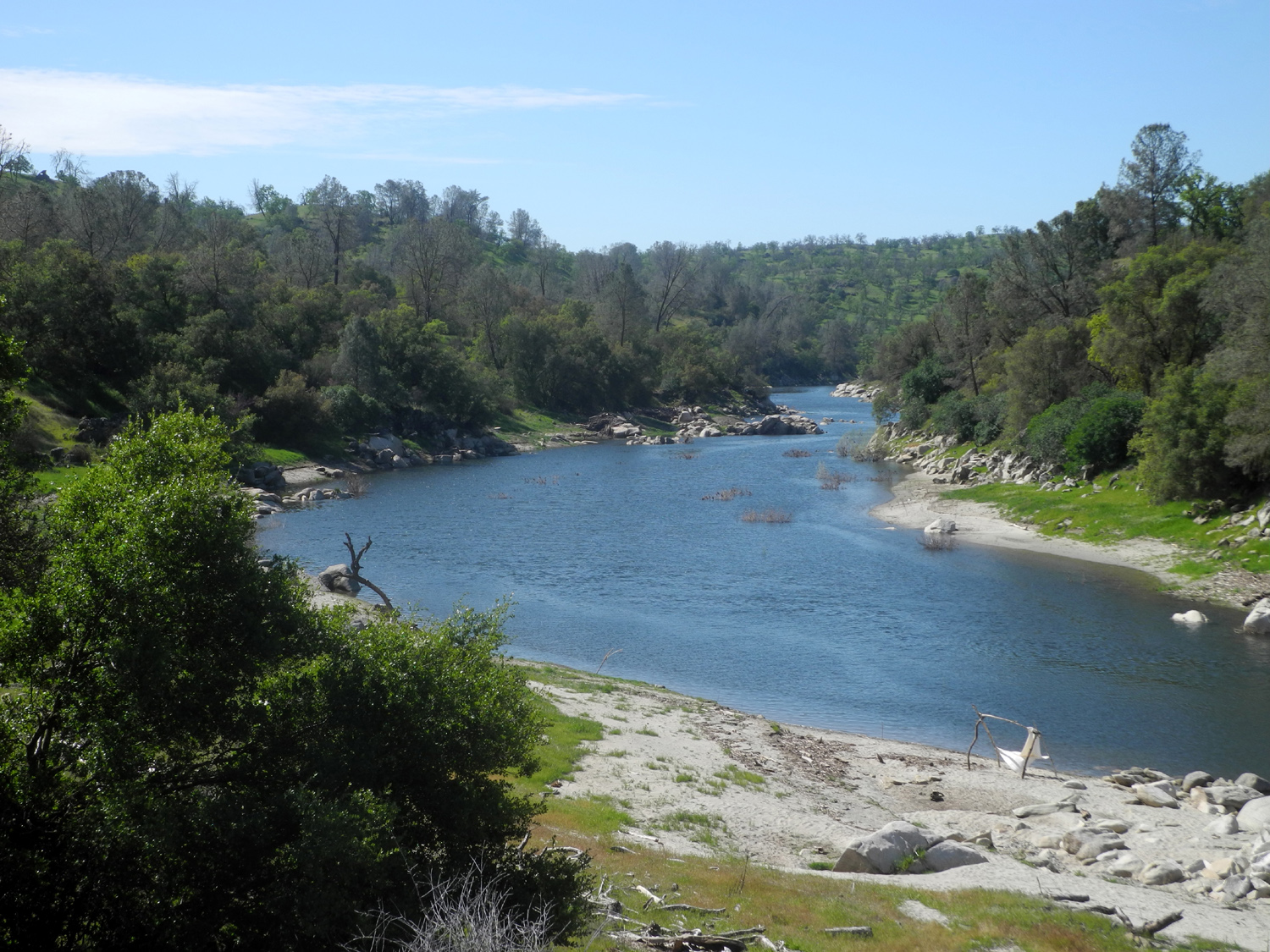
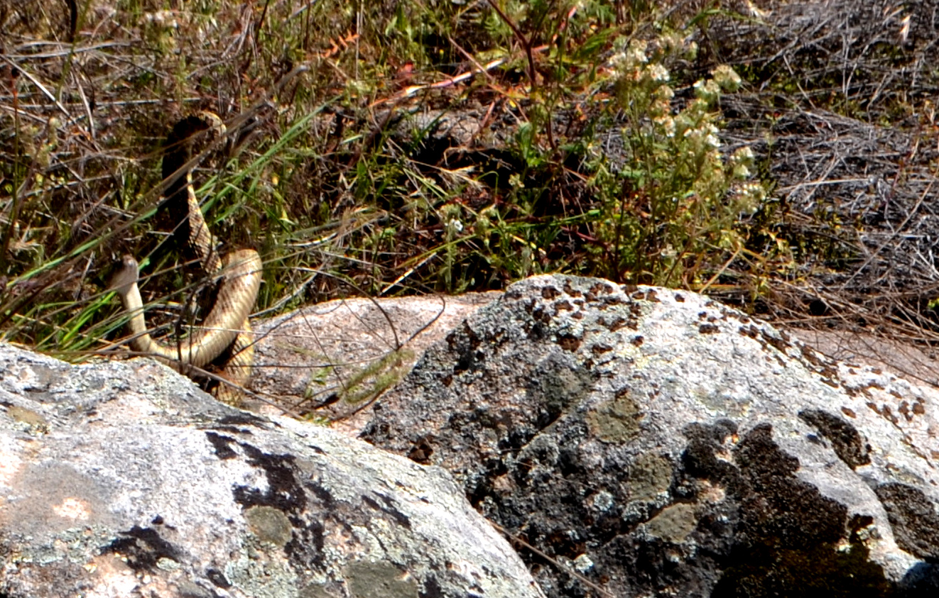
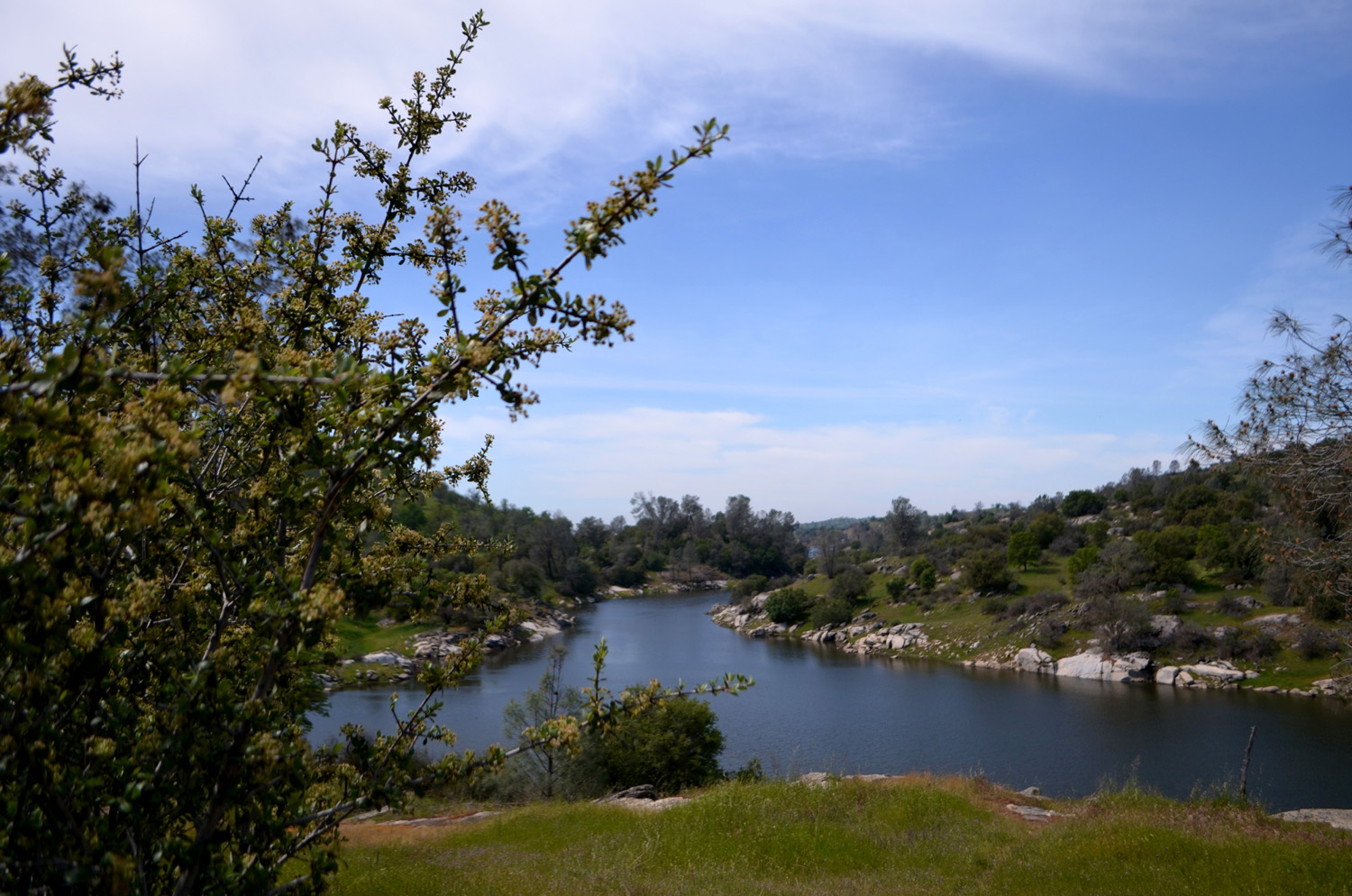
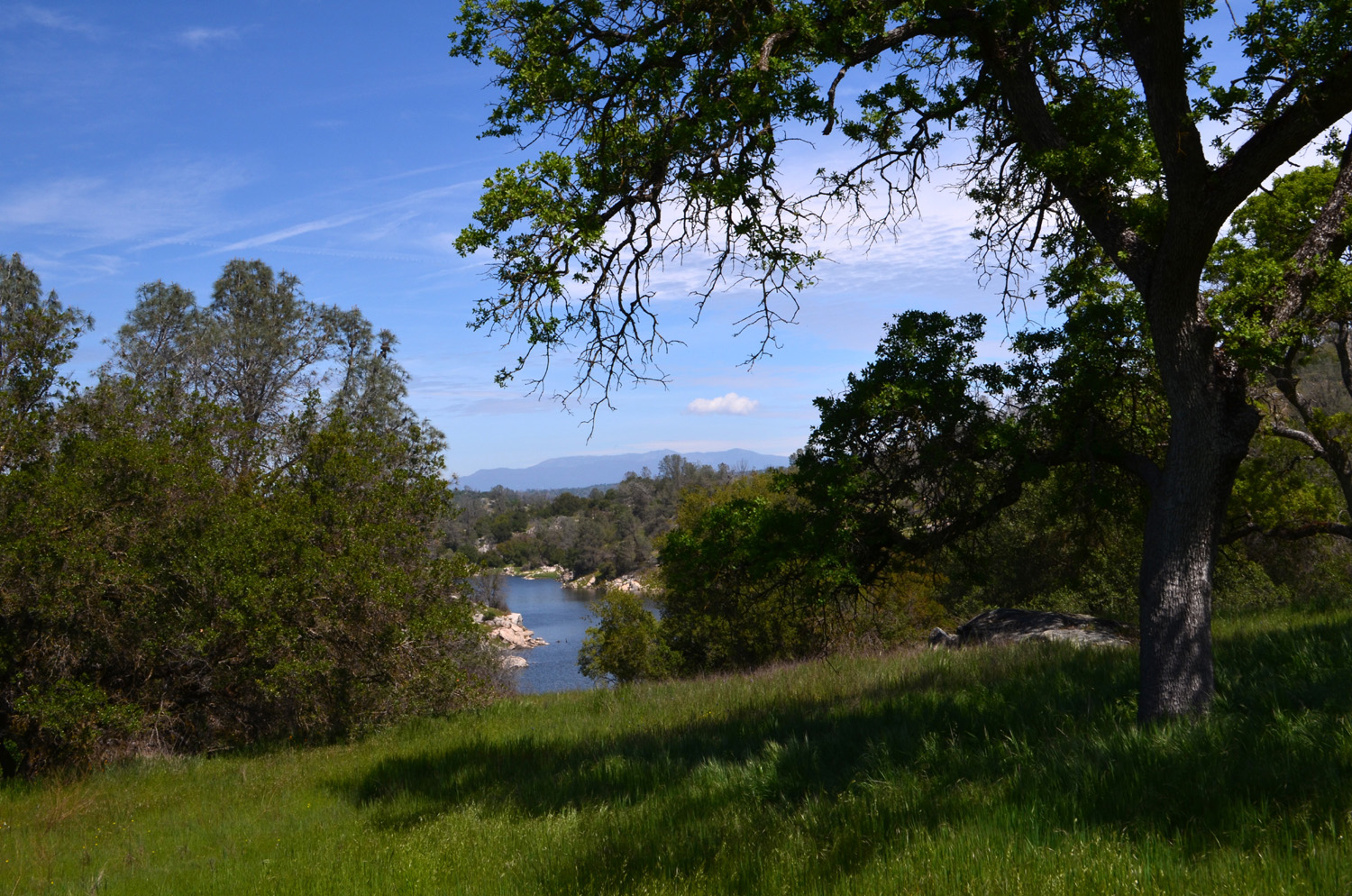
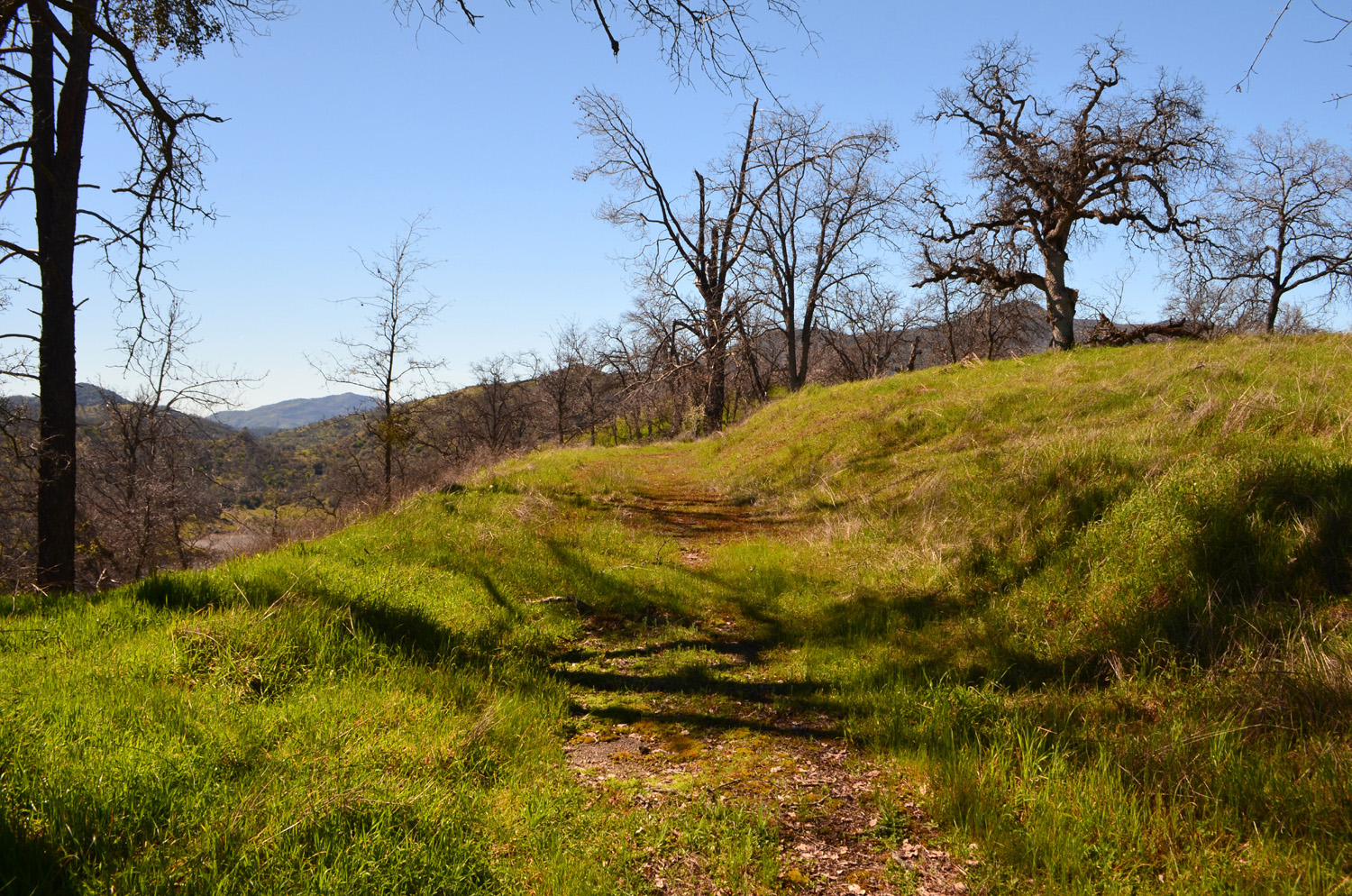
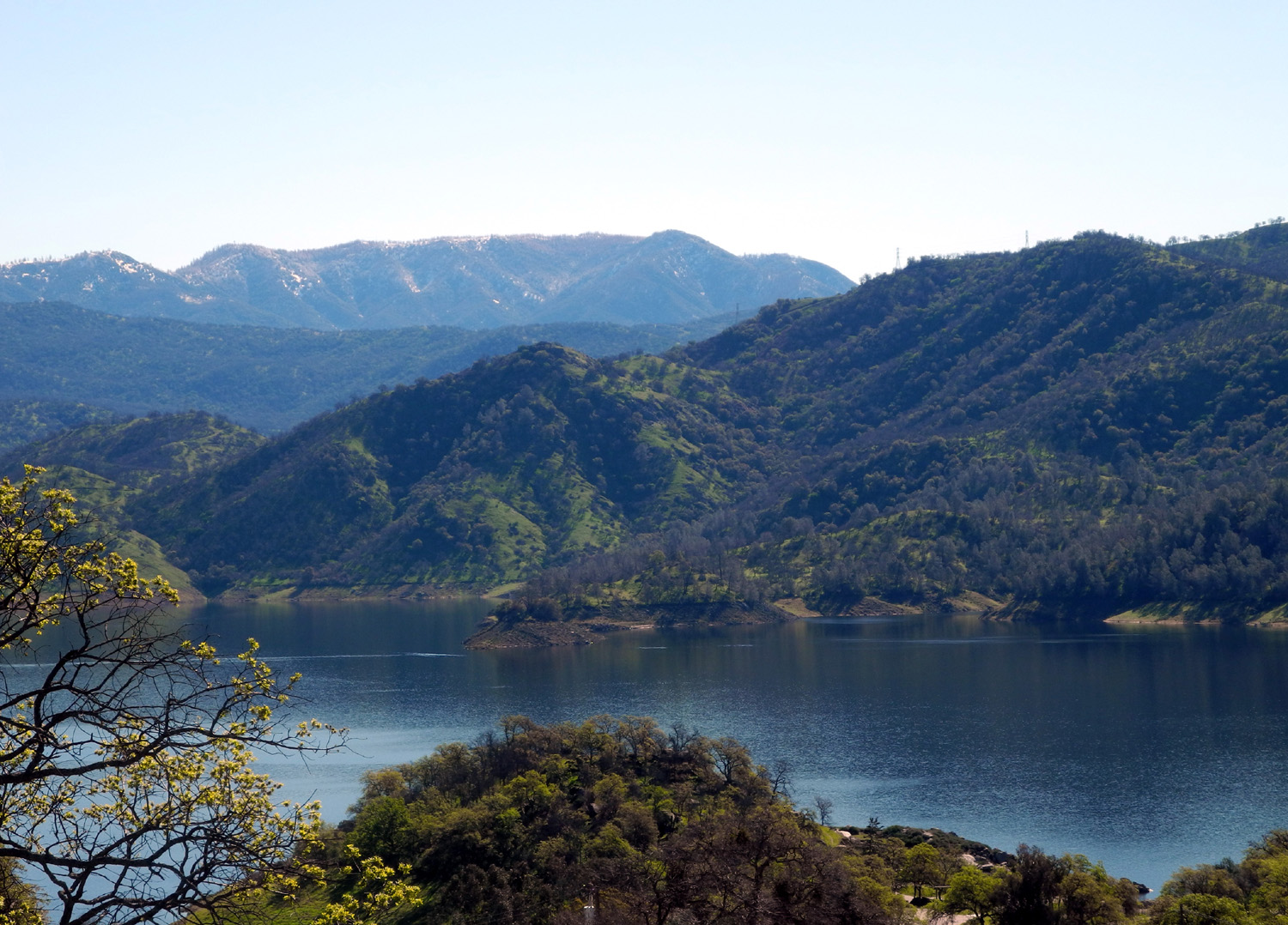
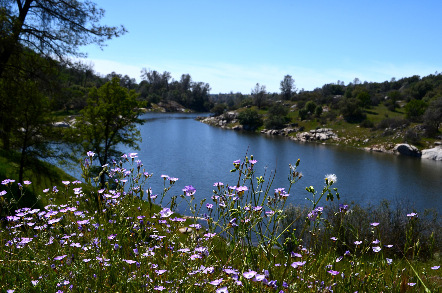
Eastman Lake This was the Ramblers second visit to Eastman Lake, and so far we have not been able to get any of the ladies to join us. Earlier this year they couldn't make it to our Hensley Lake hike. Wes thinks they are reluctant to go to Madera County, but we were in that jurisdiction in March when we crossed the bridge at the San Joaquin River Gorge, so it must be something else. In any case, Wes, Don and Dick set out on April 4 for the 50-mile drive, picking Don up near his home about a quarter of the way. The route takes us into the foothills, through the little town of Raymond, and five miles up Ben Hur Road to the Chowchilla River crossing. This marks the start of the Lakeview Trail, which goes four miles along the east side of the reservoir to the dam. We did not plan to go all the way, since only Wes is in proper shape for an eight mile round-trip hike, but we ended up going significantly farther than Wes and I went last year, a total of just under three and a quarter miles. I have the ability, probably not a good thing, to forget the steep parts of a trail after a year or so, and I recalled this one as being relatively level. In fact, a note on the area's website says, "Little elevation is lost or gained as the trail stays between 600 and 725 feet." This is true, but what it does not say is that it goes up and down between those two extremes about a dozen times. The other aspect that is overlooked is the fact that these up and down sections are quite steep - more so than the River Trail at the San Joaquin River Gorge and the trail out of Finegold Picnic Area, both routes that I have thought of in the past as having a lot of steep hiking. This was not really a big deal going in, and we've all been on harder trails, mostly when we were considerably younger. We enjoyed our ramble among the blue oaks, pines, white thorn, live oaks, and flowers, and made several stops and went off trail a few times for a closer look at things that caught our eye. One of the more exciting off-trail sights, one that only Wes saw in person, was two rattlesnakes, twined around each other, rising and falling and hissing. We later learned this was probably two males fighting. Before beating a hasty retreat, Wes managed to get several good photos. Throughout our hike we had views of the lake from time to time, and we could not help but notice the big difference from our visit last year. At that time the Chowchilla River was running strong, but the lake was not close to full capacity, so much of the time our view was of the old river bed. This time the lake reached all the way to the bridge, and we could see not only the narrow upper part, but the main section of the lake were it widens out near the dam. As we descended one section of the trail, we saw that it went right into the water of a small cove that filled the valley of a little creek. We were able to go upstream and cross on a series of strategically located rocks. As we climbed the next hill past this spot, we had a good view down toward the main part of the lake, and Don declared that we at least needed to go to the next ridge. This was a good stopping spot, with nice views of the lake, but Don later realized he has not learned (or maybe re-learned) an important hiking rule - how to judge when you've gone half of "far enough," and it's time to turn around. The return hike was a little rough for him, especially with the last of his water gone and nearly a mile still to go, but Wes had plenty and shared, and we all made it back to the parking lot under our own power. We had brought our lunch, so we set up a card table and chairs on the shady side of my truck and enjoyed our meal surrounded by views of spring grass, flowers and the lake. Most of the flowers we saw have been visible in various other areas, although we did have our first sighting this year of Chinese houses, and the birds eye gillia were thicker at Hensley than anywhere else so far. The weather was breezy at first, but became quite warm on the return section of the hike. As usual, Wes had a nice summary: It's spring time and everything is still green. Today Dick selected a hike along the beautiful Chowchilla River heading west to Eastman Lake in the foothills of Madera County. It's strange to use the adjective "beautiful" to describe this tributary which usually is barren without water and only rocks and sand as its main features. With so much rain this winter, the mighty Chowchilla has come alive with water running high and even overflowing our hiking trail at spots. Although we saw many varieties of wildflowers, we did not find the hillsides carpeted with them. It was the water that caught our eyes and hypnotized us into hiking on and on until we caught sight of the lake. By the time we dragged our tired bodies back to the trailhead, we were fully spent and totally exhausted. But it was worth every step to see and hear the flow of that precious water.
|
||
|
Photos
(Click to enlarge; pictures open in new window) |
||
|
|
||
|
Millerton South Bay Trail |
||
|
|
||
 |
|
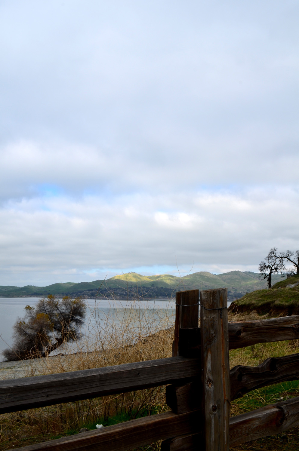 |
| Highest water in at least five years | All that rain means green grass | Sun kisses the green hills across the lake |
 |
 |
 |
| Don lines up a shot | Wes saw veins or
tentacles in this leafless blue oak |
This tree has stood
up to all that nature could throw at it |
 |
 |
 |
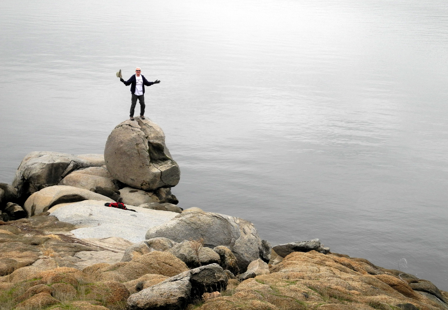
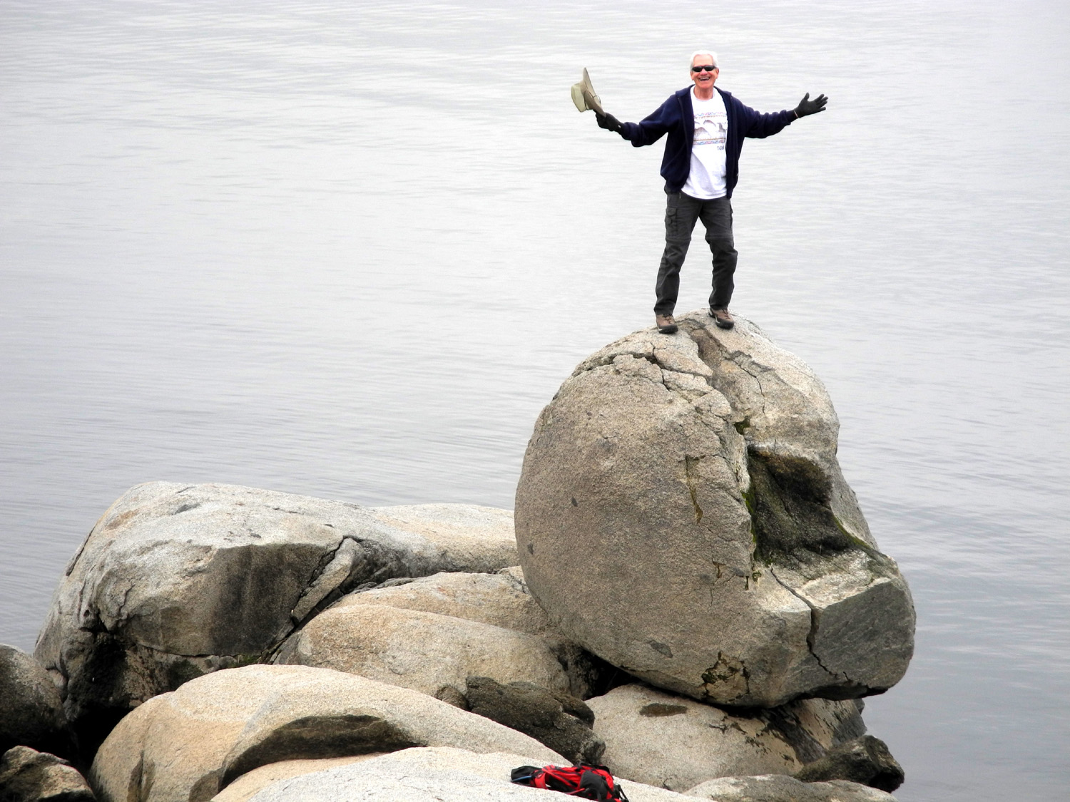
| Getting on this rock
was a challenge even for Wes |
A closer look |
Carolyn and Dick under the "Tunnel Tree" |
 |
 |
 |
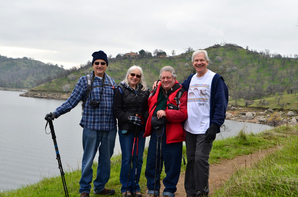
| The Ramblers: Dick, Carolyn, Don and Wes | A flock of bird watchers | A typical section of the trail |
|
 |
 |
|
Wes
captured this dramatic |
Boats tied up at Winchell Cove | The rugged, rocky
pass near the end of the trail |
 |
||
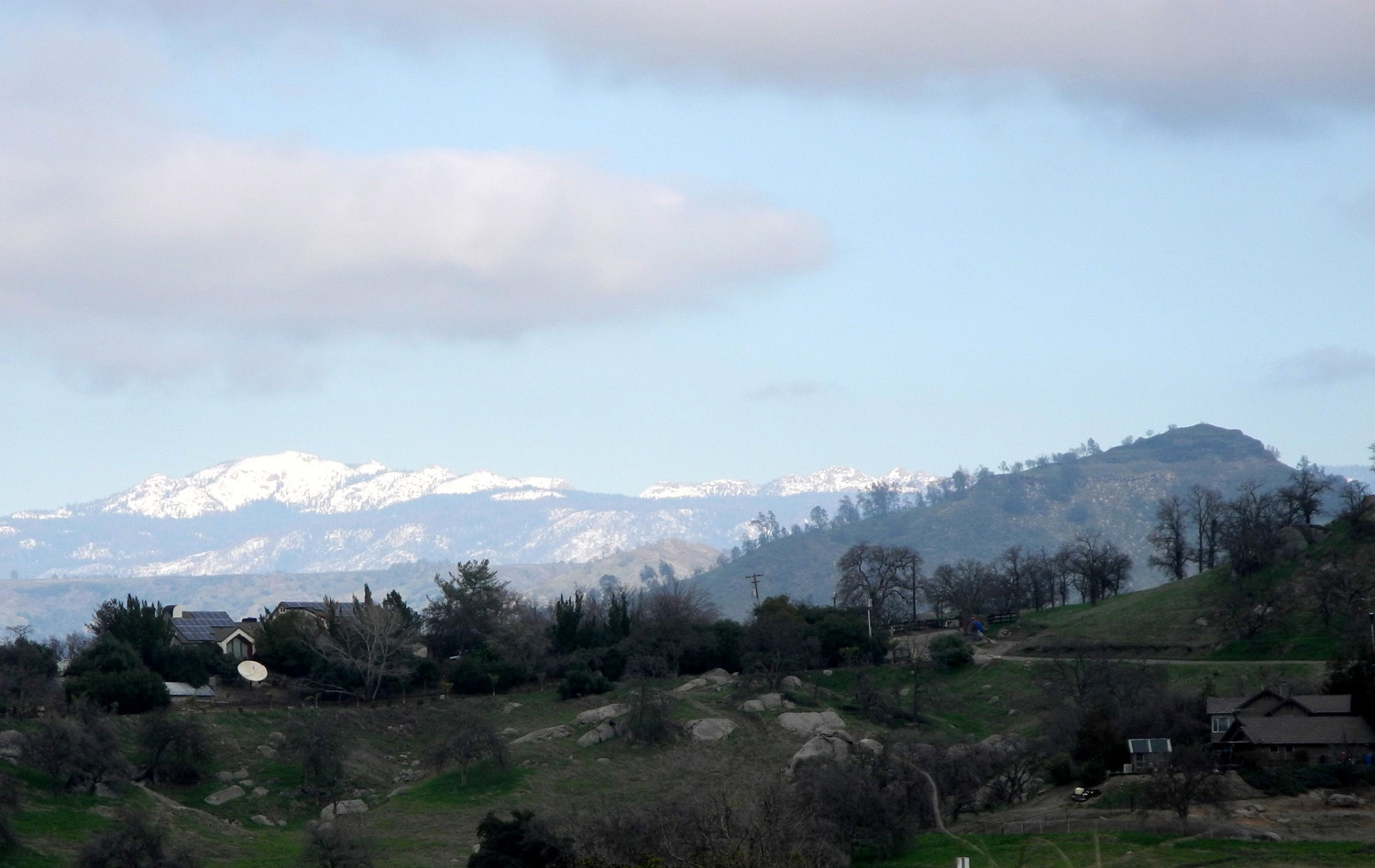
| Snowy vista from the park entrance | ||
| FINS Trail | ||
|
 |
|
| A section of the trail
before you reach the flooded area |
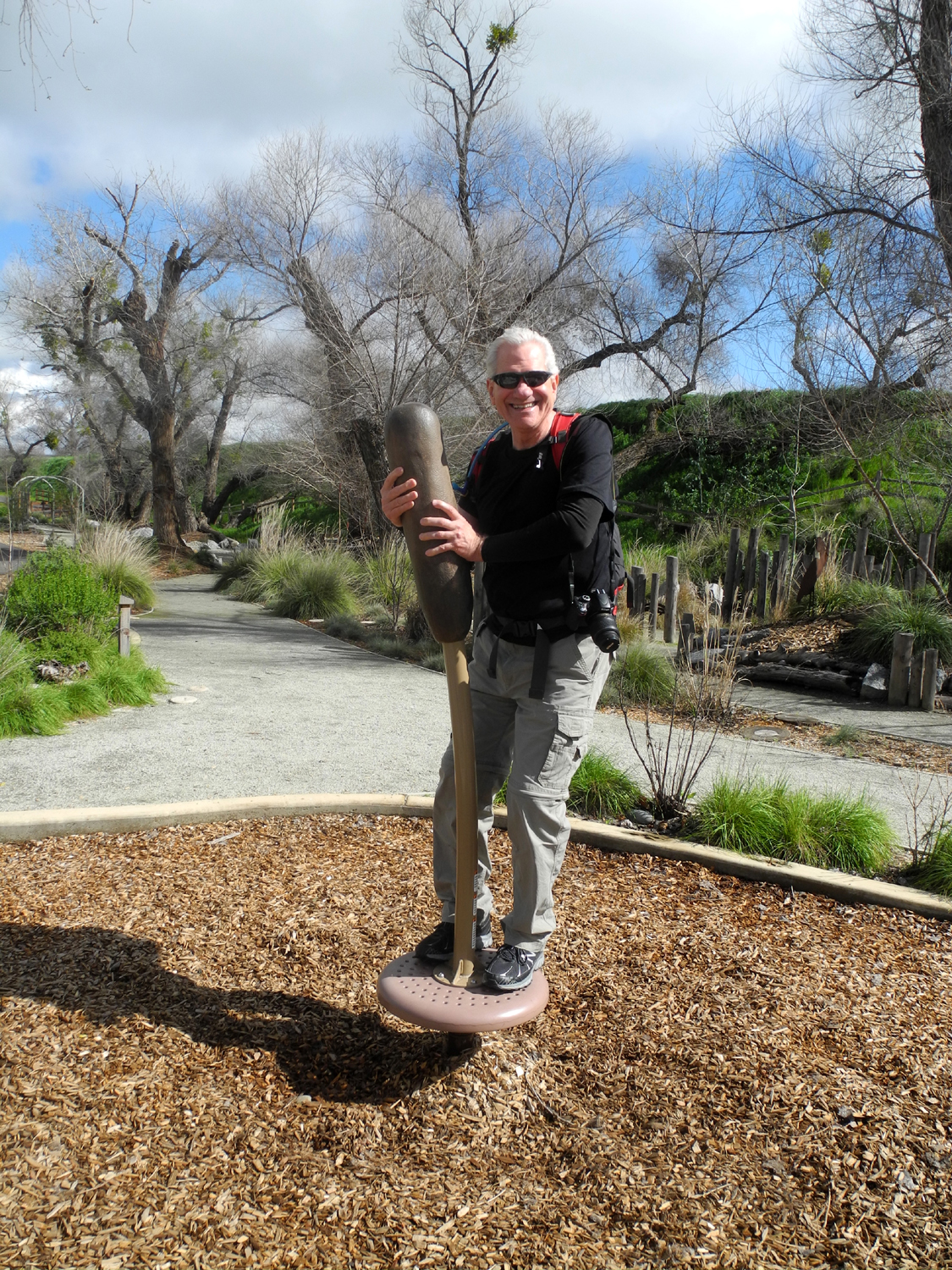
Something new - Wes on the cattail | This was where we realized we'd walked just far enough |
 |
 |
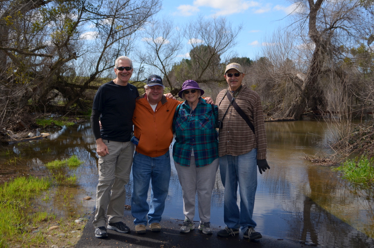 |
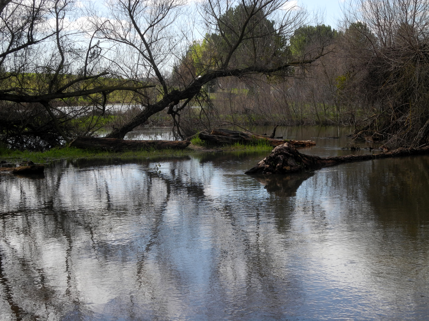
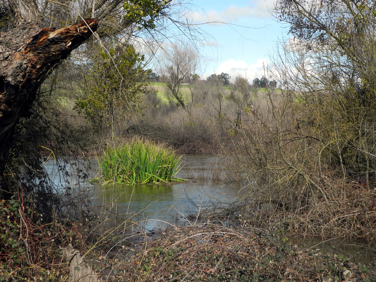
| Water comes in from an overflow channel to the right |
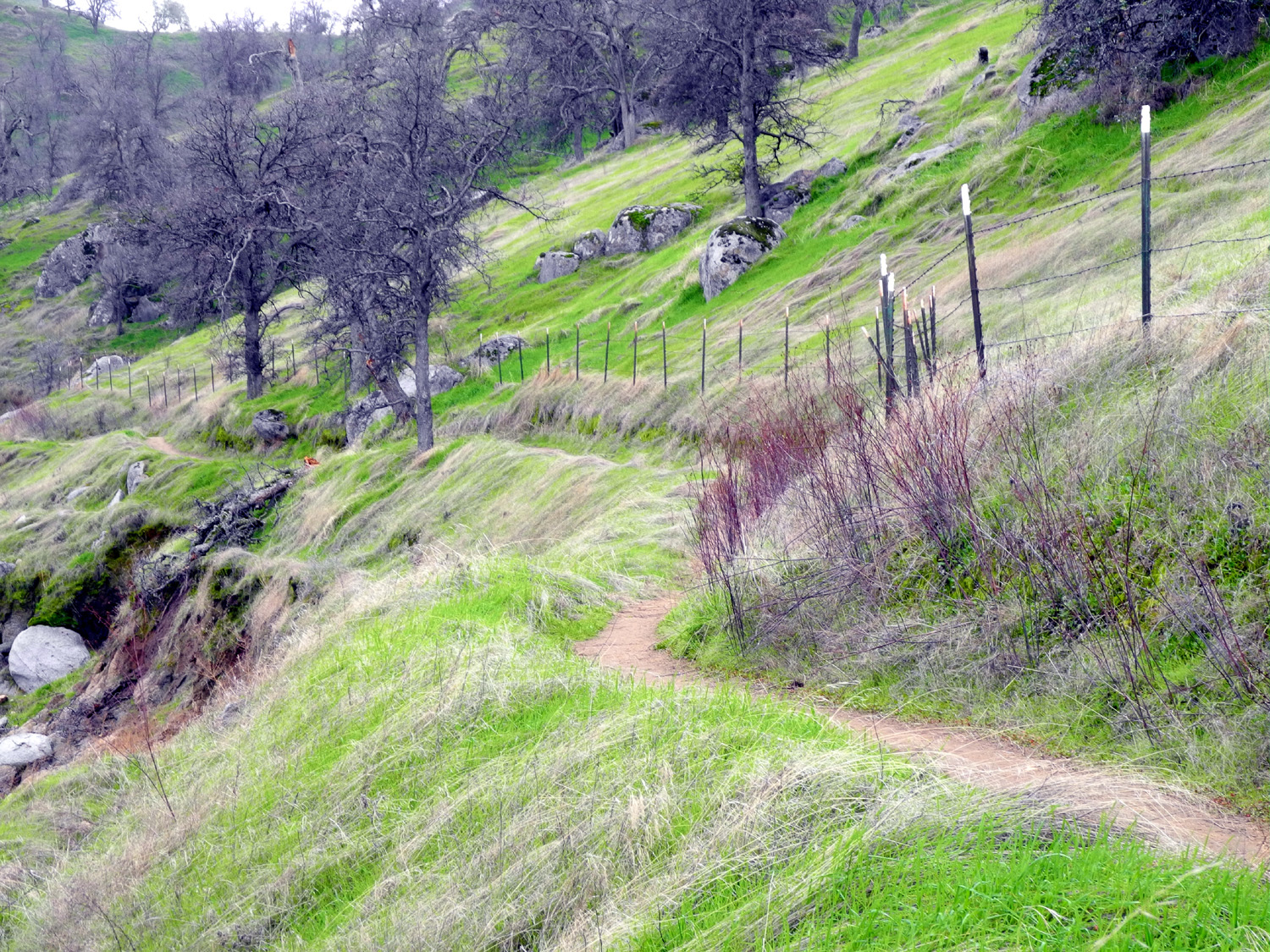
The trail winds around to the right by the fence | The Ramblers on February
22: Wes, Don, Sue and Dick |
 |
 |
 |
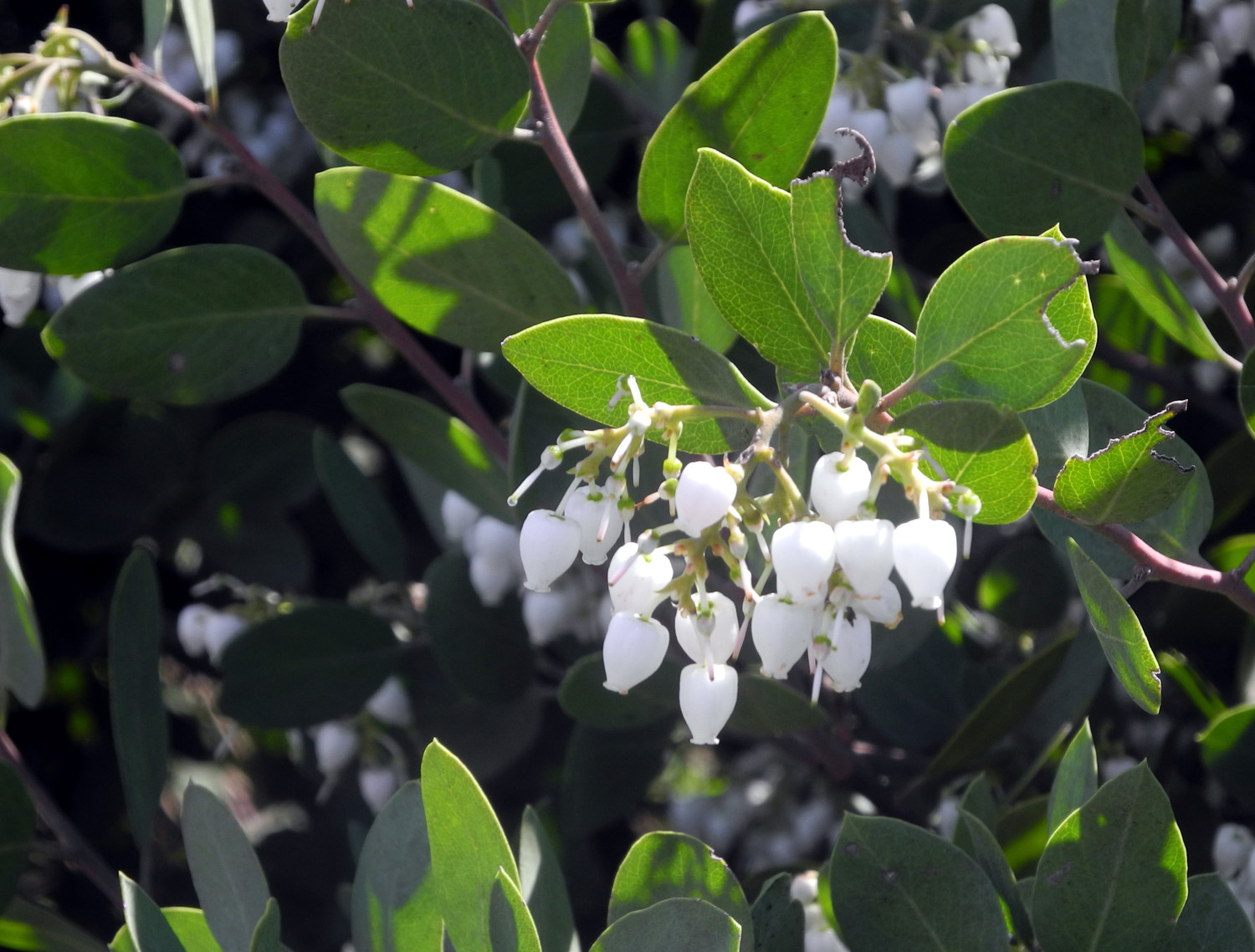
| Another section of the overflow channel | White Manzanita blossoms instead of the usual pink |
Wes can't resist climbing on stuff |
 |
 |
 |
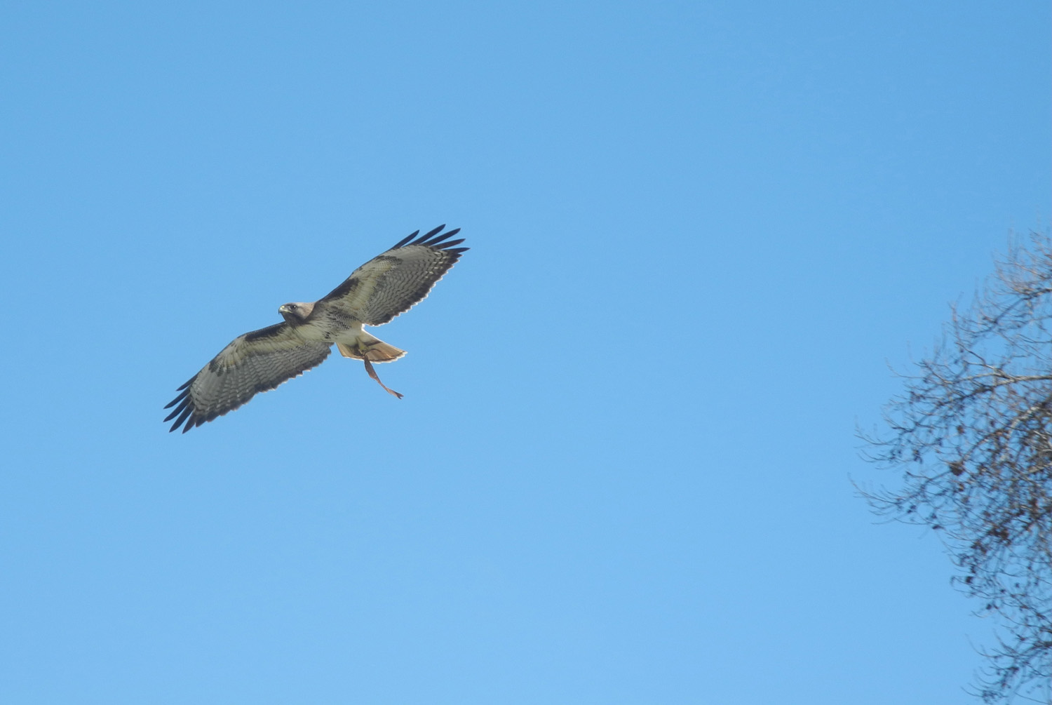
| Half of a pair of redtail
hawks that occupy a tree by the trail |
Hawk sitting on a post | A look at the nest |
 |
||
| Little Dry Creek above the Friant Road bridge | ||
| Sycamore Picnic Ground & Big Creek | ||
 |
 |
 |
| There's a
little low-elevation snow on the ridge in the distance |
Bright
new leaves stand out against the blue of the lake |
This
long-dead stump provides support for new life |
 |
 |
 |
| The blue
green leaves and pink blossoms of manzanita |
The bush itself is an extra large | Lupines against the lake |
|
 |
 |
| Seeing an eagle made this a very special trip | He sat on
the branch for a minute before soaring off |
The
gnarly branches of a large blue oak against the sky |
 |
 |
 |
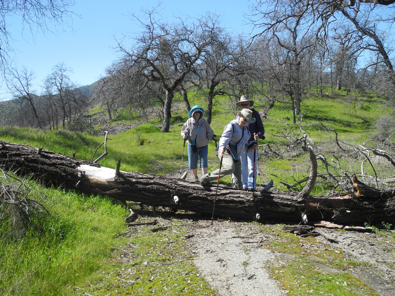
| Ramblers
are not stopped by the barriers of nature |
The old road through Sycamore Picnic Grounds | The
Ramblers: Carolyn, Julie, Dick, Wes and Don |
 |
|
 |
| The concrete-lined drainage above our lunch spot | The stairway up to the waterworks | Wes on the stairs |
 |
 |
 |
| Above the
pond is this complex concrete structure |
Wes on the weir | Blue
dicks were numerous on the bank above the road |
 |
 |
 |
| Looking upstream at Big Creek | Bridge over Big Creek on Trimmer Springs Road |
View of Big Creek from our lunch spot |
| San Joaquin Gorge | ||
 |
 |
 |
| Ready to
ramble: Dick, Don, Carolyn, Julie and Wes |
The view near the trailhead | Green beauty everywhere |
 |
 |
 |
| Don by the trail | Blue
dicks, one of the most common flowers on this hike |
A thick stand of fiddlenecks |
 |
 |
 |
| This dead snag should be called "The Sentinel" | Filaree - lots of
seed pods but still plenty of blossoms |
Wes at Lupine Point |
 |
|
 |
| This spot has a dozen or more bush lupines | Redbud across the San Joaquin River canyon | Closer look at redbud |
 |
 |
 |
| Julie, on the lower switchbacks |
The
blue oaks were clad |
Looking up the river |
 |
 |
|
| Julie and Wes on the bridge | A low-angle look at the bridge | Poppies with Kennedy
Table in the background |
 |
 |
|
| Lupines and clouds | The best little creek on the trail | |
| Eastman Lake | ||
 |
 |
 |
|
Upper
end of Eastman Lake, |
A thick patch of birds eye gillia | Some
flowers have already produced seeds for next year's growth |
 |
 |
 |
| Can anyone identify this charming flower? | Baby blue eyes and filaree | These flowers are called cream cups |
 |
 |
 |
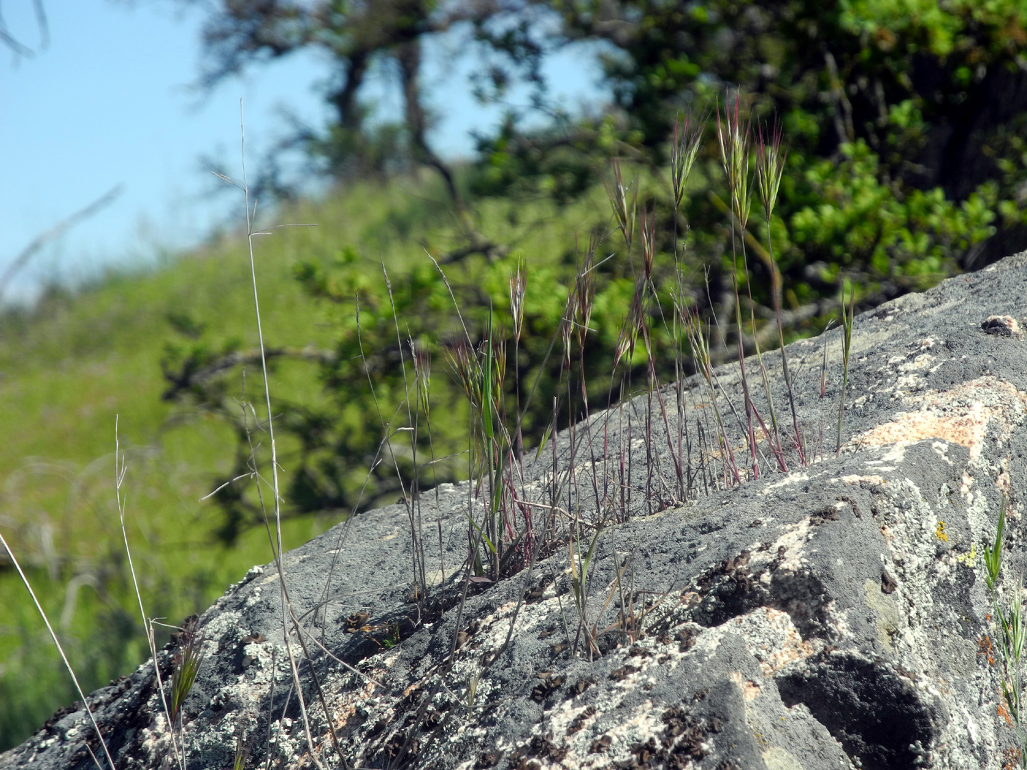
| Clouds above the blue oaks | Grass grows out of the crack in this boulder |
Wes in
search of rattlesnakes, or |
 |
 |
|
| Poppies and fiesta flowers, backed with live oak | The blue oaks are a brilliant green for spring | A typical scene along the trail |
 |
 |
 |
| Don and Wes on the trail | Wes on the rock | The Ramblers: Wes, Dick and Don |
 |
 |
|
| One of Wes's fantastic "head in the clouds" shots | Birds eye gillia above the lake | A long stretch of the lake, complete with island |
 |
 |
 |
| Dick on the trail | Rattler battle | Country fence |
 |
 |
 |
| A quiet branch of the lake | Blue oak frames the lake and distant mountains | The poppy patch |
 |
||
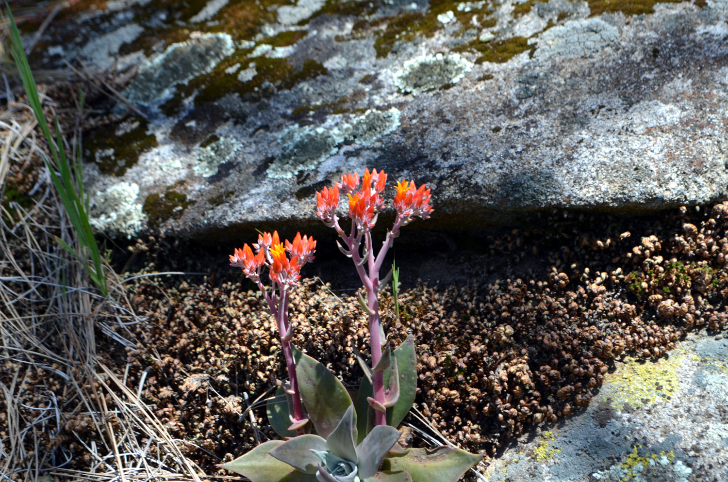
| Nature's
landscaping includes this bright succulent |
||
| Related Links | ||
| South Bay Shore Trail Info | Millerton State Recreation Area | Winchell Cove Marina |
| January 2014 Millerton Hike | Ramblers 2915 Millerton Hike | Pizza Factory |
| January 2014 Millerton Hike | April 2014 Millerton Hike | FINS Trail Opening |
| San Joaquin Hatchery | Pine Flat Campgrounds | Pine Flat Lake |
| Other San Joaquin Gorge Reports | San Joaquin Gorge Slide Show | Big Creek |
| San Joaquin River Gorge Recreation Area | Velasco's Mexican Restaurant | San Joaquin Gorge Photo Album |
| Lakeview Trail | Rattlesnake Battles | Eastman Lake |
| Chowchilla River | ||
