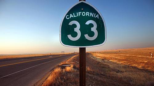
| To tour two-lane California Highway 33 from top to
bottom -- a 300-mile drive that begins south of Stockton, passes through the San Joaquin
Valley's west side, crosses steep coastal mountains and ends in Ventura
- is to tour what might be called the real California. (Michael Robinson Chavez / Los Angeles Times) |
by Peter H. King Los Angeles Times Staff Writer
July 7, 2008
California is laced with fabled roadways: Highway 1, the Golden State, El Camino Real, Route 66 and many others. Some follow the footpaths of padres, the trails of wagon trains. And some are monuments to the Freeway Age and California's
bear hug embrace of Car Culture.
State Highway 33 will not be confused with any of these asphalt icons. Nobody's likely to write a song about Highway 33, although in one stretch it does cut through Buck Owens country. Nor will a literary anthology be built around it, as was done not long ago with the Central Valley's Highway 99.
Still, to travel this two-lane from top to bottom -- a 300-mile drive that begins just below the San Francisco Bay delta, passes through the San Joaquin Valley's west side, crosses steep coastal mountains and ends at Ventura, where Highway 33 disappears into the 101 -- is to tour what might be called the real California.
Through a bug-splattered windshield, it's all there to see:
Some of the twentieth century’s many diet fads were ludicrous inventions of quack doctors, food companies, ministers, and even in some cases, cigarette brands, but despite being crazy and absurd, these diets shouldn’t be viewed with disdain.
See More Improbably far-flung subdivisions, their outward march stalled only by the mortgage mess; rolling croplands crisscrossed by irrigation canals; a young patriot's grave, the four flags at his tombstone fluttering in a hot valley wind; a hulking new federal prison, rising from cantaloupe fields; West Hills oil rigs, pumping furiously in a new boom; panoramic views of unspoiled high country; and, finally, the Pacific at sunset, 5,000 feet below.
Comparatively few people drive Highway 33; even fewer make the run from end to end. Highway 1, dancing along the coast, offers better scenery, and Interstate 5, a more-or-less parallel route, greater speed and efficiency. No, this is a workaday road, a highway for short-haul truckers and agricultural sales reps, for convoys of harvesters, vans shuttling prisoners and even the occasional lone tractor.
It is a good road for someone seeking to reacquaint himself with a vexing old friend: California. Sometimes, the best way to make sense of this state is simply to get out into it, to take a look around and refresh the eyes. And, here and there, to make some stops along the way.
In Patterson, a tidy farm town set against the dry, rolling foothills that form the western edge of the San Joaquin Valley, land broker Shane P. Donlon stood before a color-coded map in his roadside office and pointed to a particular swath of property. Nearly 1,000 acres, it extended west from the town almost to Interstate 5.
"The last time you were here," he said, referring to a similar drive-by conversation about 10 years ago, "this was all farmland."
And now it's covered with houses, nearly 4,000 of them, built on streets with names like Placer Creek and Buckskin Way and Heartland and sold to long-haul Bay Area commuters heading west through the crowded Altamont Pass each day, defying what once was presumed to be a geographical barrier to sprawl.
Of course, the mortgage crisis and $4.50 gas have blindsided these newcomers, and now there are foreclosure signs, it seems, on almost every block. So it has always gone in California, where the historic pattern of growth is to lurch forward in boom, stagger backward in bust, then repeat.
In turn, there are tensions for those who lived in Patterson before the century-old farm town was sucked into the Bay Area orbit. At a downtown diner, an old guy the waitress called Charley was complaining to another local, a heavily tattooed younger man wearing shorts: "They build those big houses and bring their juvenile-delinquent kids with them. They bring their dope with them . . ."
On the counter sat a copy of the Patterson Irrigator. In a letter to the editor, a resident complained about the recent Patterson High graduation. Newer elements in town, it seemed, had blasted air horns throughout the ceremony.
"I was also appalled," the aggrieved correspondent went on, "by the remarks of the principal when he pointed out that graduates had come from many different places. . . . As San Jose and Oakland were named, the whoops and hollers from the audience grew progressively louder, and gang signs were flashed by several people in the audience around where I was sitting."
She concluded: "Some changes need to be made."
Back on the highway and across the valley floor, through apricot country, almond country, cantaloupe country. Crops are a way to measure both place and season here, as Ernest J. Finney observed in his novel "California Time": "The valley had no calendar. Time in California wasn't measured out in months; it was by crops. Spring meant strawberries, then the apricots, cherries, peaches, and it was summer. . . . Fall, still blazing hot, was cotton, persimmons, pomegranates . . ."
Near Santa Nella, at the San Joaquin Valley National Cemetery, the flat tombstone that marks the grave of Joshua Daniel Pickard stands out. It is one of the few festooned with flags and flowers in this remote, starkly beautiful cemetery.
Many of the gravestones are unadorned, the markers barely visible in the grass. A cemetery official explained: Flowers by policy are cleared from the grave sites every other Wednesday, and it's difficult for families and friends of the dead to make it out regularly to replace them. It's a long drive from most California cities.
Pickard, though, grew up in nearby Merced, and his grave receives a lot of visitors. He was 20 years old when he was killed by sniper fire in 2006, one week before Christmas. He also happens to be one of only two Iraq war dead buried here. Although veterans are eligible to be buried in national cemeteries like this one, most of the 500 or so Californians killed in the war so far are interred in private graveyards close to their hometowns.
"When you bury a child," said Nancy Passarelli, the cemetery's budget analyst, "you want them a little closer to home. We understand that."
The highway cuts through scrappy little towns including Dos Palos, Firebaugh, Mendota, ag-dependent communities that always seem to be on the brink -- just one drought or crop calamity away from ruin -- but somehow manage to hang on. Even the road signage seems to project a stubborn resolve.
"Best Effort, No Excuses," insists the billboard at Firebaugh High School.
"Si Se Puede," vows a sign marking a used-car lot.
Highway 33 was born a century ago, in the time of Hiram Johnson and the Progressives. In a gubernatorial campaign devoted to running Southern Pacific Railroad out of California politics, Johnson pointedly stumped the state by auto, in a red Locomobile, often taking dirt trails to the next stop. The Progressive promise was to connect the county seats of California with paved roadways, and upon Johnson's victory in 1910 the work commenced.
The system has been renumbered and reconfigured over time. Today, in certain stretches, Highway 33 joins other routes: I-5, the 152, the 166. It also takes on different names: Derrick Avenue, Dos Palos Avenue, the Petroleum Highway, the West Side Highway, the Maricopa Highway. In Avenal, the street signs identify it as "Laneva," which is Avenal spelled backward.
Coming into Coalinga, a privately posted billboard proclaims that "Jesus is Lord of Coalinga." Religious sentiments aside, the town certainly is familiar with resurrection. Its downtown was shaken to the ground in a 1983 quake.
A quarter-century later, it has been completely rebuilt, though not in its original style: lovely but vulnerable brick.
"People in town were not going to let Coalinga die," said Stephanie McHaney, curator of a private museum on Elm Avenue, another of Highway 33's many fleeting aliases. "They had so many roots here. For a while, though," she conceded, "you had to wonder if we were going to make it."
The R.C. Baker Memorial Museum seemingly contains every implement and gadget known to 20th century America. Also on display are mastodon bones, a vintage firetruck, plastic dashboard hula dolls, an actual oil rig and a collection of well-worn shoes of the famous.
The shoes were gathered in the 1960s as part of a school project meant to inspire students to dream big as they walked a few steps in the actual footwear of their heroes. Columnist Art Buchwald sent a pair of loafers and Pat Boone donated white bucks. Football coach Tom Landry forwarded his cleats, black with white laces. President Nixon responded with black brogues, newly purchased and never worn.
After Coalinga, farms begin to give way to oil fields -- Elk Hills, Midway, Sunset -- with rigs pumping away miles from the highway, far into the western hills. There's a moonscape feel to the California oil patch, the dropping sun filtered through vapors and dust, the latticework of pipes stretched across parched land. Oil tankers and roughnecks' pickups boom along the highway.
Outside Taft, another roadside attraction: a rusted pipe, a pit coated with asphalt and a plaque marking where Lakeview No. 1 "blew in." Lakeview was the colossal strike in 1910 that, as one veteran of the oil fields explained, "pretty much started it all." He was one of five retired roughnecks gathered for a weekly coffee klatch at a diner on Highway 33 in Maricopa.
These men guessed their average age was 80 and for a visitor calculated their collective time in the California oil patch: 180 years. With an easy patience, they described how the booming global price of crude translated into changes on the ground.
"Basically," said Rod Napoleon, a week shy of his 80th birthday, "what you will see now is that every one of them that is able to pump is pumping." He had noticed, too, a proliferation of "work-over rigs," mobile contraptions brought in to coax older wells back into service. Meanwhile, wells that extract crude with steam have been shut down; the fuel to run them costs too much now.
Less easy for the men to explain is why gas costs more at the pump in oil towns like Taft and McKittrick than in the cities.
"It's higher here than anywhere else, even Bakersfield," Napoleon said.
"Everything is higher around here," someone else chipped in, "except the wages."
They spoke with affection about their particular corner of California, one not often described as scenic. Their places in the old fields had long since been taken by their children and grandchildren, just as they had followed their fathers and grandfathers. Still, they chose to stay.
"Look, we're in the middle of nowhere and it is as ugly as hell," said Phil Allmon, who at 58 was the youngster at the table. "But we're just two hours from everything!"
And so they are.
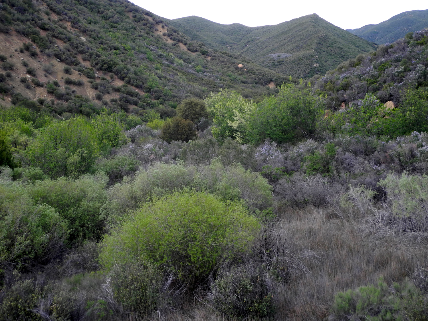
After Maricopa, it's a little less than two hours to Ventura. The highway jogs past the southern flank of the vast Carrizo Plain and then, running along the Cuyama River, begins to climb through a rolling landscape of hayfields and vines -- a stunning landscape and a reminder of California's enduring capacity to surprise: No matter how much of it you believe you've seen, there's always more.
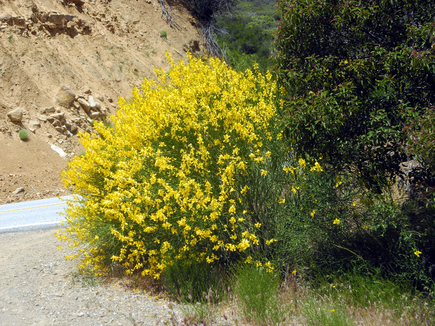
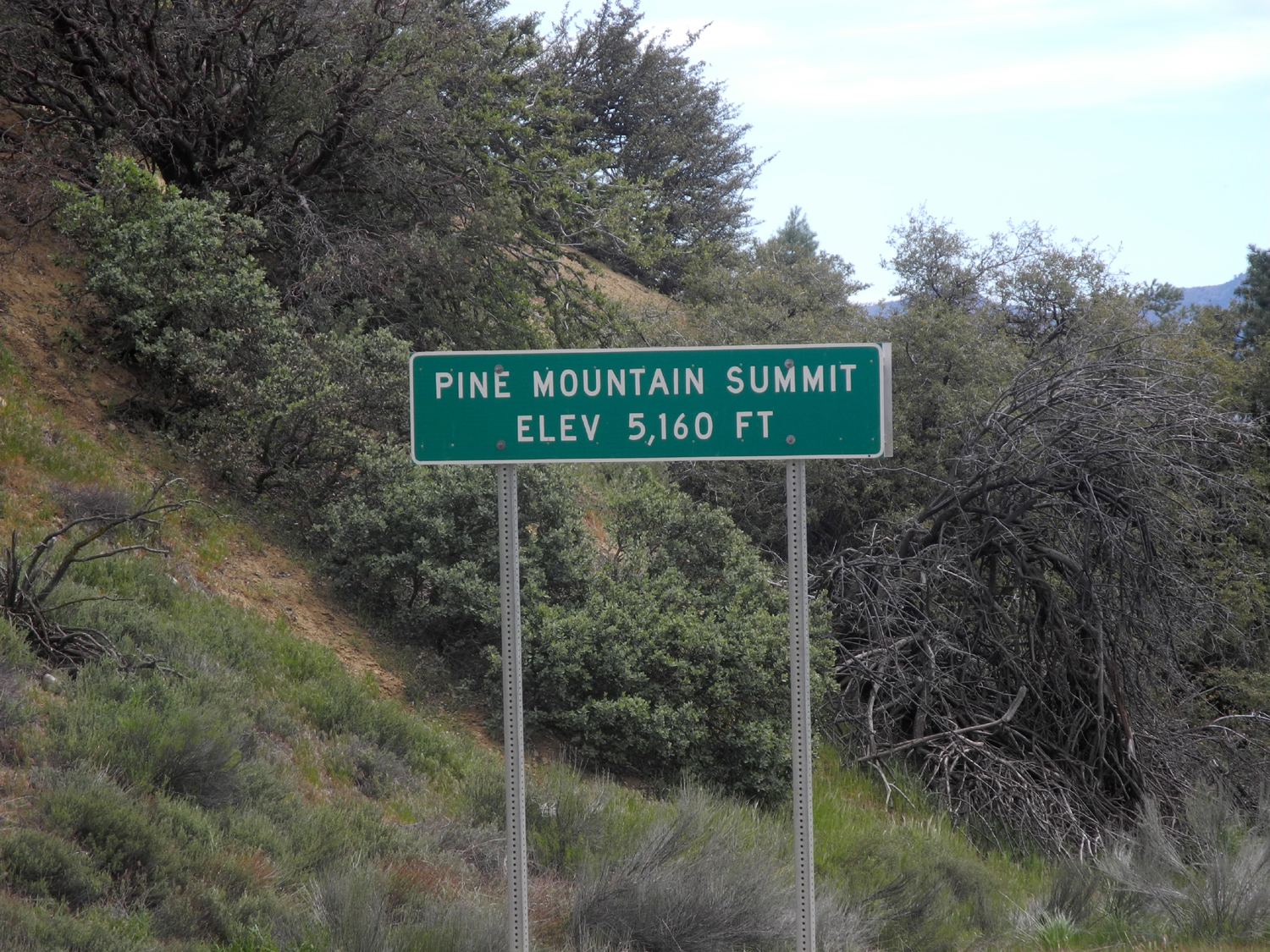
Here Highway 33 becomes an almost forgotten road, carrying only a few hundred vehicles a day. It leads into Los Padres National Forest, which crests at 5,000 feet on Pine Mountain, with its woods, waterfalls and an abundance of white Matilija poppies. To the west, the roadside flowers compete for attention with the still-vivid scars of the vast Zaca fire of last summer.
After the crest, the descent into Ojai and Ventura begins. At certain bends, it's now possible to catch glimpses of the Santa Barbara Channel. The climb down doesn't take long. On a road sign 33 miles from the coast, a first splash of graffiti. The radio begins to pick up scratchy traffic bulletins from Los Angeles, and there's a haze on the horizon.
At the bottom, Highway 33 widens and then, after a few miles, disappears into the thrumming currents of U.S. 101, packed with evening traffic headed south to Los Angeles or north to Santa Barbara, San Francisco and beyond, to different pieces of the wonderfully strange puzzle that is California.
peter.king@latimes.com
Copyright © 2017, Los Angeles Times